Cascade Saddle Route - The Alpine Heart of Mount Aspiring National Park
The Cascade Saddle Route is widely regarded as one of New Zealand’s most spectacular, demanding, and rewarding alpine crossings. Located within the majestic Mount Aspiring National Park, part of the Te Wāhipounamu South West New Zealand World Heritage Area, this route connects the West Matukituki Valley with the Dart Valley. Unlike the manicured Great Walks, the Cascade Saddle is a "route" in the truest sense—a challenging journey that requires navigation skills, high-level fitness, and a deep respect for the volatile alpine environment. Spanning approximately 25.4 kilometres of technical terrain, it offers walkers an unparalleled front-row seat to the "Matterhorn of the South," Mount Aspiring/Tititea, and the sprawling glaciers that feed the mighty rivers of the Otago and Southland regions.
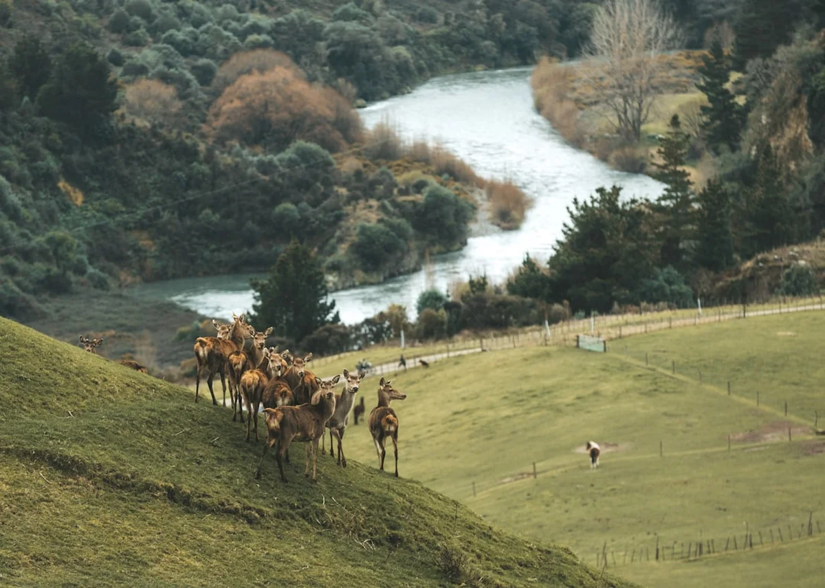
This is not a journey for the faint-hearted or the inexperienced. The route is famous for "The Pylon," a notoriously steep and exposed section of snowgrass and rock that has claimed lives in inclement weather. However, for those with the right skills and a clear weather window, the reward is a 360-degree panorama of hanging glaciers, vertical granite walls, and alpine meadows filled with unique flora. It is a point-to-point journey that fundamentally tests a tramper's resolve while providing a sense of isolation and grandeur that few other tracks in the Southern Alps can match. From the lush beech forests of the valley floors to the stark, wind-swept schist of the saddle at 1,524 metres, the Cascade Saddle Route is a masterclass in New Zealand’s raw, geological power.
- Distance: 25.4 km (technical alpine section; total trip typically 50–60 km)
- Duration: 4–5 days
- Trail Type: Point-to-point (Raspberry Flat to Rees/Dart Road Ends)
- Season: November–April (strictly weather dependent; winter requires mountaineering expertise)
- Accommodation: Aspiring Hut, Dart Hut, and alpine camping
- Highest point: Cascade Saddle (1,524 m) / The Pylon (1,835 m)
- Difficulty: Very Challenging / Expert
- Closest Town: Wanaka
Overview
The Cascade Saddle Route is a point-to-point alpine traverse that bridges two of the South Island’s most iconic glacial valleys. The journey typically begins at Raspberry Flat in the West Matukituki Valley, an hour’s drive from the lakeside town of Wanaka. The first stage is a deceptively gentle introduction, following the Matukituki River through wide, grassy flats grazed by cattle, with the shimmering peaks of the Main Divide beckoning in the distance. This ease is short-lived, as the route soon transforms into a vertical challenge that defines the Cascade Saddle experience.
The defining feature of the route is the ascent (or descent) of the ridge leading to the "Pylon." Over a horizontal distance of just a few kilometres, trampers must gain over 1,000 metres of elevation. This section is characterised by steep, slippery snowgrass (tussock) and exposed rock bluffs. There is no formed track here, only a marked route that requires the use of hands for balance. In wet or icy conditions, this section becomes treacherous, as the schist rock and vegetation offer little traction. Reaching the Pylon at 1,835 metres provides a moment of profound relief and awe, as the full North Face of Mount Aspiring/Tititea (3,033 m) reveals itself, draped in the blue ice of the Bonar Glacier.
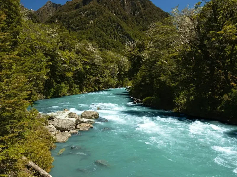
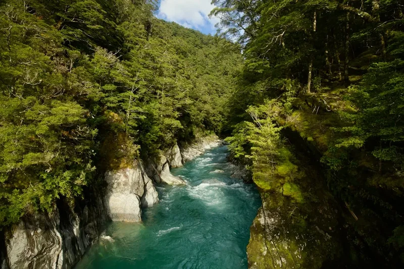
Beyond the Pylon, the route traverses the high alpine plateau of the Cascade Saddle itself. This is a world of rock, ice, and alpine tarns. The descent into the Dart Valley is equally dramatic, involving a steep scramble down a lateral moraine alongside the retreating Cascade Glacier. The landscape here is a textbook of glaciology: U-shaped valleys, hanging cirques, and the constant roar of waterfalls fed by melting ice. The route eventually joins the Rees-Dart Track, leading walkers through ancient silver beech forests to the Dart Hut. This transition from the high-altitude "dead zone" back into the vibrant, mossy green of the forest is one of the most sensory-rich experiences in the New Zealand backcountry. Because this is a point-to-point route, logistics require careful planning, often involving a shuttle or a pre-arranged vehicle swap between the Matukituki and Rees/Dart road ends.
History and Cultural Context
The mountains and valleys of Mount Aspiring National Park hold deep significance for Ngāi Tahu, the Māori iwi (tribe) of the South Island. For centuries, Māori explored these rugged corridors as part of seasonal expeditions to find pounamu (greenstone) and to hunt for birds like the kākāpō and moa. The Matukituki and Dart valleys were part of a network of ara tawhito (ancient trails) that connected the interior of the South Island with the West Coast. The mountains themselves are seen as ancestors, with Tititea (Mount Aspiring) standing as a prominent figure in Ngāi Tahu mythology, representing purity and the connection between the heavens and the earth.
European history in the area began in the mid-19th century with the arrival of pastoralists and surveyors. The Matukituki Valley was first explored by Europeans in the 1860s, as they sought new grazing lands for sheep. However, the high alpine passes like Cascade Saddle remained the domain of explorers and early mountaineers. The saddle was named for the spectacular waterfalls (cascades) that plunge from the hanging glaciers into the Dart River below. Early surveyors, including James McKerrow and John Turnbull Thomson, mapped the region under immense physical hardship, often battling the same unpredictable weather that modern trampers face today.
The establishment of Mount Aspiring National Park in 1964 marked a shift from exploitation to preservation. The Cascade Saddle Route became a legendary "rite of passage" for New Zealand trampers in the 1970s and 80s, as the "golden age" of tramping saw more people venturing into the high country. The New Zealand Alpine Club (NZAC) played a pivotal role in the area, constructing the historic Aspiring Hut in 1949, which remains a beloved base for both trampers and climbers. Today, the route is managed by the Department of Conservation (DOC), which maintains the delicate balance between allowing access to this wild terrain and ensuring that the fragile alpine ecosystem is protected from the impacts of increasing tourism.
Want more background? Read extended notes on history and cultural context → Learn more
Seasonal Highlights and Weather Reality
The window for safely attempting the Cascade Saddle Route is narrow, typically extending from late November to April. During these months, the snow on the Pylon and the saddle has usually melted enough to reveal the route, though patches of permanent ice and late-season snow remain common. Summer (December to February) offers the longest daylight hours and the warmest temperatures, but it also brings the risk of afternoon thunderstorms and the infamous New Zealand sandflies in the valley floors.
Autumn (March to April) is often considered the best time by locals. The air is crisper, the light is golden, and the weather patterns tend to be more stable. However, the days are shorter, and the risk of an early winter dusting of snow increases. Spring (October to November) is exceptionally dangerous on this route due to unstable snowpacks and the high risk of avalanches from the surrounding peaks. The "Pylon" section can hold dangerous ice well into December, requiring crampons and ice axes for anyone attempting it outside of the peak summer window.
Weather in the Southern Alps is notoriously fickle. A clear morning can transform into a life-threatening storm within hours. The Cascade Saddle is particularly exposed to the prevailing westerly winds, which can reach hurricane force as they are funnelled over the Main Divide. Rainfall is measured in metres rather than millimetres here; when it rains, the Matukituki and Dart rivers can rise with terrifying speed, cutting off access to huts and making river crossings impossible. Visibility often drops to zero in "clag" (thick alpine mist), making navigation on the saddle extremely difficult. Any tramper must be prepared to wait for days in a hut for a safe weather window or be willing to turn back if conditions deteriorate.
Recommended Itinerary
4-Day Cascade Saddle Itinerary
Day 1: Raspberry Flat to Aspiring Hut
- Distance: 9 km
- Elevation gain: 100 m
- Time: 2–3 hours
- Start at the Raspberry Flat car park at the end of Wanaka-Mount Aspiring Road
- Easy walk along the wide Matukituki River flats through active farmland
- Cross several small streams (can be tricky after heavy rain)
- Arrive at Aspiring Hut (38 bunks), a historic stone hut with stunning views of the valley head
- Use the afternoon to scout the start of the Cascade track and check the weather forecast via the hut warden
- This is a gentle warm-up before the massive vertical gain of the following day
Day 2: Aspiring Hut to Cascade Saddle (The Pylon)
- Distance: 7 km
- Elevation gain: 1,400 m
- Time: 6–8 hours
- The most demanding day of the trip, requiring an early start
- Follow the track through beech forest before emerging onto the steep tussock slopes
- Ascend the "Pylon" ridge—extremely steep and exposed; use caution and hands for balance
- Reach the Pylon (1,835 m) for iconic views of Mount Aspiring and the Bonar Glacier
- Traverse the alpine plateau to the Cascade Saddle (1,524 m)
- Camping is permitted on the saddle (no facilities, must be 500 m from the track)
- Note: This section is dangerous in wind, rain, or snow; do not attempt in poor conditions
Day 3: Cascade Saddle to Dart Hut
- Distance: 10 km
- Elevation: 600 m descent, 200 m gain
- Time: 5–7 hours
- Descend from the saddle via a steep, rocky route alongside the Cascade Glacier
- The descent involves scrambling over loose moraine and rock slabs
- Follow the markers down into the upper Dart Valley
- The route joins the Rees-Dart Track near the head of the valley
- Walk through alpine scrub and forest to reach the modern Dart Hut (32 bunks)
- Dart Hut is situated at the junction of the Snowy Creek and Dart River, a spectacular location
Day 4: Dart Hut to Rees Valley Road End (via Rees Saddle)
- Distance: 18 km
- Elevation: 600 m gain to Rees Saddle, 1,000 m descent
- Time: 7–9 hours
- Climb steadily from Dart Hut up to the Rees Saddle (1,471 m)
- Enjoy final views back toward the Dart Glacier and the Snowy Creek waterfalls
- Descend steeply into the Rees Valley, following the Rees River downstream
- The track passes through forest and open flats, ending at the Muddy Creek car park
- Requires a pre-arranged shuttle or vehicle to return to Wanaka or Glenorchy
- This is a long, tiring final day that requires good stamina
Important Notes:
- This is a point-to-point route; the 25.4 km distance refers to the core alpine crossing, but the full journey to a road end is longer
- Aspiring Hut and Dart Hut require bookings during the peak season
- The route is often walked in reverse (Dart to Matukituki), but the descent of the Pylon is considered more dangerous than the ascent
- River levels must be monitored; the Matukituki and Rees rivers are prone to rapid flooding
- Always carry a Personal Locator Beacon (PLB) as there is no mobile coverage
Planning and Bookings
Book Your Trip
Everything you need to plan your journey
Accommodation
Find places to stay near Wanaka
Flights
Search flights to Wanaka
Essential Preparation
Preparation for the Cascade Saddle Route must be meticulous. This is not a track where you can "wing it." Physical fitness is paramount; you should be comfortable carrying a 15–20 kg pack over steep, uneven terrain for 8 hours a day. Training should include hill repeats and multi-day hiking to toughen the legs and back. Because the route is point-to-point, you must coordinate transport between the Matukituki Valley (near Wanaka) and the Rees/Dart Valley (near Glenorchy). Shuttles are available but must be booked in advance, and they are expensive due to the long driving distance between the two road ends.
Wanaka is the primary base for this trek. It has several high-quality outdoor stores where you can hire PLBs, buy gas canisters, and get the latest track conditions from the DOC Visitor Centre. It is highly recommended to spend at least one night in Wanaka before starting to finalise logistics and check the mountain weather forecast. Ensure you have a "Plan B" in case the weather prevents a safe crossing of the saddle; the Rees-Dart Track or the Gillespie Pass are excellent alternatives in the same region.
Trail Accommodation
Accommodation on the route consists of Department of Conservation (DOC) huts and alpine camping. The huts provide a roof and a bunk, but little else.
Aspiring Hut: Managed by the New Zealand Alpine Club in conjunction with DOC. It is a large, historic stone hut with 38 bunks. During the summer, it has a resident warden. It features mattresses, a common area, and a wood burner for heating. Water is from a tank (treatment recommended). Bookings are essential through the DOC website.
Dart Hut: A modern, 32-bunk hut located at the junction of the Rees and Dart tracks. It is well-insulated and has great facilities, including gas hobs for cooking during the summer season. Like Aspiring Hut, it requires pre-booking. It is a popular hub for those doing the Rees-Dart circuit, so expect it to be busy.
Camping: Camping is permitted along most of the route, provided you are at least 500 metres from the track. On the Cascade Saddle itself, there are several flat spots near the tarns, but there are no facilities (no toilets, no shelter). You must be prepared for extreme wind and cold if camping high. All waste, including human waste, must be managed according to Leave No Trace principles (carry a trowel or, preferably, a pack-out kit for the high alpine sections).
Required Gear
- Technical tramping boots - Must have excellent grip and ankle support for the steep schist and tussock slopes
- Personal Locator Beacon (PLB) - Non-negotiable; there is no cell service and the terrain is high-risk
- High-quality waterproof jacket - Must be 3-layer Gore-Tex or equivalent to withstand Southern Alps storms
- Waterproof overtrousers - Essential for the exposed ridge sections
- Alpine-rated tent - If planning to camp, it must be able to withstand 100 km/h winds
- Warm layers - Merino base layers, a heavy fleece or down jacket, beanie, and gloves (even in mid-summer)
- Topographic map and compass - And the knowledge of how to use them in whiteout conditions
- Sun protection - High SPF sunscreen, polarized sunglasses, and a hat (the alpine UV is extreme)
- Sturdy trekking poles - Highly recommended for saving knees on the 1,400 m descent
What to Bring
- Food for 5 days - High-calorie, lightweight meals (dehydrated is best). Always bring 1 extra day of emergency rations
- Cooking system - Lightweight gas stove and sufficient fuel (huts do not always have gas provided)
- Water treatment - Purification tablets or a filter (while alpine water is generally clean, Giardia is present in valley floors)
- Sleeping bag - 4-season rated (comfort level -5°C or lower), as temperatures on the saddle drop below freezing at night
- First aid kit - Including plenty of blister care, triangular bandages, and any personal medications
- Repair kit - Duct tape, needle and thread, and spare buckles for your pack
- Toiletries - Biodegradable soap, toothbrush, and a small trowel for waste
- Power bank - To keep your phone/camera charged for navigation apps and photos
Permits
While there is no "permit" required to walk the route itself, you must book your hut stays in advance. The Cascade Saddle Route passes through areas covered by the DOC booking system, particularly during the peak season (late October to April). Unlike the Great Walks, these huts do not sell out in seconds, but they do reach capacity during January and February and over public holiday weekends.
Booking Process:
- Visit the Department of Conservation (DOC) website and create an account
- Select "Backcountry Huts" and search for Aspiring Hut and Dart Hut
- Pay the required fee (approx. NZ$30–$40 per night for adults)
- Print your booking confirmation or have it available on your phone to show the hut warden
- If you are a member of the New Zealand Alpine Club (NZAC), you receive a discount at Aspiring Hut, but you must still book
Camping Fees: If you choose to camp near the huts, a smaller fee (usually NZ$5–$10) applies, which allows you to use the hut's water and toilet facilities. Camping on the saddle itself is free, but you must adhere to the "500 metres from the track" rule to protect the fragile alpine vegetation. No permits are required for parking at Raspberry Flat or Muddy Creek, but do not leave valuables in your vehicle as these remote car parks are occasionally targeted by thieves.
Other Activities in the Area
The region surrounding Wanaka and Mount Aspiring National Park is an outdoor enthusiast's playground. Consider these additions to your trip:
- Rob Roy Glacier Track: A stunning half-day walk from the same car park (Raspberry Flat). It offers spectacular views of the Rob Roy Glacier and multiple waterfalls without the technical difficulty of the Cascade Saddle.
- Wanaka Lake Activities: After your trek, relax with a kayak or paddleboard on Lake Wanaka, or visit the famous "That Wanaka Tree" for a sunset photo.
- Rock Climbing: The Matukituki Valley and the cliffs around Wanaka offer some of the best sport and trad climbing in New Zealand.
- Skydiving and Scenic Flights: For a different perspective, take a scenic flight over Mount Aspiring. You will be able to see the Cascade Saddle from the air and truly appreciate the scale of the terrain you conquered.
- Puzzling World: A great "rest day" activity in Wanaka, featuring a massive 3D maze and optical illusion rooms.
- Wine Tasting: The Central Otago region is world-famous for its Pinot Noir. Visit a vineyard in the nearby Cardrona or Rippon areas for a celebratory post-hike drink.
Safety and Conditions
The "Pylon" Danger: The section between Aspiring Hut and the Cascade Saddle is one of the most dangerous stretches of marked route in New Zealand. The combination of steepness (up to 45 degrees), slippery snowgrass, and smooth schist rock makes it a "no-fall zone." If you slip here, there is often nothing to stop you for hundreds of metres. Do not attempt this section if it is raining, if there is snow on the ground, or if high winds are forecast. Several fatalities have occurred here when trampers were caught in sudden storms or attempted the descent in icy conditions.
River Crossings: The Matukituki, Dart, and Rees rivers are all glacier-fed. They can rise rapidly during heavy rain or on warm afternoons when snowmelt increases. If a river looks too deep or is flowing too fast (if you can hear boulders rolling on the bottom), do not attempt to cross. Wait for the levels to drop, which usually happens a few hours after the rain stops. Remember: "If in doubt, stay out."
Hypothermia: Even in summer, temperatures in the alpine zone can plummet to near zero. Combined with wind and rain, this creates a high risk of hypothermia. Always carry adequate warm layers and a waterproof shell, even if the forecast looks good. Know the signs of hypothermia: shivering, confusion, and loss of motor skills.
Navigation: The route is marked with orange poles, but these can be difficult to see in thick mist or "clag." You must be competent with a map and compass or a GPS device. Do not rely solely on your phone, as batteries fail in the cold and screens can be impossible to read in heavy rain.
Kea: The world’s only alpine parrot, the Kea, is highly intelligent and mischievous. They will destroy tents, boots, and packs left unattended. When camping, ensure all gear is inside your tent or secured. Do not feed them, as it makes them dependent on humans and can lead to their death from inappropriate food.
Side Trips and Points of Interest
Dart Glacier and Hovercraft Alley: From Dart Hut, a 2–3 hour return walk takes you to the base of the Dart Glacier. The area is known as "Hovercraft Alley" due to the flat, silt-covered floor of the upper valley. It is a hauntingly beautiful landscape of grey rock and blue ice, providing a close-up look at the source of the Dart River.
Mount Bevan and Mount Barff: For those with mountaineering experience and extra time, the peaks surrounding the saddle offer relatively accessible (Grade 1–2) climbing options. Mount Bevan provides an even higher vantage point over the Bonar Glacier and the Matukituki Valley.
The Cascade Tarns: On the saddle itself, several small alpine tarns (lakes) reflect the surrounding peaks. These are perfect spots for photography, especially at sunrise or sunset when the light hits the North Face of Mount Aspiring. The water is crystal clear but freezing cold—only for the bravest swimmers!
Liverpool Hut: A popular side trip from the Matukituki Valley. It is a "red hut" perched on a dramatic shelf overlooking the valley. The climb to Liverpool Hut is very steep but offers a different perspective of the mountains you will be crossing on the Cascade Saddle Route.
Leave No Trace
Mount Aspiring National Park is a pristine wilderness. To keep it that way, all visitors must strictly adhere to Leave No Trace principles. The alpine environment is particularly fragile; a single footprint on a cushion plant can take decades to heal.
Key Principles for Cascade Saddle:
- Plan Ahead and Prepare: Ensure you have the skills and gear to avoid needing rescue, which puts others at risk and impacts the environment.
- Travel and Camp on Durable Surfaces: Stay on the marked route. When camping on the saddle, choose rock or bare ground rather than vegetation.
- Dispose of Waste Properly: Pack out everything you pack in. This includes food scraps (even biodegradable ones like banana peels) and all litter. In the high alpine zone, use a "poo tube" or pack-out kit for human waste, as it does not decompose in the cold, thin soil.
- Leave What You Find: Do not pick alpine flowers or remove rocks. Leave the landscape as you found it for others to enjoy.
- Minimise Campfire Impacts: Campfires are strictly prohibited in Mount Aspiring National Park. Use a portable stove for all cooking.
- Respect Wildlife: Observe Kea and other birds from a distance. Never feed them.
- Be Considerate of Others: Keep noise to a minimum and share the hut space graciously.