
Routeburn Track - The Ultimate Alpine Traverse
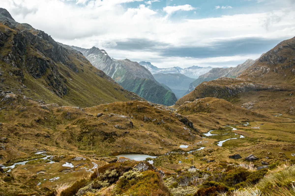
The Routeburn Track is one of New Zealand's most celebrated alpine journeys—a 33 km three-day, two-night traverse linking Mount Aspiring National Park and Fiordland National Park across the spine of the Southern Alps. Unlike the valley-bound Great Walks, the Routeburn spends its central day above the bushline, crossing the exposed Harris Saddle (1,255 m) with sweeping views across two national parks and out toward the Tasman Sea on clear days. The track can be walked in either direction between Routeburn Shelter near Glenorchy and The Divide on the Milford Road, and each direction offers a distinct experience: an east-to-west traverse begins in drier beech valleys and finishes in Fiordland rainforest; the reverse flips that arc. Compact, varied, and genuinely alpine, the Routeburn delivers a concentration of landscape that few three-day walks anywhere can match.
- Distance: 33 km point-to-point (walked in either direction)
- Duration: 3 days / 2 nights
- Season: Late October–April (Great Walks season; outside this window, winter alpine skills essential)
- Huts (mandatory booking during Great Walks season): Routeburn Flats, Routeburn Falls, Lake Mackenzie, Lake Howden
- Campsites: Routeburn Flats, Lake Mackenzie
- Highest point: Harris Saddle (1,255 m)
- Direction: East–west or west–east (both equally valid)
Overview
The Routeburn's defining feature is the contrast between its two halves, and the saddle that joins them. The eastern approach from Routeburn Shelter climbs through silver and red beech forest along the Route Burn, opening into the broad valley floor of Routeburn Flats before a steeper pitch up to Routeburn Falls Hut perched above the bushline. The western approach from The Divide moves through Fiordland rainforest—mossier, lusher, wetter—past Lake Howden and the cascade of Earland Falls before climbing into the Mackenzie basin. Whichever end you start at, the middle day is the one walkers come for: the sustained alpine crossing of Harris Saddle, with optional side trips that elevate an already exceptional day into something extraordinary.
This is fundamentally a landscape defined by exposure. The Harris Saddle sits squarely in the path of weather systems rolling east off the Tasman Sea, and conditions can shift from clear to whiteout within an hour. Fiordland receives over 200 rain days per year, and the eastern side, while drier, is not far behind. On a settled day, the views from Conical Hill (a 1.5–2 hour return side trip from the saddle) extend across both national parks, taking in the Darran Mountains, the Hollyford Valley, the Humboldts, and the head of Lake Wakatipu. In poor weather, the same ridge becomes serious alpine terrain that demands respect, full waterproofs, and the willingness to turn back.
The Routeburn is shorter than the other South Island Great Walks but is not a soft introduction to multi-day tramping. The bookings are competitive, the weather window matters, and the alpine section rewards walkers who arrive fit, properly equipped, and prepared to adapt. Done well, the three days deliver beech forest, tussock basins, hanging valleys, alpine lakes, glaciated cirques, and rainforest cascades in a single continuous traverse.
Recommended Itinerary
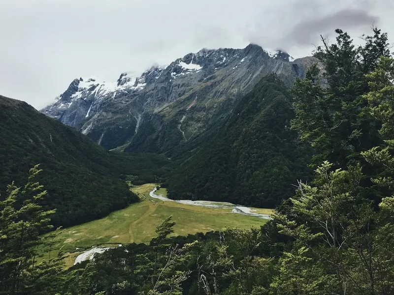
The Routeburn Track can be walked in either direction over three days. The east-to-west traverse from Routeburn Shelter to The Divide is the most popular option and is described first below; the reverse west-to-east direction is equally valid and is often preferred for hut availability or onward transport to Te Anau and Milford Sound.
3-Day Routeburn Track Itinerary (East to West)
Day 1: Routeburn Shelter to Routeburn Falls Hut
- Distance: 8.8 km
- Elevation gain: 530 m
- Time: 3–4 hours
- Start at Routeburn Shelter, crossing the swing bridge into beech forest
- Gradual climb along the Route Burn through silver and red beech
- Pass Routeburn Flats Hut and campsite at the open valley floor
- Steeper final pitch to Routeburn Falls Hut, perched above the bushline
- Evening: explore the tussock benches and waterfalls behind the hut
Day 2: Routeburn Falls Hut to Lake Mackenzie Hut
- Distance: 11.3 km
- Elevation: 300 m gain to Harris Saddle, 500 m descent to Mackenzie
- Time: 4.5–6 hours
- Early start strongly recommended to clear the exposed alpine section before any afternoon weather
- Climb into an open tussock basin, traversing beneath bluffs above Lake Harris
- Reach Harris Saddle (1,255 m), the highest point on the track
- OPTIONAL: Conical Hill side trip (1.5–2 hours return) for 360° views across both national parks
- Long sidle along the Hollyford Face with sweeping views toward the Darran Mountains
- Descend through tussock and forest to Lake Mackenzie Hut and campsite, set beside the lake
- The most spectacular day on the track—exposed, scenic, and weather-dependent
Day 3: Lake Mackenzie Hut to The Divide
- Distance: 12 km
- Elevation: 300 m gain, 500 m descent
- Time: 4–5.5 hours
- Climb out of the Mackenzie basin through the "Orchard" and "Fairyland" forest sections
- Pass Earland Falls, a cascade that drops directly beside the track and produces heavy spray after rain
- Continue through Fiordland rainforest to Lake Howden Hut
- OPTIONAL: Key Summit side trip (1–1.5 hours return) for panoramic views across the Hollyford and Eglinton valleys
- Final descent through rainforest to The Divide car park for transport pickup
3-Day Routeburn Track Itinerary (West to East)
Day 1: The Divide to Lake Mackenzie Hut
- Distance: 12 km
- Elevation: 500 m gain, 300 m descent
- Time: 4–5.5 hours
- Start at The Divide and climb steadily through Fiordland rainforest
- OPTIONAL: Key Summit side trip (1–1.5 hours return) early in the day for panoramic valley views
- Continue past Lake Howden Hut and on to Earland Falls, dramatic after rain
- Walk through the "Fairyland" and "Orchard" forest sections
- Final descent into the Mackenzie basin to Lake Mackenzie Hut and campsite, set beside the lake
Day 2: Lake Mackenzie Hut to Routeburn Falls Hut
- Distance: 11.3 km
- Elevation: 500 m gain to Harris Saddle, 300 m descent
- Time: 4.5–6 hours
- Early start strongly recommended to clear the exposed alpine section before any afternoon weather
- Sustained climb out of Lake Mackenzie up the Hollyford Face with sweeping views toward the Darran Mountains
- Reach Harris Saddle (1,255 m), the highest point on the track
- OPTIONAL: Conical Hill side trip (1.5–2 hours return) for 360° views across both national parks
- Traverse beneath bluffs above Lake Harris and descend through the tussock basin
- Arrive at Routeburn Falls Hut, perched above the bushline with views back down the valley
- The most spectacular day on the track—exposed, scenic, and weather-dependent
Day 3: Routeburn Falls Hut to Routeburn Shelter
- Distance: 8.8 km
- Elevation loss: 530 m
- Time: 3–4 hours
- Descend from above the bushline back into silver and red beech forest
- Pass Routeburn Flats Hut and campsite at the open valley floor
- Follow the Route Burn through the valley, crossing the swing bridge
- Finish at Routeburn Shelter for transport pickup
Important Notes:
- All huts and campsites must be pre-booked through DOC during the Great Walks season
- Bookings open months in advance and popular dates sell out quickly
- Transport logistics differ by direction—confirm shuttle timetables to both trailheads before committing
- Weather can change rapidly, especially around Harris Saddle and the Hollyford Face
- Carry full waterproof gear and warm layers even in summer
- Sandflies are present at lower-elevation huts, particularly Lake Mackenzie—bring effective repellent
Planning and Bookings
Essential Preparation
Securing a Routeburn booking takes planning. Three components need to align: hut or campsite bookings for two nights, transport to the chosen trailhead, and transport away from the exit point. Most walkers base in Queenstown or Te Anau either side of the walk; Glenorchy is a quieter alternative close to the Routeburn Shelter end. Build in a buffer day before or after if you can, particularly if you have onward flights—Fiordland weather can extend a walk or force a postponement.
Queenstown is the main logistical hub for the eastern trailhead, with full accommodation, supermarkets, outdoor retailers, and shuttle operators serving Routeburn Shelter via Glenorchy. Te Anau serves the western end, with shuttles up the Milford Road dropping walkers at The Divide. Through-walkers typically arrange a one-way shuttle and either return via the opposite-end transport network or pre-arrange vehicle relocation.
Trail Accommodation
The Routeburn Track has four Department of Conservation (DOC) huts: Routeburn Flats, Routeburn Falls, Lake Mackenzie, and Lake Howden. Two of these (Routeburn Flats and Lake Mackenzie) also have associated campsites. The standard three-day itinerary uses two huts—commonly Routeburn Falls and Lake Mackenzie—but other combinations are possible depending on availability and pace.
Hut Facilities:
- Bunk beds with mattresses (sleeping bags required—no bedding provided)
- Common area with benches and tables
- Gas cookers with bench space (no pots or cooking equipment provided)
- Cold running water (treatment recommended)
- Composting toilets
- Drying rooms (often inadequate in heavy rain)
- No electricity or charging facilities
- Resident warden during Great Walks season
What Huts Don't Provide:
- Food or cooking equipment
- Sleeping bags, pillows, or bedding
- Dishes, plates, cups, or cutlery
- Heating (huts are unheated but enclosed)
- Cell phone signal or WiFi
Booking Requirements:
- Bookings open once per year via the DOC website
- High demand—popular dates sell out within hours of release
- Hut and campsite costs differ; NZ resident pricing is lower than the international rate
- Campsites at Routeburn Flats and Lake Mackenzie are an alternative if huts are full
Required Gear
- Tramping boots—waterproof, ankle support, broken in (blisters end dreams)
- Waterproof jacket—Gore-Tex or equivalent, taped seams essential
- Waterproof overtrousers—full-length side zips for easy on/off in sudden downpours
- Sleeping bag—3-season rated (comfort 0–5°C), huts are unheated but enclosed
- Tramping pack—40–60L, rain cover included, hip belt crucial for multi-day comfort
- Head torch—with spare batteries, huts have no electricity
- First aid kit—plasters, blister treatment, pain relief, personal medications
- Sandfly repellent—DEET-based, apply at hut stops and shaded sections
- Tent (optional)—only if camping at Routeburn Flats or Lake Mackenzie
What to Bring
- Food for 3 days—breakfast, lunch, dinner, snacks (no food available on track)
- Cooking gear—lightweight gas stove, pot, utensils, lighter/matches (huts have bench space but no stoves)
- Water treatment—filter or purification tablets (stream water plentiful but untreated)
- Plate, bowl, cup—lightweight camping set, huts have no dishes
- Toiletries—biodegradable soap, toothbrush/paste, toilet paper, hand sanitiser
- Sun protection—sunscreen SPF50+, sunglasses, hat (alpine sun intense even in cloud)
- Warm layers—merino base layer, insulating mid-layer, beanie, gloves (Harris Saddle can be near-freezing)
- Emergency shelter—lightweight emergency blanket or bivvy bag
- Navigation—offline map app, compass, trail description printout (mobile signal non-existent on track)
- Personal locator beacon—recommended, available for hire from DOC and outdoor stores
- Entertainment—book, cards, journal (hut evenings are social but long)
Permits

Bookings for the Routeburn Track open once per year via the DOC website, with the date announced several months in advance. Demand is high—popular summer dates and weekends typically sell out within hours, though midweek and shoulder-season dates remain available for longer.
Booking strategy:
- Create a DOC account well in advance (weeks, not days, before booking opens)
- Log in early on the day bookings open and join the booking queue as soon as it launches
- Do not refresh your browser once you enter the queue—you will lose your place
- Have multiple flexible date ranges ready (at least 3–4 alternative week options)
- Be flexible on direction—if east-to-west is full, the reverse may still have availability
- Keep your credit card accessible; payment must be completed immediately to secure the booking
If you miss the initial booking rush: Don't despair. Cancellations regularly surface in the weeks before walking dates as plans change. Check the DOC booking page daily during the 2–4 week pre-walk window, and consider the campsites at Routeburn Flats and Lake Mackenzie, which can release availability separately to the huts.
Costs (Great Walks season):
- Huts: lower rate for NZ residents, higher rate for international visitors
- Campsites: significantly cheaper than huts, available at Routeburn Flats and Lake Mackenzie only
- Children: reduced rates (typically around 50% of adult cost)
Off-season: Lower rates apply outside the Great Walks season, but huts operate in basic winter mode, and the track is advanced-alpine only.
Transport and Logistics:
- Eastern trailhead: shuttles run from Queenstown via Glenorchy to Routeburn Shelter
- Western trailhead: shuttles run from Te Anau (and connect from Queenstown) up the Milford Road to The Divide
- Through-walk options: book a one-way shuttle pairing both ends, or arrange vehicle relocation services
- Buffer days: strongly recommended either side of your walk, particularly for travellers with onward flights
Safety and Conditions
Pre-Departure Checks:
- Check the MetService mountain forecast for Fiordland and Mount Aspiring National Parks before departure
- Review DOC track alerts and closures for the Routeburn on the DOC website (updated regularly during Great Walks season)
- Verify shuttle bookings and pickup times at both ends, and check Milford Road status if your transport runs that way
- Monitor real-time weather as your start date approaches; have a contingency plan if heavy rain or snow warnings are issued
Alpine Pass Hazards: Be prepared for rapid weather changes around Harris Saddle and along the Hollyford Face—conditions can differ sharply from the morning forecast. Expect strong winds, driving rain or sleet, low visibility (cloud can envelop the saddle within minutes), hypothermia risk even in summer, and snow and ice from May through October (expert-only terrain outside Great Walks season). If conditions deteriorate, turn back to the previous hut rather than committing to the crossing.
Flood and Rockfall Risk: Heavy rain can flood track sections at lower elevations and increase rockfall risk on the Hollyford Face. If a heavy rain warning is issued during your walk, consider delaying the alpine day until conditions stabilise—wardens at each hut can advise.
Sandflies: Sandflies are present at lower-elevation huts, particularly Lake Mackenzie and Lake Howden, and peak in summer. They are tiny but persistent biters. Carry DEET-based repellent, cover exposed skin when stationary, and keep moving when outdoors—sandflies are weak fliers.
Travel insurance is strongly recommended to cover potential medical emergencies, evacuation, and trip cancellations.
Routeburn Track
Detailed route notes, maps, logistics and practical tips in one downloadable guide.
Seasonal Highlights and Weather Reality
During Great Walks season (late October to 30 April), the track operates at full capacity: resident wardens staff each hut, gas cooking facilities are operational, bridges are maintained, and the track is benched and well-marked throughout. This is the period during which you have the highest probability of completing the walk as booked, though weather can still close the saddle for a day or more at a time.
Summer (December to February) brings the longest days and warmest temperatures, ideal for the alpine crossing and for evening light around the huts. It is also peak demand for bookings and the period of greatest sandfly activity at lower-elevation huts, particularly Lake Mackenzie. Rain remains a constant possibility regardless of season; even in midsummer, expect at least one wet day across three.
Shoulder seasons (late October–November and April) offer settled spells, golden beech colour in autumn, and noticeably fewer walkers. The trade-off is increased risk of early or late snow on Harris Saddle and the Hollyford Face—conditions that can make the alpine section significantly harder, and that occasionally require parties to turn back.
Outside the Great Walks season (May to October), the Routeburn becomes an advanced alpine route. Bridges may be removed or damaged, huts operate in basic winter mode, avalanche paths cross the track on the Hollyford Face, and the saddle demands ice axe and crampon proficiency. This is expert-only territory and should not be attempted by recreational trampers; the consequences of error on the alpine section in winter are severe.
History and Cultural Context
Long before European surveyors, Māori—particularly Ngāi Tahu—used routes through the Southern Alps to transport pounamu (greenstone/jade) from the West Coast rivers to the Wakatipu basin and onward to coastal trading centres. The Harris Saddle area served as one of these crossing points, and the route's Māori name, Tarahaka Whakatipu, reflects this long-standing connection. These journeys were arduous, technically demanding, and embedded in seasonal patterns of resource gathering and exchange that shaped the cultural geography of the region.
European exploration of the Routeburn area began in the 1860s during the Otago gold rush, when prospectors and surveyors pushed up the Route Burn and Dart River valleys looking for new ground. The track itself developed gradually through the late 19th and early 20th centuries as a route between the Wakatipu and Hollyford regions. The establishment of Fiordland National Park (1952) and Mount Aspiring National Park (1964) formalised the protection of the surrounding landscape, and the Routeburn was later inscribed within the Te Wāhipounamu South West New Zealand World Heritage Area in 1990.
A 1963 tragedy, in which a group of students was caught in a sudden blizzard near Harris Saddle, remains part of the track's living memory and a sobering reminder of how quickly alpine weather can turn. The huts, bridges, and benched track sections that walkers use today are the product of decades of work by the Department of Conservation and earlier track-cutters; the route across the saddle, however, follows a line shaped by centuries of foot travel before any of that infrastructure existed.
Want more background? Read extended notes on history and cultural context → Learn more
Side Trips and Points of Interest
Conical Hill: The standout side trip on the Routeburn. From Harris Saddle, a steep marked route climbs to the summit (1,515 m) for a 360° panorama across both national parks, the Darran Mountains, the Hollyford Valley, and—on the clearest days—a glimpse of the Tasman Sea. The return trip takes 1.5–2 hours and should only be attempted in settled conditions; the route is exposed and offers no shelter. The reward, on the right day, is one of the finest accessible alpine viewpoints in New Zealand.
Key Summit: A shorter side trip from near Lake Howden Hut on the western end of the track. The 1–1.5 hour return walk climbs to a tussock plateau with views across the Hollyford and Eglinton valleys to the Darran Mountains, and a short interpretive loop highlights the alpine flora and tarns. A worthwhile addition for walkers with energy on the final day.
Earland Falls: Between Lake Mackenzie and Lake Howden, the track passes directly beneath this spectacular cascade. After heavy rain the spray reaches well across the track—expect to get wet, and exercise caution on the slick stones. A bypass route is available in high water if the main crossing is unsafe.
Routeburn Falls and the Valley of the Trolls: From Routeburn Falls Hut, short tracks lead to viewpoints over the falls and into the tussock benches behind the hut. Strong walkers with energy to spare can continue further toward Lake Wilson and the Valley of the Trolls, an unmarked alpine basin that gives a sense of the wild country beyond the main track. Off-track travel here requires navigation skills and stable weather.
MacKenzie Lake foreshore: The campsite and hut at Lake Mackenzie sit beside an alpine lake ringed by beech forest and steep ridges. Worth a slow lap of the foreshore at dusk for the reflection and the chance of kea overhead.
Leave No Trace
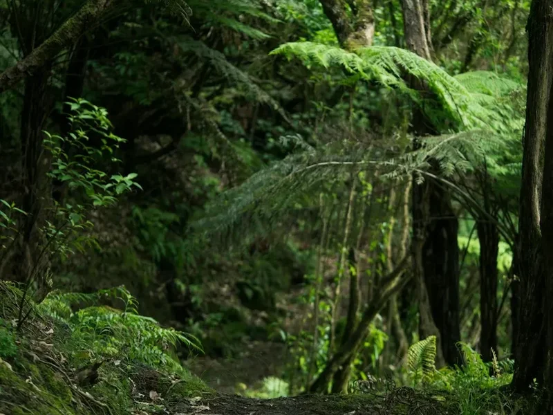
You are walking through a UNESCO World Heritage Area—an ancient, fragile, and irreplaceable ecosystem. The Routeburn's tussock basins and alpine plant communities are particularly vulnerable: a single off-track footprint can damage cushion plants and mosses that take decades to recover. The limited daily numbers and benched track design exist precisely to protect this wilderness for future generations.
Your responsibility as a walker:
- Pack out everything you pack in, including all food scraps, soiled toilet paper (use the hut toilet facilities), and micro-trash
- Use biodegradable soap and wash well away from waterways (minimum 50 m from streams and lakes)
- Stay on the marked track at all times, particularly across the alpine section, to protect fragile vegetation
- Never feed the kea—these endangered mountain parrots are killed by inappropriate human food and are classified as Nationally Endangered. They will also damage gear if left unattended
- Minimise noise and avoid playing music or loud voices—part of the Routeburn's value is the silence and solitude of wilderness
- Use hut composting toilets correctly (follow posted instructions)
- Respect heritage features and signage along the track
Tread lightly. Leave only footprints. The Routeburn is a privilege, not a right—walk it with humility and respect for the landscape and its Māori heritage.
Other Activities in the Area
Consider extending your trip to experience more of this remarkable region:
- Queenstown adventures: Jet boating on the Shotover, bungy jumping, paragliding, and gondola access to Bob's Peak for views over the lake and the Remarkables.
- Glenorchy and the Dart Valley: A quieter base near the Routeburn trailhead, with horse trekking, jet boating up the Dart River, and the Lord of the Rings filming locations many walkers know on sight.
- Milford Sound cruises: The classic finish for west-end walkers. View the fiord from the water with waterfalls cascading directly into the sea, spot fur seals, and see Mitre Peak rising 1,692 m straight from the water.
- Te Anau Glowworm Caves: A boat trip across Lake Te Anau to an underground network of bioluminescent glowworms.
- Gibbston Valley wineries: Cellar doors and tastings in one of New Zealand's premier pinot noir regions, an easy day trip from Queenstown.
- Scenic flights: Helicopter and fixed-wing flights from Queenstown or Te Anau offer aerial views of the Routeburn, Milford Sound, and the wider Southern Alps.
Book Your Trip
Everything you need to plan your journey
Accommodation
Find places to stay near Queenstown