Yorkshire Three Peaks Challenge
The Yorkshire Three Peaks Challenge is a demanding, yet incredibly rewarding, circular route in the heart of the Yorkshire Dales National Park, England. This iconic trek takes in the three highest peaks in Yorkshire: Pen-y-ghent, Whernside, and Ingleborough. While often completed in a single day by seasoned hikers and ultra-runners, it is a significant undertaking that requires careful planning, excellent physical fitness, and a good understanding of the terrain and weather conditions. The route traverses a diverse landscape, from rugged moorland and limestone pavements to rolling hills and ancient geological formations, offering breathtaking panoramic views across the Dales and beyond.
- Distance: 39.0 km
- Elevation Gain: 1600 m
- Duration: 10–12 hours (for a single-day challenge)
- Season: April–October (best weather window)
- Difficulty: Challenging
- Closest Town: Horton-in-Ribblesdale
- Trailhead Access: Horton-in-Ribblesdale village
- Permits: Not required
Overview
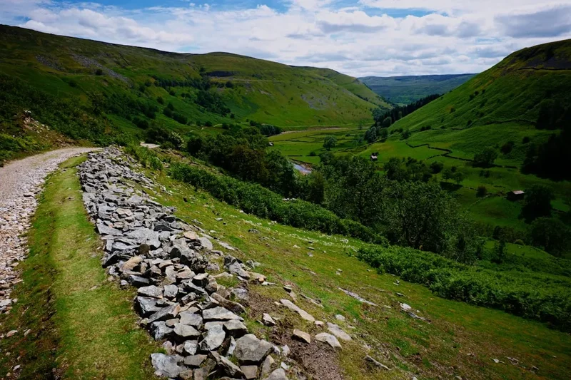
The Yorkshire Three Peaks route is a true test of endurance and navigation. Starting and finishing in the picturesque village of Horton-in-Ribblesdale, the challenge is typically undertaken in a clockwise direction, though an anti-clockwise route is also feasible. The journey begins with the ascent of Pen-y-ghent, a distinctive peak with a steep, rocky western face and a more gradual eastern slope. From Pen-y-ghent, the path leads across undulating moorland towards Ribblehead Viaduct, a magnificent Victorian railway engineering marvel. The second peak, Whernside, is the highest of the three, offering expansive views from its summit, often stretching as far as the Lake District on a clear day. The descent from Whernside brings you to the valley floor before a final, significant climb up to Ingleborough, the third and final peak, known for its flat summit and ancient hill fort remains. The descent from Ingleborough completes the circuit, returning walkers to Horton-in-Ribblesdale.
The terrain is varied and can be demanding. Sections of the route are well-trodden footpaths, while others involve navigating boggy moorland, rocky ascents, and exposed ridges. The weather in the Yorkshire Dales can change rapidly, with mist, rain, and strong winds being common, even during the summer months. This unpredictability adds to the challenge and necessitates careful preparation. The challenge is not just about covering the distance, but about managing energy, hydration, and nutrition effectively throughout the long day.
The Yorkshire Three Peaks is more than just a physical challenge; it's an immersion into the rugged beauty of the Yorkshire Dales. The historical significance of the landscape, from ancient settlements to industrial heritage like the Ribblehead Viaduct, adds layers of interest to the trek. It's a journey that tests your limits, rewards you with unparalleled vistas, and leaves you with a profound sense of accomplishment.
History and Cultural Context
The landscape traversed by the Yorkshire Three Peaks has a rich and varied history, stretching back thousands of years. The peaks themselves have been significant landmarks for millennia. Ingleborough, with its flat summit and strategic position, was the site of an Iron Age hill fort, evidence of its importance to early inhabitants of the region. The remains of ancient settlements and field systems can still be found scattered across the Dales, hinting at a long history of human habitation and land use.
The more recent history of the area is deeply intertwined with industrial development. The construction of the Settle-Carlisle Railway in the late 19th century dramatically altered the landscape and the lives of those living in the Dales. The iconic Ribblehead Viaduct, a masterpiece of Victorian engineering, stands as a testament to the ambition and scale of this project. The railway line itself, which the Three Peaks route often parallels or crosses, was a vital artery for transporting goods and people, though it faced closure threats in the latter half of the 20th century before being saved by public outcry and campaigning.
The tradition of walking the Three Peaks as a challenge gained momentum in the mid-20th century, particularly with the rise of fell running and endurance events. The route became a popular test for hikers and athletes alike, with organised events and unofficial attempts contributing to its legendary status. The challenge is often undertaken to raise money for charity, adding a philanthropic dimension to the physical endeavour. The peaks are not just geographical features; they are symbols of the enduring spirit of the Yorkshire Dales and the people who have lived and worked within its dramatic landscapes.
Seasonal Highlights and Weather Reality
The Yorkshire Dales offers a distinct experience throughout the year, but the optimal time for tackling the Three Peaks is generally between April and October. During these months, daylight hours are longer, and the weather is typically more favourable, though still unpredictable.
Spring (April–May): The landscape begins to awaken after winter. Wildflowers start to appear on the lower slopes, and the heather begins to show its first hints of colour. Days are getting longer, offering more time for the challenge. However, spring can still bring cold snaps, rain, and even late snow on the higher peaks, particularly on Whernside and Ingleborough. Navigation can be tricky if mist descends.
Summer (June–August): This is the most popular season for the Three Peaks. The days are at their longest, providing ample daylight for completion. The heather is often in full bloom, creating a vibrant purple carpet across the moors, especially in late summer. However, summer can also bring heatwaves, which can make the long ascents arduous, and the risk of thunderstorms increases. Sandflies can be a nuisance in damp, sheltered areas, though less prevalent than in some other regions.
Autumn (September–October): Autumn offers crisp air, stunning autumnal colours as the foliage changes, and often clearer skies. The crowds tend to thin out after the summer holidays. However, daylight hours begin to decrease, and the weather can become more volatile, with increased chances of rain, wind, and early frost or snow on the higher ground. Navigation in fog or poor light becomes more critical.
Winter (November–March): The Yorkshire Three Peaks is generally not recommended for a single-day challenge during winter. Daylight is severely limited, and the peaks are often covered in snow and ice. Conditions can be treacherous, requiring advanced winter mountaineering skills, specialised equipment (ice axe, crampons), and extensive experience in navigation and avalanche awareness. The route can become impassable due to snowdrifts and icy conditions. While it is possible to complete the peaks over multiple days in winter with appropriate preparation, the single-day challenge is best avoided.
Recommended Itinerary
Yorkshire Three Peaks - Single Day Challenge (Clockwise)
Early Morning (Start: Horton-in-Ribblesdale)
- Distance: 0 km
- Elevation Gain: 0 m
- Time: 06:00 - 07:00
- Begin at the designated start point in Horton-in-Ribblesdale (e.g., near the Pen-y-ghent Cafe or the Old Hill Inn).
- Ensure all gear is checked, food and water supplies are topped up.
- Briefing on the day's route and conditions.
Morning: Ascent of Pen-y-ghent
- Distance: ~6.5 km
- Elevation Gain: ~400 m
- Time: 07:00 - 09:00
- Follow the clear path from Horton-in-Ribblesdale towards Pen-y-ghent.
- The initial section is relatively gentle, but the final ascent to the summit is steep and rocky.
- Summit Pen-y-ghent (694 m) and enjoy the first panoramic views.
- Descend the eastern side of Pen-y-ghent towards the B6255 road.
Late Morning: Towards Ribblehead
- Distance: ~10 km
- Elevation Gain: ~150 m
- Time: 09:00 - 11:00
- Join the B6255 road and follow it northwards.
- Pass the iconic Ribblehead Viaduct. Take time for photos and a brief rest.
- Continue along the well-defined path towards the base of Whernside.
Midday: Ascent of Whernside
- Distance: ~5 km
- Elevation Gain: ~250 m
- Time: 11:00 - 13:00
- The ascent of Whernside is a steady climb from the valley floor.
- The path is generally good, though can be boggy in places.
- Summit Whernside (736 m), the highest of the three peaks.
- Enjoy expansive views, potentially reaching the Lake District and the Irish Sea.
- Begin the long descent towards Chapel-le-Dale.
Afternoon: Towards Ingleborough
- Distance: ~12 km
- Elevation Gain: ~200 m
- Time: 13:00 - 16:00
- Follow the path from Chapel-le-Dale, often alongside the railway line.
- The terrain is relatively flat for a significant section, allowing for faster progress.
- Reach the village of Ingleton or the base of Ingleborough.
- Take a substantial break for food and drink, preparing for the final ascent.
Late Afternoon: Ascent of Ingleborough
- Distance: ~4 km
- Elevation Gain: ~300 m
- Time: 16:00 - 18:00
- The climb up Ingleborough is steep and rocky, with a well-maintained path.
- The summit plateau features ancient earthworks and stone walls.
- Summit Ingleborough (723 m) and take in the final views.
- Begin the descent back towards Horton-in-Ribblesdale.
Evening: Return to Horton-in-Ribblesdale
- Distance: ~7 km
- Elevation Loss: ~300 m
- Time: 18:00 - 20:00 (or later depending on start time and pace)
- The descent from Ingleborough is steep and can be hard on the knees.
- Follow the clear path back to the village.
- Celebrate the completion of the challenge!
Important Notes:
- This itinerary is a guideline; actual timings will vary significantly based on fitness, weather, and breaks.
- Start early to maximise daylight and avoid rushing.
- Carry sufficient food and water for the entire duration.
- Be prepared for all weather conditions.
- Navigation skills are essential, especially in poor visibility.
- Consider the use of a GPS device or map and compass.
Planning and Bookings
Book Your Trip
Everything you need to plan your journey
Accommodation
Find places to stay near Horton-in-Ribblesdale
Flights
Search flights to Horton-in-Ribblesdale
Essential Preparation
The Yorkshire Three Peaks is a serious undertaking that demands thorough preparation. Physical fitness is paramount; regular cardiovascular exercise, including hill walking with a weighted pack, is crucial. Aim to complete several long hikes in the weeks leading up to your attempt. Familiarise yourself with the route using detailed maps and GPS devices. Understand the terrain, potential hazards, and bail-out points. The closest major city with an airport is Leeds Bradford (LBA), approximately a 1.5-hour drive to Horton-in-Ribblesdale. Parking is available in Horton-in-Ribblesdale, often on a pay-and-display basis. Public transport options are limited; a bus service connects to nearby towns, but it is infrequent. Road conditions to Horton-in-Ribblesdale are generally good, being well-maintained rural roads.
Trail Accommodation
This is a day hike requiring no overnight accommodation. However, for those wishing to break the journey or prepare/recover, Horton-in-Ribblesdale offers several options:
- The Old Hill Inn: A historic pub offering accommodation and meals.
- Pen-y-ghent Cafe: Provides basic accommodation and is a popular starting/finishing point.
- Various Bed & Breakfasts and Guesthouses: Available within Horton-in-Ribblesdale and surrounding villages.
- Campsites: Limited camping facilities may be available in the wider Dales area, but wild camping is generally discouraged and often prohibited in the National Park.
Booking accommodation in advance is highly recommended, especially during peak season (summer and bank holidays).
Required Gear
- Sturdy walking boots: Waterproof, with good ankle support and well broken-in.
- Waterproof jacket and trousers: Essential for protection against rain and wind. Ensure they are breathable.
- Warm layers: Including a fleece or insulated jacket, and thermal base layers. The temperature can drop significantly at higher altitudes.
- Hat and gloves: Even in summer, these can be vital for warmth and protection.
- Backpack: A comfortable 30-45 litre pack to carry essentials.
- Navigation equipment: Detailed OS map (Explorer OL2 or OL19), compass, and a GPS device or smartphone with offline mapping capabilities. Knowledge of how to use them is vital.
- Head torch: With spare batteries. Essential for early starts or late finishes, and in case of unexpected delays.
- First-aid kit: Including blister plasters, pain relievers, antiseptic wipes, bandages, and any personal medication.
- Whistle: For emergency signalling.
- Sun protection: Sunscreen, sunglasses, and a sun hat, even on cloudy days.
What to Bring
- Food: High-energy, easily digestible food. This includes sandwiches, energy bars, gels, nuts, dried fruit, and chocolate. Plan for at least 3,000-4,000 calories.
- Water: At least 2-3 litres per person. Water sources are available along the route (e.g., streams near Ribblehead, taps in villages), but water treatment (filter or purification tablets) is recommended if relying on natural sources.
- Mobile phone: Fully charged, with a power bank for backup. Signal can be intermittent.
- Emergency shelter: A lightweight emergency bivvy bag or foil blanket.
- Walking poles: Highly recommended for reducing strain on knees during descents and providing stability on uneven terrain.
- Small trowel and toilet paper: For emergency toilet stops, ensuring you follow Leave No Trace principles.
- Cash: For parking, refreshments at cafes, or in case of emergencies.
Permits
No specific permits are required to walk the Yorkshire Three Peaks route. The paths are public rights of way and are accessible to all. However, it is important to be aware of the rules and regulations of the Yorkshire Dales National Park, particularly regarding camping and environmental protection.
Respecting the Environment:
- Leave No Trace: Pack out all litter, including food scraps and wrappers. Avoid disturbing wildlife and vegetation.
- Wild Camping: Wild camping is generally not permitted within the Yorkshire Dales National Park without the landowner's express permission. Designated campsites are available in the wider area.
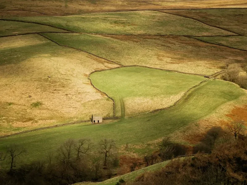
- Farming Land: Much of the route crosses farmland. Always close gates behind you, keep dogs under control, and avoid disturbing livestock.
- Respect Historical Sites: The summits of Ingleborough and Pen-y-ghent have historical significance. Treat these areas with respect and do not disturb ancient remains.
While no formal permits are needed, adherence to the principles of responsible outdoor recreation is essential to preserve the beauty and integrity of the Yorkshire Dales for everyone.
Other Activities in the Area
The Yorkshire Dales National Park offers a wealth of activities beyond the Three Peaks challenge:
- Exploring Ingleborough Cave: A spectacular show cave located at the foot of Ingleborough, offering guided tours through stunning formations.
- Visiting Malham Cove and Gordale Scar: Famous limestone features with dramatic cliffs, a cove, and a spectacular gorge, a short drive from Horton-in-Ribblesdale.
- Walking the Settle-Carlisle Railway line: Sections of the line offer scenic walks, and the train itself provides a fantastic way to see the Dales.
- Visiting Ribblehead Viaduct: Take time to appreciate this engineering marvel up close, and explore the surrounding moorland.
- Exploring local villages: Discover charming Dales villages like Grassington, Kettlewell, and Hawes, offering local crafts, pubs, and tearooms.
- Cycling: The Dales offer numerous cycling routes, from challenging road climbs to off-road trails.
- Rock climbing and caving: The area is renowned for its opportunities for these adventurous pursuits.
Safety and Conditions
Weather: The most significant hazard is the unpredictable weather. Mist can descend rapidly, reducing visibility to a few metres, making navigation extremely difficult. Strong winds can make exposed sections treacherous, and heavy rain can lead to boggy conditions and flash floods in valleys. Always check the mountain forecast (e.g., Met Office Mountain Forecast for Yorkshire Dales) before and during your walk.
Navigation: While the route is generally well-trodden, especially between the peaks, navigation skills are essential. Relying solely on a GPS device is not recommended; always carry a map and compass and know how to use them. The terrain can be featureless in poor visibility, and it's easy to stray from the path.
Terrain: The path can be rocky, boggy, and uneven. Steep ascents and descents, particularly on Pen-y-ghent and Ingleborough, can be hard on the legs and require careful footing. Exposed ridges can be challenging in high winds.
Fitness: The challenge requires a high level of cardiovascular fitness and muscular endurance. Undertaking the walk without adequate preparation can lead to exhaustion, injury, and the need for rescue.
Water and Food: Dehydration and bonking (running out of energy) are common issues. Ensure you carry sufficient supplies and consume them regularly. Water sources should be treated.
Emergency Procedures:
- In a genuine emergency, dial 999 or 112 and ask for Police, then Mountain Rescue.
- Provide your location as accurately as possible (grid reference if known).
- Describe the nature of the emergency and the condition of the casualty.
- Stay with the casualty and keep them warm.
- Conserve your mobile phone battery.
Insurance: It is highly recommended to have personal accident insurance that covers mountain rescue.
Side Trips and Points of Interest
Ribblehead Viaduct: A truly spectacular feat of Victorian engineering, this viaduct comprises 24 arches and spans 400 metres. It's a must-see landmark and a popular spot for photographs. You can walk beneath it and explore the surrounding area, which was once a hub of activity during its construction.
Ingleborough Summit: The flat summit of Ingleborough is a fascinating archaeological site. It features the remains of an Iron Age hill fort, including ramparts and hut circles. The views from the summit are extensive, offering a commanding perspective over the surrounding Dales.
Pen-y-ghent Summit: While less archaeologically significant than Ingleborough, Pen-y-ghent's summit offers a dramatic drop on its western face and a more gentle eastern slope. The views from here are also superb, providing an excellent introduction to the scale of the Dales.
Chapel-le-Dale: A small hamlet located between Whernside and Ingleborough, it offers a convenient stopping point for refreshments and a brief rest. The local churchyard contains a poignant memorial to railway workers who died during the construction of the Settle-Carlisle line.
The Old Hill Inn: Located in Horton-in-Ribblesdale, this historic pub is one of the oldest in Yorkshire and a traditional starting and finishing point for the Three Peaks challenge. It offers a chance to refuel and reflect on your journey.
Leave No Trace
The Yorkshire Three Peaks route passes through a protected National Park, and it is crucial for all walkers to adhere to Leave No Trace principles to minimise their impact on this beautiful environment.
Plan Ahead and Prepare: Understand the route, weather, and potential hazards. Pack appropriately and be prepared for all conditions.
Travel and Camp on Durable Surfaces: Stick to established paths and trails. Avoid walking on fragile vegetation, especially on moorland and near ancient sites. If camping is necessary (and permitted), choose established campsites.
Dispose of Waste Properly: Pack out everything you pack in. This includes all litter, food scraps, and wrappers. Use designated toilet facilities where available. If you must go in the wild, dig a cathole at least 60 metres away from water, trails, and campsites, and bury human waste. Pack out toilet paper.
Leave What You Find: Do not remove rocks, plants, or historical artefacts. Take only photographs and memories.
Minimise Campfire Impacts: Campfires are generally not permitted in the Yorkshire Dales National Park. Use a portable stove for cooking.
Respect Wildlife: Observe wildlife from a distance. Do not feed animals, as this can harm their health and alter their natural behaviour.
Be Considerate of Other Visitors: Keep noise levels down, yield to other walkers on narrow paths, and be respectful of the rural communities you pass through.