The Wicklow Way - Ireland's Premier Long-Distance Trail
The Wicklow Way is Ireland's oldest and most iconic long-distance walking route, stretching 131 kilometres from the leafy suburbs of south Dublin to the rolling pastoral hills of Clonegal in County Carlow. This journey is a profound immersion into the "Garden of Ireland," traversing the granite spine of the Wicklow Mountains, crossing deep glacial valleys, and skirting the edges of ancient monastic settlements. The trail offers a remarkable transition from the urban edge of a capital city into a rugged wilderness of upland blanket bogs, heather-clad moors, and dense coniferous forests. Whether you are standing on the windswept shoulder of Djouce Mountain looking out over the Irish Sea or descending into the serene, twin-lake valley of Glendalough, the Wicklow Way provides a sense of isolation and natural beauty that belies its proximity to Dublin. It is a trail of two halves: the northern section is defined by dramatic mountain passes and steep elevation changes, while the southern section mellows into a landscape of quiet boreens (narrow country lanes), forest tracks, and fertile farmland. This is not just a physical challenge; it is a walk through Irish history, folklore, and the very heart of the country's eastern wilderness.
- Distance: 131.0 km one-way
- Duration: 5–7 days
- Season: April to September (best weather and longest daylight)
- Total Elevation Gain: 3,700 m
- Highest Point: White Hill (630 m) near Djouce Mountain
- Difficulty: Moderate (requires good fitness and navigation skills in mist)
- Direction: Traditionally walked North to South (Dublin to Carlow)
Overview
The Wicklow Way is a masterclass in landscape diversity. It was the first waymarked trail in Ireland, formally established in 1980, and it remains the benchmark by which all other Irish "Ways" are measured. The route begins in Marlay Park, Dublin, where the transition from manicured parkland to the rugged foothills of the Dublin Mountains happens with surprising speed. Within the first ten kilometres, walkers are elevated above the city, treated to panoramic views of Dublin Bay and the Howth Peninsula before being swallowed by the vastness of the Wicklow Mountains National Park.
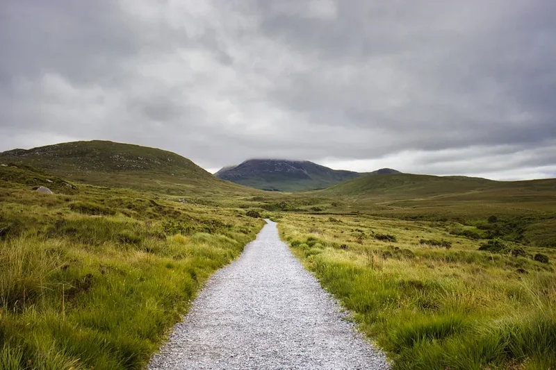
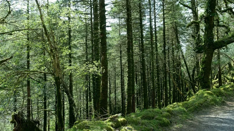
The geology of the trail is dominated by the Leinster Granite pluton, which was intruded approximately 400 million years ago. This granite core forms the rounded, "whale-back" mountains that characterise the northern half of the walk. Over millennia, glaciation carved deep, U-shaped valleys such as Glendalough and Glenmalure, creating the dramatic vertical relief that provides the trail's most challenging climbs and rewarding vistas. The landscape is a tapestry of upland blanket bog—a rare and fragile ecosystem—interspersed with vast plantations of Sitka spruce and pockets of native sessile oak forest. The "Garden of Ireland" moniker becomes evident as you pass through the manicured estates of Powerscourt and Luggala, where the dark, peaty waters of Lough Tay (famously known as the Guinness Lake) sit cradled by steep granite cliffs.
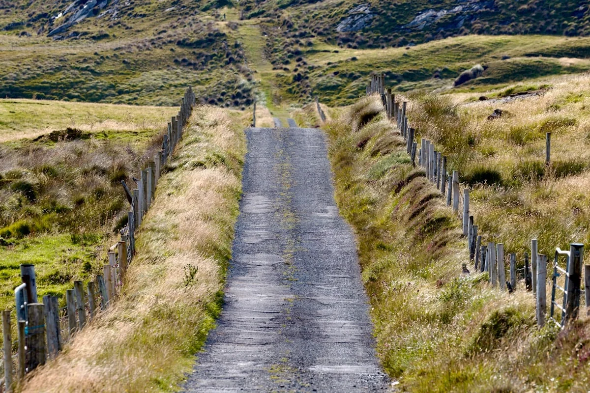
Walking the Wicklow Way is an exercise in endurance and adaptability. While the maximum altitude of 630 metres might seem modest compared to alpine routes, the cumulative elevation gain of 3,700 metres is significant. The terrain varies from well-maintained gravel forest roads and boardwalks (locally known as sleepers) to rocky mountain paths and soft, peaty tracks that can become exceptionally boggy after rain. The southern section of the trail, from Glenmalure to Clonegal, shifts the focus from high-altitude drama to rural charm. Here, the path winds through the foothills of the Blackstairs Mountains, following quiet country roads and forest fringes, offering a peaceful conclusion to a demanding journey. This trail is a quintessential Irish experience, combining wild mountain solitude with the legendary hospitality of the small villages that serve as waypoints along the route.
History and Cultural Context
The Wicklow Way owes its existence to the vision and persistence of one man: J.B. Malone (1913–1989). A passionate hillwalker and cartographer, Malone spent decades exploring the Wicklow Mountains and documenting routes in his popular newspaper column. He proposed the concept of a national long-distance trail in 1966, but it took until 1980 for the first section to be officially opened. Malone’s vision was to create a route that allowed the public to access the beauty of the mountains while respecting the rights of landowners. Today, a memorial to Malone stands on the slopes of Djouce, overlooking Lough Tay—a fitting tribute to the man who "opened" the mountains for generations of walkers.
However, the history of the land the trail traverses goes back much further. The most significant cultural landmark on the route is Glendalough (the Valley of the Two Lakes). Founded in the 6th century by St. Kevin, this monastic city became one of the great centres of learning in Early Christian Ireland. The iconic Round Tower, stone churches, and high crosses that walkers pass on Day 3 are remnants of a golden age of Irish monasticism. The valley remained a place of pilgrimage and retreat for centuries, even after the monastery was dissolved in the 16th century.
The trail also crosses paths with Ireland's turbulent political history. The military road, which the Wicklow Way intersects at several points, was constructed by British forces following the 1798 Rebellion to flush out Irish rebels hiding in the inaccessible mountain fastnesses of Glenmalure and the surrounding valleys. The ruins of old shooting lodges and abandoned farmsteads scattered along the route tell a story of a landscape that was once more densely populated before the Great Famine and subsequent rural depopulation. Walking the Wicklow Way is, in many ways, a walk through the layers of Ireland's past, from prehistoric megalithic tombs to the resilient spirit of the modern rural communities that maintain the trail today.
Want more background? Read extended notes on history and cultural context → Learn more
Seasonal Highlights and Weather Reality
The Wicklow Way is accessible year-round, but the experience changes dramatically with the seasons. Due to its proximity to the Atlantic, Wicklow weather is notoriously fickle. It is common to experience "four seasons in one day," where bright sunshine is followed by heavy rain and mist within minutes. The mountains create their own microclimate, and temperatures on the high ridges can be 5–10 degrees Celsius cooler than in Dublin city centre.
Spring (April to May): This is arguably the best time to walk. The weather begins to stabilise, and the landscape comes alive with the vibrant yellow of flowering gorse (whin) and the deep blue of wild hyacinths in the wooded sections. The days are lengthening, providing ample light for the longer stages, and the trail is generally less crowded than in peak summer.
Summer (June to August): This is the peak season. Expect the warmest temperatures (averaging 15–20°C) and the longest daylight hours (up to 17 hours of light in late June). However, this is also the time when the "Wicklow Midge" is most active, particularly in sheltered forest areas and near water. Summer also brings the most walkers, so booking accommodation in advance is essential. The heather begins to purple the hillsides in late August, creating a spectacular visual display.
Autumn (September to October): September offers a beautiful "second spring" with crisp air and the changing colours of the deciduous trees in the valleys. The bracken turns a deep rust-orange, and the light takes on a golden quality. October can be wet, but the sight of the mist clinging to the glacial valleys is quintessentially Irish.
Winter (November to March): Only recommended for experienced walkers with high-level navigation skills. Daylight is short (sunset as early as 4:00 PM), and the high ground is frequently shrouded in thick mist or "clag." Snow is common on the higher passes like the Sally Gap and the shoulder of Djouce. Many B&Bs close during this period, and the boggy sections of the trail become significantly more difficult to traverse.
Recommended Itinerary
7-Day Wicklow Way Itinerary
Day 1: Marlay Park to Knockree
- Distance: 21 km
- Elevation gain: 600 m
- Time: 6–7 hours
- Start at the official trailhead in Marlay Park, Rathfarnham.
- Ascend through Kilmashogue Forest to the shoulder of Fairy Castle.
- First major views over Dublin city and the Irish Sea.
- Descend into the Glencullen Valley and pass the famous Johnnie Fox's Pub (a short detour).
- Cross the valley and climb over Prince William's Seat.
- Finish with a descent into the scenic Dargle Valley to reach Knockree Youth Hostel or local B&Bs.
Day 2: Knockree to Oldbridge (Roundwood)
- Distance: 18 km
- Elevation gain: 500 m
- Time: 5–6 hours
- A spectacular day featuring the Powerscourt Estate.
- Walk along the shoulder of Djouce Mountain (625 m).
- Pass the J.B. Malone memorial with views of Lough Tay (the Guinness Lake).
- Traverse the "White Hill" boardwalks to protect the fragile blanket bog.
- Descend through the Luggala Estate, often seeing wild deer and goats.
- Finish in the quiet hamlet of Oldbridge, near the village of Roundwood.
Day 3: Oldbridge to Glendalough
- Distance: 12 km
- Elevation gain: 400 m
- Time: 3–4 hours
- A shorter day allowing time to explore the monastic city of Glendalough.
- Climb through forest tracks over Paddock Hill.
- Descend into the village of Laragh, a popular hub for hikers.
- Follow the "Green Road" into the heart of Glendalough.
- Visit the Round Tower, St. Kevin's Kitchen, and the Upper Lake.
- Stay in Laragh or Glendalough.
Day 4: Glendalough to Glenmalure
- Distance: 14 km
- Elevation gain: 450 m
- Time: 4–5 hours
- One of the most iconic sections of the trail.
- Ascend the steep "Spinc" steps for breathtaking views over the Glendalough lakes.
- Cross the upland plateau of Mullacor.
- Descend into Glenmalure, Ireland's longest glacial valley.
- Pass the base of Lugnaquilla (Leinster's highest peak).
- Finish at the historic Glenmalure Lodge.
Day 5: Glenmalure to Iron Bridge (Moyne)
- Distance: 21 km
- Elevation gain: 550 m
- Time: 6–7 hours
- A long, remote stretch through extensive forest plantations.
- Climb out of Glenmalure over the shoulder of Slieve Maan.
- Descend to the military road and climb again over Mucklagh.
- Views shift from rugged granite peaks to the softer hills of South Wicklow.
- Finish at the Iron Bridge over the Ow River.
- Accommodation is usually found in the nearby village of Moyne or via local B&B pickups.
Day 6: Iron Bridge to Tinahely
- Distance: 21 km
- Elevation gain: 400 m
- Time: 6–7 hours
- The terrain becomes gentler, following forest edges and quiet boreens.
- Pass through the townlands of Ballycumber and Kyle.
- Enjoy views of the rolling Carlow farmland to the west.
- Descend into the market town of Tinahely.
- Tinahely offers several pubs, shops, and comfortable guesthouses.
Day 7: Tinahely to Clonegal
- Distance: 24 km
- Elevation gain: 400 m
- Time: 7–8 hours
- The final push to the finish line.
- Follow the ridge of Muskeagh Hill.
- A significant portion of this day is on quiet paved roads, which can be hard on the feet.
- Cross the border from County Wicklow into County Carlow.
- Finish at the official Wicklow Way monument in the village green of Clonegal.
- Celebrate your achievement at Osborne's Pub, a historic establishment at the trail's end.
Planning and Bookings
Book Your Trip
Everything you need to plan your journey
Accommodation
Find places to stay near Dublin
Flights
Search flights to Dublin
Essential Preparation
The Wicklow Way requires a moderate level of fitness. While the paths are generally well-marked with the yellow "walking man" symbol, you should be comfortable walking 20+ kilometres per day with a loaded pack. Navigation skills are essential; while the trail is waymarked, mist can obscure markers on the high ground between Knockree and Glenmalure. You should be able to read a 1:50,000 scale map and use a compass or GPS.
Logistically, the trail is very accessible. Most walkers fly into Dublin Airport (DUB). From the airport, you can take a bus or taxi to the city centre, and then use the Dublin Bus (Route 16 or 14) to reach Marlay Park. At the southern end, Clonegal is more remote. You will likely need to arrange a taxi to the nearby town of Bunclody or Tullow, from where buses run back to Dublin or Waterford. Booking accommodation in advance is the most critical part of planning, especially during the summer months and weekends.
Trail Accommodation
Accommodation on the Wicklow Way is a mix of B&Bs, guesthouses, hostels, and basic mountain shelters. There is no "hut system" like in the Alps or New Zealand, so you will mostly be staying in villages or rural farmhouses.
B&Bs and Guesthouses: This is the most common choice. Most are located in or near the villages of Enniskerry (near Knockree), Roundwood, Laragh, Glenmalure, and Tinahely. Many B&B owners are accustomed to walkers and offer luggage transfer services, packed lunches, and pickups from the trail if their house is a few kilometres off-route. Expect to pay €50–€80 per person per night including breakfast.
Hostels: There are excellent hostels in Knockree (An Óige) and Glendalough. These offer dormitory-style beds, communal kitchens, and drying rooms. They are a budget-friendly option and great for meeting other walkers.
Adirondack Shelters: There are three basic wooden shelters (lean-tos) provided by Coillte (the forestry board) at Mullacor, Mucklagh, and Brusher Gap. These are free to use on a first-come, first-served basis. They provide a roof and a wooden floor but no facilities—no water, no toilets, and no mattresses. You must carry all your own camping gear if you plan to use these.
Camping: Wild camping is permitted in some areas of the Wicklow Mountains National Park, provided you follow the "Wild Camping Code" (camping at least 400 metres from a road and 20 metres from water). However, much of the trail passes through private farmland or commercial forestry where camping is not allowed. Always seek permission if in doubt.
Required Gear
- Footwear: Waterproof hiking boots with good ankle support are essential. The terrain is often wet and rocky. Ensure they are well broken-in before starting.
- Rain Gear: A high-quality waterproof jacket and overtrousers (Gore-Tex or similar). Ireland's rain is persistent and often accompanied by wind.
- Backpack: A 35–50 litre pack if staying in B&Bs, or 65+ litres if camping. A waterproof rain cover is mandatory.
- Clothing: Use a layering system. Merino wool or synthetic base layers (no cotton), a fleece or insulated mid-layer, and quick-drying trekking trousers.
- Navigation: EastWest Mapping or Ordnance Survey Ireland (OSI) Sheet 50, 56, and 62. A compass and a GPS/Smartphone with offline maps (e.g., Hiiker or AllTrails).
- Safety: A basic first aid kit (including blister plasters like Compeed), a whistle, and a space blanket.
What to Bring
- Water Treatment: While tap water in B&Bs is safe, if you are taking water from streams in the mountains, you must use a filter or purification tablets due to the presence of sheep and deer.
- Food: Carry enough snacks and a packed lunch for each day. While you pass through villages, there are long stretches (especially Day 5) with no shops.
- Midge Repellent: Essential from June to August. Look for products containing DEET or Smidge.
- Sun Protection: Even on overcast days, the UV levels on the mountains can be high. Bring SPF 30+ sunscreen and sunglasses.
- Power Bank: To keep your phone/GPS charged, as cold weather and searching for signal can drain batteries quickly.
- Towel: A lightweight travel towel if staying in hostels.
Permits
One of the great advantages of the Wicklow Way is that no permits or fees are required to walk the trail. It is a public right-of-way that traverses a mix of National Park land, state-owned forestry (Coillte), and private farmland. Access is granted through the goodwill of local landowners and the work of the Dublin Mountains Partnership and Wicklow County Council.
Key Considerations:
- No Booking Required for the Trail: You can start and finish whenever you like. There is no registration system at the trailhead.
- Accommodation Bookings: While the trail is free, your accommodation is not. During the peak months of July and August, you should book your B&Bs or hostels at least 2–3 months in advance.
- Group Sizes: If you are organising a large group (more than 10 people), it is polite to notify the Wicklow Mountains National Park office, especially if you plan to pass through Glendalough, to ensure there are no conflicting events.
- Dogs: Dogs are strictly prohibited on many sections of the Wicklow Way that pass through private farmland, even if on a lead. This is to protect livestock (sheep). It is highly recommended to leave dogs at home for this specific trail.
Other Activities in the Area
If you have extra time before or after your walk, the region offers several world-class attractions:
- Powerscourt Estate and Gardens: Located near Enniskerry, these gardens were voted the third best in the world by National Geographic. The estate also features Ireland's highest waterfall (121 m), which is a short detour from the trail.
- Glendalough Monastic Site: Spend a full day here exploring the 6th-century ruins. The Visitor Centre provides excellent historical context.
- Mount Usher Gardens: Located in Ashford, these are famous Robinsonian-style wild gardens, perfect for a relaxing afternoon.
- Beyond the Trees Avondale: A spectacular Treetop Walk and viewing tower in Rathdrum, offering a bird's-eye view of the Wicklow forests.
- Dublin City: Since the trail starts in Dublin, take a day to visit Trinity College (Book of Kells), the Guinness Storehouse, or the EPIC Emigration Museum.
- Lugnaquilla Ascent: For experienced hikers, a detour from Glenmalure to summit Lugnaquilla (925 m), the highest point in Ireland outside of County Kerry, is a popular challenge.
Safety and Conditions
Weather Awareness: The primary danger on the Wicklow Way is the weather. Hypothermia is a genuine risk, even in summer, if you are caught in a heavy downpour on the high ground without proper waterproofs. Always check the Met Éireann mountain forecast before setting out. If the forecast calls for high winds or low cloud, consider taking a lower-level road alternative.
Navigation: The section between Djouce Mountain and Glendalough is particularly prone to sudden mist. The trail follows a boardwalk in many places, but if you lose the path, the terrain is featureless blanket bog. Always carry a physical map and compass and know how to use them. Do not rely solely on a mobile phone, as battery life can fail and signal is non-existent in deep valleys like Glenmalure.
Terrain Hazards:
- Bog Holes: In the wetter sections, "shaking bogs" can be deep. Stay on the marked path or boardwalks.
- Road Walking: The southern section involves significant walking on narrow country roads. Be mindful of local traffic; walk on the right-hand side facing oncoming vehicles and wear reflective gear if light is low.
- River Crossings: Most major crossings have bridges, but after extreme rainfall, small streams can become torrents. Never attempt to cross a fast-flowing, knee-deep stream.
Emergency Services: In the event of an emergency, dial 999 or 112 and ask for Mountain Rescue. Be prepared to give your coordinates or a clear description of your last known waypoint.
Side Trips and Points of Interest
Lough Tay (The Guinness Lake): One of the most photographed spots in Ireland. The lake's dark peaty water and white sand beach (imported by the Guinness family) make it look like a giant pint of stout. The view from the J.B. Malone memorial on the Wicklow Way is the best vantage point.
The Spinc Ridge: While the Wicklow Way traditionally follows the forest tracks above Glendalough, many walkers choose the "Spinc" alternative. This involves climbing a long series of wooden steps to a ridge overlooking the Upper Lake. It adds elevation but offers the most dramatic views of the entire trail.
Glenmacnass Waterfall: A short detour from the trail near Laragh leads to this 80-metre waterfall where the Glenmacnass River plunges off the Sally Gap plateau. It is particularly impressive after heavy rain.
The Military Road: You will cross this historic road several times. Built between 1800 and 1809, it was a feat of engineering designed to allow the British army to move quickly through the mountains. Today, it is one of the most scenic driving routes in Europe.
Leave No Trace
The Wicklow Way passes through a fragile environment that is under constant pressure from its proximity to a major city. Following the seven principles of Leave No Trace Ireland is essential to ensure the trail remains open and beautiful for everyone.
- Plan Ahead and Prepare: Know the route, check the weather, and ensure you have the right gear to avoid needing rescue.
- Travel on Durable Surfaces: Stay on the marked trail and boardwalks. Stepping off the path in boggy areas causes "braiding," where multiple paths form and destroy the vegetation.
- Dispose of Waste Properly: Pack out everything you pack in. This includes organic waste like banana skins and orange peels, which do not decompose quickly in the acidic mountain soil and can harm local wildlife.
- Leave What You Find: Do not pick wildflowers or remove stones from historic structures like the monastic ruins or dry-stone walls.
- Minimise Campfire Impacts: Fires are strictly prohibited in the Wicklow Mountains National Park and Coillte forests due to the high risk of peat fires. Use a lightweight stove for cooking.
- Respect Wildlife: Observe deer, feral goats, and birds from a distance. Keep noise levels low.
- Be Considerate of Others: Yield to uphill walkers. Keep gates as you find them (usually closed to prevent livestock escaping). Respect the privacy of landowners whose gardens the trail may skirt.