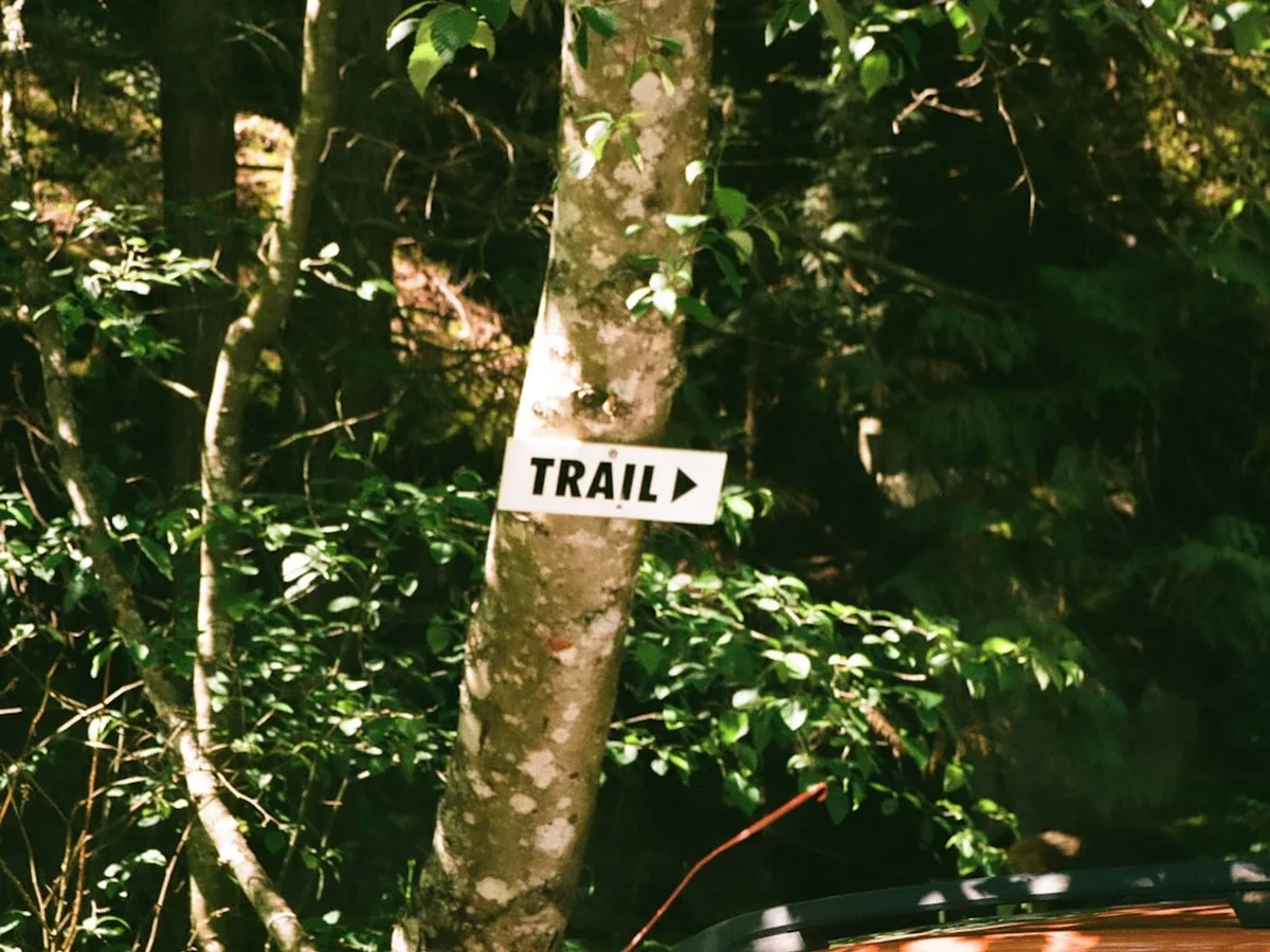
White Rim Trail - The Desert's Grandest Loop
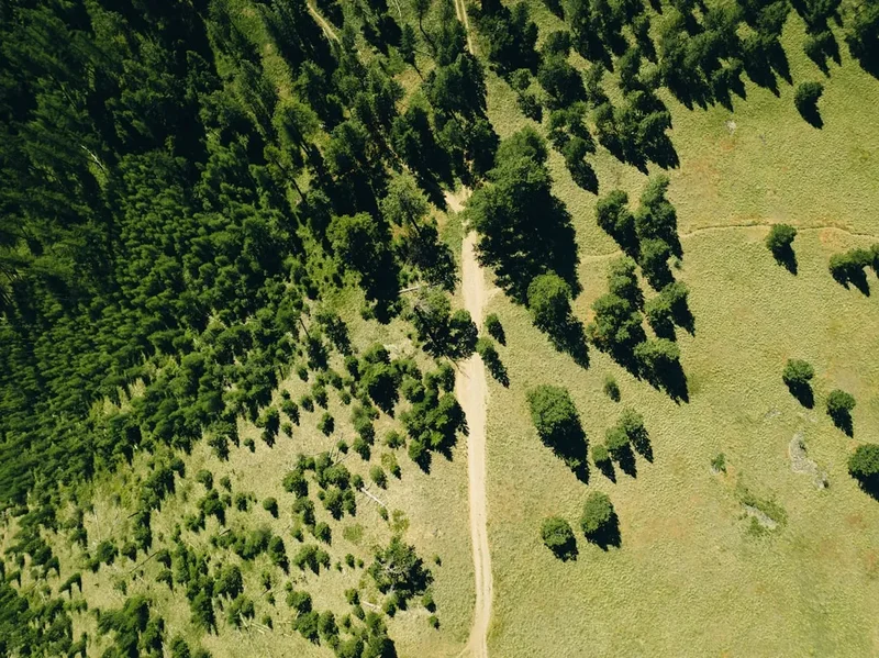
The White Rim Trail is a legendary 160.9-kilometre loop that circumnavigates the Island in the Sky mesa in Canyonlands National Park, Utah. This remote desert trek offers an unparalleled journey through a landscape defined by deep canyons, towering spires, and the stark, pale sandstone bench from which the trail takes its name. Unlike many alpine treks, the White Rim is a journey of horizontal immensity, where the scale of the American West is revealed in every sweeping vista of the Colorado and Green Rivers. Whether tackled by high-clearance four-wheel-drive vehicle or as a multi-day mountain biking expedition, the trail demands meticulous preparation and a deep respect for the arid environment. It is a place where the silence is heavy, the stars are blindingly bright, and the geological history of the earth is laid bare in vibrant shades of ochre, vermillion, and bone-white.
- Distance: 160.9 km loop
- Duration: 2–4 days
- Season: Spring (March–May) and Autumn (September–October)
- Campsites (mandatory booking): 20 designated camping areas (e.g., Airport, Murphy Hogback, Hardscrabble)
- Highest point: Approximately 1,800 m (at the mesa top)
- Daily access: Strictly limited by permit for both day use and overnight stays
- Direction: Can be travelled clockwise or anti-clockwise (clockwise is traditional for cyclists)
Overview
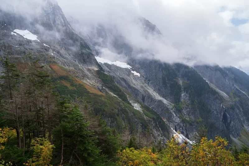
The White Rim Trail is often described as one of the most scenic drives and rides in the world, but such a simple description fails to capture the raw, visceral experience of traversing the heart of Canyonlands. The trail follows a natural terrace of White Rim Sandstone, a resistant layer of rock deposited roughly 250 million years ago during the Permian period. This "rim" sits approximately 300 to 400 metres below the top of the Island in the Sky mesa and roughly 300 metres above the rivers that continue to carve the canyons today. The result is a middle-world—a vast, flat bench that provides a front-row seat to the erosive power of nature.
The journey is a masterclass in desert geology. To your left (if travelling clockwise), the sheer Wingate Sandstone cliffs of the Island in the Sky rise like fortress walls, while to your right, the land drops away into the "inner canyon," a labyrinth of red rock fins, secret slot canyons, and the distant, shimmering ribbons of the Green and Colorado Rivers. The trail itself is a rugged, unpaved track that varies from smooth, hard-packed dirt to technical sections of loose rock, deep sand, and steep, exposed switchbacks. It is not a journey for the faint of heart or the ill-prepared; the environment is unforgiving, with no potable water, no cellular service, and temperatures that can fluctuate wildly within a single day.
What sets the White Rim apart is the profound sense of isolation. Because the National Park Service strictly limits the number of permits issued, you can travel for hours without seeing another soul. This solitude allows for a deep connection with the desert. You begin to notice the subtle shifts in the colour of the rock as the sun moves across the sky, the resilient desert flora like the twisted Utah juniper and pinyon pine, and the occasional glimpse of a desert bighorn sheep navigating a cliff face that looks impossible to scale. It is a journey that rewards patience, self-reliance, and a willingness to slow down to the pace of the desert.
History and Cultural Context
The history of the White Rim Trail is a tapestry of ancient habitation, rugged ranching, and the feverish energy of the Cold War. Long before the first wheels touched this dirt, the Ancestral Puebloan and Fremont people inhabited the surrounding canyons. While the White Rim itself was likely too arid for permanent settlement, these ancient cultures left their mark in the form of granaries, rock art, and lithic scatters in the more sheltered canyons nearby. To them, this was a landscape of spiritual significance and a source of seasonal resources.
In the late 19th and early 20th centuries, the area was the domain of hardy cattle ranchers. The Shafer family, prominent local pioneers, were instrumental in developing the first rudimentary routes down from the mesa top. The famous Shafer Trail—a series of hair-raising switchbacks that drop 450 metres in less than 8 kilometres—was originally a path used by ranchers to move sheep and cattle to the lower pastures during the winter months. These early settlers lived a life of incredible hardship, navigating a vertical world with little more than grit and horses.
However, the modern White Rim Trail as we know it was largely a product of the 1950s uranium boom. During the Cold War, the United States government, through the Atomic Energy Commission (AEC), offered incentives for the discovery of uranium. Prospectors swarmed the Colorado Plateau, and the AEC funded the construction of hundreds of kilometres of "atomic roads" to allow trucks to access remote ore deposits. The White Rim Road was one such project, carved into the sandstone to facilitate the extraction of "yellowcake" uranium. While the boom eventually faded, the roads remained, providing the infrastructure for what would eventually become Canyonlands National Park in 1964. Today, the trail serves as a reminder of how human ambition and industrial necessity can inadvertently create a gateway to wilderness appreciation.
Want more background? Read extended notes on history and cultural context → Learn more
Seasonal Highlights and Weather Reality
Timing is everything on the White Rim Trail. The desert is a land of extremes, and choosing the wrong season can transform a challenging adventure into a life-threatening ordeal. The primary seasons for the trail are Spring and Autumn, when temperatures are generally moderate and the weather is most stable.
Spring (March to May) is perhaps the most popular time. The desert comes alive with wildflowers—claret cup cacti, desert primrose, and globemallow add splashes of vibrant colour to the red earth. Daytime temperatures typically range from 15°C to 25°C, though nights can still drop below freezing. This is also the windiest season; "sand blasts" are common, and gusts can make cycling or driving difficult. Autumn (September to October) offers similar temperatures but generally calmer winds and more predictable weather. The low angle of the autumn sun deepens the shadows in the canyons, making it a favourite season for photographers.
Summer (June to August) is brutally hot, with daytime temperatures frequently exceeding 40°C. There is virtually no shade on the White Rim, and the heat radiating off the sandstone can make the trail feel like an oven. This is also the season of the "North American Monsoon," where sudden, violent thunderstorms can occur in the late afternoon. These storms bring the risk of flash floods, which can wash out sections of the road or trap travellers between flooded washes. Travel during mid-summer is strongly discouraged for cyclists and requires extreme caution for vehicle travellers.
Winter (November to February) brings a quiet, stark beauty to the park. Snow occasionally dusts the red rocks, creating a stunning visual contrast. However, the trail can become treacherous. The shaded sections of the Shafer Trail and Murphy Hogback can hold ice and snow for weeks, making them impassable for vehicles. Furthermore, when the snow melts, the bentonite clay in the soil turns into "grease mud," which can stop even the most capable 4WD vehicle in its tracks. Winter travel requires specialised equipment and a high degree of self-sufficiency.
Recommended Itinerary
4-Day White Rim Loop Itinerary (Clockwise)
Day 1: Island in the Sky to Airport Campsite
- Distance: 30 km
- Elevation: 450 m descent via Shafer Trail
- Time: 3–5 hours (cycling) / 2–3 hours (driving)
- Start at the Island in the Sky Visitor Centre for a final permit check and water top-up
- Descend the iconic Shafer Trail switchbacks—use low gear and check brakes frequently
- Pass the junction with Potash Road and continue onto the White Rim Road proper
- Visit Musselman Arch, a 57-metre natural bridge you can walk across (with caution)
- Arrive at Airport Campsite, named for the nearby flat mesa that resembles a runway
- Enjoy the first night under a vast canopy of stars, far from any light pollution
Day 2: Airport to Murphy Hogback
- Distance: 45 km
- Elevation: Gradual rolling terrain with a steep final climb
- Time: 6–8 hours (cycling) / 4–5 hours (driving)
- Travel through the "Goosenecks" section, where the Colorado River carves deep loops below
- Pass through the spectacular Monument Basin, filled with towering stone "totem poles"
- Take the optional side trip to White Crack for one of the best panoramic views in the park
- Face the challenge of Murphy Hogback—a steep, technical climb that often requires cyclists to hike-a-bike and drivers to use 4WD Low
- Camp at Murphy Hogback, perched on a high ridge with 360-degree views of the surrounding canyons
Day 3: Murphy Hogback to Hardscrabble
- Distance: 40 km
- Elevation: Steep descent followed by river-level cruising
- Time: 5–7 hours (cycling) / 3–4 hours (driving)
- Descend the western side of Murphy Hogback—steep and loose, requiring careful braking
- The trail moves closer to the Green River, offering a change in vegetation and scenery
- Pass through Holeman Slot and the Black Crack, interesting geological features near the trail
- Navigate the "Potato Bottom" area, which can be sandy or muddy depending on recent rain
- Arrive at Hardscrabble Campsite, located near the river with views of the orange cliffs above
- Listen for the sound of the river and watch for bighorn sheep in the riparian zones
Day 4: Hardscrabble to Mineral Bottom and Exit
- Distance: 45.9 km
- Elevation: 300 m climb via Mineral Bottom switchbacks
- Time: 6–8 hours (cycling) / 4–5 hours (driving)
- Climb over Hardscrabble Hill, another steep and rocky section that tests tired legs
- Follow the Green River closely, passing through groves of tamarisk and willow
- Reach the Mineral Bottom switchbacks—the final major obstacle of the trip
- Ascend the switchbacks to reach the top of the mesa and the Mineral Canyon Road
- Complete the loop by travelling across the flat Horsethief Point area back to UT-313
- Celebrate the completion of one of the world's most demanding and beautiful desert loops
Important Notes:
- Permits are mandatory for all overnight stays and must be displayed on your vehicle or bike
- There is NO water on the trail; you must carry every drop you need (minimum 4–6 litres per person per day)
- Human waste must be managed using a "WAG bag" system or the pit toilets at campsites
- High-clearance 4WD vehicles are required; AWD vehicles often lack the clearance for Murphy Hogback
- Check the weather forecast daily; flash floods can occur even if it is not raining directly on you
- Pack out all rubbish, including orange peels and nut shells
Planning and Bookings
Book Your Trip
Everything you need to plan your journey
Accommodation
Find places to stay near Moab, Utah
Flights
Search flights to Moab, Utah
Essential Preparation
The White Rim Trail is a serious undertaking that requires months of planning. Because the trail is located in a remote desert environment, self-sufficiency is the primary requirement. For vehicle travellers, this means having a high-clearance 4WD vehicle with a true low-range transfer case. Many "crossover" SUVs do not have the clearance or the gearing necessary to safely navigate sections like Murphy Hogback or Hardscrabble Hill. Ensure your vehicle is in peak mechanical condition, with good tyres (including a full-sized spare) and all fluids topped up.
For cyclists, the White Rim is a test of endurance and technical skill. Most riders choose to have a support vehicle to carry water, food, and camping gear, allowing them to ride "light." If you are bikepacking (carrying all your own gear), be prepared for the significant weight of the water required, which can add 15–20 kilograms to your setup. Fitness is crucial; while the total elevation gain is 1,219 metres, the steepness of the climbs and the heat of the sun make it feel much more strenuous.
Moab, Utah, is the primary base for the White Rim. It is a world-class outdoor adventure hub with numerous bike shops, 4WD rental agencies, supermarkets, and hotels. It is highly recommended to spend at least one night in Moab before your trip to finalise gear and acclimatise to the dry desert air.
Trail Accommodation
Accommodation on the White Rim Trail consists exclusively of primitive campsites. There are 20 designated camping areas spread along the loop, each containing one to three individual sites. These must be booked in advance through Recreation.gov.
Campsite Facilities:
- Flat areas for tents or vehicles
- Vault toilets (pit toilets) are available at most, but not all, camping areas
- No water, no electricity, and no rubbish bins
- No shade structures (bring your own awning or tarp)
- Fires are strictly prohibited; use only gas stoves for cooking
What Campsites Don't Provide:
- Potable water (you must carry all water)
- Privacy (sites are often open to the trail)
- Protection from the elements (wind and sun are constant)
- Cell phone signal
Booking Requirements:
- Overnight permits are required year-round
- Reservations open four months in advance on a rolling basis
- Demand is extremely high for Spring and Autumn dates; sites often book out within minutes of becoming available
- Cost: US$30 per permit plus a US$6 reservation fee (prices subject to change)
- Maximum group size is 15 people and 3 vehicles per campsite
Required Gear
- High-clearance 4WD vehicle - Must have a low-range transfer case (4LO)
- Full-sized spare tyre - And the knowledge/tools to change it on uneven ground
- Vehicle recovery gear - Shovel, traction boards (Maxtrax), and a tow strap
- Mountain bike - Well-maintained, with tubeless tyres and spare tubes/sealant
- Bike tools - Multi-tool, chain tool, pump, and spare derailleur hanger
- Navigation - High-quality topographic map and a GPS unit (offline maps are essential)
- First aid kit - Including tweezers for cactus spines and plenty of electrolyte salts
- Emergency communication - A satellite messenger (e.g., Garmin inReach) as there is no cell service
- Shade structure - A vehicle-mounted awning or a lightweight tarp for midday sun
What to Bring
- Water - Minimum 4–6 litres per person per day (more in summer). Carry at least one extra day's supply
- Food - High-calorie, easy-to-prepare meals. Salty snacks are essential to replace lost electrolytes
- Human waste bags - "WAG bags" are required for use between vault toilets to protect the environment
- Sun protection - SPF 50+ sunscreen, polarised sunglasses, and a wide-brimmed hat
- Clothing - Lightweight, breathable layers for the day; warm fleece or down jacket for the cold desert nights
- Sturdy footwear - Hiking boots or stiff-soled cycling shoes. Avoid sandals on the trail due to rocks and cacti
- Toiletries - Biodegradable soap, wet wipes (for "desert baths"), and hand sanitiser
- Repair kits - For tents, sleeping mats, and stoves
- Extra fuel - For your vehicle and your cooking stove
Permits
Permits are the gatekeepers of the White Rim experience. The National Park Service uses a permit system to prevent overcrowding, protect the fragile desert ecosystem, and ensure that visitors have a high-quality wilderness experience. There are two types of permits: Day Use and Overnight.
Overnight Permits: These are required for anyone staying at the designated campsites along the trail. They must be reserved online via Recreation.gov. The reservation window opens four months in advance. For example, if you want to hike in October, you should be ready to book in June. Because of the trail's popularity, it is essential to have a "Plan B" and "Plan C" for your itinerary, as your first-choice campsites may be taken.
Day Use Permits: If you intend to drive or ride the entire loop (or any portion of it) in a single day, you still need a permit. These are also available on Recreation.gov and are limited to a specific number per day. Day use permits are often easier to obtain than overnight permits but still require advance planning during the peak seasons.
Permit Strategy:
- Create your Recreation.gov account and log in before the reservation window opens
- Be online at exactly 8:00 AM Mountain Time on the day your window opens
- Have your vehicle's make, model, and licence plate number ready
- Print your permit before you leave home; digital copies are not always accepted by rangers in the field
- Always carry your permit on your person or display it clearly on your vehicle's dashboard
Other Activities in the Area
The White Rim Trail is located in the heart of one of the world's greatest outdoor playgrounds. Consider these nearby activities to round out your Utah adventure:
- Island in the Sky Viewpoints: Visit Grand View Point and Orange Cliffs Overlook for a "bird's eye" perspective of the trail you just travelled.
- Upheaval Dome: A mysterious geological feature—either a salt dome or a meteor impact crater—located just a short drive from the White Rim trailhead.
- Arches National Park: Located just outside Moab, this park features over 2,000 natural stone arches, including the world-famous Delicate Arch.
- Dead Horse Point State Park: Offers one of the most photographed vistas in the world, looking down 600 metres to a gooseneck in the Colorado River.
- Moab Mountain Biking: If the White Rim didn't satisfy your craving for dirt, try the Slickrock Trail or the Whole Enchilada for world-class technical riding.
- Rafting the Colorado River: Experience the canyons from the bottom up with a half-day or full-day rafting trip through the Fisher Towers section.
Safety and Conditions
Environmental Hazards: The desert is a beautiful but indifferent environment. Dehydration and heat exhaustion are the most common medical issues on the White Rim. Because the air is so dry, sweat evaporates almost instantly, meaning you may not realise how much fluid you are losing. Drink constantly, even if you don't feel thirsty. Hyponatremia (low blood salt) is also a risk; ensure you are consuming enough salt and electrolytes alongside your water.
Flash Floods: Canyonlands is prone to sudden flash floods, particularly during the summer monsoon season. A storm many kilometres away can send a wall of water, mud, and debris down a dry wash in minutes. Never camp in a wash, and if you encounter a flooded section of the road, do not attempt to cross it. Wait for the water to recede, which usually happens within a few hours.
Vehicle Safety: Mechanical failure on the White Rim is more than an inconvenience; it is a survival situation. Towing fees from the trail can exceed US$2,000. Always stay with your vehicle if it breaks down. A vehicle is easier for search and rescue to spot than a person on foot, and it provides shade and shelter. Carry at least 20 litres of extra water specifically for your vehicle's radiator and for emergency use.
Wildlife: While generally shy, the desert is home to rattlesnakes, scorpions, and black widows. Always look before you place your hands or feet in rocky crevices. Desert bighorn sheep are common; give them plenty of space and never approach or feed them. Mountain lions also inhabit the park but are rarely seen.
Communication: Do not rely on mobile phones. There is no signal on the vast majority of the trail. A satellite-based emergency notification device (like a SPOT or Garmin inReach) is highly recommended. In the event of a life-threatening emergency, these devices can summon help to your exact coordinates.
Side Trips and Points of Interest
Musselman Arch: Located on the eastern side of the loop, this is a spectacular "flat" arch that you can actually walk across. It is only about 2 metres wide and has a sheer drop on both sides, so it is not for those with a fear of heights. It provides an incredible photo opportunity and a chance to feel the scale of the White Rim sandstone.
White Crack: Often considered the best campsite and viewpoint on the entire trail, White Crack is located at the southern tip of the Island in the Sky. A short side road leads to a point where the Colorado and Green River canyons converge. The views here are immense, stretching across the Needles District to the distant Abajo Mountains.
Lathrop Canyon: This is the only place on the White Rim Trail where a vehicle-accessible road leads all the way down to the banks of the Colorado River. It is a steep, sandy, and technical side trip (8 km return), but the reward is the chance to see the river up close and perhaps even find a small patch of shade under the cottonwood trees.
Fort Bottom: A short hike from the road leads to a historic stone structure perched on a high ridge overlooking a loop in the Green River. This "fort" was likely built by Ancestral Puebloans and provides a fascinating glimpse into the ancient human history of the canyon.
Leave No Trace
The desert ecosystem is incredibly fragile. One of the most important things to understand is "Biological Soil Crust" (also known as cryptobiotic soil). This dark, knobby crust is a living community of cyanobacteria, lichens, and mosses that prevents erosion and fixes nitrogen in the soil. A single footprint can destroy decades of growth. Always stay on the road, on established trails, or on bare rock.
The Seven Principles on the White Rim:
- Plan Ahead and Prepare: Know the regulations and carry enough water.
- Travel and Camp on Durable Surfaces: Stay on the road and in designated campsites.
- Dispose of Waste Properly: Pack out all rubbish. Use vault toilets or WAG bags for human waste. Never bury toilet paper.
- Leave What You Find: Do not move rocks, pick plants, or touch archaeological sites.
- Minimise Campfire Impacts: Fires are prohibited. Use a stove.
- Respect Wildlife: Observe from a distance and keep your food secure from rodents and ravens.
- Be Considerate of Other Visitors: Keep noise levels down and yield to uphill traffic on the switchbacks.