Via Transilvanica - The Path That Unites
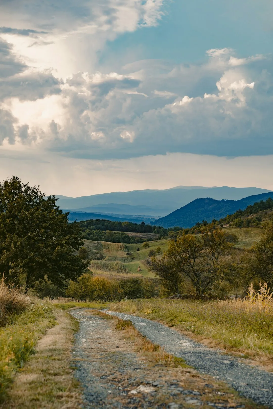
Via Transilvanica is Romania's first long-distance thru-hiking trail, a monumental 1,400-kilometre journey that traverses the country from the northern reaches of Bucovina to the banks of the Danube in the south. Often referred to as the "El Camino of Romania," this trail is far more than a simple hiking route; it is a cultural, historical, and spiritual artery that connects 108 local communities across seven distinct historical regions. The path is marked by unique andesite milestones, each weighing 230 kilograms and individually carved by artists, serving as both navigational aids and a massive outdoor art gallery. Walking the Via Transilvanica is an invitation to rediscover the soul of rural Europe, passing through ancient forests, medieval Saxon villages, Dacian ruins, and the rugged peaks of the Carpathian Mountains.
- Distance: 1,400 km (approximate, depending on route choices)
- Duration: 50–70 days for a full thru-hike
- Season: May to October (high mountain passes may be snow-bound outside this window)
- Accommodation: Guest houses, monasteries, local homes, and campsites
- Highest point: Approximately 1,500 m (varies by route in the Călimani and Mehedinți ranges)
- Total Elevation Gain: Approximately 45,000 m
- Direction: Generally walked North to South (Putna to Drobeta-Turnu Severin)
Overview
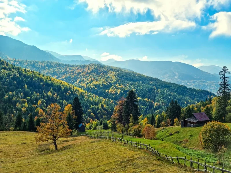
The Via Transilvanica is a project of unprecedented scale in Eastern Europe, conceived by the NGO Tășuleasa Social to revitalise rural communities and promote sustainable tourism. The trail is divided into seven major regions, each offering a completely different landscape and cultural experience. In the north, Bucovina greets hikers with its famous painted monasteries and rolling emerald hills. As the trail moves south into the Highlands (Ținutul de Sus), the terrain becomes more rugged and mountainous, demanding higher physical fitness and navigation skills. The central sections—Terra Siculorum and Terra Saxonia—immerse the walker in the unique heritage of the Hungarian-speaking Szekler people and the fortified churches of the Transylvanian Saxons.
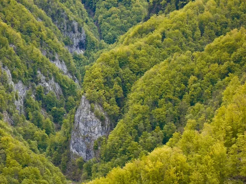
The southern half of the trail, Terra Dacica and Terra Romana, leads through the heart of ancient history, passing the ruins of Sarmizegetusa Regia (the capital of the Dacian Kingdom) and Ulpia Traiana Sarmizegetusa (the Roman capital). The journey concludes in the Cerna Valley and the Mehedinți Mountains before reaching the final milestone at the Bridge of Trajan in Drobeta-Turnu Severin. This is a landscape of immense biodiversity; Romania is home to the largest populations of brown bears, wolves, and lynx in Europe outside of Russia, and the trail passes through some of the continent's last remaining virgin forests.
Unlike many European trails that are heavily commercialised, Via Transilvanica offers a raw and authentic experience. You will walk through villages where horse-drawn carts are still common, where hospitality is a sacred duty, and where the rhythm of life is dictated by the seasons. The difficulty is rated as moderate, but the sheer length and the cumulative elevation gain make it a formidable challenge for any hiker. It is a journey of endurance, but also one of profound connection—to the land, to history, and to the people who call this diverse landscape home.
History and Cultural Context
The Via Transilvanica was officially inaugurated in October 2022, following four years of intensive work by hundreds of volunteers. The project was spearheaded by Alin Ușeriu and his brother, the ultra-marathon runner Tibi Ușeriu, through their organisation Tășuleasa Social. Their vision was to create a "path that unites" (calea care unește), bringing together the diverse ethnic and cultural threads that make up the Romanian identity—Romanians, Hungarians, Saxons, Roma, and others.
The trail's historical depth is staggering. In Bucovina, you walk in the footsteps of Stephen the Great, the 15th-century prince who defended the region against Ottoman invasions. In Transylvania, the path weaves through the "Terra Saxonia," a region settled by German colonists in the 12th century who built the iconic fortified churches that are now UNESCO World Heritage sites. Further south, the trail enters the realm of the Dacians and Romans, where the very foundations of the Romanian language and culture were laid nearly two millennia ago. The andesite milestones themselves are a nod to this history; each one is a unique work of art, carved with symbols that reflect the local folklore, history, or natural beauty of the specific kilometre it marks.
Culturally, the trail serves as a lifeline for dying villages. By bringing hikers to remote areas, the Via Transilvanica provides economic incentives for locals to preserve their traditional crafts, architecture, and "puncte de gastronomie locală" (local gastronomic points). These are certified private kitchens where villagers serve traditional meals to travellers, offering a taste of authentic Romanian cuisine that has remained unchanged for centuries.
Want more background? Read extended notes on history and cultural context → Learn more
Seasonal Highlights and Weather Reality
The ideal window for a full thru-hike of the Via Transilvanica is from late May to early October. During this period, the weather is generally stable, and the mountain passes are clear of snow. However, Romania's climate is continental, meaning temperatures can fluctuate significantly.
Spring (May to June): This is perhaps the most beautiful time to walk. The meadows of Bucovina and Transylvania are in full bloom, and the landscapes are vibrantly green. However, this is also the wettest period. Frequent afternoon thunderstorms are common, especially in the mountains. Hikers should be prepared for mud and swollen streams. Temperatures range from 10°C at night to 25°C during the day.
Summer (July to August): The weather is hot and dry, particularly in the southern sections of Terra Romana and the Danube. Temperatures can soar above 35°C, making the exposed sections of the trail quite gruelling. In the mountains, the air remains cooler, but the risk of sudden, violent thunderstorms increases. This is the peak season for local tourism, so booking accommodation in advance is highly recommended.
Autumn (September to October): Many thru-hikers consider this the best time. The heat of summer has faded, the air is crisp and clear, and the autumn colours in the Carpathian forests are spectacular. September is generally dry, though by October, the nights become quite cold, and the first snows can fall on the higher peaks of the Călimani or Mehedinți ranges.
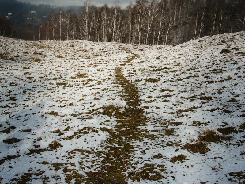
Winter (November to April): A full thru-hike is not recommended during winter unless you are an expert in winter navigation and survival. Large sections of the trail become impassable due to deep snow, and many guest houses in remote villages close for the season. Avalanche risk is a serious concern in the mountainous sections.
Recommended Itinerary
The Seven Regions of Via Transilvanica
Region 1: Bucovina (Putna to Vatra Dornei)
- Distance: 136 km
- Duration: 6–8 days
- Terrain: Rolling hills, dense spruce forests, and pastoral landscapes
- Key Waypoints: Putna Monastery, Sucevița Monastery, Vatra Moldoviței, Sadova
- Highlights: The UNESCO-listed painted monasteries and the traditional wooden architecture of northern Romania
- Difficulty: Moderate; well-marked with frequent village access
Region 2: The Highlands / Ținutul de Sus (Vatra Dornei to Câmpu Cetății)
- Distance: 275 km
- Duration: 12–15 days
- Terrain: High alpine ridges, volcanic plateaus, and deep valleys
- Key Waypoints: Călimani National Park, Tășuleasa Social (the trail's headquarters), Pasul Tihuța
- Highlights: Crossing the Călimani Mountains, the highest and most rugged section of the trail
- Difficulty: Hard; significant elevation gain and remote sections requiring self-sufficiency
Region 3: Terra Siculorum (Câmpu Cetății to Archita)
- Distance: 157 km
- Duration: 7–9 days
- Terrain: Gentle hills and wide valleys in the heart of the Szekler region
- Key Waypoints: Sovata, Praid, Lupeni, Odorheiu Secuiesc
- Highlights: Unique Hungarian-influenced culture, salt mines, and traditional Szekler gates
- Difficulty: Moderate; pleasant walking through agricultural landscapes
Region 4: Terra Saxonia (Archita to Micăsasa)
- Distance: 203 km
- Duration: 9–11 days
- Terrain: Oak and beech forests, medieval village paths
- Key Waypoints: Sighișoara (UNESCO citadel), Biertan, Mediaș, Axente Sever
- Highlights: The highest concentration of fortified churches in the world and the medieval charm of Sighișoara
- Difficulty: Moderate; some steep climbs between valleys but generally well-trodden paths
Region 5: Terra Dacica (Micăsasa to Ulpia Traiana Sarmizegetusa)
- Distance: 198 km
- Duration: 9–11 days
- Terrain: Hilly terrain transitioning into the foothills of the Southern Carpathians
- Key Waypoints: Blaj, Alba Iulia (The Great Union city), Orăștie, Sarmizegetusa Regia
- Highlights: Exploring the ancient Dacian fortresses and the massive Vauban-style citadel of Alba Iulia
- Difficulty: Moderate; long stretches of historical interest
Region 6: Terra Romana (Ulpia Traiana Sarmizegetusa to Drobeta-Turnu Severin)
- Distance: 258 km
- Duration: 12–14 days
- Terrain: Limestone plateaus, deep gorges, and the Mehedinți Mountains
- Key Waypoints: Retezat National Park (edge), Domogled-Valea Cernei National Park, Băile Herculane
- Highlights: The dramatic limestone scenery of the Cerna Valley and the Roman history of the Danube
- Difficulty: Hard; remote mountain sections and significant elevation changes
Region 7: The Danube (Final Stretch)
- Distance: Final approach to the city
- Key Waypoint: Drobeta-Turnu Severin
- Highlights: Reaching the final milestone at the Bridge of Trajan, overlooking the Danube River
- Difficulty: Easy; a celebratory finish to a massive journey
Important Notes:
- The trail is marked with orange "VT" symbols and andesite milestones every kilometre
- It is highly recommended to use the official "Ghidul Drumețului" (Hiker's Guide) available on the official website
- Water sources are generally available in villages, but mountain sections require carrying 2–3 litres
- The trail can be walked in sections; many locals choose to do one region per year
Planning and Bookings
Book Your Trip
Everything you need to plan your journey
Accommodation
Find places to stay near Cluj-Napoca
Flights
Search flights to Cluj-Napoca
Essential Preparation
Planning a thru-hike of the Via Transilvanica requires more than just physical fitness; it requires logistical coordination. The trail is not a wilderness track in the North American sense; it is a "cultural route" that passes through inhabited areas. Therefore, your planning should focus on understanding the local customs and the availability of services in each village. The official website (viatransilvanica.com) provides a comprehensive guide and a downloadable GPS track, which is essential as some sections can be confusing due to livestock paths.
Cluj-Napoca or Suceava are the best base cities for starting the trail. Suceava is closer to the northern trailhead at Putna. You should spend at least two days in your base city to finalise your gear, buy a local SIM card (Digi or Orange have the best coverage), and register your intent to hike with Tășuleasa Social if you wish to receive the "Carnetul Drumețului" (Hiker's Passport).
Trail Accommodation
Accommodation on the Via Transilvanica is diverse and reflects the hospitality of the Romanian people. Unlike the hut systems in the Alps, you will mostly stay in village-based establishments.
Types of Accommodation:
- Pensiuni (Guest Houses): The most common form of lodging. They offer private or shared rooms, usually with hot showers and home-cooked meals. Costs range from 100 to 200 RON (approx. €20–€40) per night.
- Monasteries: In Bucovina, many monasteries offer basic lodging for pilgrims and hikers. These are often very affordable or based on donations, but require respectful behaviour and adherence to quiet hours.
- Local Homes: In more remote villages, locals may offer a bed and a meal. This is often arranged on the spot or through the "Ghidul Drumețului" contact list.
- Camping: Wild camping is generally legal in Romania, provided you are not on private agricultural land or in a strictly protected core zone of a National Park. However, due to the high density of bears, camping near villages or in designated areas is safer.
- Tășuleasa Social: The trail's headquarters in Pasul Tihuța offers a dedicated hostel for hikers and is a must-stop for the community experience.
Booking Requirements: During the peak months of July and August, it is wise to book your next night's accommodation at least 24 hours in advance. In the shoulder seasons, you can often find a bed on the day of arrival.
Required Gear
- Footwear: High-quality trekking boots with good ankle support are essential. The terrain varies from asphalt and gravel to deep mud and rocky mountain paths. Ensure they are well broken-in.
- Rain Gear: A high-quality waterproof jacket (minimum 15,000mm hydrostatic head) and overtrousers. Romanian storms can be intense.
- Backpack: A 50–65L pack with a proper suspension system. A rain cover is mandatory.
- Navigation: A smartphone with the GPX track loaded into an app like Gaia GPS or Komoot. A power bank (20,000mAh) is necessary for multi-day remote sections.
- Bear Safety: Bear spray is highly recommended and can be purchased in major Romanian cities. A bear bell is also useful to avoid surprising animals.
- First Aid: Include plenty of blister plasters (Compeed), antiseptic cream, and any personal medications.
What to Bring
- Water Treatment: While village tap water is generally safe, mountain springs should be treated with a filter (like a Sawyer Squeeze) or purification tablets.
- Cash (RON): Many village guest houses and small shops do not accept cards. Carry at least 500–1,000 RON in small denominations at all times.
- Sun Protection: SPF 50 sunscreen, a wide-brimmed hat, and polarised sunglasses. The Transylvanian plateaus are very exposed.
- Clothing: Merino wool base layers are ideal for odour control on long trips. Include a lightweight down or synthetic "puffy" jacket for cold mountain evenings.
- Hiker's Passport: The "Carnetul Drumețului" to collect stamps at each milestone or village—a wonderful souvenir of the journey.
- Emergency Whistle: Often built into backpack chest straps, but essential for signalling in case of injury or to deter aggressive sheepdogs.
Permits
One of the greatest appeals of the Via Transilvanica is its accessibility. There are no permits required to walk the trail, and there are no daily quotas or entry fees for the route itself. However, there are a few administrative and logistical considerations to keep in mind.
National Park Fees: The trail passes through several National Parks, including Călimani and Domogled-Valea Cernei. While walking through is free, if you choose to stay in specific mountain refuges or designated campsites within these parks, a small fee (usually 10–20 RON) may be required, payable via SMS or at park visitor centres.
The Hiker's Passport (Carnetul Drumețului): While not a legal permit, this document is the "official" way to track your progress. You can obtain it at the start in Putna or at the Tășuleasa Social headquarters. It costs a nominal fee (approx. 50 RON) which goes toward trail maintenance. Collecting stamps from guest houses, shops, or monasteries along the way is a key part of the trail culture.
Registration: It is highly recommended to register your start date and expected duration on the official Via Transilvanica website. This helps the organisers track trail usage and can be vital for safety if you go missing in the more remote mountain sections.
Border Police: In the final sections near the Danube, the trail runs close to the Serbian border. It is essential to carry your passport or national ID card at all times, as border police patrols are common in this area.
Other Activities in the Area
Romania is a country of deep contrasts, and there are many ways to complement your hike:
- Sighișoara Citadel: Spend an extra day in this UNESCO World Heritage site, one of the best-preserved medieval citadels in Europe and the birthplace of Vlad the Impaler.
- Alba Iulia: Explore the massive star-shaped citadel, the site where the unification of Romania was declared in 1918.
- Băile Herculane: Near the end of the trail, soak your tired muscles in the thermal waters of this ancient Roman spa town, which was a favourite of Empress Elisabeth (Sisi) of Austria.
- Transfăgărășan Highway: If you have access to a car before or after your hike, drive this world-famous mountain road, often called the "best road in the world" by Top Gear.
- Bear Watching: Join an organised tour with a professional ranger in the Brașov or Harghita areas to see brown bears in their natural habitat from safe hides.
- Traditional Crafts Workshops: In the Terra Siculorum and Terra Saxonia regions, many artisans offer workshops in pottery, weaving, or woodcarving.
Safety and Conditions
Wildlife - The Brown Bear: Romania has the highest concentration of brown bears in Europe. While they generally avoid humans, encounters are possible, especially in the Highlands and Terra Romana. Always make noise while walking (talking, singing, or using a bear bell) to avoid surprising a bear. Never keep food inside your tent if camping; use a bear bag and hang it at least 4 metres high and 100 metres away from your sleeping area. If you encounter a bear, do not run. Speak in a calm, firm voice and back away slowly.
Shepherd Dogs (Ciobănești): For many hikers, the large, protective sheepdogs are a greater concern than bears. These dogs are bred to protect flocks from wolves and can be very aggressive toward strangers. If you approach a flock, the dogs will likely bark and run toward you. Stop immediately. Do not throw stones or run. Use your trekking poles as a barrier (but do not strike the dogs) and wait for the shepherd to call them off. If no shepherd is visible, back away slowly while facing the dogs.
Weather Extremes: The Carpathian Mountains are notorious for rapid weather changes. Hypothermia is a risk even in summer if you are caught in a cold rainstorm at high altitude. Always check the mountain forecast (Meteoblue is generally accurate for Romania) before heading into the Călimani or Mehedinți sections. Lightning is a significant danger on the open ridges; if a storm approaches, descend to lower ground immediately.
Water and Hygiene: While mountain springs are often pristine, the presence of large numbers of sheep means that Giardia and other waterborne pathogens are a risk. Always filter or treat water collected from the trail. In villages, tap water is generally safe, but if in doubt, ask the locals ("Este apa potabilă?").
Emergency Services: The emergency number in Romania is 112. For mountain-specific rescues, ask for "Salvamont" (the mountain rescue service). It is highly recommended to download the "Salvamont" app, which allows you to send your GPS coordinates directly to rescuers.
Side Trips and Points of Interest
Sarmizegetusa Regia: Located in the Terra Dacica section, this is the Stonehenge of Romania. The sacred sanctuary of the Dacians features impressive circular stone calendars and the remains of a sophisticated water drainage system. It is a place of immense atmospheric power, nestled deep in the Orăștie Mountains.
The Painted Monasteries of Bucovina: While the trail passes near several, taking a half-day detour to see Voroneț (known for its unique "Voroneț Blue") or Sucevița is highly recommended. The exterior frescoes have survived centuries of harsh weather and depict complex biblical scenes with incredible detail.
The Biertan Fortified Church: A short detour in Terra Saxonia leads to this massive architectural marvel. It features three tiers of defensive walls and a famous "matrimonial prison" where couples seeking divorce were locked together for two weeks with only one bed and one set of cutlery (legend says only one couple ever proceeded with the divorce after the ordeal).
The Iron Gates: At the very end of the trail in Drobeta-Turnu Severin, take a boat trip on the Danube to see the "Decebalus Rex" rock carving—the tallest rock sculpture in Europe—and the narrowest point of the Danube gorges.
Leave No Trace
The Via Transilvanica passes through some of the most pristine and culturally sensitive areas of Europe. As a hiker, you are an ambassador for the trail. Following Leave No Trace principles is essential to ensure the trail remains a positive force for the local communities.
Key Principles for Via Transilvanica:
- Respect the Milestones: The andesite milestones are unique works of art. Never deface them, climb on them, or leave stickers on them.
- Manage Your Waste: There is no rubbish collection on the trail. Pack out everything you pack in. In villages, ask your host where you can properly dispose of your waste.
- Respect Private Property: Much of the trail passes through hay meadows and pastures. Always close gates behind you to prevent livestock from escaping. Stay on the marked path to avoid trampling crops.
- Fire Safety: Wildfires are a growing concern in Romania. Never build a fire outside of designated fire rings in established campsites. Use a lightweight camping stove for cooking.
- Human Waste: Use toilets in villages whenever possible. If you must go on the trail, dig a "cathole" at least 15–20 cm deep and at least 60 metres away from water sources and the trail. Pack out your toilet paper.