Camino de Santiago (Vía de la Plata) - The Silver Way
The Vía de la Plata, or the Silver Way, represents the longest and perhaps most historically profound of all the pilgrimage routes leading to Santiago de Compostela. Stretching approximately 1,000 kilometres from the sun-drenched plazas of Seville in Andalusia to the mist-shrouded spires of the Cathedral of Santiago in Galicia, this trail is a journey through the very soul of Spain. Unlike the more crowded Camino Francés, the Vía de la Plata offers a solitary, contemplative experience, traversing vast landscapes of "dehesa" (oak pastureland), Roman ruins, and medieval cities. It follows an ancient Roman road that once linked the south of Hispania to the gold mines of the north, and today it serves as a challenging but deeply rewarding odyssey for those seeking a more rugged and authentic pilgrimage experience.
- Distance: 1,000.0 km (approximate, depending on route variations)
- Duration: 4–6 weeks
- Season: Spring (April–May) and Autumn (September–October) are ideal; summer is dangerously hot
- Accommodation: Albergues (pilgrim hostels), hostals, and rural guesthouses
- Highest point: Puerto de Chandoiro (approx. 1,260 m) or various points in the Sanabrés mountains
- Difficulty: Moderate to Strenuous (due to distance and heat, rather than technical terrain)
- Direction: South to North (Seville to Santiago de Compostela)
Overview
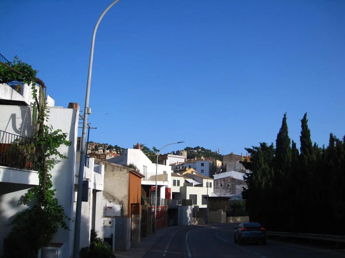
The Vía de la Plata is a trail of immense scale and dramatic transitions. It begins in the heart of Seville, where the scent of orange blossoms and the intricate Mudéjar architecture of the Alcázar set a majestic tone. From here, the route strikes north across the Guadalquivir valley, entering the vast, rolling plains of Extremadura. This is a landscape of big skies and ancient history, where the trail often follows the original Roman paving stones laid two millennia ago. Walkers will pass through Mérida, the "Rome of Spain," where a perfectly preserved Roman theatre and bridge still stand as testament to the engineering prowess of the empire.
As the journey progresses through the provinces of Cáceres and Salamanca, the scenery shifts from the red earth of the south to the golden sandstone of the central plateau. The "dehesa"—a unique Mediterranean ecosystem of cork and holm oak forests where Iberian pigs roam—provides a rhythmic, almost hypnotic backdrop for days of walking. The silence here is profound, broken only by the sound of cowbells or the wind through the oaks. This section of the trail is known for its long distances between villages, requiring pilgrims to be self-sufficient and mentally prepared for the solitude that defines the "Silver Way."
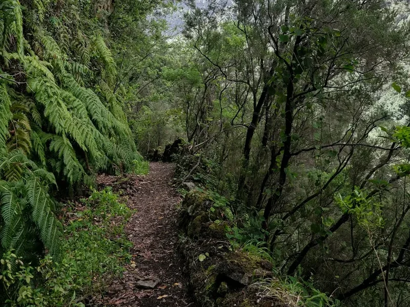
The final third of the route offers a choice: continuing north to join the Camino Francés at Astorga, or taking the Camino Sanabrés westward through the mountains of Zamora and Ourense. The Sanabrés route is the traditional choice for those completing the Vía de la Plata, leading through some of the most remote and beautiful terrain in Spain. Here, the dry heat of the south is replaced by the lush, green, and often rainy hills of Galicia. The final approach to Santiago de Compostela is a triumphant descent through eucalyptus forests and small stone hamlets, culminating in the arrival at the Praza do Obradoiro, where the journey of a thousand kilometres finds its spiritual and physical conclusion.
History and Cultural Context
The origins of the Vía de la Plata predate the Christian pilgrimage to Santiago. It began as a series of prehistoric tracks used by nomadic tribes and later formalised by the Romans in the 1st century AD. Known as the "Iter ab Emerita Asturicam," it was a vital artery for the Roman Empire, connecting the administrative centre of Emerita Augusta (modern-day Mérida) with the gold-rich regions of Asturica Augusta (Astorga). The name "Plata" is a linguistic curiosity; it likely does not refer to silver (plata in Spanish), but rather derives from the Arabic word "al-balat," meaning "the paved way" or "the wide road," referring to the impressive Roman engineering that characterised the route.
Following the Moorish conquest of the Iberian Peninsula, the route became a strategic corridor for both military campaigns and trade. During the Reconquista, as Christian kingdoms pushed south, the road was used by Mozarabic Christians (Christians living under Muslim rule) to travel north to the tomb of Saint James. This established the Vía de la Plata as a legitimate pilgrimage route, distinct from the northern paths. The cultural heritage along the trail is a palimpsest of these eras: Roman milestones (miliarios) still mark the kilometres, Visigothic churches sit in quiet valleys, and the fortified walls of cities like Cáceres reflect the centuries of conflict and coexistence between Islamic and Christian cultures.
In the modern era, the Vía de la Plata was largely forgotten as a pilgrimage route until a revival in the late 20th century. Today, it is recognised as a UNESCO World Heritage route (as part of the Caminos de Santiago). Walking this trail is not merely a physical exercise but a journey through the layers of Spanish history, where every step on a Roman stone or through a medieval gate connects the modern pilgrim to thousands of years of human movement and faith.
Want more background? Read extended notes on history and cultural context → Learn more
Seasonal Highlights and Weather Reality
Timing is the most critical factor when planning the Vía de la Plata. Because the route traverses the southern half of Spain and the high central plateau, weather conditions can be extreme and, in some cases, life-threatening if not respected.
Spring (April to May): This is widely considered the "Golden Window" for the Vía de la Plata. The plains of Extremadura are carpeted in wildflowers—lavender, rockrose, and poppies—and the temperatures are generally mild (15°C to 25°C). The days are long enough to allow for steady progress, and the water sources are usually reliable. However, spring can also bring "abril aguas mil" (April's thousand waters), meaning sudden and heavy rain showers, particularly as you approach the mountains of the north.
Autumn (September to October): Another excellent choice, as the searing heat of summer begins to fade. The landscape takes on a golden, parched beauty, and the harvest season in the vineyards of the Ribera del Duero and Galicia adds a festive atmosphere to the journey. Mornings can be crisp and cool, while afternoons remain warm. By late October, however, the risk of Atlantic storms in Galicia increases significantly.
Summer (June to August): Walking the Vía de la Plata in mid-summer is strongly discouraged for most people. Temperatures in Andalusia and Extremadura regularly exceed 40°C. There is very little shade on the long stretches between towns, and heatstroke is a genuine danger. Many albergues in the south may even close or have limited capacity during the hottest months. If you must walk in summer, you must start before dawn and finish your day's walking by 11:00 AM.
Winter (November to March): Winter is a lonely time on the Silver Way. While the south remains relatively mild, the central plateau (Meseta) and the mountains of Galicia can be bitterly cold, with snow, ice, and biting winds. Many seasonal albergues close during this period, making logistics much more difficult. However, for the experienced and well-equipped walker, winter offers a level of solitude and stark beauty that is unmatched.
Recommended Itinerary
6-Week Vía de la Plata Itinerary (Seville to Santiago)
Week 1: Seville to Zafra (The Andalusian Start)
- Distance: 140 km
- Key Waypoints: Seville, Guillena, Castilblanco de los Arroyos, Almadén de la Plata, Monesterio, Fuente de Cantos, Zafra
- Terrain: Flat river valleys transitioning into the Sierra Norte mountains
- Highlights: Leaving the Giralda behind, the first "dehesas," and the "White Towns" of the south
- Challenge: The climb to Almadén de la Plata and the increasing heat as you move inland
Week 2: Zafra to Cáceres (The Heart of Extremadura)
- Distance: 165 km
- Key Waypoints: Zafra, Villafranca de los Barros, Torremejía, Mérida, Alcuéscar, Valdesalor, Cáceres
- Terrain: Vast agricultural plains and rolling hills
- Highlights: The Roman ruins of Mérida (Teatro Romano, Puente Romano), the medieval UNESCO centre of Cáceres
- Challenge: Long, exposed stretches with no shade between Villafranca and Mérida
Week 3: Cáceres to Salamanca (The Roman Road)
- Distance: 205 km
- Key Waypoints: Cáceres, Embalse de Alcántara, Cañaveral, Galisteo, Carcaboso, Aldeanueva del Camino, Baños de Montemayor, Fuenterroble de Salvatierra, Salamanca
- Terrain: Crossing the Tajo river and ascending the Central System mountains
- Highlights: The walled town of Galisteo, the Roman arch of Cáparra, the thermal baths of Baños de Montemayor, and the stunning Plaza Mayor of Salamanca
- Challenge: The steep climb to the Puerto de Béjar (the border between Extremadura and Castile)
Week 4: Salamanca to Puebla de Sanabria (The Castilian Plains)
- Distance: 170 km
- Key Waypoints: Salamanca, El Cubo de la Tierra del Vino, Zamora, Montamarta, Granja de Moreruela, Tábara, Santa Marta de Tera, Mombuey, Puebla de Sanabria
- Terrain: Flat, high-altitude plateau (Meseta) and the transition to the Sanabrés route
- Highlights: The Romanesque architecture of Zamora, the decision point at Granja de Moreruela, the lake at Sanabria
- Challenge: The psychological demand of the flat, straight roads in the "Land of Wine"
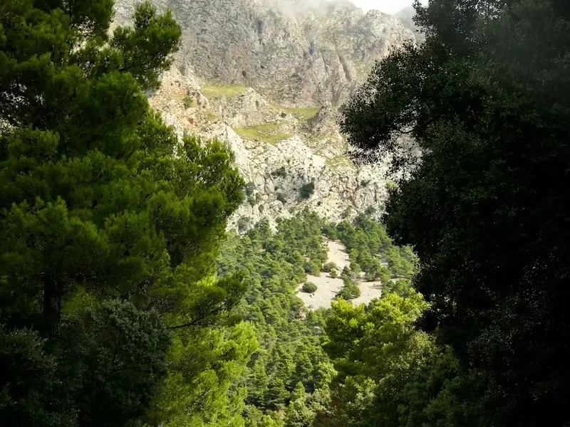
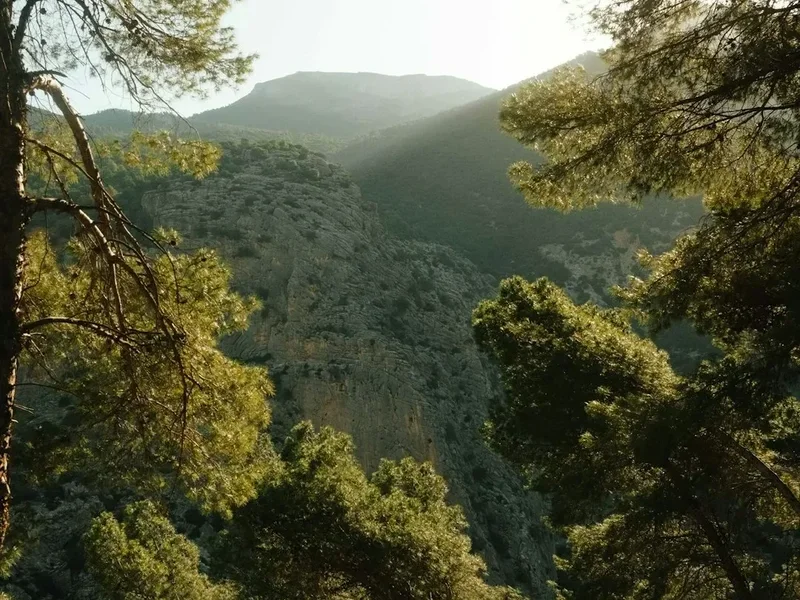
Week 5: Puebla de Sanabria to Ourense (The Galician Mountains)
- Distance: 160 km
- Key Waypoints: Puebla de Sanabria, Lubián, A Gudiña, Laza, Xunqueira de Ambía, Ourense
- Terrain: Significant mountain passes and steep descents into lush valleys
- Highlights: The Padornelo and A Canda passes, the traditional carnival town of Laza, the thermal springs of Ourense
- Challenge: The most physically demanding week with substantial elevation gain and loss
Week 6: Ourense to Santiago de Compostela (The Final Approach)
- Distance: 105 km
- Key Waypoints: Ourense, Cea, Monasterio de Oseira, Lalín, Silleda, Ponte Ulla, Santiago de Compostela
- Terrain: Green, hilly countryside with frequent small villages
- Highlights: The massive Cistercian monastery of Oseira, the crossing of the Ulla river, the first glimpse of the Cathedral towers from Monte do Gozo
- Challenge: Navigating the final hills of Galicia, which are short but steep and frequent
Important Notes:
- Distances are approximate and can vary based on the specific albergues chosen
- The "Camino Sanabrés" variation is chosen here from Granja de Moreruela onwards
- Water management is critical in Weeks 1-3; some stretches have 20+ km without a fountain
- The route is marked with yellow arrows and granite milestones, but a GPS app is highly recommended
- Sundays can be difficult for food; many village shops close entirely
Planning and Bookings
Book Your Trip
Everything you need to plan your journey
Accommodation
Find places to stay near Seville
Flights
Search flights to Seville
Essential Preparation
The Vía de la Plata requires a higher level of physical and logistical preparation than the Camino Francés. Because of the long distances between services (sometimes 30 kilometres without a shop or fountain), you must be capable of carrying all your daily needs and walking significant distances. Fitness training should focus on endurance and walking with a weighted pack. It is recommended to spend at least three months building up to 20-25 kilometre walks on consecutive days.
Logistically, you must obtain a "Credencial del Peregrino" (Pilgrim Passport) before you start. This can be obtained from the Cathedral in Seville or various Friends of the Camino associations. This document is essential for staying in pilgrim hostels (albergues) and for receiving your "Compostela" certificate in Santiago. Seville is the primary base; it is well-connected by international flights and high-speed rail (AVE) from Madrid. Spend at least two days in Seville to acclimatise and finalise your gear.
Trail Accommodation
Accommodation on the Vía de la Plata is a mix of traditional pilgrim hostels and commercial options. Because this route is less travelled, you will rarely face the "race for a bed" common on other routes, but you must check opening dates as some albergues are seasonal.
Hut/Albergue Facilities:
- Albergues Municipales/Parroquiales: Basic, dormitory-style rooms with bunk beds. Usually run by volunteers (hospitaleros). Facilities include shared bathrooms, cold (and sometimes hot) showers, and often a communal kitchen. Costs: €5–€12 or "donativo" (donation-based).
- Albergues Privados: Often more comfortable, with smaller dorms, better kitchen facilities, and sometimes laundry machines. Costs: €12–€20.
- Hostals and Pensiones: Private rooms in small guesthouses. Ideal for a rest day or if you need more privacy. Costs: €30–€60.
- Paradores: Luxury hotels in historic buildings (like the Parador in Mérida or Zamora). Expensive but a spectacular way to experience Spanish history.
What is NOT provided:
- Bedding: Most albergues only provide a plastic-covered mattress and a pillow. You MUST bring your own sleeping bag or silk liner.
- Toiletries: Soap, shampoo, and towels are rarely provided in basic albergues.
- Food: While some albergues offer a communal dinner, most require you to buy and cook your own food or eat at a local "Mesón."
Required Gear
- Footwear: High-quality walking shoes or trail runners are often better than heavy boots for the hard-packed Roman roads. Ensure they are well broken-in.
- Backpack: 35–45 litres is sufficient. Keep the total weight (including water) under 10% of your body weight. A rain cover is essential.
- Clothing: Moisture-wicking base layers, two pairs of high-quality wool socks (e.g., Merino), a lightweight fleece, and a high-quality waterproof jacket (Gore-Tex or similar).
- Sun Protection: A wide-brimmed hat, high-SPF sunscreen, and quality sunglasses are non-negotiable for the southern sections.
- Navigation: A physical guidebook (e.g., Brierley or Village to Village) and a GPS app (e.g., Buen Camino or Gronze) for offline use.
- First Aid: Focus on blister care (Compeed, needle and thread, antiseptic), ibuprofen, and rehydration salts.
What to Bring
- Water Treatment: While tap water in Spanish towns is safe, a filter bottle (like LifeStraw) is useful for emergency refills from rural fountains or if you are sensitive to the chlorine in city water.
- Consumables: Always carry at least 2 litres of water and 500-1000 calories of emergency food (nuts, dried fruit, energy bars).
- Electronics: A power bank, European plug adapter, and a long charging cable (outlets in albergues are often in awkward places).
- Personal Items: A lightweight microfibre towel, earplugs (essential for dorms), and a small bottle of biodegradable laundry detergent for daily hand-washing.
- Cash: Many small villages do not have ATMs and albergues often only accept cash. Carry at least €100 in small notes as a backup.
Permits
No formal "permit" is required to walk the Vía de la Plata in the sense of a wilderness permit. However, the Credencial del Peregrino (Pilgrim Passport) is the functional equivalent for those wishing to use the pilgrim infrastructure. Without this stamped document, you cannot stay in municipal albergues and you will not be eligible for the "Menú del Peregrino" (discounted three-course meals) offered by many restaurants.
How to obtain the Credencial:
- In Seville: Available at the Cathedral (check opening hours for the pilgrim office) or the Church of San Jacinto in Triana.
- By Mail: Many national "Friends of the Camino" associations (e.g., in the UK, USA, or Ireland) can mail one to you before you leave home.
- Cost: Usually €2–€5.
The Compostela: To receive the official certificate of completion (the Compostela) in Santiago, you must prove you have walked at least the last 100 kilometres (from Ourense on the Sanabrés route) by having your Credencial stamped twice daily at albergues, churches, or cafes along the way. If you are cycling, the requirement is the last 200 kilometres.
National Park Regulations: While the trail passes through various protected areas (like the Monfragüe National Park nearby or the Sanabria Lake Natural Park), there are no additional fees or permits required for walkers staying on the marked Camino path. Camping is generally prohibited along the route; you are expected to stay in designated accommodation.
Other Activities in the Area
The Vía de la Plata passes through some of Spain's most culturally rich regions. Consider adding "rest days" in these locations to fully experience the surroundings:
- Flamenco in Seville: Experience an authentic "tablao" in the Triana district, the spiritual home of flamenco.
- Roman Heritage in Mérida: Spend a full day exploring the National Museum of Roman Art and the sprawling ruins of the circus and villas.
- Cáceres Old Town: Wander the silent, stone-walled streets of the Ciudad Monumental at night; it is one of the best-preserved medieval cities in Europe.
- Salamanca University: Visit the oldest university in Spain and try to find the "frog" carved into the ornate Plateresque facade.
- Zamora's Romanesque Trail: This city has the highest concentration of Romanesque churches in Europe; a guided walking tour is highly recommended.
- Thermal Springs in Ourense: Soak your tired muscles in the "As Burgas" hot springs in the city centre or the larger "Outariz" thermal baths along the Miño river.
- Wine Tasting: The route passes through the Tierra del Vino (Zamora) and the Ribeira Sacra (near Ourense). Local "bodegas" often offer tours and tastings of Mencia and Godello wines.
Safety and Conditions
Heat and Hydration: The single greatest risk on the Vía de la Plata is heat exhaustion. In the southern sections, there are stretches of 20–30 kilometres with no shade and no water. You must carry more water than you think you need (minimum 3 litres in warm weather) and use electrolyte replacements. Learn the signs of heatstroke: dizziness, cessation of sweating, and confusion.
Road Walking: While much of the trail is on dirt tracks or ancient stone, some sections follow or cross busy national roads (like the N-630). Always walk facing traffic, wear high-visibility gear or a reflective strip on your pack, and be extremely cautious at dawn or dusk.
Solitude and Mental Health: Unlike the Camino Francés, you may go days without seeing another pilgrim. This solitude is a draw for many, but it can be taxing. Ensure you have a way to contact family, and always tell the hospitalero at your albergue where you intend to walk the next day. Download offline maps (like Maps.me or Gaia GPS) as mobile signal can be spotty in the mountains of Extremadura and Galicia.
Livestock and Dogs: You will walk through many "dehesas" with cattle and sheep. Generally, they are harmless, but give them a wide berth. Be cautious of "Mastín" dogs—large livestock guardian dogs. They are not pets; they are working animals. If you encounter one, do not run. Walk slowly and calmly away, keeping your walking poles between you and the dog. Do not make eye contact.
Emergency Numbers: The general emergency number in Spain is 112. Operators usually speak some English. It is highly recommended to have travel insurance that covers medical repatriation and search and rescue.
Side Trips and Points of Interest
The Roman Arch of Cáparra: Located between Carcaboso and Aldeanueva del Camino, this is the only "tetrapylum" (four-sided) Roman arch remaining in Spain. It stands in the middle of a deserted Roman city. Standing beneath it, you are standing exactly where Roman legionnaires and ancient traders stood 2,000 years ago. There is a small, excellent visitor centre nearby.
Monasterio de Oseira: Known as the "Galician Escorial," this massive Cistercian monastery is a highlight of the Sanabrés route. Pilgrims can stay in the monastery's albergue and attend the evening vespers sung by the monks. The architecture, particularly the "Palm Tree" staircase, is a masterpiece of the Galician Baroque and Renaissance styles.
The Miliarios (Milestones): Throughout the provinces of Cáceres and Salamanca, you will see original Roman milestones. Some are still in their original positions, while others have been moved to town squares. They are numbered and provided the distance in Roman miles to the nearest major city. Touching these stones is a powerful physical link to the history of the road.
Puebla de Sanabria: This medieval town sits on a rocky outcrop overlooking the Tera river. Its 15th-century castle and perfectly preserved stone houses make it one of the most beautiful stops on the route. A short taxi ride or a long walk takes you to the Lago de Sanabria, the largest glacial lake in the Iberian Peninsula.
The "Despoblados": You will pass through several abandoned villages, particularly in the mountains of Zamora. these "despoblados" are haunting reminders of the rural exodus in Spain (the "España Vaciada"). They offer a poignant look at traditional stone architecture and the changing social fabric of the country.
Leave No Trace
The Vía de la Plata traverses fragile ecosystems and historic sites that are under increasing pressure from human activity. As a pilgrim, you are a guest in these landscapes and communities. Practising Leave No Trace principles is essential to ensure the trail remains viable for future generations.
Specific Considerations for the Vía de la Plata:
- Waste Management: There are no rubbish bins on the long stretches of the dehesa. You must carry all your trash (including fruit peels and nut shells) to the next town. Never leave "white flowers" (toilet paper) behind bushes; carry a small zip-lock bag for used paper and dispose of it in a bin.
- Respect the Dehesa: The oak forests are private agricultural land. Stay on the marked path, close all gates behind you (essential to keep livestock from wandering), and never disturb the Iberian pigs or cattle.
- Water Conservation: In the arid south, water is a precious resource. Use albergue showers sparingly and never wash clothes directly in village fountains or streams.
- Cultural Respect: Many of the churches and monuments along the way are active places of worship or fragile archaeological sites. Dress modestly when entering churches and never climb on Roman ruins or milestones.
- Noise Pollution: The silence of the Vía de la Plata is one of its greatest assets. Avoid playing music through speakers and keep your voice low when walking through quiet villages or in the early morning.
By walking with awareness and respect, you contribute to the "Leyenda del Camino"—the legend of the way—ensuring that the hospitality and beauty of the Silver Way endure.