Via Coloniensis - The Ancient Pilgrimage from Cologne to Trier
The Via Coloniensis is one of the most historically significant and visually diverse pilgrimage routes in Western Europe, serving as a vital link in the extensive network of the Camino de Santiago (Way of St. James). Stretching approximately 225 kilometres from the twin spires of the Cologne Cathedral to the Roman foundations of Trier, this trail traverses the heart of the Rhineland and the rugged, volcanic landscapes of the Eifel region. Unlike the high-altitude alpine passes of the Pyrenees, the Via Coloniensis offers a moderate but deeply rewarding journey through ancient forests, medieval half-timbered villages, and valleys carved by the relentless flow of the Rhine and Moselle rivers. It is a path where Roman history, Christian mysticism, and German natural beauty converge, providing walkers with a profound sense of continuity across two millennia of human travel.
The route is traditionally walked in 9 to 12 days, depending on the pilgrim's pace and desire for cultural immersion. It begins in the urban bustle of Cologne, Germany's oldest major city, and gradually transitions into the serene, rolling hills of the Eifel National Park. The trail is marked by the iconic yellow scallop shell on a blue background, a symbol recognised by pilgrims worldwide. While the elevation gain is a manageable 1,500 metres over the entire distance, the undulating terrain of the Eifel provides a consistent physical challenge that rewards the hiker with panoramic views of extinct volcanic craters (maars) and dense beech forests. This is not merely a hike; it is a cultural odyssey that connects the resting place of the Three Kings in Cologne with the tomb of Saint Matthias in Trier—the only apostle buried north of the Alps.
- Distance: 225.0 km one-way
- Duration: 9–12 days
- Season: May to September (best weather and maximum daylight)
- Accommodation: Pilgrim hostels, guesthouses, hotels, and monastery stays
- Highest point: Near Blankenheim/Hillesheim (approx. 600 m)
- Difficulty: Moderate (well-marked, undulating terrain, good infrastructure)
- Direction: North to South (Cologne to Trier)
Overview
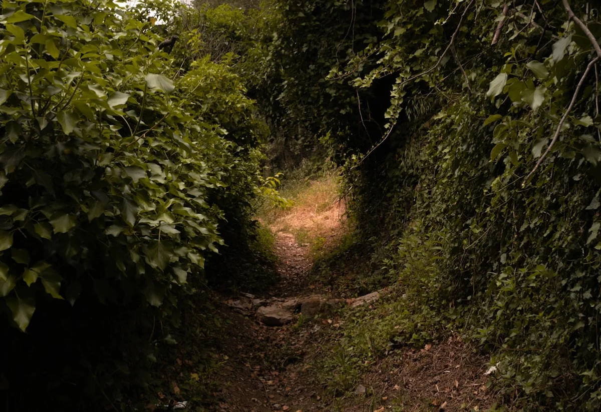
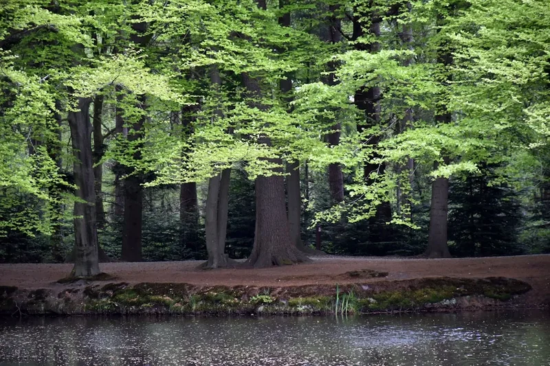
The Via Coloniensis is a masterclass in landscape transition. The journey begins in the flat, fertile plains of the Rhine Valley, where the trail follows ancient Roman roads that once connected the provincial capital of Colonia Claudia Ara Agrippinensium (Cologne) with Augusta Treverorum (Trier). For the first two days, the walking is gentle, allowing the body to adjust to the rhythm of the trail as it passes through the manicured parklands of Brühl and the agricultural heartland of the Voreifel. However, as the trail approaches Bad Münstereifel, the horizon begins to rise, and the true character of the Eifel mountains reveals itself. This middle section of the trail is defined by deep valleys, limestone plateaus, and the unique geological features of the Vulkaneifel, where the earth's volcanic past is visible in the circular, water-filled maars that dot the landscape.
Culturally, the Via Coloniensis is unparalleled. Every village along the route seems to hold a piece of the European puzzle. You will walk through Romanesque churches, past wayside shrines that have stood for centuries, and into towns like Blankenheim and Hillesheim that retain their medieval fortifications. The trail is designed to be a contemplative experience; while it passes through populated areas, it frequently seeks the solitude of the forest, providing long stretches of silence where the only sound is the wind through the beech trees or the crunch of gravel underfoot. The infrastructure is exceptionally well-organised, with frequent opportunities for food and water, yet the trail never feels overly commercialised. It retains an air of authentic pilgrimage, where the "Ultreia" greeting of fellow walkers reminds you that you are part of a tradition that spans a thousand years.
The final descent into the Moselle Valley is perhaps the most breathtaking portion of the trek. After days of forest and field, the sight of the steep, vine-clad slopes of the Moselle signifies the approach to Trier. Entering the city through the Porta Nigra—the best-preserved Roman city gate north of the Alps—provides a sense of arrival that few other trails can match. Whether you are walking for spiritual reasons, historical interest, or simply the love of the German countryside, the Via Coloniensis offers a balanced, accessible, and deeply moving trekking experience.
History and Cultural Context
The history of the Via Coloniensis is inextricably linked to the Roman Empire. Much of the modern hiking trail follows the "Via Agrippa," a military road built in the 1st century BC to connect the Rhine with the Mediterranean. For the Romans, this was a vital artery for the movement of legions and trade goods. Following the collapse of Roman authority, the road remained in use, eventually becoming a primary route for medieval pilgrims. By the 12th century, Cologne had become one of the most important pilgrimage sites in Christendom following the arrival of the relics of the Three Kings (the Magi) from Milan. Pilgrims from Northern and Eastern Europe would gather at the Cologne Cathedral before setting off toward Santiago de Compostela in Spain; the Via Coloniensis was their first major leg on this multi-month journey.
During the Middle Ages, the route was dotted with "hospitals" and monasteries designed to care for the "pauperibus et peregrinis" (the poor and the pilgrims). Towns like Prüm grew in power and influence due to their position on this route, with the Abbey of Prüm becoming a major intellectual and spiritual centre. The Reformation and subsequent European wars saw a decline in the popularity of the pilgrimage, and many of the original paths were lost to forest or modern road construction. However, the late 20th-century revival of the Camino de Santiago sparked a renewed interest in the German sections of the Way. In the early 2000s, the St. Jakobus-Gesellschaft Rheinland-Pfalz-Saarland and the Landschaftsverband Rheinland worked together to research, signpost, and revitalise the Via Coloniensis, ensuring it met modern hiking standards while respecting its ancient origins.
Today, the trail is a living museum. In Cologne, you stand before the Shrine of the Three Kings, a masterpiece of medieval goldsmithing. In Trier, you visit the Basilica of St. Matthias, where the remains of the apostle have been venerated since the 12th century. Between these two poles, the trail is a tapestry of local legends, from the "Eifel-Gothic" architecture of the churches to the myths of the volcanic lakes. Walking the Via Coloniensis is an act of historical immersion, where every kilometre reveals a layer of the European story, from Roman legionaries to medieval monks and modern-day adventurers.
Want more background? Read extended notes on history and cultural context → Learn more
Seasonal Highlights and Weather Reality
The Via Coloniensis is best experienced from late spring to early autumn. During this window, the German weather is generally stable, and the natural landscape is at its most vibrant. However, the Eifel region is known for its microclimates, and walkers should be prepared for variability regardless of the month.
Spring (May to June): This is arguably the most beautiful time to walk. The beech forests of the Eifel are a brilliant, translucent green, and the meadows are filled with wildflowers. Temperatures are mild, typically ranging from 12°C to 20°C, making for comfortable walking conditions. However, May can bring "Eisheilige" (Ice Saints) cold snaps, and rain is frequent, so waterproof gear is essential.
Summer (July to August): These are the warmest months, with temperatures often reaching 25°C to 30°C. While the shade of the Eifel forests provides relief, the sections through the Rhine plain and the open fields of the Voreifel can be quite hot. This is the peak season for tourism, so booking accommodation in advance is highly recommended. Thunderstorms are common in the late afternoon, often providing a dramatic end to a day's hike.
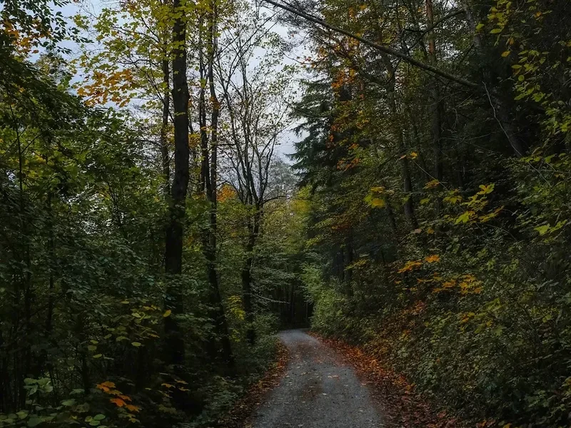
Autumn (September to October): September offers stable, "Golden October" weather with crisp mornings and clear, sunny days. The changing colours of the forest are spectacular, particularly in the dense woodlands between Blankenheim and Prüm. As October progresses, the chance of fog and frost increases, and daylight hours diminish significantly. Many smaller pilgrim hostels may begin to close for the season in late October.
Winter (November to April): Walking the Via Coloniensis in winter is possible but challenging. The Eifel can receive significant snowfall, and the trail can become muddy or icy. Many services are closed, and the lack of daylight makes long stages difficult. This season is only recommended for experienced hikers who enjoy solitude and are prepared for cold, damp conditions.
Recommended Itinerary
10-Day Via Coloniensis Itinerary
Day 1: Cologne to Brühl
- Distance: 19 km
- Elevation gain: 80 m
- Time: 4–5 hours
- Start at the South Portal of the Cologne Cathedral (Kölner Dom)
- Follow the Rhine riverbank south before turning inland through the city's "Green Belt"
- Pass through the suburbs of Klettenberg and Efferen
- Walk through the scenic parklands of the Rhineland Nature Park
- Arrive in Brühl, home to the UNESCO World Heritage Augustusburg and Falkenlust Palaces
- An easy introductory day on mostly flat, paved, or well-maintained gravel paths
Day 2: Brühl to Euskirchen
- Distance: 22 km
- Elevation gain: 120 m
- Time: 5–6 hours
- Leave Brühl passing the historic palaces and gardens
- Traverse the "Voreifel" landscape, a transition zone between the Rhine plain and the mountains
- Pass through the village of Walberberg with its historic church
- Walk through open agricultural fields with views of the Eifel hills in the distance
- Arrive in Euskirchen, a bustling town with excellent amenities and transport links
- Gentle gradients continue, though the distance begins to test the legs
Day 3: Euskirchen to Bad Münstereifel
- Distance: 16 km
- Elevation gain: 250 m
- Time: 4 hours
- A shorter day allowing for exploration of the destination
- The trail begins to climb noticeably as you enter the Erft Valley
- Follow the Erft river through meadows and small patches of woodland
- Enter Bad Münstereifel through its medieval city gates
- Explore the fully preserved city wall and the Romanesque Basilica of St. Chrysanthus and Daria
- The transition to the "High Eifel" begins here with more frequent elevation changes
Day 4: Bad Münstereifel to Blankenheim
- Distance: 24 km
- Elevation gain: 450 m
- Time: 6–7 hours
- A challenging day with significant forest walking
- Climb out of the valley into the dense forests of the Münstereifel Forest
- Pass the "Michelsberg," a prominent hill with a chapel and panoramic views
- Descend into the Ahr Valley and follow the trail to the source of the Ahr River
- Arrive in Blankenheim, a picturesque town dominated by its castle (now a youth hostel)
- The route is increasingly remote, with fewer services between towns
Day 5: Blankenheim to Hillesheim
- Distance: 25 km
- Elevation gain: 350 m
- Time: 6–7 hours
- Cross the border from North Rhine-Westphalia into Rhineland-Palatinate
- Walk through the "Limestone Eifel" (Kalkeifel), known for its unique flora
- Pass the historic monastery of Niederehe with its 12th-century church
- Traverse open plateaus with wide-ranging views of the volcanic landscape
- Arrive in Hillesheim, a town famous for its crime fiction connections and medieval walls
- A long stage requiring good stamina and sufficient water supplies
Day 6: Hillesheim to Gerolstein
- Distance: 18 km
- Elevation gain: 300 m
- Time: 4.5–5 hours
- A visually stunning day through the heart of the Vulkaneifel
- Pass the "Gerolsteiner Dolomiten," impressive limestone cliffs overlooking the town
- Visit the Castle of Kasselburg with its eagle and wolf park (optional detour)
- Descend into the Kyll Valley
- Arrive in Gerolstein, famous for its mineral water and the Erlöserkirche (Church of the Redeemer)
- Moderate climbing with rewarding geological landmarks
Day 7: Gerolstein to Prüm
- Distance: 24 km
- Elevation gain: 400 m
- Time: 6–7 hours
- Leave the Kyll Valley and climb back into the high forest ridges
- Pass through the "Prümer Kalkmulde," a region of significant geological interest
- Walk through quiet, deep forests where wildlife sightings (deer, wild boar) are common
- Enter Prüm and visit the massive St. Salvator Basilica, which houses the sandals of Christ
- A demanding day due to the cumulative elevation and distance
Day 8: Prüm to Waxweiler
- Distance: 21 km
- Elevation gain: 300 m
- Time: 5–6 hours
- Follow the trail through the "Islek" region, a rugged part of the Eifel near the Belgian border
- Pass through small, traditional Eifel villages like Schönecken with its castle ruins
- Walk along high ridges with views stretching toward the Ardennes
- Descend into the Prümtal (Prüm Valley) to reach Waxweiler
- Visit the "Mariensäule" (Mary's Column) overlooking the town
- The terrain is undulating and can be muddy after rain
Day 9: Waxweiler to Bitburg
- Distance: 26 km
- Elevation gain: 350 m
- Time: 7–8 hours
- The longest stage of the itinerary, requiring an early start
- Traverse the agricultural heart of the Bitburger Gutland
- Pass through the village of Neustraß, which sits directly on the old Roman road
- Walk through a mix of open fields and small woodlots
- Arrive in Bitburg, a city with Roman origins and a world-famous brewery
- Mostly flat or gently rolling terrain, but the distance is the primary challenge
Day 10: Bitburg to Trier
- Distance: 30 km
- Elevation gain: 400 m
- Time: 8–9 hours
- The final push toward the oldest city in Germany
- Follow the Kyll Valley once more before climbing the final ridge overlooking the Moselle
- Pass the "Kaiser-Wilhelm-Turm" for a first glimpse of Trier
- Descend through vineyards into the city, entering via the Porta Nigra
- Finish at the Cathedral of Trier and the Basilica of St. Matthias
- A very long final day; some walkers choose to split this into two stages (stopping in Welschbillig)
Important Notes:
- The trail is marked with the yellow scallop shell; always follow the shell's "rays" or the direction indicated
- Public transport (Deutsche Bahn) is available in many towns (Cologne, Brühl, Euskirchen, Gerolstein, Bitburg, Trier), allowing for section hiking
- Pilgrim passports (Credencial) can be stamped at churches, town halls, and hostels along the route
- Water is generally safe to drink from taps, but "Kein Trinkwasser" signs on fountains must be respected
- Sunday is a rest day in Germany; most supermarkets will be closed, so plan food accordingly
Planning and Bookings
Book Your Trip
Everything you need to plan your journey
Accommodation
Find places to stay near Cologne
Flights
Search flights to Cologne
Essential Preparation
The Via Coloniensis requires a moderate level of physical fitness. While it does not involve technical climbing, the ability to walk 20–25 kilometres per day for consecutive days is essential. Before departing, it is highly recommended to obtain a "Pilgrim Passport" (Credencial) from the St. Jakobus-Gesellschaft or the Cologne Cathedral information centre. This document allows you to stay in dedicated pilgrim hostels and serves as a beautiful memento of your journey, filled with stamps from the various stations along the way.
Logistically, Cologne is the perfect starting point. It is served by the Cologne Bonn Airport (CGN) and is a major hub for the German rail network (ICE/RE). Most pilgrims spend a night in Cologne to visit the Cathedral and the Shrine of the Three Kings before starting their walk. Trier, the finish point, is equally well-connected, with direct trains back to Cologne or onward to Luxembourg and France. Downloading the "DB Navigator" app is essential for checking local train and bus schedules if you need to skip a stage or reach accommodation off the main trail.
Trail Accommodation
Accommodation on the Via Coloniensis is varied and generally of a high standard. Unlike the Camino Frances in Spain, there are fewer large-scale "albergues," but the network of private guesthouses, small hotels, and church-run hostels is excellent.
Types of Accommodation:
- Pilgrim Hostels (Pilgerherbergen): Often run by parishes or local associations. These are basic, affordable (10–20 Euro), and provide a communal atmosphere. Some require a pilgrim passport.
- Monasteries (Klöster): Places like the Abbey of Steinfeld or the Monastery in Niederehe offer a unique, quiet stay. Bookings should be made well in advance.
- Gasthöfe and Pensions: Traditional German guesthouses. Expect to pay 40–70 Euro for a single room, often including a hearty breakfast.
- Hotels: Available in larger towns like Euskirchen, Bitburg, and Trier.
Booking Requirements:
- During the peak months of July and August, booking 1–2 days in advance is wise, especially for popular guesthouses.
- For monastery stays, contact them at least a week before your arrival.
- Many pilgrim hostels operate on a "first-come, first-served" basis, but a quick phone call in the morning can often secure a bed.
Required Gear
- Hiking Boots: Mid-cut boots with good ankle support are recommended for the Eifel sections. Ensure they are well broken-in to avoid blisters.
- Backpack: A 30–40 litre pack is sufficient if you are staying in guesthouses. If carrying a sleeping bag for hostels, 45 litres may be better.
- Rain Gear: A high-quality waterproof jacket and overtrousers. The Eifel can be very wet even in summer.
- Socks: Merino wool blend socks (bring at least 3 pairs) to manage moisture and prevent friction.
- Navigation: While the trail is well-marked, a GPS app (like Komoot or Outdooractive) with offline maps is highly recommended.
- First Aid Kit: Focus on blister care (Compeed), antiseptic cream, and basic pain relief.
What to Bring
- Pilgrim Passport: Essential for stamps and access to certain hostels.
- Water Bottles: At least 2 litres of capacity. While there are towns, some forest stretches are long.
- Snacks: Energy bars, nuts, and dried fruit. German bakeries (Bäckerei) are excellent for buying fresh sandwiches in the morning.
- Toiletries: Travel-sized soap, shampoo, and a quick-dry microfibre towel.
- Sun Protection: Hat, sunglasses, and SPF 30+ sunscreen, especially for the open field sections.
- Power Bank: To keep your phone charged for navigation and emergency calls.
- Cash: While cards are increasingly accepted, many small guesthouses and rural cafés in Germany still prefer or only accept cash (Euros).
Permits
One of the great advantages of the Via Coloniensis is that no formal permits or entry fees are required to walk the trail. It is a public route that makes use of existing forest tracks, agricultural roads, and municipal paths. You are free to start and end your journey whenever you choose.
Pilgrim Passport (Credencial): While not a legal permit, the Credencial is the "spiritual permit" of the trail. It is required if you wish to stay in specific church-run pilgrim hostels and is necessary if you intend to continue your walk beyond Trier into France and eventually Spain. You can order one online from the Deutsche St. Jakobus-Gesellschaft or pick one up at the Domforum (information centre) directly opposite the main entrance of the Cologne Cathedral.
Camping: Wild camping is strictly prohibited in Germany, particularly in the Eifel National Park and nature reserves. If you wish to camp, you must use designated campsites (Campingplätze), which are available near Brühl, Euskirchen, and Gerolstein. These usually cost between 10 and 15 Euro per night for a small tent.
Group Travel: If you are organising a large group (more than 15 people) to walk the trail, it is a courtesy to inform the larger monasteries or hostels in advance to ensure they can accommodate the numbers.
Other Activities in the Area
The regions of the Rhineland and the Eifel offer a wealth of attractions that can be easily integrated into your pilgrimage or visited as a post-hike reward:
- Cologne Cathedral Treasury: Before you leave Cologne, visit the underground treasury to see the liturgical items and relics associated with the Three Kings.
- Phantasialand (Brühl): One of Europe's top-rated theme parks, located just outside Brühl. A stark contrast to the quiet of the trail, but a fun detour for families.
- Eifel National Park: If you have extra days, explore the "Wilder Kermeter" area of the park for primeval beech forests and sightings of wildcats.
- Vulkaneifel Maars: Visit the "Eyes of the Eifel"—the volcanic crater lakes near Daun (a short bus ride from Gerolstein). You can swim in some of these lakes during the summer.
- Bitburger Brewery Tour: Learn about the brewing process of one of Germany's most famous pilsners in the town of Bitburg.
- Roman Trier: Spend at least two days in Trier after your walk. Highlights include the Imperial Baths (Kaiserthermen), the Roman Amphitheatre, and the Aula Palatina (Constantine's Throne Room).
- Moselle Wine Tasting: Take a short train ride from Trier to the village of Bernkastel-Kues or Saarburg to sample the world-class Rieslings produced on the steep river slopes.
Safety and Conditions
General Safety: The Via Coloniensis is a very safe trail. Germany has a low crime rate, and the trail passes through friendly, rural communities. However, standard hiking precautions apply. Always let someone know your intended destination for the day.
Navigation and Marking: The trail is marked with the yellow shell on a blue background. In some areas, you may also see the "St. James" silhouette. If you haven't seen a marker for more than 500 metres, you may have missed a turn. The markers are usually placed at eye level on trees, lamp posts, or signposts. Be particularly careful in autumn when fallen leaves can obscure the path.
Weather Hazards: The Eifel is prone to sudden weather shifts. In summer, heat exhaustion is a risk in the open fields; stay hydrated and wear a hat. In the forest, be aware of "Eichenprozessionsspinner" (oak processionary moths) during late spring and summer; their hairs can cause severe skin irritation and respiratory issues. If you see warning signs on trees, do not linger in the area.
Ticks (Zecken): Ticks are common in the long grass and forests of Western Germany. Some carry Lyme disease or FSME (Tick-borne encephalitis). Wear long trousers in overgrown areas, use insect repellent, and perform a thorough tick check on your body every evening.
Road Crossings: While most of the trail is on dedicated paths, you will occasionally need to cross or walk along busy country roads. Wear high-visibility clothing if walking in low light or fog, and always use designated crossing points where available.
Emergency Numbers:
- General Emergency / Ambulance: 112
- Police: 110
Side Trips and Points of Interest
Schloss Augustusburg (Brühl): Located directly on the trail at the end of Day 1, this Rococo masterpiece is a must-visit. The staircase designed by Balthasar Neumann is considered one of the finest in the world. The surrounding gardens are perfect for a gentle evening stroll after your first day of walking.
The Roman Aqueduct (Voreifel): Between Euskirchen and Bad Münstereifel, the trail passes sections of the Eifel Aqueduct, one of the longest aqueducts in the Roman Empire, which once supplied Cologne with fresh water. Look for the "Römerkanal-Wanderweg" signs that occasionally overlap with the Via Coloniensis.
Abbey of Steinfeld: A short detour from the main path near Blankenheim leads to this impressive Premonstratensian monastery. It is famous for its "Eifel Basilica" and the tomb of Saint Hermann Joseph. The abbey also offers excellent accommodation and a peaceful atmosphere for reflection.
The Gerolsteiner Dolomites: These are not true mountains but massive limestone reefs from a prehistoric sea. The hike through these formations on Day 6 offers some of the most dramatic scenery on the entire route. The "Munterley" viewpoint provides a stunning vista over the Kyll Valley.
The Sandals of Christ (Prüm): Inside the St. Salvator Basilica in Prüm, you can see the "Sandals of Christ," a gift from Pope Zachary to King Pepin the Short in the 8th century. It is one of the most significant relics in Northern Europe and has been a draw for pilgrims for over a millennium.
Klausen Pilgrimage Church: On the final approach to Trier, the trail passes through Klausen, a famous pilgrimage site dedicated to Mary. The church is a beautiful example of Gothic architecture and is a traditional stopping point for pilgrims to offer a final prayer before reaching Trier.
Leave No Trace
The Via Coloniensis passes through several sensitive ecological zones, including the Eifel National Park and various Natura 2000 protected areas. As a pilgrim and a hiker, it is your responsibility to ensure that the trail remains pristine for those who follow.
Principles for the Via Coloniensis:
- Pack it in, pack it out: There are bins in the villages, but very few in the forest sections. Carry all your litter, including fruit peels and tissues, until you reach a town.
- Stay on the path: The Eifel forests are home to rare ground-nesting birds and delicate orchids. Straying from the marked trail can damage these habitats.
- Respect the silence: Many people walk this route for spiritual or meditative reasons. Keep noise to a minimum, especially when passing through villages or near churches.
- No Wild Camping: Use the established campsites and guesthouses. Wild camping is illegal and can disturb nocturnal wildlife like the European wildcat.
- Water Protection: Do not use soaps or detergents in the streams or maars of the Eifel. Even biodegradable soaps can harm aquatic life in small volumes.
- Respect Private Property: Much of the trail passes through working agricultural land. Close all gates behind you and do not disturb livestock.
By following these principles, you honour the tradition of the pilgrimage and help preserve the natural beauty of the German landscape.