
Via Alpina Red Trail (Section) - Swiss Alps Adventure
The Via Alpina Red Trail, specifically the Swiss section, is a spectacular long-distance hiking route traversing the heart of the Swiss Alps. This iconic trail offers an unparalleled journey through diverse alpine landscapes, from verdant valleys and flower-strewn meadows to rugged mountain passes and glistening glaciers. It is a challenging yet immensely rewarding trek, designed for seasoned hikers seeking an authentic alpine experience. The route is meticulously marked, ensuring navigation is straightforward, allowing walkers to fully immerse themselves in the breathtaking scenery and the rich cultural heritage of Switzerland's mountain communities. This section of the Via Alpina is a testament to the enduring beauty and accessibility of the Swiss Alps, providing a profound connection with nature and a sense of accomplishment upon completion.
- Distance: 161.0 km
- Duration: 7–10 days (variable based on pace and side trips)
- Season: Mid-June to mid-September (snow-free conditions essential for higher passes)
- Accommodation: Mountain huts (SAC Huts), guesthouses, hotels
- Highest point: Approximately 2,800 m (depending on specific route variations)
- Difficulty: Challenging
- Closest City: Interlaken
Overview
The Via Alpina Red Trail in Switzerland is more than just a hike; it's an immersion into the quintessential alpine experience. This 161 km journey unfolds across a dramatic tapestry of peaks, valleys, and pristine lakes, showcasing the raw beauty and formidable power of the Swiss Alps. The trail is renowned for its well-maintained paths, clear signage, and the sheer variety of landscapes it traverses. From the charming, traditional villages nestled in the foothills to the stark, majestic grandeur of the high alpine passes, every kilometre offers a new vista and a fresh perspective.
The route is characterised by significant elevation changes, with numerous ascents and descents that test a hiker's stamina and resolve. However, these challenges are consistently rewarded with panoramic views that stretch across snow-capped giants, emerald valleys dotted with wildflowers, and turquoise glacial lakes. The trail often follows ancient mule tracks and shepherd paths, offering a glimpse into the historical human interaction with this rugged terrain. Hikers will encounter a diverse range of flora and fauna, from hardy alpine flowers clinging to rocky outcrops to the majestic ibex and chamois that roam the higher slopes.
The infrastructure along the Via Alpina is excellent, with a network of Swiss Alpine Club (SAC) huts providing essential shelter and sustenance at strategic points. These huts, often perched in breathtaking locations, offer a warm welcome, hearty meals, and a chance to connect with fellow trekkers from around the globe. The accessibility of the trail, with numerous transport links to and from trailheads and villages, makes it a feasible, albeit demanding, undertaking for those prepared for alpine conditions. The Via Alpina Red Trail is a true celebration of the Swiss Alps, offering an unforgettable adventure for those who dare to explore its heights.
History and Cultural Context
The Via Alpina, as a concept, emerged from a desire to create a network of long-distance hiking trails that would connect the alpine regions of several European countries. The Red Trail, specifically within Switzerland, builds upon centuries of human history in the Alps. For millennia, these mountains have served as both barriers and conduits for trade, migration, and cultural exchange. Ancient pathways, trodden by Roman legions, medieval merchants, and later by shepherds and hermits, form the historical bedrock upon which modern trails like the Via Alpina are laid.
The establishment of the Swiss Alpine Club (SAC) in 1863 marked a pivotal moment in the exploration and popularisation of the Swiss Alps. The SAC's mission was to promote mountaineering, explore the alpine regions, and provide safe access to the mountains. This led to the construction of numerous mountain huts, many of which now form integral parts of the Via Alpina route. These huts, initially built for scientific exploration and mountaineering, evolved into vital refuges for hikers and travellers, fostering a unique alpine hospitality culture.
The modern Via Alpina project, initiated in the late 20th century, aimed to create a pan-European network of trails. The Swiss section, being at the heart of the Alps, is a crucial component. Its development involved meticulously mapping and marking existing paths, often upgrading them to meet long-distance hiking standards, while respecting the natural environment and the historical significance of the routes. The trail passes through regions rich in local traditions, dialects, and architectural styles, reflecting the diverse cultural tapestry of Switzerland. From the Bernese Oberland to the Valais, each section of the Via Alpina Red Trail tells a story of human resilience, adaptation, and deep connection to the alpine world.
Seasonal Highlights and Weather Reality
The optimal season for hiking the Via Alpina Red Trail in Switzerland is generally from mid-June to mid-September. During this period, most of the higher passes are typically free of snow, and the weather is most favourable for alpine trekking.
Late June to July: This is often considered the prime time for the Via Alpina. Wildflowers are in full bloom, carpeting alpine meadows with vibrant colours. The days are long, providing ample daylight for hiking. However, early summer can still bring unpredictable weather, including late snowfalls at higher elevations and thunderstorms, particularly in the afternoons. Snowmelt can also make some lower sections muddy.
August: This month offers a good balance of stable weather and accessible trails. The wildflowers may have started to fade, but the landscapes remain stunning. August is also peak tourist season, so huts and popular sections of the trail can be busier. Afternoon thunderstorms remain a possibility.
September: Early September can be spectacular, with crisp air, clear skies, and the beginnings of autumn colours in the lower valleys. The crowds tend to thin out. However, the risk of early snowfalls on the higher passes increases significantly as the month progresses. Days become shorter, and temperatures drop, especially at night and at higher altitudes.
Weather Considerations: Alpine weather is notoriously fickle. Even during the summer months, hikers must be prepared for a wide range of conditions, including sunshine, rain, strong winds, fog, and even snow. Temperatures can fluctuate dramatically between day and night and with altitude. Hypothermia is a real risk, even in summer, if one is caught unprepared in adverse weather.
Outside the main season: Hiking the Via Alpina outside of the June-September window is generally not recommended for most hikers. From October onwards, snow can accumulate on the passes, making them impassable or dangerous without winter mountaineering equipment and experience. Huts may also have reduced operating hours or be closed.
Recommended Itinerary
Via Alpina Red Trail - Swiss Section (Sample 8-Day Itinerary]
Day 1: Meiringen to Grindelwald
- Distance: ~25 km
- Elevation gain: ~1,500 m
- Time: 7–9 hours
- Start in Meiringen, a picturesque town in the Bernese Oberland.
- Ascend towards the Rosenlaui glacier area, offering stunning views of the Wetterhorn.
- Continue over the Grosse Scheidegg pass, a historic route with excellent mountain vistas.
- Descend into the renowned alpine resort town of Grindelwald, nestled beneath the Eiger's north face.
- Key Waypoints: Rosenlaui, Grosse Scheidegg.
Day 2: Grindelwald to First (via Bachalpsee)
- Distance: ~15 km
- Elevation gain: ~1,000 m
- Time: 5–7 hours
- Take a gondola from Grindelwald to First (or hike up for a more challenging start).
- Hike to the iconic Bachalpsee, famous for its mirror-like reflections of the surrounding peaks.
- Continue along the ridge towards Faulhorn, offering expansive panoramic views.
- Descend to a mountain guesthouse or hut near First.
- Key Waypoints: First, Bachalpsee, Faulhorn.
Day 3: First to Schynige Platte
- Distance: ~18 km
- Elevation gain: ~800 m
- Time: 6–8 hours
- A scenic ridge walk with continuous views of the Eiger, Mönch, and Jungfrau.
- Pass through alpine meadows and rocky terrain.
- Arrive at Schynige Platte, known for its alpine garden and historic cogwheel railway.
- Key Waypoints: Schynige Platte, alpine meadows.
Day 4: Schynige Platte to Lauterbrunnen
- Distance: ~20 km
- Elevation gain: ~700 m gain, ~1,200 m descent
- Time: 6–8 hours
- Descend from Schynige Platte, potentially via the cogwheel railway for a gentler start.
- Hike through charming alpine hamlets and forests.
- Descend into the dramatic Lauterbrunnen Valley, famous for its 72 waterfalls.
- Key Waypoints: Lauterbrunnen Valley, Staubbach Falls.
Day 5: Lauterbrunnen to Mürren and Gimmelwald
- Distance: ~10 km (plus cable car options)
- Elevation gain: ~600 m
- Time: 4–5 hours
- Ascend from Lauterbrunnen to the car-free village of Mürren via cable car or a steep hike.
- Explore Mürren, enjoying views of the Jungfrau massif.
- Continue to the even smaller, picturesque village of Gimmelwald.
- Option to take cable cars for easier access or more extensive exploration.
- Key Waypoints: Mürren, Gimmelwald, Jungfrau views.
Day 6: Gimmelwald to Kandersteg
Day 7: Kandersteg to Adelboden
- Distance: ~22 km
- Elevation gain: ~1,000 m
- Time: 6–8 hours
- Hike from Kandersteg over the Hahnenmoos pass.
- Pass through alpine pastures and enjoy views of the Wildstrubel massif.
- Descend into the charming village of Adelboden.
- Key Waypoints: Hahnenmoos pass, Wildstrubel views.
Day 8: Adelboden to Lenk
- Distance: ~18 km
- Elevation gain: ~700 m
- Time: 5–6 hours
- A final, relatively gentler day of hiking.
- Traverse rolling hills and alpine meadows.
- Arrive in the spa town of Lenk, marking the end of this section.
- Key Waypoints: Lenk, Simmental valley.
Important Notes:
- This is a sample itinerary; distances and times are approximate and can vary significantly based on individual pace, route choices, and weather.
- Accommodation in huts and guesthouses should be booked well in advance, especially during peak season.
- Consider using cable cars and cogwheel trains to shorten some days or access higher starting points if time or fitness is a concern.
- Always check weather forecasts and trail conditions before setting out each day.
- Carry sufficient water and food, as services can be sparse between villages and huts.
Planning and Bookings
Book Your Trip
Everything you need to plan your journey
Accommodation
Find places to stay near Interlaken
Flights
Search flights to Interlaken
Essential Preparation
The Via Alpina Red Trail in Switzerland is a demanding trek that requires thorough preparation. Begin by assessing your fitness level; this route involves significant daily elevation gains and losses, often over rugged terrain. A good level of cardiovascular fitness and leg strength is essential. Familiarise yourself with the route using detailed maps and guidebooks. Consider purchasing a comprehensive map set or a dedicated guidebook for the Swiss section of the Via Alpina.
Logistics are key. The trail passes through numerous villages and towns, offering various accommodation and resupply options. However, some sections are remote, necessitating careful planning for food and water. Interlaken is a major transport hub and a convenient base for starting or ending the hike, offering excellent train and bus connections. Other key towns along the route, such as Meiringen, Grindelwald, Lauterbrunnen, Kandersteg, and Lenk, also provide good access points and amenities.
Book accommodation well in advance, particularly if travelling during the peak summer months (July and August). Swiss Alpine Club (SAC) huts, guesthouses, and hotels can fill up quickly. Research the specific requirements for each type of accommodation. For huts, this often includes booking a bed and potentially a meal. For hotels and guesthouses, standard booking procedures apply.
Trail Accommodation
The Via Alpina Red Trail in Switzerland offers a variety of accommodation options, catering to different budgets and preferences. The most common and recommended options are:
Swiss Alpine Club (SAC) Huts:
- Description: These are mountain refuges managed by the SAC, typically located at high altitudes in remote areas. They offer basic but comfortable dormitory-style sleeping arrangements (bunk beds).
- Booking Requirements: Mandatory booking is highly recommended, especially during peak season. Some huts may require advance booking for all guests. Membership in the SAC or a reciprocal alpine club often provides a discount.
- Facilities Provided: Dormitory beds with mattresses and blankets (sleeping bags or liners are usually required), communal dining areas, often a warden on duty, basic WC facilities, and sometimes running water. Many huts offer half-board (dinner and breakfast).
- What's NOT Provided: Personal sleeping bags/liners, toiletries, towels, cooking equipment (unless specified), electricity for charging devices (though some may have limited charging points for a fee).
- Seasonal Availability: Most SAC huts are open from mid-June to mid-September or early October, depending on the specific location and snow conditions. Some may offer limited winter services.
- Costs: Prices vary, but expect approximately CHF 30-60 per night for a dorm bed, with discounts for SAC members. Half-board is an additional CHF 30-50.
Mountain Guesthouses and Mountain Restaurants:
- Description: These are often located in more accessible alpine areas or near villages, offering a more hotel-like experience than SAC huts.
- Booking Requirements: Advance booking is strongly advised, especially during peak season.
- Facilities Provided: Private rooms (often with shared bathrooms), communal dining areas, restaurant services.
- What's NOT Provided: Similar to hotels, personal items and specific amenities depend on the establishment.
- Seasonal Availability: Generally open during the summer hiking season (June-September/October).
- Costs: Higher than SAC huts, ranging from CHF 80-150+ per night for a double room.
Hotels and Guesthouses in Villages:
- Description: Located in towns and villages along the route (e.g., Meiringen, Grindelwald, Lauterbrunnen, Kandersteg, Lenk). These offer the most comfortable and amenity-rich accommodation.
- Booking Requirements: Advance booking is essential, particularly during peak season.
- Facilities Provided: Private rooms with en-suite bathrooms, restaurants, Wi-Fi, often other amenities like spas or pools.
- What's NOT Provided: None, beyond personal items.
- Seasonal Availability: Most are open year-round, but some may have seasonal closures or reduced services outside the main tourist season.
- Costs: Varies widely, from CHF 100-300+ per night.
Camping: Wild camping is generally restricted in Switzerland, especially in protected areas and national parks. Designated campsites are available in some villages, but are not typically located directly on the trail itself.
Required Gear
- Sturdy Hiking Boots: Waterproof, broken-in hiking boots with good ankle support are crucial for navigating varied alpine terrain.
- Waterproof and Windproof Outerwear: A high-quality waterproof and breathable jacket (e.g., Gore-Tex) and overtrousers are essential due to unpredictable alpine weather.
- Layered Clothing: Multiple layers of synthetic or merino wool clothing (base layers, mid-layers like fleece or down jacket) to adapt to changing temperatures. Avoid cotton.
- Warm Hat and Gloves: Even in summer, temperatures at higher altitudes can be cold.
- Backpack: A comfortable backpack (40-60 litres) with a rain cover. Ensure it fits well and has a hip belt for weight distribution.
- Sleeping Bag or Liner: Required for SAC huts. A lightweight, compressible sleeping bag or a silk/cotton liner is recommended.
- Head Torch: With spare batteries, for navigating huts at night or in case of unexpected delays.
- Navigation Tools: Detailed topographic maps of the region, a compass, and a GPS device or smartphone with offline maps. Knowledge of how to use them is vital.
- First-Aid Kit: Comprehensive kit including blister treatment, pain relievers, antiseptic wipes, bandages, and any personal medications.
- Sun Protection: High SPF sunscreen, sunglasses, and a wide-brimmed hat or cap. The sun at altitude is intense.
- Trekking Poles: Highly recommended for stability on ascents and descents, and to reduce strain on knees.
What to Bring
- Food and Snacks: Carry enough high-energy snacks (nuts, dried fruit, energy bars) for daily hikes. For days between huts or villages, pack lunches and sufficient food.
- Water Bottles or Hydration Reservoir: Carry at least 2-3 litres of water per person. Water sources are available but should be treated.
- Water Purification Method: A water filter, purification tablets, or a UV steriliser is recommended for treating stream water.
- Toiletries: Biodegradable soap, toothbrush, toothpaste, small towel, hand sanitiser.
- Personal Items: Camera, power bank for electronics, book or journal, insect repellent (though less of an issue than in some other alpine regions).
- Cash: While cards are widely accepted in villages, carry some Swiss Francs (CHF) for remote huts, small purchases, or in case of card machine failures.
- Duct Tape and Repair Kit: For minor gear repairs.
- Emergency Whistle: For signalling in emergencies.
- Plastic Bags: For packing out all rubbish and keeping gear dry.
Permits
For the Via Alpina Red Trail in Switzerland, specific permits are generally not required for hiking itself. Switzerland has a strong tradition of public access to its natural landscapes, and most trails, including the Via Alpina, are open to all. However, there are important considerations regarding accommodation and transport:
Accommodation Bookings: As detailed in the "Trail Accommodation" section, booking beds in Swiss Alpine Club (SAC) huts, mountain guesthouses, and hotels is essential, especially during the peak hiking season (mid-June to mid-September). These are not permits but reservations that guarantee your place to stay.
Transport: While the trails are free to use, you will likely utilise Switzerland's excellent public transport system (trains, buses, cable cars, gondolas) to reach trailheads and depart from endpoints. These services require tickets, and purchasing a Swiss Travel Pass or regional passes can offer cost savings if you plan extensive travel.
National Park Regulations: Some sections of the Via Alpina may pass through or near Swiss National Parks or protected areas. While general hiking is permitted, specific regulations regarding camping, fires, and drone usage may apply within these zones. Always check local signage and park information if you deviate from the main trail or plan to camp.
SAC Membership: While not a permit, becoming a member of the Swiss Alpine Club (SAC) or a reciprocal club (e.g., The Alpine Club in the UK, American Alpine Club) offers significant discounts on hut stays and access to a wealth of alpine knowledge and resources. It is highly recommended for anyone planning multiple stays in SAC huts.
Summary: For the act of hiking the Via Alpina Red Trail itself, no specific permit is needed. The primary requirement is to plan and book your accommodation and transport in advance.
Other Activities in the Area
The regions traversed by the Via Alpina Red Trail offer a wealth of additional activities for hikers looking to extend their stay or explore beyond the trail:
- Mountaineering and Climbing: The Bernese Oberland and Valais regions are world-renowned for mountaineering. Guided ascents of iconic peaks like the Eiger, Mönch, Jungfrau, or the Matterhorn are available for experienced climbers.
- Via Ferrata: Several areas offer "via ferrata" routes – protected climbing paths with steel cables, rungs, and ladders. These provide an exciting way to experience steep terrain with enhanced safety.
- Paragliding and Hang Gliding: Interlaken is a global hub for paragliding, offering tandem flights with spectacular aerial views of the lakes and mountains.
- Canyoning: The numerous gorges and waterfalls in the region are ideal for canyoning tours, involving rappelling, jumping, and sliding down natural water slides.
- Adventure Sports: Interlaken and surrounding areas offer a wide range of adrenaline-pumping activities, including white-water rafting, bungee jumping, and mountain biking.
- Scenic Train Journeys: Switzerland is famous for its panoramic train routes. Consider a journey on the Jungfrau Railway to the "Top of Europe" or the Glacier Express for an unforgettable scenic experience.
- Lake Cruises: Enjoy leisurely cruises on Lake Thun or Lake Brienz, offering stunning views of the surrounding mountains and charming lakeside villages.
- Cultural Exploration: Visit traditional Swiss villages, explore local museums, sample regional cuisine, and experience the unique culture of the alpine regions.
- Spa and Wellness: Towns like Lenk and Kandersteg offer thermal baths and wellness centres, perfect for relaxing after a strenuous hike.
Safety and Conditions
Weather: Alpine weather is highly unpredictable. Be prepared for rapid changes, including sunshine, rain, fog, strong winds, and even snow, regardless of the season. Always check the mountain forecast (e.g., from MeteoSwiss or local tourist information) before setting out and be ready to alter your plans. Afternoon thunderstorms are common in summer.
Terrain: The Via Alpina Red Trail covers a variety of terrain, from well-maintained paths and gravel tracks to rocky, uneven, and steep sections. Proper footwear with good grip is essential. Be aware of potential hazards such as loose scree, slippery rocks (especially when wet), and exposed ridges.
Altitude: While not extremely high, some sections of the Via Alpina reach significant altitudes (up to ~2,800 m). Be aware of the symptoms of altitude sickness, especially if ascending rapidly. Stay hydrated and acclimatise gradually.
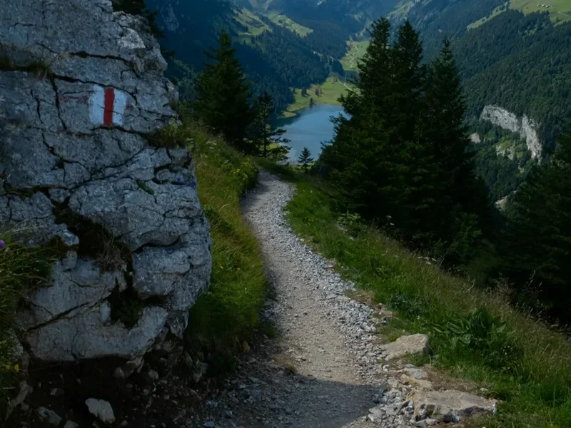
Navigation: Although the trail is generally well-marked with yellow signs indicating the Via Alpina route, it is crucial to carry and know how to use topographic maps, a compass, and a GPS device or smartphone with offline maps. Visibility can drop rapidly in fog or bad weather, making navigation challenging.
Water: While streams and springs are common, it is advisable to treat all water before drinking, especially at lower altitudes or near livestock. Carry a water filter or purification tablets.
Emergency Contacts: Know the emergency numbers for Switzerland: 144 for medical emergencies, 112 for general emergencies. Consider carrying a personal locator beacon (PLB) or satellite messenger for remote sections with no mobile signal.
Hut Safety: Follow the rules and guidelines provided by hut wardens. Be mindful of noise, especially during sleeping hours. Ensure you have a sleeping bag liner. Do not leave valuables unattended.
Wildlife: While encounters are rare, be aware of potential wildlife such as chamois, ibex, and marmots. Maintain a safe distance and do not feed them.
Physical Fitness: Ensure you are adequately fit for the demands of the trail. Undertaking long, strenuous days with significant elevation changes requires good physical conditioning. Start with shorter hikes and gradually increase distance and elevation.
Travel Insurance: It is highly recommended to have comprehensive travel insurance that covers hiking and potential medical evacuation.
Side Trips and Points of Interest
The Via Alpina Red Trail is rich with opportunities for exploration beyond the main route. Here are some notable side trips and points of interest:
Bachalpsee Lake (near First): A short, relatively easy hike from the First gondola station leads to Bachalpsee, a stunning alpine lake famous for its perfect reflections of the Schreckhorn and Finsteraarhorn. It's a quintessential Swiss Alps postcard view and a popular spot for photography.
Faulhorn Summit: For those seeking panoramic views, a detour to the summit of Faulhorn (2,681 m) from the Bachalpsee area offers breathtaking 360-degree vistas of the Bernese Alps, including the Eiger, Mönch, and Jungfrau. There is also a historic mountain hotel at the summit.
Schynige Platte Alpine Garden: Located near the Schynige Platte station, this garden showcases a remarkable collection of over 600 species of Swiss alpine flora. It's a beautiful and educational stop, offering a close-up look at the delicate plant life of the mountains.
Lauterbrunnen Valley Waterfalls: While Staubbach Falls is visible from the valley floor, a short walk or bus ride can take you closer to other impressive waterfalls like Trümmelbach Falls, a series of ten glacier-waterfalls inside the mountain, made accessible by tunnel-lift.
Männlichen: Accessible via cable car from Wengen or Grindelwald, Männlichen offers spectacular views of the Eiger, Mönch, and Jungfrau. The "Royal Walk" trail from the summit station is a popular, easy-to-moderate hike with incredible vistas.
Oeschinensee Lake (near Kandersteg): A short hike or gondola ride from Kandersteg leads to the breathtakingly beautiful Oeschinensee, a turquoise glacial lake nestled beneath towering cliffs. It's a popular spot for swimming, boating, and enjoying the alpine scenery.
Adelboden's Hinterstockensee: Another beautiful alpine lake, Hinterstockensee, offers a serene setting and is accessible from the Adelboden area, providing a peaceful contrast to the more dramatic peaks.
Traditional Villages: Many villages along the route, such as Grindelwald, Mürren, Gimmelwald, Kandersteg, and Adelboden, are worth exploring for their traditional architecture, local crafts, and culinary specialties. They offer a glimpse into the enduring alpine way of life.
Leave No Trace
The Via Alpina Red Trail traverses some of Europe's most pristine and ecologically sensitive alpine environments. Adhering to Leave No Trace principles is paramount to preserving this natural beauty for future generations and ensuring the sustainability of the trail.
Plan Ahead and Prepare: Research your route, understand the terrain and weather, and pack appropriately. Know the regulations for the areas you will be hiking through, especially regarding camping and fires.
Travel and Camp on Durable Surfaces: Stick to marked trails to avoid damaging fragile alpine vegetation. If camping is permitted in designated areas, use established campsites. Avoid trampling vegetation or creating new paths.
Dispose of Waste Properly: Pack out everything you pack in, including all food scraps, wrappers, and toilet paper. Use designated toilets in huts and villages. If no facilities are available, dig a cathole at least 60 metres away from water sources, trails, and campsites, and bury human waste.
Leave What You Find: Do not remove or disturb natural objects such as rocks, plants, or flowers. Take only photographs and memories.
Minimise Campfire Impacts: Campfires are generally prohibited in most alpine areas in Switzerland due to fire risk and environmental impact. Use a portable stove for cooking.
Respect Wildlife: Observe wildlife from a distance. Never feed animals, as this can disrupt their natural behaviours and diets, and can be harmful to their health. Store food securely to prevent attracting animals.
Be Considerate of Other Visitors: Keep noise levels down, especially in huts and natural areas. Yield to other hikers on narrow trails. Respect the local culture and customs.
By following these principles, you contribute to the preservation of the stunning alpine environment and ensure that the Via Alpina remains a magnificent experience for all.