Tres Cruces to Manu Edge: A Journey into the Cloud Forest
The Tres Cruces to Manu Edge trek is an extraordinary multi-day expedition that plunges you into the heart of Peru's cloud forest and the fringes of the Amazon basin. This challenging 65 km route, typically spanning 4 to 5 days, traverses dramatic changes in elevation and ecosystem, from high Andean viewpoints to the humid, biodiverse lower slopes that herald the vastness of Manu National Park. Starting near the Mirador Tres Cruces, this walk is a profound immersion into a world where mist-shrouded peaks give way to a symphony of life, offering unparalleled opportunities for wildlife spotting and experiencing the raw, untamed beauty of the Peruvian Andes and its transition to the Amazon.
- Distance: 65.0 km one-way
- Duration: 4–5 days
- Season: May to September (dry season)
- Difficulty: Challenging
- Closest City: Cusco
- Trailhead Access: From Cusco, bus or taxi to Tres Cruces (Mirador Tres Cruces) (~4-5 hrs, paved then gravel road). Limited parking. Manu Park entrance fee applies.
- Coordinates: -13.0500, -71.5000
Overview
This trek is a spectacular journey through contrasting landscapes, beginning at high altitudes with panoramic views and descending into the lush, vibrant cloud forest. The initial days are characterised by rugged mountain terrain, often shrouded in mist, offering a sense of remote wilderness. As you descend, the environment transforms dramatically. The air becomes warmer and more humid, the vegetation thickens, and the sounds of the forest come alive with the calls of exotic birds and insects. This transition zone, where the Andes meet the Amazon, is renowned for its exceptional biodiversity, making it a prime location for observing unique flora and fauna.
The challenge of this trek lies not only in its distance and elevation changes but also in the unpredictable mountain weather and the remoteness of the route. Hikers must be prepared for a variety of conditions, from cool, crisp mountain air to the warm, humid embrace of the cloud forest. The reward for this effort is an intimate encounter with one of the planet's most biologically rich regions, a place where the sheer abundance of life is overwhelming and awe-inspiring. The trek culminates at the "Manu Edge," a point that signifies the threshold of the vast Manu National Park, a UNESCO World Heritage site and one of the most biodiverse places on Earth.
This is a trek for the adventurous, those seeking an authentic wilderness experience far from the usual tourist trails. It requires a good level of fitness, self-sufficiency, and a deep appreciation for the natural world. The journey offers a unique perspective on Peru's ecological diversity, showcasing the dramatic interplay between high-altitude ecosystems and the burgeoning life of the Amazonian frontier.
History and Cultural Context
The region surrounding Tres Cruces and the upper reaches of the Manu watershed has a long and complex history, deeply intertwined with the Inca Empire and the subsequent Spanish colonisation. While not as extensively documented as the Inca heartland further west, these high-altitude areas served as important routes and resource zones for ancient Andean peoples. The Mirador Tres Cruces itself likely held significance as a vantage point, offering strategic views over the surrounding valleys and potentially serving ceremonial purposes.
The descent into the cloud forest and towards the Amazon basin represents a journey into territories that were historically inhabited by various indigenous groups who maintained their distinct cultures and ways of life, often in relative isolation. The Spanish conquistadors and later explorers ventured into these regions seeking riches and new territories, but the dense forests and challenging terrain meant that much of the Amazonian interior remained largely untouched by direct colonial influence for centuries. The establishment of Manu National Park in the latter half of the 20th century was a crucial step in protecting this unique environment and the indigenous communities who call it home, recognising its immense ecological and cultural value.
The modern history of this trek is one of exploration and discovery by adventurers and naturalists drawn to the region's unparalleled biodiversity. It is a testament to the enduring allure of the Andes and the Amazon, two of South America's most iconic natural wonders. The route, while not a formalised Inca trail, follows ancient pathways and natural corridors that have been used for millennia, connecting the high Andes to the lowland rainforest.
Seasonal Highlights and Weather Reality
The best time to undertake the Tres Cruces to Manu Edge trek is during the dry season, which generally runs from May to September. This period offers the most favourable weather conditions for high-altitude trekking and for experiencing the cloud forest with reduced rainfall.
Dry Season (May to September):
- Weather: Days are typically sunny and clear, with cooler temperatures at higher elevations. Nights can be cold, with frost possible above 3,500 metres. The cloud forest will be less humid than in the wet season, though still warm and moist.
- Visibility: Higher chances of clear views from Mirador Tres Cruces and other high points. The cloud forest will be more accessible, with fewer heavy downpours obscuring trails.
- Wildlife: This season can be excellent for spotting certain types of wildlife, particularly birds, as they may be more active during the cooler parts of the day.
- Challenges: Cold temperatures at night and in the early mornings at higher altitudes require warm clothing.
Wet Season (October to April):
- Weather: Characterised by frequent and heavy rainfall, particularly in the afternoons. Temperatures are warmer and humidity is significantly higher, especially in the cloud forest.
- Visibility: Frequent mist and cloud cover at higher elevations can severely limit views. Trails can become muddy, slippery, and more challenging to navigate.
- Wildlife: The increased moisture can lead to a surge in insect activity, including mosquitoes and sandflies. However, some species of amphibians and reptiles may be more active.
- Challenges: The primary challenge is the rain, which can make trekking difficult and increase the risk of landslides or flash floods in lower-lying areas.
Given the challenging nature of the trek and the significant elevation changes, the dry season is strongly recommended for safety and enjoyment.
Recommended Itinerary
4-Day Tres Cruces to Manu Edge Itinerary
Day 1: Tres Cruces (Mirador Tres Cruces) to High Camp
- Distance: 12 km
- Elevation gain: 800 m
- Time: 5–7 hours
- Start at Mirador Tres Cruces, enjoying panoramic Andean views (weather permitting)
- Begin descent into a high-altitude valley, transitioning from open grassland to scrub
- The trail can be steep and rocky in sections
- Establish a high camp at approximately 4,000 metres
- This day focuses on acclimatisation and the initial descent into the wilderness
- Set up camp and prepare for the colder night ahead
Day 2: High Camp to Cloud Forest Transition Zone
- Distance: 15 km
- Elevation gain: 500 m descent, 700 m ascent
- Time: 6–8 hours
- Continue descent, entering areas of sparse cloud forest vegetation
- The landscape begins to change dramatically as humidity increases
- Cross streams and navigate potentially boggy terrain
- Reach an elevation where the dense cloud forest truly begins
- Set up camp in a sheltered area within the transition zone
- Begin to hear the sounds of the lower forest and observe changes in flora
Day 3: Cloud Forest Exploration and Lower Camp
- Distance: 20 km
- Elevation gain: 1,200 m descent
- Time: 7–9 hours
- Descend deeper into the vibrant cloud forest
- The trail becomes more challenging with steep, muddy sections and dense vegetation
- Opportunities for wildlife spotting: diverse birdlife, insects, and potentially mammals
- Pass numerous waterfalls and streams
- Reach a lower elevation camp, closer to the "Manu Edge"
- Experience the full immersion of the humid, biodiverse cloud forest environment
Day 4: Manu Edge and Return to Trailhead Access Point
- Distance: 18 km
- Elevation gain: 300 m descent, 500 m ascent (return to vehicle access)
- Time: 6–8 hours
- Reach the designated "Manu Edge" point, marking the transition towards the park's core
- Spend time observing the unique ecosystem and reflecting on the journey
- Begin the ascent back towards the vehicle access point near Tres Cruces
- The return journey will retrace some of the path, but with a different perspective
- Arrive back at the trailhead access point by late afternoon
- Transfer back to Cusco (requires pre-arranged transport)
Optional Day 5: Extended Exploration or Slower Pace
- Allows for more in-depth exploration of the cloud forest, additional wildlife viewing, or a more relaxed pace on challenging sections.
- Could involve setting up a second camp in the cloud forest for deeper immersion.
- Provides a buffer for weather delays or unexpected trail conditions.
Important Notes:
- This itinerary is a guideline; actual timings and distances may vary based on trail conditions, weather, and group pace.
- Camping is required throughout the trek; no huts are available.
- A high level of self-sufficiency is essential, including navigation, cooking, and first aid.
- Pre-arranged transport from Cusco to Tres Cruces and back is mandatory.
- Manu National Park entrance fees and regulations must be adhered to.
Planning and Bookings
Book Your Trip
Everything you need to plan your journey
Accommodation
Find places to stay near Cusco
Flights
Search flights to Cusco
Essential Preparation
This trek demands significant preparation due to its challenging nature and remote location. The closest major city and logistical hub is Cusco. From Cusco, you will need to arrange private transport (taxi or 4x4 vehicle) to reach the trailhead at Mirador Tres Cruces. The journey typically takes 4-5 hours, with the latter part of the road being unpaved and potentially rough. It is crucial to book this transport well in advance. Given the altitude, acclimatisation in Cusco (which sits at around 3,400 metres) for at least 2-3 days before starting the trek is highly recommended to mitigate the risk of altitude sickness. Ensure you have all necessary gear, food, and water purification methods, as resupply points are non-existent once you depart the main road.
Trail Accommodation
This is a wilderness trek requiring camping. There are no established huts, lodges, or campsites along the Tres Cruces to Manu Edge route. Hikers must be fully self-sufficient and carry all necessary camping equipment, including tents, sleeping bags, and cooking gear. Campsites will be established in suitable, sheltered locations along the route, chosen for safety and minimal environmental impact. The choice of camping spots will depend on terrain, water availability, and weather conditions. Given the remote nature, expect to be entirely self-reliant for shelter and sustenance throughout the 4-5 days.
Required Gear
- Sturdy, waterproof hiking boots with good ankle support, well broken-in.
- Waterproof and windproof outer layers (jacket and trousers) with good breathability.
- Warm layers: thermal base layers (merino wool or synthetic), fleece or down mid-layers, warm hat, and gloves.
- Durable hiking trousers (quick-drying).
- High-quality tent suitable for variable mountain and forest conditions.
- Sleeping bag rated for sub-zero temperatures (e.g., -5°C to -10°C comfort rating) for high-altitude camps.
- Sleeping mat for insulation and comfort.
- Backpack (60-75 litres) with a rain cover.
- Head torch with spare batteries.
- First-aid kit including blister treatment, pain relievers, antiseptic wipes, bandages, and any personal medications.
- Navigation tools: GPS device or smartphone with offline maps, compass, and a detailed map of the area.
- Trekking poles for stability on steep and slippery terrain.
- Sun protection: high SPF sunscreen, sunglasses, wide-brimmed hat.
- Insect repellent with a high concentration of DEET or Picaridin for the cloud forest sections.
- Water bottles or hydration reservoir (minimum 3 litres capacity).
- Water filter or purification tablets.
What to Bring
- High-energy, non-perishable food for 4-5 days (breakfasts, lunches, dinners, snacks). Consider freeze-dried meals for weight efficiency.
- Camp stove and fuel (sufficient for the duration of the trek).
- Cooking pot, utensils, mug, and plate/bowl.
- Biodegradable soap, toothbrush, toothpaste, and other personal toiletries.
- Toilet paper and a trowel for burying human waste (follow Leave No Trace principles).
- Hand sanitiser.
- Camera and spare batteries/power bank.
- Binoculars for wildlife viewing.
- Dry bags or waterproof stuff sacks to protect gear.
- Personal identification and any necessary permits or park entry documentation.
- Cash for local expenses (e.g., transport, potential park fees).
Permits
Entry into Manu National Park requires a permit and adherence to park regulations. While the trailhead at Mirador Tres Cruces may not have an immediate checkpoint, the trek descends into areas managed by the park. It is essential to confirm the current permit requirements and fees with the Peruvian Ministry of Environment (MINAM) or the park authorities in Cusco prior to your trek. Often, guided tours will handle permit acquisition as part of their service. Independent trekkers must research and secure these permits well in advance. The park is divided into different zones, and access to certain areas may be restricted or require specific authorisation, particularly for overnight stays. Ensure you understand the regulations regarding camping and waste disposal within the park boundaries to minimise your environmental impact.
Other Activities in the Area
While the Tres Cruces to Manu Edge trek is a significant undertaking, the region around Cusco and the gateway to Manu National Park offers a wealth of other experiences:
- Cusco City Exploration: Immerse yourself in the historical capital of the Inca Empire. Visit the Plaza de Armas, Cusco Cathedral, Qorikancha (Temple of the Sun), and the vibrant San Blas artisan quarter.
- Sacred Valley Tour: Explore the picturesque Sacred Valley of the Incas, visiting archaeological sites like Pisac, Ollantaytambo, and the Maras salt mines.
- Machu Picchu: No trip to Cusco is complete without a visit to the iconic Inca citadel of Machu Picchu. This can be done via train from Ollantaytambo or Aguas Calientes.
- Rainbow Mountain (Vinicunca): A popular day trip from Cusco, offering stunning views of a multi-coloured mountain range. Requires acclimatisation.
- Amazon Lodges (Lower Manu): For a more in-depth Amazon experience, consider staying at a jungle lodge deeper within Manu National Park. This requires separate travel arrangements, often involving flights or long boat journeys from Cusco or Puerto Maldonado. These lodges offer guided walks, boat trips, and excellent wildlife viewing opportunities.
- Birdwatching Tours: The cloud forest and lower Amazonian regions are world-renowned for their avian diversity. Dedicated birdwatching tours can be arranged from Cusco or Puerto Maldonado.
Safety and Conditions
Altitude Sickness: Cusco is at high altitude (3,400m), and the trek begins even higher. Acclimatisation is paramount. Symptoms include headache, nausea, dizziness, and fatigue. Ascend slowly, stay hydrated, avoid alcohol and heavy meals, and consider consulting your doctor about altitude medication (e.g., Diamox).
Weather: The weather in the Andes and cloud forest is highly unpredictable. Be prepared for rapid changes, including strong winds, heavy rain, mist, and cold temperatures at higher elevations. Hypothermia is a risk, especially during the dry season nights. Ensure you have adequate warm and waterproof clothing.
Terrain: The trail involves steep ascents and descents, rocky paths, and muddy, slippery sections, particularly in the cloud forest. Trekking poles are highly recommended for stability. Landslides and flash floods can occur during the wet season.
Wildlife: While the cloud forest is rich in biodiversity, encounters with potentially dangerous wildlife are rare on established trails. However, be aware of your surroundings. Venomous snakes and insects exist, so wear appropriate footwear and long trousers. Always maintain a safe distance from wildlife.
Navigation: This is a remote trek. Navigation skills are essential, especially if hiking independently. Trails can be faint or obscured by vegetation. It is strongly advised to hire a local guide or join an organised tour, particularly for independent trekkers unfamiliar with the region.
Water: Water sources are generally available, but all water must be treated (filtered or purified) to prevent waterborne illnesses.
Communication: Mobile phone signal is non-existent for most of the trek. Consider carrying a satellite communication device (e.g., Personal Locator Beacon - PLB) for emergencies.
Emergency Evacuation: Due to the remote nature, emergency evacuation can be difficult and expensive. Ensure you have comprehensive travel insurance that covers high-altitude trekking and emergency medical evacuation.
Side Trips and Points of Interest
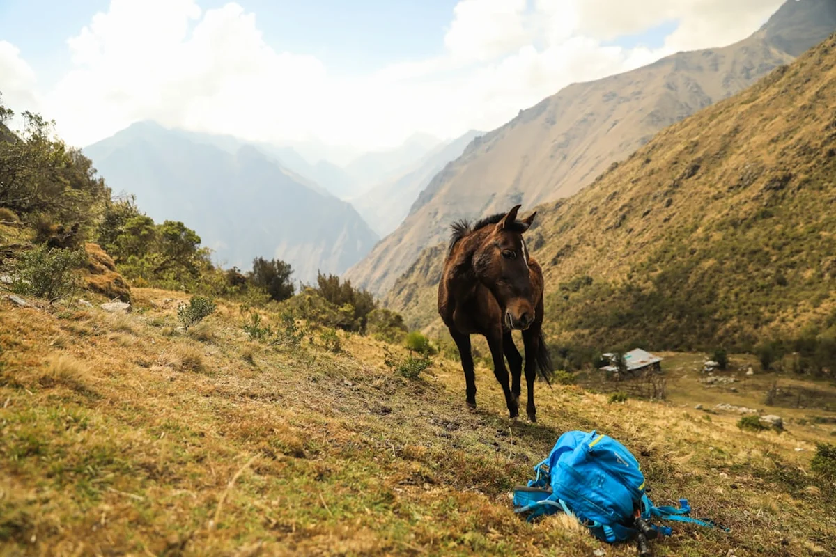
Mirador Tres Cruces: The starting point offers spectacular panoramic views of the surrounding Andean landscape, often above the cloud line. On clear days, the vistas are breathtaking, showcasing jagged peaks and vast valleys. This is an ideal spot for photography and to appreciate the scale of the environment you are about to enter.
High-Altitude Lakes: Depending on the exact route taken, there may be opportunities to pass by small, pristine high-altitude lakes. These offer serene beauty and are often surrounded by unique alpine flora.
Transition Zone Flora and Fauna: The gradual descent into the cloud forest is a point of immense interest. Observe the subtle yet dramatic changes in vegetation, from hardy alpine grasses and shrubs to the first moss-laden trees and giant ferns. Keep an eye out for diverse bird species, including hummingbirds, quetzals (if lucky), and various tanagers, as well as insects and amphibians that thrive in this humid environment.
Waterfalls and Streams: The cloud forest is characterised by abundant water. Numerous waterfalls and cascading streams are encountered throughout the descent, adding to the lush and dynamic atmosphere of the environment. These provide excellent opportunities for photography and a refreshing presence.
The "Manu Edge": This is not a single, marked point but rather a conceptual culmination of the trek, representing the threshold of the vast Manu National Park. It signifies the point where the high-altitude cloud forest transitions into the lower, more tropical rainforest ecosystems. Reaching this point is a significant achievement, marking your entry into a region of unparalleled biodiversity.
Leave No Trace
The Tres Cruces to Manu Edge trek traverses fragile ecosystems, from high alpine meadows to the incredibly biodiverse cloud forest. Adhering to Leave No Trace principles is paramount to preserving this environment for future generations and for the indigenous communities who call these lands home.
- Plan Ahead and Prepare: Research the route, understand local regulations, and be prepared for all weather conditions. Carry appropriate gear and sufficient food.
- Travel and Camp on Durable Surfaces: Stick to established trails where they exist. When camping, choose established sites or camp on durable surfaces like rock or dry grass, at least 70 metres away from water sources. Avoid trampling vegetation.
- Dispose of Waste Properly: Pack out everything you pack in, including all food scraps, wrappers, and toilet paper. Use designated toilets where available, or dig catholes 15-20 cm deep and at least 70 metres from water, camp, and trails. Pack out all human waste in remote areas.
- Leave What You Find: Do not remove plants, rocks, or cultural artifacts. Take only photographs and memories.
- Minimise Campfire Impacts: Campfires are generally discouraged in sensitive environments like the cloud forest. If permitted and necessary, use a camp stove for cooking. If a fire is essential, use existing fire rings and keep fires small. Ensure fires are completely extinguished.
- Respect Wildlife: Observe wildlife from a distance. Never feed animals, as it disrupts their natural behaviours and diets. Store food securely to prevent attracting animals.
- Be Considerate of Other Visitors: Keep noise levels down, especially in natural settings. Yield to other hikers on the trail.
By following these principles, you help ensure that the pristine beauty and ecological integrity of this remarkable region are maintained.