Tre Cime di Lavaredo Loop: The Iconic Dolomites Circuit
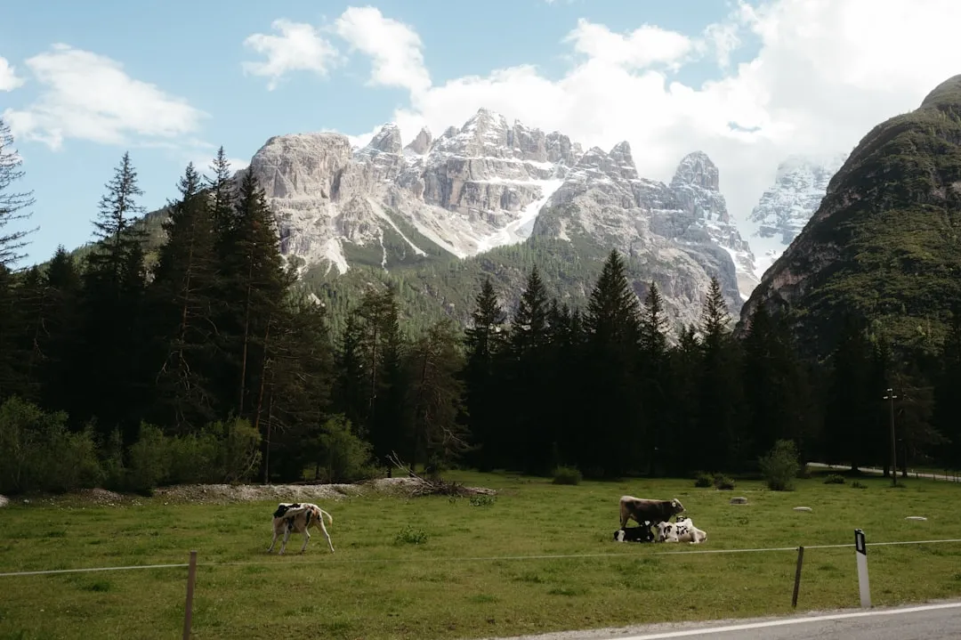
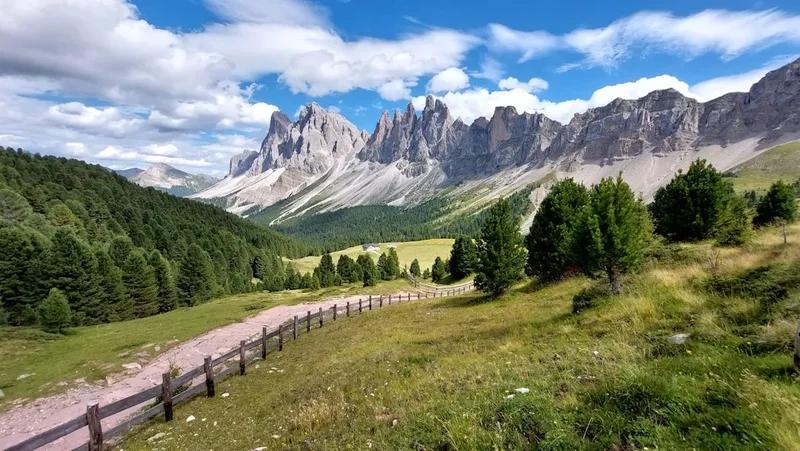
The Tre Cime di Lavaredo Loop is a quintessential day walk in the Italian Dolomites, renowned for its breathtaking scenery and accessibility. This relatively short circuit offers unparalleled views of the three iconic, jagged peaks of Tre Cime di Lavaredo (Drei Zinnen in German), which stand as a majestic natural monument in the heart of the Dolomites. The trail winds through alpine meadows, past serene mountain lakes, and offers panoramic vistas of the surrounding rugged mountain ranges, making it a must-do for hikers visiting the South Tyrol region.
- Distance: 9.6 km
- Elevation Gain: 340 m
- Duration: 3-4 hours
- Difficulty: Moderate
- Season: June to September
- Closest City: Cortina d'Ampezzo
- Trailhead Access: Nearest airport: Venice (VCE). Drive (~2.5 hrs) or bus to Cortina d'Ampezzo, then bus #30/31 to Rifugio Auronzo. Road is toll (summer). Parking available (fee). GPS: 46.6167, 12.2917. No permits usually needed, check local regulations.
- Coordinates: 46.6167, 12.2917
Overview
The Tre Cime di Lavaredo Loop is a moderate, circular hiking trail that encircles the famous Tre Cime peaks. It is one of the most popular and visually rewarding walks in the Dolomites, attracting hikers of all levels. The trail is well-maintained and clearly marked, making navigation straightforward. The loop typically starts and finishes at Rifugio Auronzo, a large mountain hut accessible by a scenic toll road during the summer months. From Rifugio Auronzo, the path leads towards the imposing faces of the Tre Cime, offering spectacular photographic opportunities at every turn.
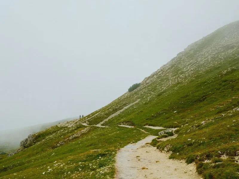
The route is characterised by its relatively gentle gradients for much of the way, interspersed with short, steeper sections. The highest point of the loop is near Forcella Lavaredo (Lavaredo Pass), offering a commanding view of the north faces of the Tre Cime. Along the way, hikers will encounter other mountain huts, such as Rifugio Lavaredo and Rifugio Locatelli (Dreizinnenhütte), which provide excellent resting points, refreshments, and further opportunities to soak in the alpine atmosphere. The loop is designed to provide continuous, awe-inspiring views of the Tre Cime from various angles, showcasing their dramatic geological formations and the surrounding vastness of the mountain landscape.
The trail's moderate difficulty makes it suitable for families and less experienced hikers, provided they are prepared for the altitude and potential for changing mountain weather. The duration of 3-4 hours allows ample time for photography, breaks, and enjoying the serene alpine environment. The loop is best undertaken during the summer months when the mountain roads are open and the weather is generally more stable, though conditions can still be unpredictable.
History and Cultural Context
The Tre Cime di Lavaredo region, like much of the Dolomites, has a rich history intertwined with its strategic location and dramatic landscape. Historically, this area served as a border region between Italy and Austria-Hungary until the end of World War I. The scars of this conflict are still visible in some parts of the Dolomites, with remnants of trenches and fortifications found in higher alpine areas, though the immediate Tre Cime loop is largely free of such direct evidence.
The name "Tre Cime di Lavaredo" is Italian, while "Drei Zinnen" is the German equivalent, reflecting the linguistic and cultural duality of the South Tyrol region. This area was part of the Austro-Hungarian Empire until it was ceded to Italy after World War I. Consequently, both Italian and German are widely spoken, and the culture is a unique blend of both influences, evident in the cuisine, architecture, and local customs.
The development of tourism in the Dolomites gained momentum in the late 19th and early 20th centuries. Mountain huts, or "rifugi," began to be established to cater to the growing number of climbers and hikers. Rifugio Auronzo, Rifugio Lavaredo, and Rifugio Locatelli are all testament to this era of exploration and the subsequent popularisation of the mountains for recreational purposes. The construction of the toll road to Rifugio Auronzo in the mid-20th century significantly increased accessibility, transforming the Tre Cime from a remote mountaineering objective into a world-renowned hiking destination.
Today, the Tre Cime di Lavaredo are a protected natural monument and a UNESCO World Heritage site, recognised for their outstanding geological significance and dramatic beauty. The loop walk allows visitors to appreciate not only the natural grandeur but also the historical context of a region that has witnessed centuries of cultural exchange and human endeavour.
Seasonal Highlights and Weather Reality
The best time to hike the Tre Cime di Lavaredo Loop is generally from June to September. During these months, the mountain roads are typically open, and the weather is most favourable for hiking.
June: The early summer offers a chance to see the alpine meadows in bloom, with wildflowers carpeting the slopes. Snow may still linger in shaded areas and at higher elevations, particularly on the northern slopes of the Tre Cime. The weather can be variable, with a possibility of late snow showers, but days are long and daylight is plentiful.
July and August: These are the peak months for tourism. The weather is generally warmer and more stable, though afternoon thunderstorms are common. The mountain huts are fully operational, and the atmosphere is lively. The meadows are at their most vibrant, and the views are typically clear, offering excellent photographic conditions. However, expect larger crowds on the trail.
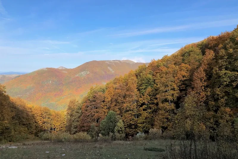
September: Autumn brings crisp air, clear skies, and fewer crowds. The larch trees begin to turn golden, adding a spectacular splash of colour to the landscape. The weather can be cooler, and the first snowfalls are possible towards the end of the month. The mountain road may close by late September or early October depending on snowfall.
October to May: Outside of the main hiking season, the area is largely inaccessible due to snow. The toll road to Rifugio Auronzo is closed, and the trails are covered in deep snow, making them suitable only for experienced winter mountaineers with appropriate equipment. The mountain huts are generally closed during this period.
Weather Considerations: Mountain weather in the Dolomites can change rapidly and unpredictably. Even during the summer months, hikers should be prepared for sudden shifts in temperature, wind, rain, and even snow. Afternoon thunderstorms are a common occurrence and can develop quickly, bringing lightning and heavy downpours. It is crucial to check the weather forecast before setting out and to carry appropriate gear for all conditions.
Recommended Itinerary
Tre Cime di Lavaredo Loop: A Day Walk Itinerary
Start: Rifugio Auronzo
- Morning (approx. 9:00 AM): Arrive at Rifugio Auronzo. Pay the toll for the road access if driving, or disembark from the bus. Take a moment to admire the initial views of the Tre Cime from the rifugio's vicinity.
- Begin the loop by heading east along the well-marked path (Trail 101). The initial section is a gentle, wide gravel track offering expansive views.
- Mid-Morning (approx. 10:00 AM): Continue on Trail 101 towards Forcella di Longéres. The path gradually ascends, providing increasingly dramatic perspectives of the Tre Cime's southern faces.
- Reach Forcella di Longéres, a saddle offering a first close-up view of the iconic peaks.
- Continue on Trail 101 towards Rifugio Lavaredo. This section involves a short, steeper climb.
- Late Morning (approx. 11:00 AM): Arrive at Rifugio Lavaredo. This is a good spot for a brief rest and to enjoy the proximity to the Tre Cime.
- From Rifugio Lavaredo, the trail continues towards Forcella Lavaredo (Lavaredo Pass). This is the highest point of the loop.
- Midday (approx. 12:00 PM): Reach Forcella Lavaredo. This pass offers a spectacular vantage point, with the north faces of the Tre Cime directly in front of you. Take time for photos and to absorb the panoramic views of the surrounding Dolomites.
- Descend from Forcella Lavaredo on Trail 101 towards Rifugio Locatelli (Dreizinnenhütte). This section offers a different perspective of the Tre Cime, with the iconic view often captured from this side.
- Early Afternoon (approx. 1:00 PM): Arrive at Rifugio Locatelli. This rifugio is famous for its incredible views and is a popular spot for lunch.
- From Rifugio Locatelli, the trail begins its return journey towards Rifugio Auronzo. You will follow Trail 101, which loops back around the peaks.
- The path from Rifugio Locatelli offers a final, sweeping view of the Tre Cime as you walk away from them, before the trail turns and heads back towards the starting point.
- Mid-Afternoon (approx. 2:30 PM - 3:30 PM): Arrive back at Rifugio Auronzo, completing the loop.
Important Notes:
- The trail is well-signposted with red and white markers and numbered trails (primarily Trail 101).
- Wear sturdy hiking boots.
- Carry water and snacks, although huts offer refreshments.
- Be prepared for rapidly changing mountain weather.
- The toll road to Rifugio Auronzo is open from approximately late May/early June to late September/early October, weather permitting.
- Bus services operate from Cortina d'Ampezzo to Rifugio Auronzo during the summer season.
Planning and Bookings
Book Your Trip
Everything you need to plan your journey
Accommodation
Find places to stay near Cortina d'Ampezzo
Flights
Search flights to Cortina d'Ampezzo
Essential Preparation
The Tre Cime di Lavaredo Loop is a day hike, meaning no overnight accommodation is required on the trail itself. However, planning your access and timing is crucial for an enjoyable experience. The closest major town and logistical hub is Cortina d'Ampezzo, a well-known ski resort and summer hiking destination. From Cortina, you can reach the trailhead at Rifugio Auronzo via public bus or by private vehicle.
Access to Rifugio Auronzo:
- By Car: The most direct way is to drive to Rifugio Auronzo. The road is a toll road during the summer season (typically from late May/early June to late September/early October). The toll fee is per vehicle. Parking is available at Rifugio Auronzo, also for a fee. The GPS coordinates for Rifugio Auronzo are approximately 46.6167° N, 12.2917° E.
- By Bus: Public bus services operate from Cortina d'Ampezzo to Rifugio Auronzo during the summer months. This is a convenient option if you do not have a car or prefer not to drive the winding mountain road. Check local bus schedules and ticket prices in advance, as they can vary.
Timing: Arrive at Rifugio Auronzo as early as possible, especially during peak season (July and August), to secure parking and avoid the largest crowds on the trail. Early morning light also offers beautiful photographic opportunities.
Cortina d'Ampezzo: This town offers a wide range of accommodation options, from luxury hotels to more budget-friendly guesthouses and apartments. It also has numerous restaurants, shops, and outdoor gear stores. It's advisable to book accommodation in Cortina in advance, particularly during the summer high season.
Trail Accommodation
This is a day hike requiring no overnight accommodation.
Required Gear
- Hiking Boots: Sturdy, waterproof hiking boots with good ankle support are essential. The terrain can be uneven, rocky, and sometimes slippery. Ensure they are well broken-in to prevent blisters.
- Waterproof Jacket: A lightweight, breathable waterproof jacket is crucial. Mountain weather can change rapidly, and rain showers are common, even in summer.
- Waterproof Overtrousers: Recommended for protection against rain and wind, especially if the forecast is poor.
- Layers of Clothing: Dress in layers. A moisture-wicking base layer, an insulating mid-layer (fleece or down jacket), and an outer shell provide flexibility for changing temperatures.
- Hat and Gloves: Even in summer, temperatures at altitude can be cool, especially in the shade or if the wind picks up. A warm hat and gloves are advisable.
- Sun Protection: High-altitude sun is intense. Bring sunscreen (SPF 30 or higher), sunglasses, and a wide-brimmed hat or cap.
- Backpack: A comfortable daypack (20-30 litres) to carry essentials like water, snacks, extra clothing, and a first-aid kit.
- Navigation: While the trail is well-marked, a map of the area and a compass or GPS device are recommended, especially if you plan to explore any side paths. A charged mobile phone is useful for emergencies, but reception can be spotty.
- First-Aid Kit: A basic kit including plasters, antiseptic wipes, pain relievers, and any personal medications.
What to Bring
- Water: Carry at least 1.5 to 2 litres of water per person. Refill opportunities exist at the mountain huts, but it's wise to start with ample supply.
- Food: Pack high-energy snacks such as trail mix, energy bars, fruit, and sandwiches. While huts offer meals and refreshments, having your own supplies ensures you're covered.
- Camera: You'll want to capture the incredible scenery! Ensure batteries are fully charged and you have sufficient memory space.
- Trekking Poles: Optional, but can be helpful for stability on ascents and descents, and for reducing strain on knees.
- Cash: While many huts accept credit cards, it's always wise to carry some Euros in cash for smaller purchases or in case of card machine issues.
- Toilet Paper: Carry your own, as facilities at huts may be basic.
- Hand Sanitiser: Useful for hygiene, especially before eating.
Permits
For the standard Tre Cime di Lavaredo Loop hike, no specific permits are generally required for individuals or small groups. The primary access requirement is the payment of a toll fee for the road leading to Rifugio Auronzo, which is the starting and ending point of the loop. This toll is collected during the summer season when the road is open.
Road Toll:
- The toll road to Rifugio Auronzo is managed by a private concessionaire.
- The fee is per vehicle and is subject to change annually. It is advisable to check the current toll price before your visit.
- The road is typically open from late May/early June to late September/early October, depending on snow conditions.
- Payment is usually made at a toll booth before reaching the rifugio.
Parking Fee:
- In addition to the road toll, there is a parking fee at Rifugio Auronzo. This fee is also per vehicle and is collected upon arrival at the parking area.
- Parking can be limited, especially during peak season, so arriving early is highly recommended.
Bus Access:
- If you opt for public transport, the bus ticket price covers your transport to Rifugio Auronzo. You will not need to pay the road toll or parking fee.
- Bus schedules and fares should be confirmed with the local transport authority in Cortina d'Ampezzo.
Group Hikes and Guided Tours: If you are participating in a guided tour or a large organised group hike, the tour operator will typically handle all access arrangements and fees as part of the package. Always confirm what is included in your tour price.
Conservation Efforts: While no specific hiking permit is needed for the loop, the area is part of the Dolomites UNESCO World Heritage site. Visitors are expected to adhere to principles of responsible tourism and respect the natural environment. This includes staying on marked trails, not littering, and respecting the wildlife.
Other Activities in the Area
The region around Tre Cime di Lavaredo offers a wealth of activities for visitors looking to extend their stay or explore beyond the iconic loop:
- Rifugio Hopping: Numerous other mountain huts (rifugi) are accessible from the Tre Cime area, offering opportunities for multi-day hikes or shorter excursions to different viewpoints. Rifugio Antonio Carestiato, Rifugio Fonda Savio, and Rifugio Zsigmondy-Comici are just a few examples.
- Via Ferrata: The Dolomites are famous for their "via ferrata" routes – protected climbing paths equipped with steel cables, rungs, and ladders. Several challenging and scenic via ferratas are located within reach of the Tre Cime, such as the Via Ferrata Ivano Dibona, which follows old WWI military paths. These require specific equipment and experience.
- Photography: The dramatic landscapes of the Dolomites are a photographer's paradise. Sunrise and sunset offer particularly spectacular light for capturing the Tre Cime and surrounding peaks.
- Cycling: The toll road to Rifugio Auronzo is also popular with road cyclists, offering a challenging climb with rewarding views. Mountain biking trails are also available in the wider region.
- Exploring Cortina d'Ampezzo: The nearby town of Cortina d'Ampezzo offers a vibrant atmosphere with excellent dining, shopping, and cultural attractions. It also serves as a base for numerous other hiking and outdoor activities.
- Lake Braies (Pragser Wildsee): A stunning alpine lake located about an hour's drive from the Tre Cime area, famous for its emerald waters and surrounding peaks. It's a popular spot for leisurely walks and boat rentals.
- Other Dolomite Peaks: The region is dotted with other famous peaks and massifs, such as the Marmolada (the highest peak in the Dolomites), the Sella Group, and the Brenta Dolomites, each offering unique hiking and climbing opportunities.
Safety and Conditions
Weather: Mountain weather is unpredictable. Always check the forecast before you go and be prepared for rapid changes. Afternoon thunderstorms are common in summer and can bring lightning, heavy rain, and strong winds. Hypothermia is a risk even in summer if you get wet and cold.
Altitude: The Tre Cime di Lavaredo Loop reaches an altitude of approximately 2,450 metres at Forcella Lavaredo. While this is not extremely high, some individuals may experience mild altitude sickness. Take it easy on your first day at altitude, stay hydrated, and avoid strenuous activity if you feel unwell.
Trail Conditions: The main loop trail (Trail 101) is generally well-maintained and clearly marked. However, sections can be rocky, uneven, and exposed. Wear appropriate footwear and watch your step. Snow can linger on shaded sections well into early summer.
Navigation: While the main loop is straightforward, it's always wise to carry a map and compass or GPS device. Familiarise yourself with the route before you start.
Emergency: In case of an emergency, dial the European emergency number 112. Mobile phone reception can be unreliable in mountainous areas, so do not rely solely on your phone for communication.
Hydration and Nutrition: Carry sufficient water and high-energy snacks. Dehydration and low blood sugar can lead to fatigue and poor decision-making. Refill water bottles at mountain huts if possible, but treat water from natural sources if you are not at a hut.
Respect the Environment: Stay on marked trails to protect fragile alpine vegetation. Do not litter; pack out everything you pack in. Do not disturb wildlife.
Hut Etiquette: If you stop at a rifugio, be mindful of other hikers. Respect quiet hours if staying overnight (though this is a day hike). Purchase food and drinks to support the upkeep of these vital mountain facilities.
Side Trips and Points of Interest
Rifugio Locatelli (Dreizinnenhütte): While a standard stop on the loop, the views from this rifugio are exceptional. It offers arguably the most iconic perspective of the Tre Cime's north faces, with the peaks framed by the surrounding landscape. It's a perfect spot for a leisurely lunch and photography.
Cimabanche Pass (Passo di Monte Croce Comelico): Located a short drive or bus ride from Rifugio Auronzo, this pass offers a different perspective of the Dolomites and is the starting point for several other hiking routes. It's a good option if you have extra time or want to explore a less crowded area.
Lake Auronzo and Lake Misurina: These picturesque lakes are located at lower altitudes near the base of the road leading to Rifugio Auronzo. They offer pleasant walks and beautiful reflections of the surrounding mountains, providing a different kind of alpine beauty compared to the high-altitude trails.
WWI Trenches and Fortifications: While not directly on the main loop, remnants of World War I fortifications and trenches can be found in the broader Dolomite region. For those interested in history, exploring these sites can add a significant dimension to a visit. Some via ferrata routes incorporate these historical elements.
Alpine Flora and Fauna: Keep an eye out for the diverse alpine flora, especially during spring and early summer when wildflowers are in bloom. You might also spot marmots, chamois, or various bird species. The area is also home to the majestic golden eagle.
Leave No Trace
The Tre Cime di Lavaredo is a jewel of the Dolomites, a UNESCO World Heritage site that demands respect and careful stewardship. Adhering to Leave No Trace principles ensures that this magnificent landscape remains pristine for future generations of hikers and nature lovers.
Plan Ahead and Prepare: Research the trail, weather conditions, and access requirements. Pack appropriate gear and sufficient supplies to avoid needing to forage or rely on potentially scarce resources. Understand the regulations regarding the toll road and parking.
Travel and Camp on Durable Surfaces: For this day hike, this means staying on the well-defined trails. Avoid cutting switchbacks or walking on fragile vegetation, which can take years to recover. The trails are designed to withstand foot traffic and protect the surrounding environment.
Dispose of Waste Properly: Pack out everything you pack in. This includes all food scraps, wrappers, tissues, and any other litter. There are bins at the rifugi, but it is best practice to carry your waste back down with you. Use toilet facilities at the rifugi when available.
Leave What You Find: Do not take rocks, plants, or any other natural objects. Leave them for others to enjoy and to maintain the ecological balance of the area.
Minimize Campfire Impacts: As this is a day hike, campfires are not applicable. However, if you were to undertake an overnight trip in the wider region, be aware of fire restrictions and use designated fire rings where permitted.
Respect Wildlife: Observe wildlife from a distance. Do not feed animals, as this can disrupt their natural behaviours and diets, and can be harmful to their health. Keep pets under control if you bring them.
Be Considerate of Other Visitors: Keep noise levels down, especially at rifugi. Yield to uphill hikers. Be courteous and respectful of other people's experience of the natural environment.