Tour du Pic du Midi d'Ossau - The Pyrenean Crown Jewel
The Tour du Pic du Midi d'Ossau is a spectacular multi-day circuit encircling the iconic Pic du Midi d'Ossau in the heart of the French Pyrenees. This challenging trek offers a profound immersion into high-mountain landscapes, traversing granite peaks, alpine meadows bursting with wildflowers, crystal-clear glacial lakes, and remote valleys. It's a journey that demands respect for the alpine environment, rewarding hikers with breathtaking vistas and a true sense of wilderness far from the beaten path.
- Distance: 42.0 km
- Elevation Gain: 2,600 m
- Duration: 3-4 days
- Difficulty: Challenging
- Best Time: June to October
- Closest City: Laruns
- Trailhead Access: Nearest airport: Pau Pyrénées Airport (PUF). From Pau, take a bus or taxi to Laruns, then a bus to Gabas. By car: D934 from Laruns to Gabas. Road conditions are generally good. Parking available in Gabas. No permits required.
- Coordinates: 42.8347, -0.4758
Overview
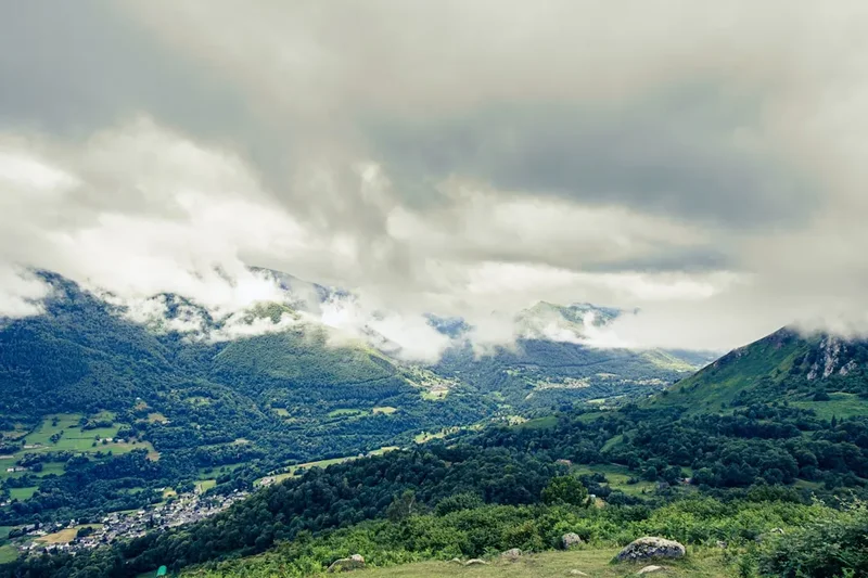
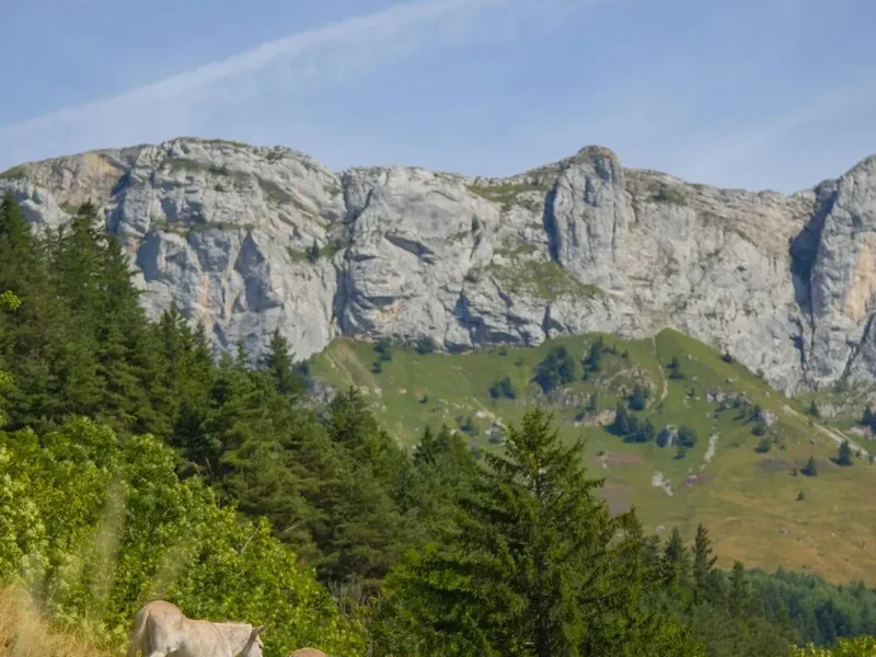
The Tour du Pic du Midi d'Ossau is not merely a walk; it's an expedition into the rugged soul of the Pyrenees. The trail circumnavigates the majestic Pic du Midi d'Ossau (2,884 m), a distinctive granite peak that dominates the skyline with its dramatic, almost volcanic silhouette. Unlike many well-trodden paths, this circuit offers a genuine sense of adventure, with sections that require sure-footedness and a good head for heights. The route is a testament to the raw beauty of the high mountains, featuring a constantly changing panorama of jagged peaks, deep valleys, and serene alpine lakes.
The trek is characterised by its significant elevation changes. While the total distance is moderate, the cumulative elevation gain of 2,600 metres means that each day involves substantial climbing and descending. This challenging profile ensures that hikers are rewarded with expansive views from every ridge and pass. The landscape shifts from verdant lower valleys, dotted with traditional Béarnaise villages, to stark, rocky cirques and high alpine pastures where marmots whistle and chamois graze. The air is crisp and clean, carrying the scent of pine and wild herbs.
The trail passes through a variety of terrains. You'll traverse well-maintained paths, rocky scree slopes, and occasionally exposed sections that require careful navigation. The presence of numerous mountain refuges (gîtes d'étape) provides essential resting points and opportunities for hearty, traditional mountain cuisine. These refuges are not just places to sleep and eat; they are vital social hubs for hikers, offering a warm welcome and a chance to share experiences. The Tour du Pic du Midi d'Ossau is an ideal trek for experienced hikers seeking a challenging and visually stunning Pyrenean adventure, offering a deep connection with the wild heart of the mountains.
History and Cultural Context
The Pic du Midi d'Ossau has long held a special place in the folklore and history of the Béarn region. Its distinctive shape has made it a natural landmark and a subject of local legends for centuries. Historically, the valleys surrounding the Pic were inhabited by shepherds and farmers who relied on the mountain pastures for their livelihood. The trails that now form the Tour du Pic du Midi d'Ossau were often ancient shepherd paths, used for centuries to move livestock between summer grazing grounds and winter valleys.
The ascent of the Pic itself has a history of mountaineering endeavour. The first recorded ascent was in 1787 by Jean-François d'Estremon, a local nobleman, accompanied by guides. The development of mountaineering in the 19th century saw more climbers tackle the peak, and the establishment of refuges along the routes leading to its base began to formalise the trekking experience. These refuges, often built by local communities or mountaineering clubs, provided essential shelter and sustenance for those venturing into the high mountains.
The Tour du Pic du Midi d'Ossau circuit, as a defined multi-day trek, gained popularity as hiking and mountaineering became more accessible. It allows walkers to experience the full grandeur of the mountain and its surrounding massif, rather than just focusing on a single ascent. The cultural heritage of the region is evident in the architecture of the villages at the trail's start and end points, such as Gabas and Laruns, with their stone houses and traditional Béarnaise charm. The area also retains strong links to Basque and Gascon cultures, reflecting the historical crossroads that the Pyrenees represent.
Seasonal Highlights and Weather Reality
The best time to undertake the Tour du Pic du Midi d'Ossau is generally from June to October. During this period, the snow has typically melted from the higher passes, and the weather is most stable, although mountain conditions can change rapidly at any time of year.
June: The early summer offers lush green landscapes and abundant wildflowers in the lower and mid-altitudes. However, higher passes may still hold significant snow, and some refuges might not yet be fully operational or accessible. Water levels in streams and rivers are high.
July and August: These are the peak months for hiking. The weather is generally warm and sunny, though afternoon thunderstorms are common. Wildflowers are at their most vibrant, and the days are long, allowing for extended hiking hours. This is also the busiest period, with refuges requiring advance booking.
September: Autumn brings crisp, clear air and stunning golden hues to the landscape. The crowds thin out, and the weather can be exceptionally stable. The risk of early snow on the highest passes increases towards the end of the month, but generally, September offers excellent hiking conditions.
October: The early part of October can still offer good hiking, especially in the lower valleys. However, the weather becomes increasingly unpredictable, with a higher chance of snow, frost, and colder temperatures. Some refuges may close for the season by mid-October. It is essential to check conditions and refuge opening times carefully.
Weather: Mountain weather in the Pyrenees is notoriously changeable. Even in summer, hikers can experience sunshine, heavy rain, strong winds, and even snow within a single day. Temperatures can vary significantly with altitude and time of day. It is crucial to be prepared for all conditions, regardless of the season.
Recommended Itinerary
3-Day Tour du Pic du Midi d'Ossau Itinerary
Day 1: Gabas to Refuge d'Arlet
- Distance: 12.0 km
- Elevation Gain: 1,100 m
- Time: 5–7 hours
- Start from the village of Gabas (1,000 m)
- Follow the GR10 path, initially through forests and then opening up to alpine pastures
- Ascend towards the Col d'Arlet (2,100 m)
- The path can be steep and rocky in places
- Enjoy increasingly spectacular views of the Pic du Midi d'Ossau
- Arrive at the Refuge d'Arlet (1,950 m), a charming stone refuge with stunning views
- This day is a significant climb, setting the tone for the challenging nature of the tour
Day 2: Refuge d'Arlet to Refuge de Pombie
- Distance: 15.0 km
- Elevation Gain: 800 m, Elevation Loss: 750 m
- Time: 6–8 hours
- Cross the Col d'Arlet (2,100 m) and descend into the Vallée d'Ossau
- Traverse high mountain terrain, often on scree and rocky paths
- Pass by the Lac d'Arlet and other small alpine lakes
- Ascend towards the Col de Peyreget (2,300 m) or a similar high pass offering views towards the Pic
- Descend towards the Refuge de Pombie (2,030 m), situated in a dramatic cirque below the Pic du Midi d'Ossau
- This day involves significant ascents and descents, with exposed sections and potentially challenging terrain
- The proximity to the Pic du Midi d'Ossau is a highlight
Day 3: Refuge de Pombie to Gabas via Col de Soum
- Distance: 15.0 km
- Elevation Gain: 700 m, Elevation Loss: 1,400 m
- Time: 6–8 hours
- Depart from Refuge de Pombie
- Ascend towards the Col de Soum (2,240 m) or a similar pass, offering final panoramic views of the Pic
- Descend through the Vallée de Bious-Artigues
- The descent is long and can be steep, passing through forests and alpine meadows
- Pass the Lac de Bious-Artigues
- Return to the village of Gabas
- This day offers a grand finale with high-altitude views before a long descent back to civilisation
Alternative 4-Day Itinerary:
- Day 1: Gabas to Refuge d'Arlet (as above)
- Day 2: Refuge d'Arlet to Refuge de Cap de Long (longer, more remote section)
- Day 3: Refuge de Cap de Long to Refuge de Pombie (crossing high passes)
- Day 4: Refuge de Pombie to Gabas (as Day 3 of the 3-day itinerary)
Important Notes:
- Refuge accommodation must be booked in advance, especially during peak season (July-August).
- The itinerary is a suggestion; variations are possible depending on fitness, weather, and personal preference.
- Carry sufficient water or a purification method, as water sources can be scarce in some sections.
- Be prepared for rapid weather changes.
- Navigation skills are essential, especially in poor visibility.
Planning and Bookings
Book Your Trip
Everything you need to plan your journey
Accommodation
Find places to stay near Laruns
Flights
Search flights to Laruns
Essential Preparation
The Tour du Pic du Midi d'Ossau is a demanding trek that requires careful planning and a good level of physical fitness. Hikers should be comfortable with multi-day walking, significant elevation changes, and navigating potentially challenging terrain. The closest major town with comprehensive services is Laruns, which is easily accessible from Pau. Gabas, the typical starting and ending point, is a small village with limited facilities, so stocking up on supplies in Laruns is advisable.
Fitness: A good cardiovascular base is essential. Regular hiking, including uphill training, is recommended in the months leading up to the trek. The cumulative elevation gain of 2,600 metres over three to four days means you should be prepared for sustained climbs and descents.
Logistics: Access to Gabas is primarily by road. From Pau, you can take a bus or taxi to Laruns, and then a local bus or taxi to Gabas. If travelling by car, there is parking available in Gabas, but it can be limited during peak season. Consider arranging transport back to your vehicle if you are not completing a loop.
Base Town: Laruns is the main service town for this area. It offers accommodation, restaurants, bakeries, and outdoor gear shops. It's a good place to spend a night before or after your trek, to finalise preparations or relax.
Trail Accommodation
The Tour du Pic du Midi d'Ossau relies on a network of mountain refuges (gîtes d'étape) that provide basic accommodation and meals. These refuges are typically open from June to October, but it is crucial to verify their operating dates and book in advance, especially during July and August.
Refuge d'Arlet (1,950 m): A charming stone refuge offering dormitory-style accommodation. Facilities usually include bunk beds with mattresses, a common dining area, and basic sanitary facilities. Meals (dinner and breakfast) are often available for an additional cost. It is known for its stunning location and views.
Refuge de Pombie (2,030 m): Situated in a dramatic cirque directly beneath the Pic du Midi d'Ossau, this refuge is a popular stop. It offers dormitory accommodation and serves hearty mountain meals. The views of the Pic from the refuge are spectacular.
Refuge de Cap de Long (if using a 4-day itinerary): Located by the Lac de Cap de Long, this refuge offers a different perspective and is part of a longer, more remote circuit.
Booking Requirements: Advance booking is highly recommended, and often essential, for all refuges. Contact them directly via phone or email. Some refuges may have online booking systems.
Facilities Provided: Dormitory beds with mattresses, blankets (sleeping bags are usually required or recommended), common dining areas, and often basic toilets and washbasins. Some refuges have showers, but water can be limited.
What's NOT Provided: Personal sleeping bags (essential), toiletries, towels, cooking equipment (unless specified), and often electricity for charging devices. Food is usually available for purchase.
Seasonal Availability: Most refuges operate from mid-June to mid-October. Outside these dates, they are typically closed, and the trails can be impassable due to snow.
Costs: Expect to pay approximately €30-€50 per night for a dormitory bed, with meals costing an additional €15-€25 each.
Required Gear
- Sturdy hiking boots: Waterproof, with good ankle support and a well-worn sole. Essential for rocky and uneven terrain.
- Waterproof and windproof jacket: Gore-Tex or similar, with taped seams. Mountain weather is unpredictable.
- Waterproof overtrousers: Full-length zips are useful for easy on/off.
- Warm layers: Fleece or down jacket, thermal base layers (merino wool or synthetic).
- Hat and gloves: Even in summer, temperatures can drop significantly at altitude.
- Backpack: 40-55 litre capacity, with a rain cover.
- Head torch: With spare batteries. Essential for early starts or late finishes, and for use in refuges.
- First-aid kit: Including blister treatment, pain relievers, antiseptic wipes, bandages, and any personal medications.
- Navigation tools: Map of the area (e.g., IGN 1:25,000 scale), compass, and a GPS device or smartphone with offline maps.
- Sun protection: High SPF sunscreen, sunglasses, and a wide-brimmed hat.
- Trekking poles: Highly recommended for stability on ascents and descents, and to reduce strain on knees.
What to Bring
- Sleeping bag: A 3-season sleeping bag (comfort rating around 0-5°C) is essential as refuges provide mattresses and blankets but not personal bedding.
- Food: While refuges offer meals, carry high-energy snacks (nuts, dried fruit, energy bars) for lunches and in case of delays.
- Water bottles or hydration reservoir: Capacity of at least 2 litres per person.
- Water purification method: Filter or purification tablets, as not all water sources are guaranteed safe.
- Toiletries: Biodegradable soap, toothbrush, toothpaste, small quick-dry towel, hand sanitiser.
- Personal items: Camera, power bank for electronics, book or journal.
- Cash: Many refuges do not accept credit cards, so carry sufficient Euros for accommodation, meals, and any other expenses.
- Insect repellent: Especially for lower altitudes and evenings.
- Small repair kit: Duct tape, safety pins, needle and thread.
Permits
For the Tour du Pic du Midi d'Ossau, no specific permits are required to hike the trails or stay in the mountain refuges. However, booking accommodation in the refuges is essential, especially during the peak season (July and August). It is advisable to book your spots in the refuges several weeks, or even months, in advance to avoid disappointment.
Refuge Booking Information:
- Contact: Each refuge has its own contact details (phone number and email address). These can usually be found on the websites of the local tourist offices or mountaineering federations.
- Booking Window: Bookings typically open in the spring for the summer season.
- Payment: Be prepared to provide a credit card number to secure your booking. Some refuges may require a deposit. Payment for your stay is usually made upon arrival or departure.
- Cancellation Policy: Familiarise yourself with the cancellation policy of each refuge in case your plans change.
National Park Regulations: While no specific permits are needed for hiking, it is important to adhere to the general regulations of the Pyrénées National Park. This includes respecting the natural environment, not disturbing wildlife, and following marked trails.
Wild Camping: Wild camping is generally not permitted within the Pyrénées National Park, especially near refuges or in sensitive ecological areas. Stick to designated accommodation options.
Other Activities in the Area
The Ossau Valley and its surroundings offer a wealth of activities beyond the main trek:
- Ascent of Pic du Midi d'Ossau: For experienced mountaineers with the right equipment and skills, a guided or independent ascent of the Pic itself is a significant undertaking. This requires technical climbing ability and is not part of the standard circuit.
- Hiking in the Vallée d'Ossau: Numerous other hiking trails exist in the region, ranging from gentle valley walks to more challenging ascents of neighbouring peaks.
- Visiting Laruns: Explore the charming market town of Laruns, known for its traditional Béarnaise architecture, local produce, and the historic church of Saint-Pierre.
- Thermal Baths: The nearby spa town of Eaux-Bonnes offers thermal baths and wellness treatments.
- Cycling: The Col du Pourtalet, a major mountain pass on the French-Spanish border, is a popular route for road cyclists.
- Exploring Local Cuisine: Sample regional specialities such as Ossau-Iraty cheese, garbure (a hearty vegetable soup), and local wines.
- Wildlife Spotting: The area is home to diverse wildlife, including marmots, chamois, vultures, and various bird species.
Safety and Conditions
Mountain Weather: The most significant safety concern is the unpredictable mountain weather. Be prepared for rapid changes, including thunderstorms, strong winds, rain, and even snow, especially at higher altitudes. Always check the weather forecast before setting out each day and be willing to alter your plans if conditions are poor.
Navigation: While the main trails are generally well-marked (often with GR markings), visibility can be severely reduced in fog or cloud. Carry a map and compass, and know how to use them. A GPS device or smartphone with offline maps is a valuable backup.
Terrain: The terrain can be steep, rocky, and exposed in places. Loose scree slopes require careful footing. Trekking poles are highly recommended to aid balance and reduce the impact on your joints.
Altitude: The trek reaches altitudes of over 2,300 metres. Be aware of the symptoms of altitude sickness, although it is less common on a 3-4 day trek than on longer, higher expeditions. Stay hydrated and ascend gradually.
Water: While water is generally available from streams and refuges, it is advisable to treat all water from natural sources using a filter or purification tablets. Carry enough water to last between reliable sources.
Refuge Safety: Follow the rules and guidelines provided by refuge wardens. Ensure your sleeping bag is clean and used appropriately. Be mindful of fire safety.
Emergency Contact: In case of emergency, the general emergency number in France is 112. Know the location of the nearest refuge or village and any emergency phone numbers provided by the refuges.
Insurance: Ensure you have adequate travel insurance that covers mountain hiking and potential emergency evacuation.
Side Trips and Points of Interest
Lac d'Arlet: A beautiful alpine lake located near the Refuge d'Arlet. It's a serene spot for a break and offers stunning reflections of the surrounding peaks on calm days.
Col de Peyreget (2,300 m): A high pass offering panoramic views towards the Pic du Midi d'Ossau and the surrounding massif. It's a key point on the route, providing a sense of the vastness of the Pyrenean landscape.
Lac de Bious-Artigues: A picturesque reservoir lake encountered on the descent towards Gabas on the final day. It's a popular spot for picnics and offers lovely views back towards the mountains.
The Pic du Midi d'Ossau itself: While the circuit does not include the summit ascent, the constant presence and dramatic silhouette of the Pic are the main points of interest. Its unique shape, often described as a "bear's paw," makes it instantly recognisable and a constant companion on the trek.
Traditional Béarnaise Villages: The villages of Gabas and Laruns, at the start and end of the trek, offer a glimpse into the traditional architecture and culture of the Ossau Valley. Their stone houses, slate roofs, and charming squares are worth exploring.
Leave No Trace
The Tour du Pic du Midi d'Ossau traverses a fragile mountain ecosystem. Adhering to Leave No Trace principles is crucial to preserve its natural beauty and ecological integrity for future generations.
- Plan Ahead and Prepare: Research the trail, understand the terrain and weather, and book accommodation in advance. Pack appropriately for all conditions.
- Travel and Camp on Durable Surfaces: Stick to marked trails to avoid damaging vegetation. When resting, use established paths or rocky areas. Wild camping is generally not permitted.
- Dispose of Waste Properly: Pack out everything you pack in, including all food scraps, wrappers, and toilet paper. Use designated toilets in refuges. If caught short in the backcountry, dig a cathole at least 60 metres from water sources, trails, and campsites.
- Leave What You Find: Do not remove rocks, plants, or any natural objects. Take only photographs and memories.
- Minimise Campfire Impacts: Campfires are generally prohibited in the high mountains. Use a portable stove for cooking.
- Respect Wildlife: Observe animals from a distance. Do not feed them, as this can disrupt their natural behaviour and diet.
- Be Considerate of Other Visitors: Keep noise levels down, especially in refuges. Yield to uphill hikers. Share the trail respectfully.
By following these principles, you help ensure that the Tour du Pic du Midi d'Ossau remains a wild and beautiful place.