
Tour du Viso - Alpine Majesty on the French-Italian Border
The Tour du Viso is a spectacular multi-day trek circumnavigating the iconic Monviso massif, a majestic peak that stands as a sentinel on the border between France and Italy. This challenging yet immensely rewarding circuit offers a profound immersion into the high alpine environment of the Cottian Alps, revealing a landscape sculpted by glaciers and time. Hikers are treated to a breathtaking panorama of jagged peaks, pristine alpine lakes, vast meadows carpeted with wildflowers in summer, and ancient stone villages clinging to steep hillsides. The route traverses a variety of terrain, from well-trodden paths to more rugged, rocky sections, demanding a good level of fitness and sure-footedness. It is a journey that encapsulates the raw beauty and wild spirit of the Alps, offering a true sense of adventure and discovery.
- Distance: Approximately 120 km
- Duration: 7–9 days
- Season: July to September (best for snow-free trails and wildflowers)
- Difficulty: Challenging
- Highest point: Approximately 2,800 metres (Colle delle Traversette)
- Accommodation: Mountain refuges (refuges/rifugi) and gîtes d'étape
- Starting/Ending Point: L'Echalp (France) or Pian del Re (Italy)
- Direction: Can be walked clockwise or anti-clockwise
Overview
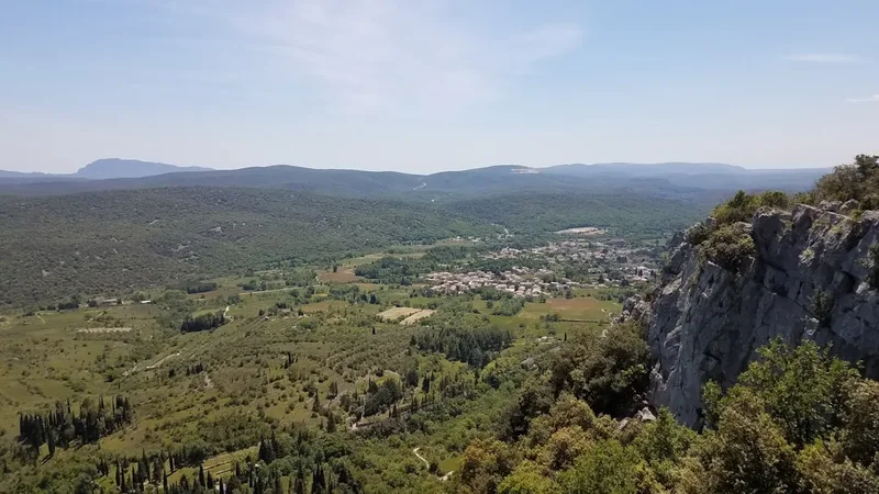
The Tour du Viso is more than just a trek; it's an expedition into the heart of the Monviso region, a place steeped in history and natural grandeur. The massif itself, with its distinctive pyramid shape, is a geological marvel and a significant landmark in the Alps. The trail network that encircles it is a testament to centuries of human passage, from ancient transhumance routes to military paths and pilgrimage trails. This circuit offers a diverse experience, taking walkers through lush French valleys, across high Italian passes, and past shimmering glacial lakes that reflect the imposing peaks above.
The route is characterised by its significant elevation changes. While the total distance is substantial, the cumulative elevation gain is considerable, requiring sustained effort and good physical conditioning. Each day presents new vistas, from the expansive views from high cols like the Colle delle Traversette (historically significant as the site of Hannibal's crossing of the Alps) to the serene beauty of lakes such as Lago Chiaretto and Lago Fiorenza. The trail passes through a mosaic of landscapes: dense pine forests, open alpine pastures, scree slopes, and rocky ridges. The presence of numerous mountain refuges and gîtes d'étape along the way provides essential resting points and opportunities to experience local hospitality and cuisine.
The Tour du Viso is particularly renowned for its summer bloom, when the alpine meadows explode with colour. From late June through August, a vibrant tapestry of wildflowers, including gentians, edelweiss, and alpine roses, carpets the landscape. The air is crisp and clean, and the soundscape is dominated by the gentle murmur of streams, the distant chime of cowbells, and the occasional call of a marmot. This trek is an ideal choice for experienced hikers seeking a challenging, multi-day alpine adventure that combines stunning natural beauty with a rich cultural and historical context.
History and Cultural Context
The Monviso massif and its surrounding valleys have a long and fascinating history, deeply intertwined with human activity and natural phenomena. For millennia, these high passes served as crucial routes for trade, migration, and military campaigns. The most famous historical event associated with the region is Hannibal's crossing of the Alps in 218 BC. While the exact route remains debated, many historians and geographers believe the Colle delle Traversette, a key point on the Tour du Viso, was one of the passes used by the Carthaginian general and his army, including elephants, on their journey to Italy.
The region also played a significant role in the development of early mountaineering and exploration. The Monviso itself was first summited in 1860 by the English mountaineer Francis Fox Tuckett, accompanied by guides Jean-Baptiste and Michel Croz. This ascent marked a turning point in the exploration of the Alps, opening up new possibilities for climbing and trekking.
Historically, the valleys on both the French and Italian sides were inhabited by communities who relied on agriculture and pastoralism. The construction of numerous stone shelters, shepherd huts, and military fortifications bears witness to this past. Many of these structures have been repurposed into the mountain refuges and gîtes d'étape that now serve hikers on the Tour du Viso, offering a tangible connection to the region's heritage. The trail network itself often follows ancient mule tracks and shepherd paths, providing a unique perspective on the historical human use of this rugged alpine terrain.
The Monviso is also the source of the Po River, Italy's longest river, which begins its journey from a small spring near Pian del Re. This geographical significance has made the area a place of natural and cultural importance for centuries.
Seasonal Highlights and Weather Reality
The prime season for hiking the Tour du Viso is from July to September. During these months, the snow typically melts from the higher passes, making the trails accessible and safer. The weather is generally more stable, with longer daylight hours and warmer temperatures, although alpine conditions can change rapidly.
July: This is often the best month for wildflowers. The alpine meadows are in full bloom, creating a spectacular display of colour. The days are long, and the temperatures are pleasant for hiking. However, there can still be lingering snow patches on the highest passes early in the month, and afternoon thunderstorms are common.
August: The peak of summer. The wildflowers may have started to fade slightly, but the landscape is still vibrant. August is a popular month, so refuges can be busy. The weather is generally warm, but the risk of thunderstorms remains, particularly in the afternoons. This is also a good month for swimming in the alpine lakes.
September: The autumn colours begin to appear in the lower valleys, and the air becomes crisper. The crowds thin out, offering a more tranquil experience. However, the days are shorter, and the temperatures start to drop, especially at higher altitudes. Snow can fall on the passes from mid-September onwards, so it's essential to check conditions before setting out. The weather can be more unpredictable in September, with a higher chance of rain or early snow.
Weather Considerations: The Alps are known for their unpredictable weather. Even in summer, hikers can encounter rain, strong winds, fog, and even snow at higher elevations. Temperatures can fluctuate significantly between day and night, and at different altitudes. It is crucial to be prepared for all conditions, regardless of the season. Afternoon thunderstorms are a common occurrence in the summer months and can develop very quickly. It is advisable to start your hiking days early to avoid the worst of the afternoon weather.
Recommended Itinerary
7-Day Tour du Viso Itinerary (Example)
Day 1: L'Echalp (France) to Refuge Carle (France)
- Distance: Approximately 10 km
- Elevation gain: ~600 m
- Time: 3–4 hours
- Start at L'Echalp, a small hamlet with parking and a gîte.
- Gentle ascent through pine forests and meadows.
- Pass the source of the Po River (Fontaine du Po).
- Arrive at Refuge Carle, a large refuge offering stunning views of the Monviso massif.
- Opportunity to acclimatise and enjoy the initial grandeur of the mountains.
Day 2: Refuge Carle to Rifugio Quintino Sella (Italy)
- Distance: Approximately 15 km
- Elevation gain: ~1000 m
- Time: 5–7 hours
- Cross the French-Italian border via the Col des Aiguilles (2,400 m).
- Descend into the Italian valley towards Lago Chiaretto.
- Continue to Rifugio Quintino Sella, a well-established refuge situated near a beautiful alpine lake.
- This day involves significant ascent and descent, offering spectacular views of the Monviso.
Day 3: Rifugio Quintino Sella to Rifugio Città di Saluzzo (Italy)
- Distance: Approximately 12 km
- Elevation gain: ~700 m
- Time: 4–5 hours
- Hike past Lago Superiore and Lago di Soprano.
- Ascend to the Colle delle Traversette (2,948 m), a historically significant pass.
- Descend towards Rifugio Città di Saluzzo, another excellent refuge.
- This day features the highest point of the trek and offers panoramic views.
Day 4: Rifugio Città di Saluzzo to Rifugio Savigliano (Italy)
- Distance: Approximately 14 km
- Elevation gain: ~600 m
- Time: 4–6 hours
- Continue through the Italian Alps, passing several smaller lakes.
- The trail is generally less steep today, allowing for a more relaxed pace.
- Arrive at Rifugio Savigliano, a charming refuge in a picturesque setting.
Day 5: Rifugio Savigliano to Rifugio Barbara (Italy)
- Distance: Approximately 16 km
- Elevation gain: ~800 m
- Time: 5–7 hours
- Ascend towards the Passo di San Chiaffredo (2,770 m).
- Enjoy views of the Monviso and surrounding peaks.
- Descend to Rifugio Barbara, located in a beautiful alpine valley.
- This day involves a significant pass crossing and descent.
Day 6: Rifugio Barbara to Gîte d'Étape de La Montagne (France)
- Distance: Approximately 18 km
- Elevation gain: ~700 m
- Time: 5–7 hours
- Cross back into France, potentially via the Col Agnel or a nearby pass.
- Descend into a French valley, passing through alpine meadows and forests.
- Arrive at a gîte d'étape, offering a taste of French mountain hospitality.
Day 7: Gîte d'Étape de La Montagne to L'Echalp (France)
- Distance: Approximately 12 km
- Elevation gain: ~400 m (mostly descent)
- Time: 3–4 hours
- A relatively easy final day, mostly descending through forests.
- Rejoin the starting point at L'Echalp.
- Opportunity for a celebratory meal and reflection on the journey.
Note: This is a sample itinerary. Distances and times are approximate and can vary based on route choices, weather, and individual fitness. It is possible to extend or shorten the trek by combining days or adding rest days.
Planning and Bookings
Book Your Trip
Everything you need to plan your journey
Accommodation
Find places to stay near Briançon
Flights
Search flights to Briançon
Essential Preparation
The Tour du Viso is a challenging trek that requires careful planning and preparation. Given its multi-day nature and remote alpine setting, it is crucial to be physically fit and mentally prepared for sustained effort. The trek involves significant ascents and descents, often on rocky and uneven terrain, and can be undertaken at altitudes exceeding 2,800 metres. A good level of cardiovascular fitness, leg strength, and endurance is essential. Familiarity with hiking in mountainous environments and experience with navigation are highly recommended.
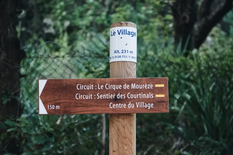
Logistics: The most common starting and ending point is L'Echalp in France, which is accessible by road and has parking facilities. Alternatively, one can start from Pian del Re in Italy. Access to these trailheads typically involves travelling to a larger town like Briançon (France) or Saluzzo (Italy) and then taking a local bus or taxi. It is advisable to check public transport schedules in advance, as they can be infrequent, especially outside of peak season. For those driving, parking is generally available at L'Echalp, but it's wise to confirm availability and any associated fees.
Base Towns: Briançon, France, is a historic fortified city and a good base for accessing the French side of the trek. Saluzzo, Italy, is a charming medieval town that serves as a gateway to the Italian side. Both towns offer a range of accommodation, restaurants, and outdoor gear shops.
Trail Accommodation
The Tour du Viso is well-served by a network of mountain refuges (refuges in France, rifugi in Italy) and gîtes d'étapes. These provide essential accommodation, meals, and a place to rest and recharge. Booking in advance is highly recommended, especially during the peak season (July and August), as refuges can fill up quickly.
Refuge Facilities:
- Dormitory-style sleeping quarters with bunk beds.
- Blankets and pillows are usually provided, but a sleeping bag liner is mandatory.
- Communal dining areas where meals are served.
- Some refuges offer packed lunches for the next day's hike.
- Toilets and washbasins are available; showers may be available but are often cold or have limited availability.
- Some refuges have limited charging facilities for electronic devices.
What's NOT Provided:
- Personal toiletries (though some basic items may be for sale).
- Towels (it's advisable to bring a quick-drying travel towel).
- Food and drink outside of meal times (though some may have a small bar).
- Electricity for extensive device charging.
Seasonal Availability: Most refuges are open from mid-June to mid-September, but exact dates can vary. It is crucial to check the opening and closing dates for each specific refuge you plan to stay in. Some refuges may operate with reduced services or self-catering options outside of the main season.
Costs: Prices vary between refuges and countries, but expect to pay approximately €40-€70 per person per night for half-board (dinner, bed, breakfast). Booking is typically done directly with the refuge via their website or by phone. Some may require a deposit.
Required Gear
- Sturdy hiking boots: Waterproof, with good ankle support and a well-worn sole. Essential for navigating varied alpine terrain.
- Waterproof and windproof jacket: Gore-Tex or similar, with taped seams. Crucial for protection against sudden weather changes.
- Waterproof overtrousers: Full-length zips are convenient for putting on over boots.
- Warm layers: Fleece jacket or down vest, thermal base layers (merino wool or synthetic). Temperatures can drop significantly at altitude, especially at night.
- Hiking trousers: Quick-drying and comfortable. Avoid jeans.
- Backpack: 40-60 litre capacity, with a comfortable harness and hip belt. A rain cover is essential.
- Sleeping bag liner: Mandatory in all refuges for hygiene.
- Head torch: With spare batteries. Useful for navigating refuges at night or for early morning starts.
- First-aid kit: Including blister treatment, pain relievers, antiseptic wipes, bandages, and any personal medications.
- Sun protection: High SPF sunscreen, lip balm with SPF, sunglasses, and a wide-brimmed hat or cap. The sun is intense at altitude.
- Navigation tools: Detailed maps of the area, a compass, and a GPS device or smartphone with offline maps. Knowledge of how to use them is vital.
- Trekking poles: Highly recommended for reducing strain on knees during descents and providing stability on uneven terrain.
What to Bring
- Food: While refuges provide meals, it's wise to carry high-energy snacks like nuts, dried fruit, energy bars, and chocolate for during the day's hike.
- Water bottles or hydration reservoir: Capacity of at least 2 litres per person.
- Water purification method: A filter or purification tablets are recommended, although water sources near refuges are generally reliable.
- Toiletries: Biodegradable soap, toothbrush, toothpaste, small quick-drying towel, hand sanitiser.
- Personal items: Camera, power bank for electronics, book or journal, insect repellent (especially for lower altitudes and evenings).
- Cash: Many refuges do not accept credit cards, or their machines may be unreliable. Carry sufficient Euros for accommodation, meals, and any incidentals.
- Duct tape: Invaluable for quick repairs to gear.
- Small knife or multi-tool.
- Whistle: For emergencies.
Permits
For the standard Tour du Viso trek, no specific permits are generally required for hiking or staying in the mountain refuges. The trails are part of the public domain in both France and Italy. However, it is essential to book accommodation in the refuges and gîtes d'étape well in advance, especially during the peak summer months of July and August. Some refuges may have specific booking procedures or require a deposit.
Accommodation Booking:
- Contact Refuges Directly: The most reliable method is to visit the individual refuge websites or contact them by phone. Many refuges have online booking systems, while others prefer email or telephone reservations.
- Booking Platforms: Some French refuges might be bookable through platforms like the FFME (Fédération Française des Clubs Alpins et de Montagne) or local tourism office websites.
- Peak Season Demand: Due to the popularity of the Monviso region, especially during July and August, it is strongly advised to book your accommodation at least 2-3 months in advance. Last-minute bookings can be difficult, and you may find yourself without a place to stay.
- Flexibility: If your dates are flexible, it can increase your chances of securing accommodation.
National Park Regulations: While no specific hiking permits are needed, it's always good practice to be aware of any local regulations regarding camping (wild camping is generally discouraged or prohibited in many areas, especially near refuges), waste disposal, and respecting the natural environment. The Monviso area is part of protected natural parks on both sides of the border, and adherence to environmental guidelines is expected.
Costs: Accommodation in refuges typically includes a bed and a meal (half-board). Prices vary, but expect to pay around €40-€70 per person per night for half-board. Day visitors can also purchase meals or drinks at most refuges.
Other Activities in the Area
Beyond the core trek, the Monviso region offers a wealth of activities for those with extra time or seeking different experiences:
- Ascent of Monviso: For experienced mountaineers with appropriate gear and skills, the summit of Monviso (3,841 m) is a challenging but achievable objective. This requires technical climbing expertise and is typically done with a guide.
- Day Hikes to Alpine Lakes: Numerous smaller lakes are accessible from the main Tour du Viso route, offering stunning reflections and opportunities for a refreshing dip (if you're brave enough for the cold water!). Examples include Lago Fiorenza, Lago Chiaretto, and Lago Superiore.
- Historical Site Exploration: Visit the historical markers and remnants of ancient routes, particularly around the Colle delle Traversette, which is believed to have been used by Hannibal.
- Photography: The dramatic landscapes, wildflowers, and wildlife provide endless opportunities for photographers. Sunrise and sunset over Monviso are particularly spectacular.
- Wildlife Spotting: Keep an eye out for marmots, chamois, ibex, and various alpine birds.
- Cultural Exploration in Base Towns: Spend time exploring the historic towns of Briançon and Saluzzo, with their ancient citadels, charming streets, and local markets.
- Via Ferrata: Several via ferrata routes are available in the broader Monviso region, offering a protected climbing experience for those with a head for heights.
Safety and Conditions
Weather: Alpine weather is notoriously unpredictable. Be prepared for rapid changes, including sudden storms, rain, wind, fog, and even snow, especially at higher altitudes. Check the mountain forecast daily before setting out. Afternoon thunderstorms are common in summer; start your hikes early to avoid them.
Altitude: The Tour du Viso reaches altitudes of nearly 3,000 metres. Be aware of the symptoms of altitude sickness (headache, nausea, dizziness, fatigue). Acclimatise properly by taking it easy on the first day or two, stay hydrated, and avoid alcohol. If symptoms worsen, descend.
Terrain: The trails can be steep, rocky, and uneven. Good hiking boots with ankle support are essential. Trekking poles can significantly improve stability and reduce strain on your joints. Be cautious on scree slopes and in areas with potential rockfall.
Navigation: While the main trails are generally well-marked, it is crucial to carry detailed maps and a compass and know how to use them. GPS devices or smartphone apps with offline maps are also valuable tools. Fog can reduce visibility to near zero, making navigation difficult.
Water: Water sources are generally plentiful along the route, especially near streams and lakes. However, it is always advisable to treat water from natural sources using a filter or purification tablets, particularly in areas with livestock grazing.
Refuge Safety: Follow the rules and guidelines provided by refuge wardens. Be mindful of noise levels, especially during sleeping hours. Ensure you have your sleeping bag liner. Report any concerns or issues to the warden.
Emergency Contacts: Know the emergency numbers for France (112) and Italy (112). Carry a fully charged mobile phone, though reception can be intermittent in the mountains. Consider carrying a personal locator beacon (PLB) for remote areas.
Insurance: Ensure you have adequate travel insurance that covers mountain rescue and medical evacuation for hiking activities at altitude.
Side Trips and Points of Interest
Colle delle Traversette (2,948 m): This is a historically significant pass, believed to be one of the routes used by Hannibal's army in 218 BC. A monument marks the pass, offering a tangible link to ancient history. The views from here are expansive, stretching across both French and Italian valleys, and providing a dramatic perspective on the Monviso massif.
Fontaine du Po (Source of the Po River): Located near L'Echalp, this is the official source of Italy's longest river. While a modest spring, it holds symbolic importance and is a pleasant spot to visit on the first or last day of the trek.
Lago Chiaretto and Lago Superiore: These stunning alpine lakes are located along the route and offer breathtaking reflections of the surrounding peaks. They are ideal spots for a rest break, a picnic, or even a bracing swim for the hardy.
Rifugio Quintino Sella: This refuge is renowned for its picturesque setting next to a beautiful alpine lake, offering excellent photographic opportunities and a chance to experience traditional Italian mountain hospitality.
Monviso Massif Views: The entire Tour du Viso is designed to offer continuous, awe-inspiring views of the Monviso. Specific viewpoints, such as those from the passes and near the refuges, provide particularly dramatic perspectives of this iconic peak.
Ancient Shepherd Paths and Stone Structures: Throughout the trek, you will traverse old mule tracks and pass by remnants of historical shepherd settlements and fortifications, offering insights into the region's past human use of the high alpine environment.
Leave No Trace
The Tour du Viso traverses a fragile alpine environment. Adhering to Leave No Trace principles is crucial to preserve its beauty and ecological integrity for future generations. As you hike, remember that you are a visitor in a wild and sensitive landscape.
Plan Ahead and Prepare: Research the trail, understand the conditions, and be prepared for all types of weather. Book accommodation in advance to avoid overcrowding and ensure you have a place to stay.
Travel and Camp on Durable Surfaces: Stick to marked trails to avoid damaging vegetation. Avoid creating new paths. When resting, choose established viewpoints or rocky areas.
Dispose of Waste Properly: Pack out everything you pack in, including all food scraps, wrappers, and any other litter. Use designated toilets in refuges. If wild camping is permitted in specific areas (check local regulations), ensure you are at least 70 metres away from water sources and trails, and pack out all human waste.
Leave What You Find: Do not pick wildflowers, disturb wildlife, or remove natural or historical objects. Take only photographs and memories.
Minimise Campfire Impacts: Campfires are generally prohibited in alpine areas and near refuges. If permitted in designated areas, use existing fire rings and ensure fires are completely extinguished.
Respect Wildlife: Observe wildlife from a distance. Do not feed animals, as this can disrupt their natural behaviours and diets. Store food securely to prevent attracting animals.
Be Considerate of Other Visitors: Keep noise levels down, especially in refuges and natural areas. Yield to uphill hikers. Respect the peace and tranquility of the mountains.