New Zealand — Ohakune
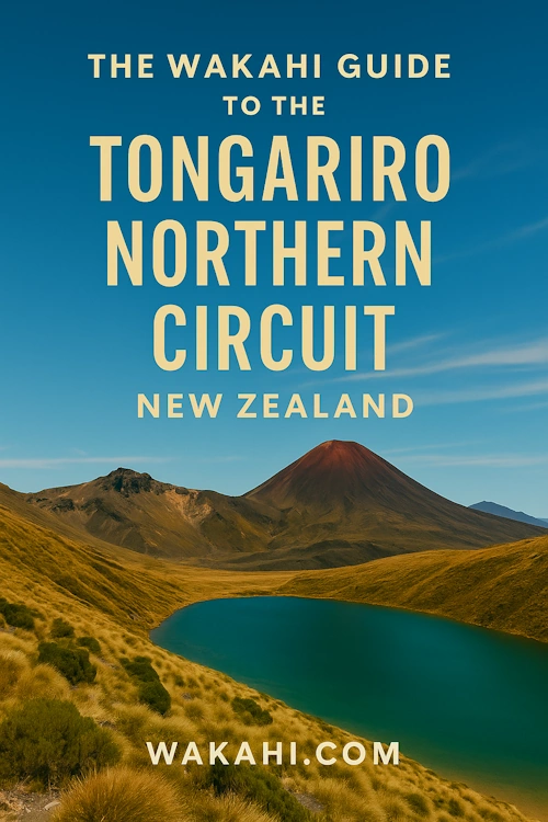
New Zealand's Tongariro Northern Circuit: a 43.1km moderate loop through a volcanic wonderland. This Great Walk circumnavigates Mount Ngauruhoe, traversing active craters, emerald lakes, and glacial valleys within a dual UNESCO World Heritage site. Allow 3-4 days for this surreal, protected wilderness, offering unparalleled panoramas and a profound immersion into a landscape shaped by fire and ice.
Distance: 43.1 km
Elevation Gain: 1940 m
Difficulty: Moderate
Duration: 3-4 days
The Tongariro Northern Circuit is one of New Zealand’s most otherworldly Great Walks, a 43.1-kilometre loop that circumnavigates the active stratovolcano of Mount Ngauruhoe. Located within the Tongariro National Park—New Zealand’s oldest national park and a dual UNESCO World Heritage site—this trail offers a profound immersion into a landscape shaped by fire and ice. Over three to four days, walkers traverse a surreal tapestry of active volcanic craters, brilliant emerald-coloured lakes, glacial valleys, and ancient beech forests. Unlike many other Great Walks that focus on coastal beauty or alpine meadows, the Northern Circuit is a raw, geological odyssey where the earth’s internal heat is visible in steaming vents and fresh lava flows. It is a journey that demands physical stamina and a deep respect for the volatile nature of the alpine environment, rewarding those who undertake it with some of the most dramatic and unique vistas found anywhere on the planet.
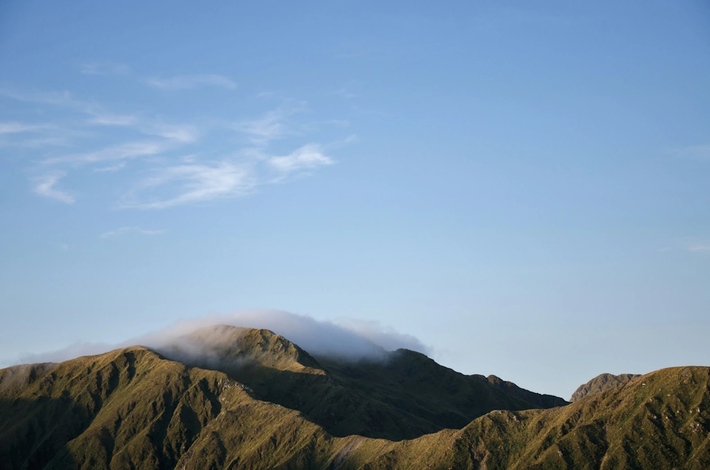
The Tongariro Northern Circuit is more than just a hike; it is an exploration of a living, breathing geological laboratory. The circuit winds its way around the base of Mount Ngauruhoe (famously known as Mount Doom in cinematic history) and traverses the shoulders of Mount Tongariro. The landscape is defined by its stark contrasts: the desolate, moon-like terrain of the central volcanic plateau gives way to the lush, cool-temperate rainforests of the lower slopes. Walkers will experience the sheer scale of the Oturere Valley, where twisted lava formations create a labyrinth of black rock, and the vibrant, almost neon hues of the Emerald Lakes, coloured by dissolved minerals leaching from the surrounding thermal areas.
The trail is a loop, typically starting and ending at Whakapapa Village, though it can be accessed from other points such as the Mangatepopo Road end. The route shares a significant portion with the world-famous Tongariro Alpine Crossing, particularly the section over Red Crater and past the Emerald Lakes. However, by completing the full circuit, walkers escape the heavy day-tripper crowds and find themselves in the quiet, expansive eastern reaches of the park, where the silence is broken only by the crunch of volcanic scoria underfoot and the occasional whistle of the wind across the desert-like plains. The elevation profile is varied, with the most significant climb occurring on the second day as the trail ascends to the summit of Red Crater, the highest point of the journey at 1,886 metres.
This is a landscape of extremes. In the height of summer, the sun reflects intensely off the volcanic rock, and there is little shade to be found on the high plateau. Conversely, even in the warmest months, the weather can shift in minutes, bringing freezing temperatures, gale-force winds, and horizontal rain. The Tongariro Northern Circuit requires walkers to be self-sufficient and prepared for an environment that is as beautiful as it is unforgiving. For those who seek a tramping experience that feels like stepping onto another planet, there is no equivalent to this volcanic loop.
The mountains of Tongariro National Park—Tongariro, Ngauruhoe, and Ruapehu—hold immense spiritual and cultural significance for the local Māori iwi (tribes), particularly Ngāti Tūwharetoa and Ngāti Rangi. In Māori mythology, these peaks are seen as living ancestors. The story of how the mountains came to be involves a great battle of the giants, where Tongariro emerged victorious, claiming the central position. The volcanic activity is often attributed to the high priest Ngātoro-i-rangi, who, while freezing on the slopes of Tongariro, called out to his sisters in Hawaiki to send fire. The fire arrived, creating the volcanic vents and saving his life, forever linking the land to the spiritual realm of Te Ao Māori.
In 1887, in an act of profound foresight and cultural preservation, Horonuku Te Heuheu Tukino IV, the paramount chief of Ngāti Tūwharetoa, gifted the sacred mountain peaks to the Crown. His intention was to ensure the mountains remained protected from being broken up and sold to private interests, creating a "sacred place" for all people to enjoy. This gift formed the nucleus of Tongariro National Park, the first national park in New Zealand and the fourth in the world. In 1993, the park became the first property to be inscribed on the UNESCO World Heritage list under the revised criteria for cultural landscapes, recognising its dual importance as a site of outstanding natural beauty and deep spiritual heritage.
The history of the track itself is intertwined with the development of New Zealand’s tramping culture. Early explorers and surveyors mapped the area in the late 19th century, and the first huts were established to support the growing interest in alpine exploration. Today, the Department of Conservation (DOC) manages the circuit as one of the ten Great Walks, maintaining high-quality huts and tracks while working closely with iwi to ensure the cultural integrity of the "Tapu" (sacred) peaks is respected by the thousands of visitors who walk the circuit each year.
Want more background? Read extended notes on history and cultural context → Learn more
The Tongariro Northern Circuit is a seasonal experience, with the "Great Walks Season" running from late October to the end of April. During this window, the huts are fully serviced, the track is generally clear of snow, and the weather is most favourable for tramping. However, "favourable" in a volcanic alpine environment is relative. Even in January, walkers must be prepared for sub-zero temperatures and sudden storms.
Summer (December to February): This is the most popular time to walk. The days are long, and the alpine flowers, such as the Mount Cook Lily and various celmisia species, are in bloom. The Emerald Lakes are at their most vibrant under the high summer sun. However, this is also the period of highest volcanic risk monitoring, as the heat can increase the activity of steam vents. Water can be scarce on the high sections, so carrying ample supplies is essential.
Autumn (March to April): Many experienced trampers consider this the best time to visit. The air is often crisper and clearer, providing exceptional visibility for photography. The crowds of the Tongariro Alpine Crossing begin to thin, and the evening light on the volcanic peaks is spectacular. Early frosts begin to appear, and the first dustings of snow may arrive on the higher peaks by late April.
Winter and Spring (May to October): Outside the Great Walks season, the Northern Circuit transforms into a serious mountaineering undertaking. The track is covered in deep snow and ice, and the risk of avalanches is significant, particularly on the slopes of Red Crater and the Mangatepopo Valley. Huts remain open but have reduced facilities (no gas, no resident wardens). Only those with high-level alpine skills, including the use of ice axes and crampons, and a deep understanding of avalanche terrain should attempt the circuit during these months. The weather is frequently brutal, with whiteout conditions making navigation nearly impossible without GPS and expert map-reading skills.
Day 1: Whakapapa Village to Mangatepopo Hut
Day 2: Mangatepopo Hut to Oturere Hut
Day 3: Oturere Hut to Waihohonu Hut
Day 4: Waihohonu Hut to Whakapapa Village
Important Notes:
Preparation for the Tongariro Northern Circuit begins with physical conditioning. While the track is well-maintained, the steep ascent of the Devil's Staircase and the loose scoria descent from Red Crater require good leg strength and balance. Walkers should be comfortable carrying a 10–15 kg pack for up to six hours a day over uneven terrain. Logistics are relatively straightforward compared to other Great Walks, as the trail is a loop. Most walkers base themselves in Ohakune, National Park Village, or Turangi. Ohakune is the largest nearby town, offering a wide range of supermarkets, gear hire shops, and accommodation. It is approximately a 45-minute drive from Ohakune to the Whakapapa Village trailhead. If you do not have a vehicle, several shuttle operators provide transport from these towns to the Whakapapa and Mangatepopo trailheads.
There are three Department of Conservation (DOC) huts on the circuit: Mangatepopo, Oturere, and Waihohonu. During the Great Walks season, these must be booked through the DOC online system. Each hut also has an adjacent designated campsite for those who prefer to carry a tent. Camping is only permitted at these designated sites to protect the fragile volcanic environment.
Hut Facilities:
What Huts Don't Provide:
Costs: During the season, hut prices are approximately NZ$37 per night for NZ residents and NZ$56 for international visitors. Campsites are significantly cheaper, around NZ$16–$24 per night. Prices are subject to annual review by DOC.
To walk the Tongariro Northern Circuit during the Great Walks season, you must have a confirmed booking for the huts or campsites. This booking serves as your permit. The booking system usually opens in May or June for the following season (October–April). Due to the popularity of the park, particularly the sections shared with the Tongariro Alpine Crossing, spots fill up very quickly—often within hours of the system opening.
Booking Process:
Parking Permits: If you are parking at the Mangatepopo Road end, be aware that there are strict time limits (4 hours) during the peak season to manage day-tripper traffic. For the Northern Circuit, it is mandatory to park at Whakapapa Village, where long-term parking is available, or use a shuttle service from Ohakune or National Park Village. Always check the latest parking regulations at the Whakapapa Visitor Centre before starting your walk.
Detailed route notes, maps, logistics & tips for the Tongariro Northern Circuit (PDF).

Precisely traced GPX for the Tongariro Northern Circuit, ready for your GPS or favourite mapping app.
The Ruapehu region is an outdoor enthusiast's playground. If you have extra time before or after your trek, consider these activities:
Safety on the Tongariro Northern Circuit is paramount due to the active volcanic nature of the terrain and the volatile alpine weather. Walkers must be proactive in checking conditions and honest about their own abilities.
Volcanic Risk: The track passes through several volcanic hazard zones. Mount Ngauruhoe, Mount Tongariro, and Mount Ruapehu are all active volcanoes. Before you set off, check the current volcanic alert levels on the GeoNet website. If the alert level is elevated, DOC may close certain sections of the track. In the event of an eruption while you are on the track, move away from the craters immediately and seek high ground, as lahars (volcanic mudflows) follow stream valleys.
Weather Extremes: The Tongariro plateau is notorious for rapid weather changes. High winds can make the crossing of Red Crater dangerous, as the narrow ridges offer little protection. If winds are forecast to exceed 50 km/h, consider delaying your crossing. Hypothermia is a real risk even in summer if you become wet and exposed to the wind. Always carry your waterproof layers in an accessible part of your pack.
Water Safety: Do not drink water from the Emerald Lakes, Blue Lake, or any streams that appear discoloured or smell of sulphur. These waters are highly acidic and contain toxic minerals. Only drink water from the hut tanks or treated water from clear, fast-flowing streams in the lower forest sections.
Communication: Mobile phone coverage is patchy and unreliable throughout the circuit. It is strongest on the high ridges but non-existent in the Oturere and Waihohonu valleys. Do not rely on your phone for emergencies. Carrying a PLB is the only way to ensure you can signal for help if needed.
The Northern Circuit offers several exceptional side trips that can enhance your experience if time and energy permit:
Tama Lakes: Located between Whakapapa and Waihohonu, these two lakes (Lower and Upper Tama) occupy old explosion craters. The side trip to the Upper Tama Lake viewpoint adds about 1.5 hours to your final day but offers a stunning perspective of the stark, water-filled craters against the backdrop of Mount Ruapehu. The wind here can be exceptionally strong, so take care on the ridge.
Ohinepango Springs: A short 20-minute walk from Waihohonu Hut, these springs are a hidden gem. Crystal-clear, freezing cold water bubbles up from beneath an old lava flow, forming a beautiful stream. It is a peaceful spot to sit and reflect on the journey.
Blue Lake (Te Wai-whakaata-o-te-Rangihiroa): Passed on Day 2 shortly after the Emerald Lakes, this large, cold, acidic lake is sacred to Māori. While it is a beautiful spot for a break, please respect its cultural significance by not touching the water or eating on its immediate shores.
Old Waihohonu Hut: This historic hut is a must-visit. Built in 1904, it was the first mountain hut in the park and served as a base for early climbers and skiers. It is now a museum, offering a fascinating glimpse into the rudimentary conditions faced by early alpine pioneers.
The volcanic environment of Tongariro National Park is surprisingly fragile. The thin soils and harsh climate mean that plants grow very slowly, and damage from footsteps can take decades to heal. As a visitor to this UNESCO World Heritage site, you have a responsibility to minimise your impact.
Principles for the Circuit:
