West Highland Way (Day Section) - A Journey Through the Heart of Scotland
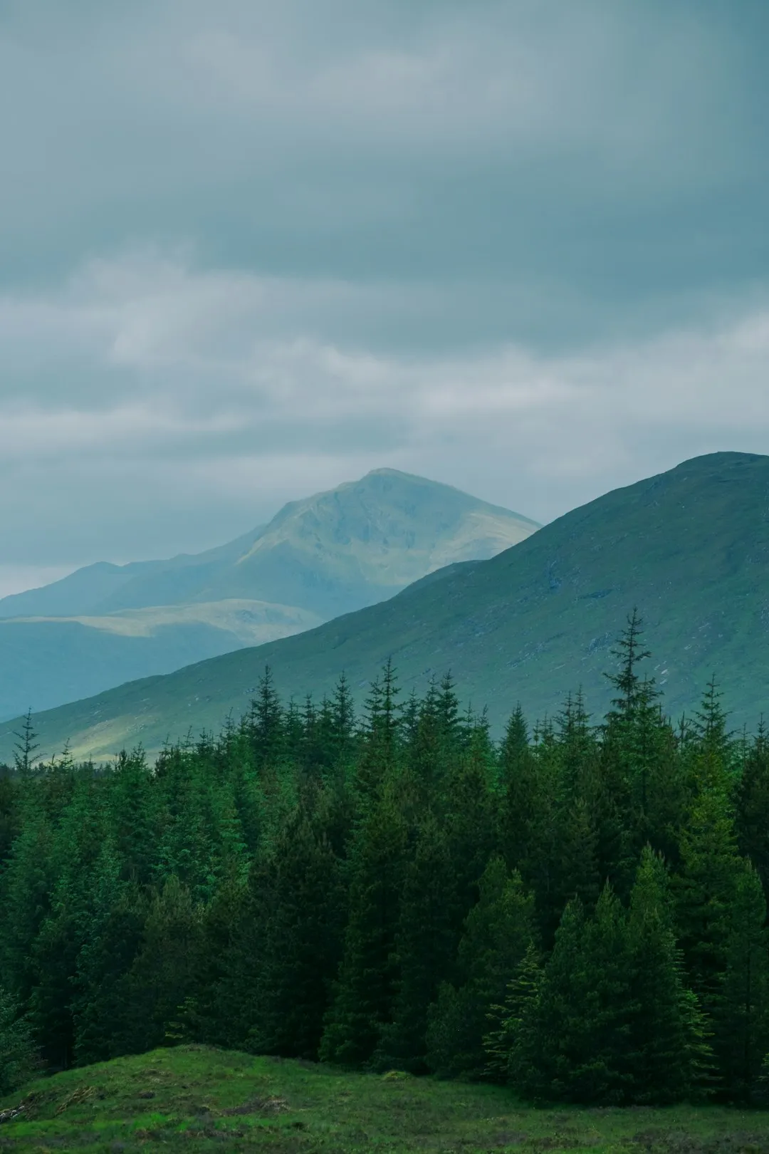
The West Highland Way is Scotland's best-loved long-distance walking route, stretching 154 kilometres from Milngavie, just outside Glasgow, to Fort William at the foot of Ben Lomond. For those seeking a condensed experience of this legendary trail, the 15-kilometre section between Balmaha and Rowardennan offers a quintessential Highland adventure. This specific day walk traverses the eastern shores of Loch Lomond, crossing the geological threshold of the Highland Boundary Fault where the gentle Lowlands transform into the rugged, mist-shrouded peaks of the Highlands. It is a journey through ancient oak woodlands, past secluded shingle beaches, and along undulating forest tracks that provide constant, breathtaking views of the "Bonnie Banks."
- Distance: 15.0 km
- Elevation Gain: 500 m
- Duration: 4–6 hours
- Difficulty: Moderate
- Best Time: April to October
- Closest City: Glasgow
- Trailhead Access: Bus or car via the A82 and A811 to Balmaha
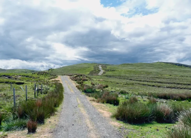
- Terrain: Well-maintained gravel paths, forest tracks, and some rocky, undulating sections
Overview
The West Highland Way (WHW) was officially opened in 1980 as Scotland's first Long Distance Route, and it has since become a pilgrimage for walkers from across the globe. While the full journey takes most hikers five to seven days, the section from Balmaha to Rowardennan is widely considered one of the most scenic and rewarding day walks in the United Kingdom. This 15-kilometre stretch captures the very essence of the Scottish landscape: the interplay of deep, dark water and steep, emerald-green mountains.
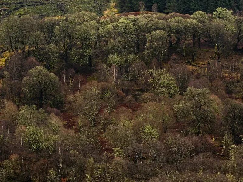
The walk begins in the charming village of Balmaha, a gateway to the Loch Lomond and The Trossachs National Park. Almost immediately, walkers are immersed in the ancient Atlantic oakwoods that line the shore. These woods are a remnant of the vast forests that once covered much of Scotland, draped in mosses and ferns that thrive in the humid, temperate climate. The path is never truly flat; it mimics the rugged coastline of the loch, rising and falling over small headlands and dipping down to quiet bays like Milarrochy and Sallochy. This constant undulation accounts for the 500 metres of total elevation gain, providing a satisfying physical challenge without the sustained grind of a high-altitude climb.
What makes this section particularly special is the sense of transition. As you walk north, the landscape becomes noticeably wilder. The rounded hills of the south give way to the sharper, more dramatic silhouettes of the Arrochar Alps across the water. To your right, the massive bulk of Ben Lomond—the most southerly of Scotland's Munros (mountains over 914.4 metres)—dominates the skyline. The trail provides a front-row seat to the geological drama of the Highland Boundary Fault, a massive fracture in the Earth's crust that separates two distinct types of rock and, consequently, two distinct types of scenery. Walking this path is, quite literally, walking across the history of the Earth.
The experience is one of profound natural beauty and historical resonance. You will share the path with through-hikers carrying heavy packs toward Fort William, day-trippers from Glasgow, and perhaps the occasional local fisherman. Despite its popularity, the trail's length and the density of the forest allow for long stretches of quiet contemplation, where the only sounds are the lapping of the loch and the call of the chaffinch. It is a masterclass in Scottish scenery, accessible yet undeniably wild.
History and Cultural Context
The West Highland Way is more than just a recreational path; it is a corridor through Scottish history. The route follows a patchwork of ancient tracks, including drovers' roads used for centuries to move cattle from the Highlands to markets in the Lowlands, and military roads built by the British government in the 18th century to suppress Jacobite uprisings. This specific section along Loch Lomond has been a vital artery for travel and trade for over a millennium.
The village of Balmaha itself takes its name from the Gaelic "Bealach Mo-Cha," meaning the pass of Saint Maha. Saint Maha was an early Christian missionary, and the area remains steeped in ecclesiastical history. Nearby, on the island of Inchcailloch (the "Island of the Old Woman"), lie the ruins of a 13th-century church dedicated to Saint Kentigerna. For centuries, the loch was a highway for the clans—most notably the MacGregors and the Colquhouns—whose fierce rivalries and bloody battles are the stuff of Highland legend. Rob Roy MacGregor, the famous outlaw and folk hero, operated throughout these hills, and the "Rob Roy's Prison" rock formation further north on the loch is a testament to his enduring presence in the local lore.
In the 19th century, the arrival of the steamship and the railway transformed Loch Lomond into a Victorian tourist destination. The "Bonnie Banks" were immortalised in song and poetry, most famously in the Jacobite-themed ballad "The Bonnie Banks o' Loch Lomond." This cultural romanticism helped preserve the area's beauty, eventually leading to the creation of the National Park in 2002. The West Highland Way was the brainchild of Tom Hunter, a Glasgow geographer who proposed the route in the 1960s to provide city dwellers with access to the wilderness. His vision was realised in 1980, and the trail has since become a symbol of Scotland's commitment to outdoor access and environmental stewardship.
Want more background? Read extended notes on history and cultural context → Learn more
Seasonal Highlights and Weather Reality
The Scottish Highlands are famous for having "four seasons in one day," and the West Highland Way is no exception. Choosing the right time to walk is crucial for both comfort and safety.
Spring (April to May): This is arguably the best time to walk the Balmaha to Rowardennan section. The weather is often at its most stable, and the ancient oakwoods are carpeted in bluebells and wild garlic. Crucially, this period precedes the emergence of the Highland midge, Scotland's most persistent and annoying insect. The air is crisp, and the peaks of the surrounding mountains may still be dusted with snow, providing spectacular photographic contrasts.
Summer (June to August): Summer brings long daylight hours—sometimes until 11:00 PM—and warmer temperatures, typically ranging from 15°C to 22°C. However, this is also the peak season for the midge. These tiny biting flies can be overwhelming on still, humid days, particularly in the sheltered forest sections. Hikers in summer must be prepared with repellent and head nets. This is also the busiest time on the trail, so expect more company.
Autumn (September to October): As the bracken turns to gold and the oak leaves transition to deep oranges and browns, the trail becomes a visual masterpiece. The midge population begins to die off with the first frosts, and the air becomes incredibly clear. September can be surprisingly mild, though October brings a higher chance of Atlantic storms and heavy rainfall. The loch often takes on a dramatic, moody character during these months.
Winter (November to March): While the trail remains open, this is a serious undertaking. Daylight is scarce (setting as early as 3:30 PM), and the path can be icy or flooded. While the low-level nature of this section means it rarely sees deep snow, the wind chill off the loch can be brutal. Only experienced walkers with appropriate cold-weather gear should attempt this section in winter.
Recommended Itinerary
Balmaha to Rowardennan Route Progression
Start: Balmaha Village
- Location: Balmaha Car Park / Visitor Centre
- Elevation: 10 m
- Key Feature: Statue of Tom Weir, the legendary Scottish climber and broadcaster.
- Action: Ensure water bottles are filled and boots are laced. The trail begins behind the visitor centre, initially climbing slightly to provide a view over the village and the islands of Loch Lomond.
Waypoint 1: Milarrochy Bay (4 km)
- Time: 1 hour from start
- Elevation: 15 m
- Key Feature: A beautiful, sweeping bay with a famous "lone tree" standing in the water.
- Action: The path follows the shoreline closely here. It is a popular spot for photographers. The terrain is mostly flat gravel, making for easy, brisk walking.
Waypoint 2: Sallochy Forest and Campsite (7.5 km)
- Time: 2 hours from start
- Elevation: 20 m
- Key Feature: Ancient oak woodland and a designated "low-impact" camping area.
- Action: This marks the halfway point. There are composting toilets available here. The path begins to become more undulating as it enters the denser forest. Look out for the ruins of old settlements hidden among the trees.
Waypoint 3: Ross Wood (11 km)
- Time: 3.5 hours from start
- Elevation: 60 m
- Key Feature: A more rugged section of the trail where the path rises higher above the loch.
- Action: The terrain becomes rockier with more exposed tree roots. This is the most "Highland" feeling part of the walk. Several small streams cross the path via wooden footbridges.
Finish: Rowardennan (15 km)
- Time: 4.5–5 hours from start
- Elevation: 15 m
- Key Feature: The Rowardennan Hotel and the base of Ben Lomond.
- Action: The trail concludes at the large car park near the hotel. This is the traditional end of the day's stage for through-hikers. Enjoy a well-earned meal or drink at the hotel while waiting for your return transport or settling into your accommodation.
Important Notes:
- The path is well-marked with the West Highland Way thistle logo.
- There are no shops between Balmaha and Rowardennan; carry all necessary supplies.
- Mobile signal is intermittent, particularly in the deeper forest sections.
- If returning to Balmaha, you must arrange a taxi or have a second car at Rowardennan, as there is no direct bus service between the two points.
Planning and Bookings
Book Your Trip
Everything you need to plan your journey
Accommodation
Find places to stay near Glasgow
Flights
Search flights to Glasgow
Essential Preparation
While this is a day walk, it requires more preparation than a simple park stroll. The West Highland Way is a remote trail, and once you leave Balmaha, you are committed to the 15-kilometre journey to Rowardennan. There are no "escape routes" by road until you reach the finish.
Fitness: A moderate level of fitness is required. While the elevation gain is only 500 metres, the constant "up and down" nature of the path can be tiring for those not used to uneven terrain. Ensure you have broken-in footwear to avoid blisters.
Logistics: Most walkers base themselves in Glasgow or the nearby town of Drymen. If you are driving, park at the Balmaha Car Park (pay and display). Because this is a linear walk, you will need to arrange transport back to your car. Options include:
- Two-car shuttle: Park one car at Rowardennan and one at Balmaha.
- Taxi: Pre-book a local taxi from Rowardennan back to Balmaha (approx. £30-£40).
- Waterbus: In the summer months, a ferry occasionally operates between Rowardennan and Luss or Tarbet, but rarely directly back to Balmaha. Check the Cruise Loch Lomond timetable carefully.
Trail Accommodation
This is primarily a day hike, but if you wish to stay overnight at either end, there are several options. Note that during the peak season (May–September), these must be booked months in advance.
Balmaha:
- The Oak Tree Inn: A popular hotel and pub with various room types.
- Balmaha Bunkhouse: Budget-friendly dormitory accommodation.
- Milarrochy Bay Camping and Caravanning Club Site: Located 4 km north of Balmaha.
Rowardennan:
- Rowardennan Hotel: Traditional Highland hotel located right at the end of the trail.
- SYHA Rowardennan Youth Hostel: A magnificent lodge-style hostel on the banks of the loch. Includes shared dorms and private rooms. Facilities include a drying room, self-catering kitchen, and a small shop.
- Sallochy Campsite: A basic, "wild-style" campsite (7.5 km from Balmaha). Must be pre-booked online via the National Park website. No showers, only composting toilets and sinks.
Note on Wild Camping: Between March and September, Camping Management Byelaws are in effect along this section of Loch Lomond. You may only camp in designated campsites or with a pre-purchased permit in specific zones. Outside these zones/times, the Scottish Outdoor Access Code applies.
Required Gear
- Footwear: Sturdy walking boots or high-quality trail shoes with good grip. The path can be slippery when wet, and there are many rocky sections.
- Waterproofs: A breathable waterproof jacket and overtrousers. Rain can arrive suddenly and last for hours.
- Clothing: Layering is key. Use moisture-wicking base layers (merino or synthetic), a fleece mid-layer, and avoid denim, which becomes heavy and cold when wet.
- Navigation: A physical map (OS Explorer OL39) and a compass, or a reliable GPS app with offline maps (e.g., AllTrails or OS Maps). Do not rely on live data.
- Pack: A 20–30 litre day pack with a waterproof cover or internal dry bags.
- Safety: A small first aid kit (including blister plasters), a whistle, and a fully charged mobile phone with a power bank.
What to Bring
- Water: At least 2 litres per person. While there are streams, the water should be treated or filtered due to livestock and high foot traffic.
- Food: High-energy snacks (nuts, chocolate, dried fruit) and a substantial lunch. There are no food outlets on the trail.
- Midge Protection: (May–September) Smidge or a DEET-based repellent, and a fine-mesh head net.
- Sun Protection: Sunscreen, sunglasses, and a hat. The reflection off the loch can intensify UV exposure even on overcast days.
- Personal Items: Hand sanitiser, tissues, and a small bag to carry out all rubbish.
Permits
For the vast majority of walkers, no permits are required to hike the West Highland Way. Scotland's "Right to Roam," enshrined in the Land Reform (Scotland) Act 2003, allows for world-class access to the countryside, provided you act responsibly.
Camping Permits: If you intend to camp overnight between Balmaha and Rowardennan during the "seasonal camping management" period (1 March to 30 September), you MUST have a permit. These are issued by the Loch Lomond & The Trossachs National Park Authority.
- Permits cost approximately £4 per tent, per night.
- They must be booked in advance via the official National Park website.
- Specific "Camping Management Zones" are clearly marked on the trail. Camping without a permit in these zones during the restricted period is a criminal offence.
Parking: The car park in Balmaha is a "Pay and Display" facility managed by Stirling Council. Ensure you pay for enough time, as wardens patrol regularly. During peak summer weekends, the car park often fills by 10:00 AM.
Organised Groups: Large charity walks or commercial groups (usually 12+ people) are encouraged to register their event with the West Highland Way Management Group to ensure the trail can accommodate the numbers and to avoid clashing with other large events.
Other Activities in the Area
The Loch Lomond area is a hub for outdoor recreation. If you have extra time, consider these activities:
- Conic Hill Ascent: Located right at Balmaha, this 361-metre hill offers the single best view of the Highland Boundary Fault. It is a 2–3 hour return trip and can be added to the start of your walk if you have the energy.
- Inchcailloch Island: Take a small wooden ferry (the "on-demand" service from Balmaha boatyard) to this stunning island. It features ancient woodlands, a historic graveyard, and a beautiful summit lookout.
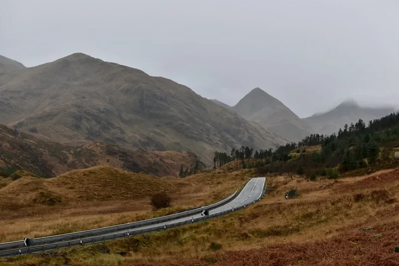
- Ben Lomond: For those seeking a greater challenge, the path to the summit of Ben Lomond (974 m) begins at Rowardennan. This is a full-day mountain hike (5–6 hours) and requires proper mountain safety equipment.
- Loch Lomond Seaplanes: For a luxury perspective, seaplane tours depart from nearby Luss or Cameron House, providing an aerial view of the entire West Highland Way.
- Distillery Visits: The Glengoyne Distillery is located just south of Drymen, offering tours and tastings of their famous Highland single malt whisky—a perfect way to celebrate finishing your walk.
Safety and Conditions
Weather Awareness: The primary danger on the West Highland Way is the weather. Hypothermia is a risk even in summer if you become wet and the wind picks up. Always check the Mountain Weather Information Service (MWIS) for the "West Highlands" area before setting off. If the forecast predicts sustained winds over 60 km/h or heavy, continuous rain, consider postponing.
Terrain Hazards: While the path is well-maintained, it is not a pavement. Expect:
- Slippery rocks and wooden bridges when wet.
- Exposed tree roots that can cause trips.
- Narrow sections where you must yield to through-hikers.
- Occasional fallen trees after winter storms.
The Highland Midge: While not dangerous in a medical sense (they do not carry disease), the psychological impact of thousands of biting midges can be severe. They are most active at dawn and dusk, and on still, cloudy days. If you are allergic to insect bites, carry antihistamines.
Livestock and Wildlife: You may encounter Highland cattle or sheep on or near the path. Give them a wide berth, especially if they have calves or lambs. Keep dogs on a short lead at all times. Ticks are present in the bracken; check your legs at the end of the day and remove any ticks immediately with a proper tool to prevent Lyme Disease.
Emergency Services: In the event of a serious injury, dial 999 or 112 and ask for "Police" then "Mountain Rescue." Be prepared to give your location using a grid reference or a "What3Words" address.
Side Trips and Points of Interest
The Lone Tree of Milarrochy: About 4 kilometres north of Balmaha, a solitary birch tree stands in the waters of the loch (depending on water levels). It has become a global icon for landscape photographers. It is a perfect spot for a short break and a photo.
The Cashel Forest: This "Forest for a Thousand Years" project is located near Sallochy. It features several loop trails that branch off the West Highland Way, focusing on the restoration of native Scottish woodland. It is a peaceful detour for those interested in ecology and reforestation.
The Rowardennan War Memorial: Located near the end of the section, this simple but moving memorial commemorates the members of the Scottish Mountaineering Club who fell in the World Wars. It is situated in a quiet spot with a magnificent view of the loch, offering a moment for reflection.
The "Bonnie Banks" Shingle Beaches: Between Sallochy and Rowardennan, there are several small, hidden beaches. In the height of summer, the water of Loch Lomond can be warm enough for a very brief, bracing swim. The water is exceptionally clean but deepens quickly—only strong swimmers should enter.
Leave No Trace
The West Highland Way passes through some of Scotland's most sensitive environments. With over 40,000 people walking the full route annually, the cumulative impact is significant. Following Leave No Trace principles is essential to keep the trail "bonnie."
Your responsibility as a walker:
- Take your litter home: There are no bins on the trail. This includes fruit peels and nut shells, which take a long time to decompose in the Highland climate and can harm wildlife.
- Stick to the path: Avoid widening the trail by walking on the edges, especially in boggy areas. This protects the fragile woodland flora.
- Respect the "Toilet Rule": Use the facilities at Balmaha, Sallochy, or Rowardennan. If you are caught short, move at least 30 metres from the trail and any water sources. Bury waste deep in a hole and pack out all toilet paper in a sealed bag.
- Keep dogs under control: This is a working landscape with livestock and ground-nesting birds.
- No fires: Use a stove for cooking if camping. Wildfires are a genuine threat to the ancient oakwoods.
- Leave what you find: Do not pick wildflowers or remove stones from historic ruins.