The Wave Hike (Coyote Buttes North) - A Geological Masterpiece
The Wave is perhaps the most coveted hiking destination in the United States, if not the world. Located within the Paria Canyon-Vermilion Cliffs Wilderness on the border of Arizona and Utah, this mesmerising sandstone formation is a testament to the patient power of wind and water. The hike to The Wave is a 9.6-kilometre round trip through a trackless desert landscape, leading to a multi-coloured swirl of Jurassic-age Navajo Sandstone that defies photographic capture. Because of its extreme fragility and the desire to preserve the wilderness experience, access is strictly limited by a highly competitive lottery system managed by the Bureau of Land Management (BLM). Walking through The Wave is less like a traditional hike and more like stepping into a surrealist painting, where the ground beneath your feet undulates in frozen waves of ochre, crimson, and gold.
- Distance: 9.6 km return
- Duration: 3–4 hours (though most spend 6+ hours exploring)
- Season: Year-round (Spring and Autumn are optimal)
- Permits: Mandatory (Daily and Advanced lotteries via recreation.gov)
- Highest point: 1,600 m
- Daily walkers: Strictly limited to 64 people or 16 groups (whichever comes first)
- Difficulty: Moderate (due to navigation and heat, not technicality)
Overview
The Wave is a spectacular trough carved into the Navajo Sandstone during the Jurassic period, approximately 190 million years ago. What makes this location globally famous is the intersection of two major troughs, creating a "wave" effect where the rock appears to flow in rhythmic, undulating patterns. The vibrant colours—ranging from deep purples and reds to bright oranges and yellows—are the result of iron oxide and manganese deposits that have leached through the porous sandstone over eons. The result is a landscape that feels entirely alien, a fragile sanctuary of stone that has been protected from the ravages of mass tourism by one of the strictest permitting systems in the world.
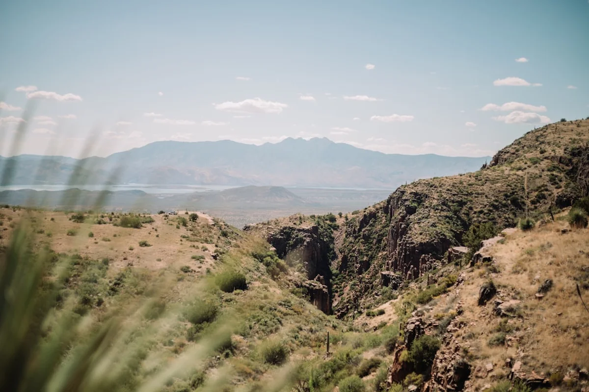
The journey begins at the Wire Pass Trailhead, located off the unpaved House Rock Valley Road. From here, hikers must navigate across open desert, over sandy washes, and across vast expanses of "slickrock" (smooth sandstone). There is no maintained trail; instead, the BLM provides permit holders with a photographic guidebook featuring key landmarks to ensure they find their way without the need for intrusive trail markers or cairns. This lack of formal infrastructure preserves the "wild" feel of the Coyote Buttes North area, but it also demands a higher level of self-reliance and navigational skill from those lucky enough to secure a permit.
While The Wave itself is the primary drawcard, the surrounding area of Coyote Buttes North contains a wealth of other geological wonders, including the Second Wave, the Alcove, and Top Rock. The experience is defined by silence, scale, and the incredible tactile nature of the rock. Every step reveals a new angle of the cross-bedded sandstone, where thin layers of sediment, once ancient sand dunes, have been compressed and tilted into the swirling patterns seen today. It is a place that requires slow movement and deep appreciation, as the "fins" of the sandstone are incredibly thin and can be easily snapped by a misplaced footstep.
History and Cultural Context
The geological history of The Wave began nearly 200 million years ago when this region was part of a vast desert, larger than the modern Sahara. The towering sand dunes of the Jurassic period were eventually buried and compressed into Navajo Sandstone. Over millions of years, the uplift of the Colorado Plateau and subsequent erosion by wind and seasonal rain carved the troughs we see today. The specific "wave" shape was formed by the drainage of water through the troughs, followed by wind erosion that polished the surfaces into their current smooth, flowing state.
Culturally, the land surrounding the Vermilion Cliffs has been home to Indigenous peoples for millennia. The Ancestral Puebloans (Anasazi) and later the Southern Paiute and Navajo (Diné) inhabited and travelled through these canyons. While The Wave itself does not feature the prominent petroglyphs found in nearby Buckskin Gulch, the entire Paria Plateau is a landscape of profound spiritual and historical significance. To the Navajo, these colourful formations are part of a living landscape, tied to the stories of the earth's creation and the movement of the sun and wind.
In the modern era, The Wave remained a relatively obscure local secret until the late 20th century. Its popularity exploded in the 1990s after it was featured in European travel documentaries and high-end photography books. Recognising that the fragile sandstone could not withstand thousands of visitors, the Bureau of Land Management (BLM) implemented a permit system to limit impact. Today, it is managed as part of the Paria Canyon-Vermilion Cliffs Wilderness, ensuring that the "discovery" of The Wave remains a quiet, personal experience for the few who are granted entry each day.
Want more background? Read extended notes on history and cultural context → Learn more
Seasonal Highlights and Weather Reality
The Wave is located in a high-desert environment where weather conditions can be extreme and life-threatening. Choosing the right time of year is critical for both safety and the quality of the photographic light.
Spring (March to May): This is widely considered the best time to visit. Temperatures are mild, typically ranging from 15°C to 25°C, making the 9.6-km trek comfortable. Wildflowers may bloom in the sandy washes, providing a rare splash of green and purple against the red rocks. However, this is also the most popular time for permit applications, and winds can be quite strong, occasionally creating sandstorm conditions.
Autumn (September to October): Similar to spring, autumn offers stable weather and pleasant temperatures. The light is particularly beautiful during these months as the sun sits lower in the sky, casting longer shadows that accentuate the textures of the sandstone. The "monsoon" season usually ends by mid-September, reducing the risk of flash floods that can make the access road impassable.
Summer (June to August): Summer is the most dangerous time to hike to The Wave. Temperatures frequently exceed 40°C, and there is virtually no shade on the entire route. The sandstone reflects heat, making the ground temperature even higher. Flash floods are a significant risk during the July and August monsoon season; even a distant storm can send a wall of water through the washes. If you hike in summer, an 5:00 AM start is mandatory to be off the trail by midday.
Winter (November to February): Winter brings a different kind of beauty, occasionally dusting the red rocks with white snow. Temperatures can drop well below freezing, and ice can make the slickrock sections treacherous. However, the low sun provides excellent light for photography all day long. The main challenge in winter is the House Rock Valley Road, which becomes a quagmire of impassable clay mud after snowmelt or rain.
Recommended Itinerary
The Wave Route Progression
Phase 1: Wire Pass Trailhead to the Twin Buttes
- Distance: 2.5 km
- Time: 45–60 minutes
- Start at the Wire Pass Trailhead and sign the register.
- Follow the wide, sandy wash for approximately 1 kilometre.
- Exit the wash to the right at the BLM signpost (the only major sign on the route).
- Ascend the sandy hill and head towards the prominent "Twin Buttes" on the horizon.
- This section is mostly soft sand and requires steady effort; keep the Twin Buttes to your right as you navigate the open desert.
Phase 2: The Slickrock Traverse to the Sand Dune
- Distance: 1.5 km
- Time: 30–45 minutes
- Once past the Twin Buttes, the terrain shifts from sand to expansive slickrock.
- Navigate across the undulating sandstone, following the photographic landmarks provided in your permit packet.
- Look for the "Black Crack" in the distance as a navigational waypoint.
- Cross a large, steep sand dune that leads toward the entrance of the Coyote Buttes North cove.
- This is the most physically demanding part of the hike due to the steepness of the sand.
Phase 3: Entering The Wave
- Distance: 0.8 km
- Time: 20 minutes
- As you reach the top of the sand dune, the entrance to The Wave becomes visible as a narrow notch in the sandstone walls.
- Enter the first trough and watch as the walls begin to swirl and rise around you.
- The "Main Wave" is located just beyond the first corridor.
- Spend time exploring the various angles; the light changes significantly between 10:00 AM and 2:00 PM.
Phase 4: Beyond The Wave (Optional Exploration)
- Distance: 1–2 km additional
- Time: 1–2 hours
- Continue south to find the "Second Wave," which is flatter and features deep purple hues.
- Climb up to "Top Rock" for a bird's-eye view of the entire formation (requires basic scrambling skills).
- Visit "The Alcove" and "Melody Arch" located high above the main floor.
- Return via the same route, ensuring you have enough water for the return journey across the exposed slickrock.
Important Notes:
- There is no shade; time your return to avoid the peak afternoon heat.
- The return journey can be more confusing than the approach; look back frequently on the way in to memorise landmarks.
- GPS is highly recommended as a backup to the BLM photo map.
- Ensure you sign out at the trailhead register upon completion.
Planning and Bookings
Book Your Trip
Everything you need to plan your journey
Accommodation
Find places to stay near Kanab
Flights
Search flights to Kanab
Essential Preparation
Planning for The Wave begins months in advance. Because the permit system is so restrictive, you must first secure your permit before making any other travel arrangements. The closest towns are Kanab, Utah (77 km west) and Page, Arizona (72 km east). Both serve as excellent bases with plenty of accommodation, supermarkets, and outdoor stores. If you are travelling from further afield, Las Vegas is the nearest major international airport, approximately a 4.5-hour drive away.
Fitness requirements are moderate, but the environment is harsh. You should be comfortable walking 10 kilometres over uneven terrain, including soft sand and steep sandstone slopes. Navigational competence is essential; while the BLM provides a map, being able to use a compass or a GPS app (like Gaia GPS or AllTrails) is a critical safety requirement. Ensure your vehicle is suitable for House Rock Valley Road; while often passable for sedans in dry weather, a high-clearance 4WD is strongly recommended, especially if there has been recent rain.
Trail Accommodation
Coyote Buttes North is a day-use area only. No overnight camping is permitted within the permit zone, and there are no facilities, shelters, or huts on the trail.
Nearby Options:
- Stateline Campground: Located 1.5 km south of the Wire Pass Trailhead. It is a primitive BLM campground with 7 sites, pit toilets, and no water. It operates on a first-come, first-served basis.
- White House Campground: Located near the Paria Contact Station, offering basic tent sites and pit toilets.
- Kanab and Page: These towns offer a full range of hotels, motels, and Airbnbs. Booking in advance is essential during the spring and autumn peak seasons.
- Dispersed Camping: Permitted on most BLM land surrounding the wilderness area, provided you follow Leave No Trace principles and stay in previously disturbed sites.
Required Gear
- Sturdy Hiking Boots: With excellent grip for slickrock. Avoid sandals or flimsy trainers.
- GPS Device or Smartphone: With offline maps downloaded. The BLM photo map is good, but digital backup is safer.
- Sun Protection: A wide-brimmed hat, high-SPF sunscreen, and UV-rated sunglasses are non-negotiable.
- Lightweight Layers: Breathable, moisture-wicking clothing. Long sleeves are recommended to protect against sun and wind-blown sand.
- Emergency Whistle and Mirror: For signalling in case of injury or becoming lost.
- First Aid Kit: Including tweezers (for cacti), blister pads, and electrolyte salts.
What to Bring
- Water: Minimum 4 litres per person. There is absolutely no water available on the trail or at the trailhead.
- High-Energy Food: Salty snacks, nuts, dried fruit, and energy bars to maintain stamina in the heat.
- Electrolytes: Powder or tablets to add to your water to prevent hyponatremia.
- Permit and ID: You must carry your physical permit and a form of photo identification at all times. BLM rangers do patrol the area.
- Camera Gear: A wide-angle lens is best for capturing the scale of The Wave. A tripod is useful for the Second Wave but can be cumbersome in the main troughs.
- WAG Bag: For the disposal of human waste. You must pack out all waste, including toilet paper.
Permits
The permit system for The Wave is managed by the Bureau of Land Management (BLM) via recreation.gov. There are two ways to obtain a permit: the Advanced Lottery and the Daily Lottery. Both are extremely competitive, with thousands of applicants vying for just 64 daily spots.
1. Advanced Lottery (Online):
- Apply four months in advance. For example, if you want to hike in October, you must apply during the month of June.
- You can select up to three dates per application.
- The application fee is non-refundable (currently US$9).
- Results are emailed on the first day of the month following the application period.
2. Daily Lottery (Mobile App):
- This has replaced the old "walk-in" lottery. It is a geofenced lottery, meaning you must be physically located within the designated area (Kanab, Page, Big Water, etc.) to apply via the Recreation.gov mobile app.
- Apply two days before your intended hike date between 6:00 AM and 6:00 PM.
- Results are announced at 7:15 PM that same evening.
- If you win, you must attend a mandatory safety briefing (online or in-person) the day before your hike.
Permit Costs:
- If successful, the permit fee is US$7 per person and per dog.
- Permits are non-transferable and valid only for the specific date and person named on the permit.
- The permit consists of two parts: one to be displayed on your vehicle dashboard and one to be attached to your backpack.
Other Activities in the Area
If you are unsuccessful in the lottery or have extra time in the region, the Paria Plateau offers world-class alternatives:
- Buckskin Gulch: One of the longest and deepest slot canyons in the world. The trailhead is the same as The Wave (Wire Pass). It requires no lottery permit for day hikes, only a self-pay fee at the trailhead.
- White Pocket: A surreal landscape of "brain rocks" and white-and-red swirled sandstone. It is even more geologically complex than The Wave and requires no permit, but a high-clearance 4WD and deep-sand driving experience are mandatory.
- Coyote Buttes South: Similar to The Wave but more spread out and featuring "teepee" formations. It requires a separate permit, which is easier to obtain than the North permit.
- Lake Powell and Antelope Canyon: Located in nearby Page, Arizona. Antelope Canyon offers world-famous slot canyon photography (guided tours only), while Lake Powell is perfect for kayaking and cooling off after a desert hike.
- The Toadstools: An easy 2.4-km hike to a collection of balanced rock formations (hoodoos) located off Highway 89.
Safety and Conditions
Heat and Hydration: The primary danger at The Wave is heat exhaustion. There is no shade and no water. Hikers have died here from dehydration and heatstroke. You must carry at least 4 litres of water and start your hike as early as possible. If you feel dizzy, nauseous, or stop sweating, find what little shade you can (usually against a north-facing cliff) and rest immediately.
Navigation: It is very easy to become disoriented on the slickrock, as there are no trails or footprints to follow. The return journey looks completely different from the approach. Always carry a GPS with extra batteries and the BLM photo map. Do not rely solely on your phone, as batteries drain quickly in the heat and GPS signal can occasionally bounce off canyon walls.
Flash Floods: While The Wave itself is high enough to be safe from floods, the access road (House Rock Valley Road) and the initial wash are not. Check the weather forecast for the entire drainage area, not just the trailhead. If rain is forecast, do not attempt the drive or the hike. The clay on the road becomes as slippery as ice when wet, and even 4WD vehicles can become hopelessly stuck.
Wildlife: Rattlesnakes are present in the area, particularly in the sandy washes and near the Twin Buttes. Watch where you place your hands and feet. Scorpions and black widow spiders may also be found under rocks. While rare, mountain lions do inhabit the wilderness area.
Emergency Services: Cell phone service is non-existent for most of the hike. If you have an emergency, you may need to send someone for help or use a satellite messenger (like a Garmin inReach). Search and rescue operations in this remote area are expensive and can take many hours to initiate.
Side Trips and Points of Interest
The Second Wave: Located about 5 minutes south of the main Wave. This formation is flatter and features incredible "cauliflower" textures and deep purple and orange banding. It is best photographed in the late afternoon when the sun hits the rock at a low angle, making the colours "pop."
The Alcove: A massive, wind-carved semi-cave located high on the cliffs above The Wave. It contains a large sand dune and offers a cool, shaded place to rest. The climb up is steep but provides a unique perspective on the surrounding desert.
Melody Arch and the Grotto: Located on the top of the plateau (Top Rock). This requires a steep scramble up a slickrock bypass. The arch is a delicate window of stone, and the nearby grotto features a small "hanging garden" of vegetation if there has been recent rain. The view from Top Rock is the best in the entire Coyote Buttes North area.
The Big Mac: A large, rounded rock formation that looks remarkably like a giant hamburger. It is located on the slickrock traverse between the Twin Buttes and The Wave and serves as an excellent navigational landmark.
Dinosaur Tracks: There are several sets of fossilised dinosaur tracks in the area, dating back to the Early Jurassic. They are difficult to find and are not marked to protect them from vandalism. If you find them, do not touch or pour water on them, as this accelerates erosion.
Leave No Trace
The Wave is one of the most fragile environments on Earth. The thin "fins" of sandstone are only a few millimetres thick and can be broken by the weight of a single person. Once broken, they can never be repaired. Your goal should be to leave the area exactly as you found it.
Leave No Trace Principles for The Wave:
- Stay off the fins: Walk only on the floor of the troughs or on solid rock. Never climb on the delicate edges of the Wave.
- Pack out all waste: This includes orange peels, nut shells, and all human waste. Use a WAG bag for solid waste.
- No Graffiti: Carving names into the soft sandstone is a federal crime and destroys the experience for everyone.
- Respect the Crust: Avoid walking on cryptobiotic soil (the black, bumpy crust in the sand). This living soil prevents erosion and takes decades to grow.
- No Drones: The Wave is located within a designated Wilderness Area where drones are strictly prohibited to preserve the silence and solitude.
- Dogs: If you bring a dog, it must be on a leash at all times and you must pack out its waste.