The Snowman Trek - The Ultimate Himalayan Odyssey
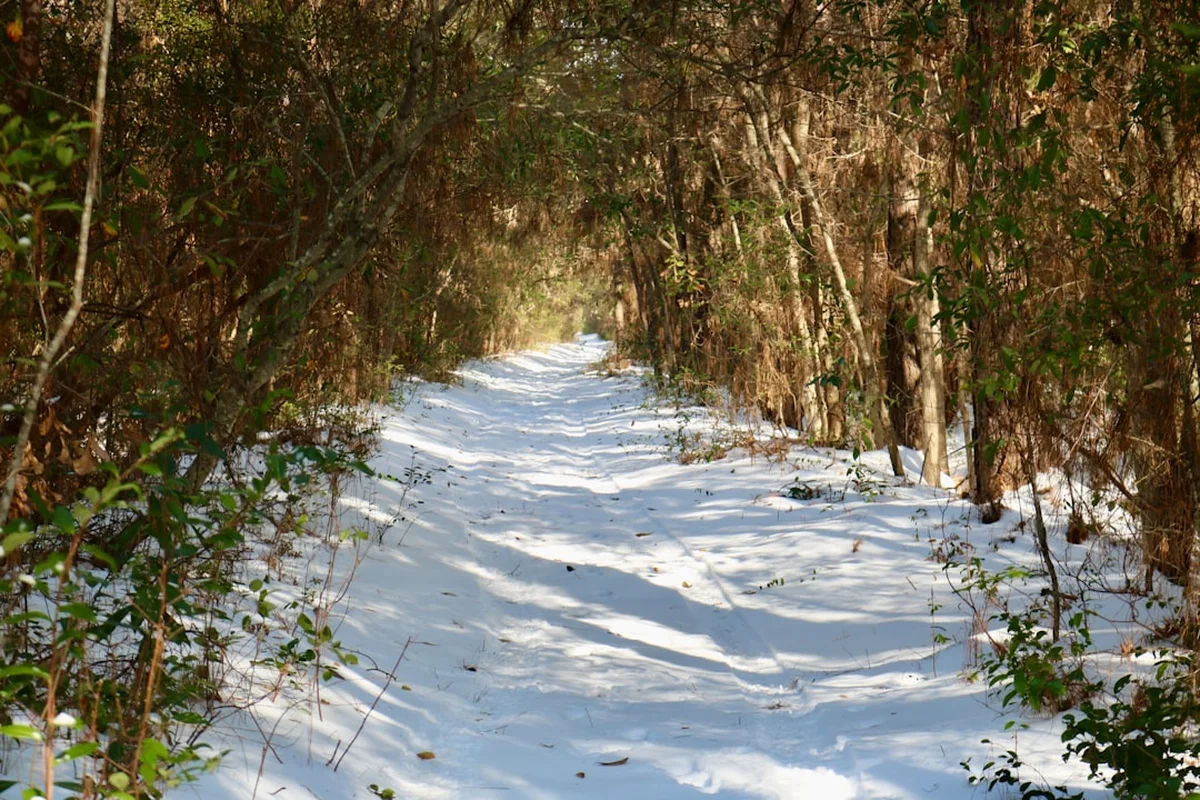
The Snowman Trek is widely considered the most difficult and rewarding high-altitude trek in the world. Spanning approximately 339 kilometres across the spine of the Bhutanese Himalayas, this 25-to-30-day expedition traverses the remote borderlands between Bhutan and Tibet, crossing 11 high mountain passes—many of which exceed 5,000 metres in elevation. Unlike more commercialised routes in neighbouring regions, the Snowman Trek offers a journey into the "Last Shangri-La," passing through the isolated Lunana region where ancient Tibetan-influenced cultures remain largely untouched by the modern world. This is not merely a hike; it is a test of human endurance, psychological resilience, and logistical precision. The route winds through pristine alpine meadows, past turquoise glacial lakes, and beneath the shadows of unclimbed peaks like Gangkhar Puensum, the highest unclimbed mountain on Earth. Access is strictly regulated by the Bhutanese government, ensuring that the wilderness remains unsullied and the experience remains one of profound solitude and spiritual depth.
- Distance: 339.0 km one-way
- Duration: 25–30 days
- Season: October (primary window); late May to June (secondary window)
- Accommodation: Wilderness camping only (no permanent huts or lodges)
- Highest point: Rinchen Zoe La Pass (5,320 m)
- Difficulty: Very Challenging (requires exceptional fitness and high-altitude experience)
- Direction: Typically West to East (Paro to Sephu or Bumthang)
Overview
The Snowman Trek is the stuff of mountaineering legend. While the Everest Base Camp trek or the Annapurna Circuit are famous for their views, the Snowman Trek is famous for its sheer audacity. It is an extension of the Jomolhari Trek and the Laya-Gasa Trek, pushing further into the most inaccessible corners of the Kingdom of Bhutan. The "Snowman" moniker is derived from the fact that the route is frequently blocked by snow, even during the peak trekking seasons, leading to a high percentage of attempted treks being cut short. To complete the full circuit is to join an elite group of trekkers who have successfully navigated the "Roof of the World."
The landscape is a masterclass in Himalayan diversity. The journey begins in the lush, temperate forests of Paro, where rhododendrons and blue pines dominate the lower elevations. As the trail ascends, the vegetation thins into sub-alpine scrub and eventually gives way to the stark, monochromatic beauty of the high-altitude desert and glacial moraines. The trek is defined by its passes: Nyile La, Jare La, Shinje La, and the formidable Rinchen Zoe La. Each pass serves as a gateway between isolated valleys, offering panoramic views of peaks that have never felt the tread of a climbing boot. The scale of the landscape is difficult to articulate; you are often walking for days without seeing a permanent human settlement, surrounded by 7,000-metre giants that dominate the horizon.
Culturally, the trek provides a rare window into the lives of the Layaps and the people of Lunana. These semi-nomadic yak herders live in some of the highest inhabited villages on the planet. Their lives are dictated by the seasons and the needs of their herds, and their hospitality is legendary. Because Bhutan operates on a "High Value, Low Volume" tourism policy, you will not encounter the crowds found in other Himalayan regions. Instead, you will find a profound sense of peace, broken only by the whistling of the wind through the prayer flags and the distant rumble of avalanches on the high peaks. This is a journey for those who seek the ultimate challenge in one of the world's last truly wild places.
History and Cultural Context
The paths that comprise the Snowman Trek were not originally designed for recreation. For centuries, these high-altitude tracks served as vital trade and pilgrimage routes connecting the remote valleys of Bhutan with the Tibetan plateau. Traders would lead caravans of yaks laden with salt, wool, and spices across the treacherous passes, while Buddhist masters travelled between monasteries, spreading teachings that would eventually form the spiritual backbone of the kingdom. The Lunana region, in particular, remained a place of mystery and exile, protected by its formidable geography and the fierce reputation of its inhabitants.
The modern iteration of the Snowman Trek as a continuous route was pioneered in the late 1970s and early 1980s as Bhutan began to cautiously open its doors to international tourism. It was quickly recognised as one of the most demanding treks on the planet. The history of the trek is inextricably linked to the history of Bhutanese conservation. The Fourth King of Bhutan, Jigme Singye Wangchuck, prioritised environmental protection and cultural preservation over rapid economic growth, a philosophy known as Gross National Happiness. This approach has kept the Snowman Trek pristine; there are no tea houses, no roads, and no electricity along the vast majority of the route.
Spiritually, the mountains you traverse are considered the abodes of deities. Gangkhar Puensum, which looms over the latter half of the trek, remains unclimbed because the Bhutanese government banned mountaineering on peaks above 6,000 metres in 1994, and altogether in 2003, out of respect for local spiritual beliefs. To the Bhutanese, these peaks are sacred, and the act of trekking through them is a form of pilgrimage. Every pass is marked by a lhabtsay (stone cairn) and fluttering prayer flags, placed there to appease the mountain spirits and ensure safe passage for travellers. Walking the Snowman Trek is as much a cultural and spiritual immersion as it is a physical endeavour.
Want more background? Read extended notes on history and cultural context → Learn more
Seasonal Highlights and Weather Reality
The window of opportunity for the Snowman Trek is notoriously narrow. Unlike lower-altitude treks in Bhutan, the Snowman is entirely dependent on the state of the high passes. If the snow is too deep, the pack animals (yaks and horses) cannot cross, and the trek becomes impossible.
October (The Golden Window): This is the most popular and reliable time to attempt the trek. Following the retreat of the monsoon, the skies generally clear, offering the most stable weather and the sharpest views of the high peaks. The autumn colours in the valleys are spectacular, and the temperatures, while cold at night, are manageable during the day. However, early winter storms can still arrive, dumping snow on the passes and ending the trek prematurely.
Late May to June (The Pre-Monsoon Window): This is the secondary window. The weather is warmer, and the alpine wildflowers, including the rare blue poppy (Bhutan’s national flower), are in full bloom. However, this season is more prone to cloud cover and afternoon rain as the monsoon approaches. The snow on the high passes may still be melting, which can make the trail muddy and difficult for the animals.
The Monsoon (July to September): Trekking during the monsoon is not recommended. Heavy rains lead to leeches in the lower forests, frequent landslides, and obscured views. More importantly, the high passes become dangerous due to unstable snow and poor visibility.
Winter (November to April): The Snowman Trek is effectively closed during the winter. The high passes are buried under several metres of snow, and temperatures at high-altitude campsites can drop well below -20 degrees Celsius. The risk of avalanches is extreme, and the logistical support required (yaks and guides) is unavailable as the local populations move to lower elevations.
Recommended Itinerary
25-Day Snowman Trek Itinerary
Day 1: Drukgyel Dzong to Shana
- Distance: 17 km
- Elevation gain: 360 m
- Time: 5–6 hours
- Start at the ruins of Drukgyel Dzong near Paro
- Follow the Pa Chhu (Paro River) through cultivated fields and tiny villages
- Enter the Jigme Dorji National Park
- Camp at Shana (2,850 m)
Day 2: Shana to Thangthangkha
- Distance: 22 km
- Elevation gain: 770 m
- Time: 7–8 hours
- A long day following the river through thick forests of oak, pine, and rhododendron
- The trail is often rocky and muddy
- First views of Mount Jomolhari on a clear day
- Camp at Thangthangkha (3,610 m)
Day 3: Thangthangkha to Jangothang
- Distance: 19 km
- Elevation gain: 480 m
- Time: 5–6 hours
- Pass a small army post and enter the high alpine zone
- The valley opens up, revealing spectacular views of Jomolhari and Jichu Drake
- Pass yak herder settlements
- Camp at Jangothang (4,080 m), the base camp for Jomolhari
Day 4: Jangothang (Acclimatisation Day)
- Rest day to adjust to the altitude
- Optional day hikes to glacial lakes or towards the base of Jomolhari
- Crucial for success on the upcoming high passes
Day 5: Jangothang to Lingshi
- Distance: 18 km
- Elevation: 840 m gain, 870 m loss
- Time: 6–7 hours
- Cross the Nyile La Pass (4,870 m)
- First major pass of the trek
- Views of Lingshi Dzong perched on a hilltop
- Camp at Lingshi (4,010 m)
Day 6: Lingshi to Chebisa
- Distance: 10 km
- Elevation gain: 280 m
- Time: 4–5 hours
- A shorter, easier day through beautiful pastures
- Pass through Lingshi village and see the local way of life
- Camp at Chebisa (3,880 m) by a dramatic waterfall
Day 7: Chebisa to Shomuthang
- Distance: 17 km
- Elevation gain: 890 m
- Time: 6–7 hours
- Cross the Gombu La Pass (4,440 m)
- Walk through forests of cedar and fir
- Camp at Shomuthang (4,220 m)
Day 8: Shomuthang to Robluthang
- Distance: 18 km
- Elevation gain: 700 m
- Time: 6–7 hours
- Cross the Jare La Pass (4,750 m)
- Stunning views of Great White Peak (Tserim Kang)
- Descend into a valley where herds of Takin (Bhutan's national animal) are often seen
- Camp at Robluthang (4,160 m)
Day 9: Robluthang to Limithang
- Distance: 19 km
- Elevation gain: 850 m
- Time: 7–8 hours
- Cross the Shinje La Pass (4,900 m), the last pass before Laya
- The descent offers views of the massive Tiger Mountain
- Camp at Limithang (4,140 m) in a beautiful meadow
Day 10: Limithang to Laya
- Distance: 10 km
- Elevation gain: 60 m
- Time: 4–5 hours
- Walk through winding river valleys and mossy forests
- Arrive at Laya (3,840 m), the highest permanent village in Bhutan
- Laya is famous for its unique culture and the conical bamboo hats worn by women
Day 11: Laya (Rest Day)
- A day to explore the village, wash clothes, and rest
- The "Snowman" officially begins here for many, as the route pushes into the even more remote Lunana region
Day 12: Laya to Rodophu
- Distance: 19 km
- Elevation gain: 1,030 m
- Time: 7–8 hours
- A steady climb out of Laya towards the high wilderness
- Camp at Rodophu (4,160 m) near the Tende Chhu river
Day 13: Rodophu to Narethang
- Distance: 17 km
- Elevation gain: 750 m
- Time: 8–9 hours
- Cross the Tsemo La Pass (4,905 m)
- The trail is rugged and high-altitude fatigue begins to set in
- Camp at Narethang (4,900 m) beneath the peak of Karakachu
Day 14: Narethang to Tarina
- Distance: 18 km
- Elevation: 270 m gain, 1,200 m loss
- Time: 5–6 hours
- Cross the Karakachu La Pass (5,020 m)
- Spectacular views of Masang Gang and other peaks
- Long descent into the Tarina valley
- Camp at Tarina (3,900 m)
Day 15: Tarina to Woche
- Distance: 17 km
- Elevation gain: 270 m
- Time: 6–7 hours
- Walk through a valley filled with glacial lakes and waterfalls
- Enter the first village of the Lunana region
- Camp at Woche (3,910 m)
Day 16: Woche to Lhedi
- Distance: 17 km
- Elevation gain: 450 m
- Time: 6–7 hours
- Cross the Keche La Pass (4,650 m)
- Views of the stunning Jejekangphu Gang
- Camp at Lhedi (3,700 m), a major settlement in Lunana
Day 17: Lhedi to Thanza
- Distance: 17 km
- Elevation gain: 450 m
- Time: 6–7 hours
- Follow the Pho Chhu river through the heart of Lunana
- Pass through Chozo village with its ancient dzong
- Camp at Thanza (4,150 m)
Day 18: Thanza (Rest Day)
- Essential rest before the final, most difficult stretch
- Yaks from Laya are often swapped for Lunana yaks here
Day 19: Thanza to Danji
- Distance: 8 km
- Elevation gain: 80 m
- Time: 3–4 hours
- A short day to position for the highest passes
- Camp at Danji (4,230 m)
Day 20: Danji to Tsho Khena
- Distance: 12 km
- Elevation gain: 980 m
- Time: 5–6 hours
- Cross the Jaze La Pass (5,150 m)
- Pass several turquoise alpine lakes
- Camp at Tsho Khena (4,960 m)
Day 21: Tsho Khena to Jichu Dramo
- Distance: 14 km
- Elevation gain: 230 m
- Time: 4–5 hours
- Cross the Loju La Pass (5,140 m)
- High-altitude plateau walking
- Camp at Jichu Dramo (5,050 m)
Day 22: Jichu Dramo to Chukarpo
- Distance: 18 km
- Elevation gain: 320 m
- Time: 7–8 hours
- Cross the Rinchen Zoe La Pass (5,320 m), the highest point of the trek
- Breathtaking views of the entire Bhutanese Himalaya
- Long descent to Chukarpo (4,600 m)
Day 23: Chukarpo to Thampe Tsho
- Distance: 18 km
- Elevation gain: 400 m
- Time: 5–6 hours
- Descend along the river and then climb to a beautiful lake
- Camp at Thampe Tsho (4,300 m)
Day 24: Thampe Tsho to Maurothang
- Distance: 14 km
- Elevation gain: 280 m
- Time: 5–6 hours
- Cross the final pass, Thampe La (4,600 m)
- Steep descent into the rhododendron forests
- Camp at Maurothang (3,610 m)
Day 25: Maurothang to Sephu
- Distance: 18 km
- Elevation gain: 100 m
- Time: 5–6 hours
- Final walk through the forest to the road head at Sephu
- End of the trek; transfer to Wangdue Phodrang or Punakha
Planning and Bookings
Book Your Trip
Everything you need to plan your journey
Accommodation
Find places to stay near Paro
Flights
Search flights to Paro
Essential Preparation
The Snowman Trek requires months of physical and logistical preparation. You cannot simply turn up and walk; Bhutanese law mandates that all trekking must be organised through a licensed Bhutanese tour operator. This operator handles all logistics, including guides, cooks, pack animals, and camping equipment. Due to the extreme altitude and duration, a high level of cardiovascular fitness and previous experience with multi-day high-altitude trekking (e.g., Everest Base Camp or Kilimanjaro) is essential. It is highly recommended to undergo a full medical check-up before booking.
Logistically, you must coordinate your arrival in Paro with your trekking agency. Most trekkers spend 2–3 days in Paro (2,200 m) for initial acclimatisation, often including the hike to the Tiger’s Nest Monastery, before starting the trek. Ensure your travel insurance specifically covers high-altitude trekking up to 6,000 metres and includes emergency helicopter evacuation, which is the only way out in the event of serious illness or injury.
Trail Accommodation
There are no permanent huts, lodges, or tea houses on the Snowman Trek. Accommodation is exclusively in high-quality mountain tents provided by your trekking agency.
Camping Facilities:
- Sleeping tents (usually 2-person mountain tents used for single or double occupancy)
- Dining tent with tables and chairs
- Kitchen tent where the crew prepares all meals
- Toilet tent (a private pit latrine set up at each camp)
- Thin foam mattresses are usually provided, but bringing your own inflatable mat is recommended
What is NOT Provided:
- Permanent toilets or showers (hot water in basins is provided for washing)
- Electricity or charging stations (you must bring solar chargers or power banks)
- Heating (tents are unheated; temperatures inside can drop well below freezing)
- Bedding (you must bring your own high-rated sleeping bag)
Booking Requirements:
- Must book through a licensed Bhutanese operator
- Bookings should be made at least 6 months in advance to secure the best guides and equipment
- The cost is typically included in the daily Sustainable Development Fee (SDF) and the tour operator's package price
Required Gear
- High-altitude mountaineering boots - waterproof, well-insulated, and thoroughly broken in
- Sleeping bag - rated to at least -20°C (essential for the high-altitude camps)
- Down jacket - heavy-duty, high-loft down for sub-zero evenings
- Waterproof shell - Gore-Tex jacket and trousers for wind and snow protection
- Trekking poles - essential for the steep, often muddy or snowy passes
- Solar charger - to keep cameras and GPS devices powered for 30 days
- Duffel bag - 90-120L, waterproof, for your gear to be carried by yaks
- Daypack - 30-40L for your daily essentials (water, layers, snacks)
What to Bring
- High-calorie snacks - energy bars, nuts, dried fruit, and chocolate (food is provided, but personal comfort snacks are vital)
- Water purification - Steripen or purification tablets (water is boiled by the crew, but extra protection is wise)
- Personal medical kit - including Diamox (for altitude), antibiotics, blister care, and rehydration salts
- Sun protection - SPF 50+ sunscreen, lip balm with SPF, and Category 4 sunglasses (the alpine sun is brutal)
- Thermal layers - multiple sets of merino wool base layers
- Head torch - with several sets of spare batteries
- Biodegradable wet wipes and hand sanitiser - for personal hygiene where water is limited
- Cash - small denominations of Ngultrum (BTN) or USD for tipping the crew at the end of the trek
Permits
Bhutan’s tourism policy is unique. To trek the Snowman, you must obtain a visa and a special trekking permit, both of which are processed by your licensed tour operator. You cannot apply for these independently.
The Sustainable Development Fee (SDF):
- All international tourists (except those from India, Bangladesh, and the Maldives) must pay a daily SDF
- As of 2024, the SDF is USD 100 per person, per night (this is a 50% reduction from the previous USD 200, valid until August 2027)
- This fee goes directly to the government to fund free healthcare, education, and environmental conservation
- For a 30-day trek, the SDF alone will cost USD 3,000
Visa and Trekking Permits:
- The visa fee is USD 40
- Trekking permits for restricted areas like Lunana are included in the administrative work done by your agency
- You must provide a scanned copy of your passport to your agency at least 30 days before arrival
- Your visa clearance letter will be sent to you, which you must present at Druk Air or Bhutan Airlines check-in and upon arrival at Paro Airport
Logistics:
- The total cost of the Snowman Trek typically ranges from USD 8,000 to USD 12,000 per person, including the SDF, visa, all meals, equipment, guides, and transport
- Helicopter evacuation insurance is mandatory and must be verified by your operator before the trek begins
Other Activities in the Area
Since you will likely start and end your journey in the main valleys of Bhutan, consider these additions:
- Tiger’s Nest (Paro Taktsang): The iconic monastery clinging to a cliffside 900 metres above the Paro valley. It is the perfect acclimatisation hike.
- Punakha Dzong: Often cited as the most beautiful dzong in Bhutan, located at the confluence of the Pho Chhu and Mo Chhu rivers.
- Hot Stone Baths: A traditional Bhutanese therapy where river stones are heated in a fire and dropped into a wooden tub filled with medicinal herbs—perfect for post-trek recovery.
- Kyichu Lhakhang: One of the oldest and most sacred temples in Bhutan, located in the Paro valley.
- Archery Matches: Observe or participate in Bhutan’s national sport, which is played with great enthusiasm in every village.
Safety and Conditions
Altitude and AMS: Acute Mountain Sickness (AMS) is the primary risk on the Snowman Trek. You will spend more than two weeks above 4,000 metres. It is vital to follow the "climb high, sleep low" principle and listen to your guide. If symptoms of High Altitude Cerebral Oedema (HACE) or High Altitude Pulmonary Oedema (HAPE) appear, immediate descent is the only cure.
Weather Extremes: Even in October, temperatures at high camps can drop to -20°C. Blizzards can occur at any time, potentially trapping the group between passes. Your guide has the final say on whether it is safe to proceed. If the yaks cannot cross a pass due to snow, the trek must be abandoned or rerouted.
Remote Location: The Lunana region is one of the most remote inhabited places on Earth. There is no mobile signal and no road access. Communication is usually via satellite phone carried by the lead guide. In the event of an emergency, a helicopter rescue from the Bhutanese Royal Air Force is the only option, and it is highly dependent on clear weather.
Water and Hygiene: To avoid gastrointestinal issues, only drink water that has been boiled or treated. Your trekking crew will provide boiled water, but personal filtration is a good backup. Maintain strict hand hygiene, especially before meals.
Side Trips and Points of Interest
Jomolhari Base Camp: The camp at Jangothang is one of the most spectacular in the Himalayas. A side trip towards the base of the 7,314-metre Jomolhari offers views of the massive north face and the glaciers that feed the Pa Chhu.
The Lakes of Lunana: The region is dotted with glacial lakes like Thanza Tsho and Tsho Khena. These lakes are often a deep, milky turquoise due to glacial flour. They are sacred to the local people and offer incredible photographic opportunities.
Laya Village: Spending an extra day in Laya allows you to witness the unique culture of the Layap people. Their language, dress, and customs are distinct from the rest of Bhutan. The village is also the site of the annual Royal Highland Festival in October.
Gangkhar Puensum Viewpoints: As you cross the Rinchen Zoe La, you get the best possible views of Gangkhar Puensum (7,570 m). As the world's highest unclimbed peak, its jagged, icy summit is a powerful sight for any mountain lover.
Leave No Trace
Bhutan is a world leader in environmental conservation, being the only carbon-negative country on Earth. The Snowman Trek passes through the Jigme Dorji National Park and the Wangchuck Centennial National Park, home to endangered species like the snow leopard, Bengal tiger, and blue sheep.
Your responsibility:
- All waste must be packed out. Your trekking crew will manage the bulk of this, but ensure you do not leave even micro-trash like sweet wrappers on the trail.
- Use the designated toilet tents provided by your crew. Do not bury waste near water sources.
- Do not disturb wildlife or pick wildflowers, including the rare blue poppy.
- Respect the local culture: always walk to the left of chortens (stupas) and prayer walls.
- Ask for permission before taking photos of local people, especially inside temples.
- Avoid using single-use plastic bottles; use the boiled water provided by your crew in reusable containers.