The Kerry Way - Ireland's Longest and Most Iconic Loop
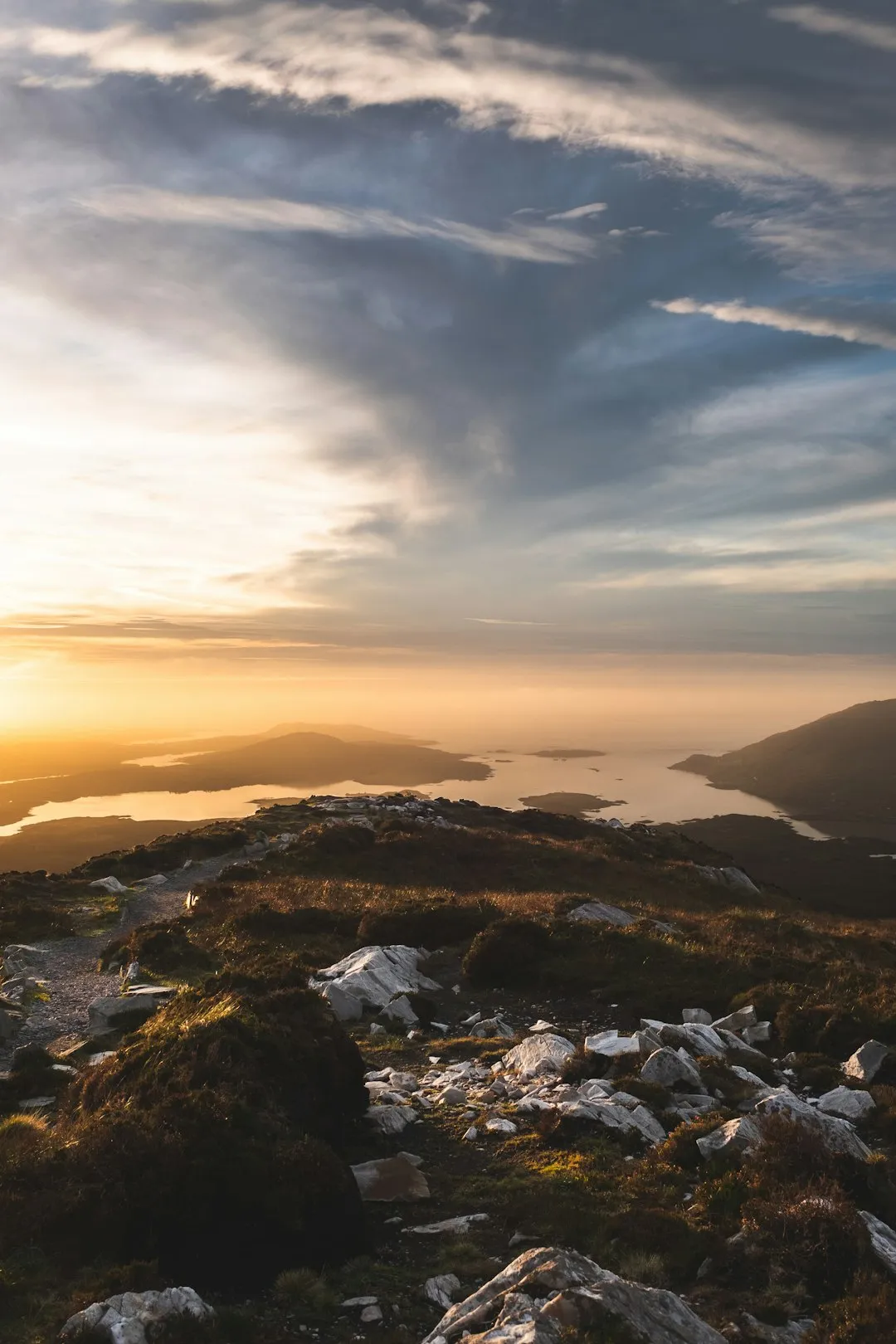
The Kerry Way is Ireland's premier long-distance walking route, a 214-kilometre odyssey that circumnavigates the Iveragh Peninsula in County Kerry. Starting and finishing in the vibrant town of Killarney, this trail offers an unparalleled immersion into the "Kingdom of Kerry," a landscape defined by the dramatic collision of the MacGillycuddy's Reeks—Ireland's highest mountain range—and the wild, salt-sprayed Atlantic coast. The route follows a mix of ancient "green roads," old butter roads, famine tracks, and quiet boreens, weaving through emerald-green valleys, desolate moorlands, and charming coastal villages. It is a journey through the very soul of the Irish landscape, where the weather changes as quickly as the terrain, and every turn reveals a new vista of rugged peaks, shimmering lakes, or the distant, jagged silhouettes of the Skellig Islands.
- Distance: 214.0 km loop
- Duration: 8–10 days
- Elevation Gain: Approximately 6,500 m
- Difficulty: Moderate (requires good fitness and navigation skills)
- Best Time: April to September
- Closest City: Killarney, County Kerry
- Trailhead: Killarney National Park / Town Centre
Overview
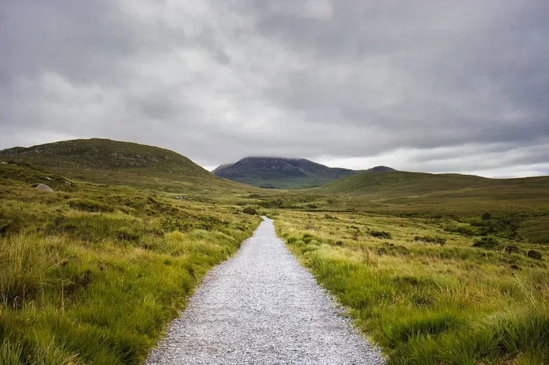
The Kerry Way is often described as the walking version of the famous Ring of Kerry driving route, but this comparison fails to capture the true intimacy of the trail. While the road sticks to the coast, the Kerry Way strikes deep into the interior, crossing high mountain passes and traversing remote valleys that vehicles can never reach. The trail is a masterclass in topographical diversity. One day you may find yourself walking through the ancient oak forests of Killarney National Park, where red deer roam freely; the next, you are climbing the "Lack Road" into the heart of the Reeks, surrounded by towering sandstone peaks and the silence of the high bog.
The experience is defined by the contrast between the rugged wilderness and the warmth of Irish hospitality. The trail passes through a series of iconic villages—Glenbeigh, Cahersiveen, Waterville, Sneem, and Kenmare—each offering a unique character and a welcome respite for the weary walker. These settlements are not just logistical stops; they are cultural hubs where the Irish language is still heard, and traditional music often spills out of local pubs in the evenings. The route is designed to be walked in a counter-clockwise direction, allowing the scenery to build in intensity, culminating in the spectacular coastal views of the western peninsula before returning through the quiet, forested hills of the south.
Physically, the Kerry Way is a significant undertaking. While it rarely reaches extreme altitudes, the cumulative elevation gain of 6,500 metres is substantial. The terrain is notoriously varied; walkers must contend with "Irish miles" (which always feel longer than standard ones), boggy patches that test the waterproofing of any boot, and rocky paths that require careful footwork. However, the rewards are immense. Standing atop a ridge overlooking Dingle Bay, with the Atlantic stretching toward the horizon and the smell of peat smoke drifting from a distant cottage, provides a sense of connection to the land that few other trails can provide. This is a walk for those who appreciate the subtle beauty of the changing light, the resilience of the Atlantic flora, and the profound peace of the Irish wilderness.
History and Cultural Context
The Kerry Way is more than just a recreational path; it is a corridor through Irish history. The trail follows routes that have been used for millennia. Along the way, walkers will encounter Ogham stones—ancient standing stones inscribed with an early form of the Irish language—and the remains of ring forts (cashels) that date back to the Iron Age. These structures, such as the magnificent Staigue Fort near Caherdaniel, serve as silent witnesses to the sophisticated societies that once thrived on this peninsula. The land is steeped in the mythology of the Tuatha Dé Danann and the legendary hero Fionn mac Cumhaill, whose stories are inextricably linked to the mountains and lakes of Kerry.
In more recent history, the trail follows "famine roads" and "old butter roads." During the Great Famine of the 1840s, many of these paths were constructed as public works projects to provide employment for the starving population. The "Old Butter Road" was the primary artery for transporting Kerry's world-famous butter from the remote farms of the Iveragh Peninsula to the international markets in Cork City. Walking these paths today is a poignant reminder of the resilience and hardship of the people who once called these valleys home. You will pass numerous "lazy beds"—the distinctive ridges used for potato cultivation—now overgrown with grass but still visible on the hillsides, marking the sites of abandoned settlements.
The modern Kerry Way was established in the early 1980s, largely through the vision of local walking enthusiasts and the cooperation of hundreds of private landowners. Unlike many national parks in other countries, much of the Kerry Way crosses private farmland. This "permissive access" is a testament to the community spirit of the region. The trail was officially opened in 1985 and has since become a model for long-distance walking routes in Ireland, balancing the needs of modern tourism with the preservation of traditional farming practices and the protection of the fragile Atlantic ecosystem.
Want more background? Read extended notes on history and cultural context → Learn more
Seasonal Highlights and Weather Reality
The weather in Southwest Ireland is heavily influenced by the North Atlantic Drift (the Gulf Stream), which brings a temperate but highly unpredictable climate. It is often said that in Kerry, you can experience all four seasons in a single afternoon. This variability is part of the trail's charm, but it requires walkers to be prepared for anything from brilliant sunshine to horizontal rain and thick Atlantic mist.
Spring (April to May): This is arguably the best time to walk the Kerry Way. The landscape erupts in colour as the gorse (whin) turns a vibrant yellow and the bluebells carpet the woodland floors. The days are lengthening, and the air is often crisp and clear. While rain is still a possibility, the "Kerry Mist" is less frequent than in the winter months. This is also before the peak tourist season, meaning the villages are quieter and accommodation is easier to secure.
Summer (June to August): The warmest months bring the longest days, with daylight lasting until 10:00 PM or later. This allows for a relaxed pace and plenty of time for evening exploration. However, this is also the peak season for the "midge"—a tiny, biting insect that can be a nuisance on calm, damp days. Summer also brings the most visitors to the region, so booking accommodation well in advance is essential. The weather can be humid, and sudden Atlantic storms can still roll in with little warning.
Autumn (September to October): September is a fantastic month for walking, often offering "Indian Summer" conditions with stable weather and beautiful autumnal light. The heather turns the hillsides a deep purple, and the bracken begins to bronze. By October, the weather becomes more unsettled, and the days shorten significantly, but the landscape takes on a rugged, dramatic quality that is perfect for photography.
Winter (November to March): Walking the full Kerry Way in winter is only recommended for experienced hikers with excellent navigation skills and high-quality gear. The days are short, the ground is often saturated and extremely boggy, and the mountain passes can be dangerous in high winds or low visibility. Many B&Bs and services close during this period, making logistics much more difficult.
Recommended Itinerary
9-Day Kerry Way Itinerary
Day 1: Killarney to Black Valley
- Distance: 22 km
- Elevation gain: 400 m
- Time: 6–7 hours
- Start at the Killarney town centre or Muckross House
- Pass the spectacular Torc Waterfall and climb the "Cardiac Hill" steps for views of the Lakes of Killarney
- Follow the Old Kenmare Road through the heart of Killarney National Park
- Traverse the remote Esknamucky Glen, surrounded by ancient oak forests
- Descend into the stunningly isolated Black Valley, one of the last places in Ireland to be connected to the electricity grid
- Stay at the Black Valley Hostel or local B&Bs
Day 2: Black Valley to Glencar
- Distance: 13 km
- Elevation gain: 450 m
- Time: 4–5 hours
- A shorter but rugged day crossing the shoulder of the MacGillycuddy's Reeks
- Climb the steep "Lack Road" pass, offering views of Carrauntoohil (Ireland's highest peak)
- Descend into the Bridia Valley, a hidden gem of the peninsula
- Continue through forest tracks and quiet roads to the hamlet of Glencar
- The scenery here is wild and mountainous, far from the coastal crowds
Day 3: Glencar to Glenbeigh
- Distance: 18 km
- Elevation gain: 350 m
- Time: 5–6 hours
- Walk along the shores of the beautiful Caragh Lake
- Climb the slopes of Seefin Mountain for the first dramatic views of the Atlantic and Dingle Bay
- Pass through the "Windy Gap," a natural notch in the ridge
- Descend into the seaside village of Glenbeigh, famous for its long sandy beach at Rossbeigh
- Excellent pubs and guesthouses available in the village
Day 4: Glenbeigh to Cahersiveen
- Distance: 23 km
- Elevation gain: 550 m
- Time: 7–8 hours
- Follow the old coach road along the side of Drung Hill
- Spectacular coastal views across Dingle Bay to the Dingle Peninsula
- The trail stays high above the modern Ring of Kerry road, offering peace and perspective
- Descend into the market town of Cahersiveen, the birthplace of Daniel O'Connell
- Visit the nearby Cahergall and Leacanabuaile stone forts
Day 5: Cahersiveen to Waterville
- Distance: 25 km
- Elevation gain: 600 m
- Time: 8–9 hours
- A long and rewarding day crossing the spine of the peninsula
- Climb to the ridge of Coomduff for panoramic views of the Skellig Islands
- Pass through remote boglands and forestry plantations
- Descend toward the coast with views of Lough Currane
- Arrive in Waterville, a beautiful coastal village famously frequented by Charlie Chaplin
Day 6: Waterville to Caherdaniel
- Distance: 28 km (Coastal route) or 15 km (Inland route)
- Elevation gain: 500 m (Coastal)
- Time: 7–9 hours
- The coastal route via Hogs Head is highly recommended for its stunning Atlantic vistas
- Pass the ruins of Derrynane House, the ancestral home of Daniel O'Connell
- Walk through the Derrynane National Historic Park and along the white sands of Derrynane Beach
- Arrive in the tiny, picturesque village of Caherdaniel
Day 7: Caherdaniel to Sneem
- Distance: 19 km
- Elevation gain: 400 m
- Time: 5–6 hours
- Follow the "Old Butter Road," a historic track used by farmers for centuries
- Pass the magnificent Staigue Fort (a short detour), one of Ireland's finest ring forts
- The trail weaves through rocky outcrops and gorse-covered hills
- Descend into Sneem, known as "The Knot in the Ring," famous for its colourful houses and village greens
Day 8: Sneem to Kenmare
- Distance: 30 km
- Elevation gain: 500 m
- Time: 9–10 hours
- The longest day of the trail, though much of it is on forest tracks and quiet boreens
- Pass through the Dromore Woods and along the shores of Kenmare Bay
- Views across the water to the Beara Peninsula
- Arrive in the elegant heritage town of Kenmare, renowned for its gourmet food and lace-making history
Day 9: Kenmare to Killarney
- Distance: 25 km
- Elevation gain: 550 m
- Time: 7–8 hours
- Follow the Old Kenmare Road back into Killarney National Park
- Cross the high plateau of the Windy Gap (a different one from Day 3!)
- Descend past Torc Waterfall and Muckross Lake
- Finish the loop back in Killarney town centre for a well-deserved celebration
Important Notes:
- The trail is well-marked with yellow arrows and "walking man" symbols, but a map is still essential.
- Many sections are extremely boggy; waterproof boots and gaiters are highly recommended.
- Public transport between villages is limited; plan your logistics carefully.
- Luggage transfer services are available and highly recommended for a more enjoyable walk.
- Always check the weather forecast; the mountain passes can be dangerous in low visibility.
Planning and Bookings
Book Your Trip
Everything you need to plan your journey
Accommodation
Find places to stay near Killarney
Flights
Search flights to Killarney
Essential Preparation
The Kerry Way is a long-distance trek that requires a solid level of cardiovascular fitness and the ability to walk 20–30 kilometres per day for multiple consecutive days. While the trail is not technically difficult, the cumulative fatigue and the often-challenging underfoot conditions (mud, bog, and loose rock) should not be underestimated. Before embarking, ensure you have "broken in" your hiking boots thoroughly to avoid blisters, which are the most common reason for walkers failing to complete the route.
Killarney serves as the primary logistical hub. It is easily accessible from Kerry Airport (KIR), which has direct flights from London, Dublin, and several European cities. Alternatively, Cork Airport (ORK) is a two-hour bus or train journey away. Killarney has a wide range of outdoor shops where you can purchase fuel, maps, and last-minute gear. It is highly recommended to spend at least one night in Killarney before starting to finalise your logistics and enjoy the local atmosphere.
Trail Accommodation
The Kerry Way is unique in that it relies almost entirely on village-based accommodation rather than wilderness huts. This allows for a "slackpacking" experience where you can enjoy a hot shower, a comfortable bed, and a cooked Irish breakfast every morning.
Accommodation Types:
- Bed & Breakfasts (B&Bs): The backbone of the Kerry Way. These are family-run guesthouses that offer a high standard of hospitality. Most B&B owners are very familiar with the trail and can provide local advice, dry your wet gear, and provide packed lunches.
- Hostels: Available in Killarney, the Black Valley, Glenbeigh, and Cahersiveen. These are great for budget-conscious walkers and offer a social atmosphere.
- Hotels: Found in the larger towns like Killarney, Waterville, Kenmare, and Sneem. Ideal for those looking for a bit of luxury at the end of a long day.
- Camping: Official campsites are limited. Wild camping is technically not permitted on private land without the owner's permission, and much of the trail crosses private farms. However, some B&Bs allow camping on their grounds for a small fee, providing access to showers and toilets.
Booking Requirements:
- During the peak months of July and August, accommodation must be booked several months in advance.
- In the shoulder seasons (May, June, September), booking a few weeks ahead is usually sufficient.
- Many B&Bs offer a luggage transfer service (or can arrange one), allowing you to walk with only a daypack.
Required Gear
- Hiking Boots: Must be waterproof (Gore-Tex or leather) with good ankle support. The boggy terrain will soak through non-waterproof shoes in minutes.
- Waterproof Jacket and Trousers: Essential. Look for high-quality breathable fabrics with a high hydrostatic head rating.
- Gaiters: Highly recommended to keep mud and water from entering the top of your boots in boggy sections.
- Backpack: A 30–40L daypack if using luggage transfer, or a 50–65L pack if carrying all your gear. Ensure it has a waterproof cover.
- Navigation: Discovery Series Maps (Sheets 70, 78, 83, 84) or a dedicated Kerry Way guidebook. A GPS or offline map app (like Hiiker or AllTrails) is very useful.
- Walking Poles: Extremely helpful for stability on slippery descents and for testing the depth of boggy patches.
- First Aid Kit: Focus on blister care (Compeed, zinc oxide tape), antiseptic wipes, and basic pain relief.
What to Bring
- Layered Clothing: Merino wool or synthetic base layers, a fleece or down mid-layer, and your waterproof outer shell. Avoid cotton, which stays cold and heavy when wet.
- Socks: High-quality wool-blend hiking socks. Bring at least three pairs to ensure you always have a dry set.
- Water Treatment: While tap water in B&Bs is safe, if you plan to take water from streams, use a filter or purification tablets due to the presence of livestock.
- Midge Repellent: Essential for summer months. Look for products containing Smidge or DEET.
- Sun Protection: Even on cloudy days, the Atlantic sun can be strong. Bring SPF 30+ sunscreen and a hat.
- Power Bank: To keep your phone and GPS charged, as cold weather can drain batteries quickly.
- Emergency Whistle and Foil Blanket: Standard safety items for any mountain walk.
- Cash: While most places take cards, some smaller B&Bs and rural pubs may still prefer cash.
Permits
One of the great advantages of the Kerry Way is that no formal permits or fees are required to walk the trail itself. The route is a public-access long-distance path that relies on the goodwill of local landowners. However, this "permissive access" comes with a responsibility to respect the land and the people who live and work on it.
Access Considerations:
- Private Land: The vast majority of the Kerry Way crosses private farmland. Walkers are guests on this land. Always stay on the marked trail and use the provided stiles and gates.
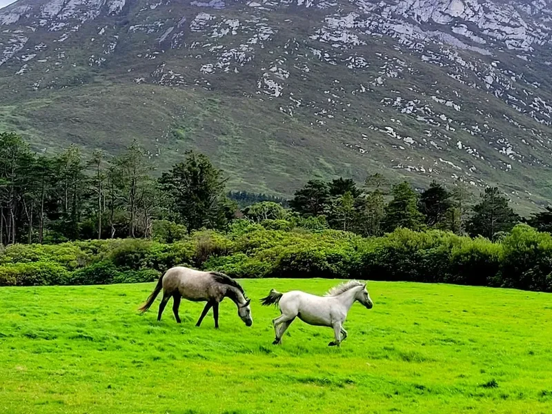
- Livestock: You will frequently walk through fields containing sheep and cattle. Keep a respectful distance and never disturb the animals, especially during lambing season (spring).
- Dogs: Dogs are strictly prohibited on almost all sections of the Kerry Way due to the presence of livestock. Even on a lead, dogs can cause significant stress to sheep.
- Killarney National Park: While no permit is needed to walk through the park, specific regulations apply regarding camping and fires (both are strictly prohibited).
Organised Groups: If you are leading a large organised group (more than 10–12 people), it is common courtesy to contact the Kerry Way committee or local tourism offices in advance to ensure your group doesn't overwhelm small sections of the trail or local services.
Other Activities in the Area
County Kerry is the tourism capital of Ireland, and there are countless ways to extend your adventure:
- Skellig Michael Boat Trip: A UNESCO World Heritage site and filming location for Star Wars. These jagged sea crags house a 6th-century monastic settlement. Trips depart from Portmagee (near Cahersiveen) and are highly weather-dependent.
- Killarney National Park: Explore Muckross House and Gardens, take a traditional "jaunting car" (horse and carriage) ride, or rent a boat to explore the three lakes.
- Gap of Dunloe: A spectacular glaciated valley that can be explored by foot, bike, or pony and trap. It is often combined with a boat trip through the lakes.
- Surfing at Rossbeigh or Inch: The Atlantic coast offers world-class surfing conditions for all levels.
- Golf: Kerry is home to some of the world's finest links courses, including Waterville, Ballybunion, and Killarney Golf & Fishing Club.
- Traditional Music Sessions: Killarney, Kenmare, and Sneem are famous for their nightly music sessions in local pubs—the perfect way to celebrate the end of a long walk.
Safety and Conditions
The Kerry Mist: The most significant safety hazard on the Kerry Way is the rapid onset of low cloud and mist, which can reduce visibility to a few metres within minutes. This is particularly dangerous on the high passes like the Lack Road or the Windy Gap. If you lose the trail markers in the mist, do not wander blindly; use your compass or GPS to reorient yourself or wait for a break in the clouds.
Boggy Terrain: Many sections of the trail cross deep peat bogs. While the trail is generally marked to avoid the worst areas, heavy rain can turn the path into a quagmire. Be careful of "bright green" patches, which often indicate deep, soft mud. Use your walking poles to test the ground before committing your weight.
Road Walking: Approximately 20–30% of the Kerry Way follows quiet paved roads (boreens). While traffic is generally light, these roads are narrow and often have blind bends. Always walk on the right-hand side (facing oncoming traffic) and be prepared to step onto the verge to let vehicles pass.
Emergency Services: In the event of an emergency, dial 999 or 112 and ask for Mountain Rescue. Be prepared to give your coordinates or a clear description of your location based on the nearest trail marker or landmark. Carrying a Personal Locator Beacon (PLB) is a good idea for solo walkers in the more remote sections like the Black Valley or Glencar.
Side Trips and Points of Interest
Staigue Fort: Located a 4-kilometre detour from the trail near Caherdaniel, this is one of the largest and finest stone ring forts in Ireland. Built entirely without mortar, its walls stand up to 5 metres high and 4 metres thick. It dates back to the early centuries AD and offers a fascinating glimpse into the defensive architecture of ancient Kerry.
Derrynane House and Beach: The home of "The Liberator" Daniel O'Connell is now a museum set within a beautiful National Historic Park. The nearby beach is one of the most beautiful in Ireland, with turquoise waters and white sand that feel more Caribbean than Atlantic on a sunny day.
Torc Waterfall: Located near the start/finish in Killarney, this 20-metre high waterfall is at its most spectacular after heavy rain. The surrounding woodland is home to rare ferns and mosses that thrive in the humid microclimate.
The Skellig Experience Centre: Located on Valentia Island (accessible via bridge from Cahersiveen), this centre provides excellent background on the history and wildlife of the Skellig Islands for those who cannot make the boat trip.
Leave No Trace
The Kerry Way passes through some of Ireland's most sensitive ecosystems, including upland bogs and ancient woodlands. Because the trail relies on the permission of private landowners, following Leave No Trace principles is essential for the trail's continued existence.
Core Principles for the Kerry Way:
- Plan Ahead and Prepare: Check the weather, carry the right gear, and know your limits to avoid the need for rescue.
- Travel on Durable Surfaces: Stay on the marked trail. Taking shortcuts across bogs or through fields damages vegetation and causes erosion.
- Dispose of Waste Properly: Pack out all rubbish, including organic waste like banana skins or orange peels, which take a long time to decompose in the cool Irish climate.
- Leave What You Find: Do not remove stones from ancient structures or pick wildflowers.
- Minimise Campfire Impacts: Fires are strictly prohibited along the trail. Use a lightweight stove for cooking if camping.
- Respect Wildlife: Observe deer and birds from a distance. Never feed wildlife.
- Be Considerate of Others: Yield to uphill walkers and keep noise levels down to preserve the sense of solitude.