The Big SEKI Loop - The Ultimate High Sierra Odyssey
The Big SEKI Loop is a monumental undertaking that traverses the rugged heart of the Sierra Nevada, encompassing the vast wilderness of Sequoia and Kings Canyon National Parks (SEKI) in California. Spanning approximately 563.3 kilometres, this thru-hike is not merely a trail but a comprehensive circumnavigation of one of the most geologically diverse and topographically dramatic regions in North America. The route ascends from the cathedral-like groves of ancient Giant Sequoias into a high-alpine world of stark granite peaks, turquoise glacial lakes, and some of the highest mountain passes in the United States. With a staggering total elevation gain of over 21,336 metres, the Big SEKI Loop demands exceptional physical endurance, advanced navigational skills, and a deep respect for the volatile mountain environment. It is a journey that takes hikers through the Evolution Valley, across the legendary Forester Pass, and into the depths of the Kern Canyon, offering a level of solitude and immersion that few other trails on the continent can provide.
- Distance: 563.3 km loop
- Duration: 30–45 days
- Season: Late July–early September (snow-free window; outside this, ice axes and crampons are mandatory)
- Accommodation: Backcountry camping (wilderness permits required; bear canisters mandatory)
- Highest point: Mount Whitney summit (4,421 m) or Forester Pass (4,000 m) depending on route variations
- Difficulty: Very Challenging (requires high-altitude experience and off-trail navigation)
- Direction: Can be hiked in either direction, though clockwise is often preferred for gradual acclimatisation
Overview
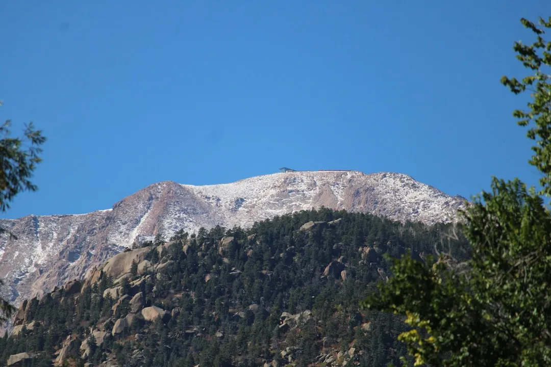
The Big SEKI Loop is often described as the "crown jewel" of California thru-hiking, a route that combines sections of the world-famous John Muir Trail (JMT) and Pacific Crest Trail (PCT) with remote, rarely visited backcountry corridors. Unlike the linear progression of the JMT, the Big SEKI Loop is a self-contained odyssey that begins and ends in the lush, forested foothills, forcing the hiker to earn every metre of elevation as they climb toward the "High Sierra." The landscape is a masterclass in glacial geology; the U-shaped valleys, hanging cirques, and polished granite domes tell a story of ice and time that spans millions of years. This is a trail of extremes: you will find yourself standing beneath the General Sherman Tree—the largest living thing on Earth—one week, and struggling for breath atop a 4,000-metre pass the next.
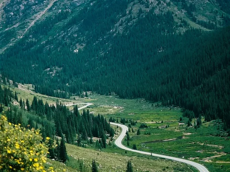
The loop is fundamentally defined by its verticality. The Sierra Nevada is a tilted fault block, with a gentle western slope and a precipitous eastern escarpment. The Big SEKI Loop dances along this crest, crossing numerous "cols" and passes that serve as the only gateways between isolated drainage basins. Hikers must navigate the "Big Five" passes of the southern Sierra—Mather, Pinchot, Glen, Forester, and Muir—each offering a unique perspective on the surrounding wilderness. The scale of the landscape is difficult to comprehend; the Kern Canyon alone is one of the deepest canyons in North America, a massive rift in the earth that runs straight for kilometres, flanked by the Great Western Divide and the Sierra Crest.
Solitude is a defining characteristic of this route. While sections overlapping with the JMT can be social, the vast majority of the Big SEKI Loop takes hikers into the "Deep Backcountry," where encounters with other humans are rare. Here, the rhythm of the day is dictated by the sun and the weather. Afternoon thunderstorms are a frequent summer occurrence, sending hikers scurrying off exposed ridges as lightning dances across the peaks. In the evenings, the "alpenglow" transforms the grey granite into shades of brilliant orange and pink, a phenomenon that has inspired naturalists and poets for generations. This is a journey for those who seek to test their limits against the rawest elements of the natural world.
History and Cultural Context
The land encompassed by the Big SEKI Loop has been the ancestral home of Indigenous peoples for millennia. The Monache (Western Mono) lived on the western slopes, while the Owens Valley Paiute occupied the eastern side. These groups utilised the high passes—many of which the trail follows today—as trade routes, exchanging acorns and obsidian across the Sierra Crest. Evidence of their presence remains in the form of "milling stations" (bedrock mortars) and lithic scatters found in sheltered valleys. For these peoples, the mountains were not a "wilderness" to be conquered, but a vital landscape of spiritual significance and seasonal sustenance.
European exploration of the region began in earnest in the mid-19th century. The California Geological Survey, led by Josiah Whitney in the 1860s, was responsible for naming many of the prominent peaks, including Mount Whitney. However, it was the legendary naturalist John Muir who became the most vocal advocate for the preservation of these mountains. Muir’s writings about the "Range of Light" captured the imagination of the American public and were instrumental in the establishment of Sequoia National Park in 1890—the second national park in the United States—followed shortly by General Grant National Park (which later became part of Kings Canyon). Muir’s legacy is woven into the very fabric of the trail, from the Muir Hut atop Muir Pass to the eponymous John Muir Trail that forms a backbone for the loop.
The development of the trail network itself was a feat of engineering and labour. During the Great Depression, the Civilian Conservation Corps (CCC) worked tirelessly to build the stone staircases and reinforced paths that allow hikers to traverse otherwise impassable terrain. The Big SEKI Loop as a concept emerged much later, as modern thru-hikers sought to link these historic paths into a single, continuous journey. Today, the parks are managed with a focus on "Wilderness" designation, ensuring that the land remains untrammelled by man, where the natural processes of fire, flood, and regrowth continue undisturbed. Walking the Big SEKI Loop is, in many ways, a walk through the history of American conservation.
Want more background? Read extended notes on history and cultural context → Learn more
Seasonal Highlights and Weather Reality
The window for completing the Big SEKI Loop is remarkably narrow due to the extreme elevation. In a typical year, the high passes remain choked with snow until late June or early July. Attempting the loop before this time requires advanced mountaineering skills, including the use of ice axes and crampons, and the ability to navigate across featureless snowfields. Furthermore, early-season river crossings can be exceptionally dangerous, as snowmelt turns placid creeks into raging torrents capable of sweeping a hiker off their feet.
Late July to early September is the "Golden Window." During this period, the snow has mostly receded, the wildflowers are in full bloom in the alpine meadows, and the weather is generally stable. However, hikers must be prepared for the "Sierra Monsoon"—a pattern of afternoon thunderstorms that can develop rapidly. These storms bring heavy rain, hail, and dangerous lightning. The standard safety protocol is to be over the day's high pass and back below the treeline by noon. Even in mid-summer, temperatures at night can drop below freezing at higher elevations, while the valleys can experience sweltering heat exceeding 30 degrees Celsius.
Autumn (September to early October) offers crisp air, fewer mosquitoes, and the stunning yellow hues of quaking aspens. However, the days grow shorter, and the risk of a "season-ending" snowstorm increases. Once the first major winter storm hits, the high country becomes the domain of backcountry skiers and winter explorers. For the thru-hiker, the Big SEKI Loop is a race against the seasons, requiring careful timing to ensure safe passage through the most exposed sections of the High Sierra.
Recommended Itinerary
35-Day Big SEKI Loop Itinerary (Clockwise)
Stage 1: Lodgepole to Roaring River (Days 1–5)
- Distance: 72 km
- Elevation gain: 3,200 m
- Key Waypoints: Lodgepole Trailhead, Elizabeth Pass, Deadman Canyon, Roaring River Ranger Station
- Begin in the Giant Forest, climbing steadily through red fir forests
- Cross Elizabeth Pass (2,890 m), the first major test of the route
- Descend into the spectacular Deadman Canyon, a classic U-shaped glacial valley
- Follow the Roaring River through remote meadows where sightings of black bears are common
Stage 2: Roaring River to Evolution Valley (Days 6–12)
- Distance: 95 km
- Elevation gain: 4,100 m
- Key Waypoints: Colby Pass, Kern-Kaweah River, Junction Meadow, Muir Pass
- Cross Colby Pass (3,650 m), offering one of the most rugged views in the park
- Navigate the Kern-Kaweah, a remote and challenging section with limited trail maintenance
- Join the John Muir Trail at Junction Meadow and begin the long climb to Muir Pass (3,644 m)
- Pass the iconic Muir Hut, a stone shelter built by the Sierra Club in 1930
Stage 3: Evolution Valley to Rae Lakes (Days 13–19)
- Distance: 88 km
- Elevation gain: 3,800 m
- Key Waypoints: Evolution Lake, Mather Pass, Pinchot Pass, Rae Lakes
- Traverse the Evolution Basin, widely considered the most beautiful alpine landscape in the Sierra
- Cross Mather Pass (3,680 m) and Pinchot Pass (3,690 m) in quick succession
- Descend into the Woods Creek drainage, crossing the famous suspension bridge
- Arrive at Rae Lakes, framed by the jagged Painted Lady and Fin Dome
Stage 4: Rae Lakes to Mount Whitney (Days 20–26)
- Distance: 82 km
- Elevation gain: 4,500 m
- Key Waypoints: Glen Pass, Forester Pass, Tyndall Creek, Mount Whitney Summit
- Climb Glen Pass (3,650 m) for views of the Kearsarge Pinnacles
- Cross Forester Pass (4,000 m), the highest point on the Pacific Crest Trail
- Enter the high-altitude plateau of the Bighorn Plateau
- Side trip to the summit of Mount Whitney (4,421 m), the highest peak in the contiguous United States
Stage 5: Mount Whitney to Kern Canyon (Days 27–31)
- Distance: 75 km
- Elevation gain: 2,200 m
- Key Waypoints: Crabtree Meadow, Kern River, Kern Hot Springs
- Descend from the high peaks into the deep rift of the Kern Canyon
- Follow the Kern River south, enjoying the warmer temperatures of the canyon floor
- Soak in the natural Kern Hot Springs, a well-earned reward for weeks of effort
- Observe the dramatic change in vegetation from alpine tundra to ponderosa pine
Stage 6: Kern Canyon to Lodgepole (Days 32–35)
- Distance: 51.3 km
- Elevation gain: 3,536 m
- Key Waypoints: Franklin Pass, Mineral King, Black Rock Pass, Bearpaw Meadow, Lodgepole
- Climb out of the Kern Canyon via the steep Franklin Pass (3,560 m)
- Descend into the historic Mineral King valley, a former mining settlement
- Cross the final hurdle of Black Rock Pass (3,540 m) with views of the Great Western Divide
- Return to Lodgepole via the High Sierra Trail, completing the massive loop
Important Notes:
- Resupply is the greatest challenge; most hikers exit at Kearsarge Pass or Muir Trail Ranch to collect food caches
- Water is abundant but must be treated due to Giardia risks
- Snow conditions on passes can vary wildly; check recent trip reports on forums like High Sierra Topix
- The route involves significant "off-trail" or "use-trail" sections; GPS and paper maps are essential
Planning and Bookings
Book Your Trip
Everything you need to plan your journey
Accommodation
Find places to stay near Visalia, California
Flights
Search flights to Visalia, California
Essential Preparation
Planning the Big SEKI Loop is a logistical undertaking that requires months of preparation. The primary challenge is resupply. Because the loop stays deep in the wilderness for over 500 kilometres, hikers cannot carry all their food at once. Most organisers coordinate resupply buckets to be mailed to Muir Trail Ranch (MTR) or Vermilion Valley Resort (VVR), though these require significant detours from the main loop. Alternatively, hikers can arrange for a "packer" (mule train) to drop food at specific locations, though this is expensive. Another common strategy is to hike out over Kearsarge Pass to the town of Independence for a full resupply and a "zero day" (rest day).
Physical preparation is non-negotiable. You will be carrying a heavy pack (often 15–22 kg with food and water) at altitudes consistently above 3,000 metres. Training should focus on weighted hill climbs and cardiovascular endurance. Acclimatisation is also critical; spending 2–3 nights at the trailhead elevation (approx. 2,000 m) before starting the hike can significantly reduce the risk of Acute Mountain Sickness (AMS).
Trail Accommodation
The Big SEKI Loop is a wilderness thru-hike, meaning there are no huts, lodges, or permanent shelters along the route (with the exception of the historic Muir Hut, which is for emergency use only). Accommodation is strictly backcountry camping.
Camping Regulations:
- Dispersed camping is permitted in most areas, provided you are at least 30 metres from water and trails
- Established "impacted" sites should be used whenever possible to prevent further damage to the environment
- Camping is prohibited in certain fragile areas (e.g., within 400 metres of certain high-use lakes); check your permit for specific closures
- Bear canisters are mandatory for food storage in all areas of Sequoia and Kings Canyon National Parks
- No campfires are allowed above 3,000 metres (3,048 m) to protect the limited supply of downed wood in the alpine zone
Facilities:
- There are no toilets in the backcountry; hikers must dig "catholes" at least 15–20 cm deep and 60 metres from water
- Some high-use areas (like Crabtree Meadow near Mount Whitney) have "WAG bag" requirements, where you must pack out your own human waste
- Ranger stations (e.g., Roaring River, LeConte Canyon, McClure Meadow) are staffed seasonally and can provide emergency assistance and weather updates
Required Gear
- Bear Canister: Hard-sided, approved container (e.g., BearVault BV500 or Wild Ideas Bearikade). This is a legal requirement.
- Shelter: Lightweight, wind-resistant tent or pyramid tarp. The Sierra is known for high winds on the passes.
- Sleeping System: A sleeping bag rated to at least -7°C (-6°C). Even in August, frost is common.
- Footwear: Trail running shoes or lightweight boots. The terrain is rocky and abrasive; ensure they are well broken-in.
- Navigation: High-resolution paper maps (Tom Harrison or National Geographic) and a GPS device (Garmin inReach or smartphone with Gaia GPS/FarOut).
- Ice Axe and Crampons: Essential if attempting the loop before mid-July or in a high-snow year.
- Water Filter: Hollow-fibre filter (e.g., Sawyer Squeeze) or chemical treatment (Aquamira).
What to Bring
- Food: High-calorie, lightweight meals (dehydrated dinners, nuts, olive oil, tortillas). Aim for 3,500–4,500 calories per day.
- Clothing: A robust layering system including a down/synthetic "puffy" jacket, a waterproof shell, merino base layers, and a wide-brimmed sun hat.
- Sun Protection: High-SPF sunscreen, lip balm with SPF, and polarised sunglasses. The UV radiation at 4,000 metres is intense.
- First Aid: Blister kit (Leukotape is a favourite), ibuprofen, antihistamines, and any personal medications.
- Repair Kit: Tenacious Tape, a small multi-tool, and spare parts for your stove.
- Power: A large capacity power bank (20,000 mAh) to keep navigation devices and cameras charged for 7–10 days between resupplies.
Permits
Securing a wilderness permit for the Big SEKI Loop is a competitive process, as the parks operate under a strict quota system to protect the wilderness character of the High Sierra. Permits are required for all overnight stays in the backcountry.
The Booking Process:
- Permits are issued through Recreation.gov.
- The reservation window typically opens six months in advance of your start date. For a July start, you must be ready to book in January.
- You must select a specific "Entry Trailhead" (e.g., Lodgepole/Twin Lakes or Mineral King). Once you have your permit, you are free to follow your own itinerary within the park, provided you exit by the date specified.
- A portion of permits (usually 25%) are held back for "Walk-up" or "Last Minute" reservations, which are released online 1–2 weeks before the start date.
Costs and Fees:
- Reservation Fee: US$6.00 (non-refundable).
- Per Person Fee: US$15.00.
- National Park Entry Fee: US$35.00 per vehicle (or use an "America the Beautiful" annual pass).
Specific Requirements: If your route includes the summit of Mount Whitney and you plan to exit via Whitney Portal (on the eastern side), you may need a specific "Whitney Zone" permit, which is managed via a separate lottery. However, if you are traversing the park and staying on the western side of the crest, a standard SEKI wilderness permit is usually sufficient. Always verify the latest boundary rules with the Wilderness Office.
Other Activities in the Area
The region surrounding Sequoia and Kings Canyon National Parks offers world-class attractions that are worth visiting before or after your thru-hike:
- The Giant Forest: Home to the General Sherman Tree. Walking the Congress Trail provides an easy, paved way to see the world's largest trees in a concentrated area.
- Moro Rock: A granite dome that offers a steep staircase climb to a 360-degree view of the Great Western Divide. It is the perfect place to scout the mountains you are about to enter.
- Crystal Cave: A marble cavern featuring stalactites and stalagmites. Guided tours are available and offer a cool respite from the summer heat.
- Zumwalt Meadow: Located in the Cedar Grove area of Kings Canyon, this flat boardwalk trail offers stunning views of the canyon walls and the Kings River.
- Boyden Cavern: Located just outside the park boundary in the Giant Sequoia National Monument, this cave features impressive flowstone formations.
- Visalia and Fresno: These gateway cities offer excellent farm-to-table dining, craft breweries, and museums detailing the agricultural history of the Central Valley.
Safety and Conditions
High Altitude Hazards: Much of the Big SEKI Loop stays above 3,000 metres. Acute Mountain Sickness (AMS) is a genuine risk. Symptoms include headache, nausea, and fatigue. The only cure is descent. More serious conditions like High Altitude Pulmonary Oedema (HAPO) or Cerebral Oedema (HACO) are rare but life-threatening. Hikers should monitor themselves and their partners closely.
River Crossings: In early summer (June–July), river crossings are the leading cause of accidents in the Sierra. Evolution Creek and the Kern River can be particularly treacherous. Always unbuckle your pack's hip belt before crossing, wear shoes to protect your feet, and cross at the widest, shallowest point. If a crossing looks too dangerous, wait until early morning when the flow is lower, or find a different route.
Wildlife: Black bears are common throughout the parks. They are generally not aggressive toward humans but are highly motivated by food. Using a bear canister is not just a rule; it is essential for the bear's survival, as "habituated" bears that learn to steal human food often have to be euthanised. Rattlesnakes are found at lower elevations (below 2,500 m), particularly in the Kern Canyon and near Mineral King. Watch where you step and place your hands.
Weather: Hypothermia can occur even in summer if you are caught in a cold rainstorm without proper gear. Lightning is a major threat on the high passes. If you hear thunder, descend immediately. Avoid standing near isolated trees or on wide-open ridges.
Emergency Communication: Cell phone service is non-existent in the backcountry. Carrying a Satellite Messenger (like a Garmin inReach or Zoleo) is highly recommended for sending check-in messages and summoning help in a life-threatening emergency.
Side Trips and Points of Interest
Mount Whitney Summit: While the Big SEKI Loop passes near the base of Whitney, the 13-kilometre return trip to the summit (4,421 m) is the ultimate side quest. Standing on the highest point in the lower 48 states provides a perspective of the entire Sierra Nevada that is simply unmatched. The trail is well-maintained but the altitude makes every step a struggle.
The Ionian Basin: For experienced navigators, a detour into the Ionian Basin (near Muir Pass) offers a glimpse into one of the most remote and "lunar" landscapes in the park. This is a cross-country (off-trail) area filled with jagged peaks and deep blue lakes like Lake McDermand. It is a place of profound silence and stark beauty.
Darwin Bench: Located just above Evolution Valley, Darwin Bench is a series of alpine benches featuring cascading streams and views of the Evolution Peaks (Mt. Darwin, Mt. Mendel). It is often less crowded than the main JMT camps and offers some of the best photography opportunities on the loop.
Kern Hot Springs: Located deep in the Kern Canyon, these natural geothermal springs have been built into a small concrete tub right next to the river. Soaking in the hot water while watching the cold Kern River rush by is a highlight for many thru-hikers, providing much-needed relief for sore muscles.
Leave No Trace
The High Sierra is a fragile environment where the growing season is short and the soil is thin. With thousands of hikers visiting each year, the cumulative impact can be devastating if Leave No Trace (LNT) principles are not strictly followed. The Big SEKI Loop traverses "Wilderness" areas where the goal is to leave no evidence of your passage.
Core Principles for the Sierra:
- Travel and Camp on Durable Surfaces: Stay on the trail. In the alpine zone, walk on rocks or gravel rather than fragile meadow grasses or "cryptobiotic" soil crusts.
- Dispose of Waste Properly: Pack out all trash, including orange peels, tea bags, and toilet paper. In high-use zones, use provided WAG bags for human waste.
- Leave What You Find: Do not collect obsidian flakes, wildflowers, or "souvenir" rocks. Leave cultural sites undisturbed.
- Minimise Campfire Impacts: Use a lightweight stove for cooking. Campfires are prohibited in most of the high country due to the scarcity of wood and the risk of wildfires.
- Respect Wildlife: Observe animals from a distance. Never feed marmots or squirrels, as this disrupts their natural foraging behaviour and can lead to plague transmission.
- Be Considerate of Others: Keep noise levels down. The sound of a Bluetooth speaker can carry for kilometres in a quiet canyon, ruining the wilderness experience for others.