Te Araroa Trail - The Long Pathway
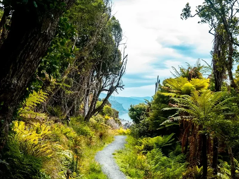
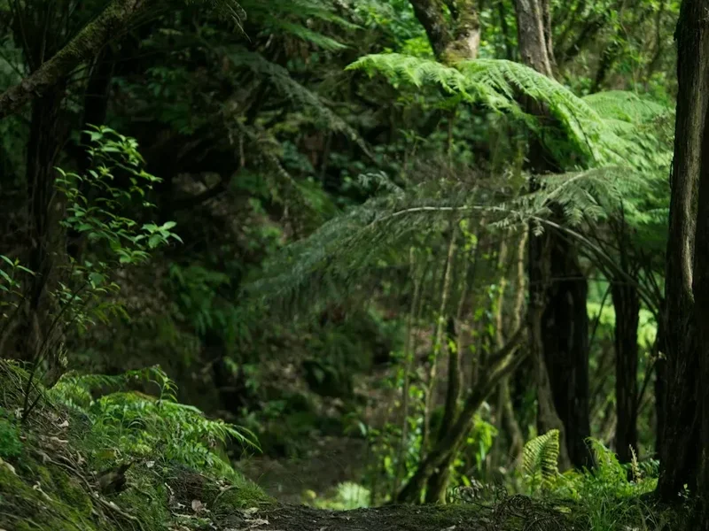
Te Araroa, translated from Māori as "The Long Pathway," is New Zealand's ultimate geographic odyssey—a 3,000-kilometre continuous tramping route stretching from the windswept northern tip of the North Island at Cape Reinga to the rugged southern shores of the South Island at Bluff. This is not merely a hike; it is a profound cultural and environmental immersion that traverses the full spectrum of the New Zealand landscape. From the endless salt-sprayed horizons of Ninety Mile Beach and the ancient, humid kauri forests of Northland to the volcanic plateaus of the central North Island and the formidable, glaciated peaks of the Southern Alps, Te Araroa offers a diversity of terrain unmatched by almost any other thru-hike on Earth.
Unlike many international long-distance trails that remain strictly in the wilderness, Te Araroa is designed to connect New Zealand's people and its land. The route weaves through bustling metropolitan centres like Auckland and Wellington, crosses private farmland with the generous permission of local "kiwi" farmers, and navigates remote backcountry where the only signs of civilisation are the iconic orange trail markers and the Department of Conservation (DOC) huts. It is a journey of immense physical challenge, requiring three to six months of sustained effort, navigating everything from muddy forest tracks and river crossings to high-alpine passes and even a multi-day canoe journey down the Whanganui River. For those who undertake the full journey, Te Araroa becomes a transformative experience, revealing the true soul of Aotearoa.
- Distance: 3,000 km (approximate, varies with seasonal detours)
- Duration: 3–6 months (typically 120–150 days)
- Season: September to April (SOBO: start Sept/Oct; NOBO: start Dec/Jan)
- Huts: Extensive network of DOC huts, plus campsites and holiday parks
- Highest point: Stag Saddle (1,925 m)
- Total Elevation Gain: Approximately 80,000 m
- Direction: Southbound (SOBO) is most common; Northbound (NOBO) is popular for late starters
Overview
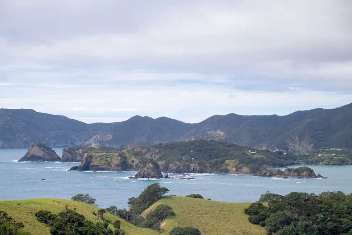
Te Araroa is a trail of two distinct halves, each offering a unique set of challenges and rewards. The North Island (approx. 1,600 km) is characterised by its coastal marches, dense subtropical forests, and significant road walking sections that connect various wilderness blocks. It is a test of mental fortitude and physical resilience against the infamous "Northland mud" and the repetitive nature of road walking. However, it also provides the most cultural interaction, passing through small rural towns where the hospitality of "Trail Angels" often becomes the highlight of the journey. The North Island also features the unique Whanganui River section, where trampers trade their boots for paddles for a 3-to-5-day river journey through deep siltstone canyons.
The South Island (approx. 1,400 km) is the rugged, alpine heart of the trail. Here, the scenery shifts to dramatic mountain ranges, wide braided river valleys, and vast tussock-covered high country. The South Island is significantly more remote and demanding, with fewer towns and longer stretches between resupply points. Trampers must navigate the technical Richmond Range, the stunning Nelson Lakes National Park, and the high-altitude passes of the Southern Alps. The weather in the South Island is notoriously fickle; even in mid-summer, snow can fall on the higher passes, and rivers can rise to impassable levels within hours of heavy rain. This section requires advanced backcountry skills, including river crossing techniques and alpine navigation.
The trail is managed by the Te Araroa Trust in partnership with the Department of Conservation. It is a relatively young trail, having officially opened in 2011, and it continues to evolve. New track sections are regularly built to move the trail off roads and into the bush, meaning the experience changes slightly every year. Whether you are a "thru-hiker" attempting the entire length in one season or a "section-hiker" tackling it piece by piece over several years, Te Araroa demands respect, careful planning, and an adventurous spirit. It is a journey that showcases the geological birth of a nation and the enduring spirit of its people.
History and Cultural Context
The concept of a continuous trail spanning the length of New Zealand was first proposed in the 1970s, but it remained a distant dream until the mid-1990s. The primary architect of the modern trail was Geoff Chapple, a journalist and author who founded the Te Araroa Trust in 1994. Chapple's vision was to create a "long pathway" that would allow New Zealanders and international visitors to walk the length of the country, connecting existing tracks with new sections to form a single, unbroken line. In 1998, Chapple walked the proposed route himself to prove its viability and to raise public awareness. His journey, documented in his book "Te Araroa," sparked national interest and began the long process of negotiating access with private landowners and government agencies.
The trail was officially opened on 3 December 2011, after seventeen years of dedicated work by hundreds of volunteers, regional trusts, and the Department of Conservation. The opening ceremony was held at Waitangi, a site of immense historical significance where the Treaty of Waitangi was signed in 1840. This choice of location underscored the trail's role as a cultural bridge. The name "Te Araroa" was gifted by Māori, reflecting the ancient tradition of "ara" (paths) that Māori used for centuries to travel for trade, warfare, and the gathering of resources like pounamu (greenstone). Many sections of the modern trail follow these ancestral routes, particularly in the North Island and the mountain passes of the South Island.
Today, Te Araroa is more than just a recreational asset; it is a living monument to New Zealand's commitment to public access and conservation. The trail crosses the traditional lands of many iwi (tribes), and walkers are encouraged to learn about the local history and spiritual significance of the areas they traverse. The "Trail Angel" phenomenon—where locals provide food, water, or a place to sleep—has become a cornerstone of the Te Araroa culture, embodying the Māori concept of "manaakitanga" (hospitality and care for others). As the trail matures, it continues to foster a deep connection between the people of New Zealand and the diverse landscapes they call home.
Want more background? Read extended notes on history and cultural context → Learn more
Seasonal Highlights and Weather Reality
Timing is the most critical factor for a successful Te Araroa journey. New Zealand's maritime climate is highly unpredictable, and the trail spans nearly 13 degrees of latitude, meaning conditions vary wildly from north to south. Most walkers choose the Southbound (SOBO) direction, starting at Cape Reinga in late September or October. This allows them to walk through the North Island during the spring and early summer, reaching the more challenging South Island in the height of summer (January/February) when the mountain passes are most likely to be clear of snow and the river levels are generally lower.
Northbound (NOBO) walkers typically start at Bluff in December or January. This direction is often chosen by those who want to tackle the rugged South Island first while they are fresh, or by those who have been delayed in their start. However, NOBO walkers must be mindful of the "winter window" in the North Island; if they are too slow, they may find themselves in the muddy forests of Northland during the wet autumn months of May and June. Regardless of direction, the "sweet spot" for being in the high country of the South Island is between January and March. Outside of this window, the risk of heavy snow and freezing temperatures on the passes increases significantly.
Weather in New Zealand can change with startling speed. A "southerly buster" can bring Antarctic air and snow to the South Island even in mid-summer, while tropical cyclones can bring torrential rain and flooding to the North Island. The North Island is generally warmer but can be extremely humid, leading to heat exhaustion on road sections and slippery, muddy conditions in the forests. The South Island is drier but much colder, with high UV levels that can cause severe sunburn even on overcast days. Trampers must be prepared for "four seasons in one day" and should never underestimate the power of the New Zealand elements. Monitoring the MetService mountain forecasts and being prepared to wait out bad weather in a hut or town is a vital skill for any Te Araroa walker.
Recommended Itinerary
Te Araroa Regional Breakdown (SOBO)
Region 1: Northland (Cape Reinga to Auckland)
- Distance: ~550 km
- Time: 20–30 days
- Key Highlights: Ninety Mile Beach, Puketi Forest, Bay of Islands, Raetea Forest (the mud!), Whangarei Heads.
- Terrain: Long beach marches, dense subtropical rainforest, rural roads.
- Note: This section is famous for its deep mud and the physical toll of walking on sand. Proper foot care is essential here.
Region 2: Auckland and Waikato (Auckland to Te Kuiti)
- Distance: ~350 km
- Time: 12–18 days
- Key Highlights: Auckland City waterfront, Hakarimata Range, Mount Pirongia, the Waitomo Caves area.
- Terrain: Urban paths, boardwalks, farmland, and significant forest climbs.
- Note: Pirongia is a highlight but can be extremely muddy and technical in wet weather.
Region 3: Central North Island (Te Kuiti to Wanganui)
- Distance: ~400 km
- Time: 15–20 days (including river journey)
- Key Highlights: Pureora Forest (Timber Trail), Tongariro Alpine Crossing, Whanganui River Journey.
- Terrain: Ancient podocarp forest, volcanic alpine plateau, river paddling.
- Note: The Whanganui River section requires booking a canoe/kayak and takes 3–5 days. It is a mandatory part of the trail experience.
Region 4: Lower North Island (Wanganui to Wellington)
- Distance: ~300 km
- Time: 10–15 days
- Key Highlights: Tararua Ranges, Kapiti Coast, Wellington City skyline.
- Terrain: Rugged mountain ridges, coastal tracks, urban walkways.
- Note: The Tararua Ranges are notorious for extreme winds and rapid weather changes. Many walkers choose the coastal "low route" in bad weather.
Region 5: Nelson Lakes and Richmond Range (Picton to Hanmer Springs)
- Distance: ~380 km
- Time: 15–22 days
- Key Highlights: Queen Charlotte Track, Richmond Range (technical), Blue Lake (clearest water in the world), Waiau Pass.
- Terrain: High alpine ridges, scree slopes, beech forest, river valleys.
- Note: The Richmond Range is often considered the most technical and difficult section of the entire trail.
Region 6: Canterbury (Hanmer Springs to Tekapo)
- Distance: ~350 km
- Time: 12–18 days
- Key Highlights: Harper River, Two Thumb Range, Stag Saddle (highest point), Lake Tekapo.
- Terrain: Braided rivers, vast tussock basins, high alpine passes.
- Note: This section involves several significant river crossings (Rangitata and Rakaia) which are often impassable and require a shuttle/hitch around for safety.
Region 7: Otago (Tekapo to Queenstown)
- Distance: ~300 km
- Time: 10–15 days
- Key Highlights: Ohau Range, Breast Hill (views of Lake Hawea), Motatapu Track, Arrowtown.
- Terrain: Steep mountain climbs, golden tussock hills, historic mining trails.
- Note: The Motatapu Track is exceptionally steep and demanding but offers some of the best views in the South Island.
Region 8: Southland (Queenstown to Bluff)
- Distance: ~370 km
- Time: 14–20 days
- Key Highlights: Mavora Lakes, Takitimu Mountains, Longwood Forest, Stirling Point (the finish).
- Terrain: Beech forest, mountain basins, muddy forest tracks, coastal roads.
- Note: The Longwood Forest is the final "mud hurdle" before the road walk to the southern terminus at Bluff.
Important Notes:
- Resupply: Towns are frequent in the North Island (every 3–5 days) but sparse in the South Island (up to 8–10 days).
- Navigation: Use the official Te Araroa App or FarOut (Guthook) for real-time GPS and water/campsite updates.
- River Safety: Never attempt to cross a flooded river. If in doubt, wait it out or find an alternative route.
- Flexibility: The itinerary above is a guide; your pace will be dictated by weather, injury, and the desire to linger in beautiful places.
Planning and Bookings
Book Your Trip
Everything you need to plan your journey
Accommodation
Find places to stay near Wellington
Flights
Search flights to Wellington
Essential Preparation
Planning for Te Araroa is a monumental task that should begin at least six months before your start date. The first step is to register with the Te Araroa Trust on their official website. While there is no mandatory fee to walk the trail, a donation (suggested NZ$500 for thru-hikers) is vital for the trail's maintenance and future development. Registration also provides you with the latest trail alerts and safety information. Physical preparation is equally important; you don't need to be an elite athlete, but you should have a solid base of hiking fitness and experience with multi-day trips in varied terrain. Many walkers find that their "trail legs" develop over the first few weeks in Northland, but starting with a good level of core strength and cardiovascular fitness will prevent early injuries.
Logistics involve deciding on your direction (SOBO or NOBO), arranging transport to the trailhead (Cape Reinga or Bluff), and planning your resupply strategy. Most walkers use a combination of buying food in towns and sending "bounce boxes" or resupply packages to remote locations where shops are limited (e.g., St Arnaud, Arthur's Pass). You will also need to coordinate the Whanganui River journey, which requires booking a canoe or kayak with an authorised operator several months in advance, especially for the peak season in January and February.
Trail Accommodation
Accommodation on Te Araroa is a mix of Department of Conservation (DOC) huts, commercial campsites, holiday parks, hostels (backpackers), and the occasional "Trail Angel" stay. In the backcountry, the DOC hut network is the backbone of the trail. These huts vary from basic 4-bunk shelters to large 20+ bunk facilities with wood fires and rain-fed water tanks.
Hut and Camping Requirements:
- DOC Backcountry Hut Pass: Essential for thru-hikers. A 6-month pass (approx. NZ$160) allows you to stay in most huts along the trail without paying individual fees. Note: This does not cover "Great Walk" huts (like those on the Tongariro or Whanganui sections), which must be booked and paid for separately.
- Campsites: In many areas, especially the North Island, you will stay in commercial holiday parks or DOC campsites. These typically cost NZ$15–$30 per night and offer facilities like showers, kitchens, and laundries.
- Wild Camping: Allowed in many backcountry areas of the South Island, but strictly prohibited on private land, in many council-managed areas, and near certain sensitive environments. Always follow the "Freedom Camping" laws of New Zealand.
- Facilities: Most backcountry huts provide bunks with mattresses and a toilet (usually a long-drop or composting). You must provide your own cooking stove, fuel, and sleeping bag. Water is usually from a tank or nearby stream and should be treated.
Required Gear
- Footwear: Lightweight trail runners are the choice for 80% of thru-hikers due to the mud and road walking, but sturdy tramping boots are recommended for the technical South Island sections. Bring high-quality merino socks.
- Pack: A 40–60L lightweight pack with a comfortable harness. A waterproof pack liner is more effective than a rain cover in New Zealand's wind.
- Shelter: A lightweight, wind-resistant tent or tarp-tent. It must be able to withstand high winds and heavy rain.
- Sleep System: A 3-season sleeping bag (comfort rating 0°C to -5°C) and a high-R-value sleeping pad.
- Clothing: The layering system is key. Merino or synthetic base layers, a warm fleece or down jacket, and a high-quality waterproof shell (Gore-Tex or similar). Avoid cotton entirely.
- Navigation: Smartphone with the Te Araroa App and FarOut (Guthook) maps. A backup power bank (10,000–20,000 mAh) is essential. Carry a paper map and compass for the more remote South Island sections.
- Safety: A Personal Locator Beacon (PLB) is non-negotiable. You can rent these or buy one. A basic first aid kit with plenty of blister care (Leukotape/Compeed).
What to Bring
- Food: High-calorie, lightweight meals. Dehydrated dinners, porridge, nuts, dried fruit, and chocolate. You will typically carry 3–8 days of food at a time.
- Water Treatment: A lightweight filter (like a Sawyer Squeeze) or purification tablets. While New Zealand water is often clean, Giardia is present in many waterways.
- Cooking Gear: A small gas stove (Jetboil or MSR Pocket Rocket), a lightweight pot, a long-handled spoon, and a lighter.
- Toiletries: Biodegradable soap, toothbrush, small toothpaste, hand sanitiser, and a "poo trowel" for when huts aren't available.
- Sun and Bug Protection: SPF 50+ sunscreen (the NZ sun is brutal), a wide-brimmed hat, and strong insect repellent (DEET) for the notorious South Island sandflies.
- Personal Items: A lightweight towel, earplugs (for noisy huts), and a small repair kit (duct tape, needle/thread).
Permits
Te Araroa does not require a single "permit" in the traditional sense, but there are several registrations and passes that are essential for a legal and supported journey. The most important is the Te Araroa Trust Registration, which should be completed online before you start. This helps the Trust track walker numbers and advocate for trail funding.
Key Permits and Passes:
- Te Araroa Registration: Free (but donation requested). Register at teararoa.org.nz.
- DOC Backcountry Hut Pass: This is the most important purchase for your accommodation. It covers the vast majority of huts in the South Island and several in the North Island. It costs approximately NZ$160 for 6 months.
- Great Walk Bookings: If you plan to stay in huts on the Tongariro Northern Circuit or the Whanganui Journey, you must book these months in advance through the DOC website. These are high-demand areas and sell out quickly.
- Whanganui River Journey: You must book your canoe/kayak through a private operator. They will also handle your DOC campsite/hut bookings for the river section as part of their package.
- Queen Charlotte Track: A "QCTLC Pass" is required to walk the sections of this track that cross private land (approx. NZ$25).
International Visitors: Ensure you have the correct visa for a 3–6 month stay. Most international hikers use a Visitor Visa or a Working Holiday Visa. You must also pay the International Visitor Conservation and Tourism Levy (IVL) when you apply for your visa or NZeTA.
Other Activities in the Area
New Zealand is a world-class tourism destination, and many walkers take "zero days" (rest days) to experience the local attractions:
- Waitomo Caves: Near the trail in the Waikato, famous for glowworms and blackwater rafting.
- Rotorua: A short detour from the trail, offering geothermal wonders, Māori cultural performances, and world-class mountain biking.
- Queenstown: The "Adventure Capital of the World." Many walkers take a break here for bungy jumping, skydiving, or simply enjoying the vibrant food and bar scene.
- Hobbiton Movie Set: Located near Matamata, a popular side trip for Lord of the Rings fans.
- Wine Tours: The trail passes through or near major wine regions like Marlborough (Blenheim) and Central Otago.
- Stewart Island / Rakiura: Many walkers finish at Bluff and then take the ferry to Stewart Island to walk the Rakiura Track, one of New Zealand's Great Walks.
Safety and Conditions
River Crossings: This is the single greatest hazard on Te Araroa. New Zealand rivers are "braided" and can rise with terrifying speed during rain. More trampers die in New Zealand rivers than from any other cause. The rule is simple: if in doubt, stay out. Learn the "mutual support" crossing technique, but never attempt a crossing if the water is discoloured, moving faster than a walking pace, or if you can hear boulders rolling on the riverbed. The Rakaia and Rangitata rivers in the South Island are considered too dangerous to cross on foot and must be bypassed by vehicle.
Weather and Hypothermia: New Zealand's weather is maritime and volatile. Hypothermia is a year-round risk, even in summer. Always carry a high-quality waterproof jacket and warm merino layers. If you get wet and the wind picks up, your body temperature can drop rapidly. Know the signs of hypothermia (the "umbles": stumbles, mumbles, fumbles) and be prepared to stop, pitch your tent, and get into your sleeping bag immediately.
Navigation and PLBs: While the trail is generally well-marked with orange triangles, markers can be lost in floods, snow, or thick forest. Always have a GPS-enabled map (like FarOut) and a Personal Locator Beacon (PLB). In the event of a life-threatening emergency, a PLB is your only reliable way to signal for help in the vast areas of New Zealand that have no mobile coverage.
Kauri Dieback: In the North Island, the ancient kauri trees are threatened by a soil-borne pathogen. You must use the cleaning stations provided at forest entries and exits to scrub all soil off your boots and gear. Failure to do so can kill these 2,000-year-old giants.
Side Trips and Points of Interest
Tongariro Alpine Crossing: While the Te Araroa route follows the lower slopes, almost every walker takes the side trip to complete the full Alpine Crossing. It is widely considered the best one-day walk in New Zealand, featuring emerald lakes, steaming vents, and the perfect volcanic cone of Mount Ngauruhoe (Mount Doom).
Blue Lake (Rotomairewhenua): Located in Nelson Lakes National Park, this lake has the clearest natural fresh water in the world, with visibility up to 80 metres. It is a sacred site to local Māori, so you must not touch or enter the water, but the view from the shore is ethereal.
Breast Hill: The climb out of Lake Hawea in Otago is one of the steepest on the trail, but the reward is a panoramic view of the Southern Alps and the deep blue waters of the lake that many consider the finest view of the entire 3,000 km journey.
The Forgotten World Highway: A section of the trail in the Taranaki/Manawatu region that passes through the "Republic of Whangamomona," a quirky town that declared independence in 1989. It's a great place to get your "passport" stamped and enjoy a pub meal.
Leave No Trace
New Zealand's wilderness is pristine but fragile. With the increasing popularity of Te Araroa, the "Leave No Trace" principles are more important than ever to ensure the trail remains sustainable. The Te Araroa Trust and DOC take these principles very seriously.
The Seven Principles on Te Araroa:
- Plan Ahead and Prepare: Know the regulations, weather, and hazards. Carry enough food and the right gear.
- Travel and Camp on Durable Surfaces: Stay on the marked track. Use existing campsites and hut areas. Avoid trampling sensitive alpine plants.
- Dispose of Waste Properly: Pack out everything you pack in. This includes food scraps (which attract pests) and all litter. Use toilets whenever possible; otherwise, bury waste 15–20 cm deep and at least 50 m from water.
- Leave What You Find: Do not take plants, stones, or historical artefacts. Respect Māori tapu (sacred) sites.
- Minimise Campfire Impacts: Campfires are generally prohibited on the trail due to fire risk. Use a portable stove for cooking.
- Respect Wildlife: Observe birds like the kea and kiwi from a distance. Never feed them. Keep your food secure.
- Be Considerate of Others: Respect other walkers and hut users. Keep noise down and share the space. Yield to uphill walkers.