
Tateyama Kurobe Alpine Route - Japan's Majestic Mountain Traverse
The Tateyama Kurobe Alpine Route is a spectacular 37.2 km journey across the Northern Japan Alps, offering a breathtaking traverse through some of Japan's most dramatic mountain scenery. This route is not a single hiking trail but a unique combination of various modes of transport, including buses, cable cars, ropeways, and a funicular railway, all designed to navigate the challenging alpine terrain. It connects Tateyama Station in Toyama Prefecture with Ogizawa Station in Nagano Prefecture, passing through the majestic Kurobe Dam, one of Japan's largest dams, and the stunning Murodo Plateau, known for its volcanic landscapes and alpine flora. The route is renowned for its accessibility to high mountain environments, offering unparalleled views of snow-capped peaks, alpine lakes, and vibrant forests, making it a popular destination for nature lovers and photographers alike.
- Distance: 37.2 km (total route length)
- Elevation Gain: 1975 m
- Duration: 6-8 hours (for the full traverse)
- Season: Mid-April to late June and late September to early November
- Difficulty: Moderate (due to elevation and length, but transport makes it accessible)
- Closest City: Toyama
- Trailhead Access: Nearest airport: Toyama Airport (TOY). Take a bus to Toyama Station, then train to Tateyama Station. From Ogizawa, take a bus to Shinano-Omachi Station. Driving not recommended due to one-way route. Parking available at both Tateyama and Ogizawa. No permits needed to traverse the route, but check bus/cable car schedules in advance.
- Coordinates: 36.5754, 137.6035
Overview
The Tateyama Kurobe Alpine Route is an extraordinary feat of engineering that allows visitors to experience the grandeur of the Northern Japan Alps without requiring extensive mountaineering skills. The route is a multi-modal adventure, seamlessly blending various forms of transport to ascend through diverse ecological zones. Starting from Tateyama Station, the journey begins with a cable car and then a highland bus, gradually climbing towards the Murodo Plateau. This high-altitude area, at approximately 2,450 metres, is the highest point on the route and offers stunning panoramic views of the surrounding peaks, including the iconic Mount Tateyama. Murodo is also known for its volcanic activity, with steaming vents and hot springs, creating a unique, almost otherworldly landscape.
From Murodo, the route continues via a trolleybus through a long tunnel to Kurobe Dam. This colossal concrete dam, completed in 1963 after seven years of arduous labour by over a million workers, is an engineering marvel in itself. The reservoir it creates, Lake Kurobe, is a striking turquoise blue, set against the dramatic backdrop of the surrounding mountains. The dam offers impressive views and a chance to learn about its construction history.
The final leg of the journey involves a cable car and then a ropeway descending towards Ogizawa Station. Throughout the traverse, the scenery transforms dramatically. In spring, the route is famous for the "Snow Wall" (Yuki-no-Otani), where massive snowdrifts line the road, creating an awe-inspiring spectacle. As the season progresses, the landscape shifts to vibrant alpine meadows dotted with wildflowers, followed by the fiery colours of autumn foliage. The Tateyama Kurobe Alpine Route is a testament to human ingenuity harmonising with nature's raw power and beauty, offering an unforgettable experience for all who undertake it.
History and Cultural Context
The history of the Tateyama Kurobe Alpine Route is deeply intertwined with the development of Japan's infrastructure and its relationship with its formidable mountain ranges. The region around Mount Tateyama has long been a sacred site, considered one of Japan's three holy mountains, and a destination for religious pilgrimages for centuries. The arduous journey to its summit was undertaken by ascetics and devotees seeking spiritual enlightenment.
The modern alpine route, however, is a product of the post-war era's drive for industrialisation and energy production. The construction of the Kurobe Dam, a monumental undertaking that began in 1956 and was completed in 1963, was a pivotal moment. This massive hydroelectric project required immense human effort and engineering prowess to overcome the challenging terrain and harsh climate of the Northern Japan Alps. The dam not only became a vital source of electricity for the Kansai region but also paved the way for the development of the alpine route as a tourist attraction.
The construction of the various transport systems—cable cars, trolleybuses, and ropeways—was a complex logistical challenge. Each segment was designed to minimise environmental impact while maximising accessibility to the high mountain environment. The route officially opened to the public in stages, with the full traverse becoming operational in the 1970s. The "Snow Wall" phenomenon, where snow can reach heights of up to 20 metres, became a major drawcard, particularly during the early spring opening. The route's development reflects Japan's ability to integrate modern technology with its natural heritage, transforming a once-inaccessible wilderness into a world-renowned scenic destination.
Seasonal Highlights and Weather Reality
The Tateyama Kurobe Alpine Route is a seasonal marvel, with each period offering a distinct and captivating experience. However, its high-altitude location means that weather can be unpredictable and extreme, even during its operational months.
Spring (Mid-April to late June): The Snow Wall Spectacle
This is arguably the most famous season, particularly for the "Snow Wall" (Yuki-no-Otani) between Murodo and Midagahara. Massive snowdrifts, remnants of the harsh winter, are cleared to create a pathway for the highland bus, resulting in towering walls of snow that can reach up to 20 metres in height. This period offers a unique, almost surreal landscape. Temperatures are cool, often hovering around 5-10°C, and snow is still prevalent at higher elevations. The route officially opens in mid-April, but the exact date can vary depending on snow conditions.
Summer (July to August): Alpine Flora and Verdant Landscapes
As the snow melts, the Murodo Plateau transforms into a vibrant alpine meadow. This is the best time to witness the diverse and colourful alpine flora in bloom. The weather is generally more stable, with warmer temperatures (around 15-20°C) and longer daylight hours, making it ideal for exploring the walking trails around Murodo. However, summer can also bring afternoon thunderstorms, so it's wise to start early and be prepared for sudden changes.
Autumn (Late September to early November): Fiery Foliage
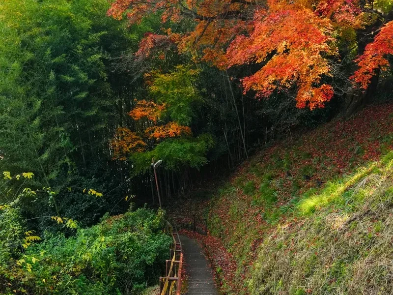
Autumn is a spectacular time to traverse the route, as the mountainsides erupt in a riot of colour. The Japanese maples and other deciduous trees turn brilliant shades of red, orange, and yellow, creating a breathtaking contrast against the evergreen conifers and the clear blue skies. Temperatures begin to drop, ranging from 5-15°C, and the air becomes crisp and invigorating. The autumn foliage typically peaks in early to mid-October, offering some of the most stunning photographic opportunities.
Weather Reality:
Regardless of the season, the weather in the Japanese Alps can change rapidly. Visitors should always be prepared for cooler temperatures, especially at higher elevations, and for sudden rain or wind. Snow can fall even in early autumn and late spring. It is crucial to check the weather forecast before and during your trip and to dress in layers. The route closes for the winter season from mid-November to mid-April due to heavy snowfall and avalanche risk.
Recommended Itinerary
Tateyama Kurobe Alpine Route Traverse (One-Way)
Start: Tateyama Station (Toyama Prefecture)
End: Ogizawa Station (Nagano Prefecture)
Early Morning (Approx. 7:00 AM - 8:00 AM): Arrival and Initial Ascent
- Arrive at Tateyama Station. Purchase your one-way ticket or use a pre-booked pass.
- Board the Tateyama Cable Car (approx. 7 minutes) from Tateyama Station to Bijodaira. This steep ascent offers initial views of the surrounding forest.
- At Bijodaira, transfer to the Tateyama Highland Bus. This is the longest bus segment of the route.
Morning (Approx. 8:00 AM - 11:00 AM): Murodo Plateau Exploration
- The highland bus journey takes approximately 50 minutes to reach Murodo.
- Disembark at Murodo, the highest point on the route (2,450 m).
- Spend time exploring Murodo. Key points of interest include:
- Mikurigaike Pond: A beautiful volcanic crater lake offering stunning reflections of Mount Tateyama.
- Jigokudani (Hell Valley): Steaming vents and hot springs, showcasing the area's volcanic activity.
- Walking trails: Numerous well-maintained paths allow for short hikes and exploration of the alpine landscape.
- Snow Wall (Yuki-no-Otani): If travelling in spring (mid-April to late June), experience the towering snow walls along the road.
- Allow at least 1.5 to 2 hours for exploration and photography at Murodo.
Midday (Approx. 11:00 AM - 1:00 PM): Descent to Kurobe Dam
- From Murodo, board the Tateyama Tunnel Trolleybus. This unique bus travels through a tunnel and takes approximately 10 minutes to reach Kurobe Dam.
- Arrive at Kurobe Dam. This is a major highlight of the route.
- Explore the Kurobe Dam area. Key activities include:
- Walking across the dam: Enjoy panoramic views of Lake Kurobe and the surrounding mountains.
- Dam observation decks: Several viewpoints offer different perspectives of the dam's scale and the reservoir.
- Kurobe Dam Rest House: Facilities for refreshments and souvenirs.
- Allow approximately 1 to 1.5 hours to experience the dam.
Afternoon (Approx. 1:00 PM - 3:00 PM): Final Descent to Ogizawa
- From Kurobe Dam, board the Kurobe Cable Car (approx. 5 minutes) to Kurobe-daira.
- At Kurobe-daira, transfer to the Kurobe Ropeway. This is a spectacular aerial ride offering breathtaking views as you descend.
- The ropeway journey takes approximately 5 minutes to reach Daikanbo.
- From Daikanbo, board the Tateyama Highland Bus again for the final leg of the journey. This bus travels down the scenic mountain road towards Ogizawa.
- The bus journey from Daikanbo to Ogizawa takes approximately 40 minutes.
Late Afternoon (Approx. 3:00 PM onwards): Arrival at Ogizawa
- Arrive at Ogizawa Station.
- From Ogizawa, you can take a bus to Shinano-Omachi Station, which is a major transportation hub for onward travel.
Important Notes:
- The order of transport can be reversed (starting from Ogizawa and ending at Tateyama).
- Check the operating hours and last departure times for each mode of transport, especially for the final services of the day.
- The entire route can be completed in 6-8 hours, but allow extra time for exploring Murodo and Kurobe Dam, and for potential queues, especially during peak season.
- Consider purchasing a Tateyama Kurobe Alpine Route Passport for convenience if you plan to use all modes of transport.
- Weather can significantly impact visibility and the overall experience.
Planning and Bookings
Book Your Trip
Everything you need to plan your journey
Accommodation
Find places to stay near Toyama
Flights
Search flights to Toyama
Essential Preparation
The Tateyama Kurobe Alpine Route is a one-way journey, meaning you'll need to plan your transportation to the starting point and from the ending point. The most common approach is to start from Tateyama Station in Toyama Prefecture and finish at Ogizawa Station in Nagano Prefecture, or vice versa. Driving is generally not recommended due to the one-way nature of the route and limited parking at one end. It's advisable to book accommodation in either Toyama City or the Shinano-Omachi/Matsumoto area depending on your chosen direction of travel.
Logistics:
- Starting Point: Tateyama Station (Toyama Prefecture). Accessible via the Toyama Chiho Railway from Toyama Station.
- Ending Point: Ogizawa Station (Nagano Prefecture). Accessible via bus from Shinano-Omachi Station, which is served by JR trains.
- Luggage Transfer: If you have large luggage, consider using a luggage forwarding service (takkyubin) to send your bags from your hotel in Toyama to your next accommodation near Ogizawa, or vice versa. This allows you to travel the route unencumbered.
- Tickets: You can purchase tickets for each segment of the route individually, or opt for a comprehensive "Tateyama Kurobe Alpine Route Passport" which covers all modes of transport for a one-way journey. These can be bought at the main stations or online in advance.
Base Town/City Information:
- Toyama City: A convenient base for starting the route from the Tateyama side. It offers a range of hotels, restaurants, and good transport links. Toyama Airport (TOY) is the nearest airport.
- Shinano-Omachi/Matsumoto: These cities serve as good bases for accessing the Ogizawa side of the route. Shinano-Omachi is closer, while Matsumoto offers more amenities and historical attractions.
Trail Accommodation
This is a day hike requiring no overnight accommodation along the route itself. The entire traverse is designed to be completed within a single day using various forms of public transport. Accommodation is available in the cities and towns at either end of the route, such as Toyama City, Tateyama Town, Shinano-Omachi, or Matsumoto City.
Required Gear
- Sturdy Walking Shoes: Comfortable, broken-in walking shoes or hiking boots with good grip are essential, even though much of the route involves transport. You will be doing a fair amount of walking at Murodo and Kurobe Dam.
- Waterproof and Windproof Outerwear: Weather can change rapidly in the mountains. A waterproof and windproof jacket and trousers are highly recommended, regardless of the season.
- Warm Layers: Even in summer, temperatures at Murodo (2,450 m) can be cool. Bring layers such as a fleece or down jacket, and a hat and gloves, especially for spring and autumn.
- Sun Protection: The sun can be intense at high altitudes, even on cloudy days. Bring sunscreen, sunglasses, and a hat.
- Backpack: A small to medium-sized backpack (20-30 litres) is sufficient to carry your daily essentials, snacks, water, and extra clothing.
- Navigation: While the route is well-signposted and easy to follow, a map of the route and transport connections is useful. Mobile phone signal can be intermittent in some areas.
What to Bring
- Food and Water: While there are restaurants and shops at various points along the route (Murodo, Kurobe Dam), it's advisable to carry your own snacks and a reusable water bottle. You can refill water at some stations.
- Camera: The scenery is spectacular, and you'll want to capture it. Ensure you have spare batteries or a power bank.
- Cash: While credit cards are accepted at major stations and some facilities, it's wise to carry some Japanese Yen for smaller purchases, vending machines, or in case of unexpected needs.
- Personal Items: Any personal medications, hand sanitiser, and tissues.
- Binoculars (Optional): For enhanced wildlife viewing or appreciating distant mountain vistas.
Permits
No specific permits are required to traverse the Tateyama Kurobe Alpine Route itself. The route is operated by the Tateyama Kurobe Alpine Route company, and access is gained by purchasing tickets for the various modes of transport. These tickets can be bought individually for each segment or as a comprehensive one-way passport.
Ticket Options:
- One-Way Passport: This is the most convenient option for traversing the entire route from Tateyama to Ogizawa (or vice versa). It covers all the necessary cable cars, buses, and ropeways. Prices vary slightly depending on the season and whether you purchase in advance or on the day. As of recent information, a typical one-way passport costs around ¥10,000-¥12,000 per adult.
- Individual Tickets: You can purchase tickets for each segment of the journey if you only wish to travel part of the route or have specific transport needs. This can be more expensive if you plan to complete the entire traverse.
- Advance Purchase: It is highly recommended to purchase your tickets or passport in advance, especially during peak seasons (spring for the Snow Wall, autumn for foliage) and weekends, to avoid long queues and ensure availability. Tickets can often be purchased online through the official Tateyama Kurobe Alpine Route website or through travel agencies.
Important Considerations:
- Operating Hours: The route operates seasonally, typically from mid-April to late November. Each mode of transport has specific operating hours, and the last departures are crucial to note to avoid being stranded.
- Weather Dependency: While tickets are generally non-refundable once used, severe weather conditions can sometimes lead to temporary closures of certain segments (e.g., ropeways due to high winds). It's advisable to check the official website for any operational updates before your travel date.
- No Reservations for Specific Times: Generally, you cannot reserve a specific departure time for the transport segments. You join the queue for the next available service. Arriving early in the morning is the best strategy to minimise waiting times.
Other Activities in the Area
Beyond the main traverse, the Tateyama Kurobe Alpine Route and its surrounding areas offer a wealth of activities and points of interest:
- Hiking around Murodo: The Murodo Plateau is a hiker's paradise. Explore trails leading to Mikurigaike Pond, Jigokudani (Hell Valley), and the summit of Mount Tateyama (for experienced hikers with appropriate gear). The alpine flora in summer is particularly beautiful.
- Kurobe Dam Observation Decks: Take time to explore the various viewpoints around the dam. The sheer scale of the structure and the surrounding landscape is impressive.
- Kurobe Gorge Railway: A scenic narrow-gauge railway that runs through the dramatic Kurobe Gorge, offering stunning views of the rugged terrain, deep ravines, and lush forests, especially during autumn. This is a separate attraction accessible from Unazuki Onsen.
- Tateyama Caldera Sabo Museum: Located near Tateyama Station, this museum showcases the history of disaster prevention efforts in the Tateyama region, particularly related to sediment control and erosion.
- Onsen (Hot Springs): Several hot spring resorts are located in the towns at either end of the route, such as Tateyama Onsen or areas near Shinano-Omachi, offering a relaxing way to unwind after your mountain journey.
- Photography: The route is a photographer's dream, with dramatic mountain vistas, unique snow formations in spring, vibrant wildflowers in summer, and stunning autumn colours.
- Geological Exploration: The Murodo area is volcanically active, offering opportunities to observe fumaroles, hot springs, and unique geological formations.
Safety and Conditions
Weather Preparedness: The most critical safety aspect is being prepared for the mountain weather. Temperatures at Murodo (2,450 m) can be significantly colder than at the base stations. Always check the weather forecast before your trip and be prepared for rapid changes, including rain, strong winds, and even snow, regardless of the season. Dress in layers and carry waterproof and windproof clothing.
Altitude Sickness: While the route is accessible via transport, Murodo is at a high altitude. Some individuals may experience mild symptoms of altitude sickness, such as headaches or dizziness. It's advisable to ascend gradually if possible, stay hydrated, and avoid strenuous activity immediately upon arrival at Murodo. If symptoms are severe, descend to a lower altitude.
Walking on Trails: When exploring Murodo or the areas around Kurobe Dam, stick to marked trails. The terrain can be uneven, and some areas around Murodo are volcanically active with hot springs and unstable ground. Respect any warning signs or closures.
Transport Safety: The various modes of transport are operated by professional companies and are generally very safe. However, always follow the instructions of the staff, especially regarding boarding and alighting, and be aware of your surroundings, particularly on crowded services.
Crowds: During peak seasons (spring for the Snow Wall, autumn for foliage, and weekends), the route can become very crowded. Be patient, especially when waiting for transport. Keep valuables secure in crowded areas.
Emergency Contacts: While mobile phone signal can be intermittent, it's a good idea to have emergency contact numbers readily available. In case of a serious emergency, alert station staff or transport operators.
Travel Insurance: It is always recommended to have travel insurance that covers medical emergencies and potential trip disruptions, especially when travelling in mountainous regions.
Side Trips and Points of Interest
Mikurigaike Pond: Located near the Murodo bus terminal, this is a stunning volcanic crater lake. On a clear day, its deep blue waters perfectly reflect the majestic peak of Mount Tateyama. A paved path circles the pond, offering easy access and beautiful photo opportunities. The surrounding area is also rich in alpine flora.
Jigokudani (Hell Valley): A short walk from Murodo, this area is a dramatic testament to the region's volcanic activity. Steaming vents, sulphurous gases, and hot springs create a stark, otherworldly landscape. Wooden boardwalks allow visitors to safely observe the geothermal activity.
Mount Tateyama Summit (for experienced hikers): For those with sufficient time, fitness, and appropriate gear, a hike to the summit of Mount Tateyama (3,015 m) is a challenging but rewarding experience. The trail from Murodo is steep and can be demanding, requiring good navigation skills and awareness of weather conditions. The panoramic views from the summit are unparalleled.
Kurobe Dam Observation Decks: Beyond the main walkway across the dam, there are several observation decks offering different perspectives. The "Kurobe Dam Station Observation Deck" provides a view from above, while other points offer wider vistas of Lake Kurobe and the surrounding peaks. Exploring these different vantage points can reveal new angles and details of this impressive structure.
Tateyama Ropeway Views: The Tateyama Ropeway offers a spectacular aerial perspective as it descends from Kurobe-daira to Daikanbo. This segment provides sweeping views of the deep valley and the rugged mountain slopes, especially breathtaking during the autumn foliage season.
Leave No Trace
The Tateyama Kurobe Alpine Route, while heavily managed with transport infrastructure, traverses a sensitive alpine environment. Practising Leave No Trace principles is crucial to preserving its natural beauty and ecological integrity for future visitors.
Stay on Marked Trails: The alpine meadows and volcanic areas around Murodo are fragile ecosystems. Straying from designated paths can damage delicate vegetation, disturb wildlife, and lead to erosion. Always follow the marked routes and boardwalks.
Dispose of Waste Properly: Pack out everything you pack in. This includes all food wrappers, fruit peels, and any other litter. There are waste disposal facilities at major stations, but it's best to carry your rubbish with you until you reach a designated bin. Avoid leaving anything behind in the natural environment.
Respect Wildlife: Observe wildlife from a distance and never feed any animals. Feeding wild animals can disrupt their natural behaviours, diets, and health, and can make them dependent on human food, which is often unhealthy for them. The alpine regions are home to various birds and small mammals.
Minimise Impact: When taking photographs, be mindful of your surroundings and avoid disturbing plants or rock formations. Keep noise levels down to appreciate the natural sounds of the mountains and avoid disturbing other visitors or wildlife.
Plan Ahead and Prepare: By planning your trip, understanding the route, and packing appropriately, you minimise the need for unplanned actions that could impact the environment. Ensure you have sufficient food and water to avoid needing to forage or rely on potentially unsustainable resources.
Travel Responsibly: Utilise the public transport options provided. These are designed to minimise the environmental footprint compared to individual vehicle use. Support local businesses and respect the cultural heritage of the region.