Küstenwanderweg Sylt - The North Sea Odyssey
The Küstenwanderweg Sylt, or the Sylt Coastal Trail, is Germany’s premier long-distance island walk, offering a 65-kilometre circumnavigation of the country’s most iconic North Sea destination. Located in the Schleswig-Holstein Wadden Sea National Park—a UNESCO World Heritage site—this trail is a journey through a landscape of dramatic contrasts. To the west, the trail hugs the rugged "Brandungsküste" (surf coast), where the full force of the Atlantic-fed North Sea batters white sandy beaches and towering red cliffs. To the east, it follows the serene "Wattenmeerküste," where the rhythmic pulse of the tides reveals vast mudflats teeming with avian life. The route is a sensory experience defined by the scent of salt spray, the cry of oystercatchers, and the sight of shifting sand dunes that are found nowhere else in Germany. Walking the Sylt Coastal Trail is not merely a physical exercise; it is an immersion into a fragile ecosystem where land and sea are in a constant, visible struggle for dominance.
- Distance: 65.0 km total (can be extended or shortened via local bus links)
- Duration: 3–5 days
- Season: May to September (best weather); April and October (crisp and quiet)
- Accommodation: Hotels, guesthouses, youth hostels, and designated campsites
- Highest point: Uwe Düne (52.5 m)
- Difficulty: Moderate (flat terrain but challenging surfaces like soft sand and high winds)
- Direction: Typically walked clockwise from Hörnum, but flexible due to island logistics
Overview
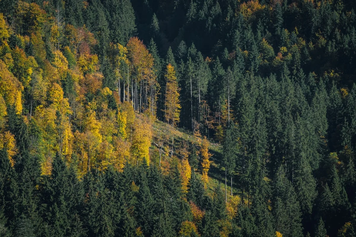
Sylt is often referred to as the "Queen of the North Sea," and the Küstenwanderweg provides the most intimate way to understand why. The trail is a masterclass in coastal geography, transitioning from the narrow, storm-battered southern tip at Hörnum-Odde to the expansive, desert-like dunes of the Listland in the north. Unlike alpine treks defined by vertical gain, the challenge of the Sylt Coastal Trail lies in the elements. Walkers must contend with the "Westwind," a persistent and often powerful force that shapes the very trees (Krummholz) and dunes of the island. The terrain varies from paved promenades in the bustling centre of Westerland to narrow sandy tracks through marram grass and expansive wooden boardwalks designed to protect the sensitive dune heath.
The island’s shape is famously reminiscent of an anchor or a dancer, and the trail follows this silhouette closely. On the western side, you are treated to over 40 kilometres of uninterrupted fine-sand beach, backed by a chain of dunes that reach up to 35 metres in height. Here, the air is rich with iodine and aerosolised salt, renowned for its health benefits. On the eastern side, the trail overlooks the Wadden Sea, one of the world's most important migratory bird stopovers. Depending on the tide, you will either see a shimmering expanse of water or kilometres of dark, nutrient-rich mudflats. This side of the island is home to traditional Frisian villages like Keitum, where the trail winds past 18th-century thatched-roof houses and ancient stone churches, offering a cultural counterpoint to the raw natural beauty of the coast.
Logistically, the trail is highly accessible. Sylt is connected to the mainland by the Hindenburgdamm causeway, and a robust bus system (the Sylter Verkehrsgesellschaft) runs the length of the island. This allows hikers to choose a base—such as the central hub of Westerland—and commute to different trailheads each day, or to move from village to village in a traditional multi-day trek. Whether you are watching the sunset from the Rotes Kliff (Red Cliff) in Kampen or navigating the northernmost point of Germany at the Ellenbogen, the Küstenwanderweg Sylt offers a profound sense of space and a unique perspective on the North German maritime soul.
History and Cultural Context
The history of Sylt is a saga of human resilience against the encroaching sea. For centuries, the islanders—the Frisians—lived a precarious existence based on fishing, small-scale farming, and, most lucratively, whaling. In the 17th and 18th centuries, Sylt’s "Commanders" led whaling expeditions to the Arctic, bringing back wealth that built the magnificent thatched-roof houses still seen in Keitum today. The local dialect, Söl'ring, is a unique variant of North Frisian, and while its daily use has declined, it remains a vital part of the island's identity, visible on street signs and in local folk songs.
The transformation of Sylt from a remote fishing outpost to a high-end tourist destination began in the mid-19th century. In 1855, Westerland was officially declared a seaside resort, and the arrival of the Hindenburgdamm in 1927—a 11-kilometre railway causeway—permanently ended the island's isolation. This history is etched into the trail: you will pass the massive tetrapods and concrete sea walls at Hörnum, designed to prevent the southern tip from washing away, and the historic lighthouses that have guided sailors through the treacherous North Sea currents for generations. The "Rotes Kliff" (Red Cliff) between Wenningstedt and Kampen served as a vital landmark for seafarers long before modern navigation, its iron-rich clay glowing fiery red in the evening sun.
Today, the island balances its reputation as a playground for the wealthy with its status as a critical conservation zone. The establishment of the Schleswig-Holstein Wadden Sea National Park in 1985 marked a turning point, ensuring that the very landscapes hikers enjoy—the shifting dunes, the salt marshes, and the mudflats—are protected by federal and international law. Walking the trail, you are following in the footsteps of Frisian sailors, Romantic-era poets, and modern conservationists, all of whom have been captivated by this "long island" in the sea.
Want more background? Read extended notes on history and cultural context → Learn more
Seasonal Highlights and Weather Reality
The North Sea climate is notoriously fickle, and weather on Sylt can change with startling speed. The "Best Time" to hike is generally considered May to September, but each season offers a distinct character for the coastal walker.
Summer (June to August): This is the peak season. Temperatures average 18–22°C, though the sun can feel much stronger due to the reflection off the white sand. The days are incredibly long, with twilight lingering until nearly 11:00 PM in June. This is the best time for swimming in the North Sea (water temperatures reach 18–20°C) and enjoying the vibrant atmosphere of the beach bistros. However, the trail—especially near Westerland and Kampen—can be crowded, and accommodation must be booked months in advance.
Shoulder Seasons (May and September): Many experienced hikers prefer these months. May brings the blooming of the "Sylt Rose" (Rosa rugosa) and the vibrant yellow of the gorse bushes. September offers more stable weather and the spectacular purple flowering of the dune heath. The air is crisp, the crowds have thinned, and the light is particularly beautiful for photography. Be prepared for cooler evenings and the occasional autumn gale.
Winter (November to March): Hiking the Küstenwanderweg in winter is a feat of endurance but offers unparalleled solitude. The island is often shrouded in mist or battered by "Orkantiefs" (cyclonic storms). While temperatures rarely drop far below freezing due to the maritime influence, the wind chill can make 2°C feel like -10°C. Many restaurants and facilities close, but the sight of a frozen Wadden Sea or the raw power of a winter storm at the Ellenbogen is unforgettable. This season requires high-quality technical windproof and waterproof gear.
Weather Reality: Regardless of the season, the wind is the defining factor. A 20 km walk with a tailwind is a joy; the same distance against a Force 6 headwind is exhausting. Always check the "Windfinder" or local maritime forecasts and consider walking the island in the direction that keeps the wind at your back.
Recommended Itinerary
4-Day Sylt Coastal Circumnavigation
Day 1: Hörnum to Westerland (The Wild South)
- Distance: 19 km
- Elevation gain: 40 m
- Time: 5–6 hours
- Start at the Hörnum Lighthouse and walk around the "Hörnum-Odde," the southern tip of the island.
- Follow the western beach or the dune trails heading north.
- Pass through the "Rantumbecken" nature reserve on the eastern side if you prefer a lagoon view.
- Key Waypoint: Sansibar—Germany’s most famous beach restaurant, located in the dunes near Rantum.
- Arrive in Westerland, the island's urban heart, for a wide range of dining and accommodation options.
- The terrain is mostly firm sand or gravel paths, but some sections of soft sand near the Odde can be tiring.
Day 2: Westerland to Kampen (The Cliff Walk)
- Distance: 12 km
- Elevation gain: 60 m
- Time: 3–4 hours
- Walk along the "Musikmuschel" promenade in Westerland before heading onto the cliff-top paths.
- Pass through Wenningstedt and reach the "Rotes Kliff" (Red Cliff), a 30-metre-high formation of iron-rich clay.
- Ascend the "Uwe Düne," the highest point on the island (52.5 m), via a wooden staircase for 360-degree views.
- Explore the luxury village of Kampen, known for its thatched-roof villas and high-end boutiques.
- This is a shorter day, allowing time to explore the cliffs and the unique architecture of Kampen.
Day 3: Kampen to List (The Shifting Dunes)
- Distance: 18 km
- Elevation gain: 30 m
- Time: 5–6 hours
- Head north from Kampen into the "Listland," a vast area of protected heath and dunes.
- The trail passes the "Wanderdünen" (shifting dunes), which move up to 10 metres per year. Note: These are strictly protected; stay on the marked paths.
- Walk along the "Königshafen," a shallow bay on the eastern side that is a haven for kite-surfers and birds.
- Arrive in List, Germany’s northernmost village and a bustling harbour town.
- Visit the "Erlebniszentrum Naturgewalten" (Forces of Nature Centre) in List harbour to learn about the island's ecology.
Day 4: The Ellenbogen Loop (The Northernmost Point)
- Distance: 16 km
- Elevation gain: 20 m
- Time: 4–5 hours
- A circular route from List harbour out to the "Ellenbogen" (The Elbow), a private nature reserve.
- Walk to the northernmost point of Germany, where you can see the Danish island of Rømø across the water.
- Pass the two iconic List lighthouses (List West and List East).
- The area is known for its free-roaming sheep and wild, desolate beauty.
- Return to List harbour for a celebratory meal of fresh Sylt oysters or fish rolls (Fischbrötchen).
- Finish the trek and take the bus back to Westerland for your train departure.
Important Notes:
- The trail is not always marked with a single "Coastal Trail" logo; follow signs for "Strand" (Beach) or specific village names.
- Walking on the beach is always an option but is significantly more strenuous than the inland dune paths.
- Check tide tables if you plan to walk on the eastern (Wadden Sea) side, as some paths can become muddy or flooded at high tide.
- The "Kurtaxe" (spa tax) card is required to access most beach sections; keep it on you at all times.
Planning and Bookings
Book Your Trip
Everything you need to plan your journey
Accommodation
Find places to stay near Westerland
Flights
Search flights to Westerland
Essential Preparation
Sylt is a highly developed island, but the Küstenwanderweg requires careful logistical planning, particularly regarding transport and timing. The island is accessed via the Hindenburgdamm causeway. Most hikers arrive by train (the "Marschbahn" from Hamburg) or by the "Sylt Shuttle" car train from Niebüll. Once on the island, the central hub is Westerland. If you plan to hike the trail in stages, basing yourself in Westerland or Rantum is highly efficient due to the central location and excellent bus connections.
Fitness requirements are moderate. While the island is flat, walking 15–20 kilometres a day on sand or uneven dune paths is more taxing than walking on pavement. Ensure you have "broken in" your footwear. Additionally, booking accommodation well in advance is non-negotiable during the summer months (July–August) and during major holidays like Easter or New Year’s Eve.
Trail Accommodation
Sylt offers a vast range of accommodation, but it is generally more expensive than mainland Germany. There is no "wild camping" allowed anywhere on the island, and the rules are strictly enforced by local rangers.
Accommodation Options:
- Hotels and Guesthouses: Available in every village. Kampen is the most expensive, while Westerland offers more mid-range options.
- Youth Hostels (Jugendherbergen): There are excellent hostels in Hörnum, List, and Westerland. These are the most budget-friendly options for hikers and often located right in the dunes.
- Campsites: There are several well-equipped campsites, notably in Rantum, Westerland, and Wenningstedt. These provide facilities for tents, caravans, and often have small cabins for rent. Booking is essential in summer.
- Appartements: Many locals rent out "Ferienwohnungen" (holiday flats). These usually require a minimum stay of 3–7 nights, making them better for those using a single base.
Facilities Provided: Most commercial accommodation includes high-standard amenities, including WiFi, showers, and breakfast. Campsites provide electricity, water, and waste disposal. What is NOT provided: There are no "wilderness huts" or shelters along the trail. You must reach a village or campsite each night.
Required Gear
- Footwear: Lightweight, waterproof hiking boots or high-quality trail running shoes. Ankle support is helpful for soft sand sections.
- Windbreaker/Shell: A high-quality, breathable waterproof jacket (Gore-Tex or similar) is the most important piece of gear. The wind is constant.
- Layering: Merino wool base layers and a fleece mid-layer, even in summer. The temperature can drop rapidly when the sun goes down or the wind shifts.
- Backpack: A 25–35L daypack is sufficient if you are using a base, or 45–55L if you are carrying gear between accommodations.
- Sun Protection: High-SPF sunscreen, polarised sunglasses, and a hat with a chin strap (to prevent it blowing away). The white sand reflects UV rays intensely.
- Navigation: A physical map of the island (available at any tourist office) and an offline GPS app (Komoot or Outdooractive are popular in Germany).
What to Bring
- Water: At least 2 litres per day. While there are kiosks in villages, long stretches of the dunes have no water sources.
- Snacks: High-energy trail mix, fruit, and sandwiches. Sylt has excellent bakeries in every village—stock up on "Franzbrötchen" (cinnamon pastries) in the morning.
- Gästekarte (Guest Card): This is your proof of payment for the "Kurtaxe." You will be asked for it at beach entry points.
- Cash: While cards are widely accepted, some smaller beach bistros or bus drivers may prefer cash (Euros).
- First Aid: Blister plasters (Compeed), antiseptic cream, and tweezers (for ticks, which can be found in the dune grass).
- Binoculars: Highly recommended for birdwatching on the Wadden Sea side.
- Power Bank: To keep your phone charged for navigation and photos.
Permits
There is no specific "hiking permit" required to walk the Küstenwanderweg Sylt. However, the island operates under a "Kurabgabe" (spa tax) system. Every visitor is legally required to pay this tax, which funds the maintenance of the beaches, promenades, hiking trails, and coastal protection measures.
The Gästekarte (Guest Card):
- If you are staying overnight, your accommodation provider will issue you a Gästekarte. The cost is included in your booking or charged separately (typically €1.50 to €3.90 per day depending on the season).
- If you are a day visitor, you must purchase a "Tagesstrandkarte" (Day Beach Card) from automated machines at the beach entrances or at tourist information centres.
- The card grants you access to all managed beach areas and public toilets. Rangers frequently patrol the beaches and trails; failure to produce a card can result in a fine.
Nature Reserve Restrictions:
- Large portions of the trail pass through "Naturschutzgebiete" (Nature Reserves) and the National Park. In these areas, you are strictly required to stay on the marked paths.
- The "Ellenbogen" in the north is a private nature reserve. While hikers are welcome, there is a small toll for cars, though it is free for those entering on foot or by bicycle.
- Dogs are welcome on many parts of the trail but must be kept on a lead at all times in nature reserves and on most beaches (except designated "Hundestrände").
Other Activities in the Area
Sylt offers a wealth of experiences beyond the hiking trail. Consider these additions to your itinerary:
- Wattwandern (Mudflat Hiking): Join a guided tour onto the Wadden Sea mudflats at low tide. Expert guides explain the complex ecosystem, from lugworms to the "Small Five" of the North Sea. Never go out onto the mudflats alone due to the danger of incoming tides and sea fog.
- Surfing and Kitesurfing: The west coast (Brandenburger Strand in Westerland) is a world-class destination for windsurfing and surfing. List and the Königshafen are ideal for beginners and kitesurfers.
- Sylter Meeresalgen (Seaweed) Tastings: Visit the seaweed farms in List to learn about sustainable aquaculture and taste local sea vegetables.
- Cycling: Sylt has over 200 km of dedicated cycle paths. Many hikers choose to walk one way and rent a bike to return, or vice versa.
- Wellness and Spas: Many of the island's towns have high-end thermal baths and saunas, such as the "Sylter Welle" in Westerland, perfect for soothing tired muscles after a long hike.
- Gourmet Dining: Sylt has one of the highest concentrations of Michelin-starred restaurants in Germany. For a more casual local experience, try the "Sylter Royal" oysters in List harbour.
Safety and Conditions
Tides and Currents: The North Sea is powerful and unpredictable. On the western side, the "Unterströmung" (undertow) can be extremely dangerous; only swim at beaches monitored by the DLRG (lifeguards), marked by red and yellow flags. On the eastern side, the tide moves rapidly. If you are walking near the water's edge on the Wadden Sea side, be aware of the tide times to avoid being cut off by rising water in tidal creeks (Priele).
Wind and Exposure: Hypothermia is a risk even in summer if you are caught in a cold rainstorm with high winds. Always carry a windproof layer. Conversely, the sun's intensity is often underestimated due to the cooling breeze. Heatstroke and severe sunburn are common among hikers who fail to hydrate or apply sunscreen.
Dune Protection: Do not climb the dunes. This is not just a legal requirement but a safety and conservation issue. The dunes are the island's primary defence against storm surges. Walking on them destroys the marram grass that holds the sand in place, leading to rapid erosion. Furthermore, dunes can be unstable, with hidden hollows.
Ticks and Lyme Disease: The dune heath and tall grasses are home to ticks. Wear long trousers when walking through narrow inland paths and check your body thoroughly at the end of each day. If you find a tick, remove it immediately with tweezers.
Emergency Services: The general emergency number in Germany is 112. Mobile signal is generally excellent across the island, though it can be spotty in the deep dunes of the Listland or the Ellenbogen.
Side Trips and Points of Interest
Uwe Düne: Located near Kampen, this is the highest point on Sylt. A wooden staircase leads to a viewing platform 52.5 metres above sea level. From here, you can see the entire width of the island—the North Sea to the west and the Wadden Sea to the east. On clear days, the Danish coast is visible to the north.
Rotes Kliff (Red Cliff): This 4-kilometre-long cliff line between Wenningstedt and Kampen is one of the island's most famous landmarks. The iron-rich clay gives the cliff a vibrant red hue, which is most spectacular at sunset. The trail runs along the top of the cliff, offering dramatic views of the beach below.
Keitum: Often called the "Green Heart" of the island, this historic Frisian village is a must-visit. The trail winds through narrow lanes lined with ancient stone walls (Friesenwälle) and captain's houses from the whaling era. The St. Severin church, dating back to the 13th century, is a peaceful spot for reflection.
The Ellenbogen: The northernmost tip of Germany is a place of wild, desolate beauty. It is a private nature reserve where sheep roam freely among the lighthouses. The air here is said to be the cleanest in Germany. It is a perfect place for those seeking solitude and a "finis terrae" feeling.
Rantumbecken: Originally created as a seaplane base in the 1930s, this enclosed lagoon is now one of the most important bird sanctuaries in Europe. A 9-kilometre path circles the basin, providing incredible opportunities for birdwatching, especially during the spring and autumn migrations.
Leave No Trace
Sylt is a highly sensitive ecological zone. The Wadden Sea is a UNESCO World Heritage site, and the dunes are a protected national park. As a hiker, your impact can be significant if you do not follow Leave No Trace principles.
Guidelines for Sylt:
- Stay on the Paths: This is the most critical rule. The dune vegetation is extremely fragile. A single footprint can kill the plants that prevent the island from washing away.
- Dispose of Waste Properly: There are numerous bins in the villages and at beach entrances. If you are in the remote northern or southern sections, pack out all your trash, including organic waste like apple cores, which do not decompose quickly in the salty, sandy soil.
- Respect Wildlife: Do not approach or feed the seals often seen resting on the sandbanks. Keep a distance of at least 50 metres. During bird nesting season (April–July), be particularly quiet and stay strictly on marked trails.
- No Fires or Smoking in the Dunes: The dune heath is highly flammable, especially in summer. Smoking is discouraged on the trails, and open fires or BBQs are strictly prohibited.
- Leave What You Find: While it is tempting to collect shells or stones, leave them for others to enjoy. Taking sand or large amounts of shells is technically prohibited in the National Park.