Sendero Sulayr: The Sierra Nevada's Grand Traverse
The Sendero Sulayr is a monumental long-distance trail traversing the heart of Spain's Sierra Nevada mountain range, a UNESCO World Biosphere Reserve. This challenging 300 km route offers an unparalleled journey through diverse landscapes, from the sun-drenched foothills and ancient olive groves to the snow-capped peaks of mainland Spain's highest mountains. It is a trek that demands respect for its scale, rewards with breathtaking vistas, and provides a profound connection to the natural and cultural heritage of Andalusia.
- Distance: 300.0 km one-way
- Duration: 14–19 days
- Season: Late spring to early autumn (May–October), avoiding extreme heat
- Difficulty: Challenging
- Highest point: Mulhacén (3,479 m)
- Lowest point: Near Motril (sea level)
- Start: Güéjar Sierra
- End: Near Motril (coast)
- Direction: West to East (generally)
Overview
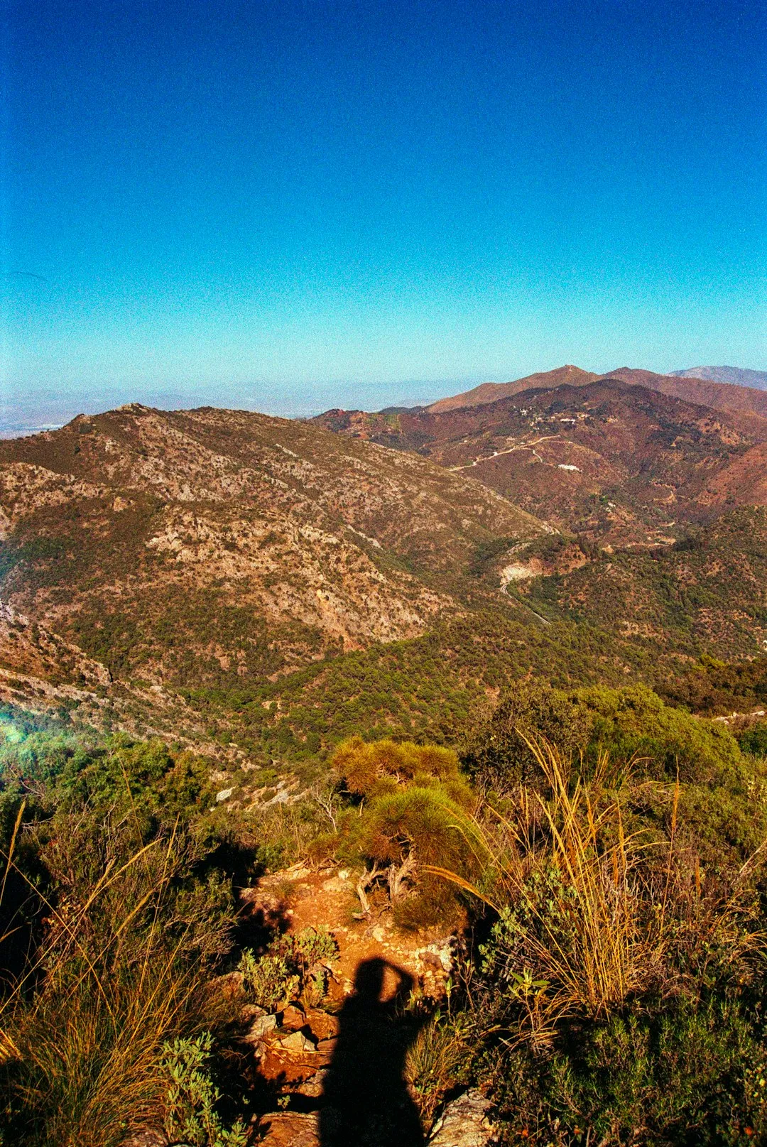
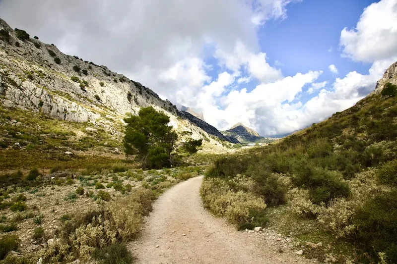
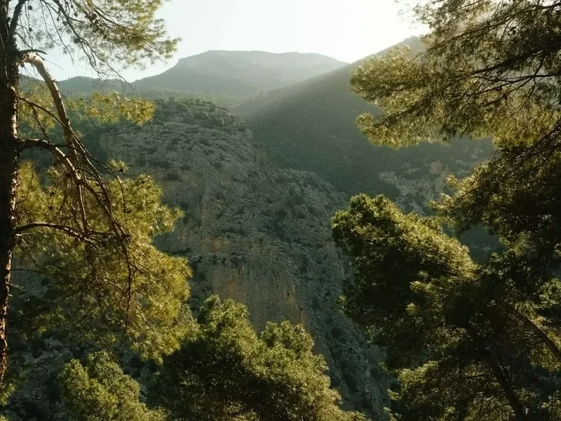
The Sendero Sulayr is not merely a walk; it is an expedition. This extensive trail system, often referred to as the Gran Recorrido GR-240, circumnavigates and penetrates the Sierra Nevada National Park, offering a comprehensive exploration of its varied ecosystems. The route begins in the Alpujarras foothills, a region of whitewashed villages clinging precariously to steep hillsides, and ascends through pine forests and alpine meadows towards the formidable peaks of Mulhacén and Veleta. It then descends towards the Mediterranean coast, showcasing a dramatic transition from high mountain environments to coastal scrubland.
The trail is a testament to the Sierra Nevada's ecological richness. Walkers will encounter a stunning array of flora and fauna, from the endemic wildflowers of the high alpine zones to the hardy shrubs of the arid southern slopes. The geological diversity is equally impressive, with ancient metamorphic rocks forming dramatic peaks and deep glacial valleys. Culturally, the Sendero Sulayr passes through villages that have retained their traditional character for centuries, offering glimpses into the agricultural practices, architecture, and way of life shaped by the mountains.
This is a trail for experienced hikers seeking a significant challenge. The elevation gains are substantial, the distances demanding, and the terrain can be rugged, particularly in the higher sections. However, the rewards are immense: panoramic views that stretch across Andalusia, the profound silence of the high mountains, and the satisfaction of completing a journey through one of Europe's most spectacular and biodiverse mountain ranges.
History and Cultural Context
The Sierra Nevada has been a cradle of human settlement for millennia. Archaeological evidence points to human presence dating back to the Neolithic period, with early inhabitants drawn to the fertile valleys and abundant natural resources. The region's strategic location made it a focal point during various historical periods, most notably under Moorish rule.
During the Nasrid dynasty (13th–15th centuries), the Sierra Nevada became a vital agricultural and defensive territory for the Emirate of Granada. The Moors introduced sophisticated irrigation systems, terraced farming techniques, and new crops, transforming the landscape. The characteristic whitewashed villages of the Alpujarras, with their flat roofs and narrow, winding streets, are a direct legacy of this period, designed to withstand the harsh mountain climate and provide defence.
Following the Reconquista, the Moriscos (Muslims who had converted to Christianity) continued to inhabit the region, maintaining many of their traditions. However, their distinct identity and practices led to persecution and eventual expulsion in the early 17th century, a period that significantly altered the demographic and cultural landscape of the Sierra Nevada.
In more recent times, the Sierra Nevada has been recognised for its unique natural value. The establishment of the Sierra Nevada National Park in 1999 and its designation as a UNESCO World Biosphere Reserve in 1986 underscore its importance for conservation and scientific research. The Sendero Sulayr, as a modern long-distance trail, connects these historical threads, allowing walkers to experience the enduring legacy of past inhabitants alongside the raw, untamed beauty of the natural environment.
Seasonal Highlights and Weather Reality
The Sendero Sulayr's vast altitudinal range means weather conditions can vary dramatically throughout the season. The best time to undertake this challenging trek is from late spring to early autumn, generally from May to October.
Late Spring (May–June): This is an ideal time for the lower and mid-altitudes. Wildflowers are in full bloom, creating vibrant carpets of colour, especially in the Alpujarras and lower mountain slopes. Snowmelt provides ample water, and temperatures are generally pleasant. However, higher passes may still hold snow, requiring careful route planning and potentially specialised gear. The risk of afternoon thunderstorms increases as the month progresses.
Summer (July–August): The high mountain sections are at their most accessible, with snow largely melted from the main peaks. Days are long, offering ample daylight for hiking. However, this is also the hottest period, particularly in the lower valleys and southern slopes, where temperatures can exceed 35°C. Early starts and late finishes are essential to avoid the midday heat. Water sources can become scarce in some areas.
Early Autumn (September–October): This is often considered the prime season for the Sendero Sulayr. The intense summer heat subsides, and the landscape takes on a golden hue. The air is crisp, and visibility is often excellent, offering spectacular views. The risk of snow on the highest passes increases later in October, so early autumn is generally preferred. The villages are less crowded than in mid-summer.
Winter (November–April): The Sendero Sulayr is generally not recommended for hiking during winter months due to heavy snowfall, ice, and extreme cold at higher elevations. The main peaks become a serious mountaineering challenge requiring winter skills, equipment (crampons, ice axe), and experience. Lower sections may be accessible, but snow can persist at mid-altitudes, making navigation difficult and potentially impassable.
Recommended Itinerary
14-Day Sendero Sulayr Itinerary (Challenging Pace)
Day 1: Güéjar Sierra to Refugio Poqueira
- Distance: 20 km
- Elevation gain: 1,500 m
- Time: 7–9 hours
- Start in Güéjar Sierra, ascend through pine forests and open moorland
- Pass the Embalse de Canales (Canales Reservoir)
- Climb towards the high peaks, reaching the Refugio Poqueira (2,500 m)
- First taste of high mountain air and dramatic scenery
Day 2: Refugio Poqueira to Capileira
- Distance: 15 km
- Elevation gain: 300 m, loss: 1,800 m
- Time: 5–7 hours
- Ascend to Mulhacén (3,479 m) - Spain's highest peak
- Descend via Alto del Chorrillo towards Capileira
- Experience the stark beauty of the high alpine environment
- Arrive in the picturesque Alpujarran village of Capileira
Day 3: Capileira to Bubión and Pampaneira
- Distance: 10 km
- Elevation gain: 300 m, loss: 400 m
- Time: 3–4 hours
- Gentle walk between the classic Alpujarran villages
- Explore the unique architecture and culture of these historic settlements
- Opportunity to rest and resupply
Day 4: Capileira to Trevélez
- Distance: 18 km
- Elevation gain: 800 m
- Time: 6–8 hours
- Ascend from Capileira towards Trevélez, one of Spain's highest villages
- Pass through terraced fields and traditional farming landscapes
- Enjoy views of the Poqueira Gorge
Day 5: Trevélez to Cortijo de las Minas
- Distance: 22 km
- Elevation gain: 1,000 m
- Time: 7–9 hours
- Continue eastwards, leaving the main Alpujarran villages behind
- Enter more remote mountain terrain
- Overnight at Cortijo de las Minas (basic accommodation or wild camping)
Day 6: Cortijo de las Minas to Hoya de la Mora
- Distance: 25 km
- Elevation gain: 1,200 m
- Time: 8–10 hours
- Traverse high mountain passes, potentially crossing the Sierra Nevada's central massif
- Pass near Veleta peak (3,396 m)
- Reach the ski resort area of Hoya de la Mora
Day 7: Hoya de la Mora to Barranco de San Juan
- Distance: 20 km
- Elevation gain: 500 m, loss: 1,000 m
- Time: 6–8 hours
- Descend from the high ski area into the northern valleys
- Pass through pine forests and open scrubland
- Camp or stay in basic accommodation near Barranco de San Juan
Day 8: Barranco de San Juan to Güejar Sierra (Return Leg)
- Distance: 18 km
- Elevation gain: 400 m, loss: 900 m
- Time: 5–7 hours
- Complete a loop or section of the GR-240, returning towards Güéjar Sierra
- Revisit familiar landscapes with a new perspective
Day 9: Güejar Sierra to Los Bermejales Reservoir
- Distance: 28 km
- Elevation gain: 800 m, loss: 1,200 m
- Time: 8–10 hours
- Head south-east from Güéjar Sierra, descending towards the foothills
- Pass through agricultural land and drier scrub
- Reach the large Los Bermejales Reservoir
Day 10: Los Bermejales Reservoir to Alhama de Granada
- Distance: 20 km
- Elevation gain: 500 m
- Time: 6–7 hours
- Walk along the reservoir and into the town of Alhama de Granada
- Explore the historic spa town
Day 11: Alhama de Granada to Ventas de Zafarraya
- Distance: 25 km
- Elevation gain: 1,000 m
- Time: 7–9 hours
- Ascend out of Alhama de Granada towards the high plains of Ventas de Zafarraya
- Experience a transition to more arid landscapes
Day 12: Ventas de Zafarraya to El Saltadero
- Distance: 30 km
- Elevation gain: 700 m, loss: 1,500 m
- Time: 9–11 hours
- Long day descending towards the coast
- Pass through varied vegetation zones
- Reach the area of El Saltadero, closer to the Mediterranean
Day 13: El Saltadero to Motril (Coastal Finish)
- Distance: 15 km
- Elevation gain: 300 m, loss: 600 m
- Time: 4–5 hours
- Final push towards the coast
- Arrive near Motril, completing the Sendero Sulayr
Day 14: Rest and Departure
- Relax in Motril or nearby coastal town
- Arrange onward travel
Note: This is a sample itinerary for experienced hikers. It can be extended to 19 days for a more relaxed pace, incorporating rest days and allowing for exploration of villages and side trips. Wild camping is permitted in designated areas outside the National Park boundaries, but always check local regulations.
Planning and Bookings
Book Your Trip
Everything you need to plan your journey
Accommodation
Find places to stay near Granada
Flights
Search flights to Granada
Essential Preparation
The Sendero Sulayr is a serious undertaking requiring meticulous planning. Given its length and varied terrain, fitness is paramount. Hikers should be comfortable with multi-day treks, significant elevation changes, and carrying a pack for extended periods. Base towns like Granada and the Alpujarran villages (Capileira, Bubión, Pampaneira, Trevélez) offer essential services, accommodation, and resupply points. Granada, with its international airport (GRX), is the primary gateway. From Granada, buses run to Güéjar Sierra (trailhead) and various Alpujarran villages. For those starting or ending near the coast, Motril is a key transport hub with bus connections to Granada and Málaga.
Trail Accommodation
Accommodation options vary significantly along the Sendero Sulayr, reflecting its passage through both populated villages and remote wilderness.
Villages: Towns like Güéjar Sierra, Capileira, Bubión, Pampaneira, Trevélez, and Alhama de Granada offer a range of hotels, guesthouses (hostales), and apartments. These provide comfortable lodging, meals, and opportunities to resupply food and gear. Booking in advance is highly recommended, especially during peak season (summer and Easter).
Refuges and Cortijos: Higher mountain sections feature basic refuges (e.g., Refugio Poqueira) and rural farmhouses (cortijos) that may offer simple accommodation. These are often rudimentary, with shared dormitories and limited facilities. Booking is usually essential, even for these basic options.
Campsites: Designated campsites are available in some areas, particularly near reservoirs or in the lower foothills. Wild camping is permitted in many parts of the Sierra Nevada National Park and surrounding areas, but strict regulations apply. Campers must be at least 2 km from any urban centre or established campsite and must not camp in protected zones or near water sources. Always check local regulations and National Park guidelines before wild camping.
What's Provided: Village accommodations typically offer private rooms, en-suite bathrooms, and meals. Mountain refuges usually provide bunks, blankets, and sometimes basic meals or snacks. Wild camping requires carrying all your own equipment.
What's NOT Provided: Huts and refuges generally do not provide cooking equipment, dishes, or toiletries. Food must be carried or purchased in villages. Sleeping bags are essential for all accommodation types.
Seasonal Availability: Most village accommodations are open year-round, though some may have reduced hours or closures outside peak season. Mountain refuges and wild camping are most feasible from late spring to early autumn. High mountain passes can be snow-covered and inaccessible outside this window.
Costs: Village accommodation can range from €30-€100+ per night depending on the establishment. Basic refuges might cost €15-€30 per night. Campsite fees vary. Wild camping is free but requires self-sufficiency.
Required Gear
- Sturdy hiking boots: Waterproof, well broken-in, with good ankle support.
- Backpack: 50-70 litre capacity, with a comfortable hip belt and rain cover.
- Tent: Lightweight, durable, and waterproof, suitable for varied conditions (if wild camping).
- Sleeping bag: Rated for temperatures down to 0°C or lower, depending on altitude and season.
- Sleeping mat: For insulation and comfort, especially if wild camping.
- Waterproof jacket and trousers: Breathable and fully waterproof (Gore-Tex or similar).
- Warm layers: Fleece jacket, down or synthetic insulated jacket, thermal base layers (merino wool or synthetic).
- Head torch: With spare batteries.
- Navigation tools: Map of the Sierra Nevada (1:25,000 scale recommended), compass, and a GPS device or smartphone with offline maps.
- First-aid kit: Comprehensive, including blister treatment, pain relievers, antiseptic wipes, bandages, and any personal medications.
- Sun protection: High SPF sunscreen, sunglasses, wide-brimmed hat or cap.
- Trekking poles: Highly recommended for steep ascents and descents.
- Water bottles or hydration reservoir: Minimum 2-3 litre capacity.
- Water filter or purification tablets.
What to Bring
- Food: Sufficient for several days between resupply points. Lightweight, high-energy options like dried meals, nuts, dried fruit, energy bars, and jerky.
- Cooking equipment: Lightweight stove, fuel, pot, utensils, mug, plate/bowl.
- Toiletries: Biodegradable soap, toothbrush, toothpaste, toilet paper, hand sanitiser, quick-dry towel.
- Personal items: Camera, power bank for electronics, book or journal, insect repellent (especially for lower altitudes in summer).
- Cash: For villages where card payment may not be accepted.
- Identification and emergency contact details.
- Small repair kit: Duct tape, needle and thread, safety pins.
Permits
The Sendero Sulayr, as a long-distance trail primarily traversing public lands and passing through villages, generally does not require specific permits for hiking. However, access to certain areas within the Sierra Nevada National Park may be subject to regulations, particularly concerning vehicle access and camping.
National Park Regulations: While walking the trails is generally free, it is crucial to be aware of the rules within the Sierra Nevada National Park. These typically include:
- Camping: Wild camping is restricted. Designated camping areas or authorised campsites must be used. Camping is generally prohibited within 2 km of urban areas and along marked trails. Always consult the official National Park website for the most current regulations.
- Fires: Open fires are strictly prohibited in most areas of the park due to the high risk of wildfires.
- Waste Disposal: All litter must be packed out. Leave no trace of your presence.
- Flora and Fauna: Do not disturb or collect plants or animals.
Vehicle Access: Access to certain high-altitude areas, such as the road to Veleta and Mulhacén (often closed to private vehicles in summer), may require special permits or the use of public transport/shuttles. Check with the National Park authorities for current access restrictions.
Accommodation Bookings: While not a permit, booking accommodation in advance, especially in popular villages and mountain refuges, is essential and effectively secures your place on the trail during busy periods.
Recommendation: Before your trip, visit the official website of the Sierra Nevada National Park (Parque Nacional de Sierra Nevada) for the most up-to-date information on regulations, access, and any specific requirements that may apply to your chosen route and season.
Other Activities in the Area
The Sierra Nevada and its surrounding regions offer a wealth of activities beyond hiking:
- Skiing and Snowboarding: During winter months, the Sierra Nevada ski resort is a major destination, offering excellent slopes and facilities.
- Cultural Tourism in Granada: Explore the magnificent Alhambra palace, the historic Albaicín quarter, and enjoy the vibrant tapas culture of this historic city.
- Visiting Alpujarran Villages: Spend time exploring the unique architecture, local crafts, and gastronomy of villages like Pampaneira, Bubión, and Capileira.
- Canyoning and Rock Climbing: The rugged terrain and numerous gorges provide opportunities for adventure sports.
- Stargazing: The Sierra Nevada's high altitudes and low light pollution make it an excellent location for astronomical observation.
- Cycling: Numerous routes cater to road cyclists and mountain bikers, offering challenging climbs and scenic descents.
- Exploring the Costa Tropical: The southern slopes lead to the Mediterranean coast, offering beaches, water sports, and charming coastal towns like Salobreña and Almuñécar.
- Olive Oil Tasting: The region is a significant producer of olive oil; many local producers offer tours and tastings.
Safety and Conditions
Weather: Mountain weather is notoriously unpredictable. Be prepared for rapid changes, including sudden storms, strong winds, and temperature drops, even in summer. Always check the forecast before setting out and be ready to alter your plans.
Altitude Sickness: The Sendero Sulayr reaches significant altitudes (over 3,400 m). Acclimatise gradually, stay hydrated, and be aware of the symptoms of altitude sickness (headache, nausea, dizziness). Descend if symptoms worsen.
Navigation: While the Sendero Sulayr is marked as GR-240, some sections may be less clear, especially in higher alpine areas or during poor visibility. Carry a map, compass, and GPS device, and know how to use them. Inform someone of your itinerary and expected return time.
Water Sources: Water is generally plentiful from snowmelt and springs in the higher mountains during spring and early summer. However, sources can dry up in late summer and autumn, especially at lower altitudes. Always treat water from natural sources.
Terrain: The trail includes steep ascents and descents, rocky paths, scree slopes, and potentially snowfields early in the season. Sturdy footwear and trekking poles are essential. Be cautious on loose or slippery surfaces.
Wildlife: While large dangerous animals are rare, be aware of potential encounters with wild boar or snakes. Respect all wildlife and maintain a safe distance.
Emergency: The emergency number in Spain is 112. Ensure you have a fully charged mobile phone, but be aware that signal coverage can be intermittent in remote mountain areas. Consider carrying a personal locator beacon (PLB) for remote sections.
Physical Fitness: This trail is demanding. Ensure you are physically prepared for long days of hiking with significant elevation changes. Train adequately beforehand.
Side Trips and Points of Interest
Mulhacén Summit (3,479 m): The highest peak in mainland Spain. A challenging but rewarding ascent from Refugio Poqueira or via the southern slopes. The panoramic views from the summit are unparalleled, stretching across Andalusia and on clear days, towards North Africa.
Veleta Summit (3,396 m): The second-highest peak, often accessible via a more direct route from the Hoya de la Mora area. The views are equally spectacular, and the summit area is a popular destination for day-trippers from the ski resort.
Siete Lagunas: A stunning glacial cirque featuring seven pristine lakes, located on the southern slopes of Mulhacén. A beautiful detour offering a different perspective on the high mountain landscape.
The Alpujarran Villages: Beyond Capileira, Bubión, and Pampaneira, explore other charming villages like Pitres, Ferreirola, and Mecina Alfahar. Each has its own character, traditional architecture, and local crafts.
Trevélez: Famous for its cured ham (jamón serrano), Trevélez is one of the highest villages in Spain. Visiting a local producer to sample the ham is a culinary highlight.
Alhama de Granada: A historic spa town known for its thermal baths and Moorish architecture. The town offers a welcome break and a chance to experience Andalusian culture.
Embalse de Canales: The large reservoir near Güéjar Sierra provides scenic views and is a popular spot for local recreation.
Leave No Trace

The Sendero Sulayr traverses a fragile ecosystem, including the Sierra Nevada National Park, a UNESCO World Biosphere Reserve. Adhering to Leave No Trace principles is crucial to preserving this environment for future generations.
Plan Ahead and Prepare: Research your route, understand the terrain and weather, and pack appropriately. Know the regulations for camping and fires.
Travel and Camp on Durable Surfaces: Stick to marked trails to avoid damaging vegetation. When camping, use established campsites or durable surfaces like rock or dry grass, at least 2 km from water sources and settlements.
Dispose of Waste Properly: Pack out everything you pack in, including food scraps, wrappers, and toilet paper. Use designated toilets where available, or dig catholes 60-70 metres away from water, trails, and campsites.
Leave What You Find: Do not remove or disturb natural objects, plants, or cultural artifacts. Take only photographs, leave only footprints.
Minimize Campfire Impacts: Campfires are generally prohibited in the Sierra Nevada. If permitted in specific areas, use existing fire rings and keep fires small. Ensure they are completely out before leaving.
Respect Wildlife: Observe animals from a distance. Never feed them, as it can disrupt their natural behaviour and diet. Store food securely to prevent attracting animals.
Be Considerate of Other Visitors: Keep noise levels down, yield to other hikers, and respect the wilderness experience of others.