St. Olavs Way - The Pilgrim's Path to the North
St. Olavs Way, specifically the Gudbrandsdalsleden, is Norway's most iconic pilgrimage route—a 643-kilometre odyssey that stretches from the urban heart of Oslo to the soaring spires of Nidaros Cathedral in Trondheim. This is not merely a hike; it is a journey through the historical and spiritual marrow of Scandinavia. Following the footsteps of medieval pilgrims who have traversed these lands since the year 1031, the trail weaves through a tapestry of diverse landscapes: from the fertile agricultural plains of Eastern Norway and the tranquil shores of Lake Mjøsa to the rugged, windswept alpine plateaus of the Dovrefjell mountains. It is a path defined by its connection to King Olav Haraldsson, the patron saint of Norway, whose legacy transformed the nation from a collection of Viking chiefdoms into a unified Christian kingdom. For the modern walker, St. Olavs Way offers a rare opportunity to disconnect from the digital world and engage with a slower, more intentional pace of life, crossing ancient stone bridges, resting in medieval stave churches, and experiencing the legendary hospitality of Norwegian farmsteads.
- Distance: 643.0 km one-way
- Duration: 30 days
- Season: June to September (high mountain passes may be snow-covered outside this window)
- Accommodation: Pilgrim hostels, historic farms, campsites, and mountain huts
- Highest point: Dovrefjell plateau (approximately 1,300 m)
- Difficulty: Moderate (requires high endurance for long-distance walking)
- Direction: South to North (Oslo to Trondheim)
Overview
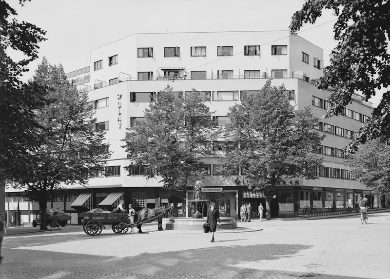
The Gudbrandsdalsleden is the main artery of the St. Olav Ways, a network of pilgrimage routes crisscrossing Scandinavia. Spanning 643 kilometres, it represents a formidable physical challenge that rewards the traveller with an unparalleled cross-section of Norwegian geography and culture. The route is traditionally divided into several distinct geographical stages, each with its own character and demands. The initial stages out of the Oslo region lead through the rolling hills of Romerike, where the path is often lined with wildflowers and traditional red-painted barns. As the trail moves north, it hugs the eastern shore of Lake Mjøsa, Norway's largest lake, providing wide-open vistas and gentle gradients that allow the body to adapt to the rigours of long-distance trekking.
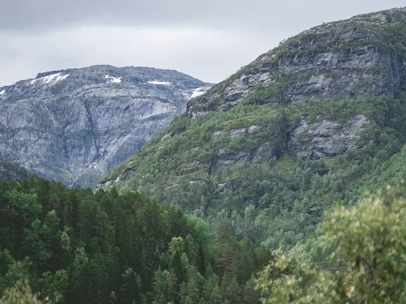
The heart of the journey lies in the Gudbrandsdalen valley, often referred to as the "King of Valleys." Here, the trail follows the Lågen River, passing through historic villages where the architecture has remained largely unchanged for centuries. The ascent into the Dovrefjell mountains marks the most dramatic transition of the trip. The lush greenery of the valley floor gives way to a stark, sub-arctic tundra where the air is crisp and the horizon is dominated by the massive silhouette of Snøhetta. This is the realm of the musk ox and the wild reindeer, a place where the weather can shift from brilliant sunshine to biting sleet in a matter of minutes. The final descent through the forests of Trøndelag brings a sense of approaching triumph, culminating in the sight of Trondheim and the Nidaros Cathedral, the traditional end-point where the remains of St. Olav are interred.
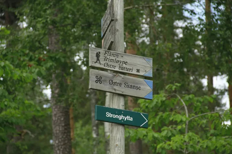
Walking St. Olavs Way is an exercise in endurance and mindfulness. Unlike many mountain trails that focus solely on wilderness, this pilgrimage is a "cultural landscape" trail. You will walk through working farms, past modern suburbs, and along ancient royal roads. The infrastructure is well-developed, with the iconic "St. Olav's Cross" (a combination of a cloverleaf and a cross) marking the way at frequent intervals. Whether undertaken for spiritual reasons, historical interest, or the simple love of the Great Outdoors, the trail provides a profound sense of accomplishment and a deep connection to the heritage of the North.
History and Cultural Context
The history of St. Olavs Way is inextricably linked to the life and death of King Olav Haraldsson. Born in 995, Olav was a Viking chieftain who sought to unify Norway under a single crown and the Christian faith. His reign was tumultuous, and he was eventually forced into exile in Kievan Rus. In 1030, he returned to Norway to reclaim his throne but was killed at the Battle of Stiklestad on 29 July. Shortly after his death, reports of miracles began to circulate. His body was moved to Nidaros (modern-day Trondheim), and when his coffin was opened a year later, his hair and nails had allegedly grown, and his body emitted a sweet fragrance. He was canonised as a saint, and Nidaros became the most important pilgrimage site in Northern Europe, rivaling Santiago de Compostela, Rome, and Jerusalem.
For nearly five hundred years, thousands of pilgrims from across Europe flocked to Nidaros. They travelled by boat and by foot, seeking healing, penance, or spiritual enlightenment. This golden age of pilgrimage came to an abrupt end with the Protestant Reformation in 1537. The veneration of saints was banned, the pilgrim hostels were closed, and the practice of pilgrimage was strictly forbidden by law. The ancient paths were largely forgotten, reclaimed by the forest or incorporated into the modern road network.
The modern revival of St. Olavs Way began in the late 20th century, inspired by the resurgence of the Camino de Santiago in Spain. In 1997, the route from Oslo to Trondheim was officially reopened by Crown Prince Haakon. In 2010, the St. Olav Ways were designated as a Cultural Route of the Council of Europe. Today, the trail serves as a bridge between the medieval past and the modern present. It is a living museum where walkers can visit the ruins of Hamar Cathedral, stay in 18th-century timber lofts, and participate in the "Olavsfest" in Trondheim, a week-long festival of music and culture that coincides with St. Olav's Day (Olsok) on 29 July. The cultural significance of the trail is protected by the National Pilgrim Centre, ensuring that the heritage of the route is preserved for future generations of "peregrini."
Want more background? Read extended notes on history and cultural context → Learn more
Seasonal Highlights and Weather Reality
The window for walking the full St. Olavs Way is relatively narrow due to Norway's northern latitude and the high elevation of the Dovrefjell plateau. The official season runs from early June to mid-September. Outside of this period, snow can make the mountain sections impassable for those without advanced winter trekking skills and equipment.
June: This is the month of the "Midnight Sun" in the northern reaches and exceptionally long days in the south. The landscape is at its most vibrant, with spring flowers in full bloom and waterfalls thundering with snowmelt. However, some snow may still linger on the highest passes of Dovrefjell, and the ground can be boggy in places. Mosquitoes can be prevalent in the forest sections during late June.
July: The most popular month for pilgrims. The weather is generally at its warmest, with temperatures ranging from 15°C to 25°C in the valleys. This coincides with the Olavsfest in Trondheim, making it a festive time to arrive. However, accommodation can be busier, and booking ahead is recommended for popular hostels. This is also the peak season for the famous Norwegian "summer rain," so high-quality waterproofs are essential.
August: A fantastic time to walk, as the weather remains stable but the intense heat of mid-summer begins to fade. The berries (blueberries and cloudberries) are ripe for picking along the trail, and the heather begins to turn purple on the mountainsides. The nights start to get darker, providing a better chance of sleep for those sensitive to the 24-hour daylight of June.
September: Early September offers crisp air and stunning autumn colours (the "fjellfarger"). The crowds have thinned, and the atmosphere is peaceful. However, the risk of early snowfall on the plateaus increases significantly after the first week of September, and many seasonal pilgrim hostels begin to close by the 15th of the month. Temperatures can drop below freezing at night in the mountains.
Recommended Itinerary
30-Day St. Olavs Way Itinerary (Gudbrandsdalsleden)
Day 1: Oslo to Skedsmo
- Distance: 24 km
- Elevation gain: 300 m
- Time: 6–7 hours
- Start at Oslo Cathedral (Oslo Domkirke)
- Walk through the urban outskirts and into the forests of Groruddalen
- Key waypoint: The ruins of Margaretakirken in Maridalen
Day 2: Skedsmo to Arteid
- Distance: 22 km
- Elevation gain: 150 m
- Time: 5–6 hours
- Rolling agricultural landscape of Romerike
- Pass through historic farmsteads and open fields
Day 3: Arteid to Jessheim/Ullensaker
- Distance: 18 km
- Elevation gain: 100 m
- Time: 4–5 hours
- Easy walking on gravel paths and quiet roads
- Visit the Raknehaugen burial mound, the largest in Northern Europe
Day 4: Jessheim to Eidsvoll
- Distance: 28 km
- Elevation gain: 200 m
- Time: 7–8 hours
- Arrive at Eidsvoll, the site of the signing of the Norwegian Constitution
- Key waypoint: Eidsvoll Church
Day 5: Eidsvoll to Espa
- Distance: 25 km
- Elevation gain: 400 m
- Time: 6–7 hours
- The trail enters the woods and begins to follow the eastern side of Lake Mjøsa
- Steeper sections as the trail climbs above the lake level
Day 6: Espa to Tangen
- Distance: 18 km
- Elevation gain: 150 m
- Time: 4–5 hours
- Beautiful views over Lake Mjøsa
- Forest paths and lakeside walking
Day 7: Tangen to Hamar
- Distance: 26 km
- Elevation gain: 100 m
- Time: 6–7 hours
- Arrive in the city of Hamar
- Key waypoint: The Glass Cathedral (Hedmark Museum) covering the medieval ruins
Day 8: Hamar to Brumunddal
- Distance: 18 km
- Elevation gain: 120 m
- Time: 4–5 hours
- Walking through the "breadbasket" of Norway
- Pass the world's tallest timber building, Mjøstårnet
Day 9: Brumunddal to Moelv
- Distance: 20 km
- Elevation gain: 250 m
- Time: 5–6 hours
- Mix of forest trails and agricultural roads
- Key waypoint: Ringsaker Church, a beautiful stone church from the 1100s
Day 10: Moelv to Lillehammer
- Distance: 28 km
- Elevation gain: 350 m
- Time: 7–8 hours
- Arrive in the Olympic city of Lillehammer
- Key waypoint: Maihaugen open-air museum
Day 11: Lillehammer to Øyer
- Distance: 20 km
- Elevation gain: 400 m
- Time: 5–6 hours
- Entering the Gudbrandsdalen valley
- Steep climb out of Lillehammer with great views back to the lake
Day 12: Øyer to Tretten
- Distance: 22 km
- Elevation gain: 300 m
- Time: 6–7 hours
- Following the valley side through traditional farms
- Key waypoint: Skarsmoen pilgrim hostel
Day 13: Tretten to Fåvang
- Distance: 24 km
- Elevation gain: 350 m
- Time: 6–7 hours
- The valley narrows; the Lågen river becomes a constant companion
- Key waypoint: Fåvang Stave Church (rebuilt in the 1600s using medieval materials)
Day 14: Fåvang to Ringebu
- Distance: 15 km
- Elevation gain: 200 m
- Time: 4 hours
- A shorter day to allow for rest and exploration
- Key waypoint: Ringebu Stave Church, one of the finest in Norway
Day 15: Ringebu to Hundorp
- Distance: 18 km
- Elevation gain: 150 m
- Time: 4–5 hours
- Key waypoint: Dale-Gudbrand’s Farm, a site of great historical significance where St. Olav met the local chieftain
Day 16: Hundorp to Vinstra
- Distance: 22 km
- Elevation gain: 300 m
- Time: 6–7 hours
- Walking through the land of Peer Gynt
- Key waypoint: Sødorp Church
Day 17: Vinstra to Kvam
- Distance: 15 km
- Elevation gain: 100 m
- Time: 4 hours
- Easy valley walking
- Key waypoint: The Sinclair Monument (commemorating the Battle of Kringen)
Day 18: Kvam to Otta
- Distance: 28 km
- Elevation gain: 600 m
- Time: 8–9 hours
- A challenging day with significant elevation gain as the trail climbs high above the valley floor
- Spectacular views of the Rondane mountains
Day 19: Otta to Dovre
- Distance: 26 km
- Elevation gain: 450 m
- Time: 7–8 hours
- The landscape begins to change as you approach the mountains
- Key waypoint: Dovre Church (the "Zion of the North")
Day 20: Dovre to Budsjord
- Distance: 12 km
- Elevation gain: 400 m
- Time: 3–4 hours
- Short but steep climb to the historic farm of Budsjord
- Budsjord is the last stop before the high mountain crossing
Day 21: Budsjord to Hjerkinn (Dovrefjell)
- Distance: 28 km
- Elevation gain: 800 m
- Time: 9–10 hours
- The most iconic and difficult stage
- Crossing the Dovrefjell plateau; high alpine environment
- Key waypoint: Allmannstua shelter
Day 22: Hjerkinn to Kongsvold
- Distance: 12 km
- Elevation gain: 100 m
- Time: 3–4 hours
- Walking through the heart of the Musk Ox territory
- Key waypoint: Kongsvold Fjeldstue, a historic mountain lodge
Day 23: Kongsvold to Ryphusan
- Distance: 20 km
- Elevation gain: 300 m
- Time: 6–7 hours
- Continuing across the high plateau
- Stay in the simple, unstaffed Ryphusan pilgrim cabin
Day 24: Ryphusan to Oppdal
- Distance: 28 km
- Elevation gain: 100 m (mostly descent)
- Time: 7–8 hours
- Long descent from the mountains into the town of Oppdal
- Key waypoint: Vang burial ground
Day 25: Oppdal to Rennebu
- Distance: 26 km
- Elevation gain: 300 m
- Time: 7–8 hours
- Entering the Trøndelag region
- Key waypoint: Rennebu Church, a unique Y-shaped church
Day 26: Rennebu to Meldal
- Distance: 24 km
- Elevation gain: 250 m
- Time: 6–7 hours
- Forest paths and rural roads
- Key waypoint: Meldal Church
Day 27: Meldal to Skaun
- Distance: 28 km
- Elevation gain: 400 m
- Time: 8–9 hours
- Hilly terrain through dense forests
- Key waypoint: Skaun Church, a medieval stone church
Day 28: Skaun to Øysand
- Distance: 20 km
- Elevation gain: 150 m
- Time: 5–6 hours
- Approaching the coast and the Trondheim Fjord
- Key waypoint: The view of the fjord from the final ridge
Day 29: Øysand to Trondheim (The Final Approach)
- Distance: 22 km
- Elevation gain: 200 m
- Time: 6–7 hours
- Walking through the suburbs of Trondheim
- Key waypoint: The view of the cathedral from Feginsbrekka (the Hill of Joy)
Day 30: Arrival at Nidaros Cathedral
- Distance: 2 km
- Elevation gain: 0 m
- Time: 1 hour
- Final walk to the West Front of Nidaros Cathedral
- Receive the Olav Letter (pilgrim certificate) at the Pilgrim Centre
- Attend the pilgrim service in the cathedral
Planning and Bookings
Book Your Trip
Everything you need to plan your journey
Accommodation
Find places to stay near Oslo
Flights
Search flights to Oslo
Essential Preparation
Walking 643 kilometres requires significant physical and mental preparation. You should be capable of walking 20–25 kilometres per day with a 10–12 kg pack for multiple consecutive days. Training should include long walks on varied terrain (asphalt, gravel, and forest trails) to toughen the feet and test your footwear. Logistics are relatively straightforward compared to remote wilderness treks, as the trail passes through towns with supermarkets and pharmacies every 1–3 days.
The most important logistical item is the Pilgrim Passport (Pilegrimspass). This document allows you to stay at dedicated pilgrim hostels and entitles you to the Olav Letter upon completion of the final 100 km. Passports can be purchased at the Pilgrim Centre in Oslo or ordered online. It is also highly recommended to download the "St. Olavs Way" app or carry the official guidebook by Westvig, which provides detailed maps and accommodation listings.
Trail Accommodation
Accommodation on St. Olavs Way is diverse, ranging from simple unstaffed cabins to luxury historic hotels. During the peak season (July), it is wise to book at least 24–48 hours in advance.
Types of Accommodation:
- Pilgrim Hostels: Often located in parish halls, old schoolhouses, or converted barns. These provide basic dormitory-style beds, shared kitchens, and showers. Costs range from 200 to 400 NOK per night.
- Historic Farms: Many farms along the Gudbrandsdalen valley offer "Stabbur" (traditional storehouse) accommodation. These are often very atmospheric and include home-cooked meals. Costs are higher (800–1,200 NOK including food).
- Mountain Huts: In the Dovrefjell section, you will stay in DNT (Norwegian Trekking Association) huts or private mountain lodges like Kongsvold. DNT huts require a membership for the best rates.
- Camping: Under Norway's "Allemannsretten" (Right to Roam), you can camp almost anywhere in the wilderness for free, provided you are at least 150 metres from the nearest inhabited house. There are also many commercial campsites with facilities along the route.
Facilities: Most hostels provide a mattress and pillow, but you must bring your own sleeping bag or liner. Kitchens are usually equipped with pots, pans, and stoves. WiFi is common in towns but non-existent in the mountain cabins.
Required Gear
- Footwear: High-quality trekking boots or sturdy trail runners. The terrain is varied; boots provide better ankle support for Dovrefjell, while trail runners are more comfortable for the long asphalt/gravel sections in the south.
- Backpack: 35–50 litres is sufficient. Ensure it has a high-quality harness and a rain cover.
- Rain Gear: A professional-grade waterproof jacket and trousers (Gore-Tex or similar). Norway is famous for sudden, heavy rain.
- Clothing: The layering system is essential. Include merino wool base layers (even in summer), a fleece or down mid-layer, and quick-drying trekking trousers. Avoid cotton.
- Navigation: A GPS-enabled smartphone with offline maps (Norgeskart or Gaia GPS) and a physical map or guidebook as a backup.
- First Aid: Focus on foot care. Bring plenty of Compeed (blister plasters), Leukotape, and antiseptic cream.
What to Bring
- Pilgrim Passport: Essential for hostel access and stamps.
- Sleeping System: A lightweight sleeping bag (comfort rating 5°C) or a silk liner if staying exclusively in hostels with bedding.
- Water Bottle: 1.5–2 litre capacity. Tap water in Norway is some of the cleanest in the world, and mountain streams are generally safe to drink from (though a filter like a Sawyer Squeeze provides peace of mind).
- Power Bank: To keep your phone charged for navigation, especially in the mountains.
- Toiletries: Biodegradable soap/shampoo, a quick-dry travel towel, and sunblock (the northern sun is stronger than it feels).
- Food: While you can buy food daily in the south, you must carry 2–3 days of supplies for the Dovrefjell crossing. Dried trekking meals are efficient for these sections.
Permits
One of the great joys of trekking in Norway is the lack of bureaucratic hurdles. There are no permits required to walk St. Olavs Way, and there are no daily quotas or "lottery" systems for the trail itself. The path is open to everyone at all times.
The Pilgrim Passport: While not a "permit" in the legal sense, the Pilgrim Passport is the essential document for the journey. It costs approximately 50 NOK and serves as your record of the trip. You collect stamps (stempler) at churches, hostels, and grocery stores along the way. To receive the Olav Letter in Trondheim, you must document that you have walked at least the final 100 kilometres (from Oppdal) or cycled the final 200 kilometres.
Dovrefjell National Park Regulations: While no permit is needed to enter the park, there are strict rules regarding wildlife. You must maintain a minimum distance of 200 metres from musk oxen. These are unpredictable animals that can charge at 60 km/h. If you encounter them on the trail, you must take a wide detour. Drones are generally prohibited in the national park areas to protect birdlife and reindeer.
Fishing Permits: If you plan to fish in the lakes or rivers along the trail, you must purchase a local fishing permit (fiskekort), which can usually be bought online via Inatur.no or at local petrol stations.
Other Activities in the Area
Norway offers a wealth of experiences that can be integrated into your pilgrimage or enjoyed as a reward at the end:
- Musk Ox Safaris: While in Hjerkinn or Kongsvold, join a guided tour to see these prehistoric creatures safely. It is one of the few places in the world where they can be seen in the wild.
- Nidaros Cathedral Tour: Spend a full day in Trondheim exploring the cathedral's crypt, climbing the tower for city views, and visiting the Archbishop's Palace Museum to see the Crown Regalia.
- Lake Mjøsa Paddle: Rent a kayak in Hamar or Lillehammer to experience the trail's landscape from the water.
- The Skibladner: Take a trip on the world's oldest operating paddle steamer, which sails on Lake Mjøsa. It is a beautiful way to rest your legs for a few hours.
- Rock Climbing in Oppdal: Known as one of Norway's premier outdoor hubs, Oppdal offers excellent climbing and rafting opportunities for those with energy left.
- Trondheim Food Scene: Trondheim was the European Region of Gastronomy in 2022. Reward yourself with a meal at one of the city's Michelin-starred restaurants or explore the local food hall, Mathallen.
Safety and Conditions
Weather Awareness: The primary safety concern on St. Olavs Way is the weather, particularly in the Dovrefjell mountains. Even in July, temperatures can drop to near freezing, and heavy fog can reduce visibility to a few metres. Always check the mountain forecast on Yr.no before heading out. If the forecast predicts high winds or heavy snow, stay in the valley or wait at a mountain lodge.
Terrain and Road Safety: A significant portion of the southern section (Oslo to Lillehammer) involves walking on or near roads. While these are mostly quiet country lanes, always walk on the left side facing traffic and wear high-visibility gear or a reflective strip on your pack, especially in overcast conditions.
Wildlife: Beyond the musk oxen mentioned previously, Norway has populations of brown bears and wolves, but these are extremely shy and rarely seen. The most common "dangerous" animal is the tick, which can carry Lyme disease or TBE. Check your body every evening and remove any ticks immediately with tweezers.
Emergency Services: The emergency number in Norway is 113 for medical emergencies and 112 for police. Mobile coverage is excellent along 90% of the trail, but there are "dead zones" in the deep valleys of Dovrefjell. Carrying a satellite messenger (like a Garmin inReach) is recommended for solo walkers in the mountain sections.
Side Trips and Points of Interest
Snøhetta Viewpoint (Tverrfjellhytta): Located near Hjerkinn, this award-winning architectural pavilion offers a stunning view of the Snøhetta massif. It is a short 1.5 km walk from the car park and is a must-visit for its design and the chance to spot wild reindeer through the floor-to-ceiling windows.
The Ruins of Hamar Cathedral: Encased in a massive glass and steel structure to prevent further erosion, these medieval ruins are hauntingly beautiful. The acoustics inside are world-famous, and if you are lucky, you might catch a choir rehearsal.
Lillehammer Olympic Park: Visit the ski jump used in the 1994 Winter Olympics. You can take a chairlift to the top for a panoramic view of the city and the start of the Gudbrandsdalen valley.
Stiklestad National Cultural Centre: While not directly on the main Gudbrandsdalsleden (it is on the St. Olav Waterway/Stiklestadleden), many pilgrims take a train or bus from Trondheim to visit the site where St. Olav actually fell in battle. It features a medieval farm, a beautiful stone church, and an amphitheatre.
The Old Town Bridge (Gamle Bybro): Known as the "Portal of Happiness," this red wooden bridge in Trondheim is the traditional entrance to the city for pilgrims. It offers the classic view of the colourful wharves lining the Nidelva river.
Leave No Trace
Norway's wilderness is pristine, and the "Right to Roam" comes with a heavy responsibility to protect the environment. The St. Olavs Way passes through many sensitive ecosystems, including alpine tundra that takes decades to recover from trampling.
Core Principles for the Trail:
- Stick to the Path: In the mountains, avoid creating "social trails" which lead to erosion. In agricultural areas, stay on the marked path to avoid damaging crops.
- Waste Management: Pack out all rubbish, including organic waste like banana skins or apple cores, which decompose slowly in the cold northern climate. Use toilets in hostels or towns whenever possible. If you must go in the woods, dig a "cathole" 20 cm deep and at least 50 metres from water.
- Respect Private Property: While you have the right to walk, you do not have the right to disturb the peace of farm owners. Close all gates behind you to prevent livestock from escaping.
- Fire Safety: From 15 April to 15 September, open fires are strictly prohibited in or near forests and uncultivated land in Norway. Use a camping stove for cooking.
- Protect Water Sources: Do not wash yourself or your dishes directly in streams. Carry water 30 metres away and use biodegradable soap.