St. Olav Ways - The Pilgrim's Path Through the Heart of Norway
The St. Olav Ways, specifically the Gudbrandsdalsleden, represents the most iconic pilgrimage route in Scandinavia, stretching 643 kilometres from the historic ruins of Oslo to the magnificent Nidaros Cathedral in Trondheim. This is not merely a long-distance hike; it is a journey through the cultural and geographical spine of Norway. Following the footsteps of medieval pilgrims who travelled to the shrine of Saint Olav, the eternal King of Norway, the trail traverses a staggering variety of landscapes—from the urban sprawl of the capital and the fertile agricultural plains of the south to the rugged, windswept plateaus of the Dovrefjell mountains and the deep, forested valleys of Trøndelag. It is a path that demands physical endurance, offering 15,000 metres of cumulative elevation gain over approximately 30 days of walking, but rewards the traveller with a profound sense of connection to Norwegian history, folklore, and the raw power of the Nordic wilderness.
- Distance: 643.0 km one-way
- Duration: 30 days
- Season: June to September (Dovrefjell section can be snow-covered outside this window)
- Accommodation: Pilgrim hostels, historic farms, mountain lodges, and churches
- Highest point: Dovrefjell plateau (approximately 1,300 m)
- Difficulty: Moderate (high endurance required due to distance)
- Direction: South to North (Oslo to Trondheim)
Overview
The St. Olav Ways (Gudbrandsdalsleden) is often referred to as the "Camino of the North," yet it offers a distinctly different experience from its southern counterparts. Where the Camino de Santiago is defined by sun-drenched Spanish plains and bustling social hubs, the St. Olav Way is defined by the quiet majesty of the Norwegian landscape and a deep, introspective solitude. The route is a masterclass in ecological transition. It begins in the Oslofjord region, winding through the historic Gamlebyen (Old Town) before heading north through the lush, rolling hills of Romerike. As the trail progresses, it skirts the eastern shores of Lake Mjøsa, Norway's largest lake, providing vistas of sparkling water and traditional red-painted farmsteads.
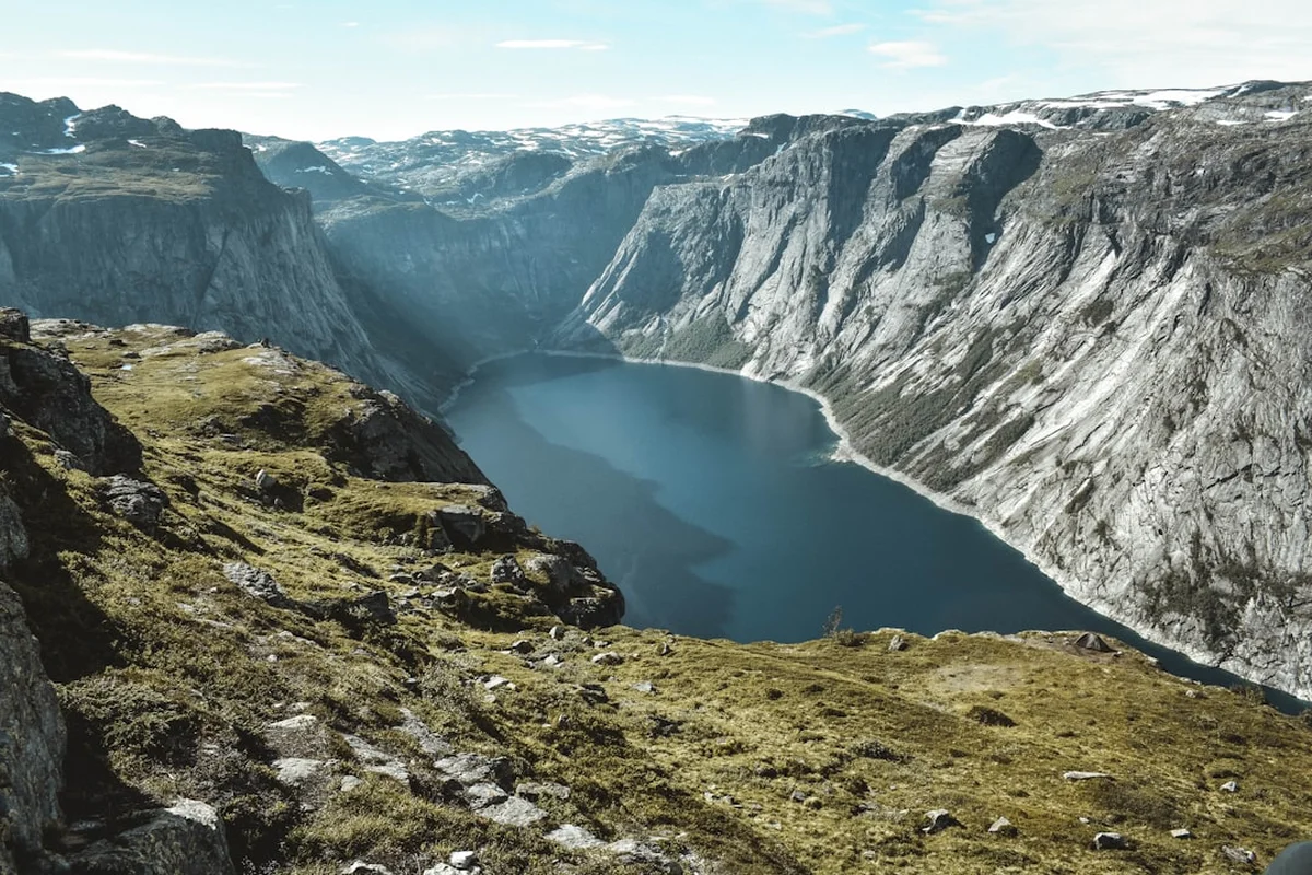
The middle section of the journey takes walkers through the Gudbrandsdalen valley, the "King of Valleys," where the cultural heritage of Norway is most palpable. Here, the trail follows ancient roads used by kings and commoners alike for over a millennium. The true physical and spiritual climax of the route occurs as the path ascends onto the Dovrefjell mountain plateau. This is a wild, treeless expanse where the weather can turn in an instant and where the rare musk ox still roams. The final descent through the forests of Trøndelag brings a softening of the landscape, leading eventually to the spires of Nidaros Cathedral, the northernmost medieval cathedral in the world and the traditional burial place of Saint Olav.
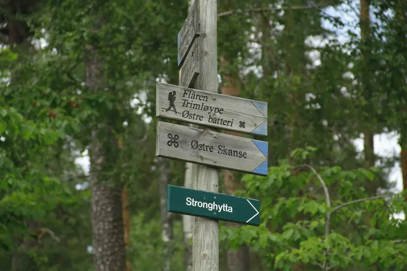
Walking the St. Olav Way is an exercise in pacing. While the terrain is rarely technical, the sheer distance requires a disciplined approach to physical care and logistics. The trail is well-marked with the distinctive red "St. Olav's Cross" logo, but the remote nature of certain sections—particularly across Dovrefjell—means that walkers must be self-sufficient and prepared for the unpredictable Norwegian climate. Whether undertaken for spiritual reasons, historical interest, or the simple love of long-distance trekking, the St. Olav Way provides a unique window into the soul of Norway.
History and Cultural Context
The history of the St. Olav Ways is inextricably linked to the life and death of King Olav Haraldsson, who reigned from 1015 to 1028. Olav was a pivotal figure in the Christianisation of Norway, a process he pursued with both religious zeal and political ambition. Following his death at the Battle of Stiklestad in 1030, reports of miracles occurring near his remains began to spread. He was canonised just a year later, and his body was moved to Nidaros (modern-day Trondheim). Almost immediately, Nidaros became one of the four most important pilgrimage destinations in Christendom, alongside Rome, Jerusalem, and Santiago de Compostela.
For nearly 500 years, thousands of pilgrims from across Europe braved the harsh Nordic climate and the dangers of the mountains to seek healing or penance at Olav's shrine. This golden age of pilgrimage came to an abrupt end with the Protestant Reformation in 1537. Pilgrimages were banned, the shrine of St. Olav was destroyed, and the ancient paths were largely reclaimed by the forest or incorporated into modern road networks. The tradition lay dormant for centuries, preserved only in local folklore and the names of landmarks along the route.
The modern revival of the St. Olav Ways began in the late 20th century, culminating in the official reopening of the Gudbrandsdalsleden in 1997 by Crown Prince Haakon. In 2010, the routes were designated as a "Cultural Route of the Council of Europe," recognising their significance to shared European heritage. Today, the trail is a living museum. Walkers pass by medieval stave churches, ancient burial mounds, and historic "Sæter" (mountain summer farms) that have served travellers for generations. The cultural context of the trail is not just found in the destination of Nidaros, but in every kilometre of the ancient road that connects the modern Norwegian state to its medieval roots.
Want more background? Read extended notes on history and cultural context → Learn more
Seasonal Highlights and Weather Reality
The window for completing the full 643-kilometre journey is relatively narrow due to Norway's high latitude and mountainous terrain. The official season runs from early June to September. Outside of this period, snow makes the Dovrefjell section impassable for those without advanced winter trekking skills and equipment.
June: This is the month of the "Midnight Sun" (or near-constant daylight in the south). The landscape is at its most vibrant, with wildflowers blooming in the valleys and snow still clinging to the high peaks. However, June can be wet, and the high mountain passes may still have significant snow patches that require careful navigation. Mosquitoes can also be prevalent in the forested sections as the ground thaws.
July: The peak of the Norwegian summer. Temperatures in the valleys can reach a pleasant 20–25°C, though the mountains remain cool. This is the most popular time to walk, and the social atmosphere at the pilgrim hostels is at its height. July 29th is "Olsok" (St. Olav's Day), and arriving in Trondheim for the festivities is a goal for many, though it requires booking accommodation well in advance.
August: Often considered the best month for the trail. The weather is generally more stable, the mosquitoes have diminished, and the berries (blueberries and cloudberries) are ripe for picking along the path. The nights begin to darken, providing a beautiful twilight for evening walks.
September: Autumn arrives early in the mountains. The Dovrefjell plateau turns a spectacular shade of gold and red. While the days are crisp and clear, the risk of early snowfall increases significantly after mid-September. Many pilgrim hostels begin to close for the season during this month, so careful planning is required.
Recommended Itinerary
30-Day Gudbrandsdalsleden Itinerary
Stage 1: The Lowlands (Oslo to Hamar)
- Day 1: Oslo to Skedsmo (26 km) - Depart from the ruins of St. Mary's Church in Oslo. A mix of urban paths and suburban forests.
- Day 2: Skedsmo to Arteid (24 km) - Transitioning into the agricultural heartland of Romerike.
- Day 3: Arteid to Kløfta (20 km) - Gentle terrain through rolling fields and historic farmsteads.
- Day 4: Kløfta to Eidsvoll (28 km) - Arrive at the site where the Norwegian Constitution was signed in 1814.
- Day 5: Eidsvoll to Espa (22 km) - Following the eastern shore of Lake Mjøsa.
- Day 6: Espa to Tangen (18 km) - Forested trails with frequent views of the lake.
- Day 7: Tangen to Hamar (28 km) - Arrive in the city of Hamar, home to the famous Hedmark Museum and cathedral ruins under glass.
Stage 2: Lake Mjøsa and the Valley Entrance (Hamar to Lillehammer)
- Day 8: Hamar to Brumunddal (18 km) - Easy walking through fertile farmland.
- Day 9: Brumunddal to Ringsaker (20 km) - Visit the beautiful Ringsaker Church, one of Norway's oldest stone churches.
- Day 10: Ringsaker to Moelv (15 km) - Short day allowing for rest and exploration of the lakeside.
- Day 11: Moelv to Lillehammer (26 km) - Enter the Olympic city of Lillehammer, the gateway to the Gudbrandsdalen valley.
Stage 3: The Great Valley (Lillehammer to Otta)
- Day 12: Lillehammer to Øyer (20 km) - Steep climb out of the city followed by forest tracks.
- Day 13: Øyer to Fåvang (28 km) - High-level route with expansive views of the valley floor.
- Day 14: Fåvang to Ringebu (22 km) - Visit the Ringebu Stave Church, a highlight of the route.
- Day 15: Ringebu to Hundorp (20 km) - Passing through Dale-Gudbrand's farm, a site of great historical significance.
- Day 16: Hundorp to Kvam (26 km) - Following the river Lågen through the narrowing valley.
- Day 17: Kvam to Otta (28 km) - A challenging day with significant elevation gain as the valley walls steepen.
Stage 4: The High Mountains (Otta to Hjerkinn)
- Day 18: Otta to Dovre (26 km) - Leaving the main valley and heading toward the mountain foothills.
- Day 19: Dovre to Budsjord (12 km) - A short but steep climb to the historic Budsjord farm, the last stop before the plateau.
- Day 20: Budsjord to Fokstugu (28 km) - The ascent onto the Dovrefjell plateau. Wild, exposed, and breathtaking.
- Day 21: Fokstugu to Hjerkinn (22 km) - Walking through the heart of the musk ox territory.
- Day 22: Hjerkinn to Kongsvold (15 km) - Descent to the historic Kongsvold Fjeldstue, famous for its alpine garden.
Stage 5: The Descent to the Sea (Kongsvold to Trondheim)
- Day 23: Kongsvold to Oppdal (28 km) - Following the Driva river down from the mountains.
- Day 24: Oppdal to Langklopp (24 km) - Transitioning back into forested terrain.
- Day 25: Langklopp to Rennebu (26 km) - Visit the unique Y-shaped Rennebu Church.
- Day 26: Rennebu to Meldal (28 km) - Deep forests and quiet rural roads.
- Day 27: Meldal to Skaun (30 km) - A long day through the rolling hills of Trøndelag.
- Day 28: Skaun to Øysand (22 km) - Catching the first glimpses of the Trondheimsfjord.
- Day 29: Øysand to Lian (18 km) - The final approach through the forests surrounding the city.
- Day 30: Lian to Nidaros Cathedral (12 km) - The final descent into Trondheim to touch the cathedral walls.
Planning and Bookings
Book Your Trip
Everything you need to plan your journey
Accommodation
Find places to stay near Oslo
Flights
Search flights to Oslo
Essential Preparation
Planning a 30-day trek requires significant logistical coordination. The most important document for any walker is the Pilgrim Passport (Pilegrimspass), which provides access to dedicated pilgrim accommodation and entitles the bearer to the Olav Letter (certificate of completion) in Trondheim. Fitness is a major factor; while the trail is not technically difficult, walking 20–30 kilometres daily for a month with a 10–12 kilogram pack is a significant physical undertaking. It is highly recommended to complete several multi-day training hikes with a full pack before attempting the St. Olav Way.
Oslo serves as the primary base for preparation. The Pilgrim Centre in Oslo (located near the trailhead in Gamlebyen) is an essential first stop for maps, advice, and the Pilgrim Passport. Most walkers fly into Oslo Airport (OSL), which has direct train links to the city centre. It is advisable to book your first two nights of accommodation in advance, as well as any stays in popular hubs like Lillehammer or Hamar.
Trail Accommodation
The St. Olav Way offers a unique range of accommodation that reflects the history of the route. These range from simple "pilegrimsherberge" (hostels) to historic farms and modern hotels.
Types of Accommodation:
- Pilgrim Hostels: Often located in parish halls or converted farm buildings. These usually offer dormitory-style bunk beds. Costs range from 200 to 400 NOK per night.
- Historic Farms: Some of Norway's oldest farms, such as Budsjord or Sygard Grytting, offer traditional lodging. These are more expensive but provide an authentic cultural experience.
- Mountain Lodges (Fjellstuer): Found in the Dovrefjell section. These offer higher comfort levels and often include meal options.
- Unmanned Cabins: Some sections have basic cabins where you pay via an honesty box or app.
Facilities Provided: Most pilgrim hostels provide a mattress, pillow, and blanket, but you must use your own sleeping bag liner or sleeping bag. Kitchen facilities are usually available for communal use. Showers are common, though sometimes require a small fee (10–20 NOK). WiFi is available in larger towns but rare in the mountain sections.
What is NOT Provided: Towels, toiletries, and food are rarely provided in the basic hostels. You must be prepared to carry and cook your own meals in many locations.
Required Gear
- Footwear: High-quality trekking boots or trail shoes. They must be well broken-in. Waterproofing (Gore-Tex) is essential for the boggy sections of Trøndelag.
- Rain Gear: A high-quality waterproof jacket and overtrousers. Norway's weather is notoriously fickle.
- Backpack: A 40–50 litre pack is usually sufficient. Ensure it has a high-quality harness and a rain cover.
- Clothing: The layering system is vital. Include merino wool base layers, a fleece or down mid-layer, and quick-drying trekking trousers. Avoid cotton.
- Navigation: While the trail is well-marked, a physical map or a reliable GPS app (such as Norgeskart) is essential for the mountain sections.
- Sleeping System: A lightweight sleeping bag or a silk liner (depending on your accommodation choices).
What to Bring
- Food: Carry at least two days of emergency rations. While there are supermarkets in towns, they are closed on Sundays, and some sections have no shops for 48 hours.
- Water Treatment: While Norwegian tap water and high-mountain streams are generally safe, a lightweight filter or purification tablets are recommended for lower-elevation streams near farmland.
- Pilgrim Passport: Essential for accessing hostels and collecting stamps.
- First Aid: Focus on blister care (Compeed, zinc tape), antiseptic cream, and basic pain relief.
- Power Bank: To keep your phone/GPS charged in remote hostels with limited outlets.
- Sun Protection: Sunglasses and SPF30+ sunscreen, as the sun can be intense on the open plateaus.
Permits
No formal permits or entry fees are required to walk the St. Olav Ways. Norway's "Allemannsretten" (Right to Roam) allows everyone the right to walk on paths and uncultivated land throughout the country. However, there are specific administrative elements to consider for the pilgrimage experience.
The Pilgrim Passport (Pilegrimspass): While not a legal permit, this document is functionally essential. It costs approximately 50–100 NOK and can be purchased at the Pilgrim Centres in Oslo, Hamar, Dale-Gudbrand, or Dovrefjell. The passport allows you to stay in dedicated pilgrim hostels, which are significantly cheaper than standard hotels. It also serves as a beautiful souvenir, as you collect stamps (stempler) from churches, hostels, and landmarks along the way.
The Olav Letter: To receive the official certificate of completion (the Olav Letter) in Trondheim, you must have walked at least the final 100 kilometres into the city and have the stamps in your passport to prove it. For cyclists, the requirement is the final 200 kilometres.
Dovrefjell National Park Regulations: While no permit is needed to enter the park, there are strict rules regarding the musk oxen. You must maintain a minimum distance of 200 metres from these animals at all times. Failure to do so is not only dangerous but can result in fines from park rangers.
Other Activities in the Area
The St. Olav Way passes through several of Norway's most significant cultural and natural hubs. Consider these additions to your journey:
- Nidaros Cathedral Tour: Spend at least a full day in Trondheim. The cathedral offers guided tours of the crypts and the tower, providing a deep dive into the architectural history of the site.
- Musk Ox Safaris: In Hjerkinn, you can join guided tours to safely view the prehistoric musk oxen of Dovrefjell.
- Maihaugen Open-Air Museum: Located in Lillehammer, this is one of the largest open-air museums in Europe, featuring over 200 historic buildings.
- Lake Mjøsa Paddle: Rent a kayak or take a trip on the Skibladner, the world's oldest preserved paddle steamer, which still operates on the lake.
- Snøhetta Viewpoint: A short detour from the trail at Hjerkinn leads to the Tverrfjellhytta, an award-winning architectural pavilion with stunning views of the Snøhetta mountain massif.
Safety and Conditions
Weather Awareness: The primary safety concern on the St. Olav Way is the weather, particularly in the Dovrefjell section. Even in July, temperatures on the plateau can drop to near freezing, and heavy fog can reduce visibility to a few metres. Always check the forecast on yr.no before heading into the mountains. If the forecast predicts high winds or heavy rain on the plateau, consider waiting a day in Dovre or Hjerkinn.
Terrain and Navigation: The trail is generally well-marked with the St. Olav's Cross. However, in the forests of Trøndelag, the path can become extremely muddy and slippery after rain. Trekking poles are highly recommended to prevent ankle injuries. In the mountains, follow the stone cairns and painted markers closely; do not attempt shortcuts across the tundra, as the terrain is more rugged than it appears.
Wildlife: The musk oxen of Dovrefjell are the only significant animal hazard. They are not naturally aggressive but will charge if they feel threatened. If you see a musk ox on the path, give it a wide berth (at least 200 metres). Ticks are present in the lower forested areas and can carry Lyme disease or TBE; check your body daily and remove any ticks immediately.
Emergency Services: The national emergency number in Norway is 112. Mobile coverage is excellent in the valleys but can be spotty on the Dovrefjell plateau. It is advisable to carry a satellite messenger (like a Garmin inReach) if travelling solo in the mountain sections.
Side Trips and Points of Interest
The Snøhetta Massif: For fit walkers, a detour to climb Snøhetta (2,286 m) from the Reinheim cabin is a spectacular addition. It is a non-technical but strenuous hike that offers the best views in central Norway.
Stiklestad National Cultural Centre: While the main Gudbrandsdalsleden goes straight to Trondheim, many pilgrims take a train or bus north of the city to visit Stiklestad, the site of the battle where Olav fell. The cultural centre and the medieval farm "Stiklastadir" are essential for understanding the Olav legacy.
The Ruins of Hamar Cathedral: The "Hamardomen" is a stunning architectural feat where the ruins of a medieval stone cathedral are protected by a massive glass and steel structure. The acoustics inside are world-famous.
Leave No Trace
Norway's wilderness is pristine but fragile. The St. Olav Way passes through several protected national parks and sensitive agricultural land. Adhering to Leave No Trace principles is essential for the continued survival of the pilgrimage tradition.
- Waste Management: Pack out all trash, including organic waste like fruit peels. In the mountains, use the toilets at cabins. If you must go in the wild, bury waste at least 15 centimetres deep and 60 metres from water sources.
- Respect the Allemannsretten: While you have the right to camp, you must be at least 150 metres from the nearest inhabited house or cabin. In the mountains, use established campsites to avoid crushing fragile alpine vegetation.
- Fire Safety: From April 15th to September 15th, open fires are strictly prohibited in or near forests and uncultivated land in Norway. Use a camping stove for cooking.
- Protect Water Sources: Do not use soap (even biodegradable) directly in streams or lakes. Carry water 30 metres away from the source for washing.