Skaftafell Glacier Hike - A Journey into the Heart of Vatnajökull
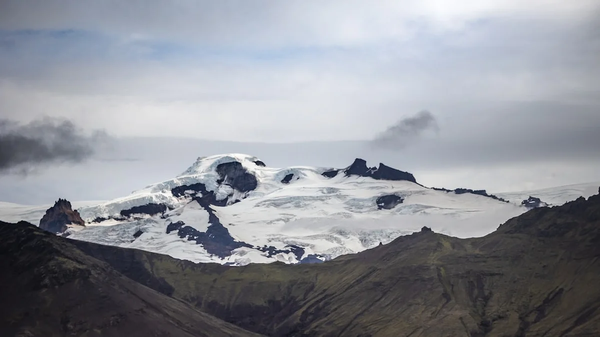
The Skaftafell Glacier Hike is one of Iceland’s most iconic outdoor experiences, offering an intimate encounter with the raw, primordial forces that have shaped the North Atlantic for millennia. Located within the southern reaches of the vast Vatnajökull National Park—a UNESCO World Heritage site—this hike typically traverses the Falljökull or Skaftafellsjökull outlet glaciers. These massive tongues of ice flow from the central Vatnajökull ice cap, the largest glacier in Europe by volume. Unlike a standard mountain trek, a glacier hike is a sensory immersion into a world of electric blue ice, deep cerulean crevasses, and the haunting groans of a moving frozen river. Spanning approximately 4.8 kilometres with a modest elevation gain of 300 metres, the journey is accessible yet profound, requiring no prior mountaineering experience but demanding a deep respect for the volatile Arctic environment. This is not merely a walk; it is a masterclass in glaciology, where every step reveals the delicate balance between the preservation of ancient ice and the accelerating reality of a warming climate.
- Distance: 4.8 km return
- Duration: 3–4 hours (including gear fitting and safety briefing)
- Season: Year-round (Best from May to September for milder weather)
- Difficulty: Moderate (requires steady footing on uneven ice)
- Highest point: Approximately 450 m (depending on the specific route and ice conditions)
- Location: Skaftafell, Vatnajökull National Park, South East Iceland
- Access: Guided tours are mandatory for safety; trailhead at Skaftafell Visitor Centre
Overview
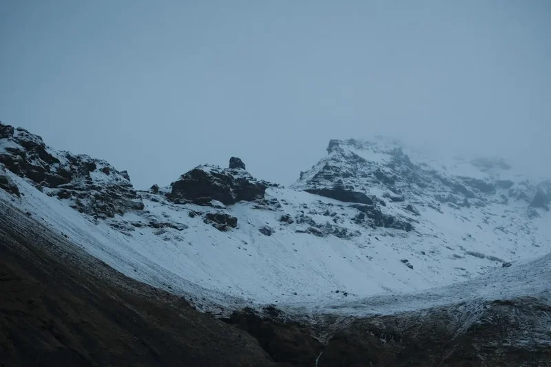
The Skaftafell Glacier Hike is a transformative experience that takes walkers from the lush, green "oasis" of the Skaftafell wilderness area directly onto the rugged, debris-strewn surface of an outlet glacier. The contrast is startling: one moment you are walking through low-lying birch forests and mossy heathlands, and the next, you are stepping onto a landscape that feels entirely extraterrestrial. The ice here is not the pristine white of a postcard; it is a complex tapestry of translucent blues, stark whites, and veins of black volcanic ash—remnants of past eruptions from Iceland’s many sub-glacial volcanoes, such as the infamous Öræfajökull.
As you ascend the glacier tongue, the scale of the landscape begins to reveal itself. To the north, the ice stretches upward toward the Hvannadalshnúkur peak, Iceland’s highest point at 2,110 metres. To the south, the vast Skeiðarársandur outwash plain spreads toward the Atlantic Ocean, a testament to the catastrophic glacial floods (jökulhlaups) that have historically scoured this region. The hike is designed to showcase the diverse features of a retreating glacier. You will encounter "moulins"—vertical shafts where meltwater plunges into the depths of the ice—and "dirt cones," which are small mounds of ice protected from melting by a layer of volcanic sand. The highlight for many is the "blue ice," a phenomenon caused by the extreme compression of snow over centuries, which forces out air bubbles and allows the ice to absorb every colour of the spectrum except blue.
Walking on a glacier requires specialised equipment, including steel crampons, an ice axe, and a safety harness. While the physical exertion is moderate, the mental engagement is high. You must learn to "stomp" with your crampons to ensure a secure grip and remain vigilant of the guide’s instructions as the ice is constantly shifting. This is a dynamic environment where the path taken today may not exist tomorrow. The Skaftafell Glacier Hike provides a rare opportunity to witness the "living" nature of the Earth’s cryosphere, offering a perspective on time and geology that few other places on the planet can provide.
History and Cultural Context
The history of the Skaftafell region is a saga of human resilience in the face of overwhelming natural power. For centuries, Skaftafell was an isolated farming community, hemmed in by the massive Skeiðará river to the west and the glacier tongues to the north and east. The farmers here lived in constant shadow of Öræfajökull, a massive volcano covered by ice. In 1362, a catastrophic eruption destroyed the entire district, then known as Hérað, leaving it a wasteland of pumice and ash for decades. When people eventually returned, the area was renamed Öræfi, which translates to "the wasteland."
The glaciers themselves have played a central role in Icelandic folklore and national identity. Historically, glaciers were viewed with a mixture of awe and terror—they were the "home of the hidden people" or barriers that could swallow entire caravans. It wasn't until the late 19th and early 20th centuries that scientific exploration began in earnest. The formation of Vatnajökull National Park in 2008 (and its subsequent expansion) marked a turning point in the conservation of this landscape. In 2019, the park was inscribed as a UNESCO World Heritage site, recognising its outstanding universal value as a place where the interaction between the mantle plume, the tectonic plate boundary, and the ice cap creates a unique geological environment.
Today, the Skaftafell Glacier Hike serves as a poignant reminder of the Anthropocene. The glaciers in this region have been retreating at an alarming rate since the 1990s. Falljökull, the "Falling Glacier," is particularly sensitive to temperature changes. Guides often point out markers showing where the ice edge stood only a decade ago, often hundreds of metres from its current position. This hike is as much a historical tour of the Earth's past as it is a contemporary witness to its changing future.
Want more background? Read extended notes on history and cultural context → Learn more
Seasonal Highlights and Weather Reality
The Skaftafell region is known for having a slightly milder and sunnier climate than the rest of Iceland, protected by the massive ice cap from the harshest northern winds. However, "mild" is a relative term in the Arctic. Weather on the glacier can change with terrifying speed, and conditions at the visitor centre are rarely indicative of conditions on the ice.
Summer (May to September): This is the most popular time for hiking. The days are long—reaching nearly 24 hours of daylight in June—and the temperatures typically range from 8°C to 15°C. The surface of the glacier is "dry" (meaning the winter snow has melted), revealing the deep blue ice and intricate crevasse patterns. Meltwater streams are at their most active, carving beautiful sapphire-blue channels across the surface. However, rain is frequent, and wind can make the perceived temperature feel much lower.
Winter (October to April): Hiking in winter is a starkly different experience. The glacier is often covered in a layer of fresh snow, giving it a pristine, white appearance. The temperatures frequently drop below freezing, and the wind can be fierce. The primary draw of winter is the potential to visit ice caves, which form as meltwater channels freeze over. The light during the "blue hour" of the short winter days is ethereal, casting long, soft shadows across the ice. Winter hiking requires more layers and a higher tolerance for cold, but the reward is a landscape of absolute, frozen silence.
Regardless of the season, the "Icelandic Rule" applies: if you don't like the weather, wait five minutes. Waterproof and windproof layers are non-negotiable year-round. Even on a sunny day, the katabatic winds blowing off the ice cap can be biting.
Recommended Itinerary
Skaftafell Glacier Hike Route Progression
Phase 1: The Meeting and Gear Fitting
- Location: Skaftafell Visitor Centre / Tour Operator Base
- Time: 30 minutes
- Meet your certified glacier guide and undergo a safety briefing.
- Fitting of essential gear: high-quality mountaineering boots (if not bringing your own), steel crampons, climbing harness, and ice axe.
- Briefing on the "Crampon Walk"—learning to walk with a wide stance to avoid catching spikes on your trousers.
Phase 2: The Approach
- Distance: 1.5 km
- Time: 20–30 minutes
- A scenic walk from the car park toward the glacier tongue (Falljökull or Skaftafellsjökull).
- The path winds through the terminal moraine—a landscape of rocks and gravel pushed forward by the glacier over centuries.
- Observe the rapid retreat of the ice; guides will point out where the glacier stood in previous decades.
- Arrive at the "crampon point" at the very edge of the ice.
Phase 3: Stepping onto the Ice
- Time: 1.5–2 hours on the ice
- Final gear check and crampon application.
- The initial ascent is usually over "dirty" ice covered in volcanic ash, which provides excellent grip.
- As you gain elevation, the ice becomes cleaner and the blue hues more intense.
- Navigate around crevasses and explore unique features like moulins and ice sculptures.
- Reach a high point on the glacier tongue for panoramic views of the Vatnajökull ice cap and the Atlantic coast.
Phase 4: The Descent and Return
- Time: 45 minutes
- Careful descent back down the glacier tongue, focusing on "heel-first" crampon technique.
- Removal of gear at the crampon point.
- Return walk through the moraine to the Skaftafell Visitor Centre.
- Opportunity to visit the visitor centre exhibition or grab a coffee at the local café.
Important Notes:
- Total time on the ice is approximately 60–90 minutes depending on the group's pace and weather.
- The route is determined daily by the guides based on ice stability and crevasse movement.
- Never attempt to step onto the ice without a guide; the "flat" sections often hide thin snow bridges over deep crevasses.
- Photography is encouraged, but always stop walking before taking a photo to maintain balance.
Planning and Bookings
Book Your Trip
Everything you need to plan your journey
Accommodation
Find places to stay near Höfn
Flights
Search flights to Höfn
Essential Preparation
The Skaftafell Glacier Hike is a popular activity, and because it requires a certified guide, booking in advance is essential, especially during the peak summer months (June–August). Most tours depart from the Skaftafell Visitor Centre, which is located about 320 kilometres from Reykjavík. If you are driving from the capital, allow at least 4.5 to 5 hours, as the Ring Road (Route 1) can be subject to delays due to weather or slow-moving campervans. Many hikers choose to stay in the nearby town of Höfn (1.5 hours east) or the village of Vík (1.5 hours west) the night before.
Physical fitness requirements are modest; if you can walk 5 kilometres on uneven terrain and climb a few flights of stairs, you can manage this hike. However, if you have significant knee or ankle issues, the repetitive "stomping" motion required for crampons can be taxing. Ensure you have eaten a hearty meal beforehand, as the cold air and physical activity burn calories quickly.
Trail Accommodation
As this is a day hike, there is no accommodation on the glacier itself. However, the Skaftafell area offers several options for those wishing to stay close to the trailhead.
Skaftafell Campground:
- Large, well-maintained site managed by the National Park.
- Facilities: Showers (paid), toilets, dishwashing areas, and laundry.
- Booking: Recommended in summer via the Vatnajökull National Park website.
- Cost: Approximately 2,500 ISK per person, per night.
- Note: No electricity for tents, but some hookups for campervans.
Nearby Lodges and Hotels:
- Hotel Skaftafell: Located just 5 km from the visitor centre, offering mid-range rooms and a restaurant.
- Fosshotel Glacier Lagoon: A higher-end option located about 25 minutes east, near the Jökulsárlón lagoon.
- Adventure Hotel Hof: Located in the historic Hof area, offering a mix of private and shared facilities.
Required Gear
- Mountaineering Boots: Must have stiff soles and provide ankle support. Soft sneakers or flexible hiking shoes will not hold crampons securely. Most tour operators provide these for a small rental fee.
- Waterproof Jacket and Trousers: Essential even if it isn't raining. The glacier creates its own microclimate, and you may need to sit or kneel on the ice.
- Crampons, Ice Axe, and Harness: These are provided by your tour operator. Do not attempt to use your own unless they are professional-grade and approved by the guide.
- Gloves: Essential for protecting your hands from the sharp ice if you slip, and for warmth. Thin liners under waterproof shells are best.
- Socks: Thick wool or synthetic trekking socks (merino wool is ideal) to prevent blisters and keep toes warm in the ice-chilled boots.
What to Bring
- Small Backpack: 15–25 litres to carry your layers, water, and snacks.
- Water: 1 litre is usually sufficient. Icelandic tap water is some of the purest in the world; fill your bottle at the visitor centre.
- High-Energy Snacks: Chocolate, nuts, or dried fruit for a quick boost on the ice.
- Sun Protection: Sunglasses are mandatory. The reflection of the sun off the white ice is intense and can cause snow blindness. Apply SPF 30+ sunscreen even on cloudy days.
- Camera/Phone: Ensure it is secured with a wrist strap. Cold temperatures drain batteries quickly, so bring a portable power bank.
- Headwear: A thin beanie that can fit under a climbing helmet (if required by the operator).
Permits
There is no individual "permit" required to hike in Skaftafell; however, access to the glacier itself is strictly regulated. Because of the extreme hazards involved—including hidden crevasses, ice collapses, and rapid weather shifts—it is illegal and highly dangerous to step onto the glacier without a certified guide and the appropriate safety equipment. Your "permit" is essentially your booking with a licensed tour operator.
Parking and National Park Fees:
- Parking Fee: There is a daily parking fee at the Skaftafell Visitor Centre. This is managed via cameras and license plate recognition. You can pay at the machines in the visitor centre or via the "Parka.is" app. The cost is approximately 1,000 ISK for a standard passenger car.
- Park Entry: There is currently no fee to enter Vatnajökull National Park on foot, but the parking fees go directly toward the maintenance of trails and facilities.
- Tour Costs: A standard 3–4 hour glacier hike typically costs between 12,000 ISK and 18,000 ISK per person. This includes all safety equipment and the services of a professional guide.
Booking Strategy: During the summer, tours can sell out weeks in advance. It is recommended to book a morning slot (around 9:00 AM or 10:00 AM) to avoid the midday crowds and to ensure you have enough daylight to explore other parts of the park, such as Svartifoss, after your hike.
Other Activities in the Area
Skaftafell is a hub for outdoor adventure. Consider these nearby attractions to round out your visit:
- Svartifoss Waterfall: A 1.5-hour return hike from the visitor centre. This stunning waterfall is framed by dark, hexagonal basalt columns that inspired the architecture of Reykjavík’s Hallgrímskirkja church.
- Jökulsárlón Glacier Lagoon: Located 45 minutes east of Skaftafell. Watch massive icebergs break off the Breiðamerkurjökull glacier and float toward the sea. Boat tours (amphibian or zodiac) are available.
- Diamond Beach: Directly across from Jökulsárlón, where the icebergs wash up on the black volcanic sand, glistening like diamonds in the sun.
- Sjónarnípa Viewpoint: A slightly longer hike from the visitor centre that offers what many consider the best panoramic view of the Skaftafellsjökull glacier tongue from above.
- Ingólfshöfði Cape: A tractor-drawn wagon tour to a private nature reserve where you can see puffins (May–August) and learn about the history of the first settler of Iceland.
Safety and Conditions
The Golden Rule: Never walk on the glacier without a guide. Glaciers are dynamic, moving rivers of ice. What looks like solid ground can be a thin bridge of snow over a 30-metre deep crevasse. Guides scout the routes daily and are trained in crevasse rescue.
Weather Awareness: Icelandic weather is notoriously unpredictable. Before heading out, check Safetravel.is for any weather alerts. Wind is the primary danger in Skaftafell; gusts exceeding 20 metres per second can make standing on ice impossible and can blow gravel and debris with significant force. If your guide cancels a tour due to weather, respect the decision—they are prioritising your life over the itinerary.
Glacial Hazards:
- Crevasses: Deep cracks in the ice. Always stay in the exact line indicated by your guide.
- Seracs: Large blocks of ice that can topple without warning. Guides will keep the group at a safe distance from these formations.
- Moulins: Deep holes carved by meltwater. While beautiful, the edges can be slippery and unstable.
- Hypothermia: Even in summer, the combination of wind, rain, and the cold radiating from the ice can lead to hypothermia. Wear layers and stay dry.
Emergency Services: The emergency number in Iceland is 112. However, cell service on the glacier can be spotty. Your guide will carry a radio and a GPS device for emergency communication.
Side Trips and Points of Interest
The "Blue Ice" Formations: During your hike, ask your guide to point out areas of high-pressure ice. These sections, often found deep within crevasses or at the base of ice falls, exhibit a deep, luminous blue colour that is breathtaking to behold. This ice is thousands of years old and so dense that it lacks the air bubbles found in younger, whiter ice.
Volcanic Ash Layers: Look for the distinct black stripes in the ice walls. These are "tephra" layers from historical eruptions. A knowledgeable guide can often tell you which eruption a specific layer belongs to, such as the 2011 Grímsvötn eruption or the 1996 Gjálp eruption. It is a literal timeline of Iceland's volcanic history frozen in place.
The Terminal Moraine: The area between the car park and the ice is a fascinating ecosystem. Look for "pioneer species"—the first plants to colonise the rocky ground left behind by the retreating ice. You will see hardy mosses, lichens, and the occasional Arctic Poppy struggling to find purchase in the nutrient-poor glacial till.
Sjónarsker: A short detour on the way back from Svartifoss offers a magnificent view over the Skeiðarársandur outwash plain. On a clear day, you can see the vastness of the area affected by the 1996 jökulhlaup, which destroyed the Ring Road bridges in a matter of hours.
Leave No Trace
Vatnajökull National Park is a fragile Arctic environment. The "Leave No Trace" principles are strictly enforced to ensure the preservation of this UNESCO site.
Specific Guidelines for Skaftafell:
- Stay on Marked Trails: The moss in Iceland is incredibly slow-growing and fragile. A single footprint can take decades to heal. When walking to the glacier, stay on the established gravel paths.
- No Littering: This includes organic waste like orange peels or apple cores, which do not decompose quickly in the cold climate and can attract invasive species.
- Do Not Move Rocks: Building "cairns" (rock piles) is discouraged as it disturbs the soil and can mislead other hikers.
- Respect the Ice: Do not chip off pieces of the glacier to take home. The ice is for everyone to enjoy in its natural state.
- Drone Usage: Drones are generally prohibited in Skaftafell and near the glacier to protect the peace of other visitors and the local birdlife. Check for specific signage at the visitor centre.