Sierra High Route - The Ultimate Alpine Traverse
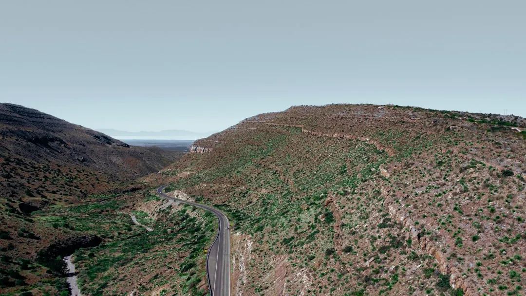
The Sierra High Route (SHR) is not a trail in the traditional sense; it is a vision of high-altitude travel through the most rugged and spectacular terrain of California’s Sierra Nevada mountains. Stretching approximately 312.2 kilometres from the lush floor of Kings Canyon to the jagged peaks of the Sawtooth Ridge near Twin Lakes, this route is the brainchild of legendary climber and author Steve Roper. Unlike the well-trodden John Muir Trail (JMT), which stays primarily in the valleys and crosses passes on engineered switchbacks, the Sierra High Route stays as close to the timberline as possible, frequently hovering between 3,000 and 3,600 metres. It is a journey defined by granite, talus, and alpine meadows, where the path is dictated by topography rather than a blazed trail. For the experienced backpacker, it represents the pinnacle of wilderness travel in the United States, demanding expert navigation, physical resilience, and a deep appreciation for the raw, unmediated landscape of the High Sierra.
- Distance: 312.2 km point-to-point
- Total Elevation Gain: 36,576 m
- Duration: 3–4 weeks (20–25 days average)
- Difficulty: Very Challenging (requires off-trail navigation and Class 2/3 scrambling)
- Best Time: Late July to early September
- Highest Point: Frozen Lake Pass (3,780 m)
- Terrain: 70% off-trail, including talus fields, scree slopes, and alpine meadows
- Permits: Required for overnight stays (Inyo, Sierra, and Sequoia/Kings Canyon National Parks)
Overview
The Sierra High Route is often described as the "anti-John Muir Trail." While the JMT is a masterpiece of trail engineering, the SHR is a masterpiece of route-finding. It was designed to provide a more intimate, challenging, and solitary experience of the Sierra Nevada. The route traverses the heart of the range, crossing 33 major passes and staying almost entirely within the high alpine zone. Because it avoids the valley floors where most trails reside, the SHR offers a continuous panorama of the "Range of Light," as John Muir famously called these mountains. The scale of the landscape is immense: you will find yourself surrounded by 4,000-metre peaks, turquoise glacial lakes, and ancient foxtail pine forests that have stood for over a millennium.
The physical demands of the SHR are extraordinary. With over 36,000 metres of total elevation gain, the route involves constant climbing and descending. Much of this movement occurs on unstable surfaces—shifting talus, steep scree, and slippery granite slabs. There are no bridges over the numerous creek crossings, and no signposts to guide the way. Success on the SHR depends on a hiker's ability to read a topographic map and interpret the landscape. You must identify the "line of least resistance" through complex glacial basins and over formidable ridges. This is a journey that rewards the patient and the observant; it is as much a mental challenge as a physical one.
Solitude is one of the SHR's greatest gifts. While the JMT can feel crowded during the peak summer months, it is entirely possible to spend days on the High Route without seeing another human being. You will share the landscape with marmots, pikas, and the occasional bighorn sheep. The silence of the high basins is profound, broken only by the sound of wind through the granite spires or the roar of a distant waterfall. For those seeking a true wilderness experience, where self-reliance is the primary currency, the Sierra High Route is unsurpassed.
History and Cultural Context
The Sierra High Route was first conceptualised and documented by Steve Roper, a prominent climber and historian of the Sierra Nevada. In the late 1970s and early 1980s, Roper sought to create a route that captured the spirit of the early Sierra explorers—men like Josiah Whitney, Clarence King, and John Muir—who moved through these mountains before the existence of a formal trail network. Roper’s goal was to stay high, avoid the dust and crowds of the JMT, and follow the natural logic of the terrain. In 1982, he published "The Sierra High Route: Traversing the Timberline," a guidebook that remains the definitive resource for the journey. Roper’s writing is famously understated, often describing terrifyingly steep passes as "straightforward" or "interesting," which has become a point of humour and caution among those who follow in his footsteps.
Before Roper, the High Sierra was the ancestral home and seasonal hunting ground of several Indigenous peoples, including the Paiute (Monache) to the east and the Yokuts and Mono to the west. These groups utilised high-altitude passes for trade and travel long before European surveyors arrived. Many of the names found on modern maps—such as Piute Pass or Mono Pass—honour this deep history. The route also passes through areas shaped by the "Golden Age" of Sierra climbing in the mid-20th century, when pioneers like Norman Clyde and Jules Eichorn made first ascents of the jagged peaks that now serve as landmarks for SHR hikers.
Today, the Sierra High Route is recognised as one of the premier long-distance routes in the world. It has inspired a new generation of "high routes" across the globe, from the Wind River High Route in Wyoming to the Pyrenean Haute Randonnée in Europe. Despite its growing fame, the SHR remains protected by its inherent difficulty. It cannot be "conquered" in the traditional sense; it must be negotiated with respect and humility. The land is managed by the National Park Service and the US Forest Service, and its preservation as a wilderness area is a testament to the environmental movement that John Muir helped ignite over a century ago.
Want more background? Read extended notes on history and cultural context → Learn more
Seasonal Highlights and Weather Reality
The window for a successful Sierra High Route thru-hike is narrow, dictated by the melting of winter snow and the arrival of autumn storms. Because the route stays at such high elevations, snow can linger on north-facing passes well into July, making certain sections dangerous or impassable without technical ice gear. Conversely, by mid-September, the first major winter storms can arrive, bringing freezing temperatures and heavy snowfall that can trap hikers in the high basins.
Late July to Early August: This is the prime season for wildflowers. The alpine meadows of the Evolution Basin and the Bear Lakes Basin erupt in a riot of colour—lupine, paintbrush, and columbine. However, this is also peak mosquito season. In wet years, the insects can be relentless, particularly near water sources and in the lower forest sections. Hikers must be prepared with head nets and repellent. Snow patches will still be present on the highest passes, such as Frozen Lake Pass and Snow Tongue Pass, requiring careful footwork.
Mid-August to Early September: This is widely considered the "Golden Window" for the SHR. The mosquitoes have largely subsided, the snow has melted from the passes, and the weather is generally stable. Days are warm and sunny, while nights are crisp and cool. This is the best time for high-altitude photography, as the air is often at its clearest. However, hikers must remain vigilant for afternoon thunderstorms. These "monsoonal" patterns can bring sudden, violent lightning and hail, which is particularly dangerous when you are exposed on a high ridge or pass.
Late September: The Sierra begins to transition into autumn. The quaking aspens in the lower canyons turn brilliant gold, and the light takes on a soft, amber quality. While the days are beautiful, the nights can drop well below freezing. The risk of a significant "early season" snowstorm increases significantly. Only highly experienced hikers with cold-weather gear should attempt the route this late in the year. Water sources also begin to dry up, requiring more careful planning for campsites.
Recommended Itinerary
24-Day Sierra High Route Itinerary
Stage 1: Kings Canyon to North Lake (The Southern Wilderness)
- Day 1: Road's End to Copper Creek. Distance: 12 km. Elevation Gain: 1,500 m. A brutal climb out of the heat of Kings Canyon to the cool heights of the Granite Basin.
- Day 2: Granite Basin to State Lakes. Distance: 14 km. Crossing Granite Pass. First taste of off-trail travel as you drop into the State Lakes basin.
- Day 3: State Lakes to Horseshoe Lakes. Distance: 11 km. Navigating the rugged terrain around grey Pass and White Pass. Spectacular views of the Monarch Divide.
- Day 4: Horseshoe Lakes to Windy Canyon. Distance: 13 km. A challenging day crossing the "Red and White" terrain. High alpine solitude at its finest.
- Day 5: Windy Canyon to Palisade Lakes. Distance: 15 km. Rejoining the JMT briefly before striking off-trail toward the Cirque Crest.
- Day 6: Palisade Lakes to Dusy Basin. Distance: 12 km. Crossing the formidable Knapsack Pass. Dusy Basin offers some of the most iconic granite scenery in the Sierra.
- Day 7: Dusy Basin to North Lake (Resupply). Distance: 14 km. Crossing Bishop Pass on a well-maintained trail to reach the trailhead for a resupply in Bishop.
Stage 2: North Lake to Red's Meadow (The Heart of the High Sierra)
- Day 8: North Lake to Humphreys Basin. Distance: 10 km. Climbing back up Piute Pass and entering the vast, lake-studded Humphreys Basin.
- Day 9: Humphreys Basin to Bear Lakes Basin. Distance: 13 km. Crossing Puppet Pass (French Canyon). Entering the Bear Lakes Basin, often cited as the most beautiful area on the entire route.
- Day 10: Bear Lakes Basin to Lake Italy. Distance: 12 km. Crossing Feather Pass. Technical Class 2 scrambling on steep granite slabs.
- Day 11: Lake Italy to Mono Creek. Distance: 15 km. Crossing Gabbot Pass. A long descent through the rugged recesses of the Mono Recesses.
- Day 12: Mono Creek to Silver Pass Lake. Distance: 14 km. A steep climb back to the timberline. Spectacular views of the Seven Gables.
- Day 13: Silver Pass Lake to Fish Creek. Distance: 16 km. Navigating the high benches above the North Fork of Fish Creek.
- Day 14: Fish Creek to Red's Meadow (Resupply). Distance: 18 km. A long day on and off trail to reach the amenities of Red's Meadow near Mammoth Lakes.
Stage 3: Red's Meadow to Tuolumne Meadows (The Ritter Range)
- Day 15: Red's Meadow to Minaret Lake. Distance: 12 km. Climbing into the shadow of the spectacular Minarets.
- Day 16: Minaret Lake to Catherine Lake. Distance: 10 km. Crossing the difficult Whitebark Pass and the steep snow/talus of North Glacier Pass.
- Day 17: Catherine Lake to Thousand Island Lake. Distance: 11 km. Descending into the headwaters of the San Joaquin River. Views of Banner Peak and Mount Ritter.
- Day 18: Thousand Island Lake to Lyell Canyon. Distance: 14 km. Crossing Island Pass and Donohue Pass (JMT section) before dropping into the vast Lyell Canyon.
- Day 19: Lyell Canyon to Tuolumne Meadows (Resupply). Distance: 15 km. An easy walk through the meadows to the Tuolumne Meadows store and post office.
Stage 4: Tuolumne Meadows to Twin Lakes (The Northern Wilderness)
- Day 20: Tuolumne Meadows to McCabe Lakes. Distance: 16 km. Climbing out of Yosemite Valley toward the high northern peaks.
- Day 21: McCabe Lakes to Matterhorn Canyon. Distance: 13 km. Crossing the spectacular Stanton Pass. Entering the remote northern canyons of Yosemite.
- Day 22: Matterhorn Canyon to Slide Canyon. Distance: 12 km. Crossing Burro Pass and Mule Pass. The terrain becomes increasingly jagged and "alpine."
- Day 23: Slide Canyon to Snow Lake. Distance: 11 km. Navigating the "Incredible Hulk" and the Sawtooth Ridge.
- Day 24: Snow Lake to Twin Lakes (Finish). Distance: 14 km. A final descent out of the high country to the trailhead at Twin Lakes near Bridgeport.
Important Notes:
- Distances are approximate; off-trail travel often takes twice as long as trail travel.
- Elevation gain is relentless; ensure you are physically prepared for 1,500m+ days.
- Resupply points are critical; Bishop, Mammoth, and Tuolumne are the standard stops.
- Navigation is the primary challenge; do not rely solely on GPS.
Planning and Bookings
Book Your Trip
Everything you need to plan your journey
Accommodation
Find places to stay near Bishop
Flights
Search flights to Bishop
Essential Preparation
Planning for the Sierra High Route is a multi-month endeavour. Because the route is 70% off-trail, you cannot simply "show up" and hike. You must possess advanced navigation skills, including the ability to read topographic maps, use a compass, and interpret terrain features. It is highly recommended to practice off-trail travel in the Sierra on shorter 3–5 day trips before attempting a full thru-hike. Fitness is equally critical; the constant scrambling over talus and the high altitude (averaging 3,300 metres) place immense strain on the cardiovascular system and the joints.
Logistically, you must coordinate your transport between the southern trailhead (Road's End) and the northern terminus (Twin Lakes). These locations are several hours apart by car. Many hikers use the Eastern Sierra Transit Authority (ESTA) bus system, which runs along Highway 395, to move between Bishop, Mammoth, and Bridgeport. Basing yourself in Bishop for a few days before starting is wise; it allows for altitude acclimatisation and last-minute gear checks at local outfitters.
Trail Accommodation
There are no huts, lodges, or permanent shelters on the Sierra High Route. This is a pure wilderness experience requiring self-contained camping for the duration of the trip. You are responsible for finding your own campsites, which must be located on durable surfaces (granite slabs or established dirt sites) at least 30 metres from water sources.
Camping Realities:
- Wild Camping: You will be camping in high alpine basins. Expect wind, cold temperatures, and rocky ground. A high-quality, lightweight tent or pyramid shelter is essential.
- Bear Canisters: Hard-sided bear-resistant food canisters are mandatory for the entire route. "Hanging" food is not permitted and is ineffective against the clever black bears of the Sierra.
- Water: Water is generally abundant from glacial lakes and streams, but it must be treated for Giardia and Cryptosporidium.
- Human Waste: In many high-altitude areas, you must pack out your solid waste using "WAG bags" (Waste Alleviation and Gelling). In lower areas, digging a 15cm deep cathole is required.
- Costs: There are no fees for camping beyond the initial permit cost (usually US$5–$15 per person).
Required Gear
- Footwear: Robust trail running shoes or lightweight mountain boots with excellent "sticky" rubber soles for granite scrambling. They must be broken in.
- Navigation: Paper topographic maps (1:24,000 scale), a reliable baseplate compass, and a GPS device (with offline maps) are non-negotiable.
- Shelter: A 3-season tent capable of withstanding high winds and occasional summer snow.
- Sleep System: A sleeping bag rated to at least -7°C (-6°C). Even in August, temperatures in high basins can drop below freezing.
- Pack: A 50–65L backpack. It must be comfortable for long days and capable of carrying the weight of a bear canister and 7–10 days of food.
- Clothing: A versatile layering system including a waterproof/breathable shell, a down or synthetic insulated jacket, and merino wool base layers.
- Safety: A Satellite Messenger (e.g., Garmin inReach) is strongly recommended due to the lack of mobile signal and the remote nature of the route.
What to Bring
- Food: High-calorie, lightweight dehydrated meals. Aim for 3,500–4,000 calories per day. You will need to carry up to 9 days of food between resupply points.
- Water Treatment: A lightweight squeeze filter (e.g., Sawyer Squeeze) or chemical drops (e.g., Aquamira).
- Sun Protection: High-altitude sun is intense. Bring SPF 50+ sunscreen, polarised sunglasses, and a wide-brimmed hat.
- Mosquito Protection: A head net and DEET or Picaridin repellent (essential for July/August).
- Repair Kit: Tenacious tape, a multi-tool, and spare parts for your stove and sleeping pad.
- First Aid: Focus on blister care (Leukotape), anti-inflammatories (Ibuprofen), and any personal medications.
- Fuel: Isobutane canisters for your stove. Ensure you have enough for the longest stretches between towns.
Permits
Securing permits for the Sierra High Route is a complex process because the route crosses multiple jurisdictions, including Sequoia and Kings Canyon National Parks, Inyo National Forest, Sierra National Forest, and Yosemite National Park. However, you only need one permit from the agency where you begin your trip. For most thru-hikers starting at Road's End, this means applying through Sequoia and Kings Canyon National Parks. If starting at North Lake, you apply through Inyo National Forest.
Booking Process:
- Recreation.gov: Almost all permits are now issued through the Recreation.gov website.
- Timeline: Permits generally become available 6 months in advance on a rolling daily basis. For a July start, you must be online in January.
- Quota System: Each trailhead has a daily quota. Popular entry points like North Lake or Road's End sell out within seconds of being released.
- Walk-up Permits: A small percentage of permits are held for "walk-up" hikers, released online 1–2 days before the start date. This is risky for a long thru-hike.
- Fees: Expect to pay a reservation fee (approx. US$6) plus a per-person fee (approx. US$5–$15).
Specific Requirements: You must list your entry date, entry trailhead, and exit trailhead. While your exact nightly campsites on the SHR are flexible, you must provide a general itinerary. You are also required to confirm that you possess an approved bear-resistant canister.
Other Activities in the Area
The Eastern Sierra is a world-class destination for outdoor enthusiasts. If you have extra time before or after your hike, consider these activities:
- Mount Whitney Ascent: The highest peak in the contiguous US (4,421 m) is located just south of the SHR. Many hikers add a Whitney detour to their southern section.
- Ancient Bristlecone Pine Forest: Located in the White Mountains east of Bishop, these are the oldest living trees on Earth, some over 4,000 years old.
- Hot Springs: The area around Mammoth Lakes and Bridgeport is famous for its natural geothermal hot springs—perfect for soaking sore muscles after a thru-hike.
- Rock Climbing: Bishop is a global bouldering mecca (Buttermilks), while the High Sierra offers world-renowned alpine granite climbing.
- Yosemite Valley: If your route ends near Tuolumne, a trip down into the main Yosemite Valley to see El Capitan and Half Dome is a must.
Safety and Conditions
Navigation and Route-Finding: This is the primary safety concern. Getting "cliffed out" (reaching a point where you can neither descend nor ascend safely) is a real possibility. Always scout your line from a distance before committing to a steep slope. If the terrain looks harder than Class 3, you are likely off-route.
Altitude Sickness: Much of the SHR stays above 3,000 metres. Acute Mountain Sickness (AMS) can affect anyone, regardless of fitness. Symptoms include headache, nausea, and fatigue. The only cure is descent. Allow at least 2–3 days of acclimatisation before starting the most strenuous sections.
River Crossings: In early summer (June/July), snowmelt turns small creeks into raging torrents. Crossings like Bear Creek or the South Fork of the Kings River can be life-threatening. Always cross at the widest, shallowest point, unbuckle your pack's waist belt, and never cross alone if the water is above mid-thigh.
Lightning: The Sierra is prone to afternoon thunderstorms. If you see dark clouds building, avoid being on high passes or ridges after 1:00 PM. If caught in a storm, descend immediately and avoid standing near lone trees or large bodies of water.
Wildlife: Black bears are common but generally shy. Use your bear canister religiously. Mountain lions exist but are rarely seen. Rattlesnakes may be encountered in the lower canyons (like Copper Creek) but are absent from the high alpine zones.
Side Trips and Points of Interest
The Bear Lakes Basin: Often called the "Crown Jewel" of the SHR, this basin contains a series of stunning lakes named after bears (Big Bear, Little Bear, Teddy Bear, etc.). It is a granite wonderland that requires crossing Feather Pass or White Bear Pass to enter. Spending an extra day here to explore the hidden tarns is highly recommended.
Mount Abbot and Mount Mills: For those with mountaineering experience, these peaks near Mono Pass offer relatively straightforward Class 2/3 scrambles with some of the best views in the central Sierra.
The Minarets: These jagged, gothic spires in the Ritter Range are perhaps the most photographed peaks in the Sierra. The SHR passes directly beneath them. A side trip to the base of the Minaret Glacier offers a close-up view of these incredible geological formations.
The Incredible Hulk: A massive granite monolith in the Little Slide Canyon (Northern Section). It is one of the most famous climbing walls in the world. Even if you aren't a climber, standing at its base is a humbling experience.
Leave No Trace
The High Sierra is a fragile ecosystem. At high altitudes, the growing season is incredibly short, and damage to vegetation can take decades to heal. Because the SHR is off-trail, the responsibility to "Leave No Trace" is even greater.
Core Principles for the SHR:
- Travel on Durable Surfaces: When walking off-trail, stay on rock, gravel, or dry grasses. Avoid stepping on lush alpine wildflowers or fragile mosses.
- Camp on Granite: Whenever possible, set up your tent on flat granite slabs. This leaves zero impact on the environment.
- No Campfires: Fires are prohibited above 3,000 metres (and often lower during fire season). Use a lightweight stove for all cooking.
- Respect the Water: Never use soap (even biodegradable) directly in lakes or streams. Carry water 30 metres away for washing.
- Pack It Out: This includes all trash, food scraps (even orange peels), and in certain areas, human waste.