Sierra Baguales Trek - The Untamed Frontier of Patagonia
The Sierra Baguales Trek is one of Chile’s best-kept secrets—a 55-kilometre journey through a landscape that feels more like a prehistoric world than a modern hiking trail. Located in the remote reaches of the Aysén Region, far from the crowded paths of Torres del Paine, this challenging multi-day walk traverses a jagged mountain range defined by basalt spires, vast fossil beds, and the raw, unyielding power of the Patagonian elements. Rising from the windswept steppe near the border with Argentina, the Sierra Baguales (meaning "Wild Horses" or "Feral Cattle") offers a profound sense of isolation that is increasingly rare in global trekking. This is not a manicured trail; it is a route through a wilderness where the paths are often made by guanacos rather than humans, and where the geological history of the Earth is laid bare in the form of ancient marine fossils resting 2,000 metres above sea level.
- Distance: 55.0 km loop or point-to-point (depending on access)
- Duration: 4–5 days
- Season: November–April (Southern Hemisphere summer)
- Difficulty: Challenging (requires navigation skills and high fitness)
- Highest point: Approximately 2,100 m (various high passes)
- Elevation Gain: 2,500 m total
- Closest City: Coyhaique, Chile
Overview
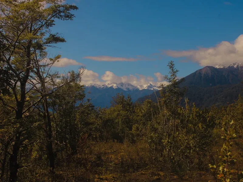
The Sierra Baguales is a geological anomaly in a region dominated by the ice fields and granite towers of the Southern Andes. While much of Patagonia is defined by glacial erosion and lush temperate rainforests, the Baguales range presents a starker, more arid beauty. The landscape is characterised by dark, volcanic basalt formations that rise like gothic cathedrals from the golden grasses of the pampa. These "spires" are the result of intense volcanic activity followed by millions of years of erosion, creating a skyline that is both intimidating and mesmerising. For the trekker, this means a journey through a vertical world of scree slopes, high alpine plateaus, and hidden valleys where the only sound is the whistling of the "Roaring Forties" winds.
What sets the Sierra Baguales apart from other Patagonian treks is its incredible fossil record. As you ascend the ridges, the ground beneath your boots changes from volcanic ash to sedimentary rock filled with the remains of ancient sea life. It is a surreal experience to find perfectly preserved ammonites and leaf impressions at altitudes where only the Andean condor flies. This transition from the steppe to the high peaks provides a masterclass in ecological diversity; you will begin in the habitat of the rhea (a flightless bird similar to an ostrich) and the guanaco, before climbing into the realm of the mountain viscacha and the elusive puma.
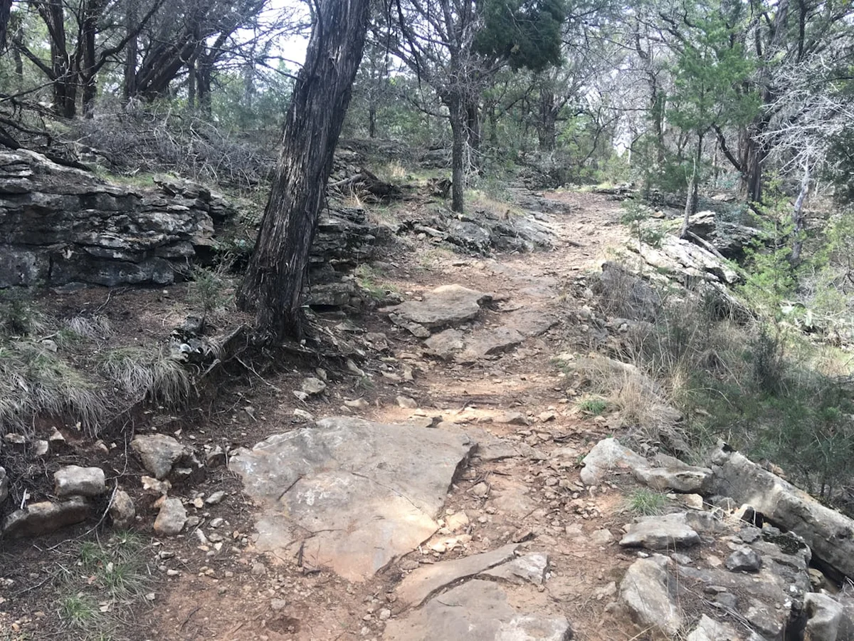
The trek is physically demanding, not just because of the 2,500 metres of elevation gain, but because of the terrain itself. There are no formal "tracks" in the traditional sense; instead, hikers follow a series of waypoints, animal paths, and riverbeds. This requires a high degree of self-sufficiency and confidence in off-trail navigation. The reward for this effort is a level of solitude that is unparalleled. It is entirely possible to spend five days in the Sierra Baguales without seeing another human being, making it the ultimate destination for those seeking a true wilderness experience in the heart of Chilean Patagonia.
History and Cultural Context
The name "Baguales" carries a deep cultural resonance in Patagonia. It refers to the feral livestock—horses and cattle—that escaped from early colonial settlements and reverted to a wild state in the remote mountain valleys. For the "gauchos" (Patagonian cowboys) of the 19th and 20th centuries, the Sierra Baguales was a legendary and dangerous place, a frontier where they would hunt these wild animals in a test of skill and endurance. This rugged history of the "bagualero" is still celebrated in the local culture of the Aysén and Magallanes regions, and the spirit of the wild horse remains a symbol of the untameable nature of this landscape.
Long before the arrival of European settlers and their livestock, the region was the ancestral home of the Tehuelche people (also known as the Aonikenk). These nomadic hunter-gatherers moved across the Patagonian steppe following the seasonal migrations of the guanaco. While the high, craggy peaks of the Sierra Baguales were likely not permanent residences, the surrounding valleys provided essential hunting grounds and transit routes. The Tehuelche were known for their incredible physical stature and their ability to thrive in one of the harshest climates on Earth, leaving behind a legacy of resilience that still haunts the windswept plains.
In the late 19th century, the landscape began to change with the introduction of large-scale sheep farming. Massive "estancias" (ranches) were established, often backed by British capital, which transformed the social and ecological fabric of Patagonia. The Sierra Baguales became part of these vast private holdings, used primarily for summer grazing. Today, much of the trek still passes through or near these historic estancias, and hikers must often coordinate with local landowners to gain access. This intersection of indigenous heritage, gaucho folklore, and the era of the great sheep barons provides a rich historical backdrop to the natural wonders of the trek.
Want more background? Read extended notes on history and cultural context → Learn more
Seasonal Highlights and Weather Reality
The window for trekking in the Sierra Baguales is narrow, dictated by the extreme weather of the Southern Hemisphere. The primary season runs from November to April, coinciding with the Patagonian summer. During this time, the days are long—with daylight lasting until 10:00 PM in December—and the temperatures are generally mild, ranging from 5°C at night to 20°C during the day. However, "mild" is a relative term in Patagonia; the weather is notoriously unpredictable and can shift from bright sunshine to a snowstorm within an hour, even in mid-summer.
The defining feature of the Baguales weather is the wind. The range sits directly in the path of the prevailing westerlies, which gain speed as they cross the Pacific and the Southern Ice Fields. In the Sierra Baguales, these winds are funnelled through mountain passes, often reaching speeds of over 100 kilometres per hour. This wind is not just a nuisance; it is a primary safety consideration that can make walking impossible and pitching a tent a significant challenge. Hikers must be prepared for the physical and mental toll of constant, high-velocity wind.
Spring (November and early December) is a time of spectacular floral displays, as the hardy plants of the steppe and alpine tundra burst into bloom. This is also the best time to see young guanacos and rheas. However, river levels can be high due to snowmelt, making crossings more difficult. Autumn (late March and April) offers more stable weather and the stunning transformation of the "Lenga" and "Ñire" (Southern Beech) forests into vibrant shades of red and orange. The nights become significantly colder during this period, and the risk of early season snow increases, but the lack of wind compared to mid-summer can make for more pleasant walking conditions.
Winter (May to October) is strictly for expert mountaineers. The range is covered in deep snow, the estancias are often closed, and the access roads become impassable. The extreme cold and short daylight hours make trekking a survival exercise rather than a recreational activity.
Recommended Itinerary
5-Day Sierra Baguales Wilderness Trek
Day 1: Estancia Entrance to Rio Baguales Valley
- Distance: 10 km
- Elevation gain: 300 m
- Time: 4–5 hours
- Begin at the designated trailhead near the estancia boundary
- Follow a faint vehicle track through the golden pampa, keeping a lookout for rheas and herds of guanacos
- Cross the first low ridge to enter the Rio Baguales drainage system
- Set up camp near the river, ensuring you are sheltered from the prevailing westerly winds
- This day serves as an introduction to the scale of the landscape and the unique light of the Patagonian steppe
Day 2: Rio Baguales to The Cathedral Spires
- Distance: 12 km
- Elevation gain: 700 m
- Time: 6–7 hours
- Leave the riverbed and begin a steady ascent toward the heart of the range
- The terrain becomes rockier as you approach the base of the basalt towers
- Navigate through a series of "portezuelos" (low passes) with increasingly dramatic views of the jagged skyline
- Camp in a high alpine cirque beneath the shadow of the "Cathedral" spires
- Water can be scarce here; look for small snow-fed streams or tarns
Day 3: The Fossil Ridge and High Passes
- Distance: 10 km
- Elevation gain: 800 m
- Time: 7–8 hours
- The most geologically fascinating day of the trek
- Ascend a steep scree slope to reach a high ridge (approx. 1,900 m) where the ground is littered with marine fossils
- Spend time exploring the ridge, but remember that removing fossils is strictly prohibited
- Cross a high, exposed pass where the wind can be extreme; use caution on the narrow sections
- Descend into a hidden valley on the western side of the range, a lush oasis compared to the arid ridges
- Camp near a small alpine lake with views of the distant Southern Ice Field peaks
Day 4: Western Valleys to the High Plateau
- Distance: 13 km
- Elevation gain: 500 m
- Time: 6–7 hours
- Traverse a series of high-altitude plateaus that feel like the roof of the world
- This section requires careful navigation, as there are no landmarks other than distant peaks
- Pass through areas of "cushion plants" and hardy alpine flora
- The descent from the plateau involves navigating steep, loose gullies; trekking poles are essential here
- Camp in a sheltered valley near the edge of the mountain range, preparing for the final exit
Day 5: Valley Exit to Trailhead
- Distance: 10 km
- Elevation gain: 200 m (mostly descent)
- Time: 4–5 hours
- Follow a long, gradual descent back toward the estancia lands
- The landscape opens up again into the vast Patagonian pampa
- Final river crossing (can be knee-deep depending on recent weather)
- Arrive back at the trailhead or pre-arranged pickup point
- Transfer back to Coyhaique for a well-earned meal and hot shower
Important Notes:
- This itinerary is a guide only; weather and wind may force you to stay in camp for an extra day
- There are no marked trails; GPS and topographic maps are mandatory
- All water must be treated, although it is generally very clean
- Respect all private property and ensure you have permission to cross estancia lands
- Pack for four seasons, even in the height of summer
Planning and Bookings
Book Your Trip
Everything you need to plan your journey
Accommodation
Find places to stay near Coyhaique
Flights
Search flights to Coyhaique
Essential Preparation
The Sierra Baguales is not a trek for beginners. It requires a high level of physical fitness, experience in off-trail navigation, and the ability to be completely self-sufficient for five days. Preparation begins in Coyhaique, the regional capital. This is where you must purchase all your supplies, as there are no shops near the trailhead. You will need to rent a 4x4 vehicle, as the access roads are gravel (ripio) and can be in poor condition, especially after rain. Coordination with local estancias is often necessary, as the most common access points are on private land. It is highly recommended to hire a local guide if you are not confident in your navigation skills or your ability to handle Patagonian weather extremes.
Trail Accommodation
This is a wilderness trek with no formal accommodation. There are no huts, lodges, or established campsites along the route. Hikers must be prepared for wild camping every night.
Camping Requirements:
- A high-quality, 4-season tent is mandatory to withstand the extreme winds
- Campsites should be chosen based on wind protection (look for natural depressions or rock walls)
- No facilities (toilets, water, or tables) are provided at any point
- All campsites must follow Leave No Trace principles
- Fires are strictly prohibited; use a reliable multi-fuel or canister stove
Required Gear
- Sturdy trekking boots - high-cut with excellent ankle support for scree and off-trail walking
- 4-season tent - must be low-profile and extremely wind-resistant (e.g., geodesic design)
- GPS and topographic maps - essential for navigation; do not rely on mobile phone apps alone
- Trekking poles - crucial for stability on loose scree and during river crossings
- High-quality waterproofs - Gore-Tex jacket and trousers with reinforced seams
- Warm sleeping bag - rated to at least -5°C comfort level
- Insulated sleeping mat - high R-value to protect against the cold ground
- Satellite communication device - (e.g., Garmin inReach) as there is no mobile signal
What to Bring
- Food for 5–6 days - high-calorie, lightweight meals (dehydrated is best) plus extra rations for weather delays
- Water treatment - lightweight filter or chlorine dioxide tablets
- Multi-fuel stove and fuel - ensure you have enough for the entire trip plus a buffer
- Sun protection - SPF 50+ sunscreen, lip balm, and high-quality sunglasses (the ozone layer is thin here)
- Personal first aid kit - including blister care, broad-spectrum antibiotics, and any personal medications
- Repair kit - for tent, sleeping mat, and clothing (duct tape and tenacious tape are essential)
- Warm layers - merino wool base layers, down or synthetic mid-layer, beanie, and windproof gloves
Permits
Unlike the national parks in Chile (such as Torres del Paine or Cerro Castillo), the Sierra Baguales does not currently have a formal permit system managed by CONAF (Corporación Nacional Forestal). However, this does not mean access is unrestricted. Much of the range is located on private estancia land, and respecting private property is the most critical aspect of planning this trek.
Access Protocols:
- Identify the estancia through which you plan to enter (common entry points include Estancia San Jose or Estancia Baguales)
- Attempt to contact the owners or managers in advance to request permission. This can often be done through local trekking agencies in Coyhaique
- Be prepared to pay a small access fee (usually in Chilean Pesos) to the estancia owners. This fee helps maintain the access roads and supports the local community
- Always check in at the estancia main house before starting your trek and provide them with your planned route and expected return date
- Ensure you are aware of any specific rules the landowner may have, such as areas that are off-limits due to livestock or conservation efforts
Border Considerations: Because the Sierra Baguales is located very close to the international border with Argentina, it is wise to carry your passport and PDI (immigration) card at all times. While you are unlikely to encounter border patrols in the high mountains, being near the frontier requires adherence to national laws regarding border zones.
Other Activities in the Area
The Aysén Region is a playground for outdoor enthusiasts. Consider these additions to your itinerary:
- Carretera Austral Road Trip: Drive one of the world's most scenic highways, passing through turquoise rivers, hanging glaciers, and dense fjords.
- Cerro Castillo National Park: Often called the "new Torres del Paine," this park offers world-class trekking with dramatic basalt peaks and alpine lakes.
- Marble Caves (Capillas de Mármol): Take a boat or kayak tour of these stunning calcium carbonate formations on General Carrera Lake, near Puerto Río Tranquilo.
- Laguna San Rafael: A boat excursion to see the massive San Rafael Glacier calving into the sea is a quintessential Patagonian experience.
- Fly Fishing: The rivers around Coyhaique are world-renowned for trout fishing, attracting anglers from across the globe.
- Queulat National Park: Home to the famous Hanging Glacier (Ventisquero Colgante), accessible via a relatively easy day hike.
Safety and Conditions
Navigation and Isolation: The Sierra Baguales is a true wilderness. There are no trail markers, no rangers, and no emergency services. You must be proficient in using a map and compass, and a GPS is highly recommended. If you get lost or injured, rescue could be days away. Always travel with a partner and carry a satellite communication device.
Wind Hazards: The wind in this region is a serious safety threat. It can blow a person off their feet, especially on exposed ridges or passes. When the wind reaches extreme levels, it is often safer to stay in your tent or find a sheltered spot and wait it out. Be aware of "flying rocks" in very high winds on scree slopes.
River Crossings: You will need to cross several rivers and streams. These can be dangerous during periods of heavy rain or rapid snowmelt. Always unclip your backpack's waist belt before crossing, use trekking poles for stability, and cross at the widest, shallowest point. If a river looks too deep or fast, wait until the following morning when water levels are typically lower.
Hypothermia: Even in summer, the combination of wind, rain, and cold temperatures creates a high risk of hypothermia. Always keep a set of dry clothes in a waterproof dry bag inside your pack. Recognise the early signs of hypothermia (shivering, confusion, loss of dexterity) and take immediate action to get dry and warm.
Wildlife: While pumas are present in the area, they are extremely shy and rarely seen. The greater risk comes from livestock or wild horses if they feel cornered. Give all animals a wide berth. Guanacos can be territorial during the mating season, so avoid getting between a male and his herd.
Side Trips and Points of Interest
The Fossil Beds: Located on the high ridges between the Rio Baguales and the western valleys, these beds contain a wealth of marine fossils from the Miocene epoch. You can find ammonites, bivalves, and even fossilised shark teeth. It is a powerful reminder that this entire mountain range was once at the bottom of the sea. Please take only photos; removing fossils is illegal and deprives future trekkers of the experience.
The Basalt Spires: The central part of the range features several dramatic basalt towers, the most famous being "The Cathedral." While climbing these requires technical skills and equipment, hiking to their base provides an incredible perspective on the volcanic forces that shaped Patagonia. The play of light on the dark rock at sunrise and sunset is a photographer's dream.
Guanaco Migration Routes: In certain valleys, you can find well-worn paths used by generations of guanacos. Following these "animal highways" is often the easiest way to navigate through dense scrub or over difficult passes. These areas are also the best places to spot condors, which scavenge on the remains of animals that didn't survive the winter.
Hidden Alpine Tarns: The western side of the Sierra Baguales hides several small, crystal-clear lakes fed by permanent snowfields. These tarns offer beautiful camping spots and a chance to see the unique alpine flora of the region, including the hardy "Llareta" (cushion plants) that can live for over 3,000 years.
Leave No Trace
The Sierra Baguales is a pristine and fragile ecosystem. Because it sees so few visitors, it is even more important that those who do trek here leave no evidence of their passage. The high-altitude tundra and steppe environments take decades to recover from human impact.
Leave No Trace Principles for Patagonia:
- Plan Ahead and Prepare: Ensure you have the skills and gear to avoid emergencies that could lead to environmental damage.
- Travel and Camp on Durable Surfaces: Stay on animal paths or rocky ground where possible. Avoid stepping on fragile cushion plants or mosses.
- Dispose of Waste Properly: Pack out ALL trash, including organic waste like orange peels or tea bags. Use a trowel to bury human waste at least 20 cm deep and 60 metres from water sources. Pack out all toilet paper.
- Leave What You Find: This is especially important for the fossils. Leave them exactly where you found them for others to discover.
- Minimise Campfire Impacts: Fires are strictly prohibited. The wind makes them a massive wildfire risk, and wood is scarce. Use a stove for all cooking.
- Respect Wildlife: Observe guanacos, rheas, and condors from a distance. Never feed them or attempt to approach them.
- Be Considerate of Other Visitors: Though rare, respect the solitude of others. Keep noise to a minimum and choose campsites that are out of sight of the main route.