
Serra Fina Crossing - Brazil's Alpine Heart
The Serra Fina Crossing is a challenging and rewarding multi-day trek located in the Mantiqueira Mountains of Brazil, straddling the border between Minas Gerais and São Paulo states. This route is renowned for its rugged beauty, high-altitude plateaus, and the sheer scale of its granite peaks, offering a true alpine experience in a tropical country. The trail traverses a remote and wild landscape, characterised by vast grasslands, dramatic rock formations, and breathtaking panoramic views. It is a journey that demands significant physical fitness, excellent navigation skills, and a deep appreciation for raw, untamed nature. Unlike more manicured trails, the Serra Fina Crossing is an expedition into a high-altitude wilderness, where weather can change rapidly and self-sufficiency is paramount. It is a test of endurance and spirit, promising an unforgettable adventure for those who dare to undertake it.
- Distance: Approximately 58.0 km
- Duration: 4-6 days
- Season: May to September (dry season)
- Difficulty: Very Challenging
- Highest point: Pico dos Três Estados (approx. 2,450 m)
- Base Town: Itamonte, Minas Gerais
- Access: Rough 4x4 access to trailheads
Overview
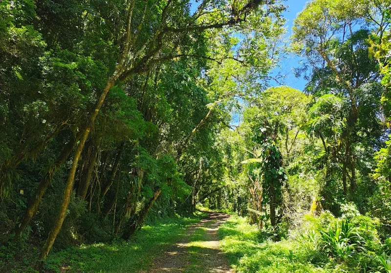
The Serra Fina Crossing is a true expedition, a journey through a landscape that feels ancient and untouched. The trail winds its way across high-altitude grasslands, known as "campos de altitude," which are a unique biome found only in specific mountainous regions of Brazil. These open plains are punctuated by dramatic granite peaks, including the iconic Pico dos Três Estados, which marks the tri-point border of Minas Gerais, São Paulo, and Rio de Janeiro states. The elevation gain is substantial, with over 4,000 metres of cumulative ascent spread across the 58 kilometres, making it one of Brazil's most physically demanding treks.
The experience is one of immersion in a vast, exposed environment. Days are spent traversing undulating plateaus, navigating rocky ascents, and camping under incredibly starry skies, far from any light pollution. The weather is a significant factor; while the dry season (May to September) offers the best conditions, with cooler temperatures and less rain, it can still bring strong winds, sudden temperature drops, and even frost or snow at higher elevations. The landscape is starkly beautiful, with sweeping vistas that stretch for kilometres, revealing rolling mountain ranges and deep valleys. The lack of dense forest cover means that views are almost constant, but it also means there is little shelter from the elements.
This trail is not for the faint of heart. It requires careful planning, robust gear, and a high level of fitness. The remoteness means that self-sufficiency is key, with trekkers needing to carry all their food, water treatment supplies, and camping equipment. The reward, however, is immense: the satisfaction of completing a formidable challenge, the unparalleled beauty of a pristine alpine environment, and the profound sense of peace that comes from being truly disconnected from the modern world.
History and Cultural Context
The Mantiqueira Mountains, where the Serra Fina Crossing is located, have a long history of human interaction, though not in the same way as more established trekking regions. Indigenous peoples likely traversed these highlands for millennia, utilising the natural resources and seasonal movements of game. However, the region's rugged terrain and high altitudes meant that permanent settlements were scarce.
The modern history of the Serra Fina is tied to the exploration and mapping of Brazil's interior. As the country developed, surveyors and geologists began to chart these remote mountain ranges. The peaks, such as Pico dos Três Estados, became important triangulation points for national mapping efforts. The trails themselves are largely unmaintained, existing as faint paths trodden by a small number of dedicated trekkers, local guides, and occasional cattle herders who utilize the high-altitude pastures during the warmer months.
The area is part of a broader cultural landscape that includes traditional rural communities in the lower valleys, particularly around towns like Itamonte. These communities have a deep connection to the land, with a history of agriculture and cattle ranching. The Serra Fina itself, however, remains largely wild, a testament to its challenging accessibility. The concept of "trekking" as a recreational activity is relatively recent in Brazil compared to other parts of the world, and trails like Serra Fina are still considered frontier expeditions, attracting those seeking a more authentic and challenging wilderness experience.
Seasonal Highlights and Weather Reality
The Serra Fina Crossing is best undertaken during the dry season, which typically runs from May to September. This period offers the most favourable conditions for trekking in the Mantiqueira Mountains.
Dry Season (May to September): This is the prime trekking window. Days are generally sunny and clear, offering spectacular, unobstructed views across the vast mountain ranges. Temperatures are cooler, with daytime highs often ranging from 10°C to 20°C. However, nights can be very cold, frequently dropping below freezing, especially at higher elevations. Frost is common, and snow is possible, particularly on the highest peaks like Pico dos Três Estados. The lack of rain significantly reduces the risk of flash floods and makes river crossings safer. The "campos de altitude" are often bathed in golden light during sunrise and sunset, creating stunning photographic opportunities. This is also the period when the air is clearest, offering the best visibility.
Shoulder Seasons (April and October): These months can be transitional. April may still see some lingering rain from the wet season, while October can mark the beginning of increased rainfall. Temperatures might be slightly warmer than the peak dry season. While still potentially viable, these months carry a higher risk of encountering adverse weather, including rain and fog, which can obscure trails and reduce visibility significantly.
Wet Season (November to March): This period is generally not recommended for the Serra Fina Crossing. Heavy rainfall is frequent, leading to swollen rivers, muddy and slippery trails, and increased risk of landslides. Fog and cloud cover are persistent, often obscuring the high-altitude plateaus and peaks, making navigation extremely difficult and diminishing the scenic rewards. Temperatures are warmer, but the humidity can be high, making trekking uncomfortable. Flash floods are a serious concern, and many of the trail sections can become impassable.
Recommended Itinerary
4-Day Serra Fina Crossing Itinerary (Challenging Pace)
Day 1: Itamonte to Campamento dos Macacos
- Distance: Approximately 12 km
- Elevation gain: Approximately 1,000 m
- Time: 6–8 hours
- Start from the Portal (near Itamonte) after arranging 4x4 transport to the trailhead
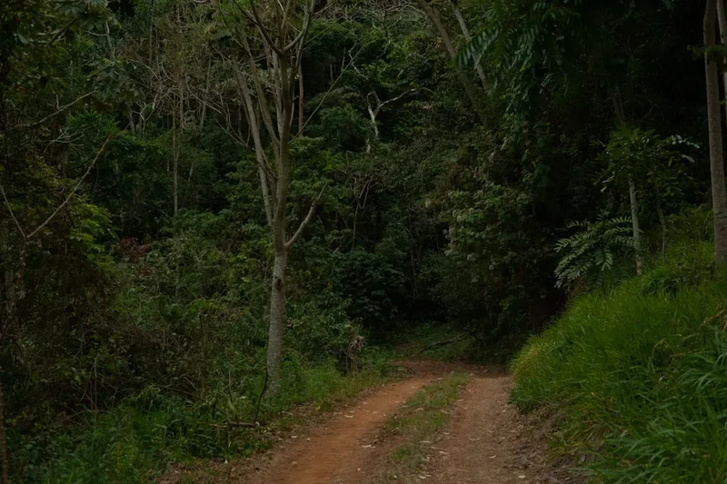
- Initial ascent through more vegetated lower slopes, gradually transitioning to open grasslands
- Pass through areas with small streams for water collection (treatment essential)
- Reach Campamento dos Macacos, a relatively flat area suitable for camping, often with a water source nearby
- This day is a significant climb, setting the tone for the challenging days ahead
Day 2: Campamento dos Macacos to Campamento dos Tropeiros
- Distance: Approximately 15 km
- Elevation gain: Approximately 1,200 m
- Time: 7–9 hours
- Traverse high-altitude grasslands and rocky terrain
- Ascend towards the main ridge of the Serra Fina
- Pass through areas with dramatic rock formations and expansive views
- Campamento dos Tropeiros is a traditional camping spot, often near a reliable water source
- This day involves sustained climbing and exposure to the elements
Day 3: Campamento dos Tropeiros to Pico dos Três Estados vicinity
- Distance: Approximately 14 km
- Elevation gain: Approximately 1,000 m
- Time: 7–9 hours
- The most challenging day, often involving a summit attempt of Pico dos Três Estados (2,450 m)
- Navigate rocky ascents and descents, potentially requiring scrambling
- The summit offers unparalleled 360-degree views if weather permits
- Camp near the summit area or a suitable sheltered spot with water access
- This day is physically and mentally demanding, requiring careful navigation and weather awareness
Day 4: Pico dos Três Estados vicinity to Itamonte (via alternative descent)
- Distance: Approximately 17 km
- Elevation loss: Approximately 1,200 m
- Time: 6–8 hours
- Begin the descent, often via a different route than the ascent to avoid repetition and access different terrain
- The descent can be steep and challenging, requiring careful footing
- Pass through varied landscapes as you descend towards the lower altitudes
- Reach the pickup point near Itamonte, where 4x4 transport will be arranged
- This day concludes the expedition, with a focus on safe descent and return to civilisation
Important Notes:
- This itinerary is a guideline; actual distances and times can vary based on route choice, weather, and individual pace.
- Water sources can be unreliable; always carry sufficient water and have a reliable treatment method.
- Camping is wild camping; choose sheltered spots away from potential rockfall or flash flood zones.
- Navigation is critical; GPS devices and detailed maps are essential.
- Weather can change rapidly; be prepared for cold, wind, and rain even in the dry season.
- A local guide is highly recommended for first-time trekkers.
Planning and Bookings
Book Your Trip
Everything you need to plan your journey
Accommodation
Find places to stay near Itamonte
Flights
Search flights to Itamonte
Essential Preparation
The Serra Fina Crossing is a serious undertaking that requires meticulous planning. Given its remote nature and challenging terrain, preparation is key to a safe and enjoyable experience. The closest major town and logistical hub is Itamonte, Minas Gerais. Itamonte offers basic accommodation, restaurants, and some outdoor gear shops, but it is advisable to arrive with most of your supplies already purchased.
Fitness: This trek demands a high level of cardiovascular fitness and muscular endurance. You should be comfortable hiking for 6-9 hours per day with a heavy backpack (15-20 kg), including significant elevation gain and loss over uneven, rocky terrain. Regular training that includes hill walking, strength training (especially for legs and core), and carrying a weighted pack is essential. Practice hiking with your fully loaded pack before the trek.
Logistics: Access to the trailhead is typically via rough 4x4 tracks. You will need to arrange transport from Itamonte to the starting point (often referred to as the "Portal" or a specific trailhead location). This often involves hiring a local guide who can also provide this transport or connect you with someone who can. Similarly, arrange for pickup at your designated exit point. It is crucial to have reliable communication with your transport providers, as mobile signal is non-existent on the trail.
Base Town: Itamonte is the primary base town. It offers a range of pousadas (guesthouses) and hotels, from budget-friendly to more comfortable options. There are also restaurants and small supermarkets where you can purchase last-minute food items. It's advisable to spend at least one night in Itamonte before and after your trek to acclimatise, finalise preparations, and rest.
Trail Accommodation
This is a wild camping trek. There are no established huts, lodges, or campsites along the Serra Fina Crossing. Trekkers are expected to be self-sufficient and camp in suitable locations found along the route.
Wild Camping: Trekkers must carry all their own camping equipment, including tents, sleeping bags, and sleeping mats. Designated campsites do not exist; instead, you will need to identify safe and environmentally responsible places to pitch your tent. Look for relatively flat, sheltered areas away from obvious hazards such as steep slopes, potential rockfall zones, or dry riverbeds that could flash flood. Always choose a spot that minimises your impact on the fragile alpine environment.
Water Sources: Water is generally available from streams and springs, particularly in the lower sections and near traditional camping spots like Campamento dos Macacos and Campamento dos Tropeiros. However, water sources can be seasonal and may dry up, especially towards the end of the dry season. It is imperative to carry a reliable water filter or purification tablets, as all water must be treated before consumption.
Seasonal Availability: Wild camping is possible year-round, but the dry season (May to September) is strongly recommended due to more predictable weather and safer conditions. During the wet season, the risks associated with flash floods, slippery terrain, and poor visibility make wild camping significantly more hazardous.
Costs: There are no direct costs for accommodation as it is wild camping. However, you will incur costs for transport to and from the trailhead, food, and potentially guide fees.
Required Gear
- Sturdy Hiking Boots: Waterproof, well broken-in, with good ankle support. Essential for navigating rocky and uneven terrain.
- Backpack: 60-75 litre capacity, with a comfortable harness and hip belt to carry the load. A rain cover is crucial.
- Tent: A robust, lightweight, 3-season tent capable of withstanding wind and rain.
- Sleeping Bag: Rated for sub-zero temperatures (e.g., -5°C to -10°C comfort rating) due to cold nights at altitude.
- Sleeping Mat: Insulated mat for comfort and warmth.
- Waterproof Jacket: High-quality, breathable, and fully waterproof (e.g., Gore-Tex).
- Waterproof Overtrousers: Essential for protection against wind and rain.
- Warm Layers: Multiple synthetic or wool layers (base layers, fleece mid-layers). Avoid cotton.
- Hat and Gloves: Warm beanie and waterproof gloves are essential, even in summer.
- Navigation Tools: GPS device with pre-loaded maps, compass, and a detailed topographic map of the area. A backup power source for electronics is recommended.
- Head Torch: With spare batteries.
- First Aid Kit: Comprehensive kit including blister treatment, pain relievers, antiseptic wipes, bandages, and any personal medications.
- Sun Protection: High SPF sunscreen, sunglasses, and a wide-brimmed hat. The sun at altitude can be intense.
- Trekking Poles: Highly recommended for stability and reducing strain on knees, especially on descents.
What to Bring
- Food: Sufficient non-perishable food for 4-6 days, including breakfast, lunch, dinner, and plenty of high-energy snacks. Plan meals carefully to balance weight and nutritional needs.
- Water Treatment: Water filter or purification tablets. Always treat water from streams and springs.
- Cooking Gear: Lightweight camping stove, fuel, cooking pot, utensils, mug, and plate/bowl.
- Toiletries: Biodegradable soap, toothbrush, toothpaste, toilet paper (pack out used paper), hand sanitiser.
- Repair Kit: Duct tape, cordage, needle and thread, safety pins, tent pole repair sleeve.
- Knife or Multi-tool: For various camp and trail tasks.
- Personal Items: Camera, power bank, book, journal, insect repellent (though less of an issue at high altitudes).
- Trash Bags: To pack out all waste.
- Emergency Whistle: For signalling in emergencies.
- Cash: For any last-minute purchases in Itamonte or for potential guide fees.
Permits
The Serra Fina Crossing does not require formal permits or booking in the same way as national park trails in some other countries. However, access to the trailhead and the general area is managed, and it is crucial to understand the local regulations and best practices.
Trailhead Access: Access to the starting points of the Serra Fina trail is typically via rough 4x4 tracks. It is highly recommended to arrange transport with local guides or experienced 4x4 drivers based in Itamonte. These individuals are familiar with the terrain and can provide essential information about current track conditions and safety. They often act as informal gatekeepers, ensuring trekkers are adequately prepared.
Park Fees: While there isn't a formal park entrance fee for the Serra Fina itself, the region is part of a broader protected area. It is always good practice to check with local authorities or your guide about any local conservation contributions or fees that may apply. The primary focus is on responsible trekking and minimising environmental impact.
Registration: It is advisable to register your trekking plans with local authorities or your guide service in Itamonte. This includes providing your intended route, expected duration, and your contact information. This is a safety measure in case of emergencies.
Guides: While it is possible to attempt the Serra Fina independently, hiring a local guide is strongly recommended, especially for first-time trekkers. Guides provide invaluable knowledge of the terrain, weather patterns, water sources, and navigation. They can also arrange necessary 4x4 transport and ensure you are aware of any local customs or regulations. Their fees are an investment in safety and a richer experience.
Environmental Responsibility: The most important "permit" is adherence to Leave No Trace principles. The Serra Fina is a fragile ecosystem, and all trekkers are expected to minimise their impact. This includes packing out all waste, staying on established paths where they exist, and respecting the natural environment.
Other Activities in the Area
While the Serra Fina Crossing is the main draw, the region around Itamonte offers several other attractions and activities for those looking to extend their stay or explore further:
- Pico das Agulhas Negras: Located in the adjacent Itatiaia National Park, this is Brazil's second-highest peak (2,791 m). It offers a challenging climb with spectacular views and is a popular destination for mountaineers and trekkers. Access is typically from the park entrance near Itatiaia town.
- Itatiaia National Park: Brazil's oldest national park, it boasts diverse ecosystems, from Atlantic rainforest to high-altitude grasslands. It offers numerous hiking trails, waterfalls, and opportunities for wildlife viewing.
- Cachoeira do Escorrega: A beautiful waterfall near Itamonte with a long, smooth rock face that acts as a natural waterslide. It's a popular spot for locals and tourists to cool off during warmer months.
- Exploring Itamonte: The town itself offers a charming atmosphere with local crafts, regional cuisine, and a relaxed pace of life. It's a good place to rest and resupply before or after your trek.
- Other Mantiqueira Mountain Treks: The Mantiqueira range is vast and offers numerous other trekking opportunities, ranging from shorter day hikes to multi-day expeditions, often with less extreme difficulty than the Serra Fina.
- Stargazing: Due to its remote location and high altitude, the Serra Fina offers exceptional opportunities for stargazing. On clear nights, the sky is a breathtaking spectacle of stars, free from light pollution.
Safety and Conditions
The Serra Fina Crossing is a demanding trek where safety must be the top priority. Due to its remoteness and challenging nature, trekkers must be well-prepared and aware of potential hazards.
Weather: The most significant hazard is the unpredictable mountain weather. Even during the dry season, conditions can change rapidly. Expect strong winds, sudden temperature drops, fog, and the possibility of rain or even frost and snow at higher elevations. Hypothermia is a real risk, even in warmer months, if you become wet and exposed to wind. Always carry adequate warm and waterproof clothing, and monitor weather forecasts as closely as possible before and during your trek.
Navigation: The trails are often faint or non-existent, especially on the high plateaus. GPS devices with pre-loaded maps and a compass are essential. Relying solely on a GPS is not recommended; ensure you have the skills to use a map and compass as a backup. Getting lost in this terrain can be extremely dangerous.
Water: While water sources are generally available, they can be unreliable, especially towards the end of the dry season. Always carry sufficient water and have a reliable method for treating all water (filter or purification tablets). Dehydration is a serious risk.
Terrain: The terrain is rugged, with steep ascents and descents, loose scree, and rocky sections that can be slippery. Proper hiking boots with good grip are essential. Falls can lead to serious injuries.
Remoteness: There is no mobile phone signal on most of the trail. In case of emergency, self-rescue or waiting for assistance can be a lengthy process. Consider carrying a personal locator beacon (PLB) or satellite messenger for emergency communication.
Physical Condition: Ensure you are in excellent physical condition. The cumulative elevation gain and long hiking days can be exhausting. Pushing yourself beyond your limits in a remote environment can lead to poor decision-making and accidents.
Guides: Hiring a local guide is highly recommended for safety. They possess intimate knowledge of the terrain, weather patterns, and potential hazards, and can assist in emergencies.
Pre-Trip Checks: Before departing Itamonte, check the latest weather forecasts and any available information on trail conditions. Inform someone of your planned itinerary and expected return time.
Side Trips and Points of Interest
While the Serra Fina Crossing is a continuous journey, several points along or near the route offer significant interest and potential for exploration:
Pico dos Três Estados Summit: The undisputed highlight of the trek. This peak (approximately 2,450 metres) marks the tri-point border of Minas Gerais, São Paulo, and Rio de Janeiro states. On a clear day, the summit offers breathtaking 360-degree panoramic views of the entire Mantiqueira mountain range, stretching for hundreds of kilometres. The ascent can be challenging, involving rocky scrambles, but the reward is immense. It's a prime spot for sunrise or sunset photography.
Rocky Outcrops and Formations: The Serra Fina is characterised by dramatic granite formations. Throughout the trek, you will encounter unique rock structures, weathered by millennia of wind and rain. These provide excellent opportunities for photography and appreciating the geological history of the region.
High-Altitude Grasslands (Campos de Altitude): The vast, open expanses of high-altitude grasslands are a unique biome. These areas are often carpeted with low-lying vegetation, wildflowers (in season), and offer a sense of immense space and solitude. The changing light across these plains, especially during dawn and dusk, is spectacular.
Water Sources and Streams: While primarily functional, the streams and springs encountered along the route are often crystal clear and set against the backdrop of the rugged mountains. They provide vital points for refilling water supplies and offer moments of natural beauty.
Traditional Camping Spots: Locations like Campamento dos Macacos and Campamento dos Tropeiros are not just camping spots but have historical significance, often used by cattle herders (tropeiros) in the past. They offer a glimpse into the traditional use of these high-altitude areas.
Leave No Trace
The Serra Fina Crossing traverses a fragile high-altitude ecosystem that is particularly susceptible to human impact. Adhering to Leave No Trace principles is not just recommended; it is essential for preserving this unique environment for future generations. The "campos de altitude" are delicate, and recovery from damage can take decades.
Plan Ahead and Prepare: Understand the challenges of the trek, pack appropriately, and be prepared for all weather conditions. Know the regulations and be aware of any local guidelines.
Travel and Camp on Durable Surfaces: Stick to existing paths where they are visible. When camping, choose established, flat spots that show signs of previous use. Avoid camping on fragile vegetation, near water sources, or in areas prone to erosion. Pitch your tent in a way that minimises ground disturbance.
Dispose of Waste Properly: Pack it in, pack it out. This includes all food scraps, wrappers, toilet paper, and any other refuse. Do not bury waste, as it can be dug up by animals or exposed by erosion. Use designated toilet facilities if available, or dig catholes at least 60 metres away from water, camp, and trails. Pack out all used toilet paper.
Leave What You Find: Do not take rocks, plants, or any natural or cultural objects. Leave the environment as you found it.
Minimise Campfire Impacts: Campfires are generally not recommended or permitted in high-altitude, fragile environments like the Serra Fina due to the risk of wildfires and long-term damage to vegetation. Use a lightweight stove for cooking.
Respect Wildlife: Observe wildlife from a distance. Never feed animals, as it can disrupt their natural behaviours and diets, and can make them dependent on human food. Store your food securely to prevent attracting animals.
Be Considerate of Other Visitors: Keep noise levels down and avoid playing loud music. Respect the solitude and natural quiet of the wilderness. Yield to other hikers when necessary.
Useful Links
- Parque Nacional do Itatiaia (Official Information)
- ClimaTempo - Itamonte Weather Forecast
- MetService - Fiordland mountain forecast (Note: This is a placeholder, as Brazilian weather services are more relevant. A specific Brazilian service link would be ideal if available.)
- Wikiloc - Serra Fina Crossing (Example - search for current routes)
- Brazil Travel - Itamonte Information