Sella-Herbetet Traverse - The High Balcony of Gran Paradiso
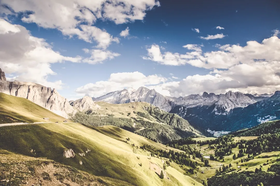
The Sella-Herbetet Traverse is a premier high-altitude mountain track located in the heart of the Gran Paradiso National Park, Italy's oldest and most prestigious protected wilderness. Spanning approximately 45 kilometres with a staggering 3,500 metres of cumulative elevation gain, this journey is not merely a hike but a technical traverse through the rugged Graian Alps. The route connects the Valsavarenche and Valnontey valleys, offering walkers an unparalleled "balcony" perspective of the Gran Paradiso massif (4,061 m), the only mountain over 4,000 metres entirely within Italian territory. This is a landscape of raw, glacial power, where ancient mule tracks built for royalty wind through fields of alpine wildflowers and over exposed, chain-assisted ledges. It is a sanctuary for the Alpine ibex, a species once saved from extinction within these very borders, and remains a challenging rite of passage for experienced mountain trekkers seeking solitude and high-alpine drama.
- Distance: 45.0 km (total circuit/traverse)
- Duration: 5–7 days
- Elevation Gain: 3,500 m
- Difficulty: Very Challenging (EE - Escursionisti Esperti)
- Best Time: July to September (strictly snow-free conditions)
- Highest Point: Approximately 3,300 m (depending on side peaks)
- Closest City: Aosta, Italy
- Accommodation: High-altitude mountain huts (Rifugi) and bivouacs
Overview
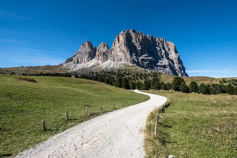
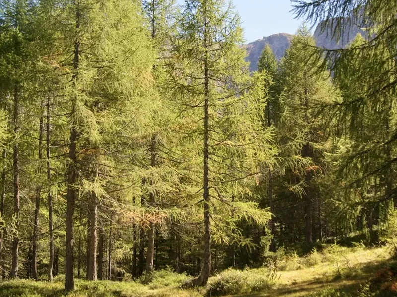
The Sella-Herbetet Traverse is widely regarded by the Club Alpino Italiano (CAI) as one of the most spectacular high-level routes in the Aosta Valley. Unlike traditional valley-to-valley treks, the "Traverse" element refers specifically to the high-altitude link between the Casolari dell'Herbetet and Rifugio Vittorio Sella. This section is a masterclass in alpine engineering and natural beauty, clinging to the steep western flanks of the Valnontey at an average elevation of 2,500 metres. The terrain is diverse and demanding, transitioning from lush larch forests and emerald meadows in the lower valleys to austere moraines, polished gneiss slabs, and permanent snowfields in the upper reaches.
The defining characteristic of this trail is its constant proximity to the great glaciers of the Gran Paradiso. As you traverse the high-level path, the Tribolazione, Grand Croux, and Money glaciers appear almost within reach, their blue-tinted ice falls providing a thunderous soundtrack of cracking ice and rushing meltwater. The path itself is a mix of well-trodden dirt tracks, boulder hopping, and "sentiero attrezzato" (equipped path) sections where fixed steel chains provide security across narrow, exposed ledges. This is not a route for those prone to vertigo; the drops into the Valnontey are sheer, and the sense of exposure is profound.
Wildlife is a cornerstone of the experience. The Gran Paradiso National Park was originally established to protect the Alpine ibex, and today, sightings are virtually guaranteed. These majestic creatures, along with agile chamois and whistling marmots, are frequently seen grazing near the trail or perched on impossible crags. The botanical diversity is equally impressive, with rare species like the alpine linaria and the iconic edelweiss clinging to the rocky outcrops. For the experienced trekker, the Sella-Herbetet Traverse offers a perfect blend of physical exertion, technical interest, and deep immersion in one of Europe's last truly wild mountain environments.
History and Cultural Context
The history of the Sella-Herbetet Traverse is inextricably linked to the Italian monarchy and the birth of European conservation. In the mid-19th century, the Alpine ibex was on the brink of extinction due to overhunting. In 1856, King Victor Emmanuel II of Italy declared the region a Royal Hunting Reserve, effectively saving the species. The King was an avid hunter and mountaineer, and he commissioned the construction of an extensive network of "mulattiere" (mule tracks). These paths, characterised by their gentle gradients, dry-stone retaining walls, and wide berths, were designed to allow the King and his retinue to reach high-altitude hunting lodges on horseback. Much of the Sella-Herbetet Traverse follows these historic royal paths, which remain marvels of 19th-century mountain masonry.
In 1922, King Victor Emmanuel III donated the royal reserve to the Italian state, leading to the creation of the Gran Paradiso National Park. This transition from a private hunting ground to a public sanctuary marked a turning point in Italian environmental policy. The huts along the route also carry significant historical weight. Rifugio Vittorio Sella, for instance, is named after the famous mountain photographer and explorer who pioneered alpine photography in the late 1800s. The hut itself was originally a royal hunting lodge used by the House of Savoy.
The local culture of the Aosta Valley, a semi-autonomous region with strong Franco-Provençal roots, permeates the journey. The architecture of the lower hamlets, such as Valnontey and Pont, features traditional stone and wood "baita" houses. The high pastures are still used for seasonal transhumance, where the famous Fontina cheese is produced in "alpeggi" (summer farms). Walking this trail is as much a journey through Italy's royal past and alpine traditions as it is a physical challenge through its mountains.
Want more background? Read extended notes on history and cultural context → Learn more
Seasonal Highlights and Weather Reality
The window for safely completing the Sella-Herbetet Traverse is narrow, dictated by the heavy snowfall that blankets the Graian Alps for most of the year. The primary season runs from early July to mid-September. Outside of this window, the high-level traverse sections are often buried under steep, unstable snow slopes, making them impassable for anyone without advanced winter mountaineering skills and equipment.
July: This is the month of the great alpine bloom. The meadows are vibrant with wildflowers, and the waterfalls are at their most powerful due to glacial melt. However, some high passes and north-facing ledges may still hold residual snow patches, requiring caution and occasionally the use of micro-spikes or an ice axe. The days are long, but afternoon thunderstorms (locally known as "temporali") are common and can be violent.
August: The most stable weather month and the peak of the Italian holiday season. The trail is at its busiest, and mountain huts (rifugi) must be booked months in advance. The temperatures at 2,500 metres are pleasant during the day (15–20°C) but can drop toward freezing at night. The glaciers are at their most "dry," revealing deep crevasses and the true scale of the ice.
September: Often considered the "golden month" by locals. The crowds thin out, the air becomes exceptionally clear, and the larch forests begin their transition to brilliant gold. The weather is generally stable, though the risk of early-season snowfall increases toward the end of the month. Many huts begin to close in mid-to-late September, so careful planning is required.
Weather Reality: Even in mid-summer, the Sella-Herbetet Traverse is a high-altitude environment. Rapid weather changes are the norm. A clear morning can transform into a whiteout or a lightning storm within an hour. Temperature inversions are common, and the wind chill on the exposed traverse sections can be significant. Walkers must be prepared for all conditions, including sleet and near-freezing temperatures, regardless of the forecast.
Recommended Itinerary
6-Day Sella-Herbetet Traverse Itinerary
Day 1: Pont Valsavarenche to Rifugio Vittorio Emanuele II
- Distance: 6 km
- Elevation gain: 800 m
- Time: 2.5–3 hours
- Start at the large car park in Pont (1,960 m) at the head of the Valsavarenche valley
- Follow the wide, historic royal mule track that zigzags up the eastern slope
- The path is well-graded and offers increasingly dramatic views of the Ciarforon and Moncorvé peaks
- Arrive at Rifugio Vittorio Emanuele II (2,732 m), a distinctive barrel-roofed hut situated next to a small alpine lake
- Afternoon: Optional scramble toward the base of the Gran Paradiso glacier for sunset views
Day 2: Rifugio Vittorio Emanuele II to Rifugio Federico Chabod
- Distance: 7 km
- Elevation gain: 300 m (with various ups and downs)
- Time: 3–4 hours
- A high-level connecting path that stays between 2,700 m and 2,800 m
- Traverse across boulder fields and glacial moraines beneath the western face of Gran Paradiso
- This section offers the best "close-up" views of the main summit and its hanging glaciers
- Cross several meltwater streams (can be high in the afternoon)
- Arrive at Rifugio Federico Chabod (2,750 m), a modern hut with spectacular views of the Laveciau Glacier
- This is a shorter day designed to aid acclimatisation before the technical traverse
Day 3: Rifugio Chabod to Casolari dell'Herbetet
- Distance: 10 km
- Elevation gain: 400 m gain, 700 m loss
- Time: 5–6 hours
- Descend slightly from Chabod before picking up the high-level path toward the Neyron glen
- Pass beneath the impressive north face of the Herbetet peak
- The terrain becomes more rugged and isolated as you leave the main climbing routes of Gran Paradiso
- Arrive at the Casolari dell'Herbetet (2,435 m), a cluster of old stone buildings used by park rangers
- Note: There is no formal hut here, only a small bivouac (Bivacco Leonessa) nearby or the option to continue to Sella if fit. Most trekkers use this as a pivot point
Day 4: The Traverse: Herbetet to Rifugio Vittorio Sella
- Distance: 8 km
- Elevation gain: 300 m (significant exposure)
- Time: 4–5 hours
- The crux of the journey: the "Sentiero Attrezzato" (equipped path)
- The trail narrows significantly, hugging the cliffs of the Valnontey balcony
- Several sections feature fixed steel chains for handholds across exposed rock slabs
- Uninterrupted views of the Tribolazione Glacier across the valley
- The path eventually widens as it enters the Conca del Lauson
- Arrive at Rifugio Vittorio Sella (2,588 m), the most famous hut in the park
- This day requires steady nerves and good weather; do not attempt in high winds or rain
Day 5: Rifugio Sella to Valnontey and Cogne
- Distance: 9 km
- Elevation loss: 900 m
- Time: 3 hours
- A long, scenic descent on a beautifully maintained royal mule track
- Pass through the Lauson meadows, a prime spot for seeing large herds of ibex
- The path enters a larch forest, providing welcome shade as you descend into the valley
- Finish in the village of Valnontey (1,666 m)
- Walk or take the local shuttle to the town of Cogne for a celebratory meal
Day 6: Return to Aosta or Valsavarenche
- Logistics day
- Take the bus from Cogne to Aosta (approx. 1 hour)
- If a vehicle was left in Pont, a complex bus transfer via Aosta and Villeneuve is required
- Alternatively, many walkers arrange a private transfer or use the "Trekbus" service if available
Important Notes:
- The EE (Escursionisti Esperti) rating is serious; expect significant exposure
- Hut bookings are mandatory and should be made via the official Rifugi Gran Paradiso website
- Water is available at huts, but carry at least 2 litres for the traverse sections
- The route can be walked in either direction, but starting in Valsavarenche allows for better acclimatisation
Planning and Bookings
Book Your Trip
Everything you need to plan your journey
Accommodation
Find places to stay near Aosta
Flights
Search flights to Aosta
Essential Preparation
The Sella-Herbetet Traverse is a high-altitude undertaking that requires a high level of physical fitness and mountain competence. Walkers should be comfortable with sustained ascents of 800–1,000 metres per day and have experience moving over technical, exposed terrain. Acclimatisation is key; the route stays consistently above 2,500 metres, and the risk of mild altitude sickness is real for those arriving directly from sea level. It is recommended to spend at least one night in Aosta (583 m) or Cogne (1,534 m) before starting the trek.
Logistically, the traverse is a point-to-point route. Most walkers base themselves in Aosta, which is well-connected to Turin and Milan by train and bus. From Aosta, local SAVDA buses run to both Pont (Valsavarenche) and Cogne (Valnontey). Coordinating these transfers is essential, as the two valleys are separated by the massif itself. If driving, parking is available at both trailheads, but you will need to use public transport to return to your vehicle.
Trail Accommodation
Accommodation on the Sella-Herbetet Traverse consists of high-altitude mountain huts (rifugi) managed by the CAI or private operators. These huts provide a unique alpine atmosphere but require adherence to specific mountain etiquette.
Hut Facilities:
- Dormitory-style sleeping arrangements (bunk beds with blankets and pillows)
- Half-board options (dinner and breakfast) are standard and highly recommended
- Common dining areas where hikers socialise
- Shared bathroom facilities (hot showers are often available for a small fee, approx. €5)
- Drying rooms for boots and wet gear
- Charging stations for phones (though capacity may be limited)
What Huts Don't Provide:
- Personal towels or toiletries
- Sleeping bag liners (mandatory for hygiene; can often be purchased at the hut)
- Private rooms (rare and must be booked very far in advance)
- WiFi (signal is non-existent or very weak in most huts)
Booking Requirements:
- Bookings should be made 3–6 months in advance for August dates
- Most huts use an online booking portal (Rifugi del Gran Paradiso)
- A deposit is usually required to secure a bed
- Costs: Approximately €60–€80 per night for half-board (dinner, bed, and breakfast)
- CAI members receive significant discounts on overnight stays
Required Gear
- Mountain boots: Sturdy, waterproof, with a Vibram-style sole for grip on rock
- Backpack: 35–45 litres is sufficient for hut-to-hut trekking
- Clothing layers: Moisture-wicking base layers, a fleece or down mid-layer, and a high-quality waterproof shell (Gore-Tex)
- Trekking trousers: Quick-drying and durable
- Gloves and beanie: Essential even in summer for high passes
- Sun protection: High SPF sunscreen, lip balm, and Category 3 or 4 sunglasses (glacier glare is intense)
- Trekking poles: Highly recommended for saving knees on long descents
- Head torch: For use in huts and early morning starts
- First aid kit: Including blister plasters (Compeed), antiseptic, and any personal medications
What to Bring
- Sleeping bag liner: Silk or cotton (mandatory for hut stays)
- Water storage: 2-litre capacity (bladder or bottles)
- High-energy snacks: Nuts, dried fruit, chocolate, or energy bars (lunch can be purchased at huts)
- Personal hygiene kit: Biodegradable soap, toothbrush, and a small travel towel
- Navigation: Topographic map (IGC 1:25,000 Sheet 101/102) and a compass or GPS
- Power bank: To keep devices charged in remote areas
- Cash: Small denominations for showers, drinks, and snacks at huts (cards are not always accepted)
- Earplugs: Essential for sleeping in crowded dormitories
- Lightweight hut shoes: Crocs or flip-flops (boots are not allowed in sleeping areas)
Permits
One of the many appeals of the Sella-Herbetet Traverse is the lack of a formal permit system for the trail itself. Unlike many North American or Oceanian national parks, there is no daily quota for hikers and no fee to enter the Gran Paradiso National Park. However, this freedom places a greater emphasis on the responsibility of the walker to manage their own logistics and safety.
Hut Bookings as "De Facto" Permits: While no trail permit is required, the limited capacity of the mountain huts effectively acts as a regulator for the number of people on the track. During the peak months of July and August, it is virtually impossible to complete the traverse without confirmed hut reservations. Wild camping is strictly prohibited within the National Park boundaries below 2,500 metres, and even above that elevation, it is only permitted in emergency situations or from sunset to sunrise. Rangers (Guardaparco) are active and will issue significant fines for illegal camping.
Registration: It is highly recommended to register your itinerary with your accommodation in Aosta or Cogne, or at the park visitor centres. In the event of an emergency, having a recorded plan can be vital for search and rescue operations. If you are planning to summit the Gran Paradiso as part of your trip, no additional permits are needed, but hiring a mountain guide is strongly advised for those without glacier travel experience.
Costs and Fees:
- Park Entry: Free
- Parking at Pont or Valnontey: Approx. €5–€10 per day
- Mountain Huts: €60–€80 per night (half-board)
- Trekbus/Local Transport: €2–€5 per journey
Other Activities in the Area
The Aosta Valley is a hub for outdoor adventure and cultural exploration. Consider these additions to your itinerary:
- Gran Paradiso Summit (4,061 m): The ultimate goal for many visiting the park. It is considered one of the "easiest" 4,000-metre peaks, but still requires crampons, ice axe, and rope work. Most ascents start from Rifugio Vittorio Emanuele II or Chabod.
- Aosta Roman Ruins: Known as the "Rome of the Alps," Aosta boasts an incredibly well-preserved Roman theatre, arch, and city walls. It is a perfect place to spend a rest day.
- Thermal Baths of Pré-Saint-Didier: Located about 40 minutes from Aosta, these historic thermal baths offer stunning views of Mont Blanc and are the perfect remedy for tired legs.
- Wine Tasting: The Aosta Valley is home to some of Europe's highest vineyards. Sample local varietals like Petit Rouge or Blanc de Morgex et de la Salle in the cellars of Aymavilles or Villeneuve.
- Cogne Ice Climbing: If visiting in winter, Cogne is world-renowned for its ice climbing, with hundreds of frozen waterfalls in the Valnontey and Valeille valleys.
- Skyway Monte Bianco: A short drive to Courmayeur allows you to take the rotating cable car up to 3,466 m for a close-up view of the Mont Blanc massif.
Safety and Conditions
Alpine Hazards: The Sella-Herbetet Traverse is a serious mountain undertaking. The primary risks include rapid weather changes, lightning, and rockfall. The "Sentiero Attrezzato" section between Herbetet and Sella is particularly sensitive to weather; in wet or icy conditions, the rock slabs become dangerously slippery. If snow is present on these ledges, the traverse should not be attempted without technical gear and the knowledge of how to use it.
Exposure and Vertigo: This trail features significant "void" or exposure. While the most dangerous sections are equipped with chains, they still require a steady head and sure-footedness. If you or anyone in your group suffers from severe vertigo, this route is not recommended. Always maintain three points of contact on the chain-assisted sections.
Altitude: Staying above 2,500 metres for several days can lead to Acute Mountain Sickness (AMS). Symptoms include headache, nausea, and fatigue. The best prevention is hydration and a gradual ascent. If symptoms persist or worsen, the only cure is to descend to a lower elevation immediately.
Emergency Services: In Italy, the emergency number for mountain rescue (Soccorso Alpino) is 112. Be prepared to provide your exact coordinates (GPS) and a description of the situation. Note that helicopter evacuations in Italy are generally free for life-threatening emergencies, but costs may be charged for non-essential rescues if you do not have appropriate insurance (such as that provided by CAI membership or specific alpine insurance).
Communication: Mobile phone signal is extremely patchy throughout the Gran Paradiso. Do not rely on your phone for navigation or emergency calls. Satellite messengers (like Garmin inReach) are highly recommended for this remote route.
Side Trips and Points of Interest
Bivacco Leonessa: Located at 2,910 m, this small, bright red "tin can" bivouac sits in a spectacular cirque above the Casolari dell'Herbetet. It is a steep 1.5-hour climb from the main trail but offers a true "edge of the world" feeling and is a great spot for lunch with views of the glaciers.
Laghetto di Lussert: For those staying at Rifugio Sella, a side trip to the Lussert Lakes (2,713 m to 2,900 m) is highly recommended. These three turquoise alpine tarns are nestled in a high basin and offer a peaceful alternative to the busier main trails. The reflections of the surrounding peaks in the still water are a photographer's dream.
Casolari dell'Herbetet: These historic stone buildings were once used by the Royal Guards of the House of Savoy. While they are now used by park rangers, the site remains a poignant reminder of the area's royal history. The view from the "terrace" here, looking straight across at the ice falls of the Tribolazione Glacier, is arguably the finest in the entire park.
Colle del Lauson (3,296 m): If you have an extra day at Rifugio Sella, you can hike up to the Colle del Lauson, the highest point on the Alta Via 2. The view from the pass extends all the way to the Matterhorn and Monte Rosa on a clear day. The ascent is steep but follows a well-maintained path.
Leave No Trace
The Gran Paradiso National Park is a fragile ecosystem that relies on the respect of its visitors. As a UNESCO-recognised area of natural importance, the "Leave No Trace" principles are strictly enforced by the Guardaparco.
Key Guidelines:
- Wildlife: Never approach or feed the animals. Ibex and chamois may seem tame, but human food is harmful to them, and approaching them causes unnecessary stress, especially during the short summer growing season.
- Waste: There are no bins on the trail or at the bivouacs. You must pack out all your rubbish, including organic waste like fruit peels, which decompose very slowly at high altitudes.
- Flora: Do not pick wildflowers. Many species, such as the Martagon lily or the various alpine orchids, are protected by law.
- Water: Use biodegradable soap if washing at huts, and never wash directly in alpine lakes or streams. These water sources are vital for the local fauna.
- Paths: Stay on the marked trails. Short-cutting switchbacks causes severe erosion and destroys the delicate alpine tundra that takes decades to recover.