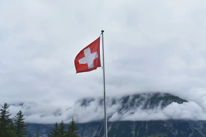
Schynige Platte to First - The Classic Bernese Oberland Ridge Walk
The hike from Schynige Platte to First is widely considered the quintessential Swiss alpine experience. Spanning 16 kilometres across the high ridges of the Bernese Oberland, this trail offers an uninterrupted panoramic spectacle of the "Big Three"—the Eiger, Mönch, and Jungfrau. This is not merely a walk; it is a journey through the heart of a UNESCO World Heritage landscape, where the emerald valleys of Interlaken and the turquoise depths of Lake Brienz sit thousands of metres below your boots. The route traverses a diverse array of terrain, from the weathered limestone karst of the Loucherhorn to the windswept summit of the Faulhorn, eventually descending to the mirror-like waters of Bachalpsee. It is a challenging day walk that demands physical stamina and respect for the alpine environment, but it rewards the hiker with views that have defined Swiss tourism for over a century. For those seeking the ultimate vantage point of the Bernese Alps without the need for technical climbing, this ridge traverse remains the gold standard.
- Distance: 16.0 km point-to-point
- Duration: 5–7 hours (depending on pace and breaks)
- Elevation Gain: 850 m (total ascent) / 650 m (total descent) - Note: Cumulative gain is approximately 1400 m
- Highest Point: Faulhorn (2,681 m)
- Difficulty: Challenging (T2/T3 on the Swiss Alpine Scale)
- Season: July to September (dependent on snow melt)
- Trailhead: Schynige Platte (accessible via cogwheel train from Wilderswil)
- Finish: First (accessible via gondola to Grindelwald)
Overview
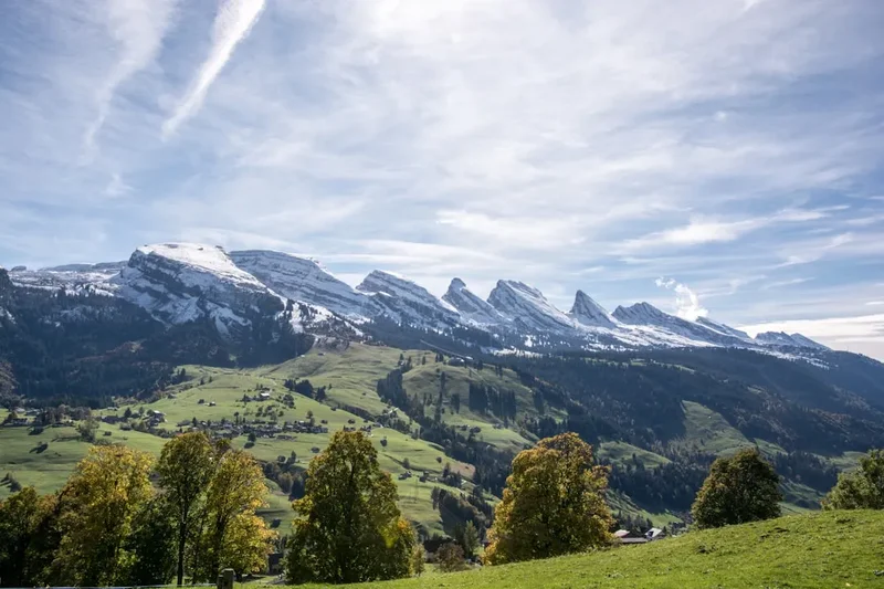
The Schynige Platte to First traverse is a masterclass in alpine geography. The trail begins at the historic Schynige Platte station, situated at 1,967 metres, where the air is immediately thinner and crisper than in the valley below. From the outset, the scale of the landscape is overwhelming. To the south, the massive glaciated peaks of the Jungfrau massif dominate the skyline, their white summits contrasting sharply against the deep blue of the Swiss sky. To the north, the land drops away precipitously toward Lake Brienz, creating a sensation of walking along the very spine of the world.
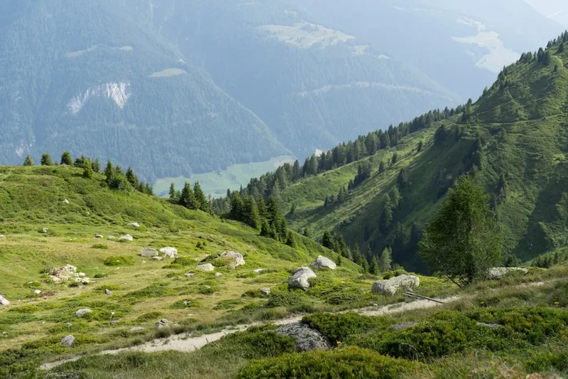
The first third of the hike winds through the Loucherhorn area, a region characterised by fascinating karst limestone formations. Here, the path is relatively level but requires careful footwork over uneven rock. As you progress, the vegetation shifts from the lush alpine meadows of Schynige Platte—famous for their botanical diversity—to a more rugged, high-alpine environment. The middle section of the hike is dominated by the steady, demanding ascent to the Faulhorn. At 2,681 metres, the Faulhorn is one of the highest points in the region accessible by a hiking trail, and the Berghaus (mountain hotel) at its summit has been welcoming travellers since 1830. The 360-degree view from this vantage point is unparalleled, encompassing the Jura Mountains to the north and the entire chain of the High Alps to the south.
The final third of the journey is a long, scenic descent toward First. This section features the Bachalpsee, a pair of alpine lakes that perfectly reflect the Schreckhorn and Finsteraarhorn on calm days. This is perhaps the most photographed spot in the Bernese Oberland, and for good reason. The trail concludes at the First gondola station, where hikers can choose to descend to Grindelwald by cable car or engage in more adrenaline-fuelled activities. Throughout the 16 kilometres, the trail is well-marked with the iconic yellow and white-red-white Swiss hiking signs, yet the physical toll of the cumulative elevation gain and the high altitude should not be underestimated. This is a high-mountain route that requires stable weather and a good level of fitness.
History and Cultural Context
The history of the Schynige Platte to First trail is inextricably linked to the birth of alpine tourism in the 19th century. Before the arrival of railways and grand hotels, these ridges were the domain of local shepherds and chamois hunters. The Faulhorn, however, gained early fame among European aristocrats and artists. In 1830, the Berghaus Faulhorn was constructed, making it the oldest mountain hotel in Switzerland and one of the oldest in Europe. It was built entirely from local stone and timber, a feat of engineering that required materials to be hauled up the steep slopes by hand and pack animal. Early visitors would often be carried up the mountain in sedan chairs to witness the sunrise, a practice that seems unimaginable to the modern hiker equipped with lightweight Gore-Tex and carbon-fibre poles.
The opening of the Schynige Platte Bahn in 1893 transformed the region's accessibility. This narrow-gauge cogwheel railway, which still uses vintage rolling stock and electric locomotives from the early 20th century, was a marvel of its time. It allowed Victorian-era tourists to reach the high meadows with ease, leading to the establishment of the Schynige Platte Alpine Botanical Garden in 1927. This garden, which hikers pass at the start of the trail, was created to preserve and showcase the incredible variety of alpine flora, including the rare Edelweiss and various species of Gentian. It remains a centre for scientific research and conservation today.
Culturally, the trail traverses land that has been used for "Alpabzug" (alpine transhumance) for centuries. During the summer months, you will still encounter cattle grazing in the lower meadows, their bells providing a rhythmic soundtrack to the hike. The production of mountain cheese (Alpkäse) remains a vital part of the local economy and heritage. The trail is more than just a recreational path; it is a link between the traditional agricultural life of the Bernese Oberland and the modern global phenomenon of alpine trekking. The UNESCO World Heritage status of the Jungfrau-Aletsch region, granted in 2001, recognises both the outstanding natural beauty and the cultural significance of this high-altitude landscape.
Want more background? Read extended notes on history and cultural context → Learn more
Seasonal Highlights and Weather Reality
The window for completing the Schynige Platte to First hike is relatively narrow due to its high elevation. The trail typically opens in early July and remains accessible until late September or early October. However, these dates are entirely dependent on the previous winter's snowfall and the rate of the spring melt.
July and August: This is the peak season. The alpine wildflowers are in full bloom, particularly in the Schynige Platte Botanical Garden and the meadows surrounding Bachalpsee. The weather is generally at its most stable, though afternoon thunderstorms are a common occurrence in the Alps. Hikers should aim for early starts to avoid being caught on the exposed ridges during a lightning storm. Temperatures can range from 20°C in the sun to near freezing if a cold front moves through.
September: Many experienced hikers consider September the best month for this trail. The air is often clearer, providing sharper views of the distant peaks, and the summer crowds have thinned. The first dustings of autumn snow may appear on the Faulhorn, and the larch trees begin to turn a golden hue. However, the days are shorter, and the temperature drops significantly once the sun dips behind the peaks.
The Winter Reality: From November to June, the trail is covered in deep snow and is often impassable without specialist mountaineering equipment and avalanche training. The Schynige Platte railway and the First gondola have seasonal closures, making access difficult. Even in late June, large snow patches can remain on the northern slopes of the Faulhorn, making the path treacherous and difficult to navigate. Always check the local "Wanderweg" (hiking trail) status on the Jungfrau region website before setting out.
Recommended Itinerary
Schynige Platte to First Route Progression
Waypoint 1: Schynige Platte Station to Loucherhorn
- Distance: 4 km
- Elevation: 150 m gain
- Time: 1–1.5 hours
- Begin at the Schynige Platte railway station (1,967 m).
- Follow signs toward "Faulhorn" and "First".
- The trail starts with a gentle climb through the Alpine Botanical Garden.
- Pass the Daube viewpoint for a spectacular look down at Interlaken and the two lakes (Thun and Brienz).
- Traverse the western flank of the Loucherhorn, entering a landscape of grey limestone karst and scattered boulders.
- The Eiger, Mönch, and Jungfrau are visible to your right throughout this section.
Waypoint 2: Loucherhorn to Männdlenen (Weberhütte)
- Distance: 4.5 km
- Elevation: 350 m gain
- Time: 1.5–2 hours
- The path becomes more rugged as it heads toward the Güw area.
- Navigate through the "Sägistal" valley, keeping an eye out for marmots in the scree slopes.
- A steady ascent leads to the Berghaus Männdlenen (also known as Weberhütte) at 2,344 m.
- This is an excellent spot for a mid-morning break; the hut serves traditional Swiss soups and refreshments.
- The terrain here is classic high-alpine: sparse vegetation, rocky outcrops, and wide-open vistas.
Waypoint 3: Männdlenen to Faulhorn Summit
- Distance: 3 km
- Elevation: 340 m gain
- Time: 1–1.5 hours
- This is the most demanding climb of the day. The trail zigzags steeply up the southern slope of the Faulhorn.
- The path is well-maintained but can be slippery if wet or if snow patches remain.
- Reach the ridge line and follow it to the Berghaus Faulhorn (2,681 m).
- The summit offers a 360-degree panorama. To the north, you can see as far as the Black Forest in Germany on exceptionally clear days.
- Take time to soak in the view of the Grindelwald valley far below.
Waypoint 4: Faulhorn to Bachalpsee
- Distance: 3 km
- Elevation: 420 m descent
- Time: 1 hour
- The descent from the Faulhorn is steep initially but soon levels out into a wide, gravelled path.
- Head southeast toward the shimmering blue waters of Bachalpsee (2,265 m).
- This section is popular with day-trippers coming from First, so expect more foot traffic.
- The twin lakes of Bachalpsee are the perfect place for a late lunch. The reflection of the Schreckhorn in the water is a world-famous photo opportunity.
Waypoint 5: Bachalpsee to First Station
- Distance: 1.5 km
- Elevation: 100 m descent
- Time: 30–45 minutes
- The final stretch is a broad, easy path that winds around the hillside toward the First gondola station.
- Pass the "First Cliff Walk by Tissot"—a metal walkway suspended over the precipice (free of charge).
- Arrive at the First mountain station (2,167 m).
- Ensure you arrive before the last gondola departure (usually between 17:00 and 18:00 depending on the month).
- Take the gondola down to Grindelwald, enjoying the views of the Eiger North Face during the descent.
Important Notes:
- The total cumulative elevation gain is significant (approx. 1400 m) due to the undulating nature of the ridge.
- There is very little shade on this trail; sun protection is vital.
- Water sources are limited between the mountain huts; carry at least 2 litres.
- The trail is a point-to-point route; ensure you have your return transport from Grindelwald organised.
Planning and Bookings
Book Your Trip
Everything you need to plan your journey
Accommodation
Find places to stay near Interlaken
Flights
Search flights to Interlaken
Essential Preparation
The Schynige Platte to First hike requires careful logistical planning, primarily due to the reliance on mountain transport. You must coordinate the timing of the Schynige Platte cogwheel train and the First gondola. It is highly recommended to stay in Interlaken, Wilderswil, or Grindelwald the night before to ensure an early start. The first train from Wilderswil usually departs around 07:25, and taking this early service is crucial to avoid the midday heat and ensure you reach First before the last gondola down.
Fitness is a key consideration. While the trail is technically a "walk" rather than a climb, the 16-kilometre distance combined with high altitude and significant cumulative ascent makes it a strenuous undertaking. Hikers should be comfortable with 6–7 hours of movement in mountainous terrain. There are no easy "exit" points once you pass the Loucherhorn; the only way out is to finish the trail or turn back.
Trail Accommodation
As this is primarily a day hike, most visitors do not require overnight accommodation on the trail. However, for those wishing to experience a high-alpine sunrise or break the journey into two shorter days, there are several unique options.
Berghaus Schynige Platte: Located at the start of the trail. Offers traditional hotel rooms and a restaurant. Ideal for those who want to start the hike at dawn.
Berghaus Männdlenen: A rustic mountain hut located roughly halfway through the hike. It offers dormitory-style sleeping (Matratzenlager). Facilities are basic: shared toilets, no showers, and limited electricity. Half-board (dinner and breakfast) is usually provided. Booking is essential, especially on weekends.
Berghaus Faulhorn: The historic hotel at the summit. It offers both private rooms and dormitories. There is no running water for showers (due to the altitude), and all supplies are brought up by helicopter or foot. It provides one of the most memorable overnight stays in the Alps. Open from July to September.
First Mountain Hotel: Located at the end of the trail. Offers more modern amenities, including private rooms with en-suite bathrooms. A good option if you finish late and want to stay on the mountain.
Note: Wild camping is strictly prohibited in this region to protect the fragile alpine ecosystem and the UNESCO World Heritage site. Fines are heavy and enforced by local rangers.
Required Gear
- Hiking Boots: Sturdy, waterproof boots with good ankle support and a Vibram-style sole are essential. The karst limestone and scree sections can be very hard on the feet.
- Clothing Layers: The weather can change in minutes. Bring a moisture-wicking base layer, an insulating mid-layer (fleece or light down), and a high-quality waterproof/windproof shell jacket.
- Sun Protection: At 2,600 metres, the UV radiation is intense. Bring a wide-brimmed hat, high-SPF sunscreen, and Category 3 or 4 sunglasses.
- Navigation: While the trail is well-marked, a topographic map (1:25,000) or a reliable GPS app with offline maps (such as SwitzerlandMobility) is necessary in case of fog or low visibility.
- First Aid: A basic kit including blister plasters (Compeed), antiseptic wipes, a space blanket, and any personal medications.
What to Bring
- Water: At least 2 litres per person. While you can refill at the mountain huts, the water may not always be treated, and there are long stretches with no access to water.
- Food: High-energy snacks (nuts, dried fruit, chocolate) and a substantial lunch. While the huts serve food, they can be busy, and having your own supplies provides flexibility.
- Cash: While many Swiss mountain huts now accept cards, some smaller establishments or "honesty boxes" for local produce may only take Swiss Francs (CHF).
- Trekking Poles: Highly recommended to reduce the impact on knees during the steep descent from the Faulhorn to Bachalpsee.
- Mobile Phone and Power Bank: Ensure your phone is fully charged for photos and emergencies. Cold temperatures can drain batteries quickly.
Permits
No formal permits are required to hike the Schynige Platte to First trail. The mountains are open to all. However, the "cost of entry" is effectively the price of the mountain transport, which is significant in Switzerland. Hikers must purchase tickets for the Schynige Platte Bahn (cogwheel train) and the Firstbahn (gondola).
Transport Costs (Approximate):
- Wilderswil to Schynige Platte (one way): CHF 32.00
- First to Grindelwald (one way): CHF 32.00
- Grindelwald to Interlaken Ost (train): CHF 11.00
Discounts: If you hold a Swiss Travel Pass or a Half Fare Card, you will receive a 50% discount on these prices. The Jungfrau Travel Pass and the Berner Oberland Pass also cover these routes, often allowing for "free" travel if you have already purchased the pass for your trip. It is highly recommended to check the current prices and operating hours on the Jungfrau.ch website before your trip.
Group Bookings: For groups of 10 or more, discounted rates are available on the mountain railways, but these must be booked in advance through the SBB (Swiss Federal Railways) or Jungfrau Railways sales offices.
Other Activities in the Area
The Jungfrau region is a playground for outdoor enthusiasts. If you have extra time in the area, consider these activities:
- First Adventure Activities: At the First station, you can try the First Flyer (a 800-metre zip line), the First Glider, or rent "Mountain Carts" and "Trottibikes" for a fun descent into Grindelwald.
- Harder Kulm: Take the funicular from Interlaken to the "Top of Interlaken" for a different perspective of the Eiger, Mönch, and Jungfrau, and a view of the town nestled between the lakes.
- Jungfraujoch - Top of Europe: The famous railway journey to the highest railway station in Europe (3,454 m). Visit the Sphinx Observatory and walk on the Aletsch Glacier.
- Lake Brienz Cruises: After a long hike, a relaxing boat trip on the turquoise waters of Lake Brienz is a perfect way to recover. The boats stop at the Giessbach Falls, which are well worth a visit.
- Lauterbrunnen Valley: Visit the "Valley of 72 Waterfalls," including the famous Staubbach Falls and the Trümmelbach Falls (waterfalls inside the mountain).
Safety and Conditions
Weather Awareness: The most significant danger on this trail is the weather. Conditions can deteriorate with startling speed. If clouds begin to build rapidly or you hear thunder, do not attempt the summit of the Faulhorn. The ridge is highly exposed, making it a dangerous place during a lightning storm. Always check the "MeteoSwiss" app for the most accurate local forecasts.
Terrain and Footing: The section around the Loucherhorn involves walking over karst limestone, which can be extremely slippery when wet. The descent from the Faulhorn is steep and consists of loose gravel; trekking poles are a major safety asset here to prevent slips and falls. Stay on the marked paths at all times; the cliffs on the northern side of the ridge are sheer and unforgiving.
Altitude Sickness: While 2,681 metres is not high enough to cause severe altitude sickness for most people, some hikers may experience mild symptoms such as headaches or shortness of breath. If you feel unwell, descend slowly. Hydration is key to managing the effects of altitude.
Emergency Contacts: In Switzerland, the emergency number for mountain rescue (REGA) is 1414. For general emergencies, dial 112. It is advisable to have a mobile phone with a Swiss SIM or roaming enabled, though be aware that signal can be spotty in the deep valleys between the ridges.
Snow Patches: Even in mid-summer, north-facing hollows may hold snow. If a snow patch looks too steep or icy to cross safely, and you do not have appropriate gear, turn back. A slip on a frozen snow patch can lead to an uncontrolled slide.
Side Trips and Points of Interest
Schynige Platte Alpine Botanical Garden: Located right at the start of the hike, this garden contains over 600 species of plants native to the Swiss Alps. It is a unique opportunity to see rare flowers like the Edelweiss, Alpine Aster, and various orchids in their natural habitat. The garden is laid out in ecological groups, making it an educational experience as well as a beautiful one.
The Daube Viewpoint: A short 15-minute detour from the main path near Schynige Platte. It offers a vertical drop view down to Interlaken and the Bödeli (the flat land between the lakes). It is one of the best spots for photography at the beginning of the day.
Oberberghorn: For those with extra energy, a short, steep climb via wooden stairs leads to the summit of the Oberberghorn. The view from the top provides a dramatic perspective of the ridge you are about to traverse.
Bachalpsee: While part of the main trail, the lakes deserve extra time. Many hikers choose to walk around the perimeter of the larger lake to find the perfect angle for the "mirror reflection" photo of the Schreckhorn. The area around the lakes is also a great place to spot alpine choughs (black birds with yellow beaks) and occasionally ibex on the higher slopes.
First Cliff Walk by Tissot: Located at the First station, this metal walkway clings to the side of the cliff and includes a 45-metre long single-filament bridge. It offers a thrilling end to the hike and spectacular views of the Grindelwald glaciers.
Leave No Trace
The Bernese Oberland is a fragile environment that sees hundreds of thousands of visitors each year. To preserve the beauty of the Schynige Platte to First trail, all hikers must adhere to strict Leave No Trace principles. The area is part of a UNESCO World Heritage site, and its protection is a matter of national pride and international importance.
Guidelines for Responsible Hiking:
- Pack it in, pack it out: There are no rubbish bins along the trail. Carry all your waste, including organic matter like banana skins and apple cores, back down to the valley. Organic waste takes years to decompose at high altitudes and can harm local wildlife.
- Stay on the path: The alpine tundra is extremely slow to recover from trampling. Short-cutting switchbacks causes erosion and destroys rare plant life.
- Respect the wildlife: Observe marmots, chamois, and ibex from a distance. Never feed them, as this disrupts their natural foraging habits and can make them dependent on humans.
- No Wild Camping: As mentioned, camping is prohibited. Use the designated mountain huts if you wish to stay overnight.
- Water Protection: Do not use soaps or detergents in the Bachalpsee or alpine streams. Even biodegradable soaps can disrupt the delicate chemical balance of these high-altitude waters.
- Leave what you find: Do not pick wildflowers or remove rocks. The Alpine Botanical Garden exists to protect these species; let them stay in the wild for others to enjoy.