
Sarek National Park Loop
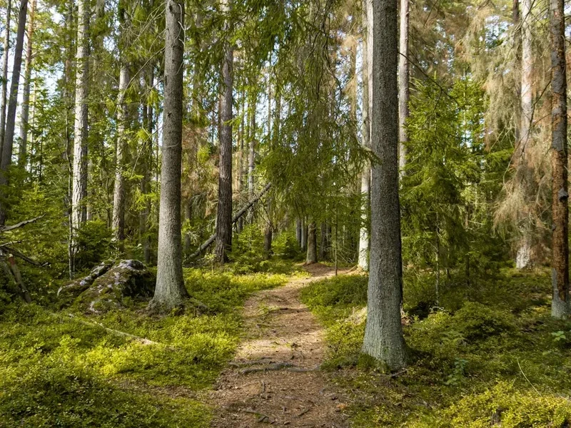
The Sarek National Park Loop is an epic, multi-day wilderness trek through one of Europe's largest remaining roadless areas. Situated in the heart of Swedish Lapland, Sarek National Park is a realm of raw, untamed beauty, characterised by vast glacial valleys, towering granite peaks, and an abundance of wild rivers. This is not a marked or maintained trail in the conventional sense; instead, it is a true expedition for experienced hikers seeking profound solitude and a genuine challenge. The loop typically traverses a significant portion of the park, offering a comprehensive immersion into its dramatic landscapes.
- Distance: Approximately 120 km (variable depending on exact route)
- Duration: 7–10 days
- Season: July to September (summer months)
- Difficulty: Very Challenging (requires advanced navigation and wilderness skills)
- Terrain: Glacial valleys, river crossings, boulder fields, scree slopes, alpine meadows
- Access: Via Kiruna or Gallivare, then bus to Ritsem or Kebnats
- Accommodation: Wild camping only
- Highest point: Varies by route, but often involves crossing high passes
Overview
The Sarek National Park Loop is an undertaking for the seasoned adventurer, a journey into a landscape that remains largely untouched by human intervention. Unlike many European national parks, Sarek offers no marked trails, no huts, and no visitor services within its boundaries. This absence of infrastructure is precisely what defines its allure: an unparalleled opportunity for solitude and self-reliance in a truly wild environment. The loop, while not a formally defined route, typically encompasses a circuit that showcases the park's most iconic features.
Hikers can expect to navigate through vast, U-shaped glacial valleys carved by ancient ice flows, such as the Rapadalen. These valleys are often carpeted with vibrant alpine flora in summer, contrasting sharply with the stark, grey granite peaks that dominate the skyline. The park is crisscrossed by numerous powerful rivers, many originating from glaciers, which present significant crossing challenges. These river crossings are often the most demanding and potentially dangerous aspects of the trek, requiring careful assessment of water levels, flow rates, and the use of appropriate techniques or equipment.
The scale of Sarek is immense. Peaks like Skierfe, with its dramatic cliff face overlooking the Rapadalen, offer breathtaking vistas. The park is also a vital habitat for Arctic wildlife, including reindeer, moose, and various bird species. The experience is one of complete immersion in nature, where the rhythm of the day is dictated by weather, daylight hours, and the physical demands of traversing challenging terrain. This is a trek that tests not only physical endurance but also mental fortitude, navigation skills, and the ability to make sound decisions in a remote and unforgiving environment.
History and Cultural Context
Sarek National Park, established in 1909, is one of Europe's oldest national parks. Its creation was part of a broader movement in the early 20th century to preserve pristine natural landscapes from industrialisation and development. The park's designation aimed to protect its unique Arctic ecosystems, its vast wilderness, and its geological formations, including the numerous glaciers and glacial valleys that define its character.
For centuries, the Sámi people have inhabited and travelled through the Sarek region. Their traditional way of life, deeply intertwined with the land and its resources, has shaped the cultural landscape of Lapland. Reindeer herding remains a significant cultural practice, and the park's vast pastures are crucial for the herds. While Sarek is a national park, it is also part of the Sámi ancestral lands, and their rights and traditions are recognised. The park's remoteness and lack of infrastructure are, in part, a legacy of its historical use by the Sámi, who moved through the landscape rather than settling it permanently.
The park's geological history is equally compelling. Sarek is a testament to the immense power of glaciation, with its characteristic U-shaped valleys, moraines, and sharp, jagged peaks sculpted by ice over millennia. The presence of numerous glaciers, some of the largest in mainland Sweden, continues to shape the landscape today, feeding the wild rivers that are a defining feature of the park.
Seasonal Highlights and Weather Reality
The primary hiking season for Sarek National Park is during the summer months, from July to September. During this period, the snow cover recedes from the lower and mid-altitudes, making travel more feasible. The days are long, with the midnight sun providing ample daylight for exploration in early summer.
July: This is often considered the prime month for hiking. The vegetation is lush and green, and the rivers, while still powerful, may be at their lowest point before the peak of glacial meltwater. Wildflowers are abundant in the alpine meadows. However, July can also bring the highest numbers of mosquitoes and biting insects, particularly in the valleys. Temperatures are generally mild, but can fluctuate significantly.
August: The insect population typically begins to decrease, making August a very popular month. The autumn colours start to appear in the vegetation, adding a new dimension to the landscape. River levels can be higher due to increased glacial melt. The weather can become more unpredictable, with a greater chance of rain and cooler temperatures.
September: This month offers crisp, clear air and the possibility of spectacular autumn colours. However, the weather becomes significantly more unpredictable, with a higher risk of early snowfalls, frost, and freezing temperatures, especially at higher elevations. Daylight hours are also shorter. River levels may start to decrease towards the end of the month.
Weather Reality: It is crucial to understand that Sarek's weather is notoriously unpredictable and can change with extreme rapidity. Even in mid-summer, hikers can experience all four seasons in a single day: sunshine, heavy rain, strong winds, fog, and even snow. Temperatures can drop below freezing at night, even at lower altitudes. Preparedness for all conditions is paramount.
Recommended Itinerary
7-10 Day Sarek National Park Loop (Example Route)
Note: This is a sample itinerary. Exact routes will vary based on conditions, personal preference, and navigation choices. River crossing difficulty is a major factor in daily progress.
Day 1: Ritsem to Vakkotavare Area (or similar starting point)
- Distance: 10-15 km
- Elevation gain: Variable
- Time: 4-6 hours
- Start from Ritsem, a small village on Lake Akkajaure.
- Begin by following the marked trail towards Vakkotavare, which offers a more established path initially.
- This day is about acclimatising to the terrain and the weight of your pack.
- Camp near Vakkotavare or in the surrounding wilderness, preparing for deeper immersion into the park.
Day 2: Vakkotavare Area towards Rapadalen Valley
- Distance: 15-20 km
- Elevation gain: Variable
- Time: 6-8 hours
- Head west into the park, aiming towards the vast Rapadalen valley system.
- This section involves off-trail navigation, crossing smaller streams and potentially boggy terrain.
- The landscape begins to open up, with views of the surrounding mountains.
- Camp in the lower reaches of the Rapadalen valley.
Day 3: Exploring Rapadalen Valley
- Distance: 10-15 km
- Elevation gain: Minimal
- Time: 4-6 hours
- Focus on navigating the Rapadalen valley floor.
- This is a prime area for wildlife spotting (reindeer are common).
- The terrain can be marshy and require careful route selection to avoid deep mud.
- Potential for a significant river crossing if deviating from the main valley floor.
- Camp within the valley, enjoying the immense scale of the landscape.
Day 4: Crossing the Rapadalen towards Sarek's Interior
- Distance: 15-20 km
- Elevation gain: Significant
- Time: 7-9 hours
- This day likely involves a major river crossing, such as the Laitaure or a tributary of the Rapaätno.
- Careful planning and assessment of conditions are critical.
- Ascend out of the main valley towards the higher mountain regions.
- The terrain becomes more rugged, with boulder fields and scree.
- Camp in a sheltered spot in the higher alpine zone.
Day 5: Navigating the High Mountain Passes
- Distance: 15-20 km
- Elevation gain: Significant
- Time: 7-9 hours
- Traverse high mountain passes, potentially crossing glaciers or snowfields depending on the season and exact route.
- Navigation is paramount; visibility can be poor due to fog or cloud.
- Enjoy panoramic views from the high points, weather permitting.
- Descend into a new valley system, seeking a suitable camping spot.
Day 6: Descending towards another major river system
- Distance: 15-20 km
- Elevation gain: Mostly descent
- Time: 6-8 hours
- Continue navigating through the wilderness, aiming for another significant river system, perhaps the Pårte or a tributary of the Sarvesjåkkå.
- Another challenging river crossing may be encountered.
- The landscape may shift, offering different geological features.
- Camp near the river.
Day 7: Towards the edge of the park / Ritsem direction
- Distance: 15-20 km
- Elevation gain: Variable
- Time: 6-8 hours
- Begin making your way back towards the park boundary or a pre-arranged pick-up point.
- This may involve following a river valley or traversing more open terrain.
- The final days are about efficient travel and ensuring you reach your exit point on time.
- Camp in a suitable location, reflecting on the journey.
Days 8-10: Contingency and Return Journey
- These days are built in for flexibility due to weather, river conditions, or simply the desire to spend more time in a particular area.
- The final push back to Ritsem or another access point.
- The journey out can be as challenging as the journey in.
Important Considerations:
- This itinerary is a guideline; actual distances and times can vary significantly.
- River crossings are the primary determinant of daily progress and safety.
- Always carry a map, compass, and GPS device, and know how to use them.
- Be prepared for all weather conditions.
- Carry sufficient food and fuel for the entire duration, plus emergency supplies.
- Inform someone of your planned route and expected return date.
Planning and Bookings
Book Your Trip
Everything you need to plan your journey
Accommodation
Find places to stay near Kiruna
Flights
Search flights to Kiruna
Essential Preparation
Embarking on the Sarek National Park Loop requires meticulous planning and a high degree of self-sufficiency. This is not a trail for the casual hiker. Essential preparation includes:
- Fitness: A very high level of cardiovascular fitness and muscular endurance is required. You will be carrying a heavy pack (15-20 kg) for extended periods over challenging, uneven terrain, often with significant elevation changes. Training should include long hikes with a weighted pack, hill training, and strength conditioning.
- Navigation Skills: Proficiency in map reading, compass use, and GPS operation is non-negotiable. You must be comfortable navigating off-trail in potentially poor visibility. Consider taking advanced navigation courses.
- Wilderness Experience: Prior experience in multi-day remote trekking, including wild camping, managing food supplies, and dealing with adverse weather, is essential.
- Logistics: Plan your transport to and from the park access points (Ritsem or Kebnats). Book flights to Kiruna (KRN) or Gallivare (GVE) well in advance. From these cities, buses operate to Ritsem (approx. 4 hours from Kiruna) or Kebnats (for access to the western side). Research bus schedules carefully as they can be infrequent.
- Base Town/City Information: Kiruna is the largest town in the area and offers comprehensive services, including supermarkets, outdoor gear shops, accommodation, and transport links. Gallivare is a smaller but still functional hub. Both are good places to finalise gear, purchase food, and gather last-minute information.
- Emergency Plan: Inform a reliable contact person of your detailed itinerary, expected return date, and emergency procedures. Carry a satellite communication device (e.g., PLB or satellite phone) for emergencies.
Trail Accommodation
This is a wilderness trek requiring wild camping only. There are no huts, lodges, or designated campsites within Sarek National Park. All accommodation must be self-provided.
- Wild Camping: Campers are expected to practice Leave No Trace principles. Choose durable surfaces away from water sources and sensitive vegetation. Set up camp discreetly and leave no trace of your presence.
- Booking Requirements: No bookings are required for camping within Sarek National Park, as it is a wilderness area with no formal accommodation.
- Facilities Provided: None. You must carry all your own shelter, sleeping gear, cooking equipment, and food.
- What's NOT Provided: Absolutely everything. This includes shelter, sleeping bags, cooking facilities, food, water treatment, toilets, and any form of assistance.
- Seasonal Availability: Wild camping is possible throughout the summer season (July-September). Outside this period, snow and extreme cold make it exceptionally dangerous and require advanced winter camping skills.
- Costs: There are no direct costs for camping within the park itself. However, transport to and from the park, food, and equipment represent significant expenses.
Required Gear
- Backpack: 70-90 litre capacity, robust and comfortable for carrying heavy loads. A good hip belt is essential.
- Tent: A sturdy, 4-season tent capable of withstanding strong winds and heavy rain/snow. Ensure it is well-ventilated to minimise condensation.
- Sleeping Bag: A high-quality down or synthetic sleeping bag rated to at least -10°C comfort temperature, preferably lower, to cope with potential freezing nights.
- Sleeping Mat: An insulated sleeping mat for warmth and comfort.
- Boots: Sturdy, waterproof, mid-to-high cut hiking boots with excellent ankle support. Ensure they are well broken-in.
- Waterproofs: High-quality, breathable waterproof jacket and overtrousers with taped seams.
- Navigation Tools: Topographic maps of the area, a reliable compass, and a GPS device with spare batteries or a power bank. Consider a satellite communication device (PLB or satellite phone).
- First Aid Kit: Comprehensive kit including blister treatment, pain relief, bandages, antiseptic wipes, personal medications, and any specific items for wilderness emergencies.
- Head Torch: With spare batteries.
- Trekking Poles: Highly recommended for stability, especially during river crossings and on uneven terrain.
- River Crossing Gear: Consider neoprene socks or water shoes for river crossings, and potentially a lightweight dry bag for essential items if crossing deep water.
What to Bring
- Food: Lightweight, high-calorie, non-perishable food for 7-10 days, plus at least 2 extra days' supply for emergencies. Dehydrated meals, energy bars, nuts, dried fruit, and jerky are good options.
- Water Treatment: A reliable water filter or purification tablets. While rivers are generally clear, treating water is always recommended due to potential upstream contamination (e.g., from reindeer).
- Cooking System: Lightweight camping stove (gas or liquid fuel), fuel, cooking pot, mug, bowl, and utensils. Lighters or waterproof matches.
- Toiletries: Biodegradable soap, toothbrush, toothpaste, toilet paper, hand sanitiser, and a small trowel for burying human waste (well away from water sources).
- Clothing Layers:
- Base layers (merino wool or synthetic)
- Mid-layers (fleece or down jacket)
- Warm hat and gloves
- Spare socks (multiple pairs of wool or synthetic)
- Camp clothing (comfortable, dry clothes for evenings)
- Sun Protection: High SPF sunscreen, sunglasses, and a wide-brimmed hat. The sun can be intense at higher altitudes, even on cloudy days.
- Insect Repellent: Strong repellent (e.g., containing DEET or Picaridin) is essential, especially in July and August. A head net is also highly recommended.
- Repair Kit: Duct tape, cordage, needle and thread, safety pins, and gear repair patches.
- Personal Items: Camera, journal, book, power bank for electronics.
Permits
Sarek National Park does not require permits for hiking or camping. As a vast wilderness area with no infrastructure, access is generally free. However, it is strongly recommended to register your intentions with the local authorities or a relevant organisation before entering the park. This is primarily for safety and emergency response purposes.
Registration:
- Mountain Stations: It is advisable to register your trip at the mountain stations in Ritsem or Kvikkjokk before you begin your trek. These stations can provide up-to-date information on weather and river conditions.
- Emergency Contact: Inform a trusted friend or family member of your detailed itinerary, expected return date, and emergency contact procedures.
Fees: There are no park entrance fees or camping fees within Sarek National Park itself. Costs are associated with transport to the park and personal equipment and supplies.
Seasonal Considerations: While no permits are required, the park is only safely accessible during the summer months (July-September). Attempting to enter the park outside this period without advanced winter expedition skills and equipment is extremely dangerous and not recommended.
Other Activities in the Area
While Sarek National Park itself is dedicated to wilderness trekking, the surrounding areas offer complementary experiences:
- Abisko National Park: Located further north, Abisko offers more established hiking trails, the famous Kungsleden (King's Trail), and the Aurora Sky Station for Northern Lights viewing in winter.
- Kungsleden (King's Trail): Sections of this long-distance trail can be incorporated into a trip to the region, offering a more structured hiking experience with huts and marked paths.
- Sámi Cultural Experiences: In towns like Kiruna and Jokkmokk, you can learn about Sámi culture, visit reindeer farms, and experience traditional crafts and cuisine.
- Kiruna: Visit the world's largest underground iron ore mine, explore the town centre (which is undergoing relocation), or enjoy local restaurants and shops.
- Jokkmokk: Known for its Sámi heritage and the annual Winter Market, Jokkmokk offers insights into the indigenous culture of the region.
- Fishing: The numerous lakes and rivers in the wider Lapland region offer excellent fishing opportunities, though local regulations and permits will apply.
- Northern Lights Viewing (Winter): If visiting outside the summer season, Lapland is one of the best places in the world to witness the Aurora Borealis.
Safety and Conditions
Pre-Departure Checks:
- Weather Forecasts: Obtain the most up-to-date weather forecasts for the Sarek region from reliable sources like the Swedish Meteorological and Hydrological Institute (SMHI) or local mountain stations. Be prepared for rapid changes.
- River Conditions: Crucially, check current river conditions. Information may be available from mountain stations or local guides. River levels can fluctuate dramatically due to rainfall and glacial melt.
- Park Alerts: While Sarek has no formal alerts system like some national parks, it's wise to check with local authorities or visitor centres for any specific warnings or advisories.
- Inform Someone: Always leave a detailed itinerary with a trusted contact person, including your planned route, expected return date, and emergency procedures.
River Crossings: This is the single most significant safety concern in Sarek. Rivers are often wide, fast-flowing, and cold.
- Assessment: Never attempt to cross a river without thoroughly assessing its depth, speed, and the stability of the riverbed. Look for wider, shallower sections.
- Technique: Use trekking poles for balance and to probe the depth. Cross at an angle upstream to the current. If the river is too high or fast, do not cross; wait for conditions to improve or find an alternative route.
- Equipment: Consider wearing sturdy water shoes or neoprene socks for better grip and protection. A dry bag for essential items is crucial if you need to carry them across.
Navigation: Off-trail navigation in potentially poor visibility (fog, rain, snow) is a constant challenge. Ensure you have reliable navigation tools and the skills to use them effectively. Getting lost in Sarek can have severe consequences.
Weather: Be prepared for extreme weather. Hypothermia is a real risk, even in summer. Carry adequate warm layers, waterproofs, and a reliable shelter. Sudden storms can make travel impossible and dangerous.
Insects: Mosquitoes and biting flies can be intense, particularly in July and August. They can be a significant nuisance and a source of discomfort, but also carry the risk of infection if bites are scratched excessively.
Wildlife: While Sarek is home to wildlife, encounters are generally not dangerous if proper precautions are taken. Keep a safe distance from reindeer and other animals. Store food securely to avoid attracting animals to your campsite.
Emergency Services: Rescue services in remote areas like Sarek are limited and can take a considerable time to reach you. Self-reliance and preparedness are key to a safe expedition.
Side Trips and Points of Interest
While Sarek is primarily about the grand, overarching wilderness experience, several areas and features stand out:
Rapadalen Valley: This is arguably the most iconic and visually stunning valley in Sarek. Characterised by its vast, meandering delta system formed by the Rapaätno river, it is a landscape of immense scale and beauty. The valley floor is often marshy and rich with vegetation in summer, offering opportunities for wildlife spotting, particularly reindeer. The dramatic cliff face of Skierfe, overlooking the delta, provides one of the most famous panoramic views in the park.
Skierfe: While not a "side trip" in the traditional sense, reaching a vantage point to view the Rapadalen delta from above, such as from the slopes of Skierfe, is a highlight for many. This requires a significant ascent and careful navigation, but the reward is an unforgettable vista of the park's intricate river systems and vast wilderness.
Sarek's Glaciers: The park is home to some of Sweden's largest glaciers, including the Sarekglaciären. While direct exploration of glaciers requires advanced mountaineering skills and equipment, their presence shapes the landscape, feeding the rivers and contributing to the dramatic, glaciated terrain.
The Great Rivers: The Rapaätno, Pårte, and Sarvesjåkkå are just a few of the major rivers that carve through Sarek. Their powerful flow, often milky with glacial silt, is a constant presence and a significant navigational challenge. Observing their raw power and the landscapes they have shaped is a key part of the Sarek experience.
Alpine Lakes: Numerous small, pristine alpine lakes dot the landscape, often nestled in cirques or glacial valleys. These offer opportunities for quiet reflection and stunning photographic subjects, especially when reflecting the surrounding peaks.
Leave No Trace
Practising Leave No Trace (LNT) principles is not just recommended in Sarek National Park; it is essential for preserving its pristine wilderness character. As a roadless area with no facilities, the impact of each visitor is magnified. Adherence to LNT ensures that Sarek remains a wild and beautiful place for future generations.
Your responsibility as a hiker:
- Plan Ahead and Prepare: Research the park, understand its challenges, and be prepared for all conditions. This includes carrying appropriate gear and sufficient food.
- Travel and Camp on Durable Surfaces: Stick to established routes where they exist (though rare in Sarek) and camp on resilient surfaces like rock, gravel, dry grass, or snow. Avoid setting up camp on fragile vegetation or near water sources.
- Dispose of Waste Properly: Pack out everything you pack in, including all food scraps, wrappers, and toilet paper. Use designated toilet facilities where available (none in Sarek), or dig catholes at least 70 metres away from water, camp, and trails. Pack out all human waste if possible, especially in sensitive areas.
- Leave What You Find: Do not remove or disturb natural objects, rocks, or plants. Leave the landscape as you found it.
- Minimise Campfire Impacts: Campfires are generally discouraged in Sarek due to the fragile environment and the availability of lightweight stoves. If a fire is absolutely necessary and permitted, use established fire rings where they exist (rare) and keep fires small. Ensure they are completely extinguished.
- Respect Wildlife: Observe wildlife from a distance. Never feed animals, as this can disrupt their natural behaviours and diets. Store food securely to prevent attracting animals to your campsite.
- Be Considerate of Other Visitors: While Sarek offers solitude, you may encounter other hikers. Keep noise levels down and yield to others on narrow paths.
Sarek is a true wilderness. Your actions have a direct impact. Tread lightly, be self-sufficient, and leave no trace of your passage.