Säntis Summit via Schwägalp: A Challenging Alpine Ascent
The Säntis Summit via Schwägalp is a demanding yet incredibly rewarding day hike in the heart of the Alpstein massif, Switzerland. This route offers a direct and challenging ascent from the Schwägalp plateau to the iconic Säntis summit, the highest peak in the Alpstein range. Known for its breathtaking panoramic views that can stretch across six countries on a clear day, the trail is a true test of endurance and a spectacular introduction to alpine hiking. The journey is characterised by steep ascents, rocky terrain, and exposure to the elements, culminating in a summit experience that is both exhilarating and humbling. This is a walk for those seeking a significant physical challenge coupled with unparalleled natural beauty, requiring careful preparation and a good level of fitness.
- Distance: 12.5 km one-way
- Elevation Gain: 1,245 m
- Duration: 5–6 hours (one-way ascent)
- Difficulty: Challenging
- Best Time: June to October (when snow-free)
- Highest Point: Säntis Summit (2,502 m)
- Trailhead Access: Schwägalp (via public transport or car)
- Permits: Not required
Overview
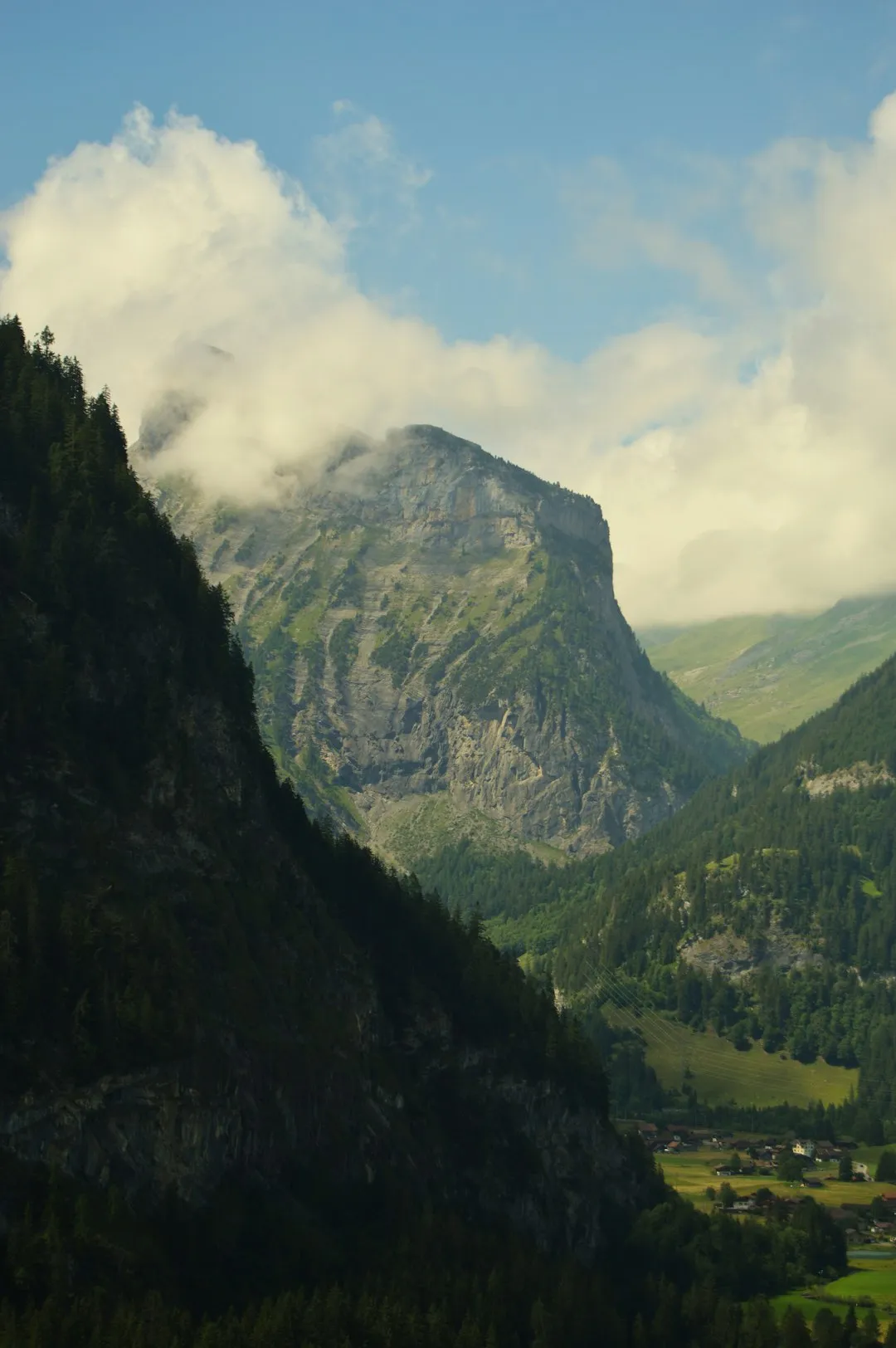
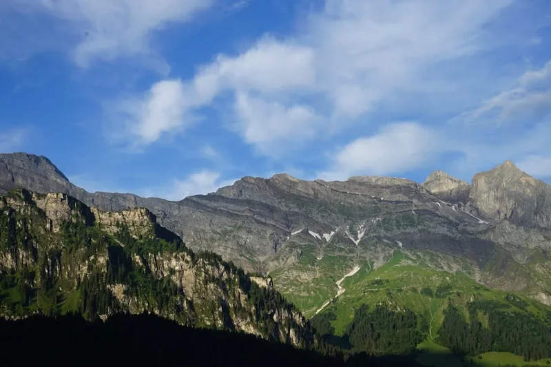
The Säntis Summit via Schwägalp hike is a classic alpine challenge that begins at the Schwägalp pass, a popular starting point accessible by car and public transport. From here, the trail embarks on a relentless, steep climb towards the summit of Säntis. The initial section winds through alpine meadows and sparse woodland, offering glimpses of the dramatic karst landscape of the Alpstein. As the altitude increases, the vegetation thins, and the path becomes more rugged, transitioning into rocky scree and exposed sections. The ascent is sustained, with significant elevation gain packed into a relatively short distance, demanding considerable physical effort and mental fortitude.
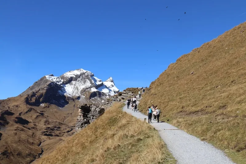
The trail is well-marked but can be steep and exposed in places, particularly as it nears the summit ridge. Hikers will encounter a variety of terrain, from well-trodden paths to rocky scrambles. The reward for this strenuous effort is immense. Upon reaching the summit of Säntis (2,502 m), hikers are greeted with a truly spectacular 360-degree panorama. On a clear day, the views extend across the Swiss Plateau, the German Black Forest, the French Vosges, the Austrian Alps, and even into Italy. The summit area is also home to a well-equipped mountain restaurant and viewing platforms, offering a comfortable place to rest and soak in the scenery. The descent follows the same route back to Schwägalp, which is equally demanding on the knees and requires careful footing.
This hike is best undertaken during the summer months when the snow has melted and the weather is generally more stable. However, mountain weather can change rapidly, and even in summer, conditions can be harsh. The Säntis Summit via Schwägalp is not a casual stroll; it is a serious alpine undertaking that requires respect for the mountain environment, appropriate gear, and a good level of physical fitness.
History and Cultural Context
The Säntis, standing at 2,502 metres, has been a significant landmark and a point of fascination for centuries. Its prominent position in the Alpstein massif has made it a natural destination for explorers, scientists, and travellers. The summit area has a long history of human presence, with early ascents likely made by shepherds and hunters long before organised mountaineering became popular.
The development of tourism in the region in the late 19th and early 20th centuries saw increased interest in reaching the Säntis summit. The construction of the Schwägalp-Säntis cable car, which opened in 1935, dramatically increased accessibility to the summit, transforming it into a major tourist attraction. However, the hiking trail from Schwägalp remains a testament to the traditional alpine experience, offering a more challenging and intimate connection with the mountain.
Historically, the Säntis was also a site of scientific interest. Meteorological observations have been conducted on the summit for over a century, contributing valuable data to understanding alpine weather patterns. The mountain's exposed position makes it an ideal location for such studies. The region surrounding the Alpstein has a rich cultural heritage, with traditions of alpine farming and cheese-making deeply ingrained in the local identity. The hike to Säntis summit connects modern visitors to this enduring relationship between people and the high mountains.
Seasonal Highlights and Weather Reality
The Säntis Summit via Schwägalp is a summer alpine hike, with the optimal season running from June to October. During these months, the snow typically recedes from the higher trails, making the ascent feasible and safer.
June: Early June can still see lingering snow patches, especially on shaded north-facing slopes and at higher elevations. While the main trail might be clear, caution is advised, and checking local conditions is essential. Wildflowers begin to bloom in the lower alpine meadows, adding colour to the landscape.
July and August: These are the peak months for hiking. The weather is generally warmer, and the trails are usually snow-free. The summit offers spectacular panoramic views, and the mountain restaurant is fully operational. However, these months also see the highest number of visitors, and sandflies can be present, though less of an issue than in some other alpine regions. Afternoon thunderstorms are a common occurrence, so starting early is crucial.
September: Autumn brings crisp air, clearer skies, and fewer crowds. The alpine meadows may start to show autumnal colours, offering a different kind of beauty. The temperatures begin to cool, and the risk of early snow increases towards the end of the month.
October: Early October can still offer good hiking days, but the likelihood of snow increases significantly. By mid-to-late October, the trail may become impassable due to snow and ice, especially at higher altitudes. The cable car typically operates until mid-November, but the hiking trail conditions are the primary determinant for this route.
Weather Considerations: The Säntis summit is exposed to extreme weather conditions at any time of year. Temperatures can drop significantly with altitude, and strong winds are common. Fog and cloud can descend rapidly, reducing visibility to near zero and making navigation difficult. Always check the mountain forecast (Metar/TAF for nearby airports and specific mountain forecasts) before setting out and be prepared for sudden changes. Hypothermia is a risk even in summer if you are caught unprepared in adverse weather.
Recommended Itinerary
Säntis Summit via Schwägalp: Day Hike Itinerary
Early Morning (approx. 7:00 AM - 8:00 AM): Arrival and Preparation at Schwägalp
- Travel to Schwägalp (via public transport or car).
- Park your vehicle at the designated parking area (fee applies).
- Visit the visitor centre or information point for the latest trail conditions and weather updates.
- Final gear check: ensure boots are laced, backpack is comfortable, and all essential items are accessible.
- Hydrate and have a light, energy-rich breakfast.
Morning (approx. 8:00 AM - 12:00 PM): Ascent from Schwägalp to Mid-Mountain
- Begin the hike from Schwägalp (1,775 m).
- The initial section is a steady, sometimes steep, climb through alpine meadows and sparse woodland.
- Follow the well-marked trail signs towards Säntis.
- Terrain is a mix of gravel paths and rocky sections.
- Gain significant elevation, with the landscape becoming more rugged and open.
- Key waypoints may include signs indicating the direction and distance to the summit.
- Enjoy the expanding views of the surrounding Alpstein massif.
Midday (approx. 12:00 PM - 2:00 PM): Reaching Higher Altitudes and Summit Approach
- The trail becomes steeper and more exposed as you gain altitude.
- You will encounter more rocky terrain, scree, and potentially some short, easy scrambling sections.
- The path is generally well-maintained but requires careful footing.
- Take short breaks to hydrate and refuel with snacks.
- The summit building and antenna become increasingly visible, providing a clear target.
- This is the most physically demanding part of the ascent.
Afternoon (approx. 2:00 PM - 3:00 PM): Summit Arrival and Exploration
- Reach the Säntis Summit (2,502 m).
- Spend time enjoying the unparalleled 360-degree panoramic views.
- Visit the summit restaurant for refreshments or a meal.
- Explore the viewing platforms and take photographs.
- Allow ample time to appreciate the vastness of the landscape stretching across multiple countries.
Late Afternoon (approx. 3:00 PM onwards): Descent to Schwägalp
- Begin the descent back to Schwägalp.
- The descent follows the same route as the ascent.
- Exercise caution, as downhill sections can be hard on the knees and require careful footing, especially on rocky or scree-covered parts.
- Take your time to avoid slips and falls.
- Arrive back at Schwägalp, where you can relax and reflect on your achievement.
Important Notes:
- This is a challenging day hike; ensure you have adequate fitness and stamina.
- Start early to allow plenty of time and avoid afternoon thunderstorms.
- Carry sufficient water and high-energy food.
- Check the weather forecast immediately before and during your hike.
- Wear sturdy, broken-in hiking boots and dress in layers.
- Be prepared for rapidly changing mountain weather.
Planning and Bookings
Book Your Trip
Everything you need to plan your journey
Accommodation
Find places to stay near St. Gallen
Flights
Search flights to St. Gallen
Essential Preparation
The Säntis Summit via Schwägalp hike is a significant undertaking that requires thorough preparation. Your fitness level is paramount; this is a strenuous climb with over 1,200 metres of elevation gain. Ensure you are comfortable with sustained uphill walking on uneven terrain for several hours. Familiarise yourself with the route using maps and guidebooks. The closest major city is St. Gallen, which offers a wide range of accommodation, dining, and transport options. From St. Gallen, you can take a scenic train journey followed by a bus to reach Schwägalp. If driving, the route to Schwägalp is well-maintained, with ample parking available at the base station, though a fee applies. It is advisable to check the status of the road and public transport schedules in advance, especially outside the peak summer season.
Trail Accommodation
This is a day hike requiring no overnight accommodation.
Required Gear
- Sturdy Hiking Boots: Waterproof, with good ankle support and a well-worn sole for grip on rocky and uneven terrain.
- Backpack: A comfortable daypack (20-30 litres) to carry essentials.
- Waterproof Jacket and Trousers: Essential for protection against rain and wind, which can change rapidly in the mountains.
- Warm Layers: Including a fleece or insulated jacket, and a hat and gloves, as temperatures can be significantly cooler at higher altitudes.
- Navigation Tools: A detailed map of the area, a compass, and a GPS device or smartphone with offline maps. Mobile signal can be unreliable.
- Head Torch: With spare batteries, in case of unexpected delays or early starts/late finishes.
- First-Aid Kit: Including blister treatment, pain relievers, bandages, antiseptic wipes, and any personal medications.
- Sun Protection: High SPF sunscreen, sunglasses, and a wide-brimmed hat, as the sun can be intense at altitude, even on cloudy days.
What to Bring
- Water: Carry at least 2-3 litres of water per person. Refill points are scarce on the trail itself, though the summit restaurant offers refreshments.
- Food: High-energy snacks such as nuts, dried fruit, energy bars, and sandwiches. A packed lunch is recommended.
- Toiletries: Biodegradable toilet paper, hand sanitiser, and any personal hygiene items.
- Trekking Poles: Highly recommended for reducing strain on knees during the ascent and descent, and for improving stability on rough terrain.
- Camera: To capture the spectacular views.
- Cash: For purchases at the summit restaurant or parking fees, as card payment facilities may not always be available or reliable.
- Emergency Whistle: For signalling in case of emergency.
Permits
No specific permits are required to hike the Säntis Summit via Schwägalp trail. The route is part of the public hiking network in Switzerland. However, access to the summit area via the cable car requires a ticket, and parking at Schwägalp incurs a fee. It is always advisable to check for any local regulations or temporary restrictions that might be in place, although these are rare for this particular hiking route.
Other Activities in the Area
The Schwägalp and Säntis region offers a variety of activities beyond the summit hike:
- Säntis Cable Car: For those who prefer not to hike the entire ascent, the cable car provides a swift and comfortable journey to the summit, offering similar panoramic views.
- Schwägalp Nature Park: Explore the well-maintained walking paths around the Schwägalp plateau, which are generally easier and suitable for families. These paths offer beautiful views of the surrounding mountains and valleys.
- Säntis Mountain Restaurant: Enjoy local Swiss cuisine and refreshments at the restaurant located at the summit, with its stunning backdrop.
- Säntis Observatory: Learn about the meteorological and astronomical research conducted at the summit.
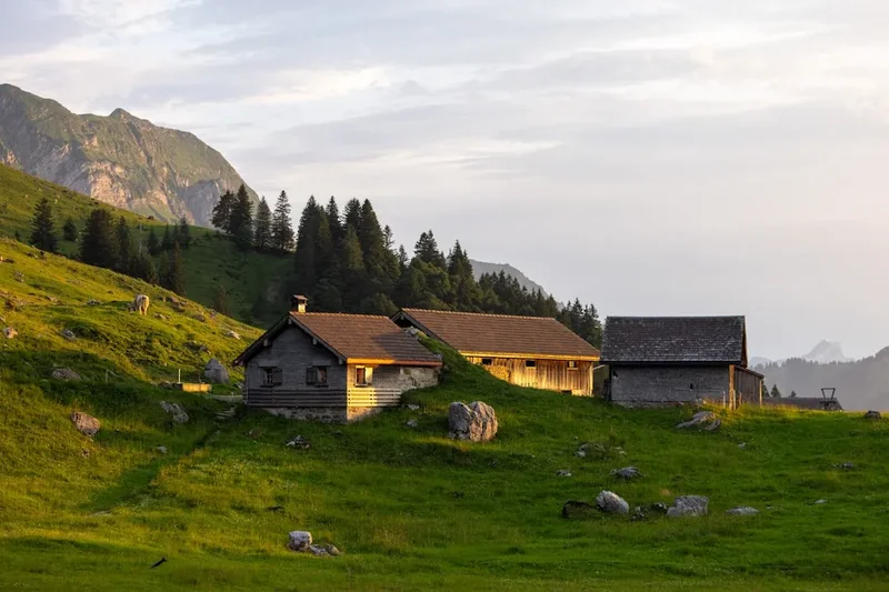
- Local Cheese Dairies: In the valleys below, you can often find opportunities to sample and purchase traditional Swiss cheeses.
- Scenic Drives: The roads leading to Schwägalp offer picturesque views of the Swiss countryside and alpine landscapes.
Safety and Conditions
Weather: Mountain weather is notoriously unpredictable. Always check the forecast from a reliable source (e.g., MeteoSwiss) before and during your hike. Be prepared for rapid changes, including sudden drops in temperature, strong winds, fog, and thunderstorms. If thunderstorms are forecast, start your hike very early and aim to be off the summit before they arrive. Hypothermia is a risk even in summer.
Trail Conditions: The trail is generally well-marked but can be steep, rocky, and exposed. In early season (June) or late season (October), snow and ice may be present, making the trail slippery and potentially hazardous. Trekking poles are highly recommended for stability and to reduce strain on joints. Ensure your footwear has excellent grip.
Fitness and Experience: This is a challenging hike requiring good cardiovascular fitness and stamina. You should be comfortable walking uphill for several hours and have experience hiking on uneven, rocky terrain. If you are not accustomed to such conditions, consider taking the cable car up or down, or choosing a less demanding route.
Navigation: While the trail is generally well-marked, it is essential to carry a map and compass and know how to use them. Mobile phone reception can be intermittent. Consider downloading offline maps to your smartphone.
Water and Food: Carry sufficient water (at least 2-3 litres) and high-energy food. There are limited opportunities to refill water on the trail, although the summit restaurant offers refreshments. Do not rely solely on the summit restaurant for your hydration and nutrition needs.
Emergency: In case of an emergency, call the Swiss emergency number: 144 (ambulance) or 112 (general emergency). Inform someone of your hiking plans and expected return time.
Respect the Environment: Stay on marked trails to protect fragile alpine vegetation. Pack out all litter. Do not disturb wildlife.
Side Trips and Points of Interest
Säntis Summit Views: The primary "point of interest" is the summit itself and the unparalleled panoramic views it offers. On a clear day, you can see across Switzerland, Germany, Austria, France, and Italy. Look for landmarks such as the Black Forest, the Vosges Mountains, and the distant Alps. The summit area has viewing platforms designed to help you identify distant features.
Säntis Meteorological Station: The summit is home to a significant meteorological station. While not directly accessible to the public, its presence highlights the importance of Säntis as a site for weather observation and research. Information boards may be available detailing the station's work.
Schwägalp Alpine Landscape: Before or after your hike, take time to explore the Schwägalp plateau. The area is a nature park with educational trails that explain the unique geology, flora, and fauna of the Alpstein region. The contrast between the rugged, high-alpine environment of the summit and the gentler, pastoral landscape of the plateau is striking.
The "Säntis Stone": While not a specific detour, keep an eye out for unique rock formations and geological features along the trail. The Alpstein massif is known for its karst topography, with interesting limestone formations.
Leave No Trace
The Säntis Summit via Schwägalp trail traverses a sensitive alpine environment. Adhering to Leave No Trace principles is crucial to preserve its natural beauty and ecological integrity for future visitors.
- Plan Ahead and Prepare: Understand the trail's difficulty, check weather forecasts, and pack appropriate gear. Know the regulations for the area.
- Travel and Camp on Durable Surfaces: Stick to the marked trails. Avoid walking on fragile vegetation, especially alpine meadows, which are slow to recover from damage.
- Dispose of Waste Properly: Pack out everything you pack in, including all food scraps, wrappers, and any other litter. Use designated toilet facilities where available; if not, dig a cathole at least 60 metres away from water sources, trails, and campsites.
- Leave What You Find: Do not remove rocks, plants, or any natural objects. Take only photographs and memories.
- Minimize Campfire Impacts: Campfires are generally not permitted on this day hike. If camping were an option, use established fire rings and ensure fires are completely extinguished.
- Respect Wildlife: Observe wildlife from a distance. Do not feed animals, as this can disrupt their natural behaviours and diets.
- Be Considerate of Other Visitors: Yield to uphill hikers. Keep noise levels down to appreciate the natural sounds of the environment.
By following these principles, you help ensure that the Säntis remains a pristine and enjoyable destination for everyone.