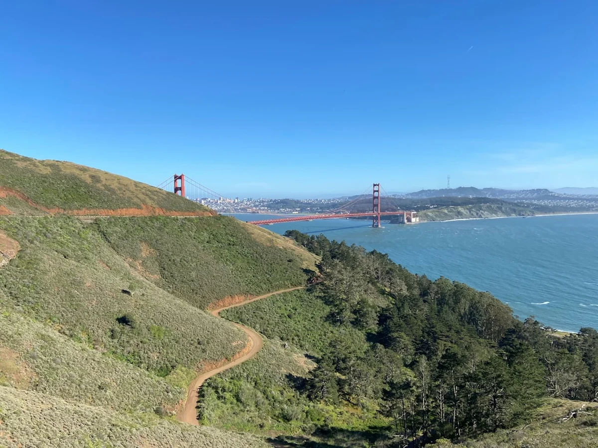
San Francisco Peaks Trail - Arizona’s Alpine Odyssey
The San Francisco Peaks Trail, primarily known as the Humphreys Peak Trail, offers a rare and dramatic ascent into the only true alpine tundra ecosystem in the state of Arizona. Rising from the high desert plateau near Flagstaff, this 14.5-kilometre round-trip journey culminates at the summit of Humphreys Peak, the highest point in Arizona at 3,851 metres. The trail is a vertical odyssey through distinct biological life zones, beginning in the cool shade of ponderosa pine forests, ascending through shimmering stands of quaking aspen and ancient bristlecone pines, and finally emerging onto a rocky, windswept ridge that feels more like the Colorado Rockies or the Swiss Alps than the American Southwest. This is a challenging day walk that demands physical stamina, respect for high-altitude environments, and a keen eye on the horizon for the region’s notorious summer thunderstorms.
- Distance: 14.5 km return
- Duration: 6–8 hours
- Elevation Gain: 762 m
- Highest Point: 3,851 m (Humphreys Peak)
- Difficulty: Challenging (due to altitude and steep, rocky terrain)
- Best Time: June to October (weather permitting)
- Trailhead: Arizona Snowbowl parking lot, Flagstaff
- Terrain: Forested paths, volcanic scree, and exposed alpine ridges
Overview
The San Francisco Peaks are the remains of an eroded stratovolcano that once stood significantly higher than the current summits. Today, the peaks form a majestic horseshoe-shaped caldera known as the Inner Basin, with Humphreys Peak standing as the undisputed monarch of the range. The trail to the summit is a masterclass in ecological transition. Walkers begin their journey at approximately 2,800 metres, immediately feeling the thinning air as they move through the Coconino National Forest. The initial kilometres are deceptively gentle, winding through lush meadows and dense forests where the scent of pine needles and damp earth dominates the air.
As the gradient increases, the forest composition shifts. The ponderosa pines give way to Douglas fir and eventually to the subalpine fir and Engelmann spruce that define the higher reaches. One of the most spectacular features of the lower trail is the abundance of quaking aspens, which turn a brilliant, shimmering gold in late September, drawing visitors from across the country. However, the true character of the San Francisco Peaks Trail reveals itself above the treeline. Here, the "Krummholz" effect is visible—trees stunted and twisted by the relentless wind, clinging to the volcanic soil in fantastic, tortured shapes.
The final three kilometres of the ascent are a test of resolve. The trail leaves the shelter of the forest and enters the alpine tundra, a fragile world of lichens, mosses, and the endemic San Francisco Peaks groundsel—a plant found nowhere else on Earth. The path becomes a series of steep switchbacks over loose volcanic rock and scree, leading to the "saddle" between Agassiz Peak and Humphreys Peak. From this vantage point, the scale of the landscape is breathtaking: to the north, the Painted Desert and the distant rim of the Grand Canyon; to the south, the forested expanse of the Mogollon Rim. The final push along the ridge to the summit involves navigating several "false summits," a psychological challenge that rewards the persistent with a 360-degree panorama that is arguably the finest in the Southwest.
History and Cultural Context
The San Francisco Peaks hold a level of spiritual and cultural significance that is almost unparalleled in North America. To at least 13 Indigenous tribes, including the Navajo (Diné), Hopi, Zuni, and Havasupai, these mountains are sacred ground. The Navajo refer to the peaks as Dook'o'oosłííd ("The Summit Which Never Melts"), marking the western boundary of their traditional ancestral lands. For the Hopi, the peaks are the home of the Katsinam (Kachina spirits), who bring rain to the desert and maintain the balance of the world. Because of this profound spiritual connection, walkers are urged to treat the mountain with the utmost reverence, staying strictly on the designated trails to avoid disturbing the sacred landscape.
Geologically, the peaks are part of the San Francisco Volcanic Field, which covers over 4,700 square kilometres. The mountains were formed by a series of eruptions beginning roughly one million years ago. It is estimated that the original volcano, prior to a massive structural collapse or explosive eruption similar to Mount St. Helens, may have reached heights of nearly 5,000 metres. The current peaks—Humphreys, Agassiz, Fremont, and Doyle—are the jagged remnants of that ancient giant. The volcanic history is evident in every step of the hike, from the porous basalt boulders to the fine grey ash and cinders that make up the trail surface.
In the late 19th century, the peaks became a site of immense scientific importance. In 1889, C. Hart Merriam, a pioneering biologist, conducted a biological survey of the San Francisco Peaks. It was here that he developed the concept of "Life Zones"—the idea that changes in elevation result in climatic and biological changes similar to those found when travelling towards the poles. He noted that a 1,000-metre ascent on Humphreys Peak was equivalent to a 1,500-kilometre journey north. This discovery revolutionised the study of ecology and remains a fundamental principle of the natural sciences today. The trail you walk is, in many ways, a living laboratory that continues to provide insights into climate change and high-altitude biodiversity.
Want more background? Read extended notes on history and cultural context → Learn more
Seasonal Highlights and Weather Reality
The window for hiking the San Francisco Peaks Trail is relatively narrow, dictated by the heavy snowpack that lingers well into the spring and the violent weather patterns of the summer. During the peak season (June to October), the trail offers vastly different experiences depending on the month.
Summer (June to August): This is the most popular time to hike, but it comes with a significant caveat: the North American Monsoon. From early July through August, moisture from the Gulf of Mexico flows into Arizona, creating massive, rapid-onset thunderstorms. These storms typically build in the early afternoon, bringing torrential rain, hail, and frequent lightning. Because the upper half of the trail is entirely exposed above the treeline, lightning is a lethal threat. The "Golden Rule" of Humphreys Peak is to be off the summit and heading back into the trees by noon. June is often the driest month, but lingering snow patches can still obscure the trail near the saddle.
Autumn (September to October): Many locals consider this the premier season. The monsoon rains subside, the air becomes crisp and exceptionally clear, and the risk of lightning decreases. The highlight of this period is the "turning of the aspens." Usually occurring in the last week of September or the first week of October, the lower slopes of the peaks are set ablaze with gold and orange hues. However, autumn also brings the first dusting of snow and freezing temperatures at the summit, requiring walkers to carry significantly more insulating layers.
Winter and Spring (November to May): During these months, the San Francisco Peaks Trail becomes a serious mountaineering undertaking. The trail is buried under several metres of snow, and the Arizona Snowbowl ski resort occupies the lower slopes. High winds on the ridge can reach hurricane force, and temperatures frequently drop to -20°C or lower. Only those with extensive winter alpine experience, including the use of ice axes, crampons, and avalanche safety gear, should attempt the peaks during this time. The trail is often "closed" to casual hikers by the sheer difficulty of access and the extreme environmental hazards.
Recommended Itinerary
San Francisco Peaks Day Hike Itinerary
Early Morning: The Forest Ascent (07:00 – 09:00)
- Start: Arizona Snowbowl Parking Lot (2,800 m)
- Distance: 0–4 km
- Elevation Gain: ~300 m
- Begin at the Humphreys Trailhead, located at the north end of the Hart Prairie Lodge parking area.
- The trail starts by crossing an open ski run before entering the dense forest of the Kachina Peaks Wilderness.
- Enjoy the relatively gentle gradient as you wind through ponderosa pines and Douglas firs.
- This is the best time to spot local wildlife, including mule deer and the Abert’s squirrel with its distinctive tufted ears.
- The air is cool and still, providing the perfect warm-up for the steeper sections ahead.
Mid-Morning: The Switchbacks and Treeline (09:00 – 10:30)
- Distance: 4–6 km
- Elevation Gain: ~350 m
- The trail begins to steepen significantly as you enter a series of long switchbacks.
- The forest thins, and you begin to see the gnarled bristlecone pines, some of which are over a thousand years old.
- Pass the "Inner Basin" junction, staying left to continue towards the summit.
- The terrain becomes rockier, with volcanic boulders requiring careful foot placement.
- Reach the treeline at approximately 3,500 metres. This is a good place for a final snack and to assess the weather before committing to the exposed ridge.
Late Morning: The Saddle and Summit Ridge (10:30 – 12:00)
- Distance: 6–7.25 km
- Elevation Gain: ~112 m
- Emerge onto the "Saddle" (3,625 m), the low point between Agassiz and Humphreys Peaks.
- The wind usually increases dramatically here. Turn right (north) to follow the ridge.
- Navigate the three "false summits"—rocky high points that look like the top but aren't.
- The trail is marked by large wooden poles to help with navigation in low visibility.
- Arrive at the summit of Humphreys Peak (3,851 m).
- Take photos at the summit sign and enjoy the view of the Grand Canyon (80 km to the north) and the volcanic cinder cones of the San Francisco field.
Afternoon: The Descent (12:00 – 15:00)
- Distance: 7.25 km (return)
- Elevation Loss: 762 m
- Begin the descent immediately if clouds are building.
- The descent over the rocky ridge can be harder on the knees than the ascent; use trekking poles if available.
- Once back in the forest, the temperature will rise, and the air will feel noticeably thicker and easier to breathe.
- Return to the Snowbowl parking lot for a well-earned rest.
Important Notes:
- No permits are required for day hiking, but you must sign the register at the wilderness boundary.
- Stay on the trail at all times to protect the endangered alpine tundra.
- Agassiz Peak (the summit to the south of the saddle) is closed to hikers to protect the San Francisco Peaks groundsel.
- Water is not available anywhere on the trail; you must carry all you need.
- The trailhead is at high altitude; if you are coming from sea level, spend at least one night in Flagstaff (2,100 m) to acclimatise.
Planning and Bookings
Book Your Trip
Everything you need to plan your journey
Accommodation
Find places to stay near Flagstaff, Arizona
Flights
Search flights to Flagstaff, Arizona
Essential Preparation
The primary challenge of the San Francisco Peaks Trail is the altitude. Flagstaff sits at 2,100 metres, and the trailhead is at 2,800 metres. For those travelling from lower elevations, altitude sickness (AMS) is a genuine risk. It is highly recommended to spend 24–48 hours in Flagstaff or at the Grand Canyon before attempting the hike. Physical fitness is essential; while the distance is not extreme, the thin air makes every step feel twice as difficult as it would at sea level.
Logistically, the trail is straightforward. Flagstaff is the primary base, offering a wide range of outdoor shops (such as Peace Surplus or Mountain Sports) where you can buy maps, rent trekking poles, or get the latest trail conditions. There is no public transport to the trailhead at Arizona Snowbowl, so a rental car or private vehicle is necessary. The drive from Flagstaff takes about 30 minutes via US-180 and Snowbowl Road, both of which are paved and well-maintained.
Trail Accommodation
This is a day hike requiring no overnight accommodation on the trail itself. Camping is strictly prohibited in the alpine tundra zone (above treeline) and within the inner caldera to protect the fragile ecosystem and the city of Flagstaff's watershed.
Nearby Options:
- Flagstaff Hotels: A vast array of options from budget motels to boutique hotels in the historic downtown area.
- US Forest Service Campgrounds: Several excellent campgrounds are located along US-180, including Fort Tuthill, Bonito Campground (near Sunset Crater), and various dispersed camping areas in the Coconino National Forest.
- Backcountry Camping: If you wish to do a multi-day trip in the area, camping is permitted in the lower elevations of the Kachina Peaks Wilderness, provided you are at least 200 metres away from the trail and water sources. No fires are allowed; use a portable stove.
Required Gear
- Footwear: Sturdy hiking boots with good ankle support and aggressive tread. The volcanic scree on the upper ridge is sharp and unstable.
- Clothing Layers: A moisture-wicking base layer, an insulating mid-layer (fleece or down), and a high-quality waterproof/windproof shell. Temperatures at the summit can be 15°C cooler than at the trailhead, with significant wind chill.
- Sun Protection: High-SPF sunscreen, lip balm with SPF, polarised sunglasses, and a wide-brimmed hat. The UV radiation at 3,800 metres is intense, even on cloudy days.
- Navigation: A physical topographic map and compass, or a GPS device with offline maps (AllTrails or Gaia GPS). While the trail is well-marked, clouds can roll in quickly, reducing visibility to a few metres.
- Trekking Poles: Highly recommended for the steep, rocky descent to save your knees and provide stability on loose scree.
What to Bring
- Water: Minimum 3–4 litres per person. There are no water sources on the trail, and the dry mountain air accelerates dehydration.
- Food: High-energy snacks (nuts, dried fruit, chocolate) and a substantial lunch. You will burn significantly more calories at altitude.
- Electrolytes: Powdered drink mixes to help maintain salt balance, which is crucial for preventing cramps and altitude headaches.
- Emergency Kit: A basic first aid kit (blister pads, bandages, antiseptic), a multi-tool, a whistle, and an emergency space blanket.
- Headlamp: Even if you plan to be back by mid-afternoon, always carry a light in case of an unexpected delay.
- Personal Items: Tissues, hand sanitiser, and a small bag to pack out all waste (including toilet paper).
Permits
For day hikers, no formal permits or fees are required to hike the San Francisco Peaks Trail. This makes it one of the most accessible high-altitude peaks in the United States. However, there are several regulations that walkers must follow to ensure the continued protection of the Kachina Peaks Wilderness.
Wilderness Regulations:
- Group Size: Limited to 12 people to minimise impact on the trail and other hikers' experiences.
- Registration: There is a voluntary registration box at the wilderness boundary (about 1 km from the trailhead). Signing in helps Search and Rescue in the event of an emergency.
- Off-Trail Travel: Strictly prohibited above the treeline. The alpine tundra is home to the San Francisco Peaks groundsel, a threatened plant species. Stepping off the trail can destroy plants that have taken decades to grow.
- Dogs: Permitted but must be on a leash at all times. Be aware that the sharp volcanic rock can be very hard on a dog's paws, and many dogs struggle with the altitude just as much as humans do.
- Parking: During the summer, the Snowbowl parking lot can fill up by 09:00 on weekends. Arrive early to secure a spot. There is no fee for parking for hikers.
Winter Access: If you are visiting in the winter for "backcountry" access (skiing or snowshoeing), a free Backcountry Permit is required from the Coconino National Forest office to pass through the Snowbowl ski area boundaries. This is primarily for safety and to ensure users are aware of avalanche risks.
Other Activities in the Area
Flagstaff and the surrounding Coconino County offer a wealth of natural and cultural attractions that complement a hike on the peaks:
- Lowell Observatory: Located on Mars Hill in Flagstaff, this is where Pluto was discovered. It offers fascinating tours and nightly telescope viewing in the "First International Dark Sky City."
- Sunset Crater Volcano National Monument: Explore the much younger volcanic landscape (erupted around 1085 AD) at the base of the peaks. The contrast between the ancient peaks and the fresh lava flows is striking.
- Wupatki National Monument: Visit the remarkably preserved ancient pueblos of the Ancestral Puebloan people, located on the high desert plain north of the peaks.
- The Arboretum at Flagstaff: A 200-acre botanical garden specialising in high-altitude native plants of the Colorado Plateau. It’s a great place to learn about the flora you saw on the trail.
- Museum of Northern Arizona: An excellent cultural institution dedicated to the anthropology, biology, and geology of the Colorado Plateau and the Indigenous tribes of the region.
- Grand Canyon National Park: The South Rim is only a 90-minute drive from the Humphreys trailhead, making it an easy day trip or a logical next stop on an Arizona itinerary.
Safety and Conditions
Altitude Sickness (AMS): This is the most common safety issue on the trail. Symptoms include headache, nausea, dizziness, and extreme fatigue. The only cure for AMS is descent. If you or anyone in your group begins to feel unwell, do not "push through" to the summit. Turn around immediately. Severe cases can lead to High Altitude Pulmonary Edema (HAPE), which is a medical emergency.
Lightning and Weather: As mentioned, the San Francisco Peaks are a lightning magnet. If you hear thunder, you are already in danger. If you see clouds building vertically (cumulonimbus), turn back. If you are caught above the treeline during a storm, move away from the ridge, drop your metal trekking poles, and crouch on your backpack to insulate yourself from the ground. Do not seek shelter under isolated trees or in small caves.
Dehydration and Heat: Even though the air is cool, the sun is intense and the humidity is very low. You will lose a significant amount of moisture through respiration. Drink frequently, even if you don't feel thirsty. Be aware that at high altitudes, your body's thirst mechanism can be suppressed.
Navigation: The trail is well-defined, but the ridge section can be confusing in "whiteout" conditions (when clouds sit on the mountain). The wooden poles are spaced to be visible from one to the next, but in heavy fog, it is easy to lose the path. Always carry a compass or GPS and know how to use it. The volcanic rock can also interfere with some magnetic compasses, so digital GPS is a reliable backup.
Emergency Contacts: Cell phone service is surprisingly good on the summit and parts of the ridge, but non-existent in the lower forest. In an emergency, dial 911. Coconino County Search and Rescue is highly experienced but can take hours to reach the upper sections of the mountain.
Side Trips and Points of Interest
The Weather Station: Located near the saddle, this automated station provides critical data for meteorologists. It is a stark reminder of the extreme conditions the peaks face year-round. It’s a common landmark for hikers to regroup before the final ridge walk.
The B-24 Bomber Crash Site: For those with excellent navigation skills and extra time, the remains of a World War II B-24 Liberator that crashed in 1944 are located on the steep slopes of the Inner Basin. This is not on the main Humphreys Trail and requires a difficult cross-country scramble. It is considered a historic site; do not remove any debris.
Kachina Trail: If the ascent to the summit seems too daunting, the Kachina Trail starts from the same parking lot but traverses the flank of the mountain at a relatively constant elevation. It offers spectacular forest scenery and views of the peaks without the extreme altitude gain.
The "False Summits": While often frustrating, the false summits are interesting geological features. Each one offers a slightly different perspective of the caldera and the surrounding volcanic field. They are excellent places to stop, catch your breath, and realise just how high you have climbed.
Leave No Trace
The San Francisco Peaks are an ecological island. The alpine tundra found here is separated from the next nearest tundra (in the Rocky Mountains) by hundreds of kilometres of desert. This isolation makes the ecosystem incredibly fragile and unique. Every walker has a direct impact on the survival of this landscape.
Core Principles for the Peaks:
- Stay on the Trail: This is the most important rule. The tundra plants, like the San Francisco Peaks groundsel, can be killed by a single footstep. The soil is thin and takes centuries to form; once eroded, it is gone forever.
- Pack It In, Pack It Out: This includes all organic waste like orange peels and apple cores. In the cold, dry air of the peaks, decomposition happens very slowly. An orange peel can last for years.
- Respect Wildlife: Do not feed the squirrels or birds. Feeding them disrupts their natural foraging habits and can make them aggressive towards other hikers.
- Leave What You Find: Do not collect volcanic rocks, wildflowers, or pieces of ancient bristlecone pine. Leave the landscape exactly as you found it for the next person to enjoy.
- Proper Waste Disposal: Use the restrooms at the Snowbowl parking lot before you start. If you must go on the trail, use a "WAG bag" (waste alleviation and gelling) to pack out human waste, as the rocky soil makes digging a proper cat-hole nearly impossible and environmentally damaging.