
Samaria Gorge - The Grand Canyon of Europe
The Samaria Gorge is the undisputed crown jewel of the Cretan wilderness—a 16-kilometre descent through the heart of the Lefka Ori (White Mountains) that terminates at the shimmering turquoise waters of the Libyan Sea. Located within the only National Park on the island of Crete, this dramatic limestone fissure is one of the longest and most spectacular canyons in Europe. The journey begins at an altitude of 1,230 metres at the Xyloskalo trailhead, where a steep, winding wooden staircase plunges into a world of ancient cypress forests, vertical rock walls, and rare endemic wildlife. This is not merely a walk; it is a geological pilgrimage through millions of years of tectonic history, a sanctuary for the endangered Cretan ibex (Kri-kri), and a testament to the rugged spirit of the Sfakia region. For those who traverse its length, the reward is a profound sense of scale, culminating in the famous "Iron Gates" where the canyon walls narrow to a mere four metres while soaring to heights of 300 metres. It is a challenging day-long odyssey that demands physical stamina and rewards the hiker with some of the most pristine natural beauty in the Mediterranean basin.
- Distance: 16.0 km (13 km through the National Park, 3 km to the coast)
- Duration: 5–7 hours
- Season: May to October (strictly weather dependent; closed in winter due to flooding)
- Elevation Loss: 1,230 m (predominantly downhill)
- Highest point: Xyloskalo Trailhead (1,230 m)
- Difficulty: Challenging (due to steep descent and rocky terrain)
- Location: Chania Prefecture, Crete, Greece
Overview
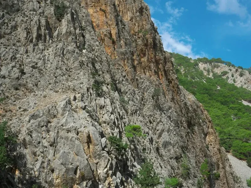
The Samaria Gorge is a landscape of superlatives. Carved over millennia by the Tarraios River, the gorge slices through the massive limestone plateau of the White Mountains, creating a vertical world that feels entirely removed from the sun-drenched beaches of northern Crete. The walk is defined by its dramatic transition: you begin in a cool, sub-alpine environment surrounded by the scent of Greek fir and ancient Cretan cypress, and you end in the arid, African-influenced heat of the southern coast. The sheer scale of the canyon is difficult to grasp until you are standing on the valley floor, looking up at cliffs that reach nearly 600 metres toward the sky.
The trail is famously "knee-punishing." The first 4 kilometres consist of a relentless descent via a series of tight switchbacks known as the Xyloskalo (meaning "wooden staircase"). This section requires intense concentration as the path is composed of loose limestone scree and polished stones that can be deceptively slippery. As the gradient levels out, the trail follows the riverbed, which remains dry in the peak of summer but can become a raging torrent during the winter rains. The middle section of the hike leads you through the abandoned village of Samaria, a hauntingly beautiful collection of stone houses that served as a remote outpost until the National Park was established in 1962.
The final third of the gorge is where the landscape reaches its dramatic crescendo. The walls begin to close in, the air grows warmer, and the vegetation shifts to hardy oleanders and aromatic herbs. This leads to the "Sideroportes" or Iron Gates, the narrowest point of the gorge. Here, the claustrophobic intensity of the rock walls creates a natural cathedral of stone. Beyond the park exit, a final 3-kilometre stretch across an arid, sun-baked plain leads to the coastal village of Agia Roumeli. There is no road access to this village; the only way out is by ferry, making the Samaria Gorge a true "point-to-point" wilderness experience that requires careful logistical planning.
While the gorge can be crowded during the peak months of July and August, the sheer immensity of the environment ensures that the experience remains humbling. It is a place where the geological power of the earth is on full display, and where the silence of the mountains is only broken by the occasional clatter of a falling stone or the distant bleat of a wild goat.
History and Cultural Context
The history of Samaria is as deep and layered as the limestone strata of its walls. Human presence in the gorge dates back to the Minoan period, and the canyon has served as a natural fortress for the fiercely independent people of Crete for thousands of years. The name "Samaria" is derived from the 14th-century Byzantine church of Osia Maria (Saint Mary), located within the abandoned village. This small, stone-built chapel remains a poignant reminder of the community that once eked out a living in this isolated environment, surviving on timber harvesting and goat herding.
In ancient times, the city of Tarra stood at the southern exit of the gorge, near present-day Agia Roumeli. Tarra was a powerful and autonomous city-state, famous for its glass-making workshops and its own coinage. It was a religious centre of significance, and legend suggests that the god Apollo once found refuge here. The gorge itself provided a strategic advantage; its narrow passages were easily defended against invaders, from the Romans to the Saracens. During the various Cretan uprisings against Ottoman rule, Samaria was a primary hideout for "hainides" (rebel fighters), as the rugged terrain made it impossible for large armies to penetrate.
The gorge's role as a sanctuary continued into the 20th century. During World War II, after the Battle of Crete in 1941, the gorge served as an escape route for Allied soldiers and Cretan resistance fighters heading toward the southern coast to be evacuated to Egypt by British submarines. The local Sfakian people, known for their bravery and hospitality, risked their lives to guide these soldiers through the treacherous mountain passes. In 1962, the Greek government declared the area a National Park to protect the unique biodiversity and the endangered Kri-kri goat. This necessitated the relocation of the last remaining residents of Samaria village, leaving behind a "ghost town" that hikers pass through today. In 1981, the park was designated a UNESCO Biosphere Reserve, recognising its global ecological importance.
Want more background? Read extended notes on history and cultural context → Learn more
Seasonal Highlights and Weather Reality
The Samaria Gorge is strictly a seasonal trail. Due to the risk of flash flooding and rockfalls caused by winter rains and melting snow from the White Mountains, the National Park is typically open only from 1 May to 31 October. Even within this window, the park authorities may close the trail at short notice if heavy rain is forecast or if there has been significant seismic activity.
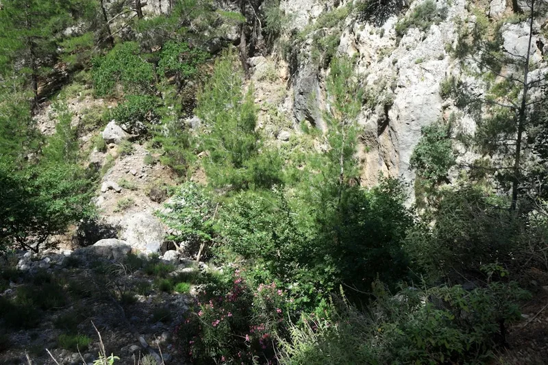
Spring (May to early June): This is arguably the best time to hike. The temperatures are mild (15–25°C), the river is still flowing with crystal-clear meltwater, and the gorge is carpeted in wildflowers, including endemic Cretan peonies and orchids. The air is fresh, and the scent of the pine forest is at its most potent. However, the water levels in the riverbed may require some careful stepping-stone crossings.
Summer (July to August): This is the peak tourist season. Temperatures can soar to 35°C or higher, especially in the lower sections of the gorge where the rock walls radiate heat. Hikers must be prepared for intense sun exposure and should start as early as possible (the park opens at 7:00 AM) to complete the most strenuous sections before the midday heat. While the gorge provides some shade, the final 3 kilometres to Agia Roumeli are completely exposed.
Autumn (September to October): The heat begins to subside, and the crowds thin out. The landscape takes on a more rugged, arid character. The light in the afternoon is particularly beautiful for photography, casting long shadows across the canyon walls. However, the risk of early autumn storms increases toward the end of October. If you are hiking in late October, always check the weather forecast the night before, as a single heavy downpour can lead to an immediate closure of the park.
Outside of the official season (November to April), the gorge is extremely dangerous. The Tarraios River can rise several metres in a matter of hours, and the narrow sections of the gorge become death traps. Access is strictly prohibited during this time for safety reasons.
Recommended Itinerary
The Samaria Gorge Route Progression
Early Morning: The Xyloskalo Descent
- Distance: 0 km to 4 km
- Elevation: 1,230 m to 800 m
- Time: 1.5–2 hours
- Start at the Xyloskalo trailhead at the Omalos Plateau.
- The trail begins with a steep, zig-zagging descent down a wooden-railed staircase.
- Pass the small chapel of Agios Nikolaos, surrounded by ancient, towering cypress trees.
- This is the most taxing section for the knees; take frequent breaks to admire the view of Mount Gigilos across the valley.
- The air is cool and crisp, often with morning mist clinging to the peaks.
Mid-Morning: The Valley Floor and Samaria Village
- Distance: 4 km to 8.5 km
- Elevation: 800 m to 300 m
- Time: 2 hours
- The gradient levels out as you reach the riverbed. The path becomes rockier and more uneven.
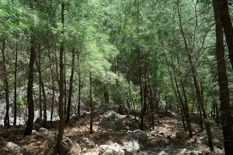
- Follow the trail alongside (or through) the dry riverbed, shaded by Calabrian pines.
- Arrive at the abandoned Samaria Village (approx. halfway point).
- This is the primary rest stop. There are benches, a forest warden station, and a pharmacy/first aid post.
- Explore the old stone houses and look for the Kri-kri goats that often congregate here looking for water.
- Refill water bottles at the natural springs.
Midday: The Iron Gates and the Narrows
- Distance: 8.5 km to 13 km
- Elevation: 300 m to 50 m
- Time: 1.5–2 hours
- The canyon walls begin to narrow significantly.
- Pass the "Christos" spring, the last reliable water source before the exit.
- Reach the "Sideroportes" (Iron Gates), the narrowest point of the gorge (4 metres wide).
- The trail here involves walking directly on the smooth, water-worn stones of the riverbed.
- Exit the National Park at the final ticket control point.
Afternoon: The Coastal Plain and Agia Roumeli
- Distance: 13 km to 16 km
- Elevation: 50 m to Sea Level
- Time: 1 hour
- The final 3 kilometres are outside the park boundaries.
- The path is flat but completely exposed to the sun, crossing an arid landscape of scrub and rock.
- Pass the ruins of Old Agia Roumeli, destroyed by a flood in the 1950s.
- Arrive at the coastal village of Agia Roumeli on the Libyan Sea.
- Reward yourself with a swim in the deep blue waters and a meal at a local taverna while waiting for the late afternoon ferry.
Important Notes:
- The park opens at 07:00 and closes at 15:00 (you must be past the halfway point by a certain time).
- Keep your entrance ticket; it is checked at the exit to ensure no one is left in the gorge overnight.
- The ferry from Agia Roumeli usually departs between 17:00 and 17:30. Do not miss it, as there are no roads out.
- The terrain is very rocky; sturdy footwear is essential to prevent ankle injuries.
Planning and Bookings
Book Your Trip
Everything you need to plan your journey
Accommodation
Find places to stay near Chania
Flights
Search flights to Chania
Essential Preparation
The Samaria Gorge is a logistically complex day hike. Most hikers base themselves in the city of Chania, which is approximately 1 hour and 15 minutes from the trailhead at Omalos. The most common way to access the trail is via the KTEL public bus system, which runs dedicated "Gorge Buses" early in the morning. You must coordinate your bus to the top (Omalos) with the ferry from the bottom (Agia Roumeli) and the connecting bus from the ferry port (usually Sougia or Chora Sfakion) back to Chania.
Physical preparation is key. While the hike is downhill, the 1,200-metre descent is strenuous on the quadriceps and knees. If you have pre-existing knee issues, trekking poles are highly recommended. Ensure you have booked your transport in advance during peak season, as buses can fill up quickly. There is no need to book the trail itself, but you should check the official National Park website or local news for weather-related closures before departing Chania.
Trail Accommodation
This is a day hike requiring no overnight accommodation. Camping and staying overnight within the National Park boundaries are strictly prohibited and heavily enforced by park wardens. The village of Samaria is abandoned and provides no lodging. If you wish to stay near the trail, there are small hotels and guesthouses on the Omalos Plateau (near the start) or in the village of Agia Roumeli (at the finish). Staying in Agia Roumeli for a night after the hike is a popular option for those who want to avoid the long bus journey back to Chania on the same day and enjoy the village after the day-trippers have left on the ferry.
Required Gear
- Hiking boots or sturdy trail shoes: The terrain is composed of sharp, loose limestone and polished river stones. Sandals or flimsy trainers are inadequate and lead to many injuries every year.
- Trekking poles: Highly recommended to alleviate pressure on the knees during the initial 4 km descent.
- Sun protection: A wide-brimmed hat, high-SPF sunscreen, and sunglasses. The Cretan sun is intense, especially in the exposed lower sections.
- Small daypack: 15–25L capacity to carry water, food, and extra layers.
- Lightweight jacket: Even in summer, the Omalos Plateau can be chilly and windy at 7:00 AM.
- Swimwear and travel towel: For the essential post-hike swim in the Libyan Sea at Agia Roumeli.
- First aid kit: Include plenty of blister plasters (Compeed), antiseptic wipes, and ibuprofen for muscle soreness.
What to Bring
- Refillable water bottle: There are several natural springs along the trail (marked on park maps) where you can refill with cold, drinkable mountain water. A 1.5L capacity is usually sufficient.
- High-energy snacks: Trail mix, energy bars, fruit, and sandwiches. There are no food outlets inside the gorge once you leave the trailhead.
- Cash: For the park entrance fee (approx. €5), the ferry ticket (approx. €13–15), and food/drinks in Agia Roumeli. Card machines in the remote south can be unreliable.
- Toilet paper and hand sanitiser: While there are basic toilets at the rest stops, they are often basic and may lack supplies by mid-afternoon.
- Printed bus/ferry schedules: Mobile signal is non-existent inside the gorge, so do not rely on live digital updates.
Permits
Access to the Samaria Gorge National Park requires an entrance permit, which can be purchased at the kiosk at the Xyloskalo trailhead or online through the official Hellenic Ministry of Environment website. The cost is currently €5 per person (children under 15 are often free, and students may receive a discount with valid ID).
The Ticket System:
- The permit is a two-part ticket. You must keep this ticket with you throughout the entire hike.
- Upon exiting the park at the southern end (near Agia Roumeli), you must present your ticket to the wardens at the control point.
- This system is used to track the number of people entering and exiting the gorge. If a ticket is not accounted for by nightfall, the park wardens will initiate a search operation.
- Do not lose your ticket, or you may face delays and questioning at the exit.
Operating Hours:
- The park is generally open from 07:00 to 15:00.
- If you enter after 14:00, you may only be allowed to walk the first 2 kilometres before being asked to turn back, as there is not enough time to complete the full distance before the park closes.
- In the event of high winds, extreme heat (over 35°C), or rain, the park will be closed. It is advisable to check the official "Samaria National Park" Facebook page or website for daily status updates before you leave your accommodation.
Other Activities in the Area
The region surrounding the Samaria Gorge and the southern coast of Crete offers a wealth of activities for those who enjoy rugged landscapes and traditional culture:
- Agia Roumeli Beach: After finishing the hike, the black pebble beach of Agia Roumeli is the perfect place to relax. The water is exceptionally deep, clear, and cool, providing instant relief for tired muscles.
- Loutro Village: Take the ferry from Agia Roumeli to the east to reach Loutro, a picturesque, car-free fishing village with white-washed houses and turquoise bays. It is only accessible by boat or by hiking the E4 coastal path.
- Imbros Gorge: A shorter (8 km), easier alternative to Samaria. It is less crowded and offers spectacular narrow sections, making it a great choice for families or those with less time.
- Aradena Gorge: For experienced hikers seeking a more technical challenge. This gorge features a famous bridge for bungee jumping and a steep descent involving ladders and rocky scrambles.
- Chania Old Town: Explore the Venetian harbour, the narrow winding alleys of the Jewish and Turkish quarters, and the vibrant municipal market. It is one of the most beautiful cities in the Mediterranean.
- The E4 European Long Distance Path: The section from Agia Roumeli to Chora Sfakion is a stunning coastal hike that takes about 6–7 hours, passing through the ancient site of Agios Pavlos and the "Marble" beach.
Safety and Conditions
Physical Demands and Injuries: The most common injuries in Samaria are twisted ankles and knee strain. The path is uneven and covered in loose stones. It is vital to watch your step and avoid rushing. If you are injured, there are "sweepers" with mules who patrol the gorge and can transport incapacitated hikers to the exit, but this is for genuine emergencies only.
Heat and Hydration: Heatstroke is a significant risk in July and August. The lower sections of the gorge act as a heat trap. Drink water at every spring, even if you don't feel thirsty, and wear a hat. If you feel dizzy or nauseous, stop in the shade immediately and alert a passing hiker or warden.
Rockfalls: As a deep limestone canyon, rockfalls are a natural occurrence. They are most likely after rain or during high winds. If you hear a crashing sound from above, move toward the canyon walls rather than staying in the centre of the riverbed. Avoid shouting or making loud noises that could potentially dislodge loose debris.
Flash Floods: Never enter the gorge if rain is forecast. The narrow sections offer no escape routes if the water level rises. The park authorities are very strict about this, but hikers should also use their own judgement.
Communication: There is no mobile phone reception within the gorge. Emergency radios are located at the warden stations in Agios Nikolaos and Samaria Village. It is always best to hike with a partner or ensure someone knows your expected return time.
Side Trips and Points of Interest
The Church of Agios Nikolaos: Located near the bottom of the Xyloskalo descent, this small chapel is built on the site of an ancient temple. It is surrounded by some of the oldest and largest Cretan cypress trees in existence, some of which are estimated to be over 1,000 years old. It is a peaceful spot for a first break.
The Abandoned Village of Samaria: This is the heart of the gorge. You can walk through the ruins of the stone houses, see the old olive presses, and visit the Church of Osia Maria. The village is a great place to observe the Kri-kri (Capra aegagrus cretica). These wild goats are shy but have become somewhat accustomed to hikers near the village water sources. Please do not feed them.
The Iron Gates (Sideroportes): This is the most photographed spot in the gorge. The walls are so close you can almost touch both sides at once, and they rise vertically for hundreds of metres. Look for the different layers of rock and the evidence of water erosion on the smooth surfaces.
Old Agia Roumeli: Located about 2 km after the park exit, these ruins are the remains of the original village that was destroyed by a massive flood in 1954. The survivors moved to the current coastal location. The ruins provide a stark reminder of the power of the river you just followed.
Leave No Trace
The Samaria Gorge is a fragile ecosystem and a protected National Park. With hundreds of thousands of visitors each year, the impact on the environment can be severe if rules are not followed. As a hiker, you have a responsibility to preserve this wilderness.
Guidelines for Responsible Hiking:
- No Smoking: Smoking is strictly prohibited throughout the gorge due to the extreme risk of forest fires, which could be catastrophic in such a confined space.
- Pack it in, pack it out: There are bins at the designated rest stops, but it is better to carry your rubbish out to Agia Roumeli. Never discard organic waste like banana peels or apple cores, as they take a long time to decompose in this arid climate and can harm local wildlife.
- Stay on the path: Straying from the marked trail causes soil erosion and can damage rare endemic plants.
- Do not disturb the wildlife: Observe the Kri-kri from a distance. Do not shout or throw stones.
- No swimming in the river: To protect the purity of the water sources for both wildlife and hikers, swimming in the pools or streams within the National Park is forbidden.
- No flower picking: Many of the plants in the gorge are rare endemics found nowhere else on Earth. Leave them for others to enjoy.
- Use the toilets: Use the provided facilities at the rest stops to prevent contamination of the watershed.