The Salt Trail - A Tropical Journey Through Penang’s Ancient Rainforest
The Salt Trail is one of Malaysia’s most evocative and physically demanding day hikes, located within the lush confines of the Penang National Park and the surrounding permanent forest reserves near Teluk Bahang. Spanning approximately 15.0 kilometres, this trail offers a profound immersion into the equatorial rainforest, a landscape defined by towering dipterocarp trees, dense humidity, and a rich tapestry of biodiversity. Unlike the more manicured paths found in urban parks, the Salt Trail is a rugged, authentic experience that challenges a hiker’s endurance and navigational skills while rewarding them with the raw beauty of the Straits of Malacca’s coastal ecology. Starting from the fishing village of Teluk Bahang, just a short journey from the UNESCO World Heritage site of George Town, the trail ascends through primary and secondary jungle, crossing ridges that offer glimpses of the turquoise Andaman Sea before descending into hidden valleys where the air is thick with the scent of damp earth and wild ginger.
This route is not merely a physical challenge; it is a sensory odyssey. Hikers must contend with steep gradients, tangled root systems, and the relentless heat of the tropics, making the 500-metre elevation gain feel significantly more strenuous than the numbers suggest. The trail serves as a vital corridor for local wildlife, including the dusky leaf monkey, the long-tailed macaque, and an array of tropical birdlife such as the white-bellied sea eagle and the vibrant kingfisher. For those seeking to escape the bustling street food scene and colonial architecture of George Town, the Salt Trail provides a stark, magnificent contrast—a place where the only sounds are the rhythmic buzzing of cicadas and the distant crash of waves against the granite boulders of the coastline. It is a journey that demands preparation, respect for the environment, and a willingness to embrace the sweat and toil of tropical trekking.
- Distance: 15.0 km (loop or point-to-point depending on exit)
- Duration: 5–7 hours
- Difficulty: Moderate to Challenging (due to humidity and terrain)
- Best Time: February to September (dry season)
- Elevation Gain: 500 m
- Closest City: George Town, Penang
- Trailhead: Teluk Bahang (near the National Park entrance)
Overview
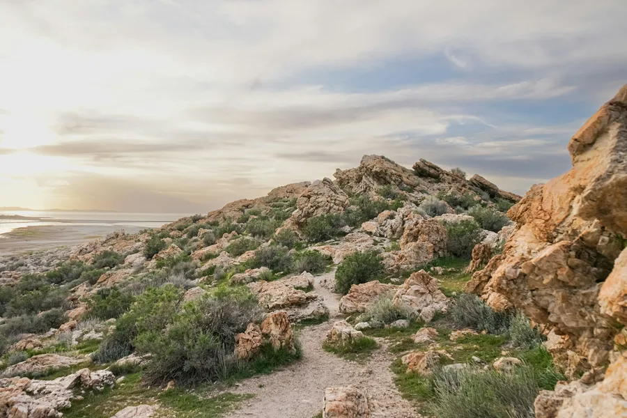
The Salt Trail represents the wilder side of Penang Island, an area often overlooked by visitors who frequent the popular beaches of Batu Ferringhi or the funicular at Penang Hill. The terrain is a classic example of a tropical coastal hill forest. The path is frequently obscured by leaf litter and intersected by the massive buttress roots of ancient trees, requiring constant attention to foot placement. The humidity here is a defining characteristic; even in the early morning, the air can reach saturation levels, meaning hikers will be drenched in perspiration within the first kilometre. This environmental factor is what elevates the trail from a simple walk to a true test of stamina. The ascent is often sharp and unrelenting, following ridges that were historically used by local inhabitants to traverse the island’s rugged interior.
As you move deeper into the forest, the vegetation changes from the coastal fringe—characterised by sea hibiscus and pandanus—to the majestic inland jungle dominated by Shorea and Dipterocarpus species. These giants of the forest create a high canopy that filters the sunlight into a dim, emerald glow, providing some relief from the direct tropical sun but trapping the heat beneath. The trail is famous for its "staircase" sections, where the path climbs steeply over granite outcrops and through narrow gaps in the undergrowth. In the rainy season, these sections can become treacherous, turning into slick mud chutes that require careful negotiation. However, during the dry season (February to September), the ground is firmer, though the heat remains a constant companion.
The Salt Trail is also a gateway to the unique geological features of the region. Depending on the specific route taken, hikers may pass near the Meromictic Lake at Pantai Kerachut—one of only a few in the world where layers of fresh and sea water do not mix—or find themselves on secluded beaches where the jungle meets the sand. The sense of isolation on the Salt Trail is palpable; despite being only 20 kilometres from a major metropolitan area, the density of the forest and the difficulty of the terrain create a feeling of being deep in the Malaysian wilderness. It is an essential experience for any serious hiker visiting Southeast Asia, offering a glimpse into the prehistoric landscapes that once covered the entire Malay Peninsula.
History and Cultural Context
The name "Salt Trail" carries significant historical weight in the Malaysian context, though its specific application to the Penang route is rooted in the traditional trade and movement patterns of the island’s early settlers. Historically, salt was a precious commodity, essential for food preservation in the sweltering tropical climate. Before the advent of modern road networks, the interior of Penang Island was a formidable barrier. Local villagers, particularly those from the coastal settlements of Teluk Bahang and the inland agricultural communities, utilised a network of forest trails to transport goods. Salt, harvested from the sea or traded at the ports, was carried by hand or on pack animals along these steep ridges to reach the interior valleys where it was exchanged for forest produce, fruits, and timber.
These trails were the lifeblood of the island’s early economy. Walking the Salt Trail today is an act of retracing the footsteps of generations of "orang darat" (inland people) and coastal traders. The route was not designed for recreation but for efficiency and survival. The steepness of the climbs and the directness of the ridge-lines reflect a time when the shortest distance between two points was a necessity, regardless of the physical toll. During the colonial era, British surveyors and naturalists also used these paths to document the island’s flora and fauna, often marvelling at the resilience of the local guides who navigated the dense undergrowth with ease.
In the mid-20th century, many of these traditional routes fell into disuse as the island developed. However, in recent decades, there has been a concerted effort by local hiking groups and environmentalists to reclaim and maintain these trails. The Salt Trail has been revitalised as a premier hiking route, serving as a reminder of Penang’s heritage as a rugged, forested island rather than just a colonial trading post. The cultural significance of the trail is also tied to the local Malay and Chinese communities in Teluk Bahang, who have long viewed the forest as a source of traditional medicine (herbs and roots) and spiritual connection. Today, the trail stands as a bridge between Penang’s industrious past and its future as a hub for eco-tourism and conservation.
Want more background? Read extended notes on history and cultural context → Learn more
Seasonal Highlights and Weather Reality
Penang’s climate is equatorial, meaning it is hot and humid year-round, but there are distinct variations in rainfall that significantly impact the hiking experience on the Salt Trail. The best time to attempt the hike is during the dry season, which typically runs from February to September. During these months, the trail is at its most stable. The ground is drier, reducing the risk of slipping on steep descents, and the humidity, while still high, is slightly more manageable than during the monsoon peaks. February and March are particularly pleasant, as they often coincide with the flowering of certain forest species, filling the air with subtle fragrances.
The "inter-monsoon" periods and the wet season (October to January) bring a different set of challenges. Rainfall in Penang can be intense and sudden, often occurring in the late afternoon. On the Salt Trail, heavy rain transforms the landscape within minutes. The dry gullies become rushing streams, and the clay-heavy soil becomes incredibly slippery. Leeches, which are largely absent during the dry months, become more active in the damp leaf litter. However, the wet season also brings a lushness to the forest that is breathtaking. The mosses on the granite boulders turn a vibrant emerald, and the many small seasonal waterfalls along the route come to life. If you choose to hike during this time, an early morning start is essential to complete the trek before the afternoon downpours begin.
Temperature-wise, there is little variation. Expect daytime highs of 30°C to 33°C, with the "feels like" temperature often exceeding 38°C due to the humidity. The forest canopy provides shade, but it also prevents air circulation, creating a "sauna" effect. Hikers must be aware of the risk of heat exhaustion. The early morning (07:00 to 09:00) is the golden window for hiking, offering the coolest temperatures and the best chance to see wildlife before they retreat from the heat of the day. Regardless of the season, the weather in the Penang hills can be unpredictable; a clear morning can quickly turn into a misty, overcast afternoon, adding an atmospheric, almost mystical quality to the ancient rainforest.
Recommended Itinerary
Salt Trail Day Hike Itinerary
Early Morning: Arrival and Ascent
- 07:30 – Arrive at Teluk Bahang. Ensure you have registered at the park office if your route enters the National Park boundaries.
- 08:00 – Begin the trek from the trailhead. The first 2 kilometres involve a steady climb through secondary forest.
- 09:00 – Reach the first major ridge. The gradient steepens here, with sections requiring the use of hands to navigate over large tree roots.
- 09:30 – Pass through the "Bamboo Zone," where the forest opens up slightly, and the sound of the wind through the bamboo stalks provides a brief respite.
- 10:00 – Arrival at the first viewpoint. On a clear day, you can see the coastline of Teluk Bahang and the distant horizon of the Andaman Sea.
Midday: The Deep Jungle and Ridge Traverse
- 10:30 – Enter the primary rainforest. This is the heart of the Salt Trail, where the trees are tallest and the biodiversity is most dense.
- 11:30 – Reach the highest point of the trail (approx. 500 m elevation). This is a perfect spot for a short break, though there are no formal facilities.
- 12:00 – Begin the ridge traverse. The trail follows the spine of the hills, with undulating terrain that tests the calves and knees.
- 12:30 – Lunch break. Find a shaded spot away from the trail. Remember to pack out all rubbish.
- 13:15 – Continue the traverse. Look out for pitcher plants (Nepenthes) hanging from the low-lying shrubs in the more open, sandy sections of the ridge.
Afternoon: Descent and Conclusion
- 14:00 – Begin the long descent towards the coast. This section is steep and can be hard on the joints; trekking poles are highly recommended.
- 15:00 – The sound of the ocean becomes audible. The vegetation shifts back to coastal species, and the air becomes saltier.
- 15:45 – Reach the coastal path. Depending on your chosen exit, you may finish at a secluded beach or loop back towards the Teluk Bahang trailhead.
- 16:30 – Arrival back at the trailhead or park entrance.
- 17:00 – Post-hike recovery in Teluk Bahang village with a cold drink and local snacks.
Important Notes:
- The trail is not always clearly marked; using a GPS-enabled offline map is essential.
- There are no water sources on the trail that are safe to drink without heavy treatment; carry at least 3 litres.
- Cell phone reception is spotty in the deep valleys but generally available on the ridges.
- Always inform someone of your expected return time.
- The humidity will slow you down; do not underestimate the time required for 15 km.
Planning and Bookings
Book Your Trip
Everything you need to plan your journey
Accommodation
Find places to stay near George Town
Flights
Search flights to George Town
Essential Preparation
Preparation for the Salt Trail begins with an honest assessment of your fitness. While 15 kilometres may seem manageable on flat ground, the combination of 500 metres of elevation gain and 90% humidity makes this a strenuous undertaking. Hikers should have experience in tropical conditions and be comfortable with uneven, root-choked terrain. Coordination of transport is the next priority. Most hikers base themselves in George Town or Batu Ferringhi. From George Town, the Rapid Penang bus 101 or 102 is a reliable and affordable way to reach Teluk Bahang. The journey takes approximately 45–60 minutes. Alternatively, using the Grab ride-hailing app is highly efficient, though you should book your return trip well in advance or be prepared to wait at the trailhead.
Logistically, you should aim to be at the trailhead by 07:30. This allows you to complete the most difficult climbing before the midday sun reaches its peak. There are several small convenience stores in Teluk Bahang where you can buy last-minute supplies like water and bananas, but it is better to come fully prepared from George Town. Ensure your mobile phone is fully charged and that you have downloaded offline maps (such as AllTrails or Maps.me), as the trail network can be confusing with many unofficial offshoots.
Trail Accommodation
This is a day hike requiring no overnight accommodation. The Salt Trail is designed to be completed within a single daylight window. Camping within the Penang National Park is strictly regulated and only permitted at designated campsites like Pantai Kerachut or Teluk Kampi, which require separate bookings and permits. For the Salt Trail itself, there are no huts, shelters, or lodges along the route. Hikers should return to Teluk Bahang or George Town for the night. George Town offers a vast array of accommodation, from heritage boutique hotels in the colonial district to budget-friendly hostels. For those who want to stay closer to the trailhead, Teluk Bahang has a few eco-resorts and homestays that provide a quieter, more nature-focused experience.
Required Gear
- Footwear: Sturdy hiking boots or trail running shoes with aggressive tread. The terrain is slippery and uneven; sandals or flat-soled sneakers are dangerous.
- Clothing: Lightweight, moisture-wicking synthetic fabrics. Avoid cotton, which becomes heavy and abrasive when wet with sweat. Long trousers are recommended to protect against scratches and insects.
- Navigation: A smartphone with offline GPS maps and a backup power bank. A physical compass is a useful secondary tool.
- Trekking Poles: Highly recommended for the steep descents to save your knees and provide stability on slippery roots.
- Pack: A 20–30L daypack with a rain cover. Even in the dry season, sudden tropical showers are common.
- Illumination: A headlamp with spare batteries, in case the hike takes longer than expected and you are caught in the forest after sunset (which occurs around 19:30).
- First Aid: A basic kit including antiseptic wipes, adhesive bandages, blister pads, and rehydration salts.
What to Bring
- Water: Minimum 3 litres per person. The heat will cause significant fluid loss. Consider an electrolyte replacement powder to prevent cramping.
- Food: High-energy, salt-rich snacks. Trail mix, energy bars, and fruit like bananas or oranges are ideal. A light lunch (e.g., a sandwich or wrap) for the midpoint.
- Sun Protection: SPF 50+ sunscreen, a wide-brimmed hat, and UV-protective sunglasses. Even under the canopy, UV levels are high.
- Insect Repellent: A strong repellent containing DEET or Picaridin to ward off mosquitoes and the occasional leech.
- Personal Items: A small towel to wipe away sweat, biodegradable wet wipes, and a waterproof bag for your electronics.
- Emergency Whistle: For signalling in case of injury or becoming lost in dense cover.
- Salt Tablets: Given the trail's name and the heavy sweating involved, salt tablets can be a lifesaver to maintain mineral balance.
Permits
As of the current regulations, no formal "permit" is required to hike the Salt Trail if you remain outside the official boundaries of the Penang National Park. However, because the trail often skirts or enters the park's buffer zones, it is highly recommended—and often mandatory—to register at the Penang National Park office in Teluk Bahang if your route includes any of the park's coastal sections. Registration is free but requires you to provide your name, passport or ID number, and contact details. This is a crucial safety measure, as it allows rangers to know who is in the forest in the event of an emergency.
Registration Process:
- Visit the National Park Entrance office in Teluk Bahang (open from 08:00).
- Fill out the registration form for all members of your party.
- Specify your intended route (mention the Salt Trail or the specific ridges you plan to traverse).
- Keep the registration slip with you throughout the hike.
Important Considerations:
- While the hike itself is free, certain attractions within the park (like the Canopy Walk, if operational) may require a small fee.
- If you plan to take a boat back from one of the beaches (like Monkey Beach or Pantai Kerachut) to the Teluk Bahang jetty, this must be arranged privately with boat operators. Prices range from RM 50 to RM 100 per boat.
- There are no "entry fees" for the forest reserves surrounding the park, but hikers should always respect "No Trespassing" signs if they encounter private orchard land on the lower slopes.
Other Activities in the Area
Penang’s northwest corner is a hub for nature lovers and those seeking a slower pace of life. After completing the Salt Trail, consider these nearby attractions:
- Penang National Park Beaches: Visit Pantai Kerachut to see the Meromictic Lake or Monkey Beach (Teluk Duyung) for a more relaxed atmosphere and beachside stalls.
- Entopia by Penang Butterfly Farm: Located in Teluk Bahang, this is a world-class invertebrate sanctuary featuring thousands of butterflies in a massive outdoor enclosure.
- Tropical Spice Garden: A beautifully landscaped garden set in a secondary forest, offering guided tours that explain the history of the spice trade in the region.
- ESCAPE Penang: An adventure park featuring zip lines, water slides, and the world’s longest tube water slide, perfect for families or those with remaining energy.
- Teluk Bahang Dam: A scenic spot for a walk or a quick photo, offering views over the reservoir and the surrounding hills.
- George Town Street Food: No trip to Penang is complete without indulging in Char Kway Teow, Assam Laksa, or Nasi Kandar in the historic centre of George Town.
Safety and Conditions
Heat and Hydration: The single greatest risk on the Salt Trail is heat exhaustion or heatstroke. The combination of high temperatures and extreme humidity prevents the body from cooling itself effectively through sweat evaporation. You must drink water proactively, even if you do not feel thirsty. If you begin to feel dizzy, nauseous, or develop a headache, stop immediately in a shaded area, drink water with electrolytes, and do not continue until your symptoms subside. If symptoms persist, you must turn back.
Wildlife Encounters: The forest is home to various animals. Long-tailed macaques can be aggressive if they see food; keep all snacks inside your pack and do not feed them. Dusky leaf monkeys are shy and beautiful to observe from a distance. Snakes, including pit vipers and cobras, exist in the forest but are generally elusive. Watch where you step and avoid placing your hands on branches or in hollow logs. If you encounter a snake, remain still and allow it to move away; do not attempt to provoke or move it.
Navigation and Terrain: The Salt Trail is not a "manicured" path. It is a wild forest track. Tree falls can obscure the path, and heavy leaf litter can make the trail difficult to follow. Always use a GPS app. If you lose the trail, do not panic. Retrace your steps to the last known marker or clear path. Do not attempt to "bushwhack" through the jungle, as the terrain is often steeper than it looks and the vegetation can be incredibly dense and thorny.
Flash Floods: In the event of a sudden heavy downpour, be wary of crossing any streams. Tropical rain can cause water levels to rise with terrifying speed. If you are on a ridge, stay there until the rain eases. If you are in a valley, move to higher ground. Avoid standing under exceptionally tall trees during thunderstorms due to the risk of lightning strikes.
Emergency Contacts: Save the local emergency number (999) and the Penang National Park office number in your phone. Note that a Personal Locator Beacon (PLB) is a wise investment for solo hikers in this terrain.
Side Trips and Points of Interest
The Meromictic Lake (Pantai Kerachut): A short detour from the main Salt Trail descent can lead you to Pantai Kerachut. This beach is home to a rare meromictic lake, where a layer of cool fresh water sits atop a layer of warm sea water. It is one of only a handful of such lakes in Asia. The beach itself is a nesting ground for Green Sea Turtles, and there is a small turtle hatchery and educational centre located at the far end of the beach.
The Pitcher Plant Ridges: Along the higher, more exposed sections of the Salt Trail, the soil becomes more acidic and nutrient-poor. This is the ideal habitat for Nepenthes (pitcher plants). These carnivorous plants are a highlight for botany enthusiasts. Look for them climbing among the ferns or hanging from low branches. They are delicate and should never be touched or disturbed.
Teluk Kampi: For those with exceptional fitness, a further extension from the Salt Trail can lead to Teluk Kampi, the most remote beach in the National Park. This adds several kilometres and significant elevation to the day but offers unparalleled solitude and a truly "castaway" feel. The trail to Kampi is notorious for its steepness and is often less maintained than the main routes.
Ancient Dipterocarps: Throughout the hike, keep an eye out for the "Kings of the Forest." Some of the Dipterocarp trees along the Salt Trail are centuries old, with massive buttress roots that can be twice the height of a human. These trees are the backbone of the ecosystem, providing habitat for countless species of epiphytes, insects, and birds.
Leave No Trace
The Salt Trail passes through some of the last remaining primary rainforest on Penang Island. This ecosystem is under constant pressure from urban development and climate change. As a hiker, you have a moral and environmental responsibility to minimise your impact. The "Leave No Trace" principles are not just guidelines; they are essential for the survival of this wilderness.
Your responsibility as a walker:
- Pack it in, pack it out: Every piece of rubbish, including organic waste like orange peels or banana skins, must be carried back to the village. Organic waste does not "belong" in this specific ecosystem and can attract pests or harm local wildlife.
- Stay on the trail: Straying from the path crushes delicate seedlings and contributes to soil erosion, which is a major issue in the steep Penang hills.
- Respect wildlife: Observe animals from a distance. Never feed them, as this habituates them to humans and often leads to aggressive behaviour and the eventual need for culling.
- No fires: The forest floor is covered in dry leaf litter that can ignite easily. Campfires are strictly prohibited.
- Leave what you find: Do not pick flowers, remove plants, or take rocks or shells. Leave the forest exactly as you found it for the next hiker to enjoy.
- Be considerate: Keep noise levels low. The "soundscape" of the rainforest is part of the experience. Avoid loud music or shouting.
By following these principles, you ensure that the Salt Trail remains a pristine and wild escape for future generations of Malaysians and international visitors alike.