Salkantay Pass Trek (Day Section) - Journey to the Savage Mountain
The Salkantay Pass Trek (Day Section) is a formidable high-altitude challenge that takes hikers to the literal and metaphorical high point of the Vilcabamba mountain range in the Peruvian Andes. While the full Salkantay Trek is a multi-day odyssey culminating in Machu Picchu, this specific day-long expedition focuses on the most dramatic and physically demanding segment: the ascent from the high-altitude plateau of Soraypampa to the majestic Salkantay Pass (Abra Salkantay). Standing at an elevation of 4,630 metres, the pass serves as a gateway between the rugged, glaciated peaks of the high Andes and the lush, cloud-forested valleys that lead toward the Amazon basin. This is a journey through a landscape of extremes, where the air is thin, the weather is unpredictable, and the scale of the mountains is truly humbling. The trek is named after Nevado Salkantay, the "Savage Mountain," a peak that rises to 6,271 metres and has long been revered as one of the most powerful "Apus" (mountain spirits) in Andean cosmology.
Unlike the more famous Inca Trail, which is defined by its stone staircases and archaeological ruins, the Salkantay Pass Trek is defined by raw, unadulterated nature. It is a path of ice, rock, and sky. The day section covers approximately 12 kilometres of round-trip distance, but the true challenge lies in the 1,200 metres of vertical elevation gain, all of which occurs at altitudes where oxygen levels are significantly lower than at sea level. This is not merely a walk; it is a test of endurance and acclimatisation. For those who undertake it, the reward is a front-row seat to one of the most spectacular glacial landscapes on Earth, a profound sense of accomplishment, and a deep connection to the ancient spiritual traditions of the Quechua people who still call these high valleys home.
- Distance: 12.0 km return
- Elevation Gain: 1,200 m
- Duration: 6–8 hours
- Difficulty: Moderate to Hard (due to altitude)
- Highest Point: Salkantay Pass (4,630 m)
- Best Time: May to September (dry season)
- Closest City: Cusco (approx. 3.5 hours by road)
- Trailhead: Soraypampa (-13.3222, -72.5453)
Overview
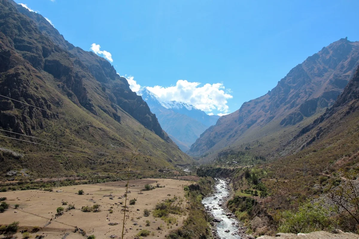
The Salkantay Pass Trek (Day Section) offers a concentrated dose of Andean majesty. The journey begins at Soraypampa, a high-altitude encampment situated at approximately 3,900 metres. From here, the trail strikes north, immediately beginning a steady climb that does not relent until the pass is reached. The landscape is initially dominated by the "Puna" ecosystem—a high-altitude grassland characterised by hardy ichu grass, low-lying shrubs, and the occasional Andean goose or caracara bird. As you ascend, the vegetation thins, replaced by a stark, beautiful world of grey scree, dark granite boulders, and the brilliant white of the surrounding glaciers. The transition is visceral; you can feel the temperature drop and the wind sharpen as you leave the relative shelter of the valley floor.
The centrepiece of the trek is, of course, Nevado Salkantay itself. As the highest peak in the Vilcabamba range, it dominates the skyline with its jagged, ice-clad ridges. The mountain's name, derived from the Quechua word "Sallqa," means wild, uncivilised, or savage—a fitting description for a peak that remained unclimbed until 1952. The day hike allows you to stand at the base of this giant, feeling the immense pressure of the ice and the silence of the high altitude. The pass itself is a narrow notch between the Salkantay and Humantay massifs, often shrouded in swirling mists or blasted by the cold winds that funnel through the gap. Reaching it is a moment of profound clarity, offering views that stretch back toward the Mollepata valley and forward toward the distant, green ridges of the Santa Teresa region.
This trek is particularly popular for those who wish to experience the grandeur of the Andes without committing to a five-day camping expedition. It is often combined with a visit to the nearby Humantay Lake, though the ascent to the pass is a significantly more demanding undertaking. The trail is well-defined but rugged, consisting of dirt paths, loose gravel, and the infamous "Siete Culebras" (Seven Snakes)—a series of steep, tight switchbacks that test the resolve of even the fittest hikers. Because of the extreme altitude, the pace is necessarily slow, turning the hike into a meditative rhythm of breath and step. It is an experience that demands respect for the environment and an awareness of one's own physical limits, but for those who reach the summit of the pass, it is an unforgettable encounter with the heart of the Andes.
History and Cultural Context
The history of the Salkantay region is inextricably linked to the rise and fall of the Inca Empire and the enduring spiritual traditions of the Quechua people. In the Andean worldview, mountains are not merely geological features; they are "Apus," powerful deities that control the weather, the fertility of the land, and the fate of the people living in their shadows. Salkantay is considered one of the most important Apus in the Cusco region, second only to Ausangate. For centuries, pilgrims and locals have made offerings of coca leaves, chicha (maize beer), and fat to the mountain, seeking protection and prosperity. Even today, you will see "apachetas"—small, carefully balanced piles of stones—left by hikers and muleteers at the top of the pass as a sign of respect and a request for safe passage.
During the time of the Incas, the Salkantay Pass was a vital link in the "Qhapaq Ñan," the vast network of roads that connected the far reaches of the empire. While the classic Inca Trail was a more ceremonial and direct route to Machu Picchu, the Salkantay route was likely used for the transport of goods, troops, and pilgrims. The pass served as a strategic transition point between the high-altitude pastoral lands and the lower-elevation agricultural zones where coca, fruit, and maize were grown. The region also played a role in the final days of the Inca resistance. After the Spanish conquest of Cusco, the remnants of the Inca royalty retreated into the rugged Vilcabamba mountains, using the difficult terrain and high passes as a natural defence against the invaders. The "Lost City" of Vitcos and the final stronghold of Espiritu Pampa lie deeper within this range, making the Salkantay Pass a gateway to the last chapter of the Inca story.
In the modern era, the Salkantay route was "rediscovered" by the international trekking community as an alternative to the heavily regulated and often overcrowded Inca Trail. It gained significant fame after being named by National Geographic as one of the 25 best treks in the world. Despite its increasing popularity, the area around the pass remains largely undeveloped, preserved by its sheer inaccessibility and the harshness of its climate. The local communities of Mollepata and Soraypampa have transitioned from purely pastoral economies to becoming integral parts of the trekking industry, providing the mules, guides, and hospitality that make these expeditions possible. Walking this trail is not just a physical journey; it is a walk through a living history where ancient beliefs and modern adventure intersect on the slopes of the Savage Mountain.
Want more background? Read extended notes on history and cultural context → Learn more
Seasonal Highlights and Weather Reality
The weather in the high Andes is defined by two distinct seasons: the dry season and the wet season. Understanding these cycles is crucial for a safe and enjoyable trek to the Salkantay Pass, as the conditions at 4,600 metres can be life-threatening if one is unprepared.
The Dry Season (May to September): This is the peak trekking window and the best time to attempt the Salkantay Pass. During these months, the skies are typically a brilliant, deep blue, providing the best possible views of the glaciers and surrounding peaks. Rainfall is rare, making the trail firmer and easier to navigate. However, the clear skies come with a trade-off: extreme temperature fluctuations. While the sun can feel intense during the day, temperatures at the pass can drop well below freezing at night and in the early morning. Frost is common at the trailhead in Soraypampa, and hikers should be prepared for biting winds at the summit of the pass. June and July are the driest and coldest months.
The Shoulder Seasons (April and October): these months can be excellent times to visit, offering a balance between manageable crowds and relatively stable weather. In April, the landscape is exceptionally green following the rains, and the mountains are often draped in fresh snow. October marks the transition back to the wet season, with increasing cloud cover and the occasional afternoon shower. These months require more flexible planning and better waterproof gear.
The Wet Season (November to March): Attempting the Salkantay Pass during the height of the rainy season is a serious undertaking. Heavy rain can turn the trail into a muddy, slippery mess, and clouds often obscure the very views that make the trek worthwhile. More importantly, the risk of landslides and rockfalls increases significantly. Snow is common at the pass during this time, and the "Siete Culebras" switchbacks can become dangerously slick. Many trekking companies suspend operations in February, the wettest month, when the nearby Inca Trail is also closed for maintenance. If you choose to hike during the wet season, high-quality waterproof layers and a high degree of mountain competence are essential.
Recommended Itinerary
Salkantay Pass Day Trek Itinerary
Early Morning: The Journey from Cusco
- Time: 03:30 – 07:30
- Departure from Cusco via private transport or organised tour
- Travel through the Limatambo valley, passing the archaeological site of Tarawasi
- Ascend the winding mountain road to the village of Mollepata (2,900 m)
- Brief stop in Mollepata for breakfast and last-minute supplies (water, coca leaves)
- Continue the drive to the Soraypampa trailhead (3,900 m)
- The road from Mollepata to Soraypampa is unpaved and can be rough; expect a bumpy ride
Morning: The Ascent from Soraypampa
- Time: 08:00 – 11:00
- Distance: 6 km (ascent)
- Elevation Gain: 730 m (from trailhead to pass)
- Begin the hike from the Soraypampa plateau, heading north toward the massive face of Salkantay
- The first hour is a steady climb through the Salkantay Pampa, a wide glacial valley
- Pass the base camp areas used by multi-day trekkers
- Reach the "Siete Culebras" (Seven Snakes) section—a series of steep, rocky switchbacks
- The air becomes noticeably thinner here; maintain a slow, steady "Andean pace"
- Pass Soyrococha Lake, a small alpine tarn that often reflects the surrounding peaks
Midday: Reaching the Salkantay Pass
- Time: 11:00 – 12:30
- Arrival at the Salkantay Pass (Abra Salkantay) at 4,630 m
- Celebrate the achievement at the highest point of the trek
- Take time to photograph the towering glaciers of Nevado Salkantay (6,271 m) and Humantay (5,917 m)
- Observe the "apachetas" (stone cairns) left by previous travellers
- If weather permits, enjoy a high-altitude lunch while taking in the 360-degree views
- Be mindful of the cold; even on sunny days, the wind at the pass is piercing
- Begin the descent before the afternoon clouds typically roll in
Afternoon: The Descent and Return
- Time: 12:30 – 15:30
- Distance: 6 km (descent)
- Elevation Loss: 730 m
- Retrace your steps down the "Siete Culebras" switchbacks
- The descent is taxing on the knees; trekking poles are highly recommended
- Enjoy the changing perspective of the Soraypampa valley as you descend
- Arrive back at the Soraypampa trailhead
- Board transport for the 3.5-hour return journey to Cusco
- Arrive in Cusco by early evening (approx. 19:00 – 20:00)
Important Notes:
- This is a high-altitude trek; at least 2–3 days of acclimatisation in Cusco is mandatory
- Weather can change in minutes; always carry layers even if the morning is clear
- Mule trains have the right of way; always move to the mountain side of the trail (not the cliff side)
- There are no permanent facilities between Soraypampa and the pass
- Hydration is critical for managing altitude; drink more water than you think you need
Planning and Bookings
Book Your Trip
Everything you need to plan your journey
Accommodation
Find places to stay near Cusco
Flights
Search flights to Cusco
Essential Preparation
The most critical aspect of preparing for the Salkantay Pass is acclimatisation. Starting a 1,200-metre ascent to 4,630 metres without prior time at altitude is a recipe for Acute Mountain Sickness (AMS). It is strongly recommended to spend at least three nights in Cusco (3,400 m) or the Sacred Valley (2,800 m) before attempting this hike. During this time, engage in light activity, stay hydrated, and avoid heavy meals or alcohol.
Logistically, you must decide between an organised tour or a self-guided trip. Organised tours from Cusco are the most common and convenient option, as they include transport, a guide, and often breakfast and lunch. If going solo, you will need to hire a private taxi or "colectivo" (shared van) from Cusco to Mollepata, and then another transport to Soraypampa. Private transport offers more flexibility but is significantly more expensive. Ensure your driver is experienced with the rough mountain roads and agree on a return time, as there is no reliable public transport from Soraypampa in the late afternoon.
Trail Accommodation
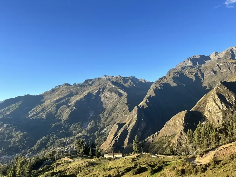
As this is a day hike, no overnight accommodation is required on the trail itself. However, many hikers choose to stay in Soraypampa the night before to get an early start and further acclimatise. Soraypampa has evolved from a basic campsite into a hub with various options:
Accommodation Options in Soraypampa:
- Sky Domes/Glass Cabins: High-end, private domes with transparent roofs for stargazing. These often include beds, heaters, and private bathrooms.
- Eco-Huts: Basic thatched-roof huts providing shelter for tents or simple bunk beds.
- Campsites: Designated areas for pitching your own tent. Facilities are basic, usually consisting of cold-water sinks and pit or flush toilets.
- Lodges: A few small lodges offer private rooms and communal dining areas.
Facilities and Costs:
- Most accommodation in Soraypampa must be booked in advance, especially during the dry season.
- Expect to pay between US$10 for a campsite to US$150+ for a luxury dome.
- Electricity is limited and often provided by generators for only a few hours in the evening.
- There is no WiFi and very limited mobile signal in Soraypampa.
- Meals are usually provided by the accommodation providers as there are no independent restaurants.
Required Gear
- Trekking Boots: Sturdy, waterproof boots with good ankle support are essential for the rocky terrain.
- Layered Clothing: A moisture-wicking base layer, a warm fleece or down mid-layer, and a high-quality waterproof/windproof outer shell.
- Trekking Poles: Highly recommended to assist with the steep ascent and to protect your knees during the 1,200 m descent.
- Headwear: A warm beanie for the cold and a wide-brimmed hat for the intense high-altitude sun.
- Gloves: Lightweight but windproof gloves are necessary for the pass.
- Daypack: A 20–30L pack with a rain cover.
- Sunglasses: Category 3 or 4 UV protection to prevent snow blindness and protect against the thin atmosphere.
What to Bring
- Water: At least 2–3 litres. Consider a hydration bladder for easy access. Water can be purchased in Soraypampa but not on the trail.
- Water Treatment: Purification tablets or a filter if you plan to refill from streams (not recommended unless necessary).
- Snacks: High-energy foods like nuts, chocolate, energy bars, and dried fruit.
- Coca Products: Coca leaves for chewing or coca candies to help with altitude symptoms.
- Sun Protection: SPF 50+ sunscreen and lip balm (the sun at 4,600 m is exceptionally strong).
- Personal First Aid: Including blister plasters, ibuprofen/paracetamol, and any personal medications.
- Altitude Medication: Consult your doctor about Diamox (Acetazolamide).
- Cash: Small denominations of Peruvian Soles for tips, snacks in Mollepata, or emergency mule hire.
- Identification: A copy of your passport.
Permits

One of the primary advantages of the Salkantay Pass Trek (Day Section) compared to the classic Inca Trail is the lack of a restrictive permit system. Currently, no government-issued permits are required to hike to the Salkantay Pass. This allows for much greater flexibility in planning, as you do not need to book months in advance.
Entry Fees and Local Regulations:
- Mollepata Entry Fee: The municipality of Mollepata charges a small entry fee for all visitors entering the region. This is typically around 20 Peruvian Soles (approx. US$5). You will usually pay this at a checkpoint on the road into town. Keep your receipt, as you may be asked to show it later.
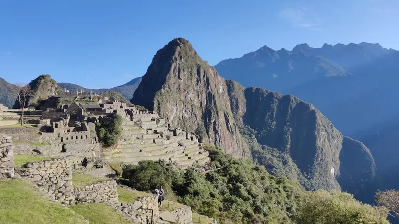
- Machu Picchu: It is important to note that while the trek itself doesn't require a permit, if you intend to continue to Machu Picchu as part of a longer trip, you MUST book your Machu Picchu entry tickets well in advance. These are not available at the site or in the Salkantay region.
- Group Size: There are currently no limits on group sizes for day hikers, but it is always best to travel with a reputable operator who follows safety protocols.
Future Changes: The Peruvian Ministry of Culture and the SERNANP (National Service of Natural Areas Protected by the State) occasionally discuss implementing more formal regulations for the Salkantay route to manage environmental impact. Always check for the latest updates before your trip, as regulations in Peru can change with little notice.
Other Activities in the Area
The region around Soraypampa and Mollepata offers several other spectacular experiences that can be combined with your trek:
- Humantay Lake (Laguna Humantay): The most popular day trip from Soraypampa. A steep 1.5-hour climb leads to a stunning turquoise glacial lake sitting at the base of the Humantay glacier. Most people visit the lake in the morning, but visiting in the afternoon (if staying overnight) offers more solitude.
- Salkantay Pampa Exploration: For those not wishing to climb all the way to the pass, the flat glacial valley of Salkantay Pampa offers beautiful, easy walking with incredible views of the mountain face.
- Coffee Tours in Lucmabamba: If you continue past the pass on a multi-day trek, you can visit organic coffee plantations and learn about the traditional roasting process.
- Cocalmayo Hot Springs: Located near Santa Teresa, these are widely considered the best natural hot springs in Peru—a perfect reward for tired legs after a high-altitude trek.
- Condor Sighting in Chonta: Located a few hours from Mollepata, the Chonta canyon offers a spectacular viewpoint where you can often see Andean Condors soaring on the thermals.
- Tarawasi Archaeological Site: A small but impressive Inca site in Limatambo featuring exceptional "cellular" stonework, easily visited on the drive to or from Cusco.
Safety and Conditions
Altitude Sickness (AMS): This is the single greatest risk on the Salkantay Pass Trek. At 4,630 metres, the air contains significantly less oxygen than at sea level. Symptoms of AMS include headache, nausea, dizziness, and fatigue. If symptoms persist or worsen, the only cure is to descend immediately. More severe forms, such as HAPE (High Altitude Pulmonary Edema) or HACE (High Altitude Cerebral Edema), are life-threatening emergencies. Never ignore your body's signals, and ensure your guide carries emergency oxygen.
Weather Hazards: The weather at the pass can turn from sunshine to a blizzard in minutes. Hypothermia is a genuine risk if you are caught in wet, windy conditions without proper layers. Lightning is also a concern during the wet season; if a storm approaches, descend from the pass and high ridges immediately. The "Siete Culebras" section can be very slippery when wet or icy; take extreme care with your footing.
Physical Demands: A 1,200-metre ascent is a major physical undertaking. Ensure you are in good cardiovascular shape. If you find the climb too difficult, "emergency mules" are often available for hire from local arrieros (muleteers) at Soraypampa or Salkantay Pampa. These can carry you up to the pass for a fee (usually 100–150 Soles), though you must still be able to descend on foot.
Trail Etiquette and Animals: The trail is shared with mule trains carrying gear for multi-day trekkers. These animals are large and can be unpredictable. Always yield the trail to them. Stand on the uphill side of the path to avoid being accidentally bumped off the edge. Be aware of free-roaming dogs in the valleys; while usually harmless, it is best not to encourage them.
Communication: There is no mobile phone reception on the trail or at the pass. If you are hiking independently, ensure someone knows your itinerary and expected return time. Satellite messengers (like Garmin inReach) are highly recommended for solo hikers.
Side Trips and Points of Interest
The Siete Culebras (Seven Snakes): This is the most famous section of the ascent. It consists of seven very tight, steep switchbacks that climb the headwall of the valley. The name comes from the way the trail snakes back and forth. It is a mental and physical milestone; once you clear the "snakes," the gradient eases slightly as you approach Soyrococha.
Soyrococha Lake: Located at approximately 4,400 metres, this small, high-altitude lake is a perfect place for a final rest before the last push to the pass. The water is a deep, cold blue, and the lake is often surrounded by small birds and the occasional viscacha (an Andean rodent that looks like a long-tailed rabbit).
The Salkantay Apachetas: At the summit of the pass, you will find hundreds of stone cairns. These are not just trail markers; they are sacred offerings. It is a tradition to carry a stone from the bottom of the valley and place it on a cairn at the top, often accompanied by three coca leaves (a "k'intu") as an offering to the Apu. This is a beautiful way to participate in the local culture, but please do not disturb existing cairns or create new ones in areas that might damage fragile alpine plants.
Glacial Moraines: The area around the pass is a textbook example of glacial geology. You can see the massive piles of rock and debris (moraines) left behind by the retreating Salkantay and Humantay glaciers. The scale of these features provides a sobering perspective on the power of ice and the ongoing impact of climate change on the Andean peaks.
Leave No Trace
The high-altitude environment of the Salkantay Pass is an extremely fragile ecosystem. At these elevations, plants grow very slowly, and the soil is thin and easily eroded. With thousands of hikers visiting each year, the cumulative impact can be devastating if we do not follow strict Leave No Trace principles.
Protecting the Savage Mountain:
- Pack it in, Pack it out: This includes all organic waste like orange peels and banana skins, which do not decompose in the cold, thin air and can be harmful to local wildlife.
- Stay on the Trail: Do not take shortcuts on the switchbacks. This causes massive erosion and destroys the delicate alpine flora.
- Respect the Water: Do not use soap or detergents in the streams or lakes. Even biodegradable soap can disrupt the chemistry of these pristine water sources.
- No Fire: High-altitude vegetation is highly flammable, and wood is a scarce resource. Use only gas stoves if camping.
- Human Waste: Use the facilities at Soraypampa before you start. If you must go on the trail, move at least 60 metres from water sources and the path, dig a "cathole" 15 cm deep, and pack out your toilet paper in a sealed bag.
- Wildlife: Do not feed the birds or foxes. This alters their natural behaviour and can make them dependent on humans.
By following these guidelines, you ensure that the Salkantay Pass remains a wild and sacred place for the generations of hikers and pilgrims who will follow in your footsteps.