Rota Vicentina (Historical Way) - A Journey Through Rural Portugal
The Rota Vicentina’s Historical Way (Caminho Histórico) is a majestic long-distance trail spanning 230 kilometres through the heart of southwest Portugal. Stretching from the medieval town of Santiago do Cacém in the Alentejo region to the dramatic cliffs of Cabo de São Vicente (Cape Saint Vincent) in the Algarve, this route offers a profound immersion into the rural soul of the Iberian Peninsula. Unlike its sister route, the Fishermen’s Trail, which clings to the rugged coastline, the Historical Way traverses the interior landscapes of the Sw Alentejo and Vicentine Coast Natural Park. It leads walkers through ancient cork oak forests, across rolling hills of wildflower-strewn scrubland, along fertile river valleys, and into the whitewashed hearts of traditional Portuguese villages. This is a journey of cultural discovery as much as physical endurance, where the rhythm of the walk is dictated by the hospitality of local "casas," the scent of eucalyptus, and the timeless agricultural traditions that have shaped this landscape for centuries.
- Distance: 230.0 km total
- Duration: 10–12 days
- Season: September to June (avoiding the peak heat of July and August)
- Accommodation: Guesthouses, rural tourism lodges, hostels, and pensions
- Highest point: Approximately 329 m (near Cercal do Alentejo)
- Total Elevation Gain: 5,700 m
- Direction: Typically walked North to South (Santiago do Cacém to Cabo de São Vicente)
Overview
The Historical Way is the backbone of the Rota Vicentina network, a project designed to promote sustainable tourism and preserve the heritage of southwest Portugal. It is a fully signposted European Long Distance Path (GR11), marked with the distinctive red and white stripes familiar to hikers across the continent. While the Fishermen’s Trail is often lauded for its dramatic ocean views, the Historical Way provides the essential context for the region. It connects the towns and villages that have historically sustained the coastal communities, weaving through a landscape that feels remarkably untouched by the rapid modernisation seen in other parts of Europe.
The terrain is varied but generally moderate. Walkers will find themselves on wide forest tracks, narrow single-track paths through dense Mediterranean scrub, and occasional stretches of quiet rural roads. The elevation gain is cumulative; while there are no high-altitude mountains, the constant "ups and downs" of the Alentejo hills (the "serras") can be surprisingly taxing over a 20-kilometre day. The route is divided into 12 stages, each ending in a village or town where accommodation and supplies are readily available. This infrastructure makes the Historical Way an accessible option for those who enjoy long-distance walking without the need to carry heavy camping gear or freeze-dried meals.
One of the defining characteristics of the Historical Way is the "Montado" ecosystem. This is the traditional cork oak forest, a man-made landscape that supports incredible biodiversity while providing a sustainable harvest of cork. Walking beneath these gnarled, ancient trees, many of which have been harvested for generations, provides a sense of continuity and peace. In the spring, the landscape erupts in a kaleidoscope of colours as rockroses, lavender, and wild orchids carpet the hillsides. In the autumn, the air is crisp, and the harvest of acorns and olives begins. It is a trail that rewards the slow traveller—the one who stops to speak with a shepherd, lingers over a "café solo" in a village square, and appreciates the subtle shifts in geology and flora as the trail moves from the Alentejo into the Algarve.
History and Cultural Context
The paths that comprise the Historical Way are not modern inventions; they are the "caminhos" used for centuries by locals to travel between markets, by pilgrims heading toward the sacred site of Cape Saint Vincent, and by labourers moving between farms. For hundreds of years, these routes were the primary arteries of communication in a region that remained isolated from the industrial centres of Lisbon and Porto. The trail passes through areas that have seen the influence of Romans, Visigoths, and Moors, all of whom left their mark on the architecture, agriculture, and language of the southwest.
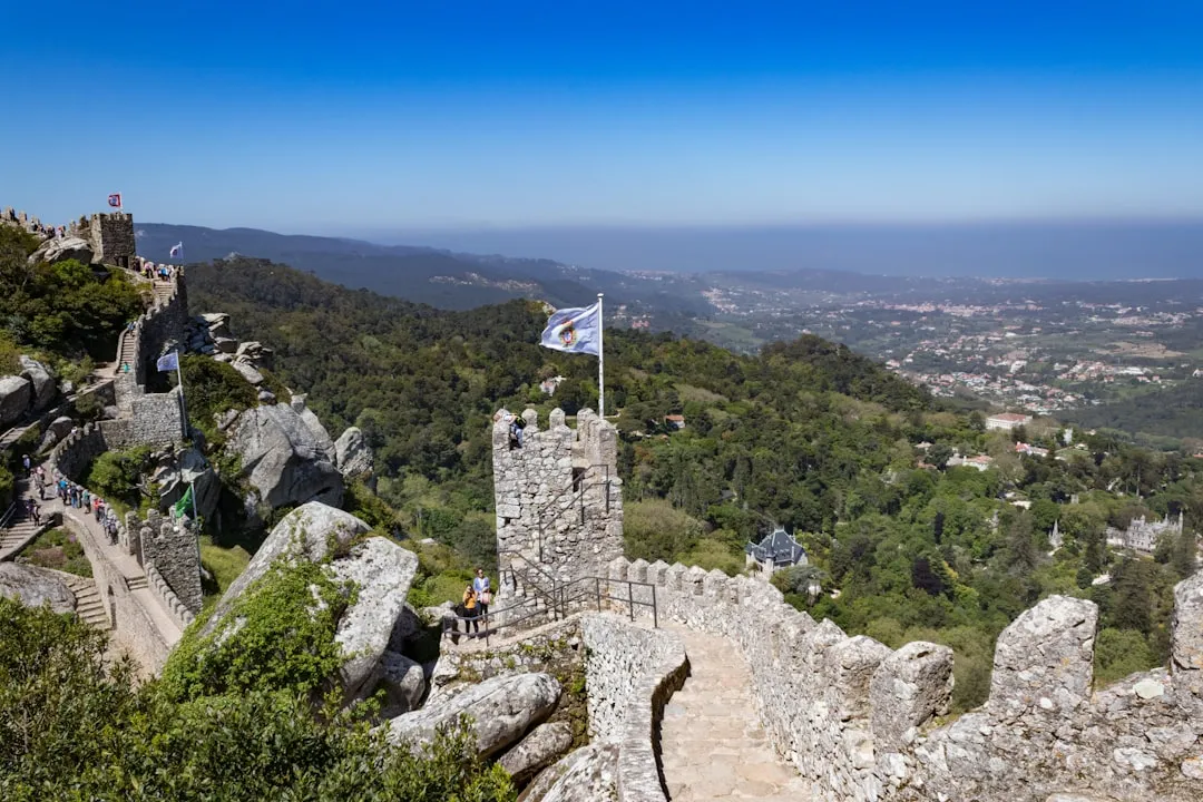
Santiago do Cacém, the northern trailhead, is dominated by its Moorish castle and the ruins of the Roman city of Miróbriga nearby. As you move south, the influence of the Moorish occupation remains visible in the irrigation systems of the river valleys and the layout of towns like Aljezur, which sits beneath the ruins of a 10th-century castle. The final destination, Cabo de São Vicente, was known to the Romans as "Promontorium Sacrum" (the Sacred Promontory), believed to be the end of the world where the sun hissed as it sank into the ocean. In the 15th century, this area became the focal point for the Portuguese Age of Discovery, with Prince Henry the Navigator establishing his school of navigation in nearby Sagres.
The Rota Vicentina project itself was born in 2012 from a desire to protect this heritage. Local residents and businesses realised that the traditional way of life was under threat from rural depopulation. By creating a world-class hiking trail, they aimed to bring "slow tourism" to the region, providing an economic incentive to maintain the paths and preserve the traditional architecture and ecosystems. When you walk the Historical Way, you are participating in a living history, supporting a community that is actively working to keep its traditions alive in the 21st century.
Want more background? Read extended notes on history and cultural context → Learn more
Seasonal Highlights and Weather Reality
The climate of southwest Portugal is Mediterranean, influenced heavily by the Atlantic Ocean. This creates a unique environment where winters are mild and summers can be intensely hot. Choosing the right time to walk is crucial for both safety and enjoyment.
Spring (March to May): This is arguably the best time to walk the Historical Way. The temperatures are mild (15–22°C), and the landscape is at its most vibrant. The wildflowers are in full bloom, and the water levels in the streams are high. Birdwatchers will find this season particularly rewarding as migratory species return from Africa. However, spring can also bring occasional Atlantic rain showers, so waterproof gear remains essential.
Autumn (September to November): As the summer heat fades, autumn offers stable weather and warm soil. The sea remains warm enough for a swim at the end of the day in coastal towns. The light in autumn is particularly beautiful for photography, with golden hues over the cork forests. This is also the time of the grape and olive harvests, adding a layer of cultural interest to the journey.
Winter (December to February): Winter is a viable option for experienced walkers. While it can be rainy and windy, there are many days of bright sunshine and crisp air. Temperatures rarely drop below 5°C at night and often reach 15°C during the day. The trail is at its quietest, and accommodation is easy to find, though some smaller rural lodges may close for the season. Be prepared for muddy sections on the trail after heavy rain.
Summer (July and August): Walking the Historical Way in mid-summer is generally discouraged. Temperatures regularly exceed 30°C and can reach 40°C in the interior sections. There is very little shade on many parts of the trail, and the risk of heatstroke and dehydration is significant. Furthermore, this is the peak season for domestic tourism, meaning accommodation in coastal towns can be fully booked and significantly more expensive.
Recommended Itinerary
12-Day Historical Way Itinerary
Day 1: Santiago do Cacém to Vale Seco
- Distance: 18 km
- Elevation gain: 350 m
- Time: 5–6 hours
- Start at the Santiago do Cacém castle, overlooking the town and the ocean in the distance.
- The trail moves quickly into the "Montado" (cork oak forest), offering a gentle introduction to the Alentejo landscape.
- Pass through small agricultural plots and eucalyptus plantations.
- Arrive in the tiny hamlet of Vale Seco, a peaceful spot with limited but charming accommodation.
Day 2: Vale Seco to Cercal do Alentejo
- Distance: 23 km
- Elevation gain: 450 m
- Time: 6–7 hours
- A more demanding day with several climbs through the "Serras."
- The trail passes the Campilhas Reservoir, a beautiful spot for a rest.
- Experience the transition from cork forest to more rugged scrubland (maquis).
- Cercal do Alentejo is a lively traditional town with excellent restaurants and all services.
Day 3: Cercal do Alentejo to Porto Covo
- Distance: 18 km
- Elevation gain: 150 m
- Time: 4–5 hours
- This stage connects the interior to the coast.
- The path follows the "Serra do Cercal," offering the first expansive views of the Atlantic Ocean.
- Descend toward the coast through fragrant pine forests.
- Porto Covo is a stunning whitewashed fishing village and the northern terminus of the Fishermen's Trail.
Day 4: Porto Covo to Vila Nova de Milfontes
- Distance: 20 km
- Elevation gain: 150 m
- Time: 5–6 hours
- Note: This section often follows the coast (Fishermen's Trail) but the Historical Way stays slightly inland.
- Walk through acacia groves and across sandy heaths.
- Cross the bridge over the Mira River to enter Vila Nova de Milfontes.
- Milfontes is one of the most beautiful towns on the route, situated on a dramatic estuary.
Day 5: Vila Nova de Milfontes to Zambujeira do Mar
- Distance: 22 km
- Elevation gain: 250 m
- Time: 6–7 hours
- The trail moves through a mix of agricultural land and coastal scrub.
- Pass through the village of Cavaleiro and the Cabo Sardão lighthouse, where storks nest on the sea cliffs.
- Zambujeira do Mar is perched on a cliff overlooking a spectacular beach.
Day 6: Zambujeira do Mar to Odeceixe
- Distance: 18 km
- Elevation gain: 200 m
- Time: 5–6 hours
- A classic stage featuring dramatic cliff-top walking and hidden beaches.
- Cross the border from the Alentejo region into the Algarve.
- The descent into Odeceixe offers views of the Seixe River winding through the valley to the sea.
- Odeceixe is a picturesque village with narrow, winding streets.
Day 7: Odeceixe to Aljezur
- Distance: 18 km
- Elevation gain: 250 m
- Time: 5–6 hours
- Follow the "Reguengo" irrigation canal for a significant portion of the day.
- The trail is flat and easy for long stretches, passing through fertile farmland.
- Enter Aljezur, a town split between the old Moorish quarter on the hill and the "new" town built after the 1755 earthquake.
Day 8: Aljezur to Arrifana
- Distance: 12 km
- Elevation gain: 300 m
- Time: 3–4 hours
- A shorter day allowing for exploration of Aljezur’s castle in the morning.
- The trail climbs out of the valley and heads back toward the coast.
- Arrifana is a surfer’s paradise with a dramatic crescent-shaped bay and high cliffs.
Day 9: Arrifana to Carrapateira
- Distance: 24 km
- Elevation gain: 400 m
- Time: 7–8 hours
- One of the longest and most remote stages of the trail.
- Walk through vast areas of aromatic Mediterranean scrub (cistus and rosemary).
- Pass the Bordeira beach, a massive expanse of sand and dunes.
- Carrapateira is a small, quiet village with a strong connection to the sea.
Day 10: Carrapateira to Vila do Bispo
- Distance: 22 km
- Elevation gain: 300 m
- Time: 6–7 hours
- The landscape becomes increasingly arid and wind-swept as you approach the southern tip of Portugal.
- Pass through the abandoned village of Pedralva, now restored as a rural tourism project.
- Vila do Bispo is a traditional Algarvean town known for its seafood (especially barnacles).
Day 11: Vila do Bispo to Cabo de São Vicente
- Distance: 14 km
- Elevation gain: 100 m
- Time: 4 hours
- The final push to the "end of the world."
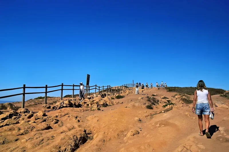
- The trail crosses the "Planalto Vicentino," a flat, rocky plateau with unique flora.
- The lighthouse at the Cape marks the official end of the Historical Way.
- Celebrate with a "Last Bratwurst Before America" at the local food stall.
Day 12: Cabo de São Vicente to Sagres (Optional)
- Distance: 6 km
- Elevation gain: Minimal
- Time: 1.5 hours
- Most walkers continue along the cliffs to the town of Sagres for better transport links and accommodation.
- Visit the Sagres Fortress and the wind compass.
- Final sunset over the Atlantic to conclude the journey.
Planning and Bookings
Book Your Trip
Everything you need to plan your journey
Accommodation
Find places to stay near Santiago do Cacém
Flights
Search flights to Santiago do Cacém
Essential Preparation
The Historical Way requires a moderate level of fitness. While the paths are generally well-maintained, walking 20 kilometres a day for 10 or more consecutive days is a significant physical undertaking. It is highly recommended to undertake several training walks with a loaded pack before departure. Because the trail passes through many small villages, you do not need to carry more than a day's worth of food, but you must be comfortable with the cumulative fatigue of multi-day trekking.
Logistically, the trail is well-supported. Most walkers fly into Lisbon (LIS) and take a bus (Rede Expressos) to Santiago do Cacém (approx. 2 hours). Alternatively, you can fly into Faro (FAO) and take a train or bus to the northern start, though this takes longer. At the end of the trail, buses run from Sagres back to Lagos, where train connections to Faro and Lisbon are available. Booking accommodation in advance is essential during the spring and autumn months, as the "casas rurais" are often small and fill up quickly with hikers and nature lovers.
Trail Accommodation
The Rota Vicentina is unique because it relies on existing village infrastructure rather than dedicated mountain huts. This allows for a high level of comfort but requires more coordination.
Types of Accommodation:
- Turismo Rural (Rural Tourism): Often beautifully restored farmhouses or manor houses. These offer high-quality rooms, breakfast, and often dinner. Expect to pay €70–€120 per night for a double room.
- Pensions and Guesthouses: Found in almost every village. These are simpler, family-run establishments. Costs range from €40–€70 per night.
- Hostels: Available in larger towns like Vila Nova de Milfontes, Aljezur, and Sagres. These offer dorm beds for €20–€30.
- Campsites: There are several commercial campsites along the route (e.g., in Porto Covo, Milfontes, and Zambujeira). Wild camping is strictly prohibited within the Natural Park.
Facilities Provided: Most accommodation includes bedding, towels, and breakfast. Many hosts are accustomed to hikers and can provide packed lunches or laundry services for an additional fee. WiFi is generally available in all but the most remote rural lodges.
Required Gear
- Footwear: Lightweight hiking boots or high-quality trail running shoes. The terrain is often rocky or sandy, so a good grip and some cushioning are essential. Ensure they are well broken-in.
- Backpack: A 30–40 litre pack is sufficient if you are staying in guesthouses. If you are using a luggage transfer service, a 15–20 litre daypack is enough.
- Clothing: Moisture-wicking base layers, a lightweight fleece or wool mid-layer, and a high-quality waterproof/breathable jacket. Zip-off trekking trousers are ideal for the variable temperatures.
- Sun Protection: A wide-brimmed hat, high-SPF sunscreen, and UV-rated sunglasses. The Portuguese sun is intense, even on cloudy days.
- Navigation: While the trail is well-marked, carry the Rota Vicentina official map or a GPS app (like AllTrails or the official Rota Vicentina app) with offline maps downloaded.
- First Aid: Blister plasters (Compeed), antiseptic cream, painkillers, and any personal medications.
What to Bring
- Water Capacity: At least 2 litres of water carrying capacity. Some sections have long stretches without water points, especially in the southern stages.
- Reusable Water Bottle: Tap water in Portugal is safe to drink, so a reusable bottle or bladder helps reduce plastic waste.
- Snacks: High-energy snacks like nuts, dried fruit, and energy bars. While you can buy lunch in villages, having a backup is wise for the longer stages.
- Power Bank: To keep your phone/GPS charged, as you will likely be using it for navigation and photography throughout the day.
- Trekking Poles: Highly recommended for the undulating terrain to save your knees on the descents and provide stability on sandy sections.
- Cash: While cards are widely accepted in towns, some small village cafés and guesthouses may only accept cash (Euros).
Permits
One of the great advantages of the Historical Way is that no permits are required to walk the trail. It is a public right-of-way, and there are no daily limits on the number of hikers. This makes it an excellent choice for those who prefer a more flexible or last-minute adventure compared to highly regulated trails like the Milford Track or the Inca Trail.
Key Regulations to Observe:
- No Wild Camping: The entire route passes through the Sw Alentejo and Vicentine Coast Natural Park. Wild camping (including in vans or motorhomes) is strictly illegal and heavily fined to protect the fragile ecosystem and prevent forest fires.
- Stay on the Path: To prevent erosion and protect rare flora, walkers must stay on the marked trails. This is particularly important in the dune systems and the rocky plateaus of the Algarve.
- Fire Safety: Portugal is extremely vulnerable to forest fires. Lighting fires or discarding cigarette butts is strictly prohibited and carries severe legal penalties.
- Private Property: Much of the Historical Way passes through private farmland. Respect the owners by staying on the path, closing all gates behind you, and not disturbing livestock or crops.
Luggage Transfers: While not a permit, many walkers choose to use "Vicentine Transfers" or "Luggage Driver" services. These companies will move your main bag from one guesthouse to the next for approximately €15 per stage. This must be booked in advance, especially during the peak walking seasons.
Other Activities in the Area
The southwest of Portugal is a playground for outdoor enthusiasts and culture seekers. Consider adding a few "rest days" to your itinerary to experience the following:
- Surfing: The beaches of Arrifana, Carrapateira, and Sagres are world-renowned for their consistent waves. Many surf schools offer beginner lessons and equipment rental.
- Birdwatching: The Sagres peninsula is a major bottleneck for migratory birds in the autumn. Thousands of raptors, storks, and songbirds can be seen crossing the Atlantic.
- Canoeing and SUP: The Mira River in Vila Nova de Milfontes and the Seixe River in Odeceixe are perfect for a peaceful paddle through the marshes and valleys.
- Wine Tasting: The Alentejo is one of Portugal’s premier wine regions. Look for local "adegas" (cellars) that offer tastings of robust reds and crisp whites.
- Gastronomy Tours: Sample the "Percebes" (goose barnacles) in Vila do Bispo, the "Choco Frito" (fried cuttlefish) in Sines, and the famous Alentejo black pork (Porco Preto).
- Historical Exploration: Spend extra time in Aljezur to visit the municipal museum and the various archaeological sites scattered around the valley.
Safety and Conditions
Heat and Hydration: The most significant risk on the Historical Way is heat exhaustion. Even in the shoulder seasons, the sun can be punishing. Always carry more water than you think you need, wear a hat, and try to start your walk as early as possible (7:00 AM) to finish before the hottest part of the day (2:00 PM – 4:00 PM).
Trail Markings: The trail is marked with red and white paint on rocks, posts, and trees. If you go more than 200 metres without seeing a marker, turn back to the last one you saw. Be aware that in some areas, the Historical Way (Red/White) may overlap with the Fishermen's Trail (Green/Blue) or local circular routes (Yellow/Red). Always follow the Red/White stripes for the Historical Way.
Dogs: In rural Alentejo, you will encounter many farm dogs. Most are behind fences or are working dogs that will ignore you if you keep moving. Occasionally, a loose dog may bark or follow you. The best strategy is to remain calm, avoid eye contact, and keep walking steadily. Carrying trekking poles can provide a psychological barrier if needed.
Processionary Caterpillars: In late winter and early spring (January to March), you may see "processions" of hairy caterpillars on the ground near pine trees. Do not touch them, and keep dogs away from them. Their hairs contain a toxin that causes severe allergic reactions and can be fatal to pets.
Emergency Services: The national emergency number in Portugal is 112. Mobile signal is generally good along the Historical Way, though there are occasional "dead zones" in deep valleys or remote forest sections.
Side Trips and Points of Interest
The Castle of Santiago do Cacém: Before you start your walk, spend an hour exploring this Moorish-built fortification. The views from the walls provide a perfect overview of the landscape you are about to traverse, stretching all the way to the industrial port of Sines and the blue Atlantic.
Miróbriga Roman Ruins: Located just outside Santiago do Cacém, this is one of the most important Roman sites in southwest Portugal. It features a well-preserved forum, thermal baths, and the only Roman hippodrome known in the country. It is a short taxi ride or a 3 km walk from the town centre.
Cabo Sardão: On the stage between Milfontes and Zambujeira, make sure to take the short detour to the lighthouse. This is the only place in the world where white storks are known to nest on sea cliffs. Watching these massive birds navigate the Atlantic winds to reach their precarious nests is a highlight of the entire Rota Vicentina.
The Old Town of Aljezur: Don't just stay in the new part of town. Cross the bridge and climb the steep, cobbled streets of the "Zona Histórica." The 10th-century castle at the top offers a 360-degree view of the lush Aljezur valley and the surrounding hills. The small museums in this quarter provide fascinating insights into the Moorish and Christian history of the region.
Pedralva: This "village of slow" was once almost entirely abandoned. It has been meticulously restored as a rural resort, maintaining its traditional architecture while providing modern comforts. Even if you aren't staying there, it is a beautiful place to stop for a coffee and appreciate the silence of the interior Algarve.
Leave No Trace
The Rota Vicentina passes through a delicate balance of natural wilderness and working agricultural land. To ensure the trail remains open and the environment protected, all walkers must adhere to the Leave No Trace principles.
Respect the Cork Oaks: The cork oak (Quercus suber) is a protected species in Portugal. Never peel the bark, carve into the trees, or climb them. These trees are the livelihood of local farmers and the lungs of the Alentejo.
Waste Management: There are no bins on the trail between villages. You must pack out all your trash, including organic waste like banana peels or apple cores, which can take a long time to decompose in the arid climate and can attract pests. In villages, use the colour-coded recycling bins (Ecopontos): Blue for paper, Green for glass, and Yellow for plastic/metal.
Water Sources: Do not wash yourself or your clothes in the streams or irrigation canals. These are vital water sources for livestock and agriculture. Use the facilities at your accommodation.
Wildlife: Observe animals from a distance. The park is home to otters, wild boar, foxes, and a vast array of birdlife. Feeding wildlife disrupts their natural behaviour and can make them dependent on humans.
Silence: One of the greatest assets of the Historical Way is its tranquillity. Avoid playing music through speakers and keep your voice low, especially when passing through small hamlets or near farmhouses.