Romsdalseggen Ridge - Norway’s Most Spectacular Mountain Vista
The Romsdalseggen Ridge is widely considered one of the world’s most beautiful and breathtaking day hikes. Located in the heart of the Romsdalen valley near the mountaineering capital of Åndalsnes, this 10.3-kilometre traverse offers unparalleled views of the Romsdal Alps, the emerald-green Rauma River, and the sheer, terrifying verticality of the Trollveggen (Troll Wall)—the tallest vertical rock face in Europe. Unlike many other famous Norwegian hikes that lead to a single iconic viewpoint, Romsdalseggen provides a continuous, high-altitude panorama that lasts for hours. It is a journey through the very soul of Norwegian mountain culture, where the jagged peaks of Vengetindene, Romsdalshorn, and Store Trolltind frame a landscape that feels both ancient and exhilaratingly immediate.
- Distance: 10.3 km point-to-point
- Duration: 7–10 hours
- Elevation Gain: 970 metres
- Difficulty: Challenging (requires a good head for heights and physical stamina)
- Season: Mid-June to September (weather dependent)
- Highest Point: Mjølvafjellet (1,216 metres)
- Start Point: Vengedalen (accessible via shuttle bus from Åndalsnes)
- End Point: Åndalsnes town centre
Overview
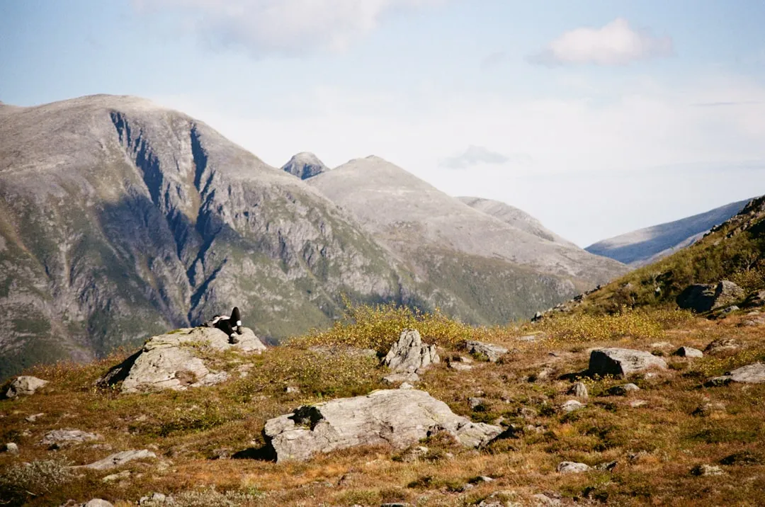
Romsdalseggen is not merely a walk; it is a high-wire act across the spine of Norway. The ridge stands as a natural balcony overlooking some of the most dramatic alpine scenery in Scandinavia. To the east, the jagged needles of the Vengetindene massif pierce the sky; to the south, the legendary Romsdalshorn stands like a sentinel; and to the west, the abyss of the Romsdalen valley drops nearly a vertical kilometre to the valley floor. The most striking feature, however, is the Trollveggen. Standing on the ridge, you are positioned directly opposite this 1,100-metre vertical wall, allowing you to trace the lines of famous climbing routes that have challenged the world’s elite mountaineers for decades.
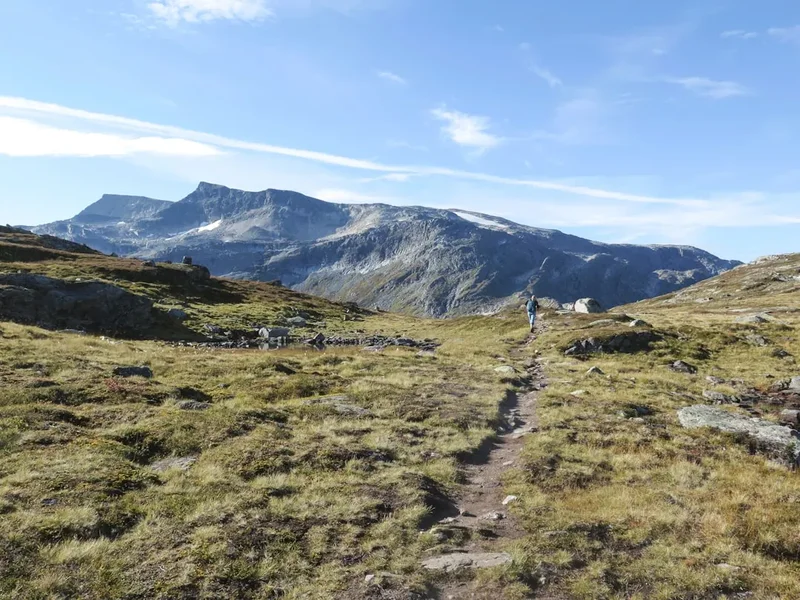
The terrain is varied and demanding. The ascent from Vengedalen begins in a lush alpine valley before climbing steeply into a world of shattered gneiss and hardy mountain flora. Once you gain the ridge, the path becomes a narrow ribbon of rock. While the most exposed sections are equipped with chains for security, hikers must be comfortable with significant "air" on either side. The descent is equally famous, passing the stone-built Romsdalstrappa (Romsdal stairs) and the iconic Rampestreken viewing platform—a steel ramp that juts out into thin air, providing the ultimate photo opportunity over Åndalsnes and the Isfjorden.
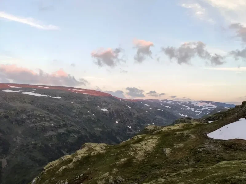
Geologically, the ridge is a testament to the power of glacial erosion. During the last ice age, massive glaciers carved out the deep U-shaped Romsdalen valley, leaving behind the sharp, narrow ridges (arêtes) that we hike today. The rock is primarily gneiss, a metamorphic rock that provides excellent friction for boots but can be unforgivingly sharp. The weather here is a primary protagonist; the proximity to the Atlantic coast means that mist can roll in within minutes, transforming a sun-drenched ridge into a mysterious, ethereal landscape where the peaks appear and disappear like ghosts.
History and Cultural Context
The Romsdalen valley has been a focal point of Norwegian mountain history since the late 19th century. While the local farmers and hunters had traversed the lower slopes for centuries, the "Golden Age" of mountaineering brought British explorers to Åndalsnes, seeking to conquer the "impossible" peaks. The Romsdalshorn, which looms over the Romsdalseggen trail, was first summited in 1828 by two local blacksmiths, a feat so incredible at the time that it was disbelieved for decades until a second ascent confirmed their claim.
The Romsdalseggen trail itself was developed more recently as a way to share this spectacular landscape with experienced hikers rather than just technical climbers. It was officially "opened" as a curated hiking route in 2009, and its popularity exploded almost overnight. The development of the trail involved significant engineering, including the installation of safety chains on the steepest sections and the construction of the Romsdalstrappa. These stone steps were built by Sherpas from Nepal, whose expertise in dry-stone masonry has become a hallmark of Norway’s most popular mountain trails. Their work ensures that the descent, while steep, is sustainable and protects the fragile alpine soil from erosion.
Åndalsnes, the town at the foot of the ridge, is officially designated as Norway’s "Mountaineering Capital" (Tindesenteret). The Norwegian Mountaineering Centre located in the harbour is a tribute to this heritage, housing the history of the pioneers who first explored these peaks. Walking Romsdalseggen is, in many ways, a pilgrimage through this history. You are walking in the shadow of Arne Randers Heen, the "King of Romsdalen," who climbed the Romsdalshorn 233 times and was a key figure in establishing the region as a world-class climbing destination. The ridge connects the modern hiker to this legacy of exploration and respect for the vertical world.
Want more background? Read extended notes on history and cultural context → Learn more
Seasonal Highlights and Weather Reality
The hiking season for Romsdalseggen is relatively short, typically running from mid-June to late September. Because of the ridge's elevation and northern latitude, snow can linger on the high passes well into July, and the first autumn dustings often arrive in early October. Attempting the ridge outside of this window is strictly for experienced winter mountaineers with appropriate ice axe and crampon skills.
Summer (July and August): This is the peak season. The days are incredibly long, with nearly 20 hours of daylight in July, providing a massive safety margin for slower hikers. The alpine flowers, including the rare mountain avens and purple saxifrage, are in full bloom. However, this is also the busiest time. The shuttle buses from Åndalsnes can sell out, and the narrowest sections of the ridge may experience "traffic jams."
Autumn (September): Many locals consider September the best time to hike. The air is crisp and clear, offering the best visibility for the distant peaks of the Jotunheimen National Park. The vegetation turns a brilliant palette of ochre, rust, and deep red, contrasting beautifully with the emerald river below. The first frosts make the rock slippery, so extra caution is required in the early mornings.
Weather Reality: Romsdalseggen is notorious for its microclimate. It is not uncommon to have bright sunshine in Åndalsnes while the ridge is shrouded in thick "havtåke" (sea fog). Wind is a significant factor; because the ridge is exposed, gusts can be much stronger than in the valley. If the forecast predicts winds exceeding 10–12 metres per second or heavy rain, the hike should be postponed. The rock becomes extremely slippery when wet, and the exposure makes high winds dangerous. Always check the specific mountain forecast on Yr.no before departing.
Recommended Itinerary
Romsdalseggen Ridge Route Progression
Stage 1: Vengedalen to Høgaksla
- Distance: 2.5 km
- Elevation Gain: 450 m
- Time: 1.5–2 hours
- The trail begins at the car park in Vengedalen (accessible via the Romsdalseggen bus).
- Follow the well-marked path through the alpine meadows, gradually gaining height.
- The trail splits early on; ensure you follow the signs for "Romsdalseggen" (the other path leads to Litlefjellet).
- The ascent steepens as you climb towards the first shoulder, Høgaksla.
- As you reach the ridge line at Høgaksla, the view opens up suddenly to the west, revealing the Romsdalen valley for the first time.
Stage 2: Høgaksla to Mjølvafjellet (The Ridge Traverse)
- Distance: 3 km
- Elevation Gain: 300 m
- Time: 2–3 hours
- This is the most spectacular and demanding part of the hike.
- The path follows the narrow spine of the ridge. In several places, you will need to use your hands for balance.
- Safety chains are provided on the most exposed sections to assist with scrambling.
- Pass the "Aksla" viewpoint, where the ridge narrows significantly.
- Reach the summit of Mjølvafjellet (1,216 m), the highest point of the trek. This is the perfect spot for a long lunch break with 360-degree views.
- Look directly across the valley to see the Trollveggen and the jagged peaks of the Trolltindene.
Stage 3: Mjølvafjellet to Nesaksla
- Distance: 2.5 km
- Elevation Loss: 500 m
- Time: 1.5–2 hours
- From the summit, the trail begins its long descent towards Åndalsnes.
- The terrain remains rocky and requires careful footwork, but the extreme exposure of the ridge begins to lessen.
- Follow the ridge down towards the stone cabin (Ottarbu) at Nesaksla.
- Nesaksla (715 m) offers a final high-altitude perspective of the Isfjorden and the surrounding mountains.
- The stone cabin provides a welcome shelter if the weather turns.
Stage 4: Nesaksla to Åndalsnes via Rampestreken
- Distance: 2.3 km
- Elevation Loss: 700 m
- Time: 1.5–2 hours
- This section follows the Romsdalstrappa, a series of impressive stone steps built by Sherpas.
- Approximately 15–20 minutes down from Nesaksla, you will reach Rampestreken.
- Expect a queue at Rampestreken during peak hours; the view from the end of the ramp is the "trophy photo" of the hike.
- Continue down the steep zig-zags of the stone stairs. This section is hard on the knees; trekking poles are highly recommended.
- The trail ends directly in the centre of Åndalsnes, near the mountaineering centre and the train station.
Important Notes:
- The hike is point-to-point; do not attempt to walk back to Vengedalen.
- The Romsdalseggen bus is the most efficient way to reach the trailhead.
- There is no water available on the ridge itself; fill all bottles in Vengedalen.
- If you find the ridge too intimidating at Høgaksla, there is a "comfort" route that stays lower in the terrain, though it misses the best views.
- The descent is very steep; allow plenty of time to avoid rushing on the stone steps.
Planning and Bookings
Book Your Trip
Everything you need to plan your journey
Accommodation
Find places to stay near Åndalsnes
Flights
Search flights to Åndalsnes
Essential Preparation
Romsdalseggen is a serious mountain undertaking. While it is a "hiking trail," the level of exposure and the total elevation gain require a good level of physical fitness and mountain experience. You should be comfortable with heights and capable of hiking for 8 hours in varied terrain. Preparation begins with logistics: because the hike is point-to-point, you must arrange transport to the start in Vengedalen.
The most common base is Åndalsnes. This small town is well-equipped for hikers, featuring several supermarkets, outdoor gear shops (like Sport 1), and the Norsk Tindesenter (Mountaineering Centre). It is highly recommended to stay at least two nights in Åndalsnes to allow for a "weather window." If the ridge is clouded in on your planned day, you can swap it for a lower-altitude activity and try again the next day. Booking your bus ticket in advance is essential during July and August, as the morning departures frequently sell out.
Trail Accommodation
This is a day hike requiring no overnight accommodation on the trail itself. Camping is technically permitted under Norway’s "Allemannsretten" (Right to Roam) laws, but the ridge itself is far too rocky, exposed, and narrow for pitching a tent. There are no mountain huts or lodges along the route that offer overnight stays.
Accommodation in Åndalsnes:
- Grand Hotel Bellevue: A historic hotel with great views of the fjord.
- Åndalsnes Vandrerhjem (Hostel): A budget-friendly option located slightly outside the centre, popular with hikers.
- Mjelva Camping: Offers cabins and tent sites with a direct view of the Romsdalshorn.
- Tindesenteret Apartments: Modern self-catering options right by the harbour.
Note: There is a small stone emergency shelter called Ottarbu at Nesaksla, but this is for emergency use only and not for planned overnight stays. Facilities are non-existent on the trail; there are no toilets until you reach the Nesaksla station (near the gondola) or return to Åndalsnes.
Required Gear
- Hiking Boots: Sturdy, high-cut boots with a Vibram-style sole are mandatory. The rock is sharp and often slippery; trail runners are not recommended for the average hiker due to the lack of ankle support on the ridge.
- Waterproof Shell: A high-quality Gore-Tex (or similar) jacket and overtrousers. Even on a sunny day, the wind on the ridge can be biting.
- Insulating Layers: A fleece or lightweight down jacket. Temperatures at 1,200 metres can be 10 degrees Celsius lower than in the valley.
- Trekking Poles: Highly recommended for the 970-metre descent. Your knees will thank you on the Romsdalstrappa.
- Gloves and Beanie: Essential even in summer. If you need to use the safety chains, gloves protect your hands from the cold metal and sharp rock.
- Backpack: A 20–30 litre pack with a rain cover.
- First Aid Kit: Include blister plasters (Compeed), a space blanket, and basic painkillers.
What to Bring
- Water: Minimum 2–3 litres per person. There are NO reliable water sources once you leave the valley floor at Vengedalen. The ridge is dry.
- Food: High-energy packed lunch (sandwiches, nuts, chocolate, dried fruit). You will burn significant calories on the ascent.
- Sun Protection: Sunscreen (SPF 30+), sunglasses, and a hat. The reflection from the rock can be intense.
- Navigation: A physical map of the Romsdalen area or a pre-downloaded offline map (UT.no or Gaia GPS). While the trail is well-marked with red 'T's, fog can obscure markers.
- Power Bank: Cold temperatures and constant photo-taking will drain your phone battery quickly.
- Trash Bag: To carry out all waste, including fruit peels and tissues.
Permits
No permits are required to hike Romsdalseggen. Norway’s "Allemannsretten" ensures free access to the countryside. However, there are "functional" permits in the form of transport bookings that you must manage to ensure a smooth experience.
The Romsdalseggen Bus:
- The bus runs from the Åndalsnes station (Norsk Tindesenter) to the trailhead at Vengedalen.
- Operating Season: Usually from June 15th to September 30th.
- Cost: Approximately 250–300 NOK per person.
- Booking: It is strongly advised to book online at least 24–48 hours in advance via the "Visit Northwest" or "SJ Nord" websites.
- Departure Times: Usually between 08:00 and 09:30. Taking the earliest bus is recommended to avoid the midday heat and the largest crowds.
Parking and Fees:
- If you choose to drive to Vengedalen yourself, be aware that the road is a private toll road (Vengedalsveien). The fee is typically paid via an automated camera system or a mobile app (around 100 NOK).
- Parking at the trailhead is limited. During peak season, the road may be closed to private vehicles if the car park is full, which is why the shuttle bus is the preferred method.
- Parking in Åndalsnes centre is generally paid; check local signs to avoid fines.
The Romsdalen Gondola:
- For those who wish to skip the final steep descent from Nesaksla, the Romsdalen Gondola offers a quick ride down to the town centre.
- A one-way ticket costs approximately 350 NOK. This can be purchased at the top station (Eggen Restaurant).
- This is an excellent "safety valve" if you are exhausted or if your knees are struggling with the stone steps.
Other Activities in the Area
Åndalsnes is a hub for outdoor adventure. If you have extra days, consider these world-class experiences:
- Trollstigen (The Troll's Path): One of Norway's most famous National Tourist Routes. This road features 11 hairpin bends as it climbs the steep mountainside. Even if you don't drive it, the viewing platform at the top is a masterpiece of modern architecture.
- Via Ferrata Romsdalsstigen: For those who want even more adrenaline, there are two via ferrata routes (Intro and Wall of Death) that climb the cliffs directly above Åndalsnes.
- The Rauma Railway: Often voted the most beautiful train journey in Europe. The line runs from Åndalsnes to Bjorli, passing directly under the Trollveggen and over the Kylling Bridge.
- Litlefjellet: A much shorter, easier hike (30 minutes) from Vengedalen that offers a "mini-Romsdalseggen" view of the Trollveggen and Romsdalshorn. Perfect for a sunset trip.
- Stand-Up Paddleboarding (SUP) on the Rauma River: Experience the emerald waters of the river from a different perspective, paddling through the calm sections of the valley.
- Norsk Tindesenter: Visit the museum to learn about the history of Norwegian mountaineering and try the indoor climbing wall (one of the tallest in Norway).
Safety and Conditions
Pre-Departure Checks:
- Check the mountain-specific forecast on Yr.no for "Mjølvafjellet." Do not rely on the forecast for Åndalsnes town.
- Ensure your phone is fully charged and you have the local emergency number (112) saved.
- Tell someone your expected return time. While the trail is popular, it is still a remote mountain environment.
- Check the "Romsdalseggen" Facebook page or local tourist office for daily updates on snow conditions or trail maintenance.
Exposure and Vertigo: The ridge is narrow. In several places, the ground drops away steeply on both sides. If you suffer from severe vertigo, this hike may not be suitable. The "Comfort Route" (marked as "Romsdalseggen om Høgnosa") avoids the narrowest ridge sections but is still a strenuous hike. The safety chains are well-maintained, but they require a firm grip and confidence.
Weather Hazards: The most dangerous condition on Romsdalseggen is a combination of rain and wind. The gneiss rock becomes incredibly slick when wet, making the scrambling sections hazardous. Lightning is a severe risk on an exposed ridge; if there is any forecast of thunderstorms, do not start the hike. If you are already on the ridge and see a storm approaching, descend to lower ground immediately.
Physical Toll: The descent is often where accidents happen. The 970-metre drop to sea level is relentless. Fatigue leads to tripped steps on the Romsdalstrappa. Take frequent breaks, stay hydrated, and use the gondola if you feel your legs becoming "jelly-like."
Rescue: Mountain rescue in Norway is performed by volunteer organisations and the police. A helicopter rescue is a serious operation and should only be summoned in life-threatening situations. There is mobile coverage on most of the ridge, but "dead zones" exist in the valleys.
Side Trips and Points of Interest
Rampestreken: This is the most famous viewpoint in the region. It is a 20-metre long steel ramp with a glass floor at the very end, suspended 537 metres above Åndalsnes. It is located on the descent path. Even if you don't do the full ridge, many people hike up from the town just to visit this platform. In high season, you may have to wait 20–30 minutes for your turn to walk to the end for a photo.
The Stone Cabin (Ottarbu): Located at the Nesaksla plateau, this small, sturdy stone hut was built as a shelter. It’s a great place to hide from a sudden rain shower and offers a fantastic view of the intersection of the Isfjorden and the Romsdalsfjorden. It is a testament to the local hiking club's dedication to trail safety.
Mjølvafjellet Summit: The highest point of the hike (1,216 m). Look for the large stone cairn. From here, on a clear day, you can see all the way to the Atlantic Ocean in the west and the snow-capped peaks of Dovrefjell in the east. It is the geographical heart of the Romsdal Alps.
Litlefjellet (Optional Add-on): If you have a car and finish the ridge early, or if you want a "warm-up" the day before, Litlefjellet is accessed from the same road in Vengedalen. It is a 20-minute steep hike to a ridge that sits directly opposite the Romsdalshorn. It offers perhaps the most "intimate" view of the Trollveggen's vertical face without the 8-hour commitment of the main ridge.
Leave No Trace
The Romsdal Alps are a pristine but fragile environment. With thousands of hikers traversing the ridge every year, the cumulative impact can be devastating if we do not follow strict conservation principles. The alpine soil is thin, and plants like the mountain lichen take decades to grow just a few centimetres.
Your responsibility as a hiker:
- Stick to the Path: Do not create "social trails" or shortcuts, especially on the zig-zags. This causes rapid erosion and destroys the work of the Sherpas.
- Pack It In, Pack It Out: This includes organic waste like banana peels and apple cores. In the cold alpine climate, these can take years to decompose and are unsightly for others.
- Human Waste: There are no toilets on the ridge. If you must go, ensure you are at least 50 metres from any water source and bury waste in a "cathole" 15cm deep, or better yet, use a "wag bag" to carry it out. Carry out all toilet paper.
- Respect Wildlife: You may encounter reindeer or birds like the ptarmigan. Observe from a distance and never attempt to feed them.
- No Drones: While not strictly banned in all areas, drones are highly discouraged on the ridge as they disturb the sense of peace and solitude for other hikers and can harass local birdlife.
- Water Purity: Do not use soaps or detergents in the alpine streams of Vengedalen.
By following these rules, you ensure that the Romsdalseggen Ridge remains as spectacular for the next generation as it is for you today. Walk with respect for the "Friluftsliv" (open-air life) culture that Norwegians hold dear.