The Rockwall Trail - A Limestone Fortress in the Canadian Rockies
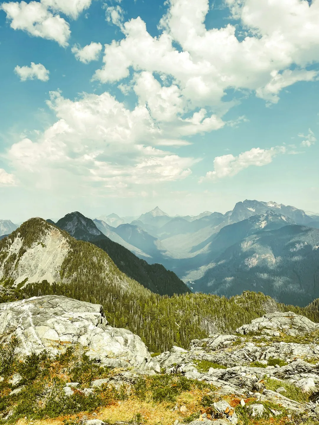
The Rockwall Trail is widely considered the crown jewel of Kootenay National Park and one of the most spectacular multi-day backpacking experiences in the Canadian Rockies. Stretching 55 kilometres along the Vermilion Range, this challenging route is defined by its namesake: a continuous, 900-metre-high limestone escarpment that towers over alpine meadows, turquoise glacial lakes, and ancient larch forests. Unlike many trails that offer a single dramatic viewpoint, the Rockwall provides a sustained, high-alpine experience that keeps hikers immersed in world-class scenery for the duration of the journey. From the thundering heights of Helmet Falls—one of Canada's tallest waterfalls—to the iconic, ice-choked waters of Floe Lake, the trail is a masterclass in geological drama and ecological diversity. This is a journey through a landscape of extremes, where weather can shift from summer heat to alpine snow in minutes, and where the sheer scale of the mountains humbles even the most seasoned adventurers.
- Distance: 55.0 km one-way
- Duration: 3–5 days
- Season: Late July to mid-September (snow often lingers on high passes until mid-July)
- Campgrounds (mandatory booking): Helmet Falls, Tumbling Creek, Numa Creek, Floe Lake
- Highest point: Numa Pass (2,355 m)
- Total Elevation Gain: 2,520 m
- Difficulty: Challenging (multiple high-altitude passes and steep descents)
- Direction: Can be hiked in either direction (Paint Pots to Floe Lake or vice versa)
Overview
The Rockwall Trail is not merely a hike; it is a traverse of a geological titan. Located in Kootenay National Park, British Columbia, the trail follows the western edge of the Continental Divide, tracing the base of a massive limestone wall that extends for nearly 30 kilometres. This wall, part of the Vermilion Range, creates a unique microclimate and a dramatic backdrop that is almost constant throughout the trek. The route is characterised by its "rollercoaster" profile, requiring hikers to ascend and descend three to four major alpine passes—Helmet, Rockwall, Tumbling, and Numa—each offering a distinct perspective on the surrounding peaks and glaciers.
The journey typically begins or ends at either the Paint Pots trailhead or the Floe Lake trailhead, both located along Highway 93 South. For those starting at Paint Pots, the trail begins with a fascinating look at the region's cultural and geological history, passing through ochre-rich mineral springs that have been used by Indigenous peoples for millennia. As the trail gains elevation, the forest of lodgepole pine and Douglas fir gives way to subalpine fir and Engelmann spruce, eventually opening into vast meadows that erupt in a carpet of wildflowers during the brief summer window. Western anemone, Indian paintbrush, and mountain arnica provide splashes of vibrant colour against the grey limestone of the Rockwall.
The physical demand of the Rockwall Trail should not be underestimated. With over 2,500 metres of total elevation gain, the trail tests the endurance of even fit backpackers. The descents into the creek valleys—Numa Creek and Tumbling Creek—are notoriously steep and can be taxing on the knees, while the climbs back up to the passes require steady effort under the weight of a multi-day pack. However, the rewards are unparalleled. Standing atop Numa Pass, the highest point on the trail, hikers are treated to a panoramic view that includes the massive hanging glaciers of Mount Foster and the startlingly blue waters of Floe Lake nestled directly beneath the vertical cliffs of the Rockwall. It is a landscape that feels prehistoric, raw, and profoundly wild.
Wildlife encounters are a significant part of the Rockwall experience. The park is home to grizzly and black bears, mountain goats, marmots, and pikas. The high-alpine meadows provide critical habitat for these species, and hikers must be diligent in their bear safety protocols. The sense of isolation on the Rockwall is palpable; while the trail is popular and requires permits, the vastness of the terrain ensures that you often feel like the only person in a cathedral of stone. Whether you are watching the sunrise hit the golden larches in September or navigating a sudden afternoon thunderstorm in August, the Rockwall Trail demands respect and offers a profound connection to the rugged heart of the Canadian Rockies.
History and Cultural Context
The land through which the Rockwall Trail passes has been of immense significance to Indigenous peoples for thousands of years. The Ktunaxa (Kootenay) and Secwépemc (Shuswap) peoples have long used the mountain passes and valleys of this region for hunting, gathering, and travel. One of the most culturally significant sites near the trail is the Paint Pots, located near the northern trailhead. these vibrant orange and red mineral springs are rich in iron oxide (ochre). For generations, Indigenous people gathered this ochre, mixing it with animal fat or fish oil to create a potent pigment used for rock painting, body decoration, and ceremonial purposes. The site remains a place of deep spiritual importance, and hikers are encouraged to visit with respect and stay on the designated boardwalks.
European exploration of the area began in the mid-19th century. In 1841, James Sinclair led a group of settlers through the region, and later, in 1858, the Palliser Expedition—led by John Palliser and including geologist James Hector—surveyed the area to find potential routes for a transcontinental railway. Hector was the first European to document the "Vermilion Plain" and the dramatic geology of the range. The name "Kootenay" is a derivation of the Ktunaxa word 'Kootenai', though the people refer to themselves as Ktunaxa.
Kootenay National Park was established in 1920 as part of an agreement to build the Banff-Windermere Highway (Highway 93 South). The highway was the first motor road to cross the Canadian Rockies, connecting the Bow Valley to the Columbia Valley. The creation of the park was a strategic move to protect the scenic corridor along the road. The Rockwall Trail itself was developed later, as the demand for backcountry recreation grew. It was designed to showcase the most dramatic geological features of the park, specifically the massive limestone escarpment that gives the trail its name. Today, the trail is part of the Canadian Rocky Mountain Parks UNESCO World Heritage Site, recognised for its exceptional natural beauty and the significant fossil records found in the nearby Burgess Shale formations.
Want more background? Read extended notes on history and cultural context → Learn more
Seasonal Highlights and Weather Reality
The window for hiking the Rockwall Trail is remarkably short, typically spanning from mid-July to mid-September. Because of the trail's high elevation and the northern aspect of several passes, snow can linger well into July, making the passes treacherous or impassable without mountaineering equipment. Conversely, the first significant snowfalls of autumn can arrive as early as the first week of September.
Summer (Late July to August): This is the peak season for the Rockwall. By late July, the alpine meadows are usually clear of snow and transformed into a riot of wildflowers. This is also the best time for stable weather, though "stable" in the Rockies is a relative term. Afternoon thunderstorms are common, often bringing intense rain, hail, and lightning. Hikers should aim to be over the high passes by noon to avoid being exposed on ridges during these storms. Temperatures during the day can reach 25°C, but can drop to near freezing at night, even in August.
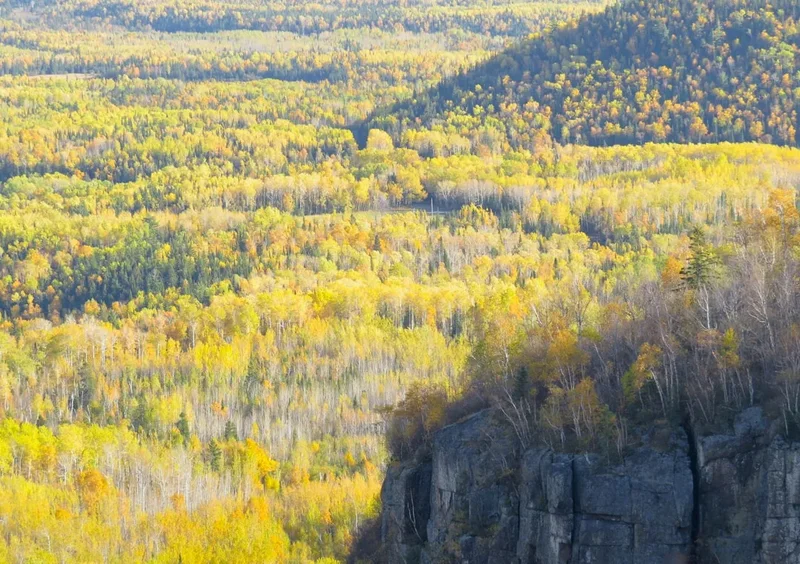
Larch Season (September): For many, the ultimate time to hike the Rockwall is during the last two weeks of September. This is when the subalpine larches—the only deciduous conifers in the region—turn a brilliant, glowing gold before dropping their needles. The contrast of the golden trees against the blue glaciers and grey limestone is breathtaking. However, this season comes with increased risk. Temperatures frequently drop below freezing, and multi-day snowstorms are a real possibility. Hikers must be prepared for full winter conditions during this period.
Weather Reality: Kootenay National Park is subject to rapid and unpredictable weather changes. It is not uncommon to experience four seasons in a single day. The "Rockwall" itself can create its own weather, trapping clouds and moisture against the cliffs. Visibility can drop to zero in minutes if a cloud bank rolls over a pass. High winds are also a constant factor on the passes, particularly Numa and Tumbling. Always check the mountain forecast before heading out and be prepared to turn back or wait out weather if conditions become dangerous.
Recommended Itinerary
5-Day Rockwall Trail Itinerary (North to South)
Day 1: Paint Pots Trailhead to Helmet Falls Campground
- Distance: 15.0 km
- Elevation gain: 310 m
- Time: 4–5 hours
- Start at the Paint Pots trailhead, crossing the Vermilion River via a sturdy bridge.
- Pass the vibrant ochre beds and continue along the Ochre Creek trail.
- The trail is relatively flat for the first 6 km, winding through forest and across several small bridges.
- Gradual climb begins as you follow Helmet Creek upstream.
- Arrive at Helmet Falls Campground, which offers spectacular views of the 352-metre Helmet Falls.
- This is a relatively gentle introduction to the trail, allowing hikers to find their rhythm.
Day 2: Helmet Falls to Tumbling Creek via Rockwall Pass
- Distance: 12.5 km
- Elevation gain: 610 m
- Time: 5–6 hours
- The day begins with a steady climb out of the Helmet Creek valley toward Goodsir Pass or the Rockwall Pass junction.
- Traverse the high alpine meadows of Rockwall Pass (2,240 m), where the limestone wall first reveals its full scale.
- Spectacular views of the Wolverine Plateau and the massive glaciers of Mount Goodsir to the north.
- The trail stays high for several kilometres, offering some of the best "walking the wall" experiences.
- A steep descent leads down into the Tumbling Creek valley.
- Arrive at Tumbling Creek Campground, situated near the base of the Tumbling Glacier.
Day 3: Tumbling Creek to Numa Creek via Tumbling Pass
- Distance: 8.0 km
- Elevation gain: 400 m, Elevation loss: 700 m
- Time: 4–5 hours
- Though short in distance, this day is physically demanding due to the steep gradients.
- Climb steeply from the campground to Tumbling Pass (2,210 m).
- The pass offers an incredible "up-close" look at the Tumbling Glacier and its icefall.
- The descent into Numa Creek is one of the steepest on the trail, dropping 700 metres over a series of tight switchbacks.
- Numa Creek Campground is located in a lush, forested valley bottom.
- Note: This is a common spot for bear activity due to the berry bushes in the valley.
Day 4: Numa Creek to Floe Lake via Numa Pass
- Distance: 10.0 km
- Elevation gain: 800 m
- Time: 5–6 hours
- This is the most challenging climb of the trip but offers the greatest reward.
- The trail climbs steadily through the forest before emerging into the vast alpine basin below Numa Pass.
- Reach Numa Pass (2,355 m), the highest point on the Rockwall Trail.
- The view from the pass looking down toward Floe Lake is the iconic "postcard" shot of the Canadian Rockies.
- A moderate descent leads down to Floe Lake Campground, perched on the edge of the water.
- Spend the evening watching the light change on the 900-metre cliffs reflecting in the lake.
Day 5: Floe Lake to Highway 93 (Floe Lake Trailhead)
- Distance: 10.5 km
- Elevation loss: 1,000 m
- Time: 3–4 hours
- The final day is almost entirely downhill.
- The trail descends through a massive burn area from the 2003 wildfires, which now offers incredible views of the surrounding peaks and vibrant new growth.
- The descent is steady and can be hard on the knees; trekking poles are highly recommended.
- Cross the Vermilion River one last time to reach the Floe Lake parking lot.
- Arrange a shuttle or hitchhike the 13 km back to the Paint Pots trailhead if you only have one vehicle.
Important Notes:
- All campgrounds must be pre-booked through the Parks Canada Reservation Service.
- The trail can be done in 3 or 4 days by fit hikers, but 5 days allows for better enjoyment of the scenery.
- Water is plentiful at campgrounds but should be treated.
- Bear spray is mandatory and must be easily accessible (not inside your pack).
- Check for trail closures or bridge washouts at the Kootenay Park Visitor Centre before starting.
Planning and Bookings
Book Your Trip
Everything you need to plan your journey
Accommodation
Find places to stay near Banff
Flights
Search flights to Banff
Essential Preparation
The Rockwall Trail is a serious undertaking that requires significant physical preparation and logistical planning. Hikers should be comfortable carrying a 15–20 kg pack over steep, rugged terrain for multiple days. Training with a weighted pack on hills or stairs in the months leading up to the trip is highly recommended. Because the trail is a point-to-point route, you must coordinate transport between the Paint Pots and Floe Lake trailheads. These are approximately 13 km apart on Highway 93 South. Options include using two vehicles, arranging a commercial shuttle (if available), or the common practice of "key swapping" with hikers going in the opposite direction.
The nearest major hub is Banff, Alberta, which is approximately a 45-minute drive from the northern trailhead. Banff offers full services, including gear rentals, grocery stores, and medical facilities. Radium Hot Springs, to the south, is another excellent base. Ensure you have a valid Parks Canada Discovery Pass or a daily entry pass for Kootenay National Park displayed on your vehicle at the trailhead.
Trail Accommodation
Accommodation on the Rockwall Trail is strictly limited to designated backcountry campgrounds managed by Parks Canada. There are no huts or lodges on this route. Each campground is equipped with specific facilities to minimise human impact on the environment.
Campground Facilities:
- Designated tent pads (usually dirt or gravel, 2.7m x 2.7m)
- Communal cooking areas with picnic tables
- Food storage lockers or high-wire cable hangs (to protect against bears)
- Grey water disposal pits
- Pit toilets (bring your own toilet paper)
- Access to a nearby water source (creek or lake)
What is NOT Provided:
- Tents, sleeping bags, or mats
- Stoves or fuel
- Food or rubbish removal (Pack it in, pack it out)
- Water treatment (all water must be filtered, boiled, or treated)
- Electricity or mobile phone service
Booking Requirements:
- Reservations are mandatory and open in early spring (usually January or February) for the entire summer season.
- Demand is extremely high; popular dates sell out within minutes of the reservation system opening.
- Cost: Approximately $13.50 per person, per night, plus a reservation fee.
- Maximum group size is 10 people.
Required Gear
- Sturdy Hiking Boots: Waterproof with good ankle support. The terrain is rocky and often muddy.
- Backpack: 50–70L capacity with a high-quality suspension system and rain cover.
- Tent: Lightweight, 3-season backpacking tent capable of withstanding high winds and heavy rain.
- Sleeping System: A sleeping bag rated to at least -5°C and an insulated sleeping pad.
- Bear Spray: Essential and must be carried in a holster on your belt or chest strap. Know how to use it.
- Navigation: Topographic map and compass, or a GPS device with offline maps. Do not rely on mobile phones as the primary source.
- Trekking Poles: Highly recommended for the steep descents and to save your knees.
- First Aid Kit: Including blister treatment (moleskin/Leukotape), antiseptic, and any personal medications.
What to Bring
- Food: Lightweight, high-calorie meals for the duration of the trip, plus one extra day of emergency rations.
- Water Treatment: A reliable filter (hollow fibre or ceramic) or chemical treatment (Aquatabs).
- Clothing Layers: Moisture-wicking base layers (merino wool is best), an insulating mid-layer (fleece or down), and a high-quality waterproof/breathable shell.
- Sun and Bug Protection: Sunscreen, sunglasses, a hat, and insect repellent (mosquitoes and flies can be intense in July).
- Cooking Gear: A lightweight stove (canister or liquid fuel), fuel, a pot, and a spork.
- Personal Items: Biodegradable soap, a small towel, a headlamp with extra batteries, and a lightweight trowel for emergency use (though pit toilets are provided).
Permits
To hike the Rockwall Trail, you require a Backcountry Permit from Parks Canada. This permit is your reservation for the specific campgrounds on specific nights. You cannot "wild camp" anywhere along the trail; you must stay at the site listed on your permit. The permit must be printed and attached to your backpack or tent while on the trail.
Booking Strategy:
- Mark the reservation launch date on your calendar (usually in late January).
- Create your Parks Canada account and familiarise yourself with the booking interface before the launch date.
- Have a "Plan B" and "Plan C" for dates and campground sequences. If Floe Lake is full, try starting from the other end or shifting your dates by a few days.
- The system uses a queue; log in at least 15 minutes before the opening time.
Fees:
- Backcountry Camping Fee: ~$13.50 per person/night.
- Reservation Fee: ~$11.50 per booking (non-refundable).
- National Park Entry Fee: A separate daily fee or a Discovery Pass is required for all visitors to Kootenay National Park.
Cancellations: If you cannot make your trip, please cancel your reservation as soon as possible. This allows other hikers to access the spots. Check the Parks Canada website frequently in the weeks leading up to your desired dates, as cancellations do occur.
Other Activities in the Area
Kootenay National Park and the surrounding region offer a wealth of activities to complement your trek:
- Radium Hot Springs: Located at the southern end of the park, these natural mineral hot springs are the perfect way to soothe sore muscles after finishing the trail.
- Marble Canyon: A short, spectacular walk over a deep limestone gorge carved by Tokumm Creek. Located near the Paint Pots trailhead.
- Stanley Glacier Hike: A popular day hike that offers views of a receding glacier and dramatic hanging valleys.
- Banff Townsite: Explore the historic town, visit the Cave and Basin National Historic Site, or take the gondola up Sulphur Mountain for views of the Bow Valley.
- The Paint Pots: Even if you aren't hiking the full trail, a short walk to these ochre beds is a must for the unique colours and cultural history.
- Scenic Drive: Highway 93 South is one of the most beautiful drives in Canada, with numerous viewpoints and picnic spots along the Vermilion and Kootenay Rivers.
Safety and Conditions
Bear Safety: Kootenay National Park is prime grizzly and black bear habitat. You are travelling through their home. To stay safe: carry bear spray in an accessible location, make noise (call out "Hey bear!") especially near rushing water or in dense brush, and never leave food or scented items unattended. Use the provided food lockers or cable hangs at every campground. If you encounter a bear, remain calm, do not run, and follow Parks Canada's bear encounter protocols.
Alpine Weather: Hypothermia is a real risk, even in summer. Sudden temperature drops, rain, and wind can quickly lead to dangerous conditions. Always carry a waterproof shell and warm layers. If lightning is present, descend from high passes and ridges immediately. Avoid standing near lone trees or large bodies of water.
Terrain Hazards: The trail involves steep, loose scree on some passes and potentially slippery mud in the valleys. Trekking poles provide essential stability. Be cautious of "deadfall" (fallen trees) across the trail, especially in the burn areas, which can be hazardous in high winds. Creek crossings are generally bridged, but early-season runoff can make small streams more difficult to navigate.
Emergency Communication: There is no mobile phone service on the Rockwall Trail. It is highly recommended to carry a satellite communication device (such as a Garmin inReach or Zoleo) for emergencies. Ensure someone at home knows your itinerary and expected return time.
Water Safety: While water is abundant, it must be treated. Glacial silt can clog some filters quickly; let the water settle or use a pre-filter if possible. Be aware of "beaver fever" (Giardia) and other waterborne pathogens.
Side Trips and Points of Interest
Helmet Falls: Don't just view the falls from the campground. A short, 1-km side trail takes you closer to the base of this 352-metre giant. The sheer power of the water and the mist it creates are invigorating. It is one of the highest waterfalls in the Canadian Rockies and is fed by the Washmawapta Icefield.
Goodsir Pass: If you have an extra day or are feeling energetic on Day 2, a detour to Goodsir Pass offers unparalleled views of Mount Goodsir (3,567 m), the highest peak in the Ottertail Range. The pass is known for its wide-open meadows and frequent mountain goat sightings.
The Wolverine Plateau: This high-altitude plateau between Helmet and Rockwall passes is a prime location for spotting grizzly bears from a safe distance. The open terrain allows for great visibility, and the wildflowers here are often the best on the entire trail.
Floe Lake at Sunrise: While not a side trip, waking up early at Floe Lake is essential. As the sun rises, it hits the top of the Rockwall, turning the limestone a brilliant orange and gold, which is then reflected in the still, turquoise water. It is a spiritual experience that defines the trip for many.
Leave No Trace
The Rockwall Trail passes through a fragile subalpine and alpine environment. The growing season here is incredibly short, and damage to vegetation can take decades to heal. Following Leave No Trace principles is essential to preserving this wilderness.
Key Principles for the Rockwall:
- Plan Ahead and Prepare: Ensure you have the correct permits and gear to avoid emergency situations that could impact the environment.
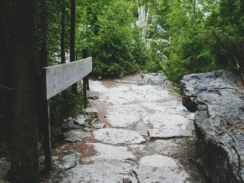
- Travel and Camp on Durable Surfaces: Stay on the designated trail at all times. Do not take shortcuts on switchbacks, as this causes severe erosion. Only camp on the provided tent pads.
- Dispose of Waste Properly: Pack out all rubbish, including food scraps (even biodegradable ones like orange peels). Use the provided pit toilets. For grey water, use the designated pits at campgrounds.
- Leave What You Find: Do not pick wildflowers or remove rocks or fossils. The ochre at the Paint Pots is sacred; do not touch or remove it.
- Minimise Campfire Impacts: Campfires are strictly prohibited on the Rockwall Trail. Use a lightweight stove for all cooking.
- Respect Wildlife: Observe animals from a distance. Never feed wildlife, as this leads to habituation and often results in the animal having to be destroyed.
- Be Considerate of Other Visitors: Keep noise levels down and yield to uphill hikers.