
Rees-Dart Track - Fiordland's Wilderness Gem
The Rees-Dart Track is a spectacular multi-day walk in the heart of New Zealand's Fiordland National Park, offering a less crowded but equally breathtaking alternative to the more famous Milford Track. This 73 km journey traverses diverse landscapes, from the lush, glacier-carved valleys of the Dart and Rees Rivers to the dramatic alpine passes that offer panoramic views of snow-capped peaks and turquoise lakes. It's a challenging yet rewarding trek that immerses you in the raw, untamed beauty of one of the world's most stunning natural regions.
- Distance: 73.0 km one-way
- Duration: 4-5 days
- Season: November to April (best weather, but can be wet)
- Huts: 3 DOC huts (Shelter Rock, Dart Hut, Rees Hut) and multiple campsites
- Highest point: 1,200 m (approximate, at the pass between Rees and Dart Valleys)
- Difficulty: Moderate to challenging, with significant elevation changes and potential for rougher terrain
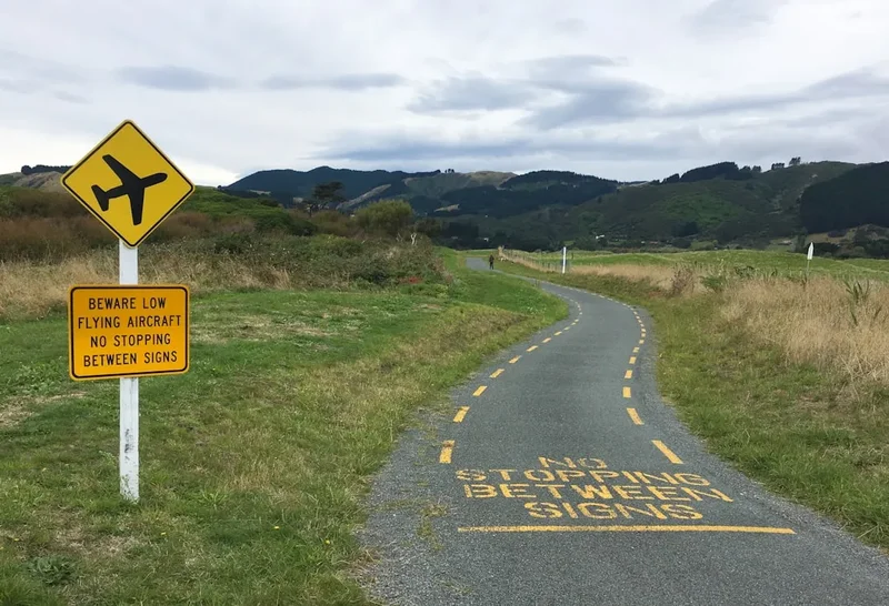
- Access: Trailhead at the end of the gravel road past the Dart River Bridge, near Glenorchy. Nearest airport: Queenstown (ZQN).
Overview
The Rees-Dart Track is a true wilderness experience, a loop or one-way option that showcases the dramatic glacial landscapes of the northern Fiordland region. Unlike the highly regulated Milford Track, the Rees-Dart offers a more independent and adventurous feel, with fewer daily restrictions and a greater sense of solitude. The track is renowned for its stunning alpine scenery, including views of Mount Aspiring/Tititea and the surrounding Southern Alps, as well as its vibrant, glacier-fed rivers and ancient beech forests.
The walk typically begins near Glenorchy, a picturesque settlement at the head of Lake Wakatipu. From here, the track follows the Rees River valley upstream, gradually ascending through beech forest and open tussock country. The highlight of the first half is the climb to the pass separating the Rees and Dart Valleys, offering expansive views. The descent into the Dart Valley leads you through a similarly wild and beautiful landscape, eventually bringing you back towards Glenorchy. The track can be walked as a loop, or as a one-way trip with transport arrangements from either end.
The weather in Fiordland is notoriously unpredictable, and the Rees-Dart is no exception. Expect sunshine, rain, and even snow at higher elevations, sometimes all within the same day. This variability contributes to the dramatic beauty of the region, with waterfalls appearing and disappearing on cliff faces and the rivers swelling with meltwater. The track is well-formed for much of its length but can be rough and exposed in places, particularly at the higher elevations. It's a walk that demands respect for the environment and a good level of fitness.
History and Cultural Context
The valleys of the Rees and Dart Rivers have a long history of human use, predating European settlement by centuries. Māori, particularly Ngāi Tahu, traversed these areas as part of seasonal routes, utilising the abundant natural resources. The valleys provided access to hunting grounds and were part of a network of trails connecting different regions of the South Island. The presence of pounamu (greenstone) in the wider Fiordland area also made these routes significant for trade and cultural exchange.
European exploration and settlement in the late 19th and early 20th centuries saw the valleys become more accessible for farming, trapping, and later, tourism. The Rees and Dart Rivers were named after early European settlers, reflecting the growing presence of European influence in the region. The development of the track as a recreational route has been a gradual process, with the Department of Conservation (DOC) maintaining and improving sections over time to make it accessible to trampers.
The Rees-Dart Track is situated within the Te Wāhipounamu South West New Zealand World Heritage Area, a designation that recognises the outstanding universal value of the region's natural and cultural heritage. This status underscores the importance of preserving these valleys for their ecological significance, their dramatic glacial landscapes, and their deep cultural connections to Ngāi Tahu.
Seasonal Highlights and Weather Reality
The Rees-Dart Track is best experienced during the warmer months, from November to April. This period offers the highest chance of favourable weather, with longer daylight hours and generally milder temperatures.
Summer (December to February): This is the most popular time to walk the track. Days are long, and the alpine meadows can be vibrant with wildflowers. However, this is also the wettest period, and sandflies can be a significant nuisance, especially in the lower valley sections. Snow can still linger on the higher passes in early summer.
Autumn (March to April): The autumn months offer a beautiful spectacle of changing colours in the beech forests, with golden and russet hues. The weather can be more settled than in summer, with fewer sandflies. However, daylight hours are shorter, and the risk of early snow on the passes increases as winter approaches.
Spring (November to December): Spring brings melting snow and swollen rivers, creating dramatic waterfalls and a sense of awakening in the landscape. The track can be muddy in places, and snow may still be present on the higher sections. Wildlife is often more active during this season.
Winter (May to October): The Rees-Dart Track is generally not recommended for casual trampers during winter. The higher passes can be snow-covered and avalanche-prone, requiring advanced mountaineering skills, specialised equipment (ice axe, crampons), and extensive winter navigation experience. Huts may have limited facilities, and the track can be impassable due to snow and ice.
Weather: Fiordland's weather is notoriously changeable. Visitors should be prepared for all conditions, including heavy rain, strong winds, and cold temperatures, even during the summer months. The alpine pass can experience significant temperature drops and whiteout conditions rapidly.
Recommended Itinerary
4-Day Rees-Dart Track Itinerary (Loop)
Day 1: Dart River Bridge to Shelter Rock Hut
- Distance: 13.0 km
- Elevation gain: 300 m
- Time: 3–4 hours
- Start at the Dart River Bridge trailhead
- Follow the Dart River valley upstream
- Walk through beech forest and open river flats
- Cross several swing bridges
- Arrive at Shelter Rock Hut (12 bunks)
- This is a relatively easy start, allowing for acclimatisation
Day 2: Shelter Rock Hut to Dart Hut
- Distance: 15.0 km
- Elevation gain: 600 m
- Time: 5–7 hours
- Continue up the Dart Valley
- The track becomes steeper and more challenging
- Pass through alpine tussock and scree slopes
- Arrive at Dart Hut (12 bunks)
- This day involves significant elevation gain and offers increasingly spectacular views
Day 3: Dart Hut to Rees Hut via the Pass
- Distance: 20.0 km
- Elevation gain: 600 m to pass, 700 m descent
- Time: 7–9 hours
- The most challenging day, crossing the pass between the Rees and Dart Valleys
- Climb to the saddle at approximately 1,200 m
- Enjoy panoramic views of the surrounding mountains, including Mount Aspiring/Tititea (weather permitting)
- Descend steeply into the Rees Valley
- Arrive at Rees Hut (12 bunks)
- This day requires good fitness and careful navigation, especially in poor weather
Day 4: Rees Hut to Rees River Trailhead
- Distance: 25.0 km
- Elevation gain: Minimal, mostly downhill
- Time: 6–8 hours
- Follow the Rees River valley downstream
- The track is generally well-formed and easier underfoot
- Pass through beech forest and open country
- Arrive back at the Rees River trailhead near Glenorchy
- This is the longest day but is mostly downhill, making it physically less demanding
Alternative 5-Day Itinerary:
For a more relaxed pace, consider adding an extra day. This could involve:
- Spending an extra night at Dart Hut to explore the upper Dart Valley.
- Breaking the long final day into two shorter days, with a night at a campsite or a more basic shelter if available.
Important Notes:
- Huts must be booked in advance through the Department of Conservation (DOC).
- Campsites are available near huts for those who prefer to camp.
- The track can be walked in either direction, but the itinerary above follows the common loop from the Dart River Bridge.
- Weather can significantly impact travel times and conditions. Always check the forecast before you go.
- Water is generally plentiful from streams, but treatment is recommended.
Planning and Bookings
Book Your Trip
Everything you need to plan your journey
Accommodation
Find places to stay near Queenstown
Flights
Search flights to Queenstown
Essential Preparation
The Rees-Dart Track requires careful planning, especially regarding accommodation and transport. As it's a multi-day hike, booking huts or campsites well in advance is crucial, particularly during the peak season (November to April). The nearest major town and logistical hub is Queenstown, which offers a wide range of accommodation, gear rental services, and transport options. From Queenstown, you can drive or take a shuttle to Glenorchy, the gateway to the Rees-Dart Track. Allow ample time for travel to Glenorchy and for any last-minute gear checks or purchases.
Fitness: This track is rated as moderate to challenging. Participants should have a good level of fitness, with experience in multi-day hiking and carrying a pack. The terrain involves significant elevation changes, potentially rough sections, and long walking days. Training that includes hill walking with a weighted pack is highly recommended.
Logistics: If walking the track as a loop, you will start and finish at the same trailhead near the Dart River Bridge. If walking it as a one-way trip, you will need to arrange transport between the Rees River and Dart River trailheads, which are approximately 25 km apart by road. Shuttle services can be booked from Queenstown or Glenorchy.
Trail Accommodation
The Rees-Dart Track has three Department of Conservation (DOC) huts and several designated campsites along its route. Booking is essential during the Great Walks season (typically October to April).
Huts:
- Shelter Rock Hut: Located at the start of the track, near the Dart River. Typically sleeps 12 people.
- Dart Hut: Situated further up the Dart Valley, offering access to higher alpine terrain. Typically sleeps 12 people.
- Rees Hut: Located in the Rees Valley, after crossing the pass. Typically sleeps 12 people.
Hut Facilities:
- Bunk beds with mattresses (bring your own sleeping bag and liner).
- Wood-burning stove for heating (bring your own firewood if possible, or check DOC guidelines).
- Basic cooking facilities (bench space, but no pots, pans, or utensils provided).
- Water from nearby streams (treatment recommended).
- Composting toilets.
- No electricity, charging facilities, or running hot water.
Campsites:
- Designated campsites are located near each hut.
- Campers must also book their spot in advance.
- Basic facilities such as a toilet and water source are usually available.
Booking Requirements:
- Bookings are made through the DOC website.
- During the peak season, huts and campsites can book out months in advance.
- Costs vary but are generally lower than the Great Walks huts, typically around NZ$20-30 per person per night for huts and NZ$10-15 for campsites.
Seasonal Availability: Huts and campsites are generally available year-round, but facilities may be reduced outside the peak season, and winter conditions require advanced skills.
Required Gear
- Waterproof and windproof jacket and overtrousers: Essential for Fiordland's unpredictable weather.
- Sturdy, broken-in hiking boots: With good ankle support and waterproof capabilities.
- Warm layers: Including thermal base layers (merino wool is ideal), fleece or down mid-layers, and a warm hat and gloves.
- Sleeping bag: Rated for cold temperatures (0°C or lower comfort rating recommended).
- Tramping pack: 45-65 litre capacity, with a comfortable hip belt and a rain cover.
- Head torch: With spare batteries, as huts have no electricity.
- First-aid kit: Including blister treatment, pain relief, and any personal medications.
- Navigation tools: Map of the area, compass, and GPS device or smartphone with offline maps. Mobile signal is unreliable.
- Sun protection: Sunglasses, sunscreen, and a wide-brimmed hat.
- Insect repellent: Especially for sandflies, which can be prevalent in the lower valleys.
What to Bring
- Food: Sufficient for the duration of your trip, including breakfast, lunch, dinner, and snacks. Lightweight, high-energy food is recommended. No food is available for purchase on the track.
- Cooking equipment: Lightweight portable stove, fuel, pot, utensils, plate, bowl, and cup.
- Water treatment: Water filter or purification tablets. While water is plentiful, it should be treated.
- Toiletries: Biodegradable soap, toothbrush, toothpaste, toilet paper, hand sanitiser.
- Trekking poles: Highly recommended for stability on steep ascents and descents, and for stream crossings.
- Dry bags: To keep essential gear dry inside your pack.
- Personal locator beacon (PLB): Recommended for remote areas where mobile reception is non-existent.
- Camera: To capture the stunning scenery.
- Book or journal: For downtime in the huts.
Permits
Advance booking for huts and campsites on the Rees-Dart Track is mandatory during the peak season, which typically runs from late October to April. Bookings are managed by the Department of Conservation (DOC) and can be made online through their website.
Booking Process:
- Online Booking: Visit the DOC website and navigate to the Rees-Dart Track page. Select your desired dates and accommodation type (hut or campsite).
- Availability: Check the availability calendar carefully. Popular dates, especially during school holidays and weekends, can book out quickly.
- Payment: Full payment is required at the time of booking to secure your spot.
- Confirmation: You will receive a booking confirmation via email, which you should print or save to your device. This confirmation serves as your permit.
Costs:
- Huts: Typically NZ$20-30 per person per night for adults.
- Campsites: Typically NZ$10-15 per person per night for adults.
- Prices may vary slightly depending on the season and specific hut/campsite.
- Children (under 18) often have reduced rates.
Off-Season: Outside of the peak booking season, huts may operate on a first-come, first-served basis, but it is always advisable to check DOC guidelines. However, winter conditions make the track significantly more challenging and potentially dangerous, requiring specialised skills and equipment.
Group Bookings: For larger groups, it's advisable to book as far in advance as possible, as availability can be limited.
Changes and Cancellations: Familiarise yourself with DOC's booking terms and conditions regarding changes and cancellations, as policies may apply.
Other Activities in the Area
The region around Glenorchy and the Rees-Dart Track offers a wealth of activities for those looking to extend their stay or explore beyond the trail:
- Jet Boating on the Dart River: Experience the thrill of high-speed jet boating through the braided river channels, surrounded by stunning mountain scenery.
- Horse Riding: Explore the valleys and foothills on horseback, with various operators offering guided rides for different skill levels.
- Kayaking and Canoeing: Paddle on Lake Wakatipu or the calmer sections of the Dart River for a different perspective of the landscape.
- Hiking in the Glenorchy area: Numerous day hikes are available, including the popular Routeburn Track day walk (access from near Glenorchy) and the Bob's Cove Track.
- Scenic Flights: Take a helicopter or fixed-wing aircraft tour for breathtaking aerial views of Fiordland National Park, including glaciers, mountains, and remote valleys.
- Photography: The area is a photographer's paradise, with dramatic landscapes, vibrant colours, and opportunities for wildlife spotting.
- Exploring Glenorchy: Visit the historic wharf, the iconic red shed, and enjoy the relaxed atmosphere of this charming lakeside settlement.
- Lord of the Rings Tours: Glenorchy was a filming location for the "Middle-earth" films, and several tours explore these iconic sites.
Safety and Conditions
Weather: Fiordland's weather is highly unpredictable. Be prepared for rain, wind, and cold temperatures at any time of year, especially at higher elevations. Always check the MetService mountain forecast before and during your trip. Rapid changes can occur, and conditions on the pass can deteriorate quickly.
Track Conditions: The Rees-Dart Track can be rough and exposed in sections. River crossings can be hazardous, especially after heavy rain. Always assess the safety of any river crossing before attempting it. If a river is too high or fast-flowing, wait for conditions to improve or turn back.
Navigation: While the track is generally well-marked, it is essential to carry a map and compass and know how to use them. Mobile phone coverage is unreliable in the valleys. Consider carrying a personal locator beacon (PLB) for emergencies.
Sandflies: Sandflies are prevalent in the lower valley sections, particularly during warmer months. Use a strong insect repellent (containing DEET) and cover exposed skin.
Wildlife: Be aware of the local wildlife. While encounters are rare, respect their space and do not feed any animals.
Emergency Contacts: In case of an emergency, contact the Department of Conservation (DOC) or emergency services. Have their contact details readily available.
Fitness and Experience: Ensure you have the necessary fitness and experience for a multi-day hike of this nature. Inform someone of your hiking plans, including your intended route and expected return time.
Side Trips and Points of Interest
The Pass: The saddle between the Rees and Dart Valleys (approximately 1,200 m) is the highlight of the track. On a clear day, the panoramic views are simply breathtaking, offering vistas of snow-capped peaks, glaciers, and the vast wilderness of Fiordland National Park. This is an excellent spot for photography and reflection.
Upper Dart Valley: For those with extra time or energy, exploring further up the Dart Valley beyond Dart Hut can lead to stunning alpine scenery, including views of glaciers and potential for more challenging off-track excursions (for experienced hikers only).
Upper Rees Valley: Similarly, the upper reaches of the Rees Valley offer opportunities for exploration, with rugged terrain and dramatic mountain landscapes. Again, this is for experienced and well-equipped hikers.
River Crossings: While a challenge, the numerous river crossings are an integral part of the Rees-Dart experience. They offer a direct connection with the powerful forces of nature that have shaped this landscape.
Alpine Meadows and Tussock Lands: As you gain elevation, the landscape transitions from dense beech forest to open alpine meadows and tussock-covered slopes. These areas are often dotted with wildflowers in the summer and offer a different kind of beauty.
Glacial Features: The entire track is a testament to the power of glaciation. Look for U-shaped valleys, moraines, and the distinctive turquoise colour of the glacier-fed rivers.
Leave No Trace
The Rees-Dart Track traverses a pristine wilderness area, and it is crucial for all visitors to practice Leave No Trace principles to minimise their impact and preserve the environment for future generations.
- Plan Ahead and Prepare: Research the track, check weather forecasts, and be prepared for all conditions. Book huts and campsites in advance.
- Travel and Camp on Durable Surfaces: Stick to the marked track and use designated campsites. Avoid walking on fragile vegetation.
- Dispose of Waste Properly: Pack out everything you pack in, including all food scraps, wrappers, and toilet paper. Use designated toilet facilities.
- Leave What You Find: Do not remove any natural or cultural items from the area.
- Minimise Campfire Impacts: Use portable stoves for cooking. If fires are permitted and necessary, use existing fire rings and keep fires small. Ensure fires are completely extinguished.
- Respect Wildlife: Observe wildlife from a distance and never feed them.
- Be Considerate of Other Visitors: Keep noise levels down and respect the solitude of others.
By adhering to these principles, you help ensure that the Rees-Dart Track remains a wild and beautiful place for everyone to enjoy.