Rangitoto Summit Walk
The Rangitoto Summit Walk is an iconic day hike located in New Zealand's Hauraki Gulf, just a short ferry ride from Auckland's city centre. This relatively short but rewarding walk takes you to the summit of Rangitoto Island, Auckland's youngest and largest volcano, offering panoramic views of the Hauraki Gulf, the Hauraki Gulf Islands, and the Auckland skyline. The island itself is a unique volcanic landscape, largely covered in native regenerating forest, including the world's largest pohutukawa forest. The walk is accessible to most fitness levels and provides a fantastic escape into nature without requiring an overnight stay.
- Distance: 5.2 km return
- Duration: 2–3 hours return
- Elevation gain: 260 m
- Difficulty: Moderate
- Season: Year-round, but best in dry weather
- Closest City: Auckland
- Trailhead Access: Ferry from downtown Auckland Ferry Terminal to Rangitoto Wharf.
- Permits: No permits required for the summit walk.
Overview
Rangitoto Island, a striking volcanic cone rising 260 metres above the Hauraki Gulf, is a beloved natural landmark and a popular destination for Aucklanders and visitors alike. The Rangitoto Summit Walk is the primary route to the island's peak, offering a journey through a fascinating volcanic landscape and regenerating native forest. The walk begins at the Rangitoto Wharf, where ferries from Auckland disembark. From here, a well-maintained gravel track leads you inland, gradually ascending towards the summit.
The initial part of the walk winds through a unique lava field, where the ground is covered in jagged, dark volcanic rock. This area is slowly being colonised by native vegetation, most notably the pohutukawa trees, which bloom with vibrant red flowers in summer. As you ascend, the track becomes steeper, with some sections featuring wooden steps and boardwalks to navigate the uneven terrain. The air is often filled with the scent of salt from the sea and the earthy aroma of the forest.
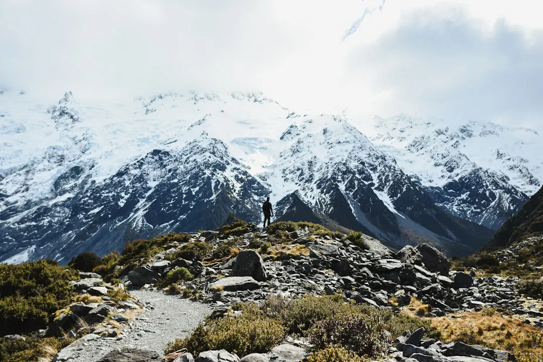
The final approach to the summit involves a short, steep climb through a lava tube cave, which is a highlight for many. This natural tunnel offers a cool respite from the sun and a glimpse into the island's volcanic origins. Emerging from the cave, you'll find yourself on the rim of the volcanic crater. A short walk around the crater rim leads to the summit trig point, where the reward is a breathtaking 360-degree view. On a clear day, you can see the Auckland CBD, the Waitematā Harbour, the islands of Tiritiri Matangi, Motutapu, Waiheke, and the Coromandel Peninsula in the distance.
The descent follows the same path back to the wharf. The moderate difficulty rating reflects the steady climb and the uneven terrain, particularly the rocky sections and the final ascent through the lava tube. It's a walk that combines natural beauty, geological interest, and stunning vistas, making it a must-do for anyone visiting Auckland.
History and Cultural Context
Rangitoto Island's dramatic formation began approximately 600 years ago with a series of volcanic eruptions that lasted for about 20 to 30 years. This relatively recent volcanic activity makes Rangitoto Auckland's youngest volcano and a significant geological site. The island's cone shape and lava fields are testament to its fiery birth, a process that dramatically reshaped the landscape of the Hauraki Gulf.
Before European settlement, Rangitoto was known to Māori as Te Motu-a-Ihenga (the island of Ihenga), named after a Polynesian explorer. Archaeological evidence suggests that Māori visited and possibly temporarily inhabited the island, utilising its resources. However, due to its volcanic nature and lack of fresh water, it was not a permanent settlement. The island's volcanic activity would have been a significant event in the oral histories and traditions of local iwi (tribes).
In the early 20th century, Rangitoto was designated as a scenic reserve. Efforts began to restore its native vegetation, which had been significantly impacted by early logging and the introduction of pests. The island is now a testament to successful ecological restoration, with extensive areas of regenerating native forest, including the largest and most significant pohutukawa forest in the world. The absence of introduced predators like stoats, rats, and possums has allowed native birdlife to flourish, making it a vital sanctuary.
The island's volcanic features, including the summit crater and lava tubes, are of significant scientific and educational interest. The Rangitoto Summit Walk provides access to these features, allowing visitors to experience the raw power of nature and the resilience of ecological recovery. The island's proximity to Auckland also makes it a popular recreational spot, offering a unique blend of natural history, cultural significance, and outdoor adventure.
Seasonal Highlights and Weather Reality
Rangitoto Island is accessible and enjoyable year-round, but each season offers a slightly different experience. The weather in Auckland can be variable, so checking the forecast before you go is always recommended.
Spring (September–November): This is a beautiful time to visit as the island's native flora begins to bloom. The pohutukawa trees start to show their first red flowers, and other native plants come alive. The weather is generally mild, with fewer crowds than in summer. Temperatures typically range from 10°C to 20°C.
Summer (December–February): Summer is the most popular time to visit Rangitoto, especially for the summit walk. The pohutukawa trees are in full bloom, creating a spectacular display of red against the green foliage and blue sea. The weather is warmer, with temperatures often reaching 20°C to 25°C, sometimes higher. However, summer can also bring humidity and sandflies, so insect repellent is advisable. The longer daylight hours allow for more leisurely exploration.
Autumn (March–May): The autumn months offer pleasant temperatures, typically between 10°C and 20°C, and fewer sandflies. The island's colours can be subtle but beautiful, and the light is often soft and golden, ideal for photography. The sea can be calmer, making the ferry journey more comfortable.
Winter (June–August): While cooler, with temperatures ranging from 8°C to 15°C, winter can still be a rewarding time to visit Rangitoto. The island is often quieter, offering a more serene experience. The regenerating forest provides shelter, and the dramatic skies can offer stunning views. However, winter can bring more rain and stronger winds, so waterproof clothing is essential. The ferry service operates year-round, but services may be reduced on days with severe weather.
Weather Considerations: Regardless of the season, Rangitoto is exposed to the elements. The summit offers no shelter, and winds can be strong. Always be prepared for sudden changes in weather, including rain and wind, even on a seemingly clear day. Sun protection is crucial year-round due to the strong New Zealand sun, especially at the exposed summit.
Recommended Itinerary

Rangitoto Summit Walk - Day Hike Itinerary
Early Morning (Approx. 9:00 AM): Ferry Departure from Auckland
- Travel to the downtown Auckland Ferry Terminal (Queen's Wharf).
- Purchase ferry tickets (or have pre-booked online).
- Board the ferry to Rangitoto Island.
- Enjoy the scenic 25–30 minute ferry ride across the Hauraki Gulf.
- Observe the approaching volcanic cone of Rangitoto.
Morning (Approx. 9:30 AM - 10:00 AM): Arrival at Rangitoto Wharf & Start of Walk
- Disembark at Rangitoto Wharf.
- Locate the start of the main summit track, clearly signposted.
- Begin the walk towards the summit.
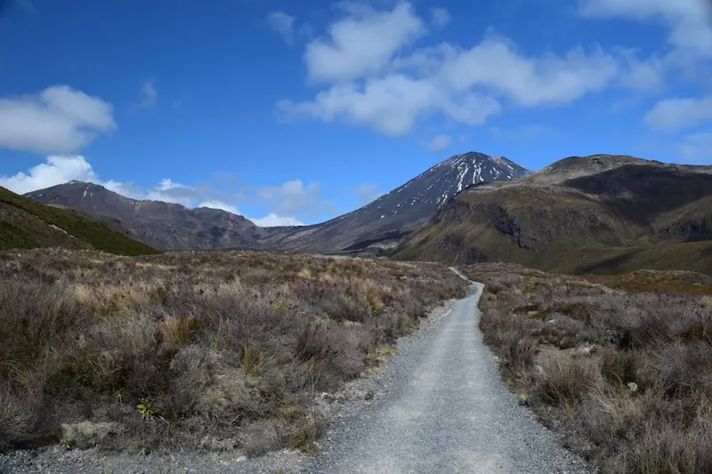
- Initial section: Walk along a gravel track through regenerating lava fields and coastal vegetation.
- Observe the unique volcanic landscape and early stages of forest regrowth.
Mid-Morning (Approx. 10:30 AM - 11:30 AM): Ascent Through Lava Fields and Forest
- The track gradually ascends.
- Pass through areas dominated by pohutukawa trees, especially vibrant in summer.
- Navigate sections of uneven terrain and rocky outcrops.
- The path may involve some steeper sections with wooden steps or boardwalks.
- Enjoy the increasing views of the Hauraki Gulf as you gain elevation.
Late Morning (Approx. 11:30 AM - 12:00 PM): Lava Tube Cave Section
- Reach the entrance to the lava tube cave.
- This is a short, natural tunnel formed by cooling lava.
- The cave is well-lit by natural light filtering through openings.
- Walk through the cave (bring a torch if you wish for a closer look, though not essential).
- The cave provides a unique geological experience and a cool break.
Midday (Approx. 12:00 PM - 12:30 PM): Summit Approach and Crater Rim
- Emerge from the lava tube cave.
- The final ascent to the summit is short but steep.
- Walk along the crater rim.
- Reach the summit trig point (260 m).
- Spend time enjoying the 360-degree panoramic views.
- Identify landmarks: Auckland skyline, other Hauraki Gulf islands, surrounding sea.
- Have a snack or packed lunch at the summit.
Afternoon (Approx. 12:30 PM - 1:30 PM): Descent Back to Rangitoto Wharf
- Begin the descent, retracing your steps.
- Take care on the rocky and uneven sections.
- Enjoy the changing perspectives of the landscape on the way down.
- Allow ample time to reach the wharf for your return ferry.
Late Afternoon (Approx. 2:00 PM - 3:00 PM): Return Ferry to Auckland
- Arrive back at Rangitoto Wharf.
- Wait for your scheduled return ferry.
- Board the ferry for the journey back to Auckland.
- Reflect on your volcanic adventure.
Important Notes:
- Ferry schedules vary; check the operator's website for current times and book in advance, especially during peak season.
- Wear sturdy walking shoes or hiking boots.
- Carry sufficient water, especially during warmer months.
- Bring sun protection (hat, sunscreen, sunglasses) and insect repellent.
- There are no facilities (shops, toilets) on the island, so come prepared.
- Allow at least 2–3 hours for the walk itself, plus ferry travel time.
Planning and Bookings
Book Your Trip
Everything you need to plan your journey
Accommodation
Find places to stay near Auckland
Flights
Search flights to Auckland
Essential Preparation
The Rangitoto Summit Walk is a day trip, making planning relatively straightforward. The primary logistical consideration is booking your ferry tickets to and from Rangitoto Island. Ferries depart from the downtown Auckland Ferry Terminal (Queen's Wharf) and operate on a schedule. It is highly recommended to book your ferry tickets in advance, particularly during weekends, public holidays, and the summer months, as services can fill up. Ensure you check the ferry operator's website for the most up-to-date timetable and booking information.
Auckland city offers a wide range of accommodation options, from budget hostels to luxury hotels, catering to all needs. If you are staying in Auckland, plan your transport to the ferry terminal, which is easily accessible by public transport or taxi/rideshare. For those driving, there are several paid parking buildings and street parking options available near the ferry terminal, though these can be expensive.
Before heading to the island, ensure you have all necessary supplies, as there are no shops or facilities on Rangitoto. This includes food, water, sun protection, and appropriate clothing. The island's volcanic terrain can be rough, so comfortable, sturdy footwear is essential.
Trail Accommodation
This is a day hike requiring no overnight accommodation.
Required Gear
- Sturdy walking shoes or hiking boots: Essential for navigating the uneven volcanic terrain, lava fields, and rocky paths. Ensure they are well broken-in to prevent blisters.
- Waterproof jacket: The weather in Auckland can change quickly, and rain is common. A lightweight, waterproof jacket is advisable year-round.
- Sun protection: A wide-brimmed hat, sunglasses, and high SPF sunscreen are crucial, especially during the summer months. The summit is exposed with no shade.
- Backpack: A small daypack (15–25 litres) is sufficient to carry water, snacks, and extra layers.
- Head torch (optional): While not strictly required for the main summit track, a small head torch can be useful for exploring the lava tube cave more thoroughly, though natural light is usually sufficient.
- First aid kit: A basic kit with plasters, antiseptic wipes, pain relief, and any personal medications.
What to Bring
- Water: Carry at least 1–2 litres of water per person, especially during warmer months. There are no water sources or taps on the island.
- Food: Pack plenty of snacks and a packed lunch. Options include sandwiches, fruit, energy bars, nuts, and trail mix.
- Insect repellent: Sandflies can be present, particularly during warmer, humid weather.
- Camera: To capture the stunning views from the summit and the unique volcanic landscape.
- Mobile phone: For communication and taking photos. Ensure it is fully charged.
- Cash: While most ferry operators accept cards, it's wise to have some cash for small purchases or in case of card machine issues.
- Hand sanitiser: Useful for hygiene before eating, especially as there are no facilities.
Permits
No permits are required to walk to the summit of Rangitoto Island. The island is a Department of Conservation (DOC) reserve, and access to the walking tracks is free. The only cost associated with visiting Rangitoto is the return ferry ticket from Auckland.
Ferry Information:
- Operator: Fullers360 is the primary ferry operator to Rangitoto Island.
- Departure Point: Downtown Auckland Ferry Terminal (Queen's Wharf).
- Journey Time: Approximately 25–30 minutes one way.
- Frequency: Ferries operate on a regular schedule, but times vary by season and day of the week. It is essential to check the latest timetable and book your tickets in advance, especially for peak times.
- Booking: Tickets can be purchased online through the Fullers360 website or at their terminal office. Booking in advance is highly recommended to secure your preferred departure and return times.
- Return Journey: Ensure you note the time of the last ferry returning to Auckland to avoid being stranded on the island.
Island Facilities:
- There are no shops, cafes, or water fountains on Rangitoto Island. Visitors must bring all their food, water, and supplies with them.
- Basic composting toilets are available near the Rangitoto Wharf.
Conservation Efforts: While no permits are needed, visitors are expected to adhere to conservation guidelines to protect the island's unique environment. This includes staying on marked tracks, not removing any plants or rocks, and taking all rubbish with you.
Other Activities in the Area
While the Rangitoto Summit Walk is the main attraction, there are other ways to enjoy Rangitoto Island and the surrounding Hauraki Gulf:
- Explore the Lava Tubes: Beyond the main summit track, several other lava tubes can be explored, offering a more adventurous experience. These may require more navigation and are less maintained.
- Motutapu Island Walk: Rangitoto is connected to Motutapu Island by a causeway (accessible at low tide). Motutapu offers different landscapes, including rolling farmland and sandy beaches, and has its own network of walking tracks. You can combine a visit to both islands for a longer day out.
- Kayaking: For the adventurous, kayaking to Rangitoto from the mainland or from other nearby islands is an option, though this requires significant experience, appropriate gear, and awareness of sea conditions and ferry traffic.
- Birdwatching: Rangitoto is a haven for native New Zealand birds, thanks to its predator-free status. Keep an eye out for tūī, fantails, kererū, and other species.
- Picnicking: The island offers several scenic spots for a picnic, particularly near the wharf or along the coastal tracks.
- Photography: The unique volcanic landscape, regenerating forest, and panoramic views make Rangitoto a photographer's paradise.
- Sailing and Boat Trips: The Hauraki Gulf is a popular area for sailing. Many boat tours depart from Auckland and may include Rangitoto as a scenic point or a stopover.
Safety and Conditions
Track Conditions: The Rangitoto Summit Walk is generally well-maintained, with a clear gravel path for most of the route. However, sections can be rocky and uneven, especially as you approach the summit and navigate the lava fields. The final ascent through the lava tube is a natural formation and requires careful footing.
Weather: Auckland's weather can be unpredictable. Be prepared for sun, wind, and rain, even on the same day. The summit is exposed and can be significantly windier and cooler than at sea level. Always check the weather forecast before you depart and carry appropriate clothing layers.
Sun Protection: The New Zealand sun is strong. Even on cloudy days, UV radiation can be intense. Wear sunscreen (SPF 30+ or higher), a wide-brimmed hat, and sunglasses. The summit offers no shade.
Hydration: Carry plenty of water. There are no water sources or facilities on Rangitoto Island. Dehydration can occur quickly, especially during warmer months or if you exert yourself on the climb.
Footwear: Sturdy, closed-toe walking shoes or hiking boots are essential. The volcanic rock can be sharp, and the terrain is uneven, increasing the risk of ankle sprains if you wear inappropriate footwear.
Sandflies: Sandflies are present on Rangitoto, particularly during warmer, humid conditions. They are most active at dawn and dusk and in sheltered, damp areas. Carry effective insect repellent containing DEET or picaridin.
Navigation: The summit track is well-signposted. However, it's always wise to have a map or use a navigation app on your phone, especially if you plan to explore any of the less-defined side tracks. Ensure your phone is fully charged.
Emergency: In case of an emergency, dial 111 for Police, Fire, or Ambulance. Be prepared to give your exact location on the island. Mobile phone reception can be patchy in some areas, but is generally available on the summit.
Ferry Schedule: Be mindful of the last ferry departure time. Missing the last ferry will mean an unplanned overnight stay on the island, which is not permitted and has no facilities.
Side Trips and Points of Interest
Rangitoto Summit Crater: The ultimate destination of the walk, the summit crater is a fascinating geological feature. While the crater itself is not deep, walking around its rim offers spectacular 360-degree views. You can see the distinct layers of volcanic rock and understand the forces that shaped the island.
Lava Tube Cave: A highlight of the walk, this natural tunnel formed by flowing lava is an unforgettable experience. The cave is relatively short and well-lit by natural light filtering through openings, but a torch can enhance the exploration of its textures and formations. It offers a cool respite and a unique insight into the island's volcanic past.
Pohutukawa Forest: Rangitoto is home to the world's largest and most significant pohutukawa forest. These iconic New Zealand trees, known for their vibrant red flowers in summer, are a dominant feature of the island's regenerating landscape. The walk passes through areas where these trees are thriving, showcasing the island's ecological recovery.
Volcanic Rock Formations: The entire island is a testament to volcanic activity. As you walk, you'll encounter various lava flows, scoria cones, and jagged rock formations. These provide a unique and rugged landscape that is distinct from mainland New Zealand.
Coastal Views: The track offers intermittent views of the Hauraki Gulf and the surrounding islands. As you ascend, these views become more expansive, culminating in the breathtaking panorama from the summit. Look out for views of Motutapu, Waiheke, Tiritiri Matangi, and the distant Coromandel Peninsula.
Regenerating Native Bush: Rangitoto is a success story of ecological restoration. The walk allows you to observe the slow but steady return of native flora and fauna to the volcanic landscape. You'll see a variety of native plants and hear the calls of native birds.
Leave No Trace
Rangitoto Island is a precious natural and geological reserve, and it's vital that all visitors practice Leave No Trace principles to help preserve its unique environment for future generations. As a relatively young volcanic island with a significant ecological restoration story, its fragility must be respected.
Pack It In, Pack It Out: This is the golden rule. Everything you bring onto the island must be taken back off with you. This includes all food scraps, wrappers, packaging, and any other rubbish. There are no bins on Rangitoto. Carry a small bag for your waste and dispose of it responsibly once you return to Auckland.
Stay on Marked Tracks: The walking tracks on Rangitoto are designed to guide visitors safely and to minimise impact on the fragile vegetation and volcanic terrain. Straying from the tracks can damage delicate plant life, disturb wildlife, and lead to erosion. The volcanic rock can be sharp and unstable off-track.
Respect Wildlife: Rangitoto is a sanctuary for native birds. Do not feed the birds, as this can disrupt their natural diet and behaviour. Observe them from a distance and avoid disturbing their nesting sites. The island is largely predator-free, which is crucial for the survival of native species.
Leave What You Find: Do not take any natural souvenirs from the island, such as rocks, shells, or plants. These are part of the island's natural heritage and should be left in place.
Minimise Campfire Impacts: Campfires are not permitted on Rangitoto Island. If you are planning a picnic, use a portable stove if necessary, and ensure all cooking is done safely and responsibly.
Be Considerate of Others: Keep noise levels down, especially in the lava tube and near other walkers. Enjoy the natural sounds of the island. Respect the experience of other visitors seeking peace and quiet.
Dispose of Waste Properly: Use the composting toilets provided near the wharf. Do not leave any waste behind. If you need to use hand sanitiser, ensure it is biodegradable if possible.
By adhering to these principles, you contribute to the ongoing conservation of Rangitoto Island's unique volcanic landscape and its thriving native ecosystem.