Quebrada del Condorito Trail
The Quebrada del Condorito Trail is a spectacular day hike located within the Quebrada del Condorito National Reserve in Argentina's Córdoba Province. This trail offers a challenging yet rewarding experience, leading hikers through diverse landscapes of high-altitude grasslands, rocky outcrops, and dramatic canyons. The primary draw is the opportunity to witness Andean Condors in their natural habitat, soaring on thermals above the rugged terrain. The trail is known for its significant elevation gain and exposure to the elements, making it a test of endurance and preparedness. It is a journey into a wild, windswept environment where the raw beauty of the Sierras Grandes is on full display.
- Distance: 17.0 km one-way
- Duration: 6-8 hours
- Season: Spring to Autumn (October to April)
- Difficulty: Moderate to Difficult
- Highest point: Approximately 2,500 m
- Trailhead Access: From Villa Carlos Paz, Ruta Provincial 34
- Closest City: Villa Carlos Paz
Overview
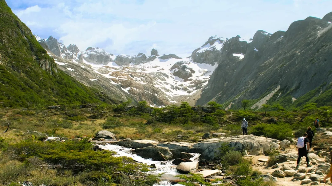
The Quebrada del Condorito Trail is a significant undertaking for day hikers, demanding a good level of fitness and careful planning. The route begins in the lower elevations of the Sierras Grandes, gradually ascending through arid scrubland and eventually into the vast, open expanso of the Pampa de Achala. This high-altitude plateau is characterised by its unique flora, adapted to harsh conditions, and its dramatic geological formations. The trail's namesake, the Quebrada del Condorito, is a deep canyon where Andean Condors (Vultur gryphus) frequently nest and hunt. Observing these magnificent birds, with their impressive wingspans, is a highlight for many visitors.
The trail is not a simple walk; it involves sustained uphill sections, rocky and uneven terrain, and exposure to strong winds and fluctuating temperatures. The landscape is starkly beautiful, with panoramic views stretching for kilometres across the rolling hills and distant mountains. The air is thin at these altitudes, and the sun can be intense, even on cooler days. The sense of remoteness and the sheer scale of the natural environment are profound. While the trail is well-marked in most sections, its length and elevation gain mean that hikers must be self-sufficient and prepared for a full day's exertion. The return journey offers a different perspective on the landscape, often with the setting sun casting long shadows across the plains.
This trail is an excellent choice for those seeking an authentic wilderness experience in the Sierras de Córdoba. It offers a chance to connect with nature on a grand scale, observe unique wildlife, and challenge oneself physically. The reward is not just the views, but the sense of accomplishment that comes from completing this demanding, yet incredibly scenic, hike.
History and Cultural Context
The Sierras de Córdoba, and specifically the region of the Quebrada del Condorito, have a long history of human interaction, though not in the same way as more densely populated areas. Indigenous peoples, such as the Comechingones, inhabited these highlands for millennia, utilising the natural resources for sustenance and shelter. Their presence is evidenced by archaeological findings, though extensive settlements were more common in the lower valleys. These early inhabitants would have been intimately familiar with the condors and the rhythms of the high-altitude environment.
During the colonial era and into the 19th and 20th centuries, the Sierras de Córdoba became a region for cattle ranching and agriculture, particularly in the more accessible lower elevations. The higher plateaus, like the Pampa de Achala, remained largely wild and sparsely populated, primarily used for seasonal grazing. The establishment of the Quebrada del Condorito National Reserve in 1977 was a crucial step in protecting this unique ecosystem, particularly its significant population of Andean Condors, which faced threats from hunting and habitat loss.
The creation of the reserve aimed to preserve the natural habitat of the condor and other endemic species, as well as the distinctive high-altitude grasslands and geological formations. The trail itself, while not a historical trade route or ancient pilgrimage path, has become a designated route for ecotourism and scientific research. It allows visitors to experience the natural heritage that the reserve was established to protect, fostering an appreciation for the conservation efforts undertaken to safeguard this fragile environment and its iconic avian inhabitants.
Seasonal Highlights and Weather Reality
The Quebrada del Condorito Trail is best experienced during the spring and autumn months, from October to April. This period generally offers more stable weather conditions and milder temperatures compared to the harsh winter. However, "mild" in the Sierras de Córdoba at this altitude is relative, and hikers must always be prepared for rapid changes.
Spring (October–November): This is a beautiful time to visit as the landscape begins to reawaken after winter. Wildflowers may start to appear, adding splashes of colour to the grasslands. Temperatures are generally pleasant during the day, but nights can still be cold. Condors are active, and this season offers good visibility. However, spring can also bring unpredictable weather, including sudden storms and strong winds.
Summer (December–February): This is the warmest period, but also the season with the highest chance of thunderstorms. These storms can be intense, with heavy rain, hail, and lightning, posing a significant risk on the exposed plateau. Daytime temperatures can be warm, but the altitude means it rarely becomes excessively hot. Condors are active, and the long daylight hours are an advantage. Hikers must be particularly vigilant about weather forecasts and be prepared to turn back if storms approach.
Autumn (March–April): This is often considered the ideal season. The weather tends to be more stable, with clear skies and crisp air. Temperatures are cooler, making the hiking more comfortable, though early mornings and evenings can be quite chilly. The autumn colours in the vegetation can be striking. Condor sightings remain good, and the reduced chance of severe thunderstorms makes it a safer time to undertake the hike. However, by late April, temperatures can drop significantly, and early snow is possible.
Winter (May–September): While the trail is technically accessible, winter presents significant challenges. Temperatures drop well below freezing, especially at night, and snow is common. The trail can be covered in snow and ice, making navigation difficult and requiring specialised winter hiking gear, including crampons and ice axes. Condors may be less visible or have moved to lower altitudes. For most day hikers, winter is not recommended due to the extreme conditions and potential for dangerous weather.
Recommended Itinerary
Day Hike: Quebrada del Condorito Trail
Early Morning (Approx. 7:00 AM - 8:00 AM): Departure from Villa Carlos Paz
- Depart from Villa Carlos Paz towards the national reserve entrance.
- The drive takes approximately 1.5 to 2 hours, with the latter part on an unpaved road.
- Ensure you have sufficient fuel and water for the journey.
- Check park opening times and any entry fees or permit requirements at the park entrance.
Morning (Approx. 9:00 AM - 10:00 AM): Trailhead Arrival and Preparation
- Arrive at the designated trailhead parking area (coordinates: -31.5779, -64.7434).
- Final gear check: ensure boots are tied, pack is comfortable, water bottles are full, and sun protection is applied.
- Briefly review the trail map and conditions with any companions.
- Begin the hike. The initial section is often a gradual ascent through scrubland.
Late Morning to Midday (Approx. 10:00 AM - 1:00 PM): Ascent and Landscape Immersion
- The trail begins to gain elevation more noticeably.
- Pass through areas of high-altitude grassland and rocky terrain.
- Keep an eye out for the first signs of condor activity, such as large birds circling overhead.
- The landscape opens up, offering expansive views of the surrounding Sierras Grandes.
- This section requires steady pacing and hydration.
Afternoon (Approx. 1:00 PM - 3:00 PM): Reaching the Canyon and Condor Viewing
- Arrive at the vicinity of the Quebrada del Condorito.
- This is the prime area for spotting Andean Condors. Find a safe, elevated spot to observe them as they ride the thermals above the canyon.
- Take time to appreciate the sheer scale of the canyon and the surrounding plateau.
- Enjoy a packed lunch while taking in the views and wildlife.
- Be mindful of the wind, which can be strong at this exposed location.
Late Afternoon (Approx. 3:00 PM - 5:00 PM): Descent and Return Journey
- Begin the descent back towards the trailhead.
- The downhill section can be hard on the knees; use trekking poles if you have them.
- The changing light can offer new perspectives on the landscape.
- Continue to stay hydrated and monitor your energy levels.
Evening (Approx. 5:00 PM - 6:00 PM): Trailhead Arrival and Departure
- Arrive back at the trailhead parking area.
- Take time to stretch and rehydrate.
- Begin the drive back to Villa Carlos Paz.
- Consider stopping for a meal in Villa Carlos Paz to celebrate your hike.
Important Considerations:
- This is a strenuous day hike with significant elevation gain and exposure.
- Weather can change rapidly; always check forecasts and be prepared for wind, rain, and temperature drops.
- Carry ample water (at least 3-4 litres per person) and high-energy food.
- Wear sturdy, broken-in hiking boots and layered clothing.
- Sun protection (hat, sunglasses, sunscreen) is essential due to the high altitude and strong sun.
- Trekking poles are highly recommended for stability and to reduce strain on joints.
- Mobile phone signal is unreliable; consider a personal locator beacon for emergencies.
Planning and Bookings
Book Your Trip
Everything you need to plan your journey
Accommodation
Find places to stay near Villa Carlos Paz
Flights
Search flights to Villa Carlos Paz
Essential Preparation
The Quebrada del Condorito Trail is a significant day hike that requires thorough preparation. Given its remote location and challenging terrain, it is crucial to be self-sufficient. The closest major town and logistical hub is Villa Carlos Paz, which offers a range of accommodation options from budget hostels to comfortable hotels, as well as supermarkets for stocking up on supplies, outdoor gear shops, and restaurants. Ensure your vehicle is in good condition, especially if it is not a 4x4, as the final stretch of road to the trailhead can be rough and unpaved. It is advisable to check the current road conditions and park regulations before your trip. Inform someone of your hiking plans, including your expected return time.
Trail Accommodation
This is a day hike requiring no overnight accommodation.
Required Gear
- Sturdy hiking boots: Waterproof and with good ankle support are essential for the rocky and uneven terrain.
- Backpack: A comfortable daypack (25-35 litres) to carry essentials.
- Waterproof and windproof jacket: Essential for protection against sudden weather changes, rain, and strong winds common at altitude.
- Warm layers: Fleece or down jacket, thermal base layers. Temperatures can drop significantly, especially in the shade or if the wind picks up.
- Sun protection: Wide-brimmed hat, sunglasses with UV protection, and high SPF sunscreen. The sun is intense at high altitudes.
- Navigation tools: A detailed map of the area, a compass, and a GPS device or smartphone with offline maps downloaded. Mobile signal is unreliable.
- First-aid kit: Comprehensive kit including blister treatment, pain relievers, antiseptic wipes, bandages, and any personal medications.
- Head torch: With spare batteries, in case of unexpected delays or an early start/late finish.
- Trekking poles: Highly recommended to aid balance, reduce strain on knees during descents, and provide stability on uneven ground.
What to Bring
- Food: High-energy snacks (nuts, dried fruit, energy bars) and a substantial packed lunch. Consider bringing more than you think you'll need.
- Water: At least 3-4 litres of water per person. There are no reliable water sources on the trail for purification.
- Water treatment (optional but recommended): A water filter or purification tablets as a backup, though relying on carrying all water is safer.
- Toiletries: Hand sanitiser, biodegradable toilet paper (pack out used paper), and any personal hygiene items.
- Camera: To capture the stunning scenery and wildlife.
- Binoculars: For enhanced condor viewing.
- Personal locator beacon (PLB) or satellite messenger: Recommended for remote areas with no mobile coverage.
- Cash: For park entrance fees or any small purchases.
Permits
Access to the Quebrada del Condorito National Reserve may require an entrance fee or permit, depending on current park regulations. It is highly recommended to check the official website of the reserve or the relevant provincial environmental authority for the most up-to-date information regarding permits, fees, and any specific access restrictions before your visit. Information can sometimes be found through the provincial government's tourism or environment departments. It is advisable to have printed confirmation of any permits or booking details with you.
Key points for permits:
- Check Official Sources: Always verify requirements directly with the park authorities or provincial government.
- Entrance Fees: Be prepared for potential entrance fees for the national reserve.
- Booking Requirements: While often not required for day hikes, some sensitive areas or specific times might have booking systems.
- Conservation Fees: Some protected areas implement conservation fees to support maintenance and wildlife protection.
- Timing: Information on permits and fees can change, so checking closer to your planned visit is wise.
Other Activities in the Area
While the Quebrada del Condorito Trail is the primary draw, the surrounding region offers several other attractions and activities for visitors:
- Exploring Villa Carlos Paz: This popular tourist town offers a lively atmosphere with a wide range of restaurants, shops, and entertainment options. You can enjoy the lakefront, visit the San Roque Dam, or explore local artisan markets.
- Cerro Uritorco: For experienced hikers, Cerro Uritorco (1,949 m) near Capilla del Monte offers another challenging ascent with rewarding panoramic views. It's a longer drive from Villa Carlos Paz but a popular destination for trekkers.
- Los Gigantes: This vast plateau, similar in character to Pampa de Achala, offers incredible hiking opportunities and unique rock formations. Access often requires a 4x4 vehicle or guided tour.
- Balnearios and Waterfalls: The rivers and streams around Villa Carlos Paz offer numerous natural swimming spots (balnearios) and smaller waterfalls, perfect for cooling off during warmer months.
- Sierras Chicas Scenic Drives: Explore the smaller towns and scenic routes of the Sierras Chicas mountain range, enjoying the changing landscapes and local culture.
- Gastronomy: Sample regional Cordobese cuisine, including traditional empanadas, locro, and asado, in local restaurants.
Safety and Conditions
Weather Preparedness: The most critical safety aspect is the unpredictable mountain weather. Conditions can change from sunny and calm to windy, rainy, and cold within minutes. Always check the MetService forecast for the Sierras de Córdoba region before you depart and be prepared for the worst. Thunderstorms are common in summer and can be dangerous at high altitudes. If you see dark clouds gathering or hear thunder, descend immediately.
Altitude and Fitness: The trail reaches significant altitudes (around 2,500 metres). Ensure you are adequately fit and acclimatised. Symptoms of altitude sickness can include headache, nausea, dizziness, and fatigue. If you experience these, descend to a lower elevation. Pace yourself, take regular breaks, and stay hydrated.
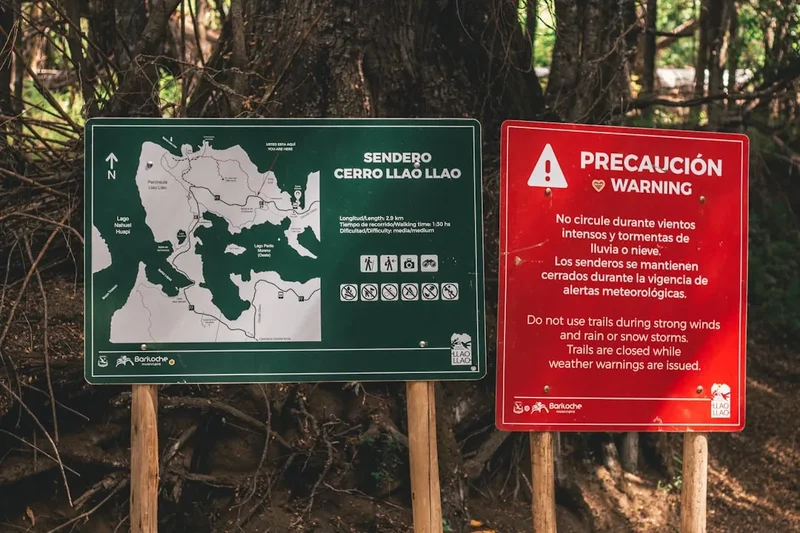
Navigation: While the trail is generally marked, it is essential to carry a map, compass, and GPS device or smartphone with offline maps. Do not rely solely on mobile phone signal, as it is often non-existent in the reserve. Familiarise yourself with the route before you start.
Water and Food: Carry more water than you think you will need, as there are no reliable water sources on the trail. Dehydration can exacerbate altitude sickness and impair judgment. Pack high-energy food to maintain your energy levels throughout the hike.
Wildlife: While the Andean Condor is the main attraction, be aware of other wildlife. Snakes can be present, so watch where you step. The reserve is a protected area, so do not disturb any animals.
Emergency Procedures: Inform someone of your hiking plans, including your expected return time and the route you intend to take. Carry a fully charged mobile phone, but be aware that reception is limited. A personal locator beacon (PLB) or satellite messenger is highly recommended for this remote area.
Footwear and Clothing: Wear sturdy, broken-in hiking boots with good ankle support. Dress in layers, including waterproof and windproof outer layers, as well as warm mid-layers. Protect yourself from the sun with a hat, sunglasses, and sunscreen.
Side Trips and Points of Interest
Andean Condor Observation Points: The primary "point of interest" is, of course, the opportunity to see Andean Condors. The trail leads to the edge of the Quebrada del Condorito, a deep canyon where these magnificent birds are frequently observed soaring on thermals. Look for them circling high above the canyon walls. Patience and a good pair of binoculars can greatly enhance the viewing experience. The best times for observation are typically in the morning and late afternoon when thermals are strongest.
Pampa de Achala Landscape: The trail traverses the vast, high-altitude plateau known as Pampa de Achala. This unique environment is characterised by its windswept grasslands, scattered rock formations, and hardy vegetation adapted to the harsh conditions. The sheer scale and emptiness of the landscape are a point of interest in themselves, offering a sense of profound wilderness and isolation.
Geological Formations: The Sierras de Córdoba are known for their distinctive geological features. As you hike, observe the various rock types, erosion patterns, and the dramatic sculpting of the land by wind and water over millennia. The canyon itself is a significant geological feature.
Panoramic Vistas: At various points along the trail, particularly as you gain elevation and reach the plateau, you will be rewarded with expansive panoramic views of the surrounding Sierras Grandes. These vistas offer a breathtaking perspective on the rugged beauty of the Cordobese highlands.
Leave No Trace
The Quebrada del Condorito National Reserve is a fragile ecosystem, and it is crucial for all visitors to practice Leave No Trace principles to minimise their impact. The Andean Condor population is particularly sensitive to human disturbance, and the high-altitude environment is slow to recover from damage.
Plan Ahead and Prepare: Research the trail, weather conditions, and any regulations before you go. Pack appropriate gear and sufficient supplies to avoid needing to forage or create waste.
Travel and Camp on Durable Surfaces: Stick to the marked trail at all times. Avoid walking on fragile vegetation, especially the high-altitude grasses and mosses, which can take years to regrow. The trail itself is the most durable surface.
Dispose of Waste Properly: Pack out everything you pack in. This includes all food scraps, wrappers, and any other litter. Use designated toilet facilities if available, or dig a cathole at least 60 metres away from water sources, trails, and campsites, and bury human waste. Pack out used toilet paper.
Leave What You Find: Do not take any natural objects, such as rocks, plants, or feathers, from the reserve. Leave them for others to enjoy and for the ecosystem to maintain its natural balance.
Minimise Campfire Impacts: As this is a day hike, campfires are generally not permitted or advisable. If permitted in designated areas for overnight stays (which is not the case for this trail), use established fire rings and keep fires small. Ensure fires are completely extinguished before leaving.
Respect Wildlife: Observe wildlife from a distance. Never feed animals, as this can disrupt their natural behaviours and diets, and can be harmful to their health. Do not approach or disturb nesting condors or other wildlife.
Be Considerate of Other Visitors: Keep noise levels down, especially when observing wildlife. Yield to other hikers on the trail. Respect the natural quiet of the environment.