
Pyrenean Haute Route (HRP) - The High Traverse of the Pyrenees
The Pyrenean Haute Route, or Haute Randonnée Pyrénéenne (HRP), is arguably Europe's most demanding and magnificent long-distance mountain traverse. Stretching approximately 800 kilometres from the Atlantic coast at Hendaye to the Mediterranean shores at Banyuls-sur-Mer, this is not a journey for the faint-hearted. Unlike its counterparts, the French GR10 and the Spanish GR11, which weave through valleys and lower passes, the HRP stays as close to the physical crest of the Pyrenees as possible. It is a high-altitude odyssey that frequently crosses the border between France and Spain, often multiple times in a single day, following the natural logic of the watershed rather than the artificial lines of man-made waymarking.
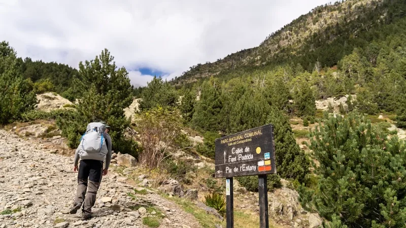
This is a thru-hike defined by its raw, unadulterated character. There are no official waymarks for the HRP; instead, walkers must rely on their navigational prowess, interpreting the landscape through maps, compasses, and GPS. The route ascends over 42,000 metres—the equivalent of climbing Mount Everest nearly five times from sea level—and traverses some of the most rugged, granite-strewn, and glaciated terrain in Western Europe. From the rolling green hills of the Basque Country to the limestone cathedrals of the central peaks and the sun-scorched maquis of the Mediterranean, the HRP offers a profound immersion into the wild heart of the Pyrenees. It is a test of endurance, a masterclass in mountain craft, and a spiritual journey across one of the world's most beautiful mountain ranges.
- Distance: 800 km (approximate, depending on variants)
- Elevation Gain: 42,350 m
- Duration: 40–45 days
- Difficulty: Very Challenging (requires advanced navigation and mountain experience)
- Best Time: Late June to September (July and August are optimal for snow-free passes)
- Highest Point: Col de Mulleres (2,928 m) or various optional summits like Aneto (3,404 m)
- Direction: Traditionally West to East (Hendaye to Banyuls-sur-Mer)
- Accommodation: Mountain refuges (guarded and unguarded), wild camping (bivouacking)
Overview
The Pyrenean Haute Route is often described as the "purist's" way across the Pyrenees. While the GR10 and GR11 are well-marked trails that provide a structured experience, the HRP is a concept—a line of best fit across the highest peaks. It was first popularised by Georges Véron in 1968, who sought to create a route that avoided the deep valley descents of the GR trails, preferring to stay in the "haute montagne" (high mountains) where the air is thin, the views are infinite, and the solitude is absolute.
The journey is typically divided into five or six major stages, each with its own distinct geological and cultural personality. The Western Pyrenees (Basque Country) offer a gentle but humid introduction, with verdant ridges and frequent Atlantic mists. As you move east, the terrain transforms into the High Pyrenees, where limestone massifs like the Cirque de Gavarnie and the granite giants of the Maladeta and Posets massifs dominate the horizon. Here, the walking becomes technical, involving steep scree slopes, boulder hopping, and the crossing of high, snow-choked notches (cols) that remain white well into July. The Central Pyrenees are the emotional and physical core of the trek, requiring sustained effort at altitudes consistently above 2,000 metres.
The final third of the trek enters the Eastern Pyrenees, where the influence of the Mediterranean begins to take hold. The granite gives way to schist and metamorphic rock, and the lush forests are replaced by aromatic scrubland. The descent from the final 2,000-metre peaks toward the sea is a sensory transition, as the smell of pine and snow is replaced by the scent of wild thyme, rosemary, and salt air. Completing the HRP is a monumental achievement; it requires not just physical fitness, but the mental fortitude to handle isolation, unpredictable weather, and the constant demand for navigational focus. It is a journey that strips a walker down to their essentials, leaving only the rhythm of the trail and the immense scale of the mountains.
History and Cultural Context
The Pyrenees have served as a natural barrier and a cultural bridge for millennia. Long before hikers arrived, these mountains were the domain of shepherds, smugglers, and pilgrims. The high passes (ports) were used by the Cathars fleeing persecution, by soldiers during the Napoleonic Wars, and by refugees escaping the Spanish Civil War and the Nazi occupation of France. The HRP crosses these historic "chemins de la liberté" (freedom trails), adding a layer of historical weight to every step.
The modern concept of the HRP was born from the vision of Georges Véron, a French mountaineer and writer. In the late 1960s, Véron felt that the existing GR10 was too focused on valley life and lacked the alpine rigour he craved. He set out to link the highest traversable points of the range, creating a route that was "neither a climb nor a simple walk." His first guidebook, published in 1968, became the bible for a new generation of "pyreneists." Unlike the GR trails, which are maintained by national hiking federations, the HRP remains an unofficial route. This lack of formal status is a point of pride for many who walk it, as it preserves the sense of adventure and self-reliance that Véron championed.
Culturally, the HRP is a journey through three distinct regions: the Basque Country (Euskadi), the central regions of Aragon and Occitanie, and finally Catalonia. Each region brings its own language, architecture, and culinary traditions. You will hear the unique, non-Indo-European Basque language in the west, the Occitan dialects in the central valleys, and Catalan as you approach the Mediterranean. The mountain culture is deeply rooted in "transhumance"—the seasonal movement of livestock. The "cabanes" (shepherd huts) that dot the landscape are testament to this ancient practice, many of which now serve as vital emergency shelters for HRP hikers.
Want more background? Read extended notes on history and cultural context → Learn more
Seasonal Highlights and Weather Reality
The window for a successful HRP thru-hike is narrow, dictated by the presence of snow in the high passes and the arrival of autumn storms. Most hikers begin in late June or early July. Starting earlier often requires mountaineering equipment (ice axe and crampons) and the skills to use them on steep, frozen slopes. Even in a "normal" year, many of the north-facing cols above 2,500 metres will hold significant snow until mid-July.
July and August are the peak months. The weather is generally stable, though the Pyrenees are famous for their "orages"—violent afternoon thunderstorms that can develop with terrifying speed. These storms usually peak between 3:00 PM and 6:00 PM, making early starts essential to ensure you are off the high ridges and passes before the lightning begins. August can be intensely hot, particularly in the lower sections of the Basque Country and the final descent into Catalonia, where temperatures can soar above 30°C.
September is often considered the "golden month" for the Pyrenees. The crowds of the summer holidays have dispersed, the air is crisp and clear, and the light has a soft, autumnal quality that is perfect for photography. However, the days are shorter, and the risk of early-season snowfall increases. By late September, many of the guarded refuges begin to close or move into "winter mode" (unstaffed), and the temperatures at night can drop well below freezing. The "Tramontane" and "Mistral" winds can also become a factor in the east, blowing with gale force across the exposed ridges of the Canigou massif.
Recommended Itinerary

45-Day Pyrenean Haute Route Itinerary
Stage 1: The Basque Country (Hendaye to Lescun)
- Duration: Days 1–8
- Distance: 145 km
- Key Waypoints: Hendaye, Col d'Ibardin, Baztan Valley, Aldudes, Pic d'Orhy, Lescun
- Character: Rolling green hills, Atlantic humidity, and the first limestone peaks
- Highlights: Reaching the first 2,000-metre summit (Pic d'Orhy) and the dramatic limestone cirque of Lescun
- Logistics: Frequent water sources, but navigation can be tricky in the frequent "brouillard" (Atlantic fog)
Stage 2: The High Pyrenees West (Lescun to Gavarnie)
- Duration: Days 9–16
- Distance: 120 km
- Key Waypoints: Pic du Midi d'Ossau, Arremoulit, Wallon, Vignemale, Gavarnie
- Character: High alpine terrain, granite spires, and glacial lakes
- Highlights: The reflection of Pic du Midi d'Ossau in Lac de Gentau and the massive north face of the Vignemale
- Logistics: This stage contains some of the most technical walking; ice axes may be needed for the Col de la Fache early in the season
Stage 3: The Central Pyrenees (Gavarnie to Salardú)
- Duration: Days 17–25
- Distance: 150 km
- Key Waypoints: Héas, Barroude, Parzán, Viadós, Benasque, Hospital de Benasque
- Character: Deep valleys and massive elevation changes
- Highlights: The Cirque de Barroude and the optional ascent of Aneto (3,404 m), the highest peak in the Pyrenees
- Logistics: Resupply in Parzán and Benasque is essential; this section has some of the longest days between refuges
Stage 4: The Granite Wilderness (Salardú to L'Hospitalet-près-l'Andorre)
- Duration: Days 26–35
- Distance: 160 km
- Key Waypoints: Aigüestortes, Certascan, Vall Ferrera, Arinsal (Andorra), L'Hospitalet
- Character: Remote, lake-strewn granite plateaus and the rugged mountains of Andorra
- Highlights: The Estany de Sant Maurici and the crossing of the Port de Rat into Andorra
- Logistics: Very remote; hikers must be self-sufficient for several days at a time in the Ariège section
Stage 5: The Mediterranean Descent (L'Hospitalet to Banyuls-sur-Mer)
- Duration: Days 36–45
- Distance: 225 km
- Key Waypoints: Lac des Bouillouses, Eyne, Ulldeter, Pic du Canigou, Las Illas, Banyuls
- Character: High plateaus transitioning to dry, aromatic Mediterranean scrub
- Highlights: The summit of Canigou, the "sacred mountain" of the Catalans, and the first sight of the sea
- Logistics: Heat and water scarcity become the primary challenges as you descend toward the coast
Important Notes:
- The HRP is not a fixed trail; these stages are based on the classic Georges Véron route
- Daily elevation gain averages 1,000–1,500 metres
- Wild camping is permitted in most areas under "bivouac" rules (sunset to sunrise)
- Navigation is the primary challenge—GPS is highly recommended as a backup to paper maps
- Resupply points are often 3–5 days apart
Planning and Bookings
Book Your Trip
Everything you need to plan your journey
Accommodation
Find places to stay near Lourdes
Flights
Search flights to Lourdes
Essential Preparation
The HRP requires a level of preparation far beyond a standard thru-hike. Physical fitness is paramount; you should be comfortable walking 8–10 hours a day with a full pack, often on unstable terrain. Training should focus on vertical gain and descent to toughen the knees and quadriceps. Beyond fitness, "mountain sense"—the ability to read weather patterns, identify safe routes through boulder fields, and manage energy levels—is critical.
Logistically, the HRP is a puzzle. You must coordinate your start date with snow conditions, resupply points, and refuge openings. Most hikers fly into Biarritz (BIQ) for the Hendaye start and fly out of Perpignan (PGF) or Barcelona (BCN) from the finish. Learning basic French and Spanish is not just a courtesy; it is essential for booking refuges, asking for directions, and understanding weather alerts in remote villages.
Trail Accommodation
Accommodation on the HRP is a mix of guarded refuges, unstaffed "cabanes," and wild camping. The flexibility to switch between these is one of the route's great joys.
Guarded Refuges (Refuges Gardés / Refugios):
- Provide dormitory-style bunks, communal dinners (demi-pension), and breakfasts
- Booking is essential in July and August, often weeks in advance
- Facilities: Toilets, cold (sometimes hot) showers, and charging points (limited)
- Cost: Approximately €50–€65 for half-board (dinner, bed, breakfast)
- Many offer "picnic" lunches for the following day if ordered in advance
Unguarded Shelters (Cabanes / Refugios Libres):
- Basic stone or wooden structures used by shepherds or maintained by hiking clubs
- No facilities other than a roof and sometimes a raised wooden platform for sleeping
- Free to use, but must be left clean; first-come, first-served
- Essential for the remote sections of the Ariège and Central Pyrenees
Wild Camping (Bivouacking):
- Generally permitted in the Pyrenees above the treeline or more than 1 hour's walk from a road
- In National Parks (e.g., Parc National des Pyrénées), strict "bivouac" rules apply: tents only between 7:00 PM and 9:00 AM
- Provides the ultimate HRP experience but requires a lightweight tent and sleep system
Required Gear
- Footwear: Sturdy mountain boots or high-quality trail runners with aggressive tread (Vibram soles recommended)
- Navigation: 1:25,000 or 1:50,000 topographic maps, compass, and a dedicated GPS unit or smartphone with offline maps (e.g., Gaia GPS or IGN France)
- Backpack: 45–60L capacity, ideally under 1.5 kg empty weight
- Shelter: Lightweight 3-season tent or tarp-tent capable of withstanding high winds
- Sleep System: Sleeping bag rated to 0°C (comfort) and an insulated sleeping mat
- Clothing: Layering system including merino base layers, a fleece or down mid-layer, and a high-quality waterproof shell (Gore-Tex or equivalent)
- Safety: Personal Locator Beacon (PLB) like a Garmin inReach, as mobile signal is non-existent in many valleys
- Technical Gear: Lightweight ice axe and micro-spikes/crampons (essential before mid-July)
What to Bring
- Food: 3–5 days of high-calorie, lightweight food (dehydrated meals, nuts, cheese, saucisson). Resupply is possible in mountain villages every few days
- Water Treatment: Lightweight filter (e.g., Sawyer Squeeze) or purification tablets. While water is plentiful, livestock are present in many high pastures
- Cooking: Lightweight gas stove (Jetboil or MSR Pocket Rocket) and one small pot. Note: "Screw-top" canisters (Lindal valve) are common in France/Spain, but "Campingaz" click-on canisters are also prevalent
- Toiletries: Biodegradable soap, trowel for LNT, sunblock (SPF 50+), and lip balm with UV protection
- First Aid: Blister kit (Compeed), ibuprofen, antiseptic wipes, and any personal medications
- Power: 10,000mAh or 20,000mAh power bank to keep navigation devices charged
Permits
One of the greatest appeals of the Pyrenean Haute Route is the lack of a formal permit system for the trail itself. Unlike the Pacific Crest Trail or the Milford Track, you do not need to "win" a lottery to walk the HRP. However, you must adhere to the specific regulations of the various National and Natural Parks you traverse.
National Park Regulations:
- Parc National des Pyrénées (France): Bivouacking is allowed between 7:00 PM and 9:00 AM, provided you are more than one hour's walk from a park entrance or road. No fires are permitted.
- Parque Nacional de Ordesa y Monte Perdido (Spain): Very strict rules. Bivouacking is only allowed above certain altitudes (usually 2,100 m or 2,500 m depending on the sector). In some areas, it is prohibited entirely.
- Parc Nacional d'Aigüestortes i Estany de Sant Maurici (Spain): Camping and bivouacking are strictly prohibited. You must stay in the guarded refuges within the park boundaries. Bookings here are essential.
Refuge Bookings: While not a "permit," booking your bed in the guarded refuges is mandatory if you don't plan to carry a tent. During the European summer holidays (mid-July to late August), refuges on the HRP can be completely full. Most can be booked online through the FFCAM (French Alpine Club) or the FEEC (Catalan Hiking Federation) websites.
Fishing and Hunting: If you plan to fish in the high lakes, you must obtain local permits (permis de pêche) for the specific department (France) or autonomous community (Spain) you are in. Hunting is strictly regulated and generally not compatible with a thru-hike.
Other Activities in the Area
The Pyrenees offer a wealth of experiences beyond the HRP. If you have extra time or need a rest day, consider these options:
- Summiting Aneto: At 3,404 metres, the highest peak in the Pyrenees is a classic mountaineering objective. It requires crossing the Glacier de l'Aneto (crampons/ice axe needed) and the famous "Bridge of Mohammed" (a narrow rock ridge).
- Canyoning in Sierra de Guara: Located just south of the HRP in Spain, this is one of the world's premier canyoning destinations, featuring turquoise pools and dramatic limestone gorges.
- Lourdes: A short bus or train ride from the trail near Cauterets, this world-famous pilgrimage site offers a fascinating cultural experience, regardless of your religious beliefs.
- San Sebastián (Donostia): If you start in Hendaye, spend a day in this Basque culinary capital, famous for its "pintxos" (tapas) and beautiful La Concha beach.
- Thermal Spas: The Pyrenees are rich in geothermal activity. Towns like Cauterets, Bagnères-de-Luchon, and Ax-les-Thermes have historic thermal baths—perfect for soothing tired muscles.
- The Little Yellow Train (Le Petit Train Jaune): In the Eastern Pyrenees, this historic narrow-gauge railway offers a spectacular scenic journey through the Têt valley.
Safety and Conditions
Navigation and Terrain: The HRP is not a waymarked trail. You will frequently find yourself on trackless terrain, crossing steep scree slopes, or navigating through complex granite boulder fields. In poor visibility (the "brouillard"), it is incredibly easy to become disoriented. You must be proficient with a map and compass and have a GPS backup with sufficient power. The terrain is physically demanding; "Pyrenean kilometres" often take twice as long as those on flatter trails.
Weather Hazards: The Pyrenees are a meeting point for Atlantic and Mediterranean air masses, leading to volatile weather.
- Thunderstorms (Orages): These are the primary summer danger. Lightning on exposed ridges is a lethal threat. Aim to be off high ground by early afternoon.
- Snow: High passes can remain snow-covered until August. A slip on a steep "névé" (snow patch) can be fatal without an ice axe to self-arrest.
- Heat: In the lower sections and the Mediterranean end, heatstroke and dehydration are genuine risks. Carry at least 3 litres of water in these sections.
Isolation and Communication: Large sections of the HRP, particularly in the Ariège (France) and the High Aragon (Spain), are extremely remote. Mobile phone coverage is spotty at best and non-existent in deep valleys. A satellite communication device (e.g., Garmin inReach or Zoleo) is highly recommended for emergencies and weather updates.
Livestock and Wildlife: You will encounter many herds of cows, sheep, and horses. While generally docile, they are often protected by "Patous" (Great Pyrenean Mountain Dogs). These large white dogs are bred to protect the flock from wolves and bears; if you encounter one, stay calm, keep your distance, and do not make sudden movements or eye contact. Bears do exist in the Pyrenees, but they are extremely shy and rarely seen.
Emergency Services: In an emergency, dial 112 (the European emergency number). Mountain rescue in France (PGHM) is generally free, but in Spain, you may be charged if the rescue is deemed a result of negligence. Comprehensive travel insurance that covers "search and rescue" and "high-altitude trekking" is essential.
Side Trips and Points of Interest
Cirque de Gavarnie: Often called the "Colosseum of Nature," this massive limestone cirque features a 1,500-metre wall and the Grande Cascade, one of Europe's highest waterfalls (422 m). While the HRP passes nearby, a detour into the heart of the cirque is a must-see.
Brèche de Roland: A legendary 40-metre wide, 100-metre high natural gap in the cliff wall of the Cirque de Gavarnie. According to legend, it was cut by Count Roland's sword, Durendal. It serves as a dramatic high-altitude border crossing between France and Spain.
Pic du Midi d'Ossau: This iconic volcanic tooth is the symbol of the Pyrénées-Atlantiques. The HRP skirts its base, but the "Tour de l'Ossau" is a popular variant that offers stunning views of the peak from every angle.
Aigüestortes i Estany de Sant Maurici: This Spanish National Park is a wonderland of over 200 glacial lakes and twin granite peaks known as "Els Encantats" (The Enchanted Ones). The HRP section through here is arguably the most scenic of the entire route.
Pic du Canigou: The final major peak of the HRP before the Mediterranean. For Catalans, Canigou is a sacred mountain. Reaching its summit (2,784 m) and seeing the Mediterranean for the first time is a powerful emotional milestone for every HRP hiker.
The Mediterranean Finish: The final walk into Banyuls-sur-Mer through vineyards and olive groves is a stark contrast to the high peaks. Tradition dictates that you walk directly into the sea at the Plage des Elmes to mark the end of your 800-kilometre journey.
Leave No Trace

The Pyrenees are a fragile ecosystem under increasing pressure from climate change and tourism. As an HRP hiker, you are an ambassador for the mountains. Following Leave No Trace (LNT) principles is not just a suggestion; it is a requirement for preserving this wilderness.
Core Principles for the HRP:
- Plan Ahead and Prepare: Know the bivouac rules for each park. Lack of planning often leads to illegal camping in fragile areas.
- Travel and Camp on Durable Surfaces: Use established campsites near refuges or "cabanes" where possible. Avoid camping on sensitive alpine meadows or near water sources.
- Dispose of Waste Properly: Pack out ALL trash, including fruit peels and nut shells. For human waste, use a trowel to dig a "cathole" at least 15–20 cm deep and 60 metres from water. Pack out your toilet paper in a sealed bag.
- Leave What You Find: Do not pick wildflowers or remove rocks. Respect the historic "cabanes" and do not deface them.
- Minimise Campfire Impacts: Fires are prohibited in almost all areas of the HRP. Use a lightweight stove for cooking.
- Respect Wildlife: Observe from a distance. Never feed marmots or birds, as this disrupts their natural foraging and can lead to dependency.
- Be Considerate of Others: Keep noise to a minimum, especially in the communal dormitories of refuges. Yield to uphill hikers on narrow trails.
The Pyrenees have a long history of human use, but the "High Route" seeks to experience the range in its most pristine state. By treading lightly, you ensure that the HRP remains a wild and challenging experience for those who follow in your footsteps.