Picos de Europa Traverse - The Limestone Fortress of Northern Spain
The Picos de Europa Traverse is a formidable high-altitude journey through Spain’s first national park, a landscape defined by jagged limestone peaks, vertiginous gorges, and emerald-green valleys. Spanning approximately 75 kilometres across the three distinct massifs—the Macizo Occidental (Western), Macizo Central (Central), and Macizo Oriental (Eastern)—this traverse is widely considered one of the most challenging and rewarding multi-day treks in Europe. Unlike the rolling greenery of the Pyrenees or the glaciated valleys of the Alps, the Picos offer a raw, lunar-like environment where water disappears into deep sinkholes (known locally as 'jous') and the weather can transform from Mediterranean sunshine to Atlantic mist in a matter of minutes. This is a trek for those who seek technical terrain, significant elevation changes, and the profound silence of a high-mountain wilderness that remains remarkably untouched by large-scale commercialisation.
- Distance: 75.0 km (variable depending on specific route choices)
- Duration: 5–7 days
- Season: June to September (July and August are peak months; snow persists until late June)
- Accommodation: High-mountain refugios (mountain huts) and valley hostels
- Highest point: Approximately 2,500 m (depending on side peaks like Torre Cerredo or Picu Urriellu)
- Total Elevation Gain: 5,500 m
- Difficulty: Challenging (requires high fitness, navigation skills, and comfort with steep, rocky terrain)
Overview
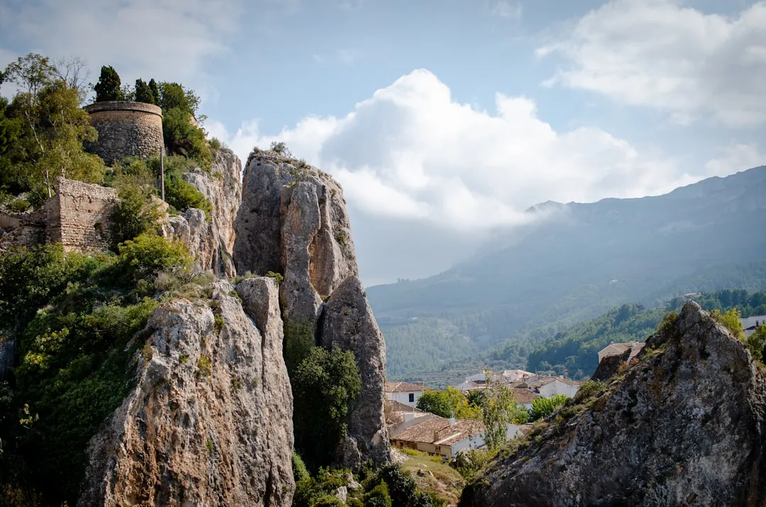
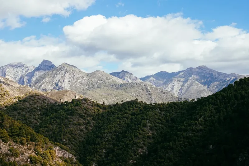
The Picos de Europa, situated just 20 kilometres from the Cantabrian coast, rise with startling abruptness from the sea. This proximity to the Atlantic Ocean creates a unique microclimate and a landscape of dramatic contrasts. The traverse is not a single, fixed path but a series of interconnected trails that allow hikers to cross the three massifs. The Central Massif (Urrieles) is the most rugged and spectacular, home to the iconic Picu Urriellu (Naranjo de Bulnes) and the highest peak in the range, Torre Cerredo (2,648 m). The Western Massif (Picos de Cornión) is known for its historical significance and the beautiful Lakes of Covadonga, while the Eastern Massif (Andara) is smaller, more accessible, and bears the scars of a rich mining history.
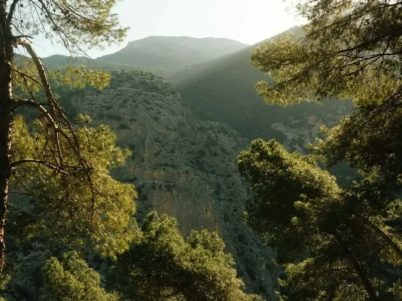
Walking the Picos is a lesson in geology. The range is composed almost entirely of Carboniferous limestone, which has been eroded over millennia into a labyrinth of sharp ridges, deep shafts, and vast depressions. There are very few permanent streams at high altitudes because the porous rock swallows rainfall immediately, funneling it into one of the deepest cave systems in the world. For the trekker, this means that water management is a critical part of the daily routine. The terrain is notoriously "leg-breaking"—rarely flat, often consisting of loose scree (pedreros), sharp karst pavement, and steep grassy slopes that require constant concentration.
The cultural experience of the Picos is as rich as its geology. The valleys are dotted with stone-built villages like Sotres and Bulnes, where traditional life continues. You will share the lower slopes with Cantabrian chamois (rebecos), griffon vultures, and the hardy cattle whose milk produces the world-famous Cabrales and Gamonéu blue cheeses. Staying in the refugios provides a communal atmosphere where hikers from across the globe share stories over hearty mountain stews. This traverse is more than just a physical challenge; it is an immersion into a landscape where the elements have dictated the pace of life for centuries.
History and Cultural Context
The Picos de Europa hold a sacred place in Spanish history. It was in these mountains, specifically at Covadonga in the Western Massif, that the Reconquista is said to have begun in 722 AD. Pelayo, a Visigothic nobleman, led a small band of Christian rebels to victory against the Umayyad Caliphate forces, a moment that is still celebrated as the foundation of the Spanish monarchy. The mountains provided a natural fortress that the invading forces could never fully conquer, preserving a distinct cultural identity that persists in the local dialects, architecture, and traditions of Asturias, Cantabria, and Castilla y León.
In 1918, thanks to the tireless efforts of Pedro Pidal, the Marquess of Villaviciosa, the "Montaña de Covadonga" was declared Spain’s first National Park. Pidal was an avid mountaineer who, along with the local shepherd Gregorio Pérez (known as 'El Cainejo'), completed the first ascent of the "impossible" Picu Urriellu in 1904. Their climb, achieved without modern equipment, remains a legendary feat in Spanish climbing history. The park was later expanded in 1995 to encompass all three massifs, covering 64,660 hectares, and was designated a UNESCO Biosphere Reserve in 2003.
For centuries, the primary inhabitants of these high pastures were shepherds. They developed an intricate system of transhumance, moving livestock to high-altitude "majadas" (summer settlements) during the warmer months. The ruins of these stone huts are still visible throughout the traverse. The shepherds also pioneered the routes that modern hikers use today, finding passages through seemingly impassable cliffs to reach isolated grazing lands. Their legacy is most evident in the local gastronomy; the intense, piquant blue cheeses aged in natural limestone caves are a direct product of this high-mountain pastoralism. To walk the Picos is to follow in the footsteps of these "pastores," whose intimate knowledge of the limestone labyrinth remains unsurpassed.
Want more background? Read extended notes on history and cultural context → Learn more
Seasonal Highlights and Weather Reality
The Picos de Europa are notorious for their unpredictable weather. Because they are the first major barrier for Atlantic storms, they receive high levels of precipitation. Even in the height of summer, a clear morning can quickly turn into a "white-out" as the 'niebla' (a thick, fast-moving sea mist) rolls in from the coast, making navigation extremely difficult.
Summer (July to August): This is the most popular time for the traverse. The weather is generally stable, and the high-altitude refugios are fully operational. However, temperatures in the valleys can exceed 30°C, and the lack of shade on the limestone plateaus makes for hot, thirsty work. This is also the busiest period; refugios must be booked months in advance, and popular spots like the Cares Gorge can feel crowded.
Autumn (September to October): Many experienced trekkers consider September the best month. The crowds thin out, the air is often clearer, and the autumn light brings out the deep ochre and gold of the beech forests in the lower valleys. While the days are shorter and the nights cooler, the stability of the weather is often superior to mid-summer. By late October, the first snows usually arrive, and many refugios begin to close or move to "winter mode."
Spring (May to June): This is a beautiful but dangerous time. While the valleys are bursting with wildflowers and the waterfalls are at their peak, the high passes remain choked with snow. Crossing the massifs in May or early June requires ice axes, crampons, and advanced winter navigation skills. The snow bridges over limestone jous can be particularly hazardous as they melt from beneath.
Winter (November to April): The Picos transform into a serious alpine environment. This is the realm of ice climbers and ski mountaineers. The terrain is prone to significant avalanche risk, and the weather is frequently brutal. Only those with extensive winter mountaineering experience should attempt the traverse during these months.
Recommended Itinerary
6-Day Picos de Europa Traverse Itinerary
Day 1: Sotres to Refugio de Urriellu
- Distance: 11 km
- Elevation gain: 950 m
- Time: 4–5 hours
- Start in the village of Sotres (1,050 m), the highest village in the Picos
- Follow the track to Pandébano Pass, offering the first views of the iconic Picu Urriellu
- Ascend the winding path through the Vega de Urriellu
- Arrive at Refugio de Urriellu (1,960 m), situated at the base of the 500-metre vertical west face of Naranjo de Bulnes
- Watch the sunset turn the limestone face of the peak a brilliant orange-red
Day 2: Refugio de Urriellu to Refugio de Jou de los Cabrones
- Distance: 6 km
- Elevation gain: 500 m
- Time: 4–5 hours
- A short but highly technical day through the heart of the Central Massif
- Cross the "Corona del Raso" and navigate the steep, rocky terrain of the Jou de los Boches
- Use fixed cables in short sections to assist with steep scrambles
- Arrive at Refugio de Jou de los Cabrones (2,100 m), the most isolated and spectacular hut in the range
- This area feels like a lunar landscape, surrounded by the highest peaks of the Picos
Day 3: Jou de los Cabrones to Caín (The Dobresengos Descent)
- Distance: 12 km
- Elevation loss: 1,600 m
- Time: 6–8 hours
- One of the most demanding descents in Europe
- Follow the Canal de Dobresengos, a long, steep limestone scree valley
- The terrain is punishing on the knees but offers incredible views of the Cares Gorge far below
- Transition from high-alpine rock to Mediterranean shrubland and finally the lush valley floor
- Arrive in the village of Caín, a green oasis at the entrance of the Cares Gorge
Day 4: Caín to Refugio de Vegabaño
- Distance: 14 km
- Elevation gain: 1,100 m
- Time: 6–7 hours
- Enter the Western Massif (Picos de Cornión)
- Ascend through the spectacular beech forests of the Canal de Trea or the more gradual route via the Portela de Agüera
- Pass through traditional grazing lands and ancient stone majadas
- Arrive at Refugio de Vegabaño (1,320 m), located in a beautiful alpine meadow surrounded by ancient forest
- This section offers a softer, greener contrast to the stark limestone of the Central Massif
Day 5: Refugio de Vegabaño to Refugio de Vega de Ario
- Distance: 16 km
- Elevation gain: 800 m
- Time: 7–8 hours
- Cross the high plateaus of the Western Massif
- Navigate through a labyrinth of limestone jous and small peaks
- Pass the scenic Mirador del Tombo for views back across the Cares Gorge to the Central Massif
- Arrive at Refugio de Vega de Ario (1,630 m)
- Enjoy the "Balcony of the Picos," with panoramic views of the entire Central Massif across the void of the Cares Gorge
Day 6: Vega de Ario to Lakes of Covadonga
- Distance: 6 km
- Elevation loss: 550 m
- Time: 2.5–3 hours
- A gentle descent to conclude the traverse
- Pass through the Majada de las Reblagas
- Reach the stunning glacial lakes of Enol and Ercina (Lakes of Covadonga)
- Visit the nearby Sanctuary of Covadonga to see the Holy Cave and the Basilica
- Take a bus or taxi back to Cangas de Onís or your starting point
Important Notes:
- This route requires confident navigation; GPS is essential as cairns can be misleading in fog
- Water is extremely scarce between refugios; carry at least 3 litres per day
- Refugios must be booked in advance via the official Picos de Europa refugio website
- The descent of Dobresengos is very strenuous; ensure your footwear is in good condition
- Be prepared for sudden temperature drops, even in August
Planning and Bookings
Book Your Trip
Everything you need to plan your journey
Accommodation
Find places to stay near Oviedo
Flights
Search flights to Oviedo
Essential Preparation
The Picos de Europa Traverse is not a trek for beginners. The primary challenge is the terrain; limestone is sharp, abrasive, and often unstable. You must be physically prepared for long days with significant elevation gain and loss, often carrying a pack with several days of supplies. Fitness training should focus on leg strength and balance. Coordination is key—ensure your transport to the trailhead (usually Sotres or Cangas de Onís) is arranged, and that your refugio bookings are confirmed in a logical sequence.
The closest major city is Oviedo, which is well-connected by bus to the gateway towns of Arenas de Cabrales and Cangas de Onís. If you are flying in, Asturias Airport (OVD) is the most convenient. It is highly recommended to spend a night in a valley town like Sotres before starting to acclimatise and check the latest weather reports with locals. Most hikers use a "base" for their extra luggage; many hotels in Arenas de Cabrales offer luggage storage for a small fee while you are on the trail.
Trail Accommodation
Accommodation on the traverse consists primarily of high-mountain refugios managed by the regional mountaineering federations. These are functional, communal spaces designed for hikers and climbers.
Refugio Facilities:
- Dormitory-style bunk rooms (usually 10–40 people per room)
- Blankets are provided, but a silk or cotton sleeping bag liner is mandatory
- Common dining area where breakfast and dinner are served
- Limited solar power for lighting; charging phones is often restricted or impossible
- Cold water sinks; some refugios have showers (often for a fee of €3–€5), but water is frequently rationed
- Basic composting or pit toilets
- Small shop selling snacks, water, and sometimes beer or wine
What Refugios Don't Provide:
- Towels or toiletries
- Private rooms (with very few exceptions)
- Reliable WiFi or mobile signal
- Heating (even in summer, stone buildings can be very cold at night)
Booking Requirements:
- Bookings should be made through the "Central de Reservas de Refugios de Picos de Europa" website
- During July and August, book at least 3–4 months in advance
- Costs: Approximately €15–€20 for a bunk, €35–€45 for half-board (dinner, bed, and breakfast)
- Federated mountaineers (with UIAA-recognised cards) receive a significant discount
Required Gear
- Mountain boots: Sturdy, waterproof, and with a high-traction sole (Vibram or similar). The limestone will shred soft trail runners
- Trekking poles: Essential for saving your knees on the long, steep descents and providing stability on loose scree
- Navigation: A high-quality 1:25,000 map (Editorial Alpina is the gold standard), a compass, and a GPS device with offline maps
- Waterproofs: A high-quality hardshell jacket and trousers. Atlantic storms are powerful
- Backpack: 35–50 litres, with a waterproof cover and a comfortable harness system
- Head torch: Essential for the refugios and in case of late finishes
- First aid kit: Focus on blister care (Compeed), sun cream, and rehydration salts
- Emergency whistle and survival bag: Standard safety gear for high-mountain environments
What to Bring
- Water treatment: While water is scarce, when you find it (at refugios or rare springs), it should be treated with tablets or a filter
- Sleeping bag liner: Mandatory for hygiene in the refugios
- Clothing layers: Merino wool base layers, a fleece or down mid-layer, and quick-drying trekking trousers
- Sun protection: High SPF sunscreen, lip balm with UV protection, and a wide-brimmed hat. The reflection off the white limestone is intense
- Personal hygiene: Biodegradable soap, travel towel, and hand sanitiser
- Earplugs: Essential for sleeping in communal dormitories
- Cash: Many refugios do not accept credit cards due to lack of connectivity
- High-energy snacks: Nuts, dried fruit, and energy bars to supplement refugio meals
Permits
Currently, there is no permit required to hike the Picos de Europa Traverse. Access to the National Park is free for all visitors. However, this does not mean the trail is unregulated. The "permit" in a practical sense is your refugio reservation. Wild camping is strictly regulated within the National Park boundaries to protect the fragile ecosystem.
Wild Camping Rules:
- Camping is generally prohibited below 1,600 metres
- Above 1,600 metres, "bivouacking" (setting up a tent at sunset and taking it down at sunrise) is permitted in certain areas, provided you are more than 500 metres from a refugio or a road
- In the Western Massif (Asturias), rules are even stricter; always check the latest National Park regulations at a visitor centre
- Given the rocky, uneven nature of the karst terrain, finding a flat spot for a tent is often impossible, making refugios the most practical option
Transport Permits: During the peak summer months, private vehicle access to the Lakes of Covadonga is restricted. You must park in Cangas de Onís or designated car parks and take an official shuttle bus. This is part of an effort to reduce the environmental impact on this highly sensitive area.
Other Activities in the Area
The Picos de Europa and the surrounding Cantabrian coast offer a wealth of experiences for those with extra time:
- The Cares Gorge (Garganta del Cares): If you don't include this in your traverse, it is a must-do day hike. Known as the "Divine Gorge," this 12 km path is carved into the cliffs 1,000 metres above the Cares River. It is flat, spectacular, and one of the most famous walks in Spain.
- Bulnes Funicular: Visit the isolated village of Bulnes, which was only accessible by a steep mountain path until 2001. You can now take a funicular railway through the heart of the mountain, though many still prefer the traditional hike up the Canal del Tejo.
- Fuente Dé Cable Car: Located in the southern part of the Central Massif, this cable car whisks you up 753 metres in just 4 minutes to a spectacular viewpoint at 1,823 metres, providing instant access to the high plateau.
- Cider Tasting in Asturias: Visit a traditional 'sidrería' in Arenas de Cabrales or Cangas de Onís. Watching the cider being poured from a height (escanciar) to aerate it is a cultural ritual not to be missed.
- Surfing on the Cantabrian Coast: The beaches of Llanes and Ribadesella are only a 40-minute drive from the mountains, offering world-class surf and a chance to soothe tired muscles in the Atlantic.
- Cave Art: The region is home to several UNESCO-listed caves with prehistoric paintings, such as Tito Bustillo in Ribadesella.
Safety and Conditions
The 'Niebla' (Fog): This is the single greatest danger in the Picos. The mist can arrive with incredible speed, reducing visibility to less than two metres. In the labyrinthine limestone terrain, where trails are often marked only by small stone cairns, it is extremely easy to become disoriented. If the fog rolls in and you are not 100% sure of your position, the safest option is often to stay put until it clears or use a high-accuracy GPS to backtrack.
Terrain Hazards: The limestone is exceptionally sharp. A simple slip can result in deep cuts. Furthermore, the 'jous' (sinkholes) can be hundreds of metres deep. Always stay on marked paths and be wary of snow bridges in early summer, which may hide deep crevices. The 'pedreros' (scree slopes) are exhausting and can be unstable; use poles and move with deliberation.
Water Scarcity: Do not underestimate the lack of water. There are almost no springs in the high Central Massif. You must carry enough water to last between refugios. Dehydration is a common cause of exhaustion and accidents in these mountains.
Emergency Contacts: The emergency number in Spain is 112. Be aware that mobile signal is non-existent in many of the deep valleys and high jous. Carrying a satellite messenger (like a Garmin inReach) is highly recommended for solo trekkers or those attempting more remote variants.
Wildlife: While the Picos are home to brown bears and wolves, they are extremely shy and rarely seen. The most common wildlife encounter is with the 'rebeco' (chamois). Do not approach or feed them. Be cautious of large livestock guardian dogs (Mastins) protecting sheep; give them a wide berth and do not act aggressively toward them.
Side Trips and Points of Interest
Torre Cerredo (2,648 m): For experienced scramblers, a detour to the highest peak in the Picos and the entire Cantabrian range is a highlight. The ascent from the Jou de los Cabrones involves Grade II scrambling and requires a good head for heights. The reward is a view that stretches from the Atlantic Ocean to the plains of Castilla.
Picu Urriellu (Naranjo de Bulnes): While the summit is the preserve of technical rock climbers, walking around the base of this 2,519 m limestone monolith is an awe-inspiring experience. The west face is one of the most famous big walls in the world. Even if you aren't climbing, spending an evening at the Refugio de Urriellu to watch the "alpenglow" on the peak is a mandatory Picos experience.
The Village of Bulnes: This tiny, stone-built hamlet is divided into Bulnes de Arriba (Upper) and Bulnes de Abajo (Lower). It is a perfect example of traditional mountain architecture. The local bars serve excellent 'caldereta' (stew) and provide a glimpse into a way of life that remained unchanged for centuries until the arrival of the funicular.
Mirador de Ordiales: A spectacular viewpoint in the Western Massif where the Marquess of Villaviciosa, the founder of the park, is buried. The cliff drops 1,000 metres sheer into the valley of Angón, offering one of the most dramatic vistas in the entire range.
The Mines of Andara: In the Eastern Massif, you can explore the remains of 19th-century zinc mines. The landscape is dotted with old tunnels and transport tracks, providing a stark contrast to the more pristine wilderness of the other two massifs.
Leave No Trace
The Picos de Europa National Park is a sanctuary for rare species and a fragile geological landscape. With increasing visitor numbers, the "Leave No Trace" principles are essential for the park's survival. The limestone environment is particularly sensitive; because there is so little soil, vegetation takes decades to recover from trampling.
Guidelines for the Picos:
- Stick to the Path: Avoid creating "social trails," especially in the grassy majadas where erosion starts easily.
- Waste Management: Pack out all rubbish, including organic waste like banana skins or nut shells, which do not decompose quickly in the high, dry alpine environment.
- Human Waste: Use the toilets at refugios whenever possible. If you must go on the trail, ensure you are at least 100 metres from any (rare) water source and bury waste deeply. Pack out your toilet paper.
- Respect the Silence: The Picos are a place of profound quiet. Avoid shouting or playing music, which can disturb both wildlife and other hikers.
- No Fires: Fire risk is high in the summer, and wood is a scarce resource for the ecosystem. Use a lightweight stove for cooking if bivouacking.
- Protect the Water: Do not use soap or detergents in the few mountain springs or lakes. Even biodegradable soap can harm the delicate aquatic life in these isolated pools.