Peñalara Peak Hike - Sierra de Guadarrama's Crown Jewel
The Peñalara Peak Hike is a quintessential day walk in Spain's Sierra de Guadarrama mountain range, offering a rewarding ascent to the highest point in the region. This trail is a popular choice for both seasoned hikers and those seeking a moderate challenge with spectacular panoramic views. Starting from the Puerto de Cotos, the route winds through diverse landscapes, from pine forests to high alpine meadows, culminating in a rocky summit that provides a breathtaking 360-degree vista of the surrounding mountains and valleys. It's a journey that encapsulates the rugged beauty of the Guadarrama, making it an accessible yet memorable mountain experience close to the bustling capital of Madrid.
- Distance: 13.5 km (return)
- Elevation Gain: 750 m
- Duration: 5–6 hours
- Difficulty: Moderate
- Best Time: June to October (summer and early autumn)
- Highest Point: Peñalara Peak (2,428 m)
- Closest City: Madrid
- Trailhead Access: Puerto de Cotos
- Permits: Not required for day access
Overview
The Peñalara Peak Hike is a moderately challenging day walk that ascends to the highest summit in the Sierra de Guadarrama, Peñalara Peak (2,428 metres). This route is celebrated for its accessibility from Madrid and its stunning alpine scenery, which feels a world away from the urban sprawl. The trail begins at the Puerto de Cotos, a well-known mountain pass and popular starting point for many hikes in the area. From here, the path gradually ascends, initially through fragrant pine forests before opening up into more exposed, rocky terrain characteristic of high mountain environments.
As you climb, the landscape transforms. The initial sections are shaded by Scots pines and Pyrenean oaks, offering a pleasant start. Soon, the trees thin out, and the path becomes rockier, leading you towards the glacial cirque of Peñalara. This area is dotted with small, picturesque glacial lakes, such as the Laguna Grande de Peñalara, which are remnants of the last ice age and add a unique geological dimension to the hike. The final push to the summit involves navigating a scree slope and a short, rocky scramble, which is manageable for most hikers with a reasonable level of fitness.
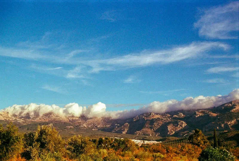
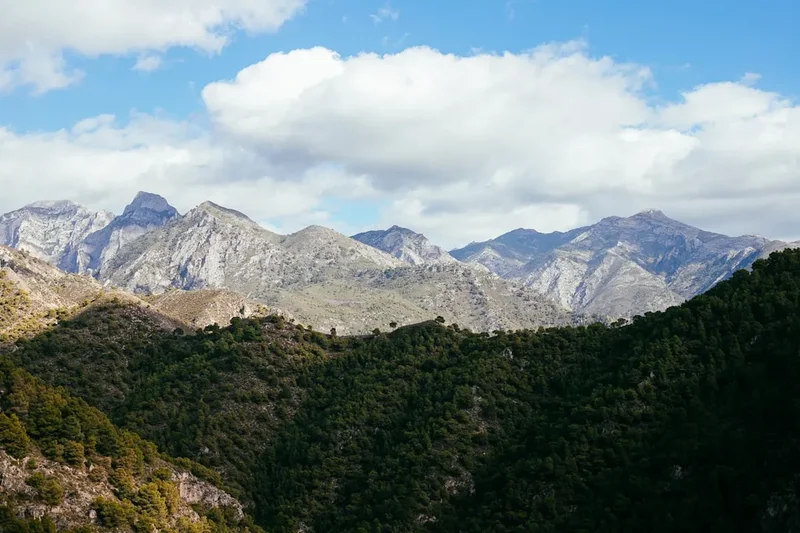
The reward at the summit is immense. On a clear day, the views are expansive, stretching across the vast expanse of the Sierra de Guadarrama, with the distinctive peaks of La Maliciosa and Siete Picos often visible. On exceptionally clear days, it's even possible to glimpse the distant peaks of the Gredos mountain range to the south. The descent follows the same route, offering a different perspective on the landscapes you traversed on the way up. The entire hike is a testament to the natural beauty and geological history of central Spain, providing a refreshing escape into the mountains.
History and Cultural Context
The Sierra de Guadarrama, and specifically the Peñalara massif, has a long history of human interaction, primarily driven by its natural resources and strategic location. For centuries, these mountains served as a vital source of timber, pasture for livestock, and hunting grounds. The area around Puerto de Cotos has been a traditional crossing point for shepherds and travellers between the northern and southern slopes of the range.
The ascent to Peñalara Peak itself has been a goal for mountaineers and nature enthusiasts for generations. In the late 19th and early 20th centuries, as mountaineering gained popularity across Europe, the Guadarrama range became a favoured destination for those seeking alpine experiences without the need for extensive travel. Peñalara, being the highest point, naturally attracted the most attention. Early ascents were often undertaken by intrepid explorers and naturalists documenting the region's flora and fauna.
The establishment of the Peñalara Natural Park (Parque Natural de Peñalara) in 1930, and later its integration into the larger Guadarrama National Park (Parque Nacional de la Sierra de Guadarrama) in 2013, has been crucial in preserving the unique ecological and geological heritage of the area. These designations have helped to protect the glacial cirques, the endemic plant species, and the diverse wildlife, while also managing the increasing number of visitors. The trails, including the route to Peñalara Peak, have been maintained and improved over time to ensure safe access for hikers while minimising environmental impact. The peak itself, while not possessing the dramatic historical narratives of some other European mountains, stands as a symbol of the enduring natural beauty and recreational significance of the Sierra de Guadarrama.
Seasonal Highlights and Weather Reality
The Peñalara Peak Hike is best enjoyed during the warmer months, from June to October. This period offers the most stable weather conditions and the highest probability of clear skies for enjoying the panoramic views from the summit.
Summer (June to August): This is the peak season for hiking in the Sierra de Guadarrama. Days are long and generally warm, with temperatures at the summit typically pleasant, though it can still be cool and windy. Wildflowers are abundant in the alpine meadows, creating a colourful spectacle. However, summer can also bring occasional thunderstorms, particularly in the afternoons. It is crucial to start early to avoid the heat and the risk of these storms.
Autumn (September to October): Early autumn is an excellent time to hike Peñalara. The crowds thin out, the air is crisp, and the landscape begins to take on autumnal hues. The weather is usually stable, with clear days and cooler temperatures, making for comfortable hiking. The risk of snow is minimal in September and early October, but it can increase towards the end of the season.
Spring (April to May): While spring can be beautiful with new growth, it is a less predictable time for this hike. Snow can linger on the higher slopes and around the summit well into May, making the trail difficult or impossible to navigate without specialised equipment like crampons and an ice axe. The glacial lakes may still be partially frozen. Weather can be highly variable, with sudden snowfalls and strong winds possible.
Winter (November to March): This period is generally unsuitable for this hike unless you are an experienced winter mountaineer equipped with appropriate gear (crampons, ice axe, snowshoes, avalanche safety equipment). The trail is often covered in snow and ice, and conditions can be extremely harsh, with high winds, freezing temperatures, and very low visibility. The Puerto de Cotos access road can also be subject to closures due to snow.
Weather Considerations: Mountain weather is notoriously changeable. Even in summer, temperatures at the summit can drop significantly, and strong winds can make it feel much colder. Always check the weather forecast specifically for the Sierra de Guadarrama before you set out, and be prepared for rapid changes in conditions. Hypothermia is a risk even in milder seasons if you are caught unprepared in rain and wind.
Recommended Itinerary
Peñalara Peak Day Hike Itinerary
Early Morning (approx. 8:00 AM): Arrival at Puerto de Cotos
- Start your journey from Madrid, driving or taking public transport to Puerto de Cotos.
- Park your vehicle or alight from the bus. The Puerto de Cotos area is a popular hub with facilities including a visitor centre and cafes.
- Ensure you have all your gear ready and have had breakfast.
Morning (approx. 8:30 AM - 11:30 AM): Ascent to Laguna Grande de Peñalara
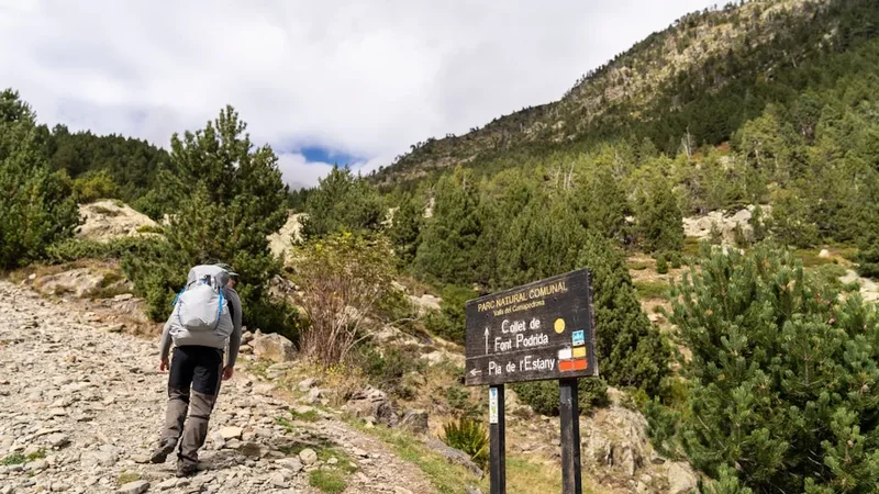
- Begin the hike from Puerto de Cotos, following the well-marked trail towards Peñalara Peak.
- The initial section winds through pine forests, offering shade and a gentle introduction to the climb.
- The path gradually opens up, revealing more rugged terrain and increasing elevation.
- You will pass by several smaller glacial lakes and rock formations.
- The trail leads towards the impressive glacial cirque of Peñalara.
- Reach the Laguna Grande de Peñalara, a beautiful glacial lake surrounded by rocky slopes. This is an excellent spot for a short break and photos.
- Distance covered: Approximately 5-6 km.
- Elevation gain: Approximately 400-450 m.
Midday (approx. 11:30 AM - 1:00 PM): Summit Push to Peñalara Peak
- From Laguna Grande, the trail becomes steeper and more challenging.
- You will navigate a rocky path and a scree slope leading towards the summit ridge.
- The final section to the peak involves a short, manageable scramble over rocks.
- Reach the summit of Peñalara Peak (2,428 m).
- Enjoy the spectacular 360-degree panoramic views of the Sierra de Guadarrama.
- Time for lunch and to soak in the accomplishment.
- Distance covered: Approximately 1-1.5 km from Laguna Grande.
- Elevation gain: Approximately 300-350 m.
Afternoon (approx. 1:00 PM - 3:30 PM): Descent to Puerto de Cotos
- Begin your descent, retracing your steps back down the mountain.
- The rocky and scree sections require careful footing.
- Continue down through the alpine meadows and back into the pine forests.
- The descent offers a different perspective on the landscape.
- Distance covered: Approximately 6-7 km.
- Elevation loss: Approximately 750 m.
Late Afternoon (approx. 3:30 PM onwards): Return to Puerto de Cotos
- Arrive back at Puerto de Cotos.
- You can relax at one of the local cafes or visitor centres.
- Begin your journey back to Madrid.
Important Notes:
- This is a day hike; no overnight accommodation is required.
- The route is well-marked, but carrying a map and compass or GPS device is advisable.
- Start early to avoid crowds and potential afternoon thunderstorms.
- Wear sturdy hiking boots and dress in layers, as mountain weather can change rapidly.
- Carry sufficient water and snacks.
Planning and Bookings
Book Your Trip
Everything you need to plan your journey
Accommodation
Find places to stay near Madrid
Flights
Search flights to Madrid
Essential Preparation
The Peñalara Peak hike is a popular day trip, especially from Madrid, so planning is key to a smooth experience. The primary logistical consideration is reaching the trailhead at Puerto de Cotos. This can be achieved by private vehicle or public transport. If driving, be aware that parking at Puerto de Cotos can become very busy, particularly on weekends and public holidays during peak season. Arriving early is highly recommended to secure a parking spot. For those using public transport, bus route 691 operates from Plaza de Castilla in Madrid, terminating at Puerto de Cotos. This bus service is reliable but can be crowded, so booking tickets in advance is advisable if possible. The drive from Madrid to Puerto de Cotos typically takes around 1.5 hours, depending on traffic conditions. Ensure you have adequate fuel if driving, as services are limited once you leave the main roads.
Trail Accommodation
This is a day hike requiring no overnight accommodation.
Required Gear
- Hiking Boots: Sturdy, broken-in hiking boots with good ankle support are essential for navigating the rocky and uneven terrain.
- Waterproof Jacket: A waterproof and windproof jacket is crucial, as mountain weather can change rapidly, bringing rain and strong winds even in summer.
- Layers of Clothing: Dress in layers to adapt to changing temperatures. Include a moisture-wicking base layer, an insulating mid-layer (fleece or down jacket), and an outer shell.
- Trousers: Comfortable, durable hiking trousers that allow for freedom of movement. Avoid jeans.
- Navigation Tools: A map of the Sierra de Guadarrama, a compass, and/or a GPS device or smartphone with offline maps are recommended. While the main trail is well-marked, it's wise to be prepared.
- Head Torch: Essential in case of unexpected delays or if you start very early or finish late. Ensure it has fresh batteries.
- Sun Protection: A wide-brimmed hat, sunglasses, and high-factor sunscreen are necessary, as the sun's intensity is greater at higher altitudes.
- First Aid Kit: A basic first aid kit including plasters, antiseptic wipes, pain relievers, and any personal medications.
What to Bring
- Water: Carry at least 2 litres of water per person. There are no reliable water sources on the upper parts of the trail, and any water found should be treated.
- Food: Pack plenty of high-energy snacks and a packed lunch. Options for purchasing food at Puerto de Cotos are limited to cafes, and there are no facilities on the trail itself.
- Water Treatment: If you plan to refill water from natural sources (e.g., Laguna Grande), bring a water filter or purification tablets.
- Toiletries: Biodegradable toilet paper, hand sanitiser, and any personal hygiene items. Pack out all waste.
- Backpack: A comfortable daypack (20-30 litres) to carry your gear.
- Trekking Poles (Optional): Can be helpful for stability on ascents and descents, especially on the scree sections.
- Mobile Phone: Fully charged, with emergency numbers saved. Signal can be intermittent.
Permits
No specific permits are required for day hikers to access the trails and ascend Peñalara Peak. The area is part of the Guadarrama National Park, and general access rules apply. However, it is important to be aware of park regulations, which generally prohibit activities such as camping outside designated areas, making fires, and disturbing wildlife. During peak times, parking at Puerto de Cotos can be restricted or require a fee, so it's advisable to check local information closer to your visit. For organised groups or specific activities, different regulations might apply, but for a standard day hike, no advance booking or permit is necessary.
Other Activities in the Area
The Sierra de Guadarrama offers a wealth of activities for nature enthusiasts and outdoor adventurers:
- Hiking: Numerous other trails exist in the vicinity, catering to all fitness levels. Popular options include the hike to the Seven Peaks (Siete Picos), the ascent of La Maliciosa, and gentler walks around the lakes and forests near Puerto de Cotos.
- Skiing: During winter months, the Valdesquí and Navacerrada ski resorts offer opportunities for downhill skiing and snowboarding.
- Rock Climbing: The granite formations in the Guadarrama are popular with climbers.
- Birdwatching: The diverse habitats support a variety of bird species, making it an excellent location for birdwatchers.
- Cycling: Mountain biking trails are available, and road cycling is popular on the scenic mountain passes.
- Visitor Centres: The National Park has several visitor centres, such as the one at Puerto de Cotos, which provide information on the local flora, fauna, geology, and hiking routes.
- Gastronomy: Enjoy traditional Castilian cuisine in the nearby towns and villages, such as Rascafría or Cercedilla, which offer local specialities and hearty mountain fare.
Safety and Conditions
Weather: Mountain weather is unpredictable. Always check the forecast for the Sierra de Guadarrama before you go. Be prepared for rapid changes, including strong winds, rain, fog, and a significant drop in temperature, especially at higher altitudes. Hypothermia is a risk even in summer if you are caught in adverse conditions without adequate clothing.
Terrain: The trail to Peñalara Peak involves rocky sections and scree slopes. Sturdy hiking boots are essential for ankle support and grip. The final ascent to the summit requires some scrambling over rocks, which is manageable but requires care.
Navigation: While the main trail is generally well-marked, it is advisable to carry a map and compass or a GPS device. Fog can descend quickly, reducing visibility to near zero, making navigation difficult.
Water: Carry sufficient water for the entire hike, as reliable water sources are scarce, especially on the upper sections. Any water collected from streams or lakes should be treated before consumption.
Physical Fitness: The hike is moderately challenging due to the elevation gain. Ensure you have a reasonable level of fitness and are comfortable with sustained uphill walking and some scrambling.
Emergency: Save the emergency number for Spain (112) on your mobile phone. Inform someone of your hiking plans, including your intended route and expected return time.
Wildlife: While large dangerous animals are not a concern, be aware of smaller wildlife. Respect their habitat and do not feed them. You may encounter mountain goats or various bird species.
Sun Exposure: The sun's rays are stronger at higher altitudes. Protect yourself with sunscreen, a hat, and sunglasses.
Side Trips and Points of Interest
Laguna Grande de Peñalara: This is the most significant glacial lake on the route and a major point of interest. Formed by glacial erosion, it sits in a dramatic cirque surrounded by steep, rocky slopes. It's a popular spot for photography and a good place to rest and refuel before the final ascent to the summit. The reflections of the surrounding peaks in the still water can be stunning on a calm day.
Laguna Chica de Peñalara: A smaller glacial lake located near Laguna Grande. It offers a slightly different perspective of the glacial landscape and is often less crowded.
Risco de los Ventisqueros: This rocky outcrop offers excellent viewpoints overlooking the glacial cirque and the lakes below. It's a good place to pause and appreciate the scale of the glacial formations.
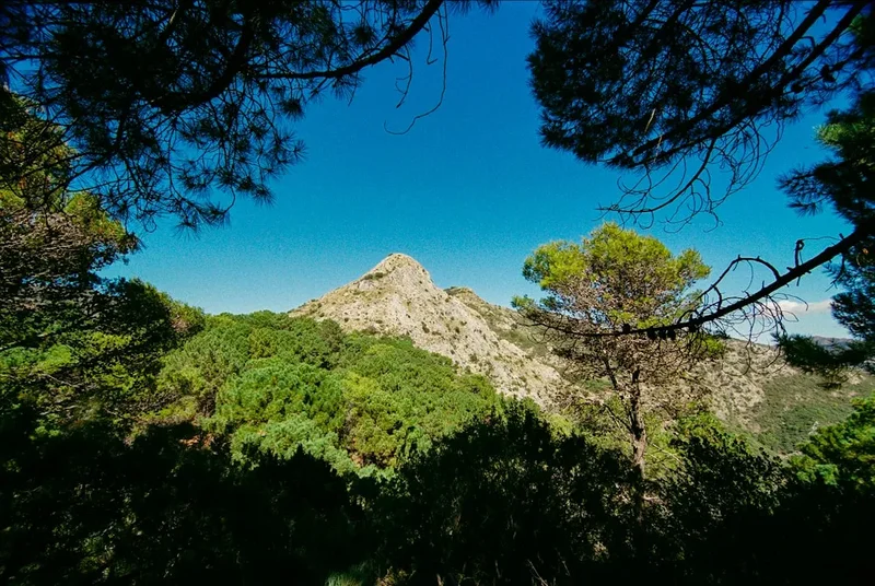
The Summit of Peñalara Peak: The ultimate point of interest, offering unparalleled 360-degree views. The summit itself is a rocky plateau, and the highest point is marked by a cairn. The sense of accomplishment upon reaching the peak, combined with the expansive vistas, makes it a memorable experience.
The Glacial Cirque: The entire area around Laguna Grande is a testament to past glaciation. The U-shaped valley, the moraines, and the lakes are all classic features of glacial erosion, providing a fascinating geological context for the hike.
Leave No Trace
The Guadarrama National Park is a precious natural environment, and it is vital that all visitors adhere to Leave No Trace principles to preserve its beauty and ecological integrity for future generations. As you hike to Peñalara Peak, remember the following:
- Plan Ahead and Prepare: Familiarise yourself with the trail, weather conditions, and any park regulations before you go. Pack appropriately for the conditions.
- Travel and Camp on Durable Surfaces: Stick to marked trails to avoid damaging fragile vegetation. The alpine meadows and rocky slopes are sensitive ecosystems. Avoid creating new paths.
- Dispose of Waste Properly: Pack out everything you pack in, including all food scraps, wrappers, and any other litter. Use designated bins where available, but be prepared to carry all waste back with you.
- Leave What You Find: Do not take rocks, plants, or any other natural objects from the park. Leave them for others to enjoy and for the ecosystem to thrive.
- Minimise Campfire Impacts: Campfires are generally prohibited in the Guadarrama National Park. If permitted in specific areas (which is unlikely for this day hike), use established fire rings and ensure fires are completely extinguished.
- Respect Wildlife: Observe wildlife from a distance and never feed them. Feeding animals can disrupt their natural behaviours and diets, and can be harmful to their health.
- Be Considerate of Other Visitors: Keep noise levels down, yield to other hikers on narrow sections of the trail, and be mindful of others' enjoyment of the natural environment.
By following these principles, you help ensure that the stunning landscapes of the Sierra de Guadarrama remain pristine and enjoyable for everyone.