Padjelantaleden Trail - The Higher Land of Swedish Lapland
The Padjelantaleden, or Padjelanta Trail, is one of Sweden’s most spectacular long-distance trekking routes, traversing the heart of the Padjelanta National Park within the UNESCO World Heritage site of Laponia. Stretching approximately 140 kilometres between the mountain stations of Ritsem in the north and Kvikkjokk in the south, this trail offers a profound immersion into the Arctic wilderness. Unlike the more rugged and jagged peaks of neighbouring Sarek National Park, Padjelanta—meaning "The Higher Land" in Lule Sami—is characterised by vast, rolling plateaus, expansive alpine meadows, and some of the largest and most beautiful lakes in Scandinavia. It is a landscape of immense scale and quiet majesty, where the horizon feels infinite and the influence of the indigenous Sami people is woven into the very fabric of the land.
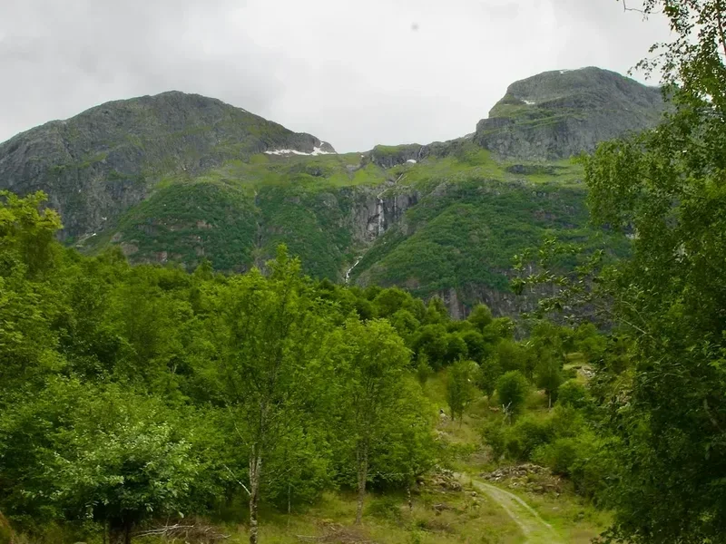
The trail is widely regarded as a "gentle" alternative to the Kungsleden (King's Trail), yet it remains a serious undertaking requiring physical stamina and self-sufficiency. Hikers journey through a region that has been used for reindeer husbandry for millennia, passing through active Sami summer villages where traditional ways of life continue to thrive. The route skirts the edges of the massive lakes Vastenjávrre and Virihávrre—the latter often described as the most beautiful lake in Sweden—offering views of the snow-capped peaks of Sarek to the east and the Norwegian mountains to the west. With a well-developed system of mountain huts managed by both the Swedish Tourist Association (STF) and the local Sami organisation Badjelánnda Laponia Turism (BLT), the Padjelantaleden provides a unique balance of wilderness immersion and accessible infrastructure.
- Distance: 140.0 km one-way
- Duration: 7–10 days
- Season: July to September (peak season for hut availability and weather)
- Huts: Akka, Kisuris, Låddejåhkå, Arasluokta, Staloluokta, Duottar, Tarraluoppal, Sommarlappa, Tarrekaise, Njunjes
- Highest point: Near the Duottar Huts (approx. 900 m)
- Difficulty: Moderate (well-marked, but long distances and remote)
- Direction: Can be walked in either direction; Ritsem to Kvikkjokk is the most common route
Overview
The Padjelantaleden is a journey through a landscape defined by its openness. While many mountain trails in Sweden follow deep, narrow valleys, the Padjelantaleden stays high on the plateau for much of its duration. This provides hikers with constant, panoramic views that are rare in other parts of the Swedish fells. The trail is part of the Laponia World Heritage area, a designation that recognises both the unique natural values of the region and the living cultural heritage of the Sami people. Walking here is as much a cultural experience as it is a physical one; you will pass through "vistas" (Sami settlements) such as Arasluokta and Staloluokta, where you can often purchase traditional smoked fish (glödkaka) or dried reindeer meat.
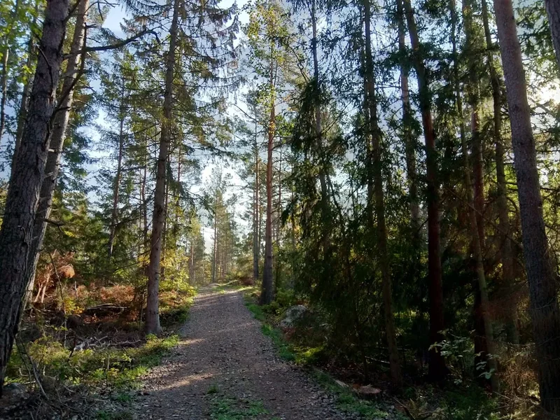
The terrain is predominantly composed of easy-to-walk alpine heath, though there are sections of birch forest at the northern and southern ends. The elevation gain is relatively modest at 1,500 metres over the entire 140 kilometres, meaning there are few punishingly steep climbs. However, the sheer distance and the exposure to Arctic weather conditions mean that hikers must be prepared for all eventualities. In July, the meadows are a riot of colour, filled with rare alpine flora like the Lapland Rosebay and various orchids, while the "midnight sun" provides 24-hour daylight. By September, the landscape transforms into a tapestry of gold and crimson as the autumn colours (höstfärger) take hold, and the first dusting of snow often touches the higher peaks.
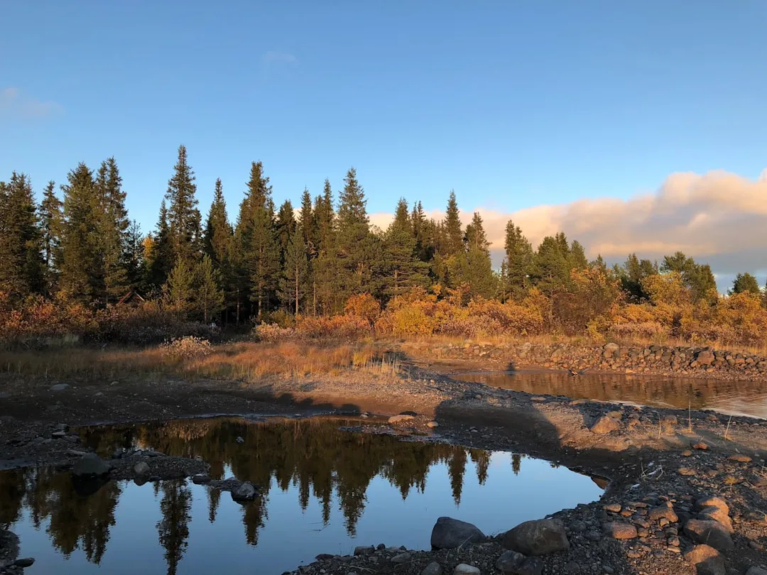
One of the defining features of the Padjelantaleden is the water. The trail follows the shores of Lake Virihávrre, a massive body of water that sits at 580 metres above sea level. Its turquoise waters, fed by glacial silt, contrast sharply with the dark, brooding mountains of Sarek that loom on the eastern horizon. The trail also crosses numerous rivers, most of which are equipped with sturdy bridges, making it a safer option than the bridge-less interior of Sarek. For those seeking a sense of true Arctic vastness without the technical demands of mountaineering, the Padjelantaleden offers an unparalleled experience of the Swedish north.
History and Cultural Context
The history of Padjelanta is inseparable from the history of the Sami people, specifically the Lule Sami communities of Tuorpon, Jåhkågaska, and Sirges. For thousands of years, this "higher land" has served as vital summer grazing grounds for reindeer. The archaeological record is rich with traces of ancient hearths, storage pits, and "stalos" (foundations of old dwellings), indicating a continuous human presence that predates the formal establishment of the Swedish state. The trail itself often follows ancient migratory routes used by the Sami to move their herds from the winter forests in the east to the lush summer pastures of the high plateau.
Padjelanta National Park was established in 1962, making it the largest national park in Sweden at the time (covering approximately 1,984 square kilometres). Its creation was a landmark in Swedish conservation, aimed at preserving a large, continuous mountain landscape in its natural state. In 1996, the park became part of the Laponia World Heritage site, a move that formally acknowledged the importance of the Sami cultural landscape. Unlike many other national parks where human activity is strictly limited, Padjelanta is a "living" park where traditional reindeer husbandry is not only permitted but is a fundamental part of the ecosystem's management.
The development of the hiking trail and the hut system was a collaborative effort. While the Swedish Tourist Association (STF) manages the huts at the northern and southern trailheads (Akka, Tarrekaise, Njunjes), the central huts within the park boundaries are managed by Badjelánnda Laponia Turism (BLT), an organisation run by the local Sami communities. This management structure ensures that the economic benefits of tourism support the local indigenous population and that the trail is maintained in a way that respects the needs of the reindeer herds. When walking the trail, hikers are guests in a working landscape, and the history of the region is felt in every encounter with a Sami herder or a traditional sod-covered "kåta" (hut).
Want more background? Read extended notes on history and cultural context → Learn more about Laponia
Seasonal Highlights and Weather Reality
The hiking season on the Padjelantaleden is relatively short, typically running from late June to mid-September. Outside of this window, the trail is covered in snow, and the huts are either closed or operating in a very limited winter capacity. Weather in the Swedish Arctic is notoriously unpredictable; even in the height of summer, temperatures can drop toward zero Celsius, and snow is possible in any month.
Early Summer (Late June to mid-July): This is the time of the midnight sun. The daylight is constant, allowing for flexible hiking schedules. However, this is also the peak season for mosquitoes and midges, which can be intense on the lower, forested sections of the trail. Snow patches may still linger on the higher passes, and river levels can be high due to the spring melt. The flora is at its most vibrant during this period.
High Summer (Late July to mid-August): Generally the most stable weather period. The insect population begins to dwindle as the nights get slightly cooler. This is the most popular time to hike, and the huts will be at their busiest. The water in the lakes is at its warmest (though still bracing), and the trail is usually dry and easy to navigate.
Autumn (Late August to mid-September): Many experienced hikers consider this the best time to visit. The "ruska" (autumn colours) turns the tundra into a spectacular display of reds and oranges. The mosquitoes are gone, and the air is crisp and clear. This is also the time when the Northern Lights (Aurora Borealis) begin to appear as the nights grow dark enough. However, the weather becomes more volatile, with a higher chance of storms and early snowfall. Most huts close by the third week of September.
Winter (October to May): The trail is a serious winter expedition route for ski touring. It requires advanced navigation skills, winter camping gear, and the ability to handle extreme cold. Only the STF huts have winter rooms available, and the BLT huts are generally closed. This is not recommended for recreational hikers.
Recommended Itinerary
10-Day Padjelantaleden Itinerary (Ritsem to Kvikkjokk)
Day 1: Ritsem to Akka and Kisuris Huts
- Distance: 14 km (after boat crossing)
- Elevation gain: 200 m
- Time: 4–5 hours
- Take the morning boat from Ritsem across Lake Áhkkájávrre to the Änonjalme pier.
- Walk through birch forest with stunning views of the Akka massif, known as the "Queen of Lapland."
- Cross the bridge over the mighty Vuojatädno river.
- Arrive at Kisuris Huts, located at the boundary of Padjelanta, Sarek, and Stora Sjöfallet National Parks.
- The terrain is relatively flat and serves as a perfect introduction to the region.
Day 2: Kisuris to Låddejåhkå Huts
- Distance: 23 km
- Elevation gain: 300 m
- Time: 7–8 hours
- A long day across open alpine heath.
- The trail climbs gently onto the plateau, offering expansive views of the surrounding peaks.
- Pass several small lakes and streams (all bridged).
- Arrive at Låddejåhkå, situated by a beautiful river with views toward Lake Vastenjávrre.
- This section is known for its birdlife, including the Long-tailed Skua and Golden Plover.
Day 3: Låddejåhkå to Arasluokta Huts
- Distance: 13 km
- Elevation gain: 250 m
- Time: 4–5 hours
- A shorter day allowing for rest and photography.
- The trail follows the eastern shore of Lake Vastenjávrre.
- Climb over a ridge to reveal the first views of Lake Virihávrre.
- Arrive at Arasluokta, a Sami summer village.
- Opportunity to buy fresh fish or traditional bread from the local Sami residents.
Day 4: Arasluokta to Staloluokta Huts
- Distance: 12 km
- Elevation gain: 150 m
- Time: 3–4 hours
- One of the most scenic stretches of the trail.
- The path winds along the hillsides overlooking Lake Virihávrre.
- Arrive at Staloluokta, the "capital" of Padjelanta.
- Staloluokta features a unique wooden church (kåta-style) and a small shop.
- This is a great place to take a "zero day" or a half-day rest to enjoy the lake.
Day 5: Staloluokta to Duottar Huts
- Distance: 18 km
- Elevation gain: 400 m
- Time: 6–7 hours
- The trail leaves the lakes behind and climbs toward the highest point of the route.
- The landscape becomes more barren and Arctic in character.
- Pass through a series of rocky valleys and small alpine tarns.
- Arrive at Duottar, the most remote and highest hut on the trail, surrounded by dramatic peaks.
Day 6: Duottar to Tarraluoppal Huts
- Distance: 11 km
- Elevation gain: 50 m (mostly descent)
- Time: 3–4 hours
- A short but beautiful descent from the high plateau.
- The trail follows a chain of lakes that form the headwaters of the Tarra River.
- Views open up toward the steep walls of the Tarradalen valley.
- Arrive at Tarraluoppal, situated at the threshold between the high tundra and the lush valley below.
Day 7: Tarraluoppal to Sommarlappa Hut
- Distance: 13 km
- Elevation loss: 300 m
- Time: 4–5 hours
- The trail enters the Tarradalen valley, and the vegetation becomes noticeably lusher.
- Walk through meadows of tall wildflowers and willow thickets.
- The descent is gradual and follows the growing Tarra River.
- Arrive at Sommarlappa, a charming hut located in a small birch grove by the river.
Day 8: Sommarlappa to Tarrekaise Hut
- Distance: 13 km
- Elevation loss: 100 m
- Time: 4–5 hours
- Continue down the Tarradalen valley.
- The trail passes beneath the massive cliffs of Tarrekaise mountain.
- The forest thickens, and the walking is easy on well-maintained paths.
- Arrive at Tarrekaise Hut, located near the shore of Lake Tarraure.
Day 9: Tarrekaise to Njunjes Hut
- Distance: 7 km
- Elevation loss: 100 m
- Time: 2–3 hours
- A very short day, often combined with the final leg to Kvikkjokk by faster hikers.
- The trail follows the river through beautiful old-growth birch and pine forest.
- Arrive at Njunjes, situated on a rocky outcrop with views of the river rapids.
Day 10: Njunjes to Kvikkjokk
- Distance: 16 km
- Elevation loss: 150 m
- Time: 5–6 hours
- The final stretch through the forest toward the village of Kvikkjokk.
- The trail becomes wider and more travelled.
- The last few kilometres involve a boat transfer or a walk to the Kvikkjokk Mountain Station.
- Celebrate the completion of the 140 km journey with a sauna and a meal at the station.
Planning and Bookings
Book Your Trip
Everything you need to plan your journey
Accommodation
Find places to stay near Jokkmokk
Flights
Search flights to Jokkmokk
Essential Preparation
Planning for the Padjelantaleden requires careful attention to transport logistics, as both ends of the trail are remote. The northern trailhead is at Ritsem, which is reached by bus from Gällivare or Jokkmokk. The southern trailhead is at Kvikkjokk, reached by bus from Jokkmokk. Because the trail is a point-to-point thru-hike, most hikers use public transport to avoid the need for a vehicle shuttle. It is essential to check the bus schedules (operated by Länstrafiken Norrbotten) and the boat schedules for the crossing at Ritsem and the final approach to Kvikkjokk.
Physical fitness is important; while the trail is not technically difficult, walking 15–23 kilometres a day with a multi-day pack is demanding. Hikers should be comfortable with basic navigation, although the trail is well-marked with orange paint on trees and stone cairns (rösen) on the open tundra. Jokkmokk is the nearest major town and serves as an excellent base for last-minute supplies and cultural immersion at the Ájtte Sami Museum.
Trail Accommodation
Accommodation on the Padjelantaleden is a mix of STF (Swedish Tourist Association) huts and BLT (Badjelánnda Laponia Turism) huts. This distinction is important for booking and payment.
Hut Types and Facilities:
- STF Huts (Akka, Tarrekaise, Njunjes, Kvikkjokk): These can be pre-booked and pre-paid online. They usually have a host (stugvärd), a small shop with basic supplies, and a sauna (at Akka and Kvikkjokk). Facilities include bunk beds with mattresses, pillows, and blankets (liner or sleeping bag required), shared kitchens with gas stoves, and composting toilets.
- BLT Huts (Kisuris, Låddejåhkå, Arasluokta, Staloluokta, Duottar, Tarraluoppal, Sommarlappa): These are managed by the Sami communities. They are generally simpler but very well-maintained. They cannot always be pre-booked in the same way as STF huts; usually, you pay on-site (card or cash, though card is increasingly common). They offer similar bunk and kitchen facilities.
- Camping: You are permitted to camp almost anywhere in the national park under the Swedish "Allemansrätten" (Right of Public Access), but you must follow specific rules within the park boundaries (e.g., camping near huts is encouraged to minimise impact). If camping near a hut and using their facilities (kitchen/toilets), a small service fee is usually required.
Required Gear
- Trekking Boots: Waterproof and well-broken-in. The trail can be muddy and involves crossing small streams.
- Backpack: 50–70 litres depending on whether you are camping or staying in huts.
- Clothing Layers: Merino wool base layers, a fleece or down mid-layer, and a high-quality waterproof shell (jacket and trousers). The weather can change from 20°C to 2°C in an hour.
- Navigation: Lantmäteriet mountain map (BD10 or equivalent) and a compass. While the trail is marked, fog can reduce visibility to a few metres on the plateau.
- Sleeping Gear: A lightweight sleeping bag or a silk/cotton liner if staying exclusively in huts.
- Insect Protection: A head net and high-strength repellent (essential in July).
- First Aid: Blister kits (Compeed), antiseptic, and any personal medications.
What to Bring
- Food: While some huts (Staloluokta, Akka, Kvikkjokk) sell basic dried food and cans, you should carry the majority of your meals. Focus on lightweight, high-calorie dehydrated options.
- Water Treatment: Generally, the water in the fast-flowing mountain streams is safe to drink without treatment. However, a lightweight filter (like a Sawyer Squeeze) is recommended if you have a sensitive stomach or are collecting water near settlements.
- Stove and Fuel: If camping, a lightweight gas or multi-fuel stove is required. If staying in huts, gas is provided in the kitchens.
- Sun Protection: Sunglasses and sunscreen. The Arctic sun is surprisingly strong, especially with 24-hour daylight and reflection from snow patches.
- Power: A power bank for charging phones/cameras. There is no electricity in the huts.
- Cash/Card: A mix of both. Most huts now take cards, but the connection can be spotty, so having Swedish Krona (SEK) as a backup is wise.
Permits
One of the great appeals of hiking in Sweden is the lack of a formal permit system for walking. Under the "Allemansrätten" (Right of Public Access), you are free to hike and camp in the wilderness. However, because the Padjelantaleden passes through a National Park and a World Heritage site, there are specific regulations you must follow to protect the environment and the Sami cultural heritage.
National Park Regulations:
- No drones are allowed within the National Park boundaries.
- Dogs must be kept on a leash at all times (and are only allowed during specific periods—check current NP rules).
- Fishing requires a specific permit (Fiskekort), which can be purchased in Jokkmokk or sometimes at the Staloluokta hut. Fishing without a permit is strictly prohibited.
- You must not disturb the reindeer. If you encounter a herd, stop and wait for them to pass or give them a very wide berth.
- Building fires is generally prohibited within the National Park except at designated sites near the huts.
Hut Payments: While not a "permit," staying in the huts requires payment. For STF huts, it is significantly cheaper if you are a member of STF or an affiliated Hostelling International (HI) organisation. Membership can be purchased online in advance and usually pays for itself within three nights.
Other Activities in the Area
The region surrounding the Padjelantaleden is a hub for Arctic adventure and Sami culture. Consider these additions to your trip:
- Ájtte Museum (Jokkmokk): The principal museum for Sami culture and mountain ecology in Sweden. It is an essential stop to understand the context of the land you are walking through.
- Sarek National Park: For experienced hikers, Sarek offers a true "off-trail" wilderness experience. Many people combine a section of the Padjelantaleden with a foray into the valleys of Sarek.
- Helicopter Tours: During the summer, regular helicopter flights operate between Kvikkjokk, Staloluokta, and Ritsem. This is used by the Sami for transport but is also available to hikers who wish to see the landscape from above or shorten their journey.
- Fishing: The lakes and rivers of Padjelanta are world-class for Arctic Char and Brown Trout. Ensure you have the correct permits.
- Boat Tours in Kvikkjokk: Explore the unique inland delta where the Tarra and Kamajåhkå rivers meet. Local guides offer tours that explain the unique flora and birdlife of the delta.
Safety and Conditions
The Padjelantaleden is remote. Once you are in the middle of the park (around Staloluokta), you are several days' walk from the nearest road. This isolation requires a high degree of self-reliance.
Weather Extremes: The most significant danger is hypothermia caused by a combination of wind, rain, and low temperatures. Even in summer, a storm can bring temperatures down to near freezing. Always have your waterproofs and a warm layer easily accessible in your pack. If the weather turns truly foul on the high plateau, it is often safer to pitch your tent and wait it out rather than pushing on into the wind.
Navigation: The trail is well-marked, but in heavy mist or "whiteout" conditions (which can happen even in summer with low clouds), it is easy to lose the path. You must be proficient with a map and compass. GPS is a useful backup, but batteries fail in the cold, and signal can be blocked by deep valleys.
River Crossings: Most major rivers on the Padjelantaleden are bridged. However, smaller streams can swell significantly after heavy rain. Never attempt to cross a fast-flowing river that is above knee-height. Look for wider, shallower sections or wait for the water level to drop (which often happens overnight as the melt slows).
Communication: Mobile phone coverage is non-existent for most of the trail. STF and BLT huts are equipped with emergency satellite phones or radios, but these are for life-threatening emergencies only. Carrying a Personal Locator Beacon (PLB) or a satellite messenger (like a Garmin inReach) is highly recommended for solo hikers or those venturing off-trail.
Side Trips and Points of Interest
Lake Virihávrre: Often called "the most beautiful lake in Sweden," Virihávrre is the heart of Padjelanta. Spend time at the shore in Staloluokta. The water is incredibly clear, and the surrounding peaks of Sarek provide a dramatic backdrop. The light here at midnight in July is ethereal.
Staloluokta Church: A beautiful, simple church built in the style of a traditional Sami kåta. It is a place of quiet reflection and represents the blending of Sami traditions with Swedish history.
Sallohaure: A slight detour from the main trail near the Kisuris huts leads toward the Sallohaure Sami village. The views of the Sallohaure lake and the mountains toward the Norwegian border are spectacular and see far fewer hikers than the main route.
The View from Duottar: The area around the Duottar huts is the highest point of the trail. If you have a clear evening, climb one of the small hills near the hut for a 360-degree view of the Padjelanta plateau and the jagged interior of Sarek. It is one of the best places to appreciate the "Higher Land" name.
Leave No Trace

The Arctic environment is extremely fragile. The growing season is short, and damage to the tundra can take decades to heal. As a visitor to Laponia, you have a responsibility to minimise your impact.
- Waste: Pack out everything you pack in. This includes fruit peels and nut shells, which do not decompose quickly in the cold climate. Use the toilets at the huts whenever possible. If you must go in the wild, bury waste at least 15 centimetres deep and 50 metres from water.
- Reindeer: This is a working landscape. Reindeer are easily stressed, especially during the calving season (May/June) and the autumn rut. If you see reindeer, keep your distance and keep dogs on a leash.
- Vegetation: Stick to the trail to avoid creating multiple paths (braiding), which leads to erosion. Avoid stepping on fragile mosses and lichens where possible.
- Water: Do not use soap or detergent directly in the streams or lakes. Even biodegradable soap requires soil to break down. Carry water 30 metres away from the source for washing.