Northumberland Coast Path - A Journey Through the Kingdom of Northumbria
The Northumberland Coast Path is a spectacular 103-kilometre long-distance trail that traces the rugged, hauntingly beautiful coastline of North East England. Stretching from the village of Cresswell in the south to the historic border town of Berwick-upon-Tweed in the north, this route traverses an Area of Outstanding Natural Beauty (AONB) that remains one of the UK’s best-kept secrets. Unlike the more crowded coastal paths of southern England, the Northumberland Coast Path offers a profound sense of space, defined by vast sandy beaches, rolling dunes, and dramatic rocky headlands. It is a landscape where the elements rule, where the North Sea crashes against ancient dolerite cliffs, and where the horizon seems to stretch into infinity.
This is not merely a walk through nature; it is a journey through the "Cradle of Christianity" and the heart of the ancient Kingdom of Northumbria. The trail is punctuated by some of the most iconic and formidable fortresses in the British Isles, including the towering ramparts of Bamburgh Castle, the haunting ruins of Dunstanburgh, and the medieval majesty of Warkworth. Walkers will find themselves following in the footsteps of saints, Vikings, and medieval knights, all while surrounded by a thriving ecosystem of rare seabirds, grey seals, and unique coastal flora. Whether you are seeking a physical challenge, a historical pilgrimage, or a quiet escape into the wild, the Northumberland Coast Path delivers an experience that is as culturally rich as it is visually stunning.
- Distance: 103 kilometres one-way
- Duration: 6–7 days
- Season: May to September (best weather and longest daylight hours)
- Accommodation: Coastal inns, bed and breakfasts, and campsites
- Highest point: Approximately 65 metres (near Cullernose Point)
- Difficulty: Moderate (mostly flat terrain with some sandy and rocky sections)
- Direction: South to north (recommended to keep the prevailing wind at your back)
Overview
The Northumberland Coast Path is a masterclass in coastal diversity. While the total elevation gain of 914 metres over 103 kilometres suggests a relatively flat journey, the terrain is far from monotonous. The route transitions seamlessly from the wide, sweeping bays of Druridge and Embleton to the intricate rocky inlets of Boulmer and Craster. One of the defining characteristics of the path is the "Whin Sill," a prominent geological feature of hard igneous rock that forms the dramatic cliffs upon which the region’s famous castles are perched. This volcanic foundation provides a rugged backbone to the trail, offering elevated vantage points that look out across the Farne Islands and the North Sea.
The pacing of the walk is naturally dictated by the rhythm of the tides and the placement of historic villages. Most walkers complete the journey in six days, allowing ample time to explore the various points of interest along the way. The southern section, beginning at Cresswell, is characterised by long stretches of sandy beach and the industrial heritage of the former coal-mining communities. As you move north, the landscape becomes increasingly wild and dramatic. The central section features the picturesque fishing villages of Alnmouth and Craster, famous for its oak-smoked kippers, while the northern reaches are dominated by the massive presence of Bamburgh Castle and the mystical Holy Island of Lindisfarne.
Wildlife is a constant companion on this trail. The Farne Islands, visible from much of the northern half of the path, are home to one of the UK's most significant grey seal colonies and over 150,000 pairs of breeding seabirds, including puffins, guillemots, and Arctic terns. In the autumn, the dunes become a haven for migratory birds, while the rock pools at low tide reveal a miniature world of marine life. The path is well-marked with the acorn symbol of the National Trails (as it forms part of the England Coast Path), making navigation straightforward, though the ever-changing coastal weather requires walkers to be prepared for all conditions.
Perhaps the most unique aspect of the Northumberland Coast Path is the crossing to Holy Island. Accessible only via a paved causeway that is submerged twice daily by the North Sea, the island requires careful planning and a deep respect for the power of the tides. Reaching the end of the trail in Berwick-upon-Tweed, a town that changed hands between England and Scotland thirteen times, provides a fittingly historic conclusion to a walk that feels like a journey through time itself.
History and Cultural Context
The history of the Northumberland coast is a turbulent saga of invasion, religious devotion, and industrial evolution. Long before the first stones of its famous castles were laid, this coastline was a strategic frontier. During the Roman occupation of Britain, the area north of Hadrian’s Wall was a frontier zone, and while the wall itself lies further south, the coastal waters were vital for Roman maritime logistics. However, it was during the Anglo-Saxon period that Northumberland truly rose to prominence as the heart of the Kingdom of Northumbria, which at its height stretched from the Humber to the Firth of Forth.
In 635 AD, King Oswald invited Saint Aidan from Iona to establish a monastery on Lindisfarne (Holy Island). This became the epicentre of the "Golden Age of Northumbria," a period of immense cultural and religious flourishing that produced the Lindisfarne Gospels, one of the world's most beautiful illuminated manuscripts. The peace was shattered in 793 AD when Viking raiders descended upon Lindisfarne, an event often cited as the beginning of the Viking Age in Europe. The threat of Norse invasion shaped the landscape for centuries, leading to the construction of the massive defensive structures that still dominate the skyline today.
The castles of Northumberland—Warkworth, Dunstanburgh, and Bamburgh—were not just homes for the nobility; they were essential bastions against Scottish incursions and internal rebellions. The Percy family, the powerful Earls of Northumberland, played a central role in these border conflicts, and their influence is still felt in the architecture and lore of the region. In later centuries, the coast transitioned from a theatre of war to a hub of industry. The southern part of the trail passes through areas once dominated by coal mining and salt production, while the fishing industry sustained villages like Craster and Seahouses for generations. Today, the path serves as a living museum, where the ruins of the past stand in silent vigil over a coastline that has returned to its natural, wild state.
Want more background? Read extended notes on history and cultural context → Learn more
Seasonal Highlights and Weather Reality
The Northumberland coast is exposed to the North Sea, meaning weather conditions can be highly variable regardless of the season. However, the experience of the trail changes significantly throughout the year, offering different rewards for those who brave the elements.
Spring (March to May): This is a season of awakening. The dunes are carpeted in wildflowers, including the rare Lindisfarne Helleborine and vibrant yellow gorse. Birdlife becomes increasingly active as migratory species return to the Farne Islands. While temperatures are cool (averaging 8°C to 12°C), the air is often crisp and clear, providing excellent visibility. May is particularly beautiful, as the days lengthen and the spring blooms are at their peak.
Summer (June to August): This is the most popular time to walk the path. The weather is generally at its warmest (15°C to 20°C), and the long daylight hours—with twilight lingering until 10:00 PM in June—allow for relaxed walking days. This is the best time for wildlife enthusiasts, as the puffin colonies on the Farne Islands are at their most boisterous until late July. However, accommodation in the small coastal villages can book up months in advance, and the more popular sections near Bamburgh can feel busy.
Autumn (September to November): September is often considered the "sweet spot" for the trail. The summer crowds have dispersed, the weather is frequently settled, and the autumn light creates a golden hue over the castles and dunes. In October and November, the coast becomes a dramatic place of crashing waves and migrating geese. This is also the time when grey seal pups are born on the Farne Islands, though boat trips become more weather-dependent.
Winter (December to February): Walking the path in winter is a serious undertaking. The North Sea winds can be biting, and daylight is limited to around seven hours. Many local amenities, including some cafes and museums, close for the season. However, for the experienced walker, winter offers a stark, solitary beauty. The frost-covered dunes and the sight of a snow-dusted Bamburgh Castle are unforgettable, provided you are equipped with high-quality thermal and waterproof gear.
Recommended Itinerary
6-Day Northumberland Coast Path Itinerary
Day 1: Cresswell to Warkworth
- Distance: 17 km
- Elevation gain: 80 m
- Time: 4–5 hours
- Start at the southern trailhead in Cresswell, marked by a stone monolith
- Walk along the vast sands of Druridge Bay, a 10-kilometre stretch of beach and dunes
- Pass through Druridge Bay Country Park, a haven for birdwatchers
- Navigate the small village of Amble, known as "the friendliest port"
- Follow the River Coquet inland to the medieval village of Warkworth
- Arrive at Warkworth, dominated by the magnificent Warkworth Castle and its unique hermitage
- The first day is relatively flat, providing an excellent introduction to beach walking
Day 2: Warkworth to Alnmouth
- Distance: 11 km
- Elevation gain: 60 m
- Time: 3–4 hours
- A shorter day allowing time to explore Warkworth Castle in the morning
- Follow the path along the estuary of the River Coquet
- Walk through the dunes of Alnmouth Bay, offering views of the colourful houses of Alnmouth
- Cross the Aln estuary (note: the footbridge is essential as the river is not fordable)
- Arrive in Alnmouth, a picturesque village once a major grain port, now famous for its golf course and art galleries
- The village offers excellent pubs and a wide, sandy beach perfect for an evening stroll
Day 3: Alnmouth to Seahouses
- Distance: 25 km
- Elevation gain: 210 m
- Time: 6–8 hours
- The "Castle Day" and the longest section of the trail
- Pass through the fishing village of Boulmer, one of the few remaining traditional coble fishing ports
- Reach Cullernose Point, where the Whin Sill basalt cliffs provide dramatic views
- Walk through the village of Craster; stop for a kipper bun at the famous Robson’s Smokehouse
- Traverse the grassy headland to the haunting ruins of Dunstanburgh Castle
- Continue along the sweeping sands of Embleton Bay, often voted the best beach in the UK
- Pass through Low Newton-by-the-Sea and Beadnell Bay
- Arrive in Seahouses, a bustling fishing port and the gateway to the Farne Islands
Day 4: Seahouses to Belford
- Distance: 18 km
- Elevation gain: 150 m
- Time: 5–6 hours
- Walk from Seahouses to the village of Bamburgh
- Experience the awe-inspiring sight of Bamburgh Castle rising 45 metres above the beach
- Explore the village of Bamburgh, the burial place of Victorian heroine Grace Darling
- The path turns slightly inland, offering a change of scenery through farmland and quiet lanes
- Climb towards the Kyloe Hills for panoramic views back towards the coast and the Farne Islands
- Arrive in the historic coaching town of Belford, situated on the old Great North Road
- This section provides a break from the coastal winds and a different perspective on the Northumbrian landscape
Day 5: Belford to Fenwick (via Holy Island)
- Distance: 15 km (plus island exploration)
- Elevation gain: 120 m
- Time: 4–5 hours (highly dependent on tide times)
- Descend from Belford back towards the coast at Fenham Flats
- The highlight of the day is the crossing to Holy Island (Lindisfarne)
- IMPORTANT: You must check the safe crossing times for the causeway. Never attempt to cross outside these windows
- Walk the "Pilgrim’s Way," marked by wooden poles across the sand (only at low tide), or use the paved causeway
- Explore Lindisfarne Priory, Lindisfarne Castle, and the quaint island village
- Return to the mainland and continue to the small hamlet of Fenwick for the night
Day 6: Fenwick to Berwick-upon-Tweed
- Distance: 17 km
- Elevation gain: 140 m
- Time: 4–5 hours
- The final stretch follows the dramatic cliff tops of the northern Northumberland coast
- Pass through the Lindisfarne National Nature Reserve, home to thousands of overwintering birds
- Walk along the rugged cliffs at Cheswick Sands and Cocklawburn Beach
- Enjoy the first views of the Elizabethan walls of Berwick-upon-Tweed
- Cross the Royal Border Bridge or the Old Bridge into the town centre
- Finish the trail at the Berwick-upon-Tweed Town Hall
- Celebrate the completion of the 103-kilometre journey in this historic border town
Important Notes:
- Tide times are the most critical factor for Day 5; plan your entire trip around the Holy Island crossing
- The path is generally well-signed with the acorn symbol, but a map is recommended for inland sections
- Public transport (the X18 "Coast & Castles" bus) runs parallel to much of the route, allowing for flexible stage lengths
- Water sources are available in every village, but carry at least 2 litres for the longer stretches
- The prevailing wind is from the south-west; walking south to north usually keeps the wind at your back
Planning and Bookings
Book Your Trip
Everything you need to plan your journey
Accommodation
Find places to stay near Newcastle upon Tyne
Flights
Search flights to Newcastle upon Tyne
Essential Preparation
The Northumberland Coast Path requires a moderate level of fitness. While the terrain is not mountainous, walking 15–25 kilometres a day for six consecutive days, often on soft sand or uneven grass, can be taxing on the legs and feet. It is highly recommended to undertake several training walks of at least 15 kilometres in the boots you intend to wear for the trip.
Logistically, the trail is well-supported. The nearest major city is Newcastle upon Tyne, which has an international airport and excellent rail links to the rest of the UK. From Newcastle, you can take a local train to Morpeth or Alnmouth, and then a bus to the start at Cresswell. Alternatively, many walkers leave their car in Berwick-upon-Tweed (the finish) and take the X18 bus or a train/bus combination back to the start. Booking accommodation in advance is essential, particularly during the peak months of July and August, as the coastal villages are small and popular with holidaymakers.
Trail Accommodation
Accommodation along the Northumberland Coast Path is varied, ranging from historic coaching inns and boutique bed and breakfasts to functional campsites and youth hostels. There are no "huts" in the New Zealand or Alpine sense; instead, you will be staying in local communities.
Types of Accommodation:
- Inns and Pubs: The most traditional option. Places like the Ship Inn in Low Newton or the Lord Crewe Arms in Bamburgh offer high-quality rooms and excellent local food. Expect to pay £80–£150 per night for a double room including breakfast.
- Bed and Breakfasts (B&Bs): Plentiful in villages like Alnmouth, Seahouses, and Berwick. These offer a more personal experience and are the backbone of UK trail walking. Costs typically range from £70–£110 per night.
- Campsites: There are several well-equipped campsites near the route, such as at Druridge Bay, Beadnell, and Seahouses. Most offer showers, toilets, and sometimes small shops. Wild camping is not legally permitted in England without the landowner's permission, and given the sensitive nature of the AONB, it is discouraged.
- Hostels: There is a YHA hostel in Berwick-upon-Tweed and independent bunkhouses in places like Alnwick (slightly off-trail) and Fenwick.
Booking Requirements:
- Summer weekends and bank holidays book up 4–6 months in advance.
- Many B&Bs have a two-night minimum stay policy during peak season; however, many are willing to waive this for walkers if they have a gap in their calendar.
- Luggage transfer services (such as Carrylite) are available and highly recommended if you prefer to walk with only a daypack. They will move your main bag from one accommodation to the next for a daily fee.
Required Gear
- Walking Boots: Waterproof and well-broken-in. While some sections are on sand, the rocky headlands and muddy farm tracks require good ankle support and grip.
- Waterproof Jacket: Essential. The North Sea weather can change in minutes. A high-quality breathable shell (Gore-Tex or similar) is required.
- Waterproof Overtrousers: Do not skip these. Horizontal rain is a common occurrence on the Northumberland coast.
- Socks: High-quality wool-blend trekking socks (e.g., Merino) to prevent blisters and manage moisture.
- Backpack: A 25–35L daypack if using a luggage transfer service, or a 50–65L pack if carrying all your gear. Ensure it has a waterproof rain cover.
- Navigation: OS Explorer Maps (325, 332, and 340) or a dedicated GPS device/app with offline maps. The trail is well-marked, but sea mist (locally known as "haar") can reduce visibility to a few metres.
- First Aid Kit: Focus on blister care (Compeed), antiseptic wipes, and basic pain relief.
What to Bring
- Layered Clothing: The "onion" principle is best. A moisture-wicking base layer, an insulating mid-layer (fleece or light down), and your waterproof shell. Avoid cotton, which stays cold and heavy when wet.
- Sun Protection: Even on overcast days, the reflection from the sea and sand can cause sunburn. Bring SPF 30+ sunscreen, a hat, and sunglasses.
- Water Treatment: Not strictly necessary as tap water in the UK is safe to drink, but a reusable 2-litre water bottle or bladder is essential.
- Food and Snacks: While there are cafes and pubs in most villages, some sections (like Druridge Bay or the stretch north of Fenwick) have no facilities for several hours. Carry high-energy snacks like nuts, dried fruit, or chocolate.
- Tide Tables: A printed copy of the Holy Island crossing times is non-negotiable if you plan to visit the island.
- Power Bank: To keep your phone/GPS charged, especially if using navigation apps.
- Cash: While most places take cards, some smaller tea rooms or honesty stalls in villages may still prefer cash.
Permits
One of the great joys of the Northumberland Coast Path is its accessibility. No permits or fees are required to walk the trail itself. The path makes use of public rights of way, which are legally protected routes across both public and private land. However, there are a few logistical "permits" and costs to consider for a smooth journey.
Holy Island Causeway: While there is no permit required to cross to Holy Island, you are strictly bound by the tide. The causeway is managed by the local council, and they publish safe crossing times. Attempting to cross outside these times is not only illegal (in terms of endangering emergency services) but life-threatening. If you are walking the "Pilgrim’s Way" (the poles across the sand), you should ideally start your crossing at the very beginning of the safe window to ensure you have enough time to reach the island before the tide returns.
Castle and Priory Entry: If you wish to explore the interiors of the historic sites along the way, there are entry fees.
- Bamburgh Castle: Approximately £17.00 per adult.
- Dunstanburgh Castle: Managed by English Heritage; approximately £7.00 (free for members).
- Warkworth Castle: Managed by English Heritage; approximately £9.00 (free for members).
- Lindisfarne Priory: Managed by English Heritage; approximately £10.00 (free for members).
Parking: If you are driving to the start, parking in Cresswell is limited. There is a small car park at the beach, but for long-term parking, it is better to use the long-stay facilities in Berwick-upon-Tweed and take public transport to the start. Berwick has several long-stay car parks near the railway station that are relatively affordable for a week-long stay.
Other Activities in the Area
The Northumberland coast offers a wealth of experiences beyond the walking trail. If you have extra time, consider these additions to your itinerary:
- Farne Islands Boat Trips: Departing from Seahouses, these trips are essential for wildlife lovers. You can take a "grey seal cruise" or a landing trip to Inner Farne or Staple Island (seasonal) to see puffins, terns, and kittiwakes at close range.
- Alnwick Castle and Garden: Located just a few kilometres inland from Alnmouth, Alnwick Castle is the seat of the Duke of Northumberland and was a filming location for the Harry Potter films (as Hogwarts). The adjacent Alnwick Garden features the famous Poison Garden and one of the world's largest treehouses.
- Barter Books, Alnwick: One of the largest second-hand bookstores in Europe, housed in a magnificent Victorian railway station. It is the birthplace of the "Keep Calm and Carry On" poster.
- Craster Kipper Experience: Visit L. Robson & Sons in Craster to see the traditional oak-smoking process that has been used for over 130 years. Tasting a fresh kipper bun overlooking the harbour is a Northumbrian rite of passage.
- Stargazing: Northumberland is home to the International Dark Sky Park. While the coast is not within the official park boundaries, the lack of light pollution in areas like Druridge Bay or Ross Back Sands offers incredible views of the Milky Way on clear nights.
- Surfing and Watersports: Beadnell Bay is a hub for kitesurfing, windsurfing, and sea kayaking. The gentle curve of the bay makes it one of the safest places on the coast for beginners.
Safety and Conditions
Tidal Safety: The single greatest hazard on the Northumberland Coast Path is the tide. This is particularly true for the crossing to Holy Island, but it also affects several beach sections. At Druridge Bay and Embleton Bay, the sand is wide, but at high tide, you may be forced into the soft dunes, which is much more tiring. Always carry a tide table and be aware that the North Sea tide can come in surprisingly quickly on flat sands.
Cliff Edges: The sections between Craster and Dunstanburgh, and north of Fenwick towards Berwick, involve walking along high cliffs. The path is generally set back from the edge, but erosion is a constant process. Stay on the marked path, keep dogs on leads, and be extremely cautious in high winds or sea mist (haar), which can obscure the edge.
Weather Extremes: While the UK doesn't experience extreme heat, the combination of wind and rain on an exposed coastline can lead to hypothermia, even in summer. Conversely, the lack of shade on the beaches means heat exhaustion is a risk on the rare hot, still days. Always carry sufficient water and high-quality waterproofs.
Livestock: Much of the path passes through working farmland. You will encounter sheep and cattle. Always close gates behind you. If walking with a dog, keep it on a short lead around livestock. If cattle approach you aggressively, the official advice is to let your dog off the lead so it can run away, and you should move calmly to the nearest exit.
Emergency Services: In the event of an emergency, dial 999 and ask for the Coastguard if you are on the shore or cliffs, or the Ambulance service if you are inland. Mobile signal is generally good along the coast, but there are "dead zones" in the dips between dunes and in the Kyloe Hills.
Side Trips and Points of Interest
The Pilgrim’s Way: For those with the correct tidal window and a sense of adventure, crossing to Holy Island via the Pilgrim’s Way is a profound experience. Instead of the tarmac road, you follow a line of vertical wooden poles across the saturated sand and mud flats. It is a 5-kilometre walk that requires you to go barefoot or wear overshoes, as the mud can be ankle-deep. Walking this ancient route, with the calls of curlews and the distant silhouette of Lindisfarne Castle, is often the highlight of the entire trip.
Dunstanburgh Castle: These 14th-century ruins are among the most atmospheric in England. Built by Earl Thomas of Lancaster as a statement of defiance against King Edward II, the castle was later a key site during the Wars of the Roses. The walk from Craster to the castle across the "Embleton Whinstone" is spectacular, especially at sunrise or sunset when the dark basalt rock glows against the sea.
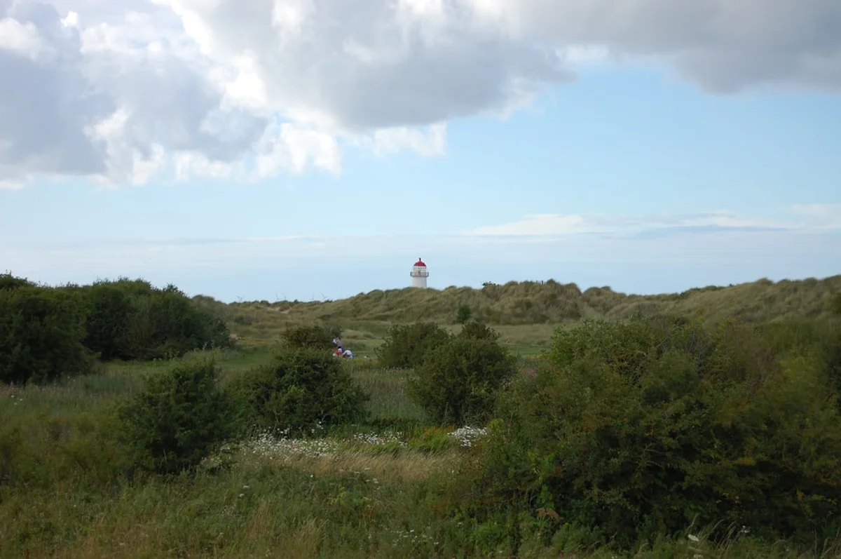
Grace Darling Memorial and Museum: In the village of Bamburgh, you can visit the memorial to Grace Darling, who in 1838 rowed out into a storm with her father to rescue survivors from the wrecked steamship Forfarshire. Her bravery made her a national hero, and the museum provides a moving insight into the Victorian life of a lighthouse keeper’s daughter.
The Royal Border Bridge: As you approach Berwick-upon-Tweed, you will see the magnificent 28-arch railway viaduct designed by Robert Stephenson. Opened by Queen Victoria in 1850, it is a masterpiece of Victorian engineering and provides a grand entrance to the town. Walking across the older, 17th-century stone bridge gives you the best views of the town’s fortifications and the river Tweed.
Ross Back Sands: For those seeking total solitude, a short detour north of Bamburgh leads to Ross Back Sands. This 5-kilometre stretch of pristine white sand is accessible only by a 20-minute walk through farmland, meaning it is almost always deserted. It offers the best views of Lindisfarne Castle from across the water.
Leave No Trace
The Northumberland coast is a fragile ecosystem. The dunes (locally called "links") are home to rare plants and ground-nesting birds, while the rocky shores are vital habitats for marine life. As a walker, you have a responsibility to protect this Area of Outstanding Natural Beauty for future generations.
Your responsibility as a walker:
- Pack out all litter: This includes organic waste like banana skins and orange peels, which take a long time to decompose in the salty coastal environment and can harm local wildlife.
- Protect the dunes: Stay on the marked paths through the dunes. The marram grass that holds the dunes together is easily damaged by trampling, leading to "blowouts" and erosion.
- Respect nesting birds: From March to August, many birds nest on the ground in the dunes or on the shingle beaches. Keep dogs on leads and avoid entering cordoned-off areas.
- No fires: The dunes are highly flammable, especially in summer. Never light fires or use disposable barbecues on the beach or in the dunes.
- Leave what you find: While it is tempting to collect shells or stones, leave them where they are to maintain the natural habitat. Never remove plants or wildflowers.
- Use official toilets: Public toilets are available in every village along the route. Use them to avoid polluting the sensitive coastal environment.
By following these principles, you ensure that the Northumberland Coast Path remains a wild and beautiful sanctuary. Take only pictures, leave only footprints.