
Mount Yotei Loop - Hokkaido's Majestic Volcano
The Mount Yotei Loop is a challenging yet immensely rewarding multi-day trek encircling the iconic stratovolcano of Mount Yotei in Hokkaido, Japan. Often referred to as the "Fuji of Ezo" due to its striking resemblance to Japan's most sacred peak, Mount Yotei offers a diverse hiking experience, from lush forests and alpine meadows to the stark, volcanic terrain near its summit. This loop trail provides a comprehensive exploration of the mountain's flanks, showcasing its grandeur from various perspectives. While the summit ascent is a popular day trip, the loop allows for a more immersive experience, revealing the mountain's ecological richness and the surrounding landscapes.
- Distance: 40.0 km
- Elevation Gain: 1700 m
- Duration: 2-3 days
- Difficulty: Challenging
- Best Time: July to September (Summer)
- Closest City: Kutchan
- Trailhead Access: Nearest airport: New Chitose Airport (CTS). Take JR train to Kutchan Station. From Kutchan, bus or taxi to trailhead (various access points around Yotei). Road conditions generally good in summer. Parking available at major trailheads. Check local advisories for permits/registration.
- Coordinates: 42.8283, 140.8178
Overview
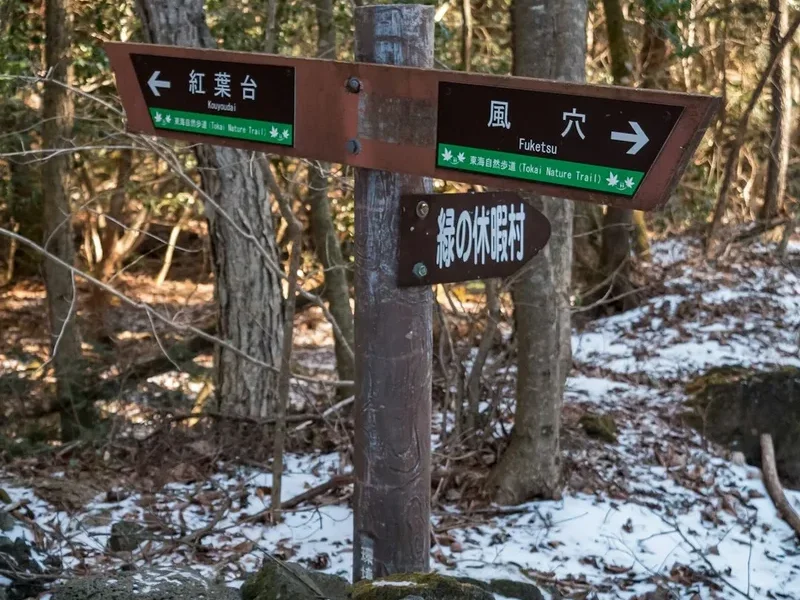
Mount Yotei (1,898 m) is a dormant stratovolcano that dominates the landscape of southwestern Hokkaido. Its near-perfect conical shape, snow-capped for much of the year, makes it a visually stunning natural landmark. The Mount Yotei Loop trail is not a single, clearly defined path but rather a network of trails that circumnavigate the mountain, often incorporating sections of the popular summit ascent route. This description focuses on a common interpretation of the loop, typically starting from a trailhead near Kutchan or Niseko, and progressing through varied terrain.
The trail begins by winding through dense forests of birch and oak, gradually ascending through meadows dotted with wildflowers during the summer months. As the elevation increases, the vegetation thins, giving way to more rugged, rocky terrain characteristic of volcanic slopes. The loop offers breathtaking panoramic views of the surrounding Niseko mountain range, Lake Toya, and on clear days, even the Sea of Okhotsk. The summit crater, with its small lake, is a dramatic highlight, though reaching it typically involves a steep, demanding climb that can be incorporated as a significant side trip or the main objective of one of the days.
The challenge of the loop lies in its sustained elevation gain and the often unpredictable mountain weather. Hikers must be prepared for rapid changes, including fog, rain, and cooler temperatures, even in mid-summer. The loop is best undertaken over two to three days, allowing ample time to appreciate the scenery, manage the ascent and descent, and enjoy the unique environment of this majestic volcano.
History and Cultural Context
Mount Yotei has held significant cultural and spiritual importance for the indigenous Ainu people for centuries. They revered the mountain as a deity, often referring to it as "Ainu-Shiri" (the mountain of the Ainu people) or "Moyoro-Nupuri" (the mountain that stands alone). Its symmetrical beauty and imposing presence made it a focal point of their spiritual beliefs and traditional practices. Ceremonies and offerings were often made to appease the mountain spirit and ensure good fortune.
During the Meiji era (1868-1912), as Japan expanded and settled Hokkaido, Mount Yotei became a symbol of the island's wild and untamed nature. Early explorers and settlers were drawn to its majestic form, and it quickly became a popular destination for mountaineering and exploration. The development of hiking trails began in earnest during the early 20th century, making the mountain more accessible to a wider range of visitors.
In more recent times, Mount Yotei has become a significant tourist attraction, drawing hikers, climbers, and nature enthusiasts from Japan and around the world. Its designation as part of the Shikotsu-Toya National Park further underscores its natural and cultural value. The surrounding areas, particularly Niseko, have gained international fame for their ski resorts, but the mountain itself remains a cherished natural treasure, offering a more traditional and rugged outdoor experience.
Seasonal Highlights and Weather Reality
The Mount Yotei Loop is primarily a summer hike, with the optimal season running from July to September. During these months, the weather is generally more stable, and the trails are free of snow, making them accessible and safer for hikers.
Summer (July - September): This is the peak season for hiking Mount Yotei. The mountain slopes are carpeted with vibrant alpine wildflowers, creating a spectacular display of colour. The weather is typically mild, with daytime temperatures ranging from 15°C to 25°C at lower elevations, but can drop significantly near the summit, especially at night or in foggy conditions. However, summer in Hokkaido can also bring sudden thunderstorms and heavy fog, which can reduce visibility to mere metres and make navigation challenging. It is crucial to be prepared for all types of weather, including rain and wind, even on a clear morning.
Late Spring (June): While some lower sections of the loop may be accessible in June, the higher elevations, including the summit trail, are often still covered in snow. This period is generally not recommended for the full loop unless you have advanced winter mountaineering skills and equipment. Snowmelt can also make some lower trails muddy and slippery.
Autumn (October): As autumn progresses, temperatures begin to drop, and the first snowfalls can occur at higher altitudes. The foliage can be beautiful, with vibrant reds and yellows, but the window for safe hiking closes rapidly. By late October, the mountain is usually inaccessible for general hiking.
Winter (November - May): Mount Yotei becomes a destination for experienced ski tourers and snowshoers. The trails are completely covered in snow, and avalanche risk is a significant concern. This period is strictly for advanced winter mountaineers with appropriate gear and expertise.
Recommended Itinerary
2-Day Mount Yotei Loop Itinerary (Challenging)
Day 1: Kutchan Trailhead to Yotei-san Sanso (Mountain Hut)
- Distance: Approximately 15-20 km (depending on exact route)
- Elevation Gain: Approximately 1000-1200 m
- Time: 6-8 hours
- Start from a designated trailhead near Kutchan (e.g., the Hirafu side or the Higashiyama side).
- Ascend through dense birch and oak forests, enjoying the cool, shaded environment.
- Pass through alpine meadows bursting with wildflowers in summer.
- The trail becomes steeper and rockier as you gain altitude.
- Reach Yotei-san Sanso (a mountain hut) or a designated camping area near the upper slopes.
- Set up camp or check into the hut (reservations may be required).
- Enjoy sunset views over the surrounding landscape if weather permits.
- Prepare for a very early start on Day 2 for the summit attempt.
Day 2: Summit Ascent, Crater Rim, and Descent to Trailhead
- Distance: Approximately 20-25 km (including summit)
- Elevation Gain: Approximately 500-700 m to summit, then significant descent
- Time: 8-10 hours (including summit time)
- Very early morning start (e.g., 2:00 AM - 3:00 AM) to reach the summit for sunrise.
- Steep, challenging ascent on volcanic scree and rock.
- Reach the summit crater rim.
- Optional: Hike around the crater rim (approximately 1-2 hours) to view the crater lake.
- Descend via a different route if possible to complete a loop, or retrace steps partially.
- The descent is often as challenging as the ascent, particularly on loose scree.
- Continue descending through forests and meadows back to the starting trailhead.
- Alternative: If not aiming for the summit, Day 2 can involve traversing a different section of the loop, exploring lower slopes and viewpoints.
3-Day Mount Yotei Loop Itinerary (More Relaxed)
Day 1: Trailhead to Mid-Slope Hut/Campsite
- Distance: 10-15 km
- Elevation Gain: 600-800 m
- Time: 4-5 hours
- Start from trailhead, enjoy a leisurely hike through forests and meadows.
- Reach a suitable campsite or basic shelter partway up the mountain.
- Set up camp, relax, and enjoy the surroundings.
Day 2: Continue to Summit and Descend to Lower Hut/Campsite
- Distance: 10-15 km
- Elevation Gain: 400-600 m to summit, then descent
- Time: 6-8 hours
- Ascend to the summit, explore the crater rim.
- Descend to a different hut or campsite on the opposite side of the mountain.
- This allows for a more gradual exploration of the upper volcanic slopes.
Day 3: Descend to Trailhead
- Distance: 10-15 km
- Elevation Gain: Minimal, mostly descent
- Time: 3-4 hours
- Enjoy a final morning in the mountains.
- Descend back to the starting trailhead.
Important Notes:
- Summit ascent is very demanding and requires good fitness.
- Weather can change rapidly; always be prepared for rain, wind, and fog.
- Carry sufficient water or a reliable water filter/purifier.
- Book mountain huts in advance if possible, especially during peak season.
- Check local trail conditions and weather forecasts before and during your hike.
- The "loop" can be adapted based on available trails and personal preference.
Planning and Bookings
Book Your Trip
Everything you need to plan your journey
Accommodation
Find places to stay near Kutchan
Flights
Search flights to Kutchan
Essential Preparation
The Mount Yotei Loop requires careful planning due to its challenging nature and the potential for rapidly changing weather. Begin by assessing your fitness level; this is not a casual stroll. The sustained elevation gain and steep, often scree-covered ascents demand good cardiovascular health and strong leg muscles. Research the specific trailheads and access points around Kutchan or Niseko, as there isn't one single designated start point for the entire loop. Public transport options to Kutchan are available via JR trains from Sapporo or New Chitose Airport. From Kutchan, local buses or taxis can take you to various trail access points. Road conditions are generally good during the summer hiking season. Parking is available at major trailheads, but it's advisable to confirm availability and any potential fees. It is also wise to check local advisories regarding trail conditions, any required registrations, or specific regulations for camping or hut use.
Trail Accommodation
Accommodation options on the Mount Yotei Loop are limited and primarily consist of mountain huts and designated camping areas. These facilities are basic and require advance planning, especially during the peak summer months.
Yotei-san Sanso (Mountain Hut): This is the most well-known and established hut on the mountain, typically located at an elevation of around 1,500 metres. It offers dormitory-style sleeping with bunk beds. Reservations are highly recommended, and sometimes mandatory, particularly for weekends and holidays. Facilities usually include a common area for dining, basic cooking facilities (often gas stoves), and toilets. Sleeping bags are essential as no bedding is provided. There is no electricity or running water beyond what is collected from streams (treatment recommended).
Designated Camping Areas: Several areas on the mountain are designated for camping. These are usually more primitive than the hut, offering flat ground for tents and access to nearby water sources. Campfires are generally prohibited. Camping permits may be required, so it's essential to check with local authorities or the park service.
What's NOT Provided: Huts and campsites do not provide food, cooking equipment (pots, pans, utensils), sleeping bags, pillows, or toiletries. You must bring all your own supplies. There is no mobile phone signal or Wi-Fi on most of the mountain.
Seasonal Availability: Huts and camping areas are typically open from late June or early July through September. Outside of this period, they may be closed or inaccessible due to snow. Always verify operational dates.
Costs: Hut fees vary but can range from approximately ¥3,000 to ¥5,000 per person per night. Camping fees are generally lower, if applicable.
This is a multi-day hike requiring overnight accommodation.
Required Gear
- Sturdy hiking boots: Waterproof, with good ankle support and a well-worn sole for grip on rocky and scree terrain.
- Waterproof and windproof jacket: Essential for protection against sudden rain and strong winds, especially at higher altitudes.
- Waterproof overtrousers: To complement the jacket and keep legs dry.
- Warm layers: Including a fleece or down jacket, thermal base layers (merino wool or synthetic), and a warm hat (beanie). Temperatures can drop significantly at night and near the summit.
- Durable hiking trousers: Quick-drying material is preferable.
- Backpack: A 40-60 litre capacity pack with a good hip belt and rain cover is recommended for carrying gear over multiple days.
- Head torch: With spare batteries, crucial for early morning summit attempts or navigating in the dark.
- First-aid kit: Including blister treatment, pain relievers, antiseptic wipes, bandages, and any personal medications.
- Navigation tools: A detailed map of the Mount Yotei area, a compass, and a GPS device or smartphone with offline maps downloaded. Mobile signal is unreliable.
- Sun protection: High SPF sunscreen, sunglasses, and a wide-brimmed hat, as the sun can be intense at higher elevations, even on cloudy days.
- Trekking poles: Highly recommended for stability on ascents and descents, especially on scree.
What to Bring
- Food: Sufficient high-energy, lightweight food for 2-3 days, including breakfast, lunch, dinner, and plenty of snacks. Consider freeze-dried meals for convenience.
- Water: Carry at least 2-3 litres of water per person per day. A reliable water filter or purification tablets are essential for refilling from streams, as water sources can be scarce at higher elevations.
- Cooking equipment: A lightweight camping stove, fuel, a pot, eating utensils, and a mug.
- Sleeping bag: A 3-season sleeping bag rated for temperatures down to 0°C or lower is advisable.
- Toiletries: Biodegradable soap, toothbrush, toothpaste, toilet paper, hand sanitiser, and any personal hygiene items. Pack out all used toilet paper.
- Trash bags: To pack out all rubbish.
- Insect repellent: Especially important during summer months to ward off mosquitoes and other biting insects.
- Camera: To capture the stunning scenery.
- Power bank: To recharge electronic devices like phones or GPS units.
- Cash: For hut fees, local transport, or any small purchases.
Permits
While the Mount Yotei Loop is located within Shikotsu-Toya National Park, specific permits for hiking the general loop trails are typically not required for independent hikers. However, regulations can change, and it is always advisable to check with the park authorities or local tourism information centres in Kutchan or Niseko before your trip. This is especially true if you plan to camp in designated areas or use the mountain huts.
Mountain Hut Reservations: For huts like Yotei-san Sanso, advance reservations are strongly recommended, and sometimes mandatory, particularly during the peak hiking season (July and August) and on weekends. These reservations can often be made online through the hut operator's website or by contacting them directly. Failure to book may mean you are unable to stay at the hut and will need to rely on camping, if permitted and feasible.
Camping Regulations: If you plan to camp, ensure you are aware of designated camping areas. Wild camping may be restricted or prohibited in certain zones to protect the fragile alpine environment. Always follow Leave No Trace principles and pack out everything you pack in.
Summit Access: The main trails leading to the summit are generally open to the public without specific permits. However, access can be restricted during periods of extreme weather, high avalanche risk (in winter), or for conservation purposes. Always check for any trail alerts or closures before you set out.
Fees: While hiking the trails themselves is usually free, there may be fees associated with using mountain huts or designated campsites. These fees contribute to the maintenance and upkeep of the facilities.
Other Activities in the Area
The region surrounding Mount Yotei offers a wealth of activities beyond the loop hike, making it an excellent destination for a longer stay:
- Niseko United Ski Resorts: Famous worldwide for its powder snow, Niseko offers incredible skiing and snowboarding in winter. In summer, the resorts provide access to hiking trails, mountain biking, and scenic gondola rides.
- Lake Toya: A beautiful caldera lake located to the south of Mount Yotei. Visitors can enjoy boat cruises, visit the volcanic eruption memorial museum, and relax in the numerous hot spring resorts (onsen) in the town of Toyako Onsen.
- Shikotsu-Toya National Park: Beyond Mount Yotei, the park encompasses diverse natural landscapes, including other volcanic mountains, forests, and lakes, offering numerous opportunities for exploration and hiking.
- Onsen (Hot Springs): Hokkaido is renowned for its natural hot springs. Many towns around Mount Yotei and Niseko offer excellent onsen facilities, providing a perfect way to relax and rejuvenate after a long hike.
- Local Cuisine: Hokkaido is a culinary paradise, famous for its fresh seafood (especially crab and sea urchin), dairy products, ramen, and Jingisukan (grilled lamb). Exploring the local restaurants and markets is a must.
- Farm Visits and Local Produce: The fertile lands around Mount Yotei are home to numerous farms producing high-quality fruits, vegetables, and dairy. Some farms offer tours or opportunities to purchase fresh produce.
Safety and Conditions
Weather Preparedness: The most significant safety concern on Mount Yotei is the unpredictable mountain weather. Conditions can change from clear and sunny to foggy, rainy, and windy within minutes. Always check the latest weather forecast from reliable sources like the Japan Meteorological Agency (JMA) or MetService before and during your hike. Be prepared for temperatures to drop significantly at higher elevations, even in summer.
Trail Conditions: The trails can be steep, rocky, and covered in loose scree, especially on the upper slopes and the summit ascent. Proper footwear with good grip is essential. Trails can become slippery and hazardous when wet. During the early summer, snow patches may linger on shaded sections of the trail, requiring caution.
Navigation: While the main trails are generally well-marked, visibility can be severely reduced by fog. Carry a map, compass, and GPS device or smartphone with offline maps. It is advisable to hike with a companion, especially if you are unfamiliar with the area.
Water Sources: Water is available from streams on the lower slopes, but it is crucial to treat all water before drinking using a filter or purification tablets. Water sources can be scarce or unreliable at higher elevations.
Physical Fitness: The Mount Yotei Loop is a challenging hike requiring a good level of physical fitness. Be realistic about your capabilities and choose an itinerary that matches your fitness level. The summit ascent is particularly strenuous.
Emergency Contacts: Know the local emergency numbers. In Japan, the general emergency number is 110 for police and 119 for fire and ambulance. It is also advisable to inform someone of your hiking plans, including your intended route and expected return time.
Wildlife: While large dangerous animals are rare in this region, be aware of smaller wildlife. Respect their space and do not feed them.
Hut and Camping Safety: If staying in a mountain hut, follow the rules and guidelines provided by the hut warden. If camping, choose a safe, designated spot away from potential hazards like rockfall or flash flood zones.
Side Trips and Points of Interest
Mount Yotei Summit Crater and Lake: The ultimate objective for many hikers. Reaching the summit crater rim (1,898 m) is a significant achievement. Within the crater, a small, shallow lake forms during the warmer months. Hiking around the crater rim offers spectacular 360-degree views of Hokkaido. This is a demanding side trip, often incorporated into Day 2 of a 2-day itinerary, requiring an early start.
Alpine Flower Meadows: During July and August, the lower and mid-slopes of Mount Yotei transform into vibrant alpine meadows. These areas are teeming with a diverse array of wildflowers, offering fantastic photographic opportunities and a beautiful contrast to the volcanic terrain higher up.
Panoramic Viewpoints: Various points along the loop offer stunning panoramic views of the surrounding landscape. These include vistas of the Niseko mountain range, the expansive Lake Toya, and on exceptionally clear days, the distant Sea of Okhotsk. Specific viewpoints are often marked or are natural clearings along the trail.
Forest Trails: The lower sections of the loop wind through dense, ancient forests of birch, oak, and other deciduous trees. These shaded trails offer a cooler hiking experience and a chance to observe the local flora and fauna. The atmosphere in these forests is often serene and mystical.
Volcanic Geology: As you ascend, you will encounter various geological features indicative of Mount Yotei's volcanic origins. These include lava flows, volcanic ash deposits, and scree slopes formed from weathered volcanic rock. Understanding these features adds an educational dimension to the hike.
Leave No Trace
The Mount Yotei Loop traverses a sensitive natural environment within Shikotsu-Toya National Park. Adhering to Leave No Trace principles is paramount to preserving its beauty and ecological integrity for future generations. As a hiker, your actions have a direct impact on this pristine landscape.
Plan Ahead and Prepare: Research trail conditions, weather forecasts, and any specific regulations for the area. Pack appropriately for the conditions and carry all necessary gear. Know your limits and choose an itinerary that matches your abilities.
Travel and Camp on Durable Surfaces: Stick to marked trails to avoid damaging fragile vegetation. When camping, use designated campsites or durable surfaces like rock or gravel. Avoid camping on meadows or near water sources.
Dispose of Waste Properly: Pack out everything you pack in, including all food scraps, wrappers, and any other litter. Use designated toilets where available. If no toilets are available, dig a cathole at least 60 metres away from water, trails, and campsites. Pack out all toilet paper.
Leave What You Find: Resist the urge to take souvenirs such as rocks, plants, or cultural artifacts. Leave the natural and cultural heritage of the area as you found it.
Minimize Campfire Impacts: Campfires are generally prohibited on Mount Yotei due to the risk of wildfire and damage to the environment. Use a lightweight camping stove for cooking.
Respect Wildlife: Observe wildlife from a distance. Never feed animals, as this can disrupt their natural behaviours and diets, and can be harmful to their health. Store food securely to prevent attracting animals.
Be Considerate of Other Visitors: Keep noise levels down and yield to other hikers on the trail. Respect the solitude and natural quiet of the mountain.