
Mount Washington via Tuckerman Ravine - The Crown of New England
Mount Washington, standing at 1,917 metres, is the highest peak in the Northeastern United States and the most formidable summit in the White Mountain National Forest of New Hampshire. Known to the indigenous Abenaki people as Agiocochook, or "Home of the Great Spirit," this mountain is legendary not for its height—which is modest by global standards—but for its notoriously erratic and violent weather. The Tuckerman Ravine Trail is the most iconic route to the summit, a 8.7-kilometre round-trip journey that ascends 1,300 metres through a dramatic glacial cirque. This is a path that transitions from lush hardwood forests to a stark, boulder-strewn alpine zone that mimics the ecology of the Arctic tundra. For hikers, it represents a rite of passage, offering a physical challenge that demands respect, careful preparation, and a keen eye on the horizon. To stand on the summit is to stand at the "Home of the World's Worst Weather," where the views across the Presidential Range are as vast as the history of the pioneers who first charted these granite slopes.
- Distance: 8.7 km return
- Duration: 6–8 hours
- Season: June to October (snow-free conditions; winter requires technical mountaineering skills)
- Elevation Gain: 1,300 m
- Highest Point: 1,917 m (Summit of Mount Washington)
- Difficulty: Challenging (steep terrain, significant elevation, unpredictable weather)
- Trailhead: Pinkham Notch Visitor centre, New Hampshire
Overview
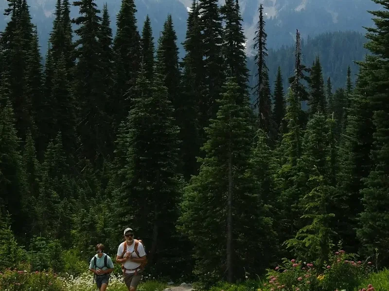
The ascent of Mount Washington via the Tuckerman Ravine Trail is a masterclass in ecological transition and geological drama. Starting at the Pinkham Notch Visitor centre (618 m), the trail begins as a wide, well-graded path through a dense canopy of yellow birch, sugar maple, and American beech. As the elevation increases, the forest composition shifts to the hardy balsam fir and red spruce of the sub-alpine zone. The first major landmark is Hermit Lake, situated at the base of the massive glacial cirque known as Tuckerman Ravine. Here, the trees begin to stunt and gnarl into "krummholz"—German for "crooked wood"—as they struggle against the relentless winds that pour over the ridge. The ravine itself is a spectacular bowl carved by glaciers during the last ice age, featuring a towering headwall that remains snow-covered well into the summer months.
The climb up the Tuckerman Ravine headwall is the most demanding segment of the hike. It is a steep, rocky scramble that requires steady footing and a tolerance for heights. Once above the lip of the ravine, hikers emerge onto the Alpine Garden, a relatively flat plateau that hosts a rare collection of alpine flora found nowhere else south of the Canadian Arctic. The final kilometre to the summit is a relentless slog over "the rock pile"—a vast field of frost-shattered granite boulders. The summit itself is a unique juxtaposition of wild nature and human engineering, featuring the Mount Washington Observatory, the historic Tip-Top House, and the terminus of the Mount Washington Cog Railway and Auto Road. While the presence of buildings and tourists who arrived by car can be jarring, the 360-degree panorama—stretching to the Atlantic Ocean on clear days—remains one of the most humbling sights in North America.
What defines Mount Washington more than its terrain is its atmosphere. The mountain sits at the confluence of three major storm tracks: the Atlantic, the Gulf, and the Pacific Northwest. This creates a funnel effect that produces hurricane-force winds on an average of 110 days per year. In 1934, the observatory recorded a surface wind speed of 372 kilometres per hour, a world record that stood for decades. Even in mid-summer, temperatures can plummet toward freezing, and dense fog can reduce visibility to mere metres in a matter of minutes. This is not a hike to be taken lightly; it is a serious mountain undertaking that requires the gear and mindset of a mountaineer, even on a sunny July morning.
History and Cultural Context
The human history of Mount Washington is as layered as the granite that forms its bulk. For thousands of years, the Abenaki and other Algonquian-speaking peoples held the mountain in deep spiritual reverence. They believed the summit was the dwelling place of the Great Spirit and generally avoided ascending above the treeline out of respect and self-preservation. The first recorded European ascent occurred in 1642 by Darby Field, an adventurous settler from Exeter, New Hampshire. Field was guided by two indigenous men to the base of the mountain, but they refused to accompany him to the summit, watching from below as he became the first non-native to stand on the peak. His reports of "shining stones" (which turned out to be common quartz) sparked early interest in the region's mineral wealth.
By the mid-19th century, Mount Washington had become a focal point for the burgeoning American Romantic movement. Artists of the White Mountain School, such as Thomas Cole and Albert Bierstadt, captured the mountain's rugged grandeur on canvas, drawing wealthy tourists from Boston and New York. This era saw the construction of the first summit houses, including the Tip-Top House in 1853, which still stands today as a museum. Built from on-site granite and anchored with heavy iron chains to withstand the wind, it is the oldest mountain top hostelry in the world. The Mount Washington Carriage Road (now the Auto Road) opened in 1861, followed by the revolutionary Cog Railway in 1869—the world's first mountain-climbing rack-and-pinion railway. These engineering marvels transformed the summit into a high-altitude destination, blending wilderness with Victorian-era industrial ambition.
In the 20th century, the mountain's focus shifted toward science and recreation. The Mount Washington Observatory was established in 1932, beginning a legacy of continuous weather observation that remains vital for meteorological research today. Tuckerman Ravine also became the birthplace of American extreme skiing. In the 1930s, "The Wildcat" and other legendary skiers began hiking into the ravine to test their mettle on the 45-degree slopes of the headwall. Today, the mountain is managed as part of the White Mountain National Forest, balancing its role as a premier hiking destination with its status as a critical site for climate science and alpine conservation. The land remains a place of profound significance, where the ghosts of early explorers and the footprints of modern adventurers meet on the wind-swept granite.
Want more background? Read extended notes on history and cultural context → Learn more
Seasonal Highlights and Weather Reality
The window for a safe, snow-free hike on the Tuckerman Ravine Trail is remarkably narrow, typically extending from late June to early October. Even within this period, the mountain operates on its own meteorological clock. In June, the "Snow Arch"—a massive bridge of ice formed by the melting remains of winter's accumulation—often persists in the ravine. While beautiful, it is extremely dangerous and prone to collapse, often leading to trail diversions. Early summer also brings the bloom of the Alpine Garden, where tiny wildflowers like the Diapensia and Lapland Rosebay create a vibrant carpet against the grey stone.
July and August are the most popular months, offering the highest probability of clear skies and manageable temperatures. However, these months also see the highest frequency of afternoon thunderstorms. On Mount Washington, a thunderstorm is not merely a nuisance; it is a life-threatening event on the exposed, lightning-prone ridges. Hikers must be prepared for "undercast" conditions, where the valleys are shrouded in clouds while the summit sits in brilliant sunshine—or, more commonly, the reverse, where the summit is "in the fog" for days on end.
September and October offer crisp air, the absence of summer insects, and the spectacular autumn foliage of the New England hardwoods in the valleys below. However, the risk of early-season snow and "rime ice"—a feathery ice formation caused by freezing fog—increases significantly. By mid-October, the mountain begins its transition into a true arctic environment. Outside the summer window, the Tuckerman Ravine Trail becomes a technical mountaineering route. The headwall fills with hundreds of centimetres of snow, creating significant avalanche danger. Winter ascents require ice axes, crampons, avalanche beacons, and expert-level knowledge of winter survival. For the recreational hiker, the mountain is effectively closed from late autumn until the spring snowmelt is complete.
Recommended Itinerary
Mount Washington Day Hike Itinerary
Early Morning: Pinkham Notch to Hermit Lake
- Distance: 3.8 km
- Elevation Gain: 560 m
- Time: 1.5–2 hours
- Start at the Pinkham Notch Visitor centre (AMC Trading Post)
- Follow the wide, gravel-surfaced Tuckerman Ravine Trail
- Cross several small bridges over the Cutler River
- Steady, moderate incline through hardwood and evergreen forest
- Arrive at Hermit Lake Shelters (1,178 m)
- Use the composting toilets here; this is the last facility before the summit
- Take a moment at the viewing deck to look up at the massive Ravine Headwall
Mid-Morning: The Ravine Floor and The Headwall
- Distance: 1.2 km
- Elevation Gain: 350 m
- Time: 1–1.5 hours
- The trail narrows and becomes significantly rockier
- Enter the floor of Tuckerman Ravine, a dramatic glacial bowl
- Pass the "Lunch Rocks" area (be wary of falling ice/rocks from above)
- Begin the steep ascent of the Headwall via tight, rocky switchbacks
- This section is very strenuous and requires occasional use of hands for balance
- Cross several small seasonal waterfalls cascading down the cliff face
- Reach the "Lip" of the ravine, where the gradient finally levels off
Midday: The Alpine Garden and The Summit Push
- Distance: 1.4 km
- Elevation Gain: 390 m
- Time: 1–1.5 hours
- Emerge onto the relatively flat Alpine Garden plateau
- Follow the cairns (large rock piles) across the boulder fields
- The trail intersects with the Lion Head Trail and the Alpine Garden Trail
- The final 0.8 km is a steep scramble over large, loose granite blocks
- Follow the yellow blazes painted directly onto the rocks
- Arrive at the summit of Mount Washington (1,917 m)
- Visit the Sherman Adams Summit Building for water, food, and the museum
- Touch the summit bolt for the mandatory photo opportunity
Afternoon: The Descent
- Distance: 4.3 km (return via same route or Lion Head)
- Elevation Loss: 1,300 m
- Time: 2.5–3.5 hours
- Option A: Descend via Tuckerman Ravine (steep, hard on knees)
- Option B: Descend via Lion Head Trail (better views, slightly more technical)
- Careful foot placement is essential on the wet rocks of the headwall
- Rejoin the main Tuckerman Ravine Trail at Hermit Lake
- Final easy walk back to Pinkham Notch Visitor centre
- Check in at the desk to report any trail issues or sightings
Important Notes:
- Start no later than 8:00 AM to ensure return before sunset
- The "Turn Back" time should be no later than 1:00 PM, regardless of position
- Weather can change in minutes; if clouds descend, stay with the cairns
- The descent often takes longer than expected due to fatigue and steepness
- Fill all water bottles at the summit building before heading down
Planning and Bookings
Book Your Trip
Everything you need to plan your journey
Accommodation
Find places to stay near North Conway, New Hampshire
Flights
Search flights to North Conway, New Hampshire
Essential Preparation
Preparation for Mount Washington begins with an honest assessment of physical fitness. While the distance is short, the 1,300-metre vertical gain is relentless. Hikers should be comfortable with steep, uneven terrain and sustained cardiovascular effort. There is no "easy" way up the mountain on foot. Logistics are centred around the town of North Conway, New Hampshire, which is approximately 25 minutes south of the trailhead. North Conway offers a full range of services, including specialist outdoor retailers (like International Mountain Equipment) where you can rent gear or seek expert advice on current conditions.
Before leaving your accommodation, you MUST check the "Higher Summits Forecast" issued by the Mount Washington Observatory. This is the only reliable forecast for the peak. If the forecast calls for sustained winds over 65 km/h or a high probability of thunderstorms, postpone your hike. The mountain will still be there tomorrow; your safety is the priority. Ensure you have a transport plan; parking at Pinkham Notch fills up very early (often by 7:30 AM) on summer weekends.
Trail Accommodation
As this is primarily a day hike, most visitors stay in local hotels or campgrounds in the White Mountains region. However, there are specific options for those wishing to stay on or near the trail.
Joe Dodge Lodge (Pinkham Notch): Located at the trailhead, this Appalachian Mountain Club (AMC) lodge offers bunk-style and private rooms. It includes breakfast and dinner, making it an excellent base for an early start. Bookings are essential and often made months in advance.
Hermit Lake Shelters: Located 3.8 km up the trail, these are rustic wooden lean-tos and tent platforms managed by the US Forest Service.
- Facilities: Composting toilets, hand-pump water (must be treated), no cooking equipment.
- Booking: First-come, first-served via the self-service kiosk at Pinkham Notch.
- Cost: Approximately US$15 per person per night.
- Note: This is a high-use area; expect company and practice strict food storage to avoid bears.
Lakes of the Clouds Hut: Located about 2.4 km from the summit (via the Crawford Path/Tuckerman Crossover), this is the AMC's highest and most popular hut.
- Facilities: Bunks with blankets, multi-course dinner and breakfast provided.
- Booking: Mandatory via the AMC website; usually sells out the day bookings open in January.
- Cost: US$150–$200 per night.
Required Gear
- Footwear: Sturdy hiking boots with aggressive tread and ankle support. The "rock pile" will destroy flimsy trainers and lead to rolled ankles.
- Outer Shell: A high-quality waterproof and windproof jacket (Gore-Tex or similar). Even on a 25°C day in the valley, the summit can be 5°C with 60 km/h winds.
- Insulation: A fleece or lightweight down jacket. Avoid cotton; merino wool or synthetic layers are essential for moisture management.
- Navigation: A physical topographic map and compass. GPS is useful, but batteries fail in the cold and signals can be spotty in the ravine.
- Headlamp: Essential even for a day hike. If you are delayed by injury or weather, descending the headwall in the dark without light is impossible.
- Emergency Whistle: For signalling in dense fog.
What to Bring
- Water: At least 3 litres per person. You can refill at the summit building, but the climb is dehydrating. Use a hydration bladder for easy access.
- Food: High-calorie, nutrient-dense snacks (nuts, chocolate, energy bars) and a substantial lunch. You will burn significantly more calories than on a flat hike.
- Sun Protection: SPF 50+ sunscreen, lip balm, and polarised sunglasses. The UV radiation is much stronger at 1,900 metres, and there is zero shade above the treeline.
- First Aid: Blister kits (moleskin/Leukotape), ibuprofen, antiseptic wipes, and any personal medications.
- Extra Socks: A spare pair of wool socks in case your feet get wet in the ravine crossings.
- Trash Bag: To pack out all waste, including fruit peels and tissues.
Permits
For standard day hiking on the Tuckerman Ravine Trail, no individual hiking permits are required. The White Mountain National Forest is public land, and access is generally unrestricted for recreational walkers. However, there are specific administrative requirements and fees associated with parking and group activities.
Parking Fees:
- The Pinkham Notch Visitor centre parking lot is free for users. However, other trailheads in the White Mountain National Forest (such as those for the Ammonoosuc Ravine Trail) require a "Recreation Pass."
- Cost: US$5 per day, payable via self-service envelopes at the trailhead.
- Annual passes are available for US$30 and are valid at all US Forest Service sites nationwide.
Group Regulations:
- Organised groups (scouts, schools, hiking clubs) of 10 or more people must obtain a Special Use Permit from the Androscoggin Ranger District at least 30 days in advance.
- The maximum group size for any single party in the Presidential Range is 10 people to minimise impact on the fragile alpine environment.
Winter Access: While no permit is required in winter, the US Forest Service and the Mount Washington Avalanche centre (MWAC) strongly advise all winter travellers to check the daily avalanche bulletin. During periods of high danger, certain areas of the ravine may be closed to public entry for safety reasons.
Other Activities in the Area
The White Mountains are a year-round playground with activities for all levels of adventure:
- Mount Washington Cog Railway: Experience the historic "Railway to the Moon." This coal-fired or biodiesel rack-and-pinion train climbs the western slopes of the mountain, offering a unique perspective on the engineering required to conquer the peak.
- Mount Washington Auto Road: Drive your own vehicle or take a guided "Stage Coach" tour to the summit. It is one of the oldest tourist attractions in America, famous for the "This Car Climbed Mt. Washington" bumper stickers.
- North Conway Village: A charming mountain town filled with local boutiques, art galleries, and the Conway Scenic Railroad. It is also a major hub for outlet shopping.
- Echo Lake State Park: Located at the foot of White Horse Ledge, this park offers swimming, picnicking, and world-class rock climbing on the massive granite cliffs.
- The Kancamagus Highway: A 55-kilometre scenic drive that cuts through the heart of the White Mountain National Forest, offering some of the best autumn foliage viewing in the world.
- Arethusa Falls: A moderate hike to New Hampshire's tallest waterfall (approximately 43 metres), located in Crawford Notch State Park.
Safety and Conditions
The "World's Worst Weather": This is not a marketing slogan; it is a statistical reality. Mount Washington's weather is lethal. Hypothermia can occur in mid-summer if a hiker is caught in a cold rain with high winds without proper layers. The "Higher Summits Forecast" is your primary safety tool. If the forecast mentions "The Fog," expect zero visibility. If you lose the trail in the fog, do not wander; stay at the last known cairn and wait for a break in the clouds or for help.
The Tuckerman Ravine Headwall: This section is extremely steep. In early summer, beware of "undermined snow"—snow that looks solid but has water running underneath it. Stepping on this can lead to a fall into a crevasse or a long slide down the rocks. Falling ice from the upper cliffs is a genuine hazard in June and July. If you hear a loud crack or a shout of "ICE!", look up and be prepared to move quickly.
Dehydration and Fatigue: The dry alpine air and physical exertion lead to rapid dehydration. Many accidents on the descent are caused by "jelly legs"—muscle fatigue that leads to trips and falls. Take frequent breaks, eat small amounts of food regularly, and monitor your companions for signs of exhaustion or mental confusion.
Search and Rescue: New Hampshire has a "Hiker Responsibility Code." If you require rescue due to negligence (e.g., hiking in a storm without a map or proper clothing), the state can and will bill you for the cost of the rescue, which can run into thousands of dollars. Consider purchasing a "Hike Safe" card (US$25) which acts as a form of rescue insurance for the year.
Emergency Contact: Cell phone service is unreliable. In an emergency, 911 is the standard number, but do not rely on it. The Mount Washington Observatory and the AMC huts have radio links to emergency services.
Side Trips and Points of Interest
The Alpine Garden: If you have extra energy, take the Alpine Garden Trail which skirts the eastern slope of the summit cone. This area is a botanical treasure trove, home to species like the Robbins' Cinquefoil, which exists only on this mountain. The terrain is gentler here, providing a brief respite from the vertical climb and offering stunning views down into Huntington Ravine.
Lion Head: Many hikers choose to ascend via Tuckerman Ravine and descend via the Lion Head Trail. The "Lion Head" is a massive rock outcrop that provides the best photographic perspective of the Tuckerman Ravine bowl. The trail is rocky and involves some minor scrambling, but it avoids the wetness of the headwall switchbacks.
The Tip-Top House: Located just below the summit, this 1853 stone structure is a marvel of mid-19th-century construction. It now serves as a museum (entry is usually free or a small donation) and provides a fascinating look at how early tourists survived the summit's conditions before modern heating and insulation.
Crystal Cascade: Located just 0.5 km from the Pinkham Notch trailhead, this is a spectacular 25-metre waterfall on the Cutler River. It is an easy detour on the way back and provides a peaceful place to reflect on the day's achievement.
Leave No Trace
The alpine zone of Mount Washington is one of the most fragile ecosystems in North America. The plants here have a growing season of only a few weeks and can be killed by a single misplaced footstep. Once the thin soil is disturbed, it can take decades for the vegetation to return.
Protecting the Alpine Tundra:
- Stay on the Rocks: When walking above the treeline, always step on durable rock surfaces rather than the soil or plants. "Rock-hopping" is the standard practice here.
- Follow the Cairns: The large rock piles are there to guide you and to keep you on the designated path. Do not build new cairns or move existing ones; this confuses other hikers and damages the ground.
- Carry Out All Waste: This includes biodegradable items like orange peels and apple cores, which do not decompose in the cold alpine environment and can attract wildlife.
- No Camping Above Treeline: Camping is strictly prohibited in the alpine zone to protect the flora. Use the designated shelters at Hermit Lake or the AMC huts.
- Respect the Wildlife: Do not feed the grey jays or chipmunks. Feeding them alters their natural behaviour and makes them dependent on human food, which lacks the nutrients they need for winter survival.